free to be able to rate and comment on reports (as well as access 1:25000 mapping).
Sub 2000 Marilyns: Beinn Lora, Na Maoilean, Beinn Duirinnis.
Date: 23/06/2013.
Distance: 17 km
Ascent: 1300m
Time taken: 5 hours 20 minutes.
Weather: Grey and windy - some sunshine, spitting rain later on.
To be fair, Beinn Duirinis probably shouldn't be described as an easy hill as it is steep and rough as hell, but there are much more straightforward ways to do the other two!
Today I had originally hoped to head down to Kingairloch and do Beinn Meadhoin with dad (a lower hill that seems to have dropped out of the most recent revision of the SMC Corbetts guide. What has it been replaced with?), but the weather said otherwise. Things looked a little clearer down the east side of the Firth of Lorn, so mum and dad decided to have an easy day out on Beinn Lora. After a quick look at the map, I realised I could add some other hills on and make a decent walk out of it. What was great was that my route finished on Beinn Duirinnis - one of a trio that were on my 'Argyll sub2k must do' list (the others being Beinn Mheadonach and An Grianan). Beinn Lora also appealed, while Na Maoilean was just something that happened to be in my path, really.
Even the Forestry Commisssion recognise that Beinn Lora is a Marilyn. Soon these things will be more popular than Arrochar on a bank holiday

:
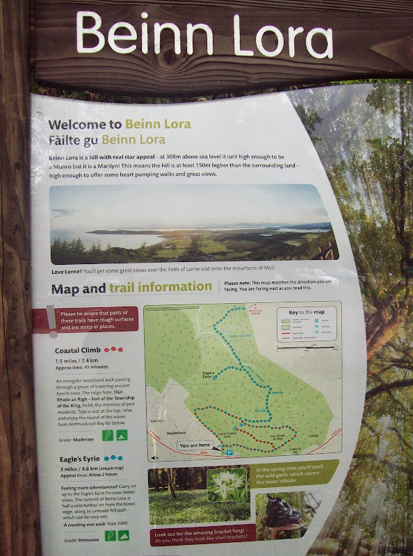
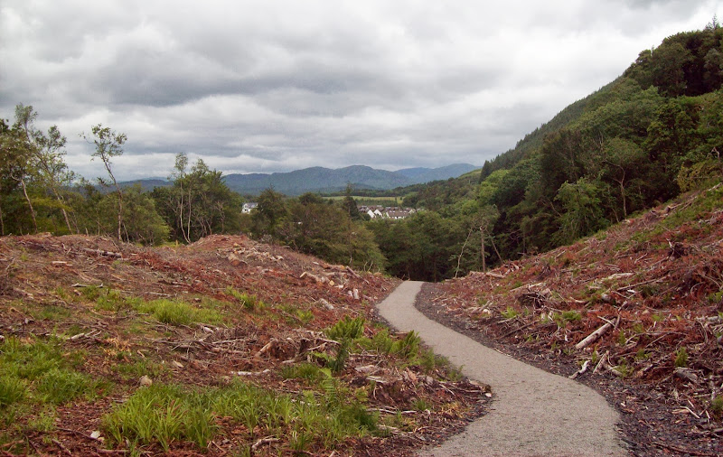
Due to the late start (3:30pm), I set off on my own rather than walking with my parents, knowing that they would be taking their time. We'd been up the forestry part of Beinn Lora in the mid '90s, but nothing was really recognisable due to the extensive felling and a mammoth new path that had been built. Still, it made for less interrupted views. The last section over the moorland was more pleasant, if a little boggy, and the views weren't too bad, despite a band of rain moving in over Mull and Morven. As forecast, the wind was much stronger than the previous days as well.
New path:
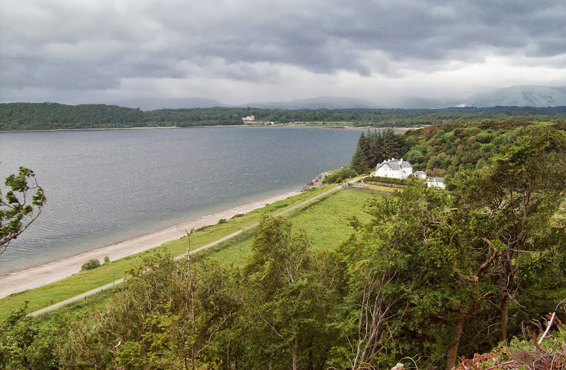
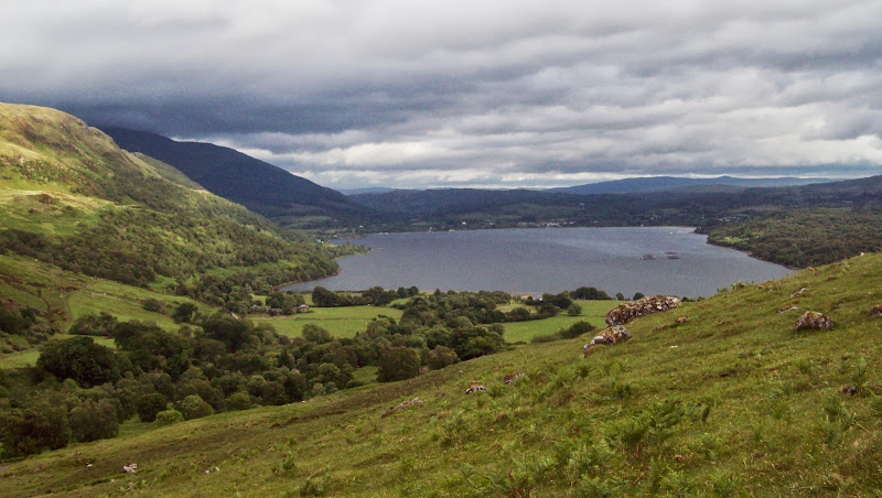
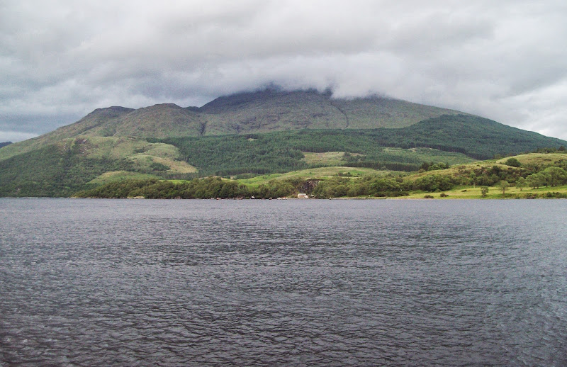
Ardmucknish Bay:
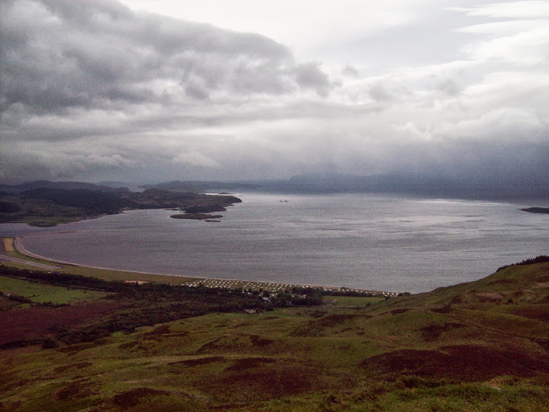
North Connel airstrip:
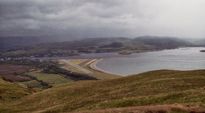
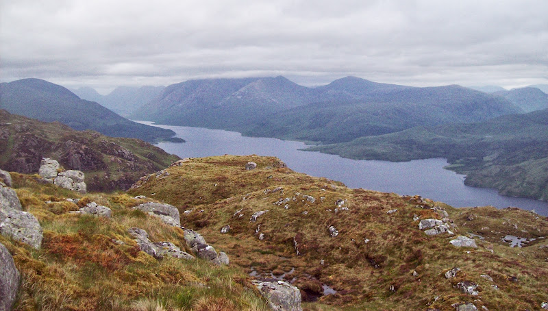
Kingairloch and Loch Linnhe:
That was the easy part over; now to contend with the walk over to Na Maoilean. I had decided I would miss this out by following the road along the shores of Loch Etive if the weather was really bad, but otherwise I would include it just in case I was missing out on something worthwhile. Everything was clear and there was the odd spot of sunshine around so it was getting included.
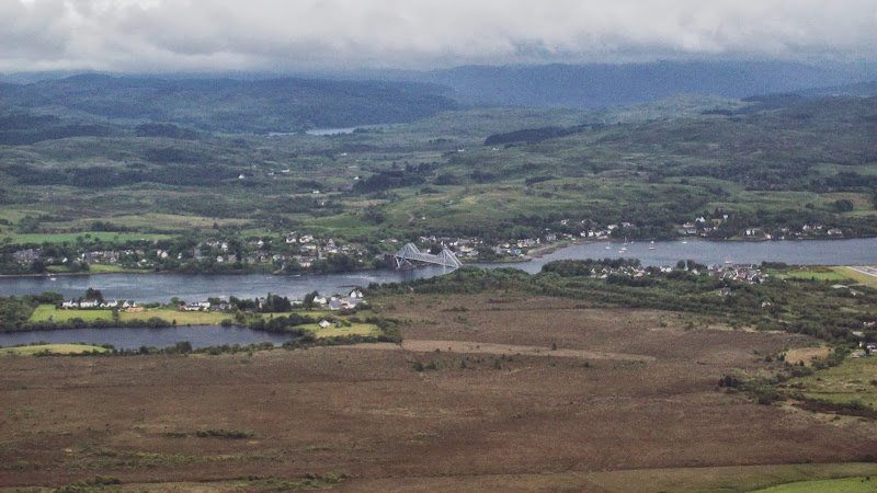
Connel Bridge:
A straightforward stroll over pathless heather led to the edge of a forest plantation. Due to the extensive planting on this hillside, it is necessary to drop most of the way down to sea level to get to Na Maoilean. I tried to be smart, cutting through a corner of woodland, but this ended in treemageddon, where I was almost trapped into a corner by windblown trees on all sides, wondering how I'd got there. On the upside, I finally clambered out onto a hydro dam holding back a tiny reservoir that I wouldn't have passed otherwise, and at least my route couldn't be described as boring!
Fallen trees:

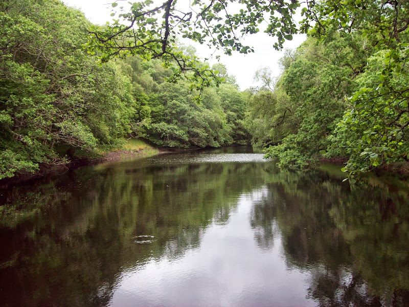
Un-named reservoir:
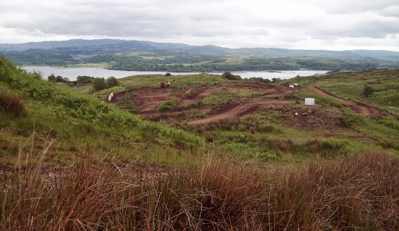
In contrast, the rest of the route to Na Maoilean was pretty easy going. I passed a quad bike circuit, then I was onto easy walking across grazed land. This felt like a spot that was rarely visited, but I was passed by a local who had been out fishing in a nearby lochan, and his two young children.
Quad bike circuit:
Na Maoilean was very shallow, and the thick heather didn't start until I had done most of the ascent. There was a slightly ankle-tugging traverse to the trig point, but none of the serious peat hags that I'd feared. In addition to the easy going terrain, Na Maoilean also redeemed itself by having great views of Beinn Duirinnis, which was picked out in sunshine. The short descent to the road was a little rougher but much more scenic than the way up. There were a couple of other potential summits on Na Maoilean slightly to the N, but the trig point was good enough for me!
Across to Glensanda quarry:
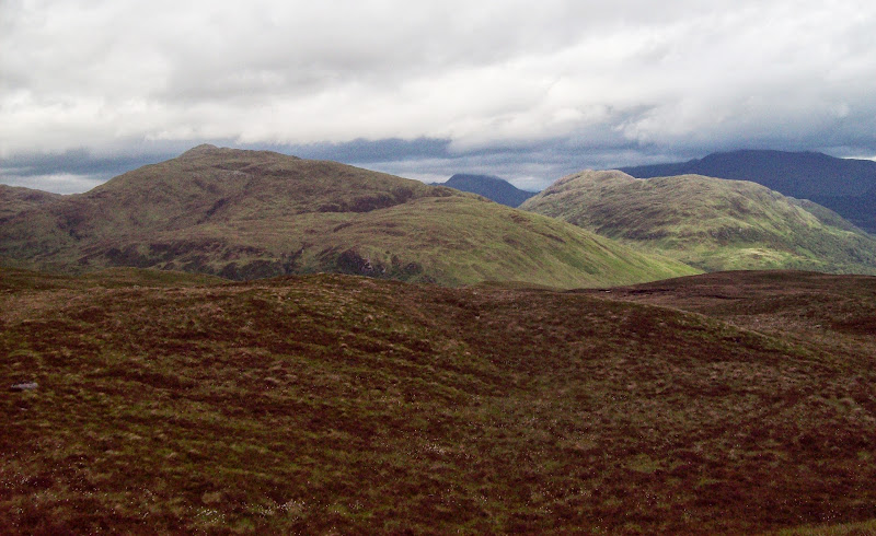
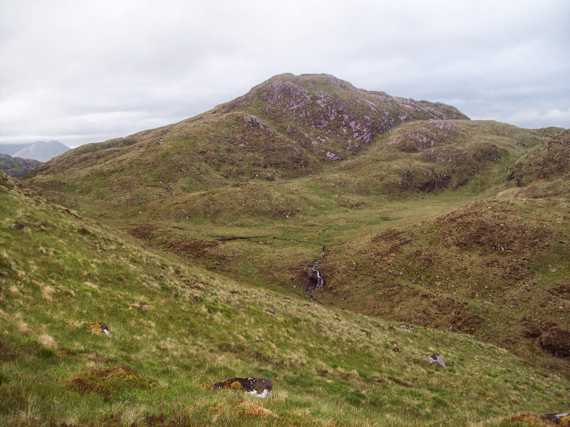
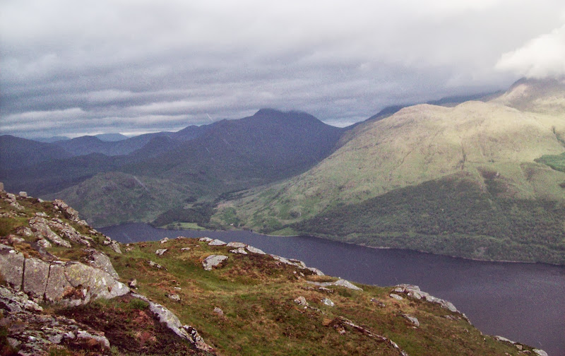
Beinn Mheadhonach and Beinn Duirinnis:
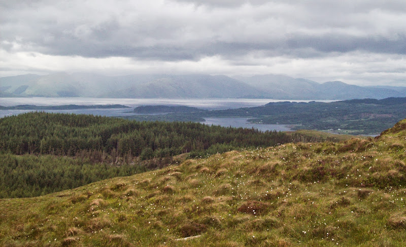
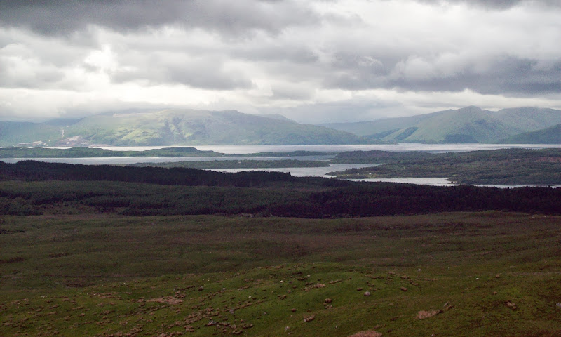
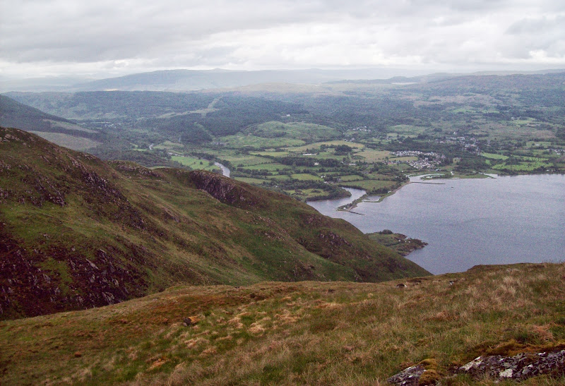
Mouth of Loch Etive:

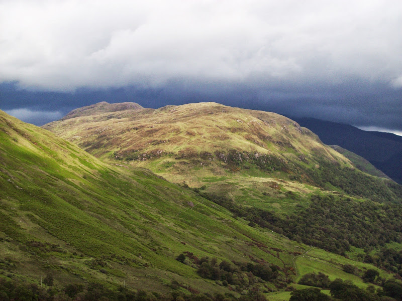
Beinn Duirinnis:

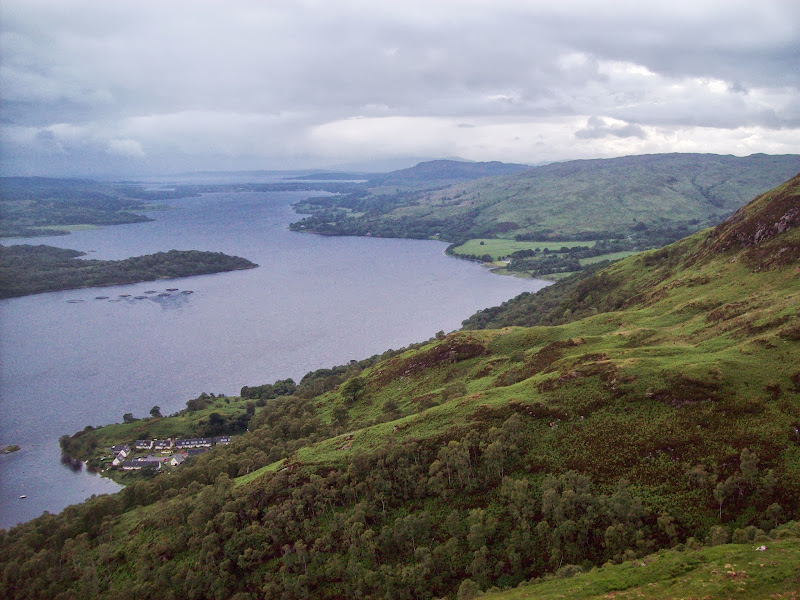
Loch Etive and Taynuilt:
A pleasant 10-15 minutes of road walking followed, taking me to the Blarcreen Burn. On the other side of this, I was hoping to pick a route up the W ridge of Beinn Duirinnis. I almost climbed the fence right by the burn, but decided to wander a few more meters along the road. Good move, as there was an overgrown ATV track leading up through the woods and bracken. Barely used, it had a lovely carpet of grass, and led through a couple of gates to a flattish area at just under 200m. Maybe Beinn Duirinnish wasn't going to be as rough as I had expected.
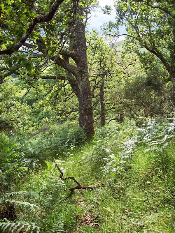
Woodland on Beinn Duirinnis ascent:
Loch Etive:

Of course it was! Once off the path, it was a wade through heather and uneven ground to the steep bit - and it was steep. Having not eaten much so far, I ran out of energy and stopped for a quick break at about 350m. The earlier sunshine had moved elsewhere and rain started spitting, but despite continuing like this for the rest of the walk, it never really got started properly.
Back to Na Maoilean:

South across Taynuilt:
I got up to the west top (Ceann Creige) soon enough and the views began to open out. The main summit was still blocking my view of Loch Etive though. It was a rough traverse, and I made the mistake of aiming directly for the main summit, which took me off the ridgeline. Eventually (at 8pm) after a bit of scrambling and weaving about, I arrived at the summit cairn. I'm not fussed whether there is a cairn on the top of a hill or not, but I do appreciate a good one, and this was one of those. It was windy again on the top, and you have to wander around a bit to get the best views of Loch Etive and Ben Cruachan, but I stuck around for a short while.
Main summit from Ceann Creige:
Summit and some scorched ground:

Unfortunately the Glen Etive, Glencoe and Cruachan hills were in the clag, but this was still a great viewpoint. Beinn Duirinnis was one of the many hillsides scarred by wildfire this spring, but there can't be many on which the fire spread right to the summit. There were burnt bits of turf right around the summit cairn, as well as on much of my descent.
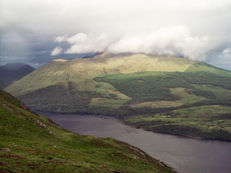
Up Loch Etive to Ben Starav:
Back of Beinn a Chochuill and Beinn Eunaich:

About 70% of Ben Cruachan:

Beinn a Chochull:
The way down to Bonawe was steep to say the least, but there were no real difficulties - more just annoyances, like the final 200m being covered in wet bracken. Since the sun popped out briefly, forming a rainbow against Cruachan, I wasn't bothered at all. A couple of minutes along the road took me to the quarry entrance, where my parents were waiting, in about 45 minutes from the top.
Loch Etive:

Eilean Duirinnis:

Cruachan again:
I'd imagine most folk doing these hills in a day would drive between them (as would I if I didn't have a lift) but I found a continuous traverse much more interesting.
