free to be able to rate and comment on reports (as well as access 1:25000 mapping).
Buzzzzz. The alarm goes off at 5am. We jump out of bed all excited. We are off to Aviemore for the third time in as many weekends. But today is going to be different. Today we are going to bag our first Munro. 6am and the car is loaded and we set off for an early-morning breakfast at McDonalds. Aberdeen is covered in a sea fog. The temperature is lower than it has been all month. It is 9C. "I hope it is a bit warmer in Aviemore" says Kamila. "You'll regret saying that later" laughs Rick.
6:30am and we're off on the picturesque drive along the A944 towards Aviemore. The haar is still with us as we pass through Alford, Mossat and Bellabeg, then finally we see a small patch of blue sky towards the Lecht. Climbing the rollercoaster of a road, the fog clears and to the west all we see is blue sky. We turn off on the minor road that takes you into the back of Nethy Bridge (signposted for the Lazy Duck Hostel) and to our shock, we are in fog again. It clears a short while later though and as we drive to Loch Morlich, the temperature is in the mid-teens already. We stop at Loch Morlich at 8:40am as Rick wants to take a photo.
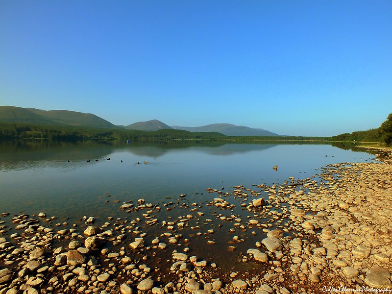 Loch Morlich on a HOT summers morning
 by
CullenEllermanPhotography, on Flickr
We follow the road past Glenmore Visitor Centre and the Reindeer House and park in the very next car park we come across, with room for 6-8 cars. We pay the £2 for a day ticket, check our map and smack bang on 9am, we set off past a picnic table and follow a path into Glenmore Forest.
The path winds its way along a small stream before reaching a ford, which is crossed easily by a wooden bridge just upstream. We notice Yellow markers all the way along this stretch which indicate a circular walk around this part of the forest. Reaching a t-junction, we turn left (but if you park in the car park indicated on the walk description, this is the path you start on) and follow it over a bridge until we reached another t-junction with an information board about the area. We followed the path to the right and reached the stunning Lochan Uaine. A quick drinks break and a check on the temperature (it was 23C now) and we set off towards the Lairig an Laoigh path. At the junction, a sign warns of the dangers of this weather we have been having.
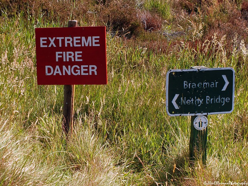 Extreme Fire Danger
 by
CullenEllermanPhotography, on Flickr
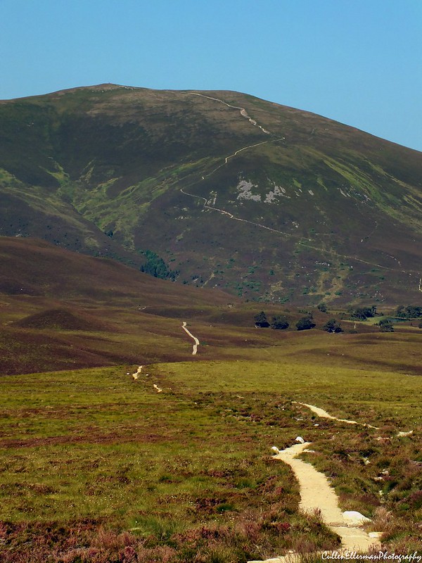
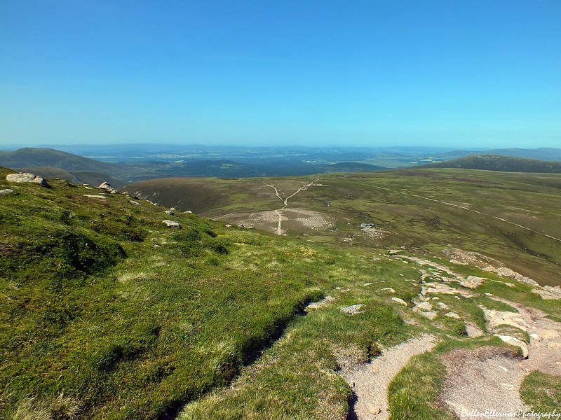
Following the path to Braemar, we could see the track as it disappears into the distance over some small hills. We passed a small sign informing us of our entry into RSPB Abernethy NNR.
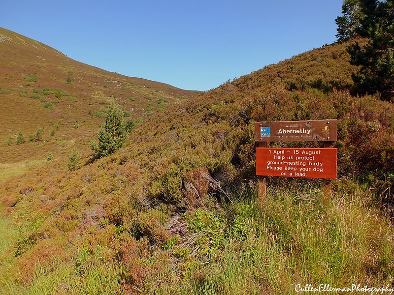 Abernethy
 by
CullenEllermanPhotography, on Flickr
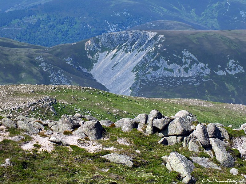
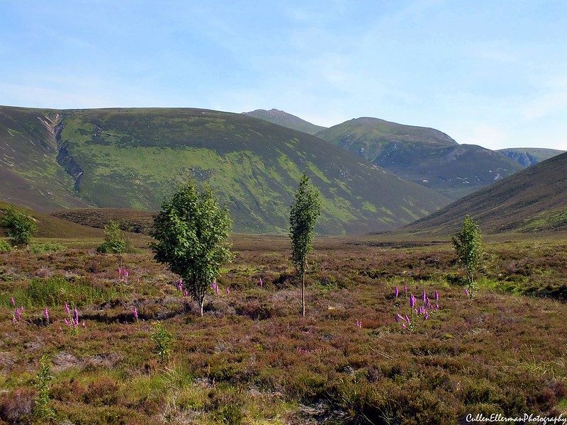
The path starts to climb slightly before some small uphill and downhill sections as it crosses the moorland. Some lochans appear on the left hand side as we turn around to admire the hill we climbed the previous weekend, Meall a' Buachaille.
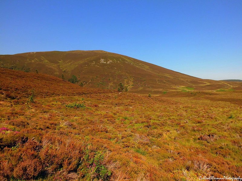 Meall a' Buachaille 2
 by
CullenEllermanPhotography, on Flickr
The temperature was rising fast. 27C in the shade. We could only imagine what it must have been like for us in the full gaze of the sun. Luckily for us, we reached the bridge at the River Nethy and took the opportunity to have a bite to eat and some water. We could see the summit of Bynack More from here. It looked a long way away. In the distance we could hear a noise, then we could see lights in the sky. The RAF Seaking from Lossiemouth was thundering down the valley towards Cairngorm. We don't know if it was on a training sortie or a mission, but wherever it was going, it was in a rush.
![DSCF6016.JPG]()
- RAF Seaking flying through the heat haze
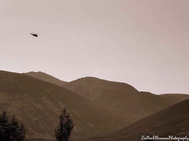 RAF Seaking
 by
CullenEllermanPhotography, on Flickr
After resting our feet in the freezing cold water of the River Nethy, we put our shoes back on, re-applied the sunscreen and rolled up our trousers as the main uphill section was about to begin. We crossed the bridge and the path started to climb, quite steeply in some places, as a warm breeze hit us as it blew through the glen. Another drinks break and Rick took the opportunity to take some photos of this stunning location.
 Lairig an Laoigh 1
 by
CullenEllermanPhotography, on Flickr
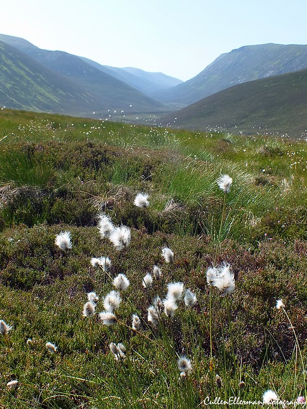 Cotton Cairngorms
 by
CullenEllermanPhotography, on Flickr
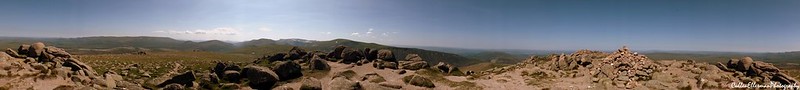
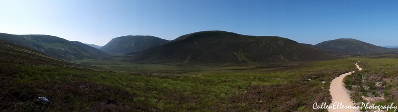 Cairngorms Panorama
 by
CullenEllermanPhotography, on Flickr
The track just kept climbing. We reached a section where a small hillock blocked the breeze and had to stop twice in a short distance to replenish our fluids.
 Meall a' Buachaille 3
 by
CullenEllermanPhotography, on Flickr
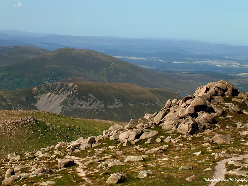
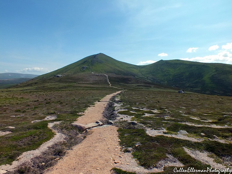
Eventually, the breeze hit us again, this time feeling a little bit cooler as we found a rock to sit on facing the wind and had a breather. We could see Bynack More's pyramid shaped peak as we were climbing, spurring us on, but also intimidating us as we could see that there was still more climbing to be done.
 Lairig an Laoigh 2
 by
CullenEllermanPhotography, on Flickr
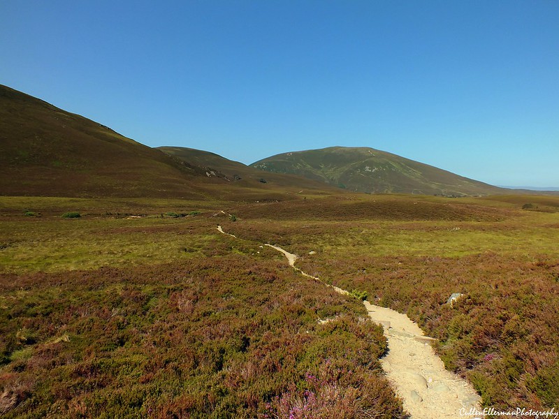
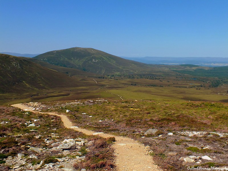
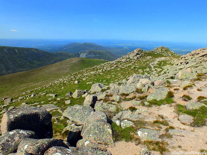
Eventually the path flattened out and walking became very easy again. The views around us were amazing. As we headed in a south-easterly direction, the path split in two and we followed the track to the right as it led us to our eventual target. The afternoon sun was very hot now and there was no protection from it on this tree-less ridge. We reached the bottom of the last climb to the summit and had a final drinks break before the 300m climb that lay before us.
Rick put his camera away as the path was gravel lined and both of us kept slipping as we made our way uphill. Kamila, leading the way, found a secondary path on the right hand side of the ridge and decided to follow this path. Rick stayed on the lower main path. With Kamila now out of sight, Rick took the opportunity to bring the camera out again and climb much slower, enjoying the views.
 Bynack More 1
 by
CullenEllermanPhotography, on Flickr
As we both made our way up the hill, two Ptarmigan's shot out from beside Rick's path. A few photos later and they were gone.
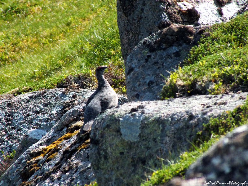 Ptarmagin 1
 by
CullenEllermanPhotography, on Flickr
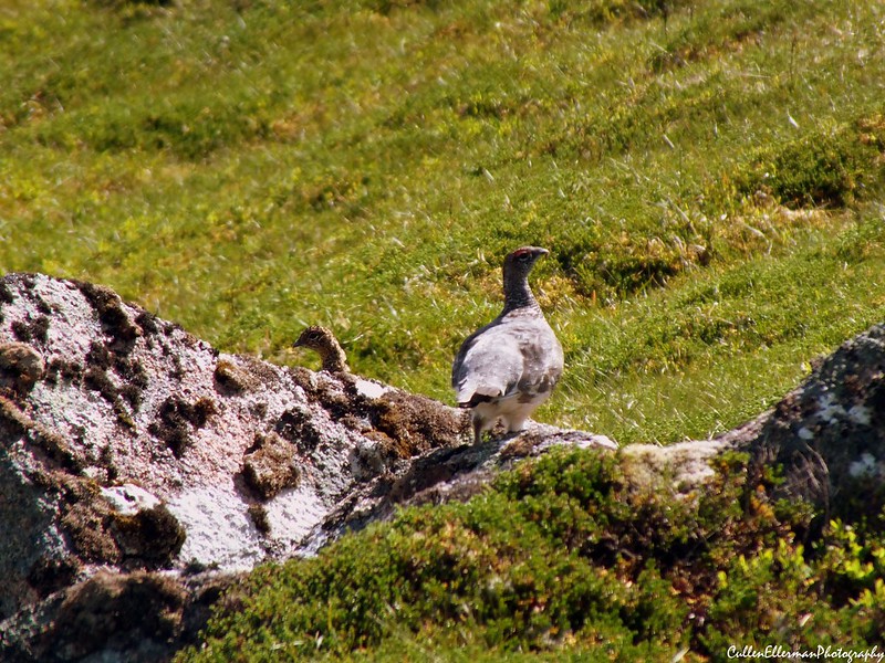 Ptarmagin 2
 by
CullenEllermanPhotography, on Flickr
After the excitement of seeing the Ptarmigan, Rick carried on along the lower path and eventually the two paths merged and Kamila re-appeared just ahead. The views were amazing from up here.
 Bynack More 3
 by
CullenEllermanPhotography, on Flickr
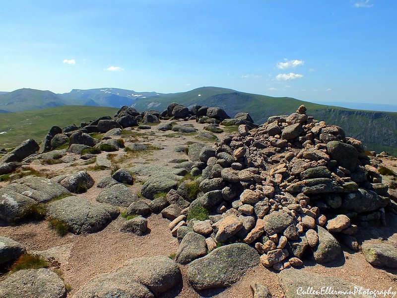
Together again, we stayed on the lower path and at 2pm in the blistering sun, 5 hours after we set off, we reached the summit of our first ever Munro.
 Bynack More 5
 by
CullenEllermanPhotography, on Flickr
We were both over the moon. It felt so fantastic to finally be on top of a Munro. We sat down on one of the many rocks that lay on the summit and had a celebratory lunch of sandwiches and a can of Coke each. We spent half an hour on the summit enjoying the views.
 Bynack More 6
 by
CullenEllermanPhotography, on Flickr
 Bynack More 9
 by
CullenEllermanPhotography, on Flickr
 Bynack More Panorama
 by
CullenEllermanPhotography, on Flickr
 Bynack More 11
 by
CullenEllermanPhotography, on Flickr
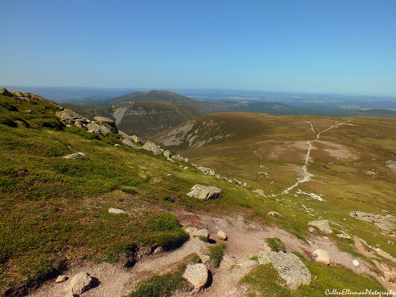
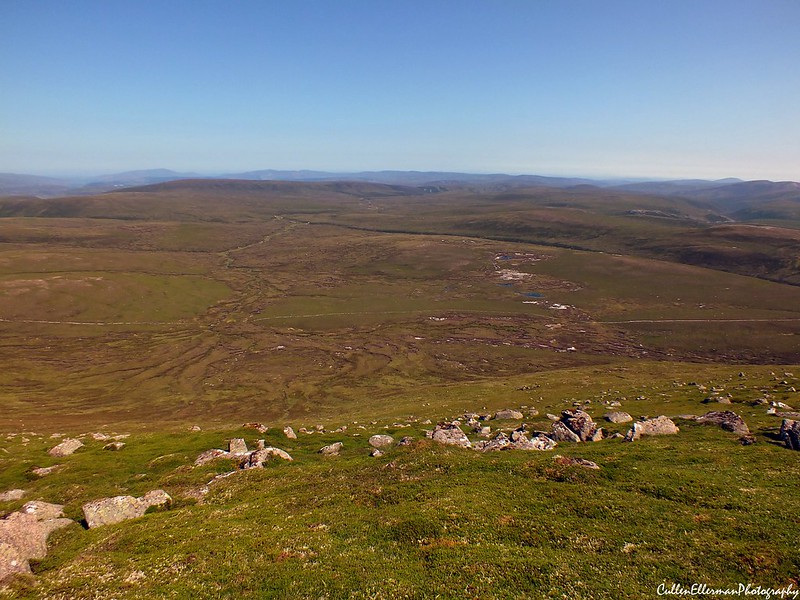
Kamila duly noted that although we were on the summit, we were still only halfway through the walk and that we still had 11km left to go, so we checked our water supplies for the return trip, said goodbye to the summit and returned back down to the ridge via the lower path. A Ptarmigan with two chicks appeared allowing Kamila to finally see her first ever Ptarmigan. A cooler breeze was blowing up here, making the walk down very pleasurable, as were the views of Speyside, Moray and Ben Avon.
 Bynack More 12
 by
CullenEllermanPhotography, on Flickr
 Bynack More 14
 by
CullenEllermanPhotography, on Flickr
 Bynack More 15
 by
CullenEllermanPhotography, on Flickr
Reaching the ridge again, we set off at a reasonably fast pace as Kamila had suggested getting an ice-cream to celebrate, so with that spurring us on, we turned around and had one last look at Bynack More from up here and rejoined the Lairig an Laoigh path.
 Bynack More 17
 by
CullenEllermanPhotography, on Flickr
The breeze started to heat up again and with the sun in its full afternoon mode, we could feel ourselves starting to sizzle. The path back down was much harder than going up as a combination of gravel and both our shoes losing their grip meant we slid more often than we should have. Rick put his camera away and we marched on to the River Nethy.
Arriving back at the bridge, our shoes and socks came off and we sat on the banks of the river with our feet in the ice-cold water. We could see the summit of Bynack More from here and sat in silence listening to the birds and reflecting on what we had just acheived.
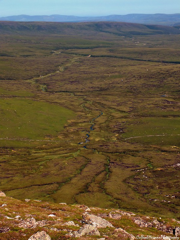
 Strath Nethy
 by
CullenEllermanPhotography, on Flickr
After what felt like only a few minutes, but was infact 20 minutes, we put our shoes back on and headed back along the track to the Ryvoan t-juntion. We wandered past Lochan Uaine and had a quick rest at its banks. The sun was intense now and the shade of the forest wasn't helping to protect us and neither was the breeze as it disappeared after Lochan Uaine.
Reaching the information board, we turned left. Our feet were hurting now. To make things worse, Kamila got a bite on her leg from a Cleg on this track and we also made an enemy with an angry wasp. Luckily it gave up chasing us after what seemed like an eternity.
We crossed the bridge and reached the next t-junction with a yellow marker post and turned right here. This track led us back to the car park. Passing families enjoying the small streams and having bbq's, we arrived back at the car 8.5 hours after we set off and had a short breather before departing Aviemore. We stopped in Nethy Bridge for a well-deserved Ice Lolly and a can of Coke from the local shop and relaxed by the river bank for a few minutes. We could hear an old wartime air-raid alarm going off in the distance to which Rick remarked that they use those in Australia at the volunteer fire brigades to warn of a nearby fire and alert the volunteers. It looks like that is what happens here too because as we were heading along the back road towards Tomintoul, we could see a large plume of smoke rising from beyond Aviemore.
We arrived back in Aberdeen at 8pm and celebrated our first Munro with a couple of glasses of wine and a light-supper. I think we now have the Munro bug....
Edit: Must learn to use spell checker...