Hillidays part 2: a wee miracle?...
The second day of hillidays started with a thick layer of cloud and mist covering Northern Soctland and as I got out of bed (without any headache this time, luckily!) I found it hard to believe that, according to forecast, it was going to brighten later. But preparations were made, route chosen, sandwiches made... Besides, we were not going to spend wedding anniversary sitting on our asses, watching TV!
Last year, for the round 5th, we climbed Buachaille Etive Mor and I still remember walking in the cloud to start with, but when we reached the summit, the thick layer lifted so we could see the views. As if the Good Shepherd kindly gave us his blessing
I don't exactly believe in miracles, but a was it a weird coincidence that the very same thing happened again this year????
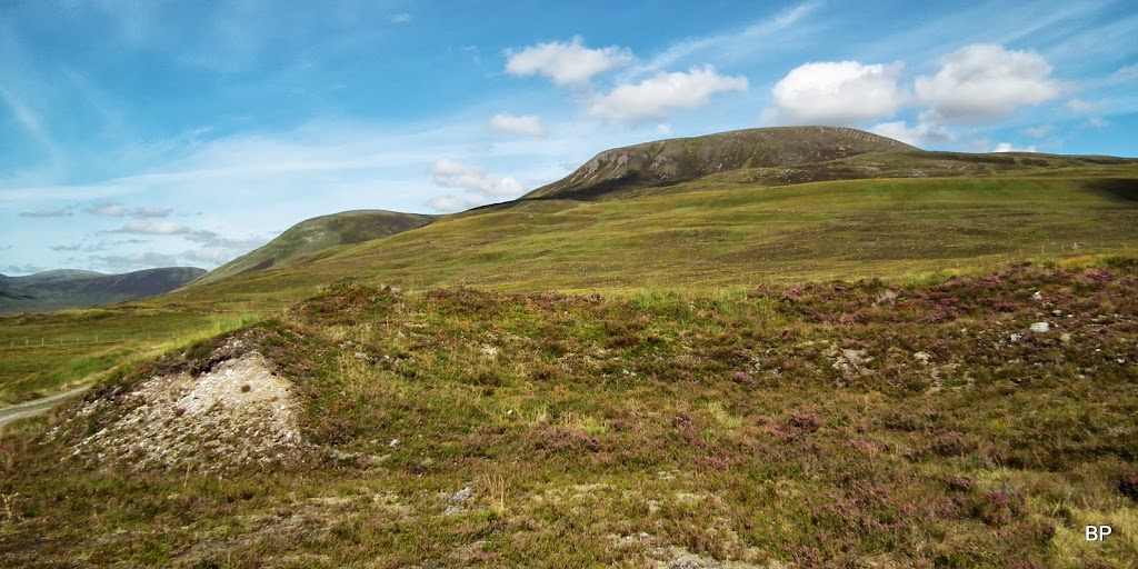
But back to the story now. The hill for the day was Beinn a' Chaisteil. Phew, just a Corbett, one could say. Yep, it may only be a Corbett, and one of the lower ones (788m), but the circular walk is really interesting. One of the longer routes for Corbetts (24km), with approach via very quiet, picturesque glen. Not a popular spot, so a perfect walk if looking for solitude. And the hill has unusual views to Beinn Dearg group, plus it's one of few summits from which you can have a good look at the inaccessible Seana Braigh. If that's not enough to advertise Beinn a' Chaisteil, then I give up
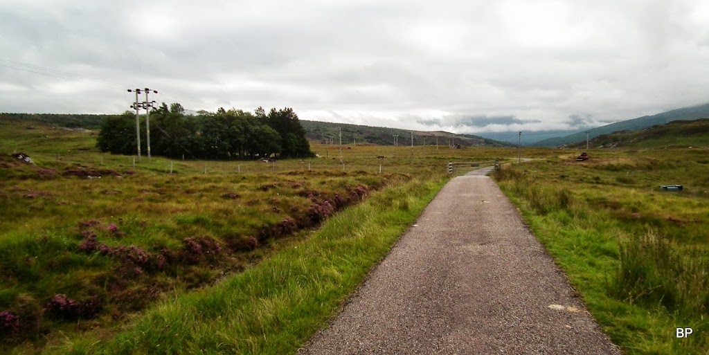
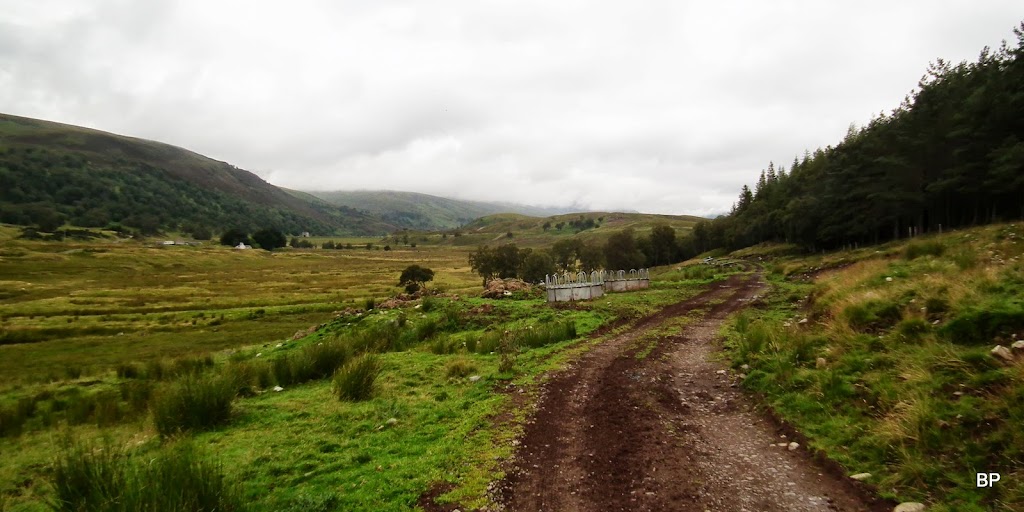
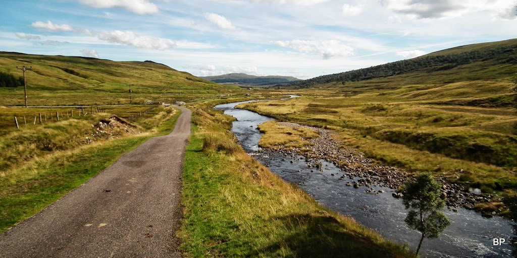
The starting point is near Black Bridge, from a good car park and for the first 2km or so follows a good tarmac road. Later, the tarmac gives way to dirt track, which (apart from a few muddy bits) generally offers good going all the way to the bottom of the hill.
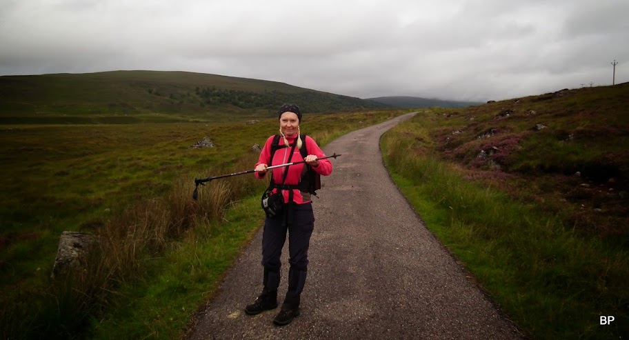
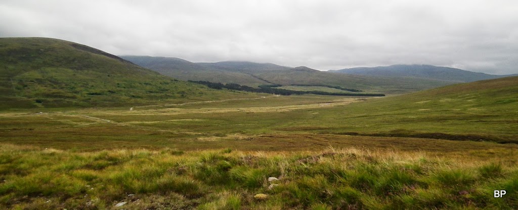
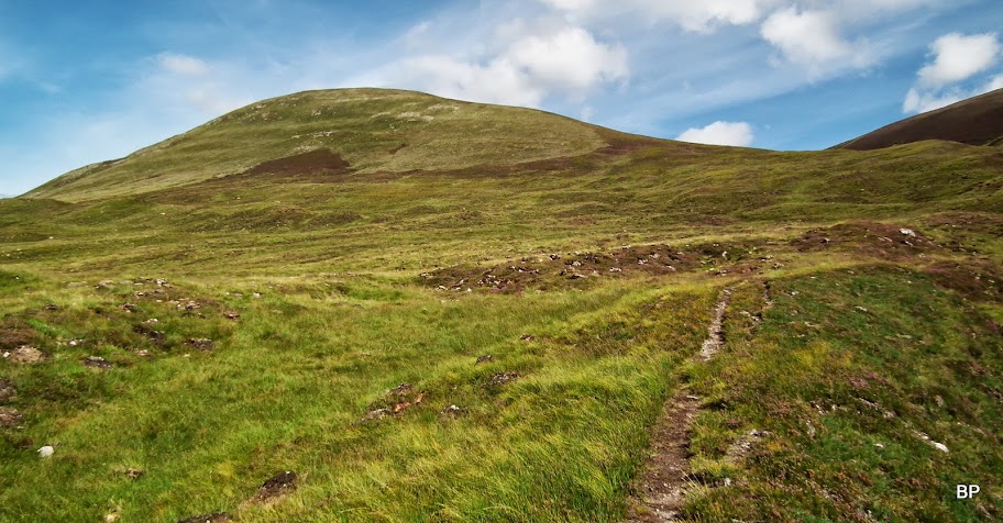
Here the walk begins:
Meeeeaaaaow! The Cat is ready for adventure!
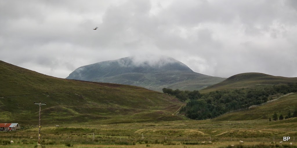
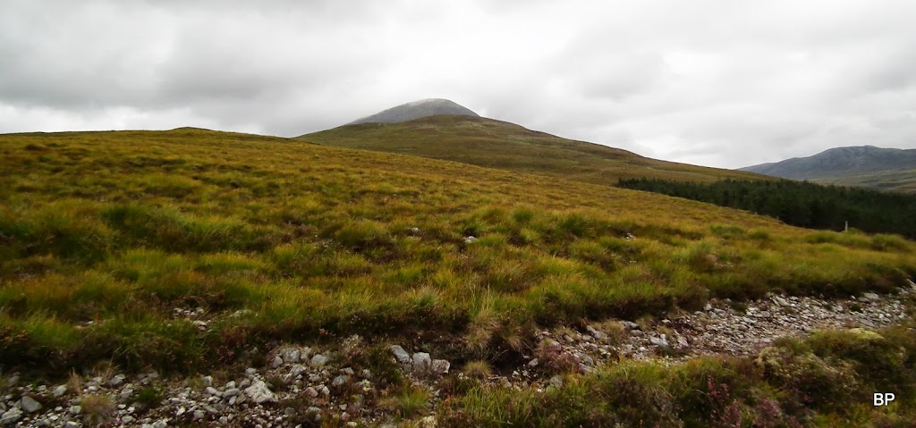
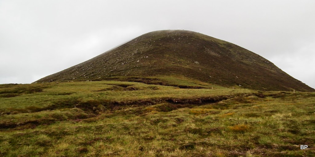
It was a pleasant walk along the road into Strath Vaich. Soon, even with the cloud level still low, we spotted "our" hill - or so we thought
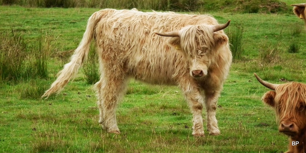
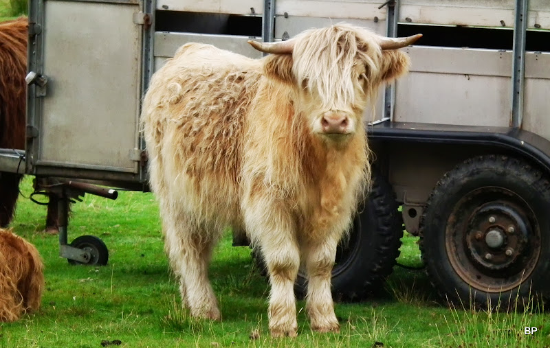
Wildlife consisted mostly of sheep and whatever they left behind (sheep poo again!!!) but we also encountered a small herd of The Wild Beasts of the Highlands
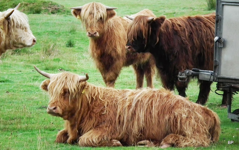
I know it's a bit silly to post pictures of cows, but aren't they cute?
Strathvaich Lodge and the eastern slopes of Am Faochagach. I always wondered if it would be possible to climb this Munro from the east:
Past Lubriach, the track becomes a bit muddy, and that must be due to farm animals come feeding here. Not too bad, though, no knee-deep bog feast.
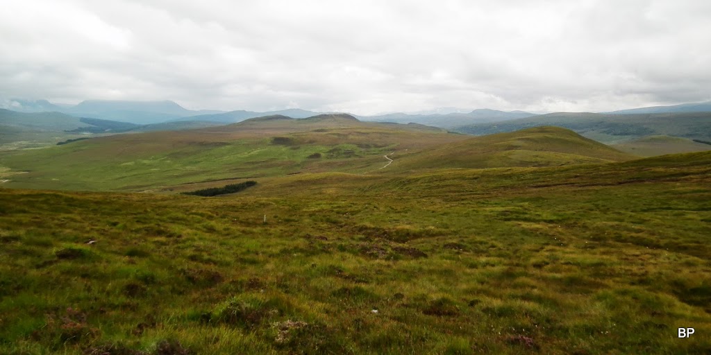
We followed the track past a small forest plantation to a gate (closed but not locked), only to feel slightly disappointed - the cloud was descending again...
Having reached a small dam, we turned right to a track, branching around Meallan Donn. If I can suggest anything, this is possibly the better direction to do this circuit, rather than following the track along Loch Vaich. The climb is less steep this way and though mostly pathless, the slopes are rather dry - I was surprised, expected more mud and bog.
Looking back along the track, with cloud over Beinn Dearg still laying low:
We circled Meallan Donn and as soon as we could see the target again, we started to look for the best point to turn off the track and tackle the slopes:
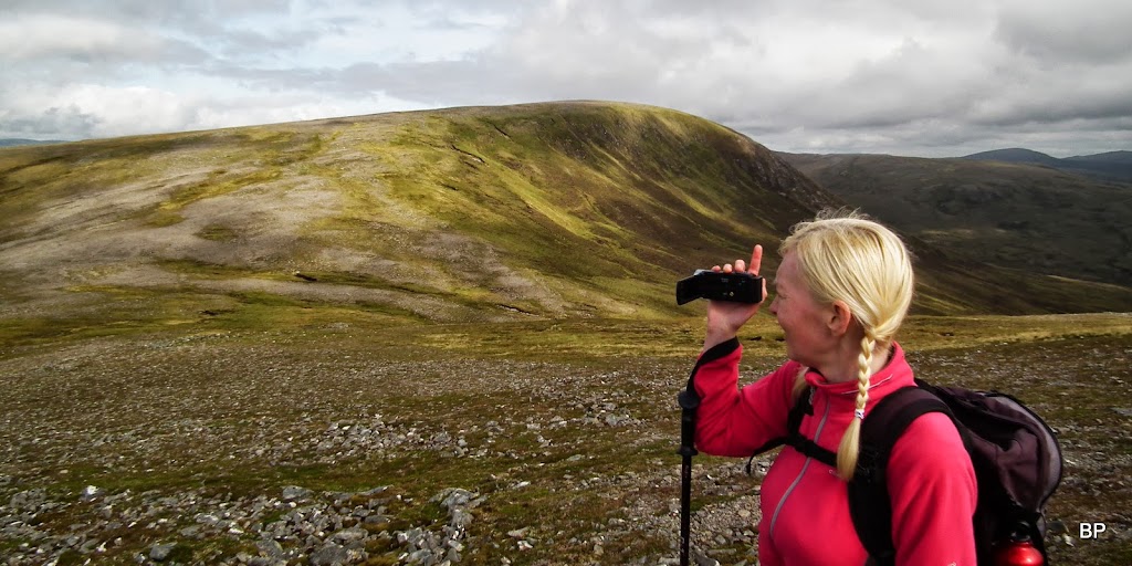
Weather was not at its best at the moment and Kevin expressed his doubts about the chance of cloud-free summit...
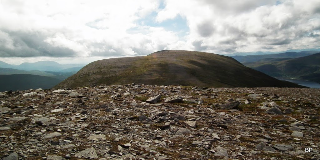
From the highest point on the track, one can basically walk in a straight line to the summit. Or so I thought. Having consulted the map I discovered that what we were looking at, was not the true summit, but just the lower top, Meall a' Ghrianan. The main top is hidden behind it.
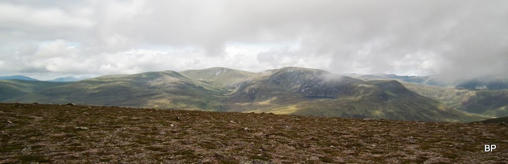
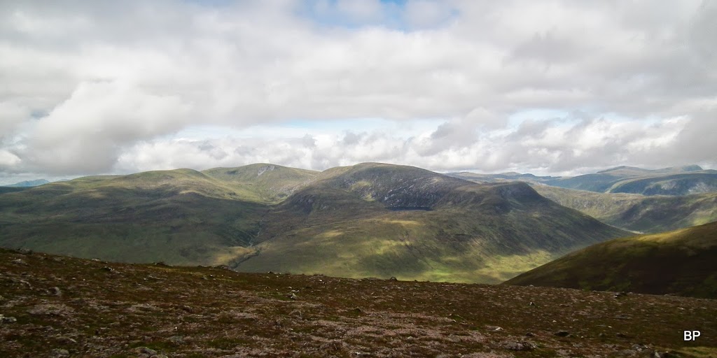
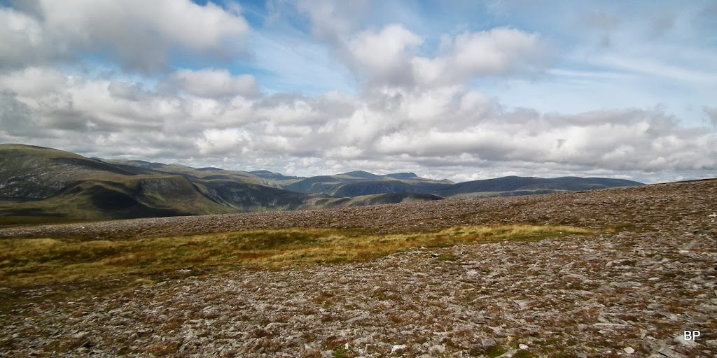
We began to climb and soon I was happy to notice that the underfoot was much less wet than I expected. We were making a good progress over grass and heather, such a shame that the panos were hidden... Here, view back south, with the lump of Meallan Donn to the right, and Little Wyvis, with its head in the cloud, to the left:
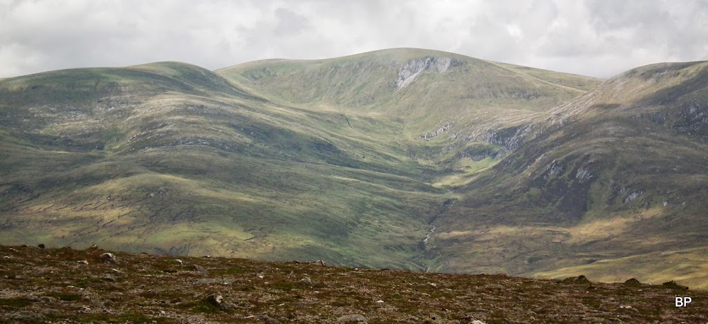
Twenty minutes later, and no significant change. just a nice view down to Strath Rannoch:
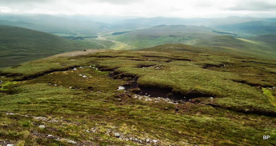
Climbing so far was not steep at all, but we reached the final push to the lower top - about 100m of steep ascent (but there is a zig-zagging path to help) and just in front - a small area of peat hags to cross. Not much of an obstacle, really:
Peat hags from above. They look worse than they are. We had no problem crossing them.
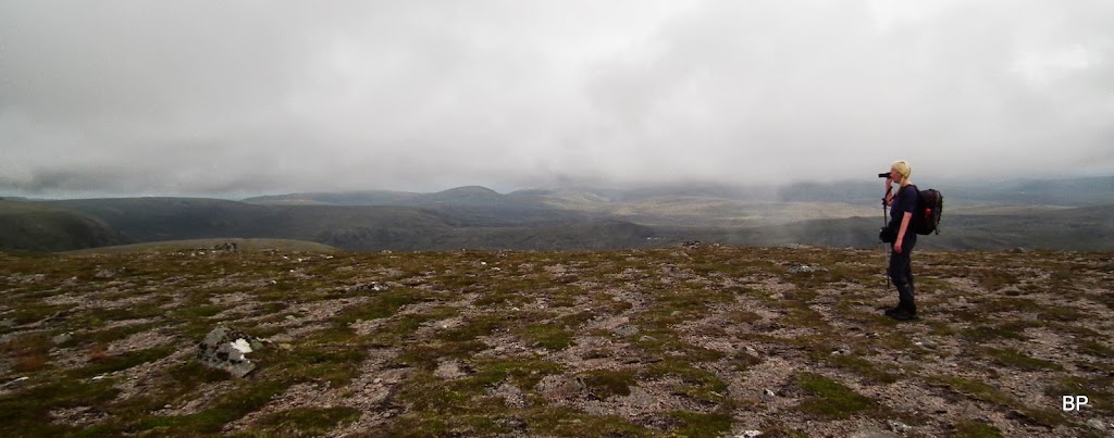
The summit of Meall a' Ghrianan is rather wide and it has a small cairn. We were not really tired, but decided to have a short break. The cloud was lingering virtually a few metres over our heads...
...and some lower views were available to photograph and to film.
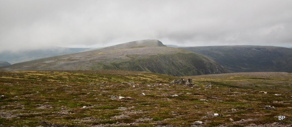
The true summit of Beinn a' Chaisteil seemed so far away, but it was a deceiving perspective:
Like in this Meat Loaf song about objects in the rear view mirror... My version would be:
OBJECTS SEEN FROM THE TOP OF THE HILL MAY APPEAR FURTHER THAN THEY ARE.
DO NOT GET DISCOURAGED.
IT IS CLOSER THAN YOU THINK.
I don't know if it was a miracle or not, a blessing in disguise, but only minutes after we reached the lower top, the thick, white cloud began to lift... And it was disappearing quickly, like with a touch of magic wand!
The "backside" of Am Faochagach:
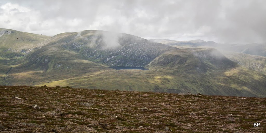
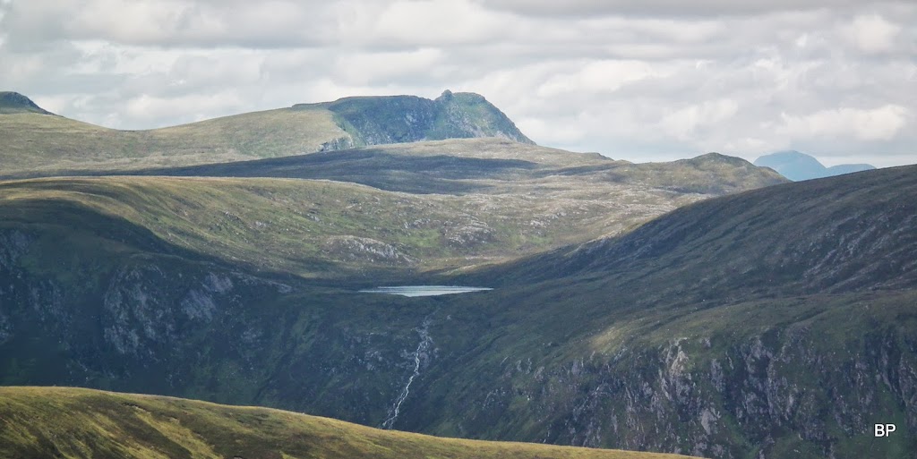
Gorm Loch, like a little blue gem fitted half way up the slopes:
Seana Braigh entered the stage...
...and only a few more minutes saw us walking in the sunshine!
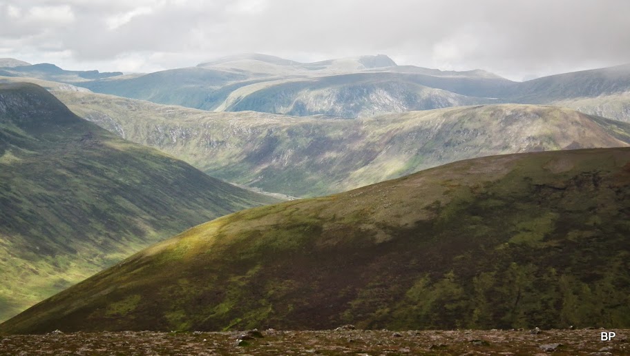
We moved on to cross the col - taking all opportunities to record the views...
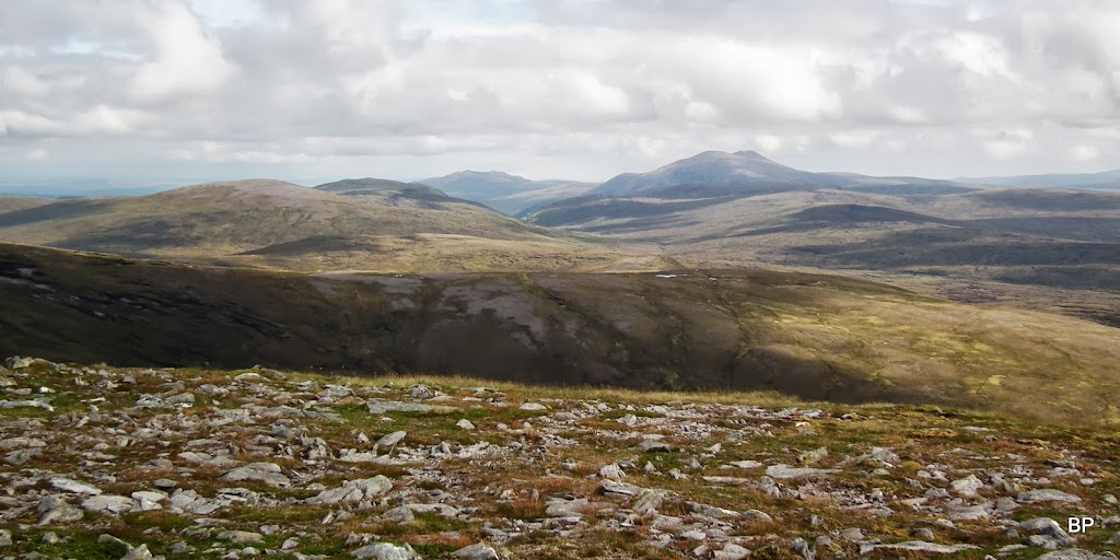
..and there was much to see and remember. View south-west, with the distinctive, pointy shape of Fionn Bheinn to the right:
Zoom to Miss Braigh:
It didn't take us much time to walk the distance to the true summit and weather has completely turned - magic??? Sunshine all over Scotland!
View back to Meall a'Ghrianan, cloud lifting:
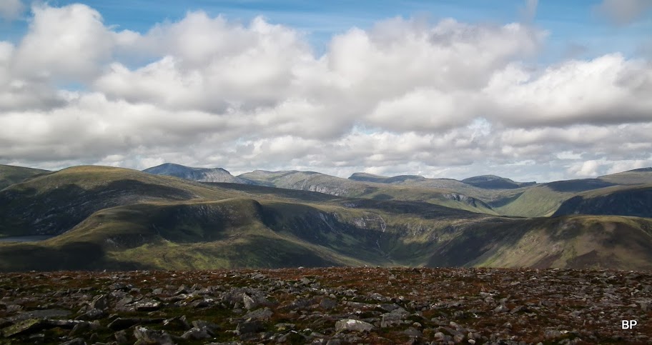
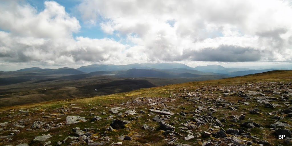
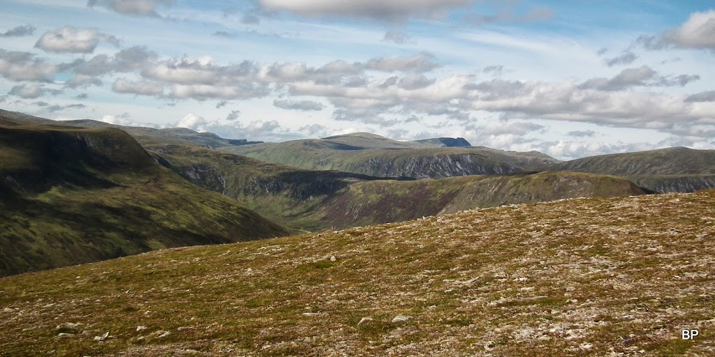
The full NW panorama:
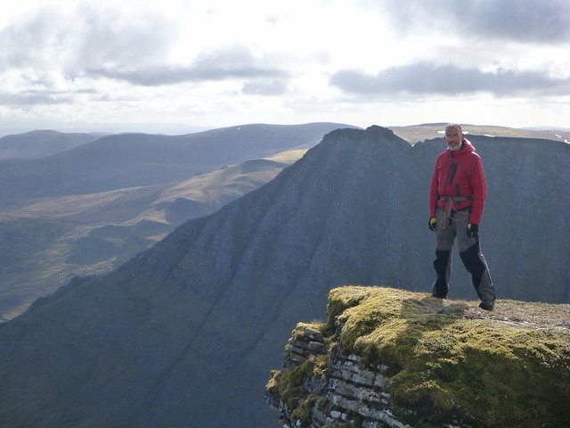
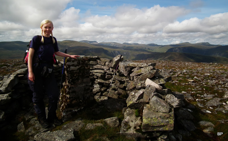
The summit of Beinn a'Chaisteil is a flat plateau, with a trig point and surrounding stone shelter, not that we were desperate to hide (not much wind on that day). This was my Corbett No.59, now I'm only one shy of my annual "C-target" of 60.
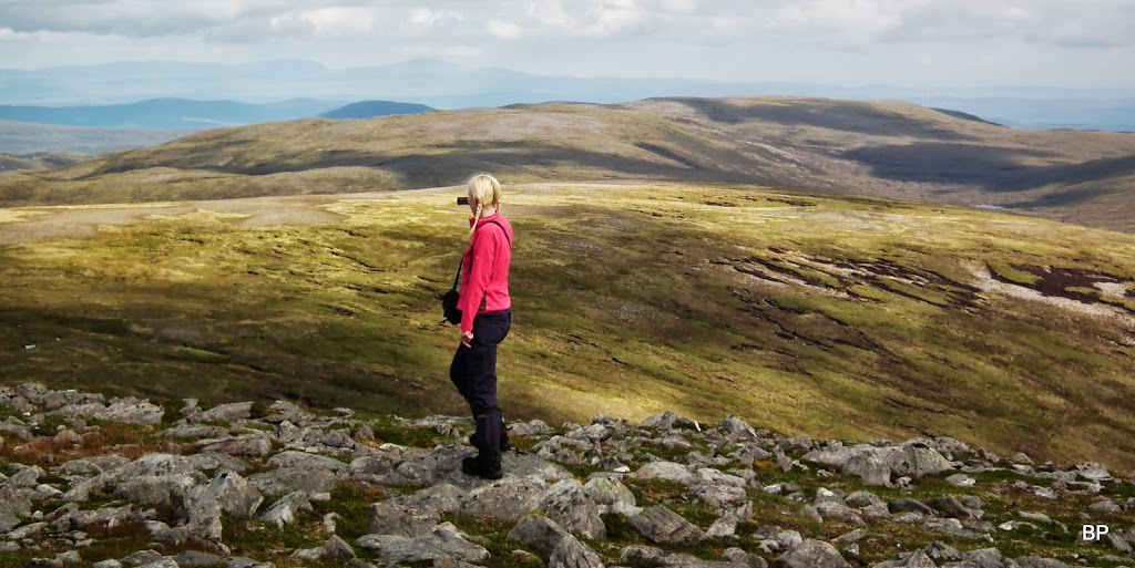
Now, it was time to relax, have some lunch, take more pictures, sink in the views and generally - be happy!
And this is what we saw - enjoy
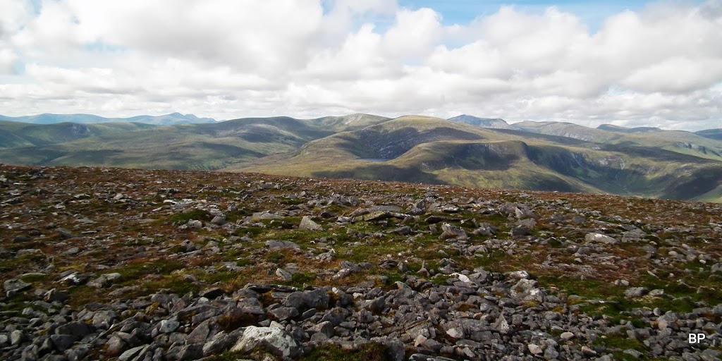
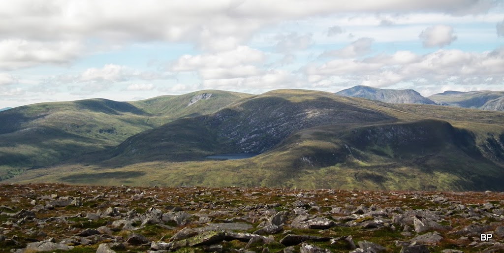
Western pano across Strath Vaich:
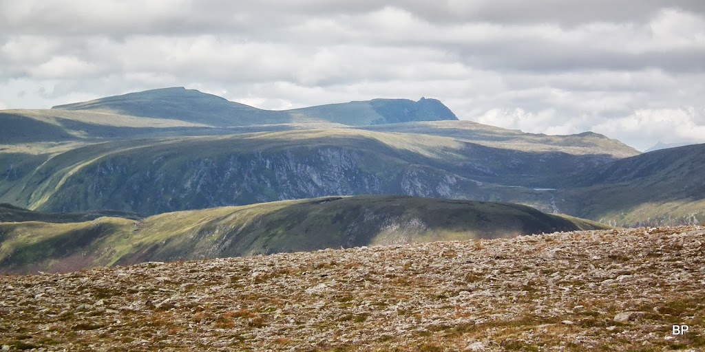
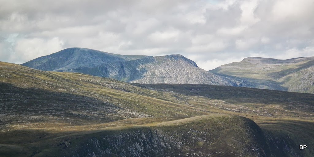
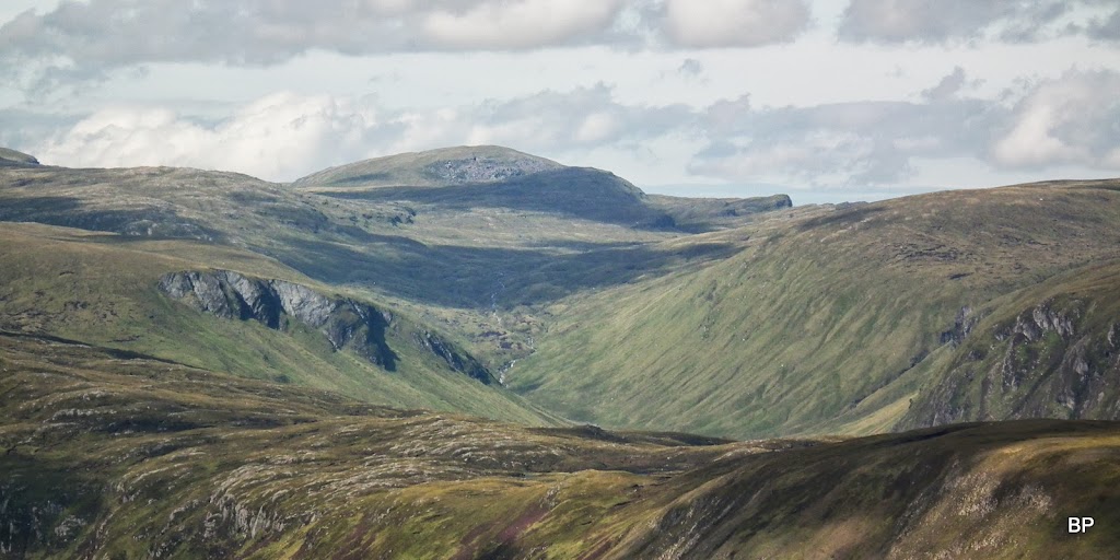
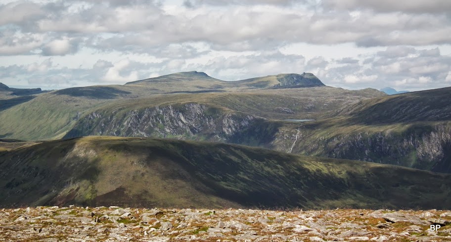
Beinn Dearg group, it can rarely be seen from this angle:
A few zooms:
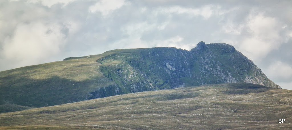
Seana Braigh:
Toman Coinich:
Fionn Bheinn:
The twin-topped Corbett, Carn a'Chlamain to the NE:
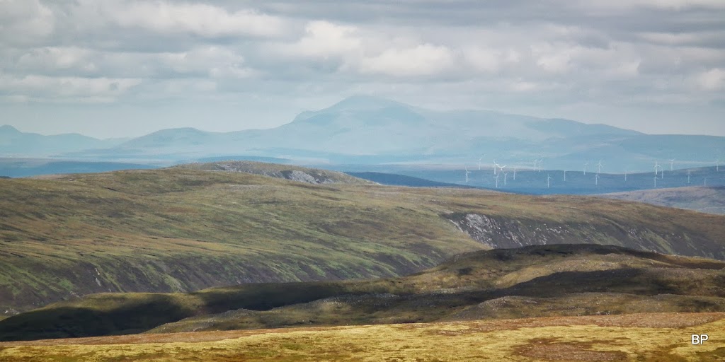
The very distant Ben Klibreck - and the wind farms
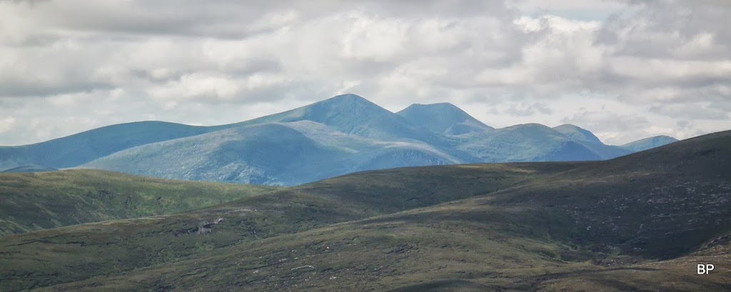
Wyvis brothers were the last ones to let go of the cloud:
...but the best views are to the west!
One more Seana...
This is one very intriguing rocky ridge:
OK, hope that was not too much... I'm infamous for writing too long reports. And that's just the best bites of what we saw!!! The day suddenly became warm and bright, so we took the full advantage of our time on the hills and spent over 30 minutes lazying on the summit... Just as well, we deserved it and it was a special day.
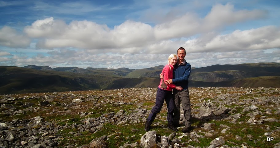
Married for 6 years, blessed with sunny weather again
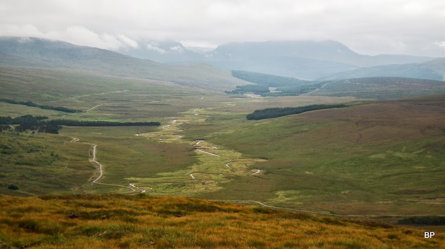
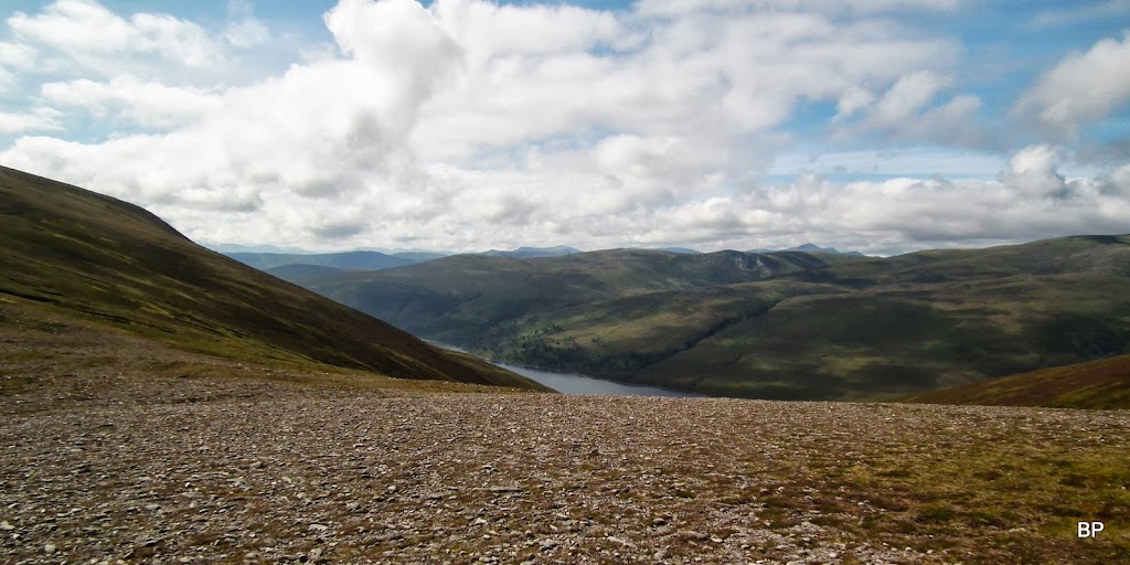
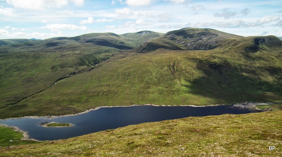
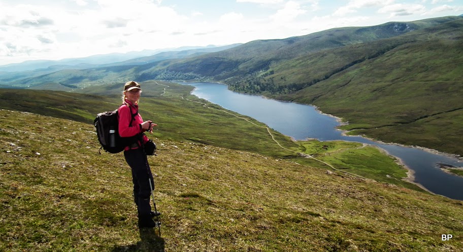
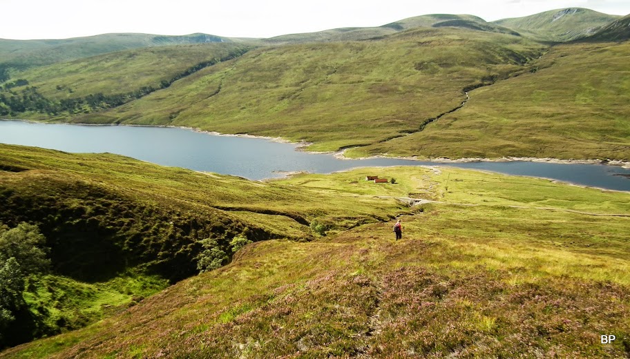
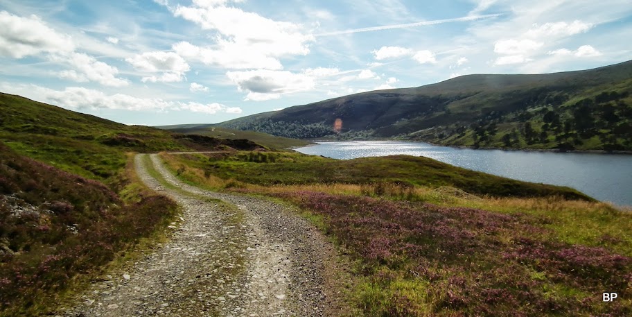
For the return route, one could retrace steps back over Meall a'Ghrianan, but a faster option is to descend straight down to the glen and walk back on the track along Loch Vaich - which is what we did. Views on the descent were lovely:
One last glimpse towards Seana Braigh, which we still have to visit - will do for sure in the future:
The descent is steep but easy going on grassy slopes:
It was getting hot now and I felt like I fancied jumping into Loch Vaich for a swim
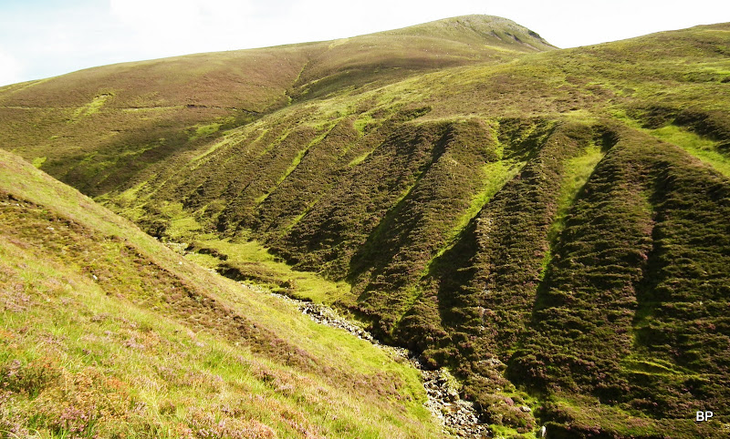
After descending maybe 200m, we picked an old stalker's path which took us down along Alt Lub a'Chlaiginn:
Walking down towards the track:
Alt Lub a'Chlaiginn, a nice cascade of falls:
Looking back up to the summit of Beinn a'Chaisteil , the path visible to the right:
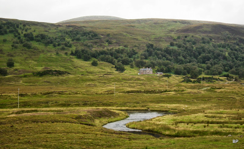
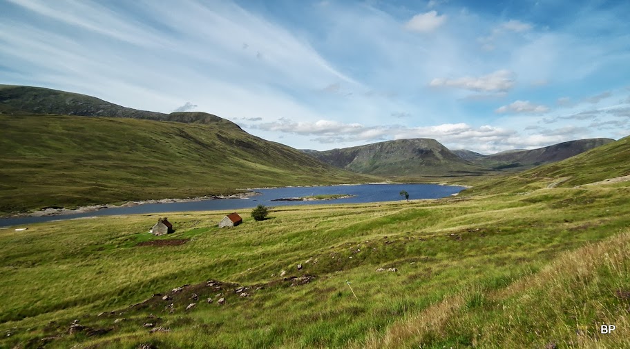
Upper Strath Vaich with the cottages of Lubachlaggan in the centre:
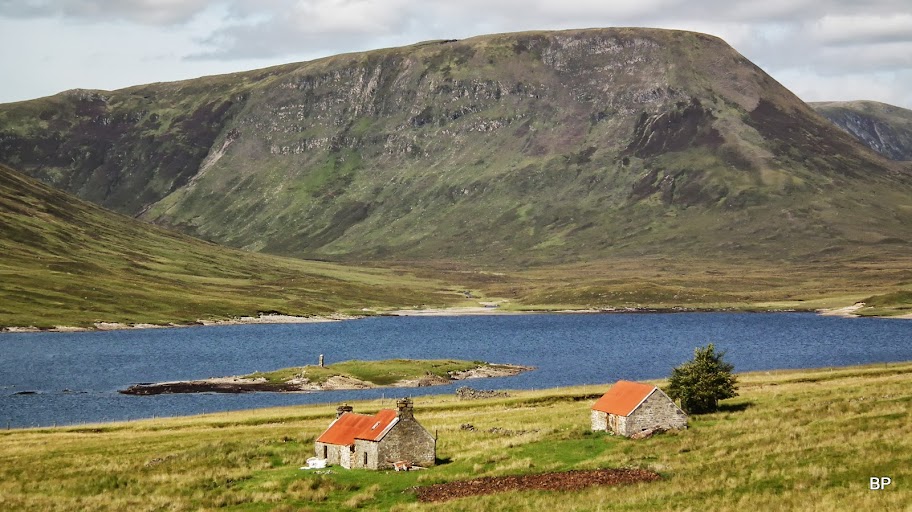
The buildings are being renovated at the moment (see the bag of stones in front of the larger house):
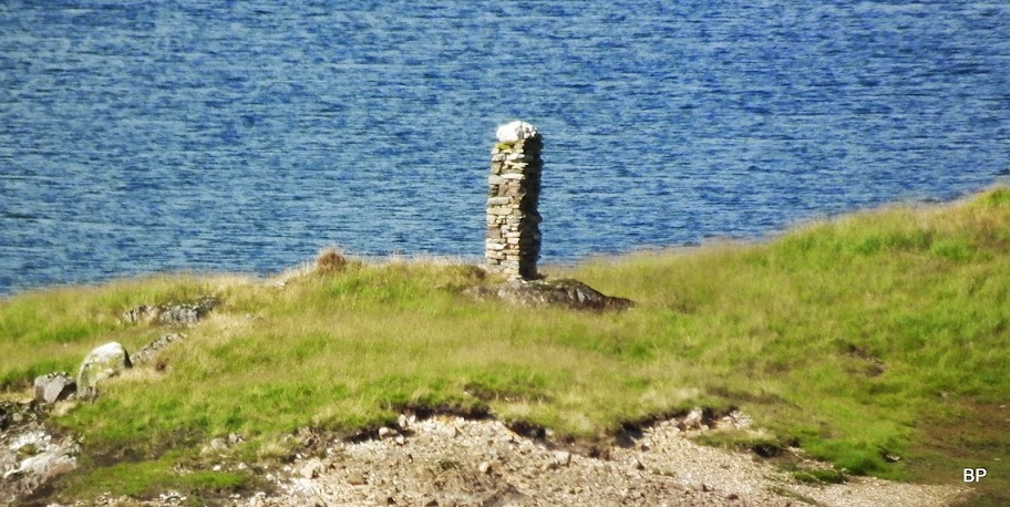
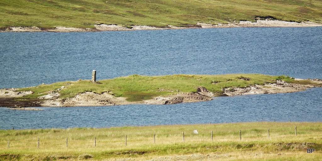
I can add this to the list of oddities - a pillar (?) built on a small loch island:
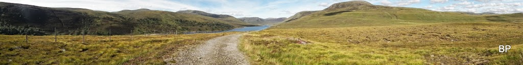
The return walk is long, but on a good track all the way, so we kept a good pace. We didn't meet a single soul, which was surprising as it was Sunday so i assumed there will be people at least taking a stroll alongside the glen. Ahh, I have to keep this Strath in mind for a wintry low-lever walk. Would be nice to see the surrounding mountains in white
Back to the little dam where we first turned off the main track, we looked back - what a difference to the early morning photos!
Panorama of Strath Vaich:
It's a straight walk on a good tarmac now...
The whole circuit was finished in about 7 hours and to be honest, it would be hard to do it in much less than that, unless you are superfit. Not that it's a difficult route, just the distance has to be walked... And to be honest, if blessed with good weather as we were, once up there, you won't be eager to finish the adventure too quickly!
Summing up: I don't understand why Beinn a'Chaisteil is so neglected, it's a superb mountain and it offers unique views to the hills of Beinn Dearg group. Not a "quickie in the neighbourhood", but the hours dedicated to climbing this hill will sure be hours well spent.
The third day of hillidays was dedicated to climbing a certain Munro which is often called a boring peak with a superb yet long approach through a lovely glen. For now - thank you for reading this, hope you enjoyed it. Meow!
Last year, for the round 5th, we climbed Buachaille Etive Mor and I still remember walking in the cloud to start with, but when we reached the summit, the thick layer lifted so we could see the views. As if the Good Shepherd kindly gave us his blessing
I don't exactly believe in miracles, but a was it a weird coincidence that the very same thing happened again this year????
But back to the story now. The hill for the day was Beinn a' Chaisteil. Phew, just a Corbett, one could say. Yep, it may only be a Corbett, and one of the lower ones (788m), but the circular walk is really interesting. One of the longer routes for Corbetts (24km), with approach via very quiet, picturesque glen. Not a popular spot, so a perfect walk if looking for solitude. And the hill has unusual views to Beinn Dearg group, plus it's one of few summits from which you can have a good look at the inaccessible Seana Braigh. If that's not enough to advertise Beinn a' Chaisteil, then I give up
The starting point is near Black Bridge, from a good car park and for the first 2km or so follows a good tarmac road. Later, the tarmac gives way to dirt track, which (apart from a few muddy bits) generally offers good going all the way to the bottom of the hill.
Here the walk begins:
Meeeeaaaaow! The Cat is ready for adventure!
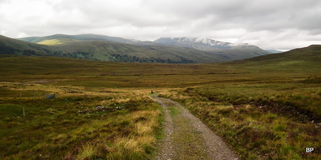
It was a pleasant walk along the road into Strath Vaich. Soon, even with the cloud level still low, we spotted "our" hill - or so we thought
Wildlife consisted mostly of sheep and whatever they left behind (sheep poo again!!!) but we also encountered a small herd of The Wild Beasts of the Highlands
I know it's a bit silly to post pictures of cows, but aren't they cute?
Strathvaich Lodge and the eastern slopes of Am Faochagach. I always wondered if it would be possible to climb this Munro from the east:
Past Lubriach, the track becomes a bit muddy, and that must be due to farm animals come feeding here. Not too bad, though, no knee-deep bog feast.
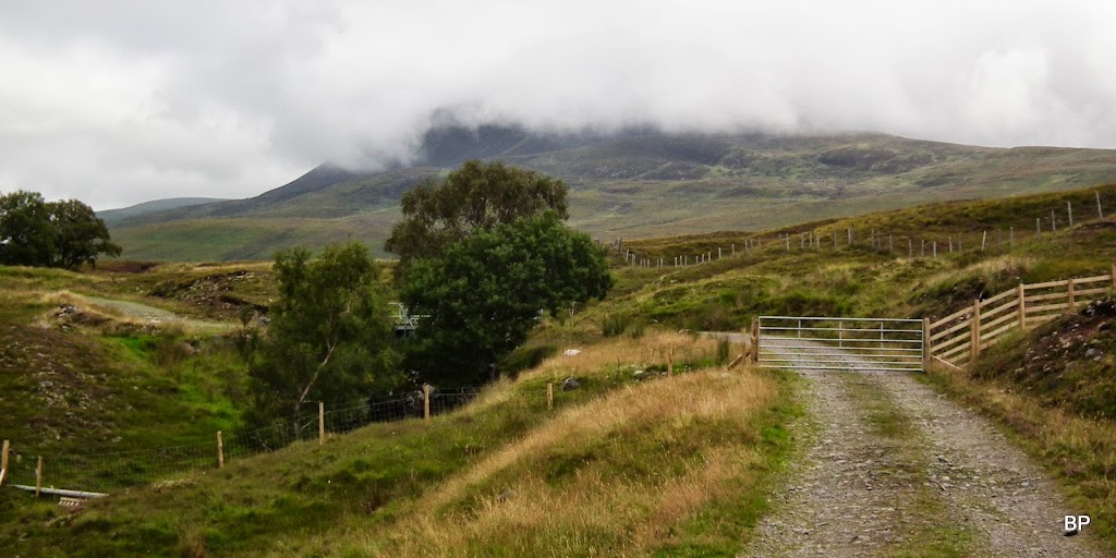
We followed the track past a small forest plantation to a gate (closed but not locked), only to feel slightly disappointed - the cloud was descending again...
Having reached a small dam, we turned right to a track, branching around Meallan Donn. If I can suggest anything, this is possibly the better direction to do this circuit, rather than following the track along Loch Vaich. The climb is less steep this way and though mostly pathless, the slopes are rather dry - I was surprised, expected more mud and bog.
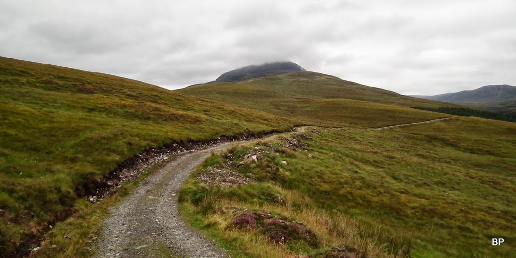
Looking back along the track, with cloud over Beinn Dearg still laying low:
We circled Meallan Donn and as soon as we could see the target again, we started to look for the best point to turn off the track and tackle the slopes:
Weather was not at its best at the moment and Kevin expressed his doubts about the chance of cloud-free summit...
From the highest point on the track, one can basically walk in a straight line to the summit. Or so I thought. Having consulted the map I discovered that what we were looking at, was not the true summit, but just the lower top, Meall a' Ghrianan. The main top is hidden behind it.
We began to climb and soon I was happy to notice that the underfoot was much less wet than I expected. We were making a good progress over grass and heather, such a shame that the panos were hidden... Here, view back south, with the lump of Meallan Donn to the right, and Little Wyvis, with its head in the cloud, to the left:
Twenty minutes later, and no significant change. just a nice view down to Strath Rannoch:
Climbing so far was not steep at all, but we reached the final push to the lower top - about 100m of steep ascent (but there is a zig-zagging path to help) and just in front - a small area of peat hags to cross. Not much of an obstacle, really:
Peat hags from above. They look worse than they are. We had no problem crossing them.
The summit of Meall a' Ghrianan is rather wide and it has a small cairn. We were not really tired, but decided to have a short break. The cloud was lingering virtually a few metres over our heads...

...and some lower views were available
The true summit of Beinn a' Chaisteil seemed so far away, but it was a deceiving perspective:
Like in this Meat Loaf song about objects in the rear view mirror... My version would be:
OBJECTS SEEN FROM THE TOP OF THE HILL MAY APPEAR FURTHER THAN THEY ARE.
DO NOT GET DISCOURAGED.
IT IS CLOSER THAN YOU THINK.
I don't know if it was a miracle or not, a blessing in disguise, but only minutes after we reached the lower top, the thick, white cloud began to lift... And it was disappearing quickly, like with a touch of magic wand!
The "backside" of Am Faochagach:
Gorm Loch, like a little blue gem fitted half way up the slopes:
Seana Braigh entered the stage...
...and only a few more minutes saw us walking in the sunshine!
We moved on to cross the col - taking all opportunities to record the views...
..and there was much to see and remember. View south-west, with the distinctive, pointy shape of Fionn Bheinn to the right:
Zoom to Miss Braigh:
It didn't take us much time to walk the distance to the true summit and weather has completely turned - magic??? Sunshine all over Scotland!
View back to Meall a'Ghrianan, cloud lifting:
The full NW panorama:
The summit of Beinn a'Chaisteil is a flat plateau, with a trig point and surrounding stone shelter, not that we were desperate to hide (not much wind on that day). This was my Corbett No.59, now I'm only one shy of my annual "C-target" of 60.
Now, it was time to relax, have some lunch, take more pictures, sink in the views and generally - be happy!
And this is what we saw - enjoy
Western pano across Strath Vaich:
Beinn Dearg group, it can rarely be seen from this angle:
A few zooms:
Seana Braigh:
Toman Coinich:
Fionn Bheinn:
The twin-topped Corbett, Carn a'Chlamain to the NE:
The very distant Ben Klibreck - and the wind farms
Wyvis brothers were the last ones to let go of the cloud:
...but the best views are to the west!
One more Seana...
This is one very intriguing rocky ridge:
OK, hope that was not too much... I'm infamous for writing too long reports.
Married for 6 years, blessed with sunny weather again
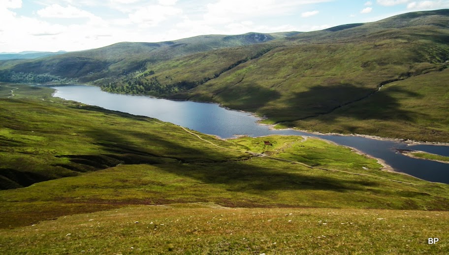
For the return route, one could retrace steps back over Meall a'Ghrianan, but a faster option is to descend straight down to the glen and walk back on the track along Loch Vaich - which is what we did. Views on the descent were lovely:
One last glimpse towards Seana Braigh, which we still have to visit - will do for sure in the future:
The descent is steep but easy going on grassy slopes:
It was getting hot now and I felt like I fancied jumping into Loch Vaich for a swim
After descending maybe 200m, we picked an old stalker's path which took us down along Alt Lub a'Chlaiginn:
Walking down towards the track:
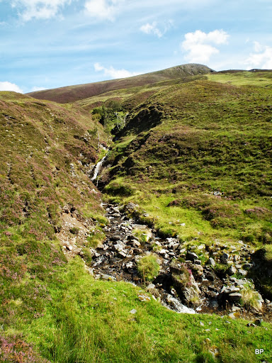
Alt Lub a'Chlaiginn, a nice cascade of falls:
Looking back up to the summit of Beinn a'Chaisteil , the path visible to the right:
Upper Strath Vaich with the cottages of Lubachlaggan in the centre:
The buildings are being renovated at the moment (see the bag of stones in front of the larger house):
I can add this to the list of oddities - a pillar (?) built on a small loch island:
The return walk is long, but on a good track all the way, so we kept a good pace. We didn't meet a single soul, which was surprising as it was Sunday so i assumed there will be people at least taking a stroll alongside the glen. Ahh, I have to keep this Strath in mind for a wintry low-lever walk. Would be nice to see the surrounding mountains in white
Back to the little dam where we first turned off the main track, we looked back - what a difference to the early morning photos!
Panorama of Strath Vaich:
It's a straight walk on a good tarmac now...
The whole circuit was finished in about 7 hours and to be honest, it would be hard to do it in much less than that, unless you are superfit. Not that it's a difficult route, just the distance has to be walked... And to be honest, if blessed with good weather as we were, once up there, you won't be eager to finish the adventure too quickly!
Summing up: I don't understand why Beinn a'Chaisteil is so neglected, it's a superb mountain and it offers unique views to the hills of Beinn Dearg group. Not a "quickie in the neighbourhood", but the hours dedicated to climbing this hill will sure be hours well spent.
The third day of hillidays was dedicated to climbing a certain Munro which is often called a boring peak with a superb yet long approach through a lovely glen. For now - thank you for reading this, hope you enjoyed it. Meow!