
A backpack around Glen Orchy
Another chance to get away for the weekend presents itself, but to make the most of the cheap bus/train tickets, I need to decide where I'm going a couple of days in advance. A number of plans were made and discarded. 3 days in the Southern Uplands? 'Taking the p.iss' was the description used by Gill  . I almost settled on an overnighter of Streap and the hills to the north of Loch Eil, but the weather forecast was deteriorating. All hills are best saved for a good day, but Streap more so than most. I picked another overnight round from Bridge of Orchy instead, meaning I could still pick Gill up from her mate's hen night on Friday night. The weather was looking worse as the day approached, but I decided that as a fair weather camper, it was time to test out my gear in some more challenging conditions.
Saturday
Corbetts: Beinn Bhreac-liath, Beinn Udlaidh.
Grahams: Beinn na Sroine, Beinn Donachain.
Date: 21/09/2013.
Distance: 26km.
Ascent: 1890m.
Time taken: 8 hours 40 minutes.
Weather: Calm, cloudy, occasional breaks. Turning to persistent rain in last 2 hours.
Passing through Fort William on the Saturday morning, the weather looked pretty good in the Streap direction actually. No matter - I had left that map at home anyway. As soon as we passed over Rannoch Moor, the rain started pelting down and I wondered how I'd judged things so badly. Off the bus just after 10am at Bridge of Orchy, and things didn't seem as bad, although rather claggy.
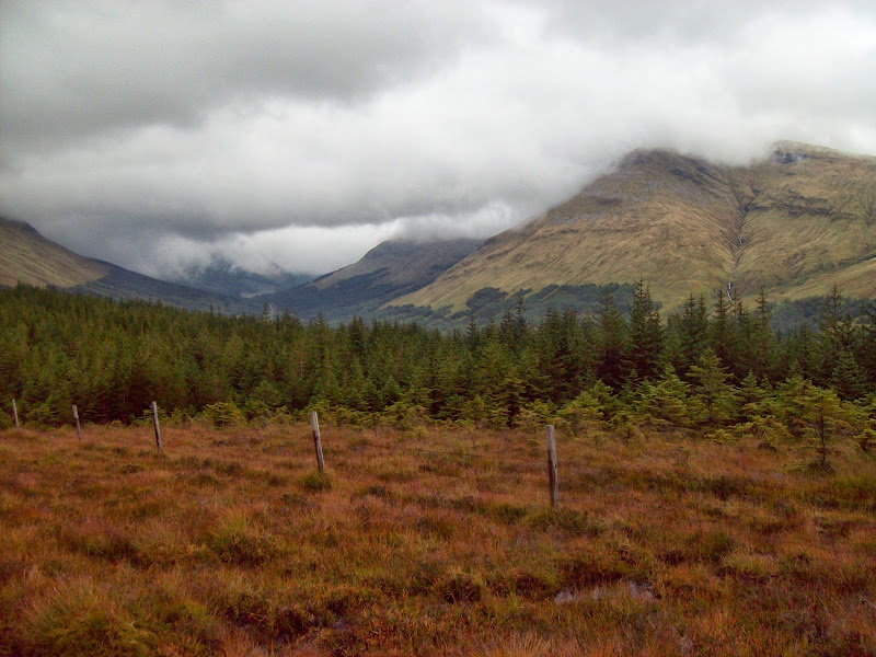
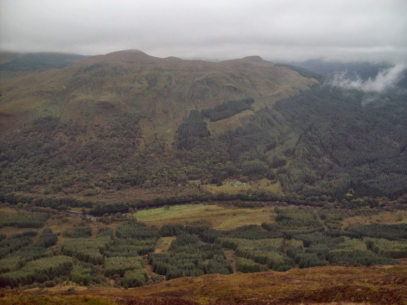
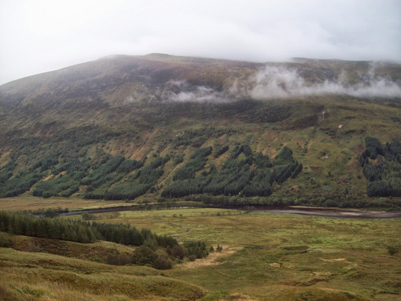
Towards Beinn Bhreac-liath from the A82:
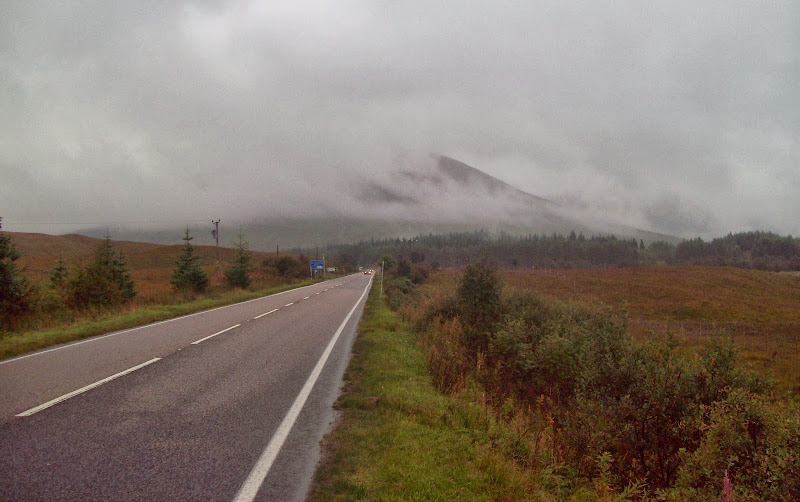
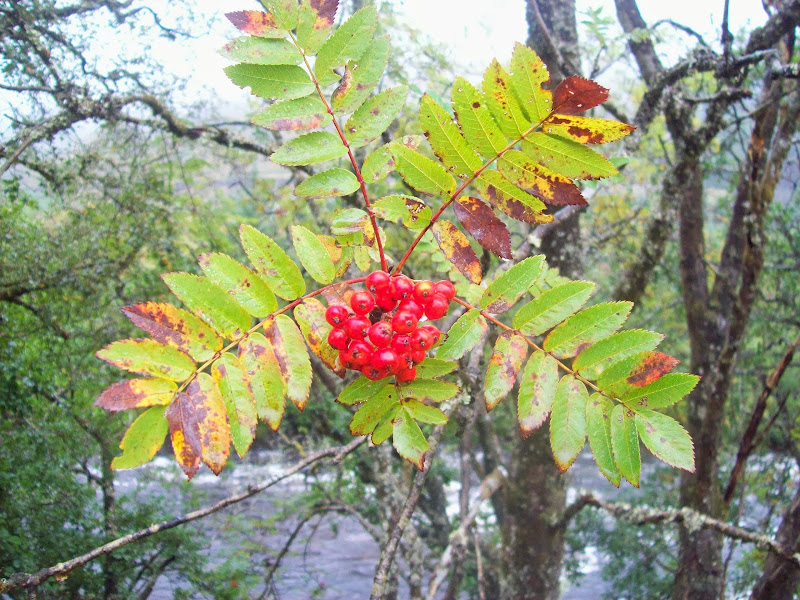
There is a track shown following the river down to the Glen Orchy turn-off, but it doesn't come right up to the village. In the end I just wandered down the verge of the A82 for 10 minutes - not much fun but soon over. I planned to get onto the nose of Beinn Bhreac-liath a short distance down Glen Orchy, and follow the ridge all the way to the summit. There were some nice beginning-of-autumn colours in the glen, although not the full show yet.
Rowan in Glen Orchy:
With the high gusts forecast, I had a mild sense of deja-vu. Along with Kevsbald, Gavin and DaveH, I had been defeated by this hill on christmas eve a couple of years ago. Thankfully the gusts didn't materialise, and it was just down to the clag to provide the similarity.
I climbed a gate at the end of the forestry plantation and headed up the hill. The thigh-high wet grass saturated my boots instantly, and was a little annoying. Once past this, it was an uneventful plod to the summit cairn.
Looking back towards Bridge of Orchy:
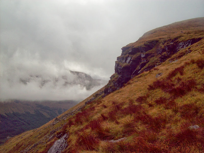
The col looked potentially awkward to descend to in the mist, so I took a bearing. I still managed to wander off it though - the sound of traffic told me I was directly over the A85. In the end, the clag cleared briefly to show me that I had dropped below the col, and was traversing endlessly round the hillside beneath it. Not a massive problem, and I was soon on my way up Beinn Udlaidh. It was nice to be able to see something as well, and Beinn Bhreac-liath was briefly lit up by the sun.
Lochan na Bi, Glen Lochy:
Shoulder of Beinn Udlaidh:
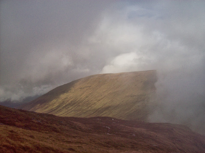
Looking back to Beinn Bhreac-liath in a rare patch of sunshine:
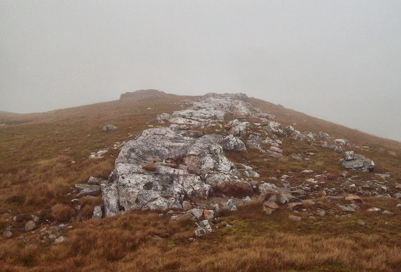
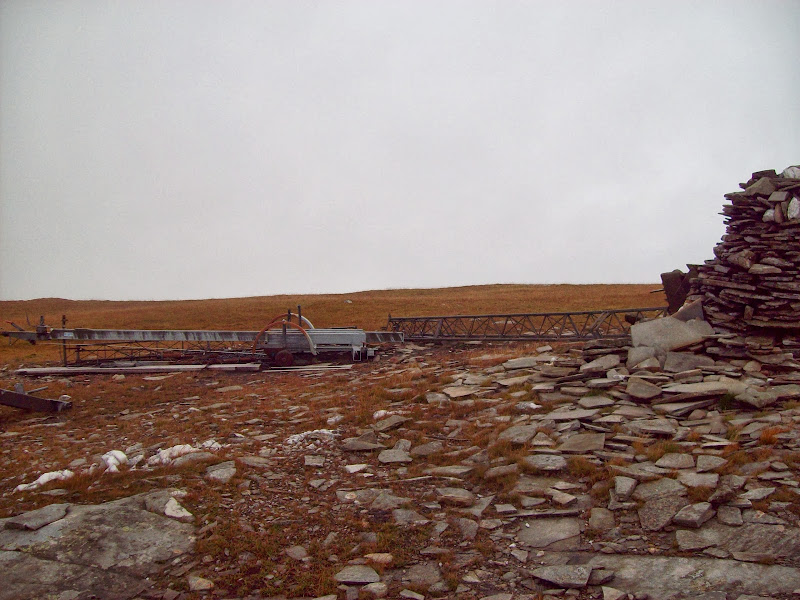
By the time I reached the summit plateau, the views were all gone again. It was nice to see the top of the vein of quartz that runs up the hillside from Glen Orchy - my route choice meant I didn't get to follow this. Between that and the ruined mast, I didn't have to worry about whether I was on the correct summit!
Top of the quartz vein that runs up the entire height of this hill:
Summit junk – you can guess which summit easily:
Again I took a bearing off, and again I didn't follow it properly. A few minutes later, a second glance at the compass revealed that I was descending to Glen Orchy. Too soon for that, I traced the top of the crags back round to the correct ridge. I would like to have seen more of this corrie, as it is very popular with winter climbers, but the clag won again (apart from a couple of promising blue spots above).
A brief clearing over one of many cairns on the plateau:
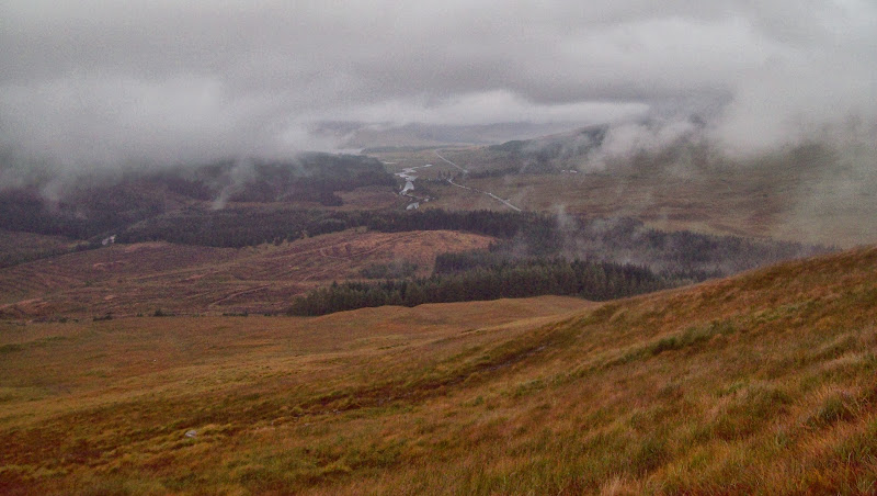
Plenty of well-built cairns led the way off the hill. There is also a faint vehicle track down to Glen Orchy, which I didn't follow. Instead I kept going SW towards Beinn na Sroine and the forest that engulfs it. I had lunch when the cloud broke again, looking back at Beinn Chuirn. That had been a battle to climb last December - I really don't seem to get the best weather when I come to this part of the country!
Beinn Chuirn:
I descended to the plantation and plunged into the trees at a likely looking spot where they were thinner. A look at a google satellite image the day before had shown me that the best route involved descending slightly to the Glen Lochy side of the ridge, before picking up a ride. However the mist was so thick I couldn't tell where on the ridge I was.
Entering the forest of doom:
The result was that after a few minutes, I was reduced to crawling through thick trees and disappearing up to my knees in muddy pools. Not what I had intended! I finally managed to extricate myself and follow a damp but easy ride to the other end of the trees. There is probably a good reason why no-one combines these hills in a single walk .
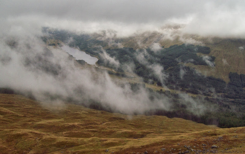
At least the cloud had lifted a little here, giving me my best views of the day down Glen Lochy.
Looking back towards Beinn Udlaidh:
Glen Lochy and Beinn Chuirn:
A short way up Beinn na Sroine, the ridge levels out. I left my bag against the fence and made my way to the summit, where I was back in the cloud again. The only excitement was the remains of an old mast. The best way down to Glen Orchy was directly from the summit, but as the only bridge in the vicinity was further upstream, I went back to my bag and cut down the hillside there.
Approaching Beinn na Sroine:
Glen Lochy again:

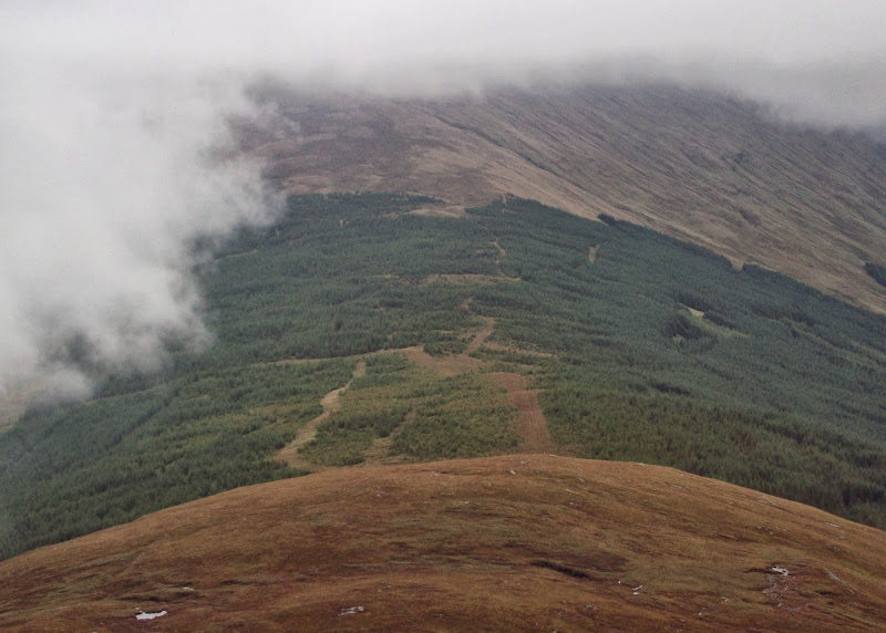
Zoom into the forest of doom – you can see the firebreaks I missed if you are ever contemplating the same route:
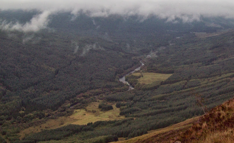
River Orchy:
The descent was steep and fast, until the final 100m, when I followed a burn through more forest (this stuff wasn't on my map - must get a newer map!). I finally dragged my way through the undergrowth and out onto the road, almost opposite the footbridge at Catnish.
Catnish and Cromadh Mor:
There were a couple of fishermen here - the only people I saw away from the A82 all day. I believe this bridge used to have a reputation for having a locked gate. I was a bit taken aback to find it locked again - for maintnance apparently (by the Forestry Commission - due to re-open in June 2014). There weren't any other crossing places particularly nearby, and I didn't fancy wading today - the Orchy is a pretty big river.
Bridge over the river Orchy near Catnish. Closed for maintenance again:

It looked possible to do a few acrobatics to climb around the gate. I couldn't possibly condone this, so I'll not tell you how I got across, suffice to say my feet didn't get wet .
.
It was a nice change to stroll along the flat on the north bank, and not have to think where to put my feet next. There was some lovely deciduous woodland here, and a good variety of fungi. The path gradually got wetter as I approached the edge of the woods, then it was back onto steep long grass again as I cut a corner on the stalker's path heading up Beinn Donachain.
Fungi:
Colours starting to turn along the river bank:
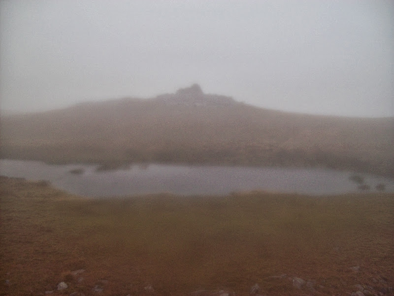
The rain came on here properly for the first time since getting off the bus, and fatigue began to set in. Having wasted the best part of an hour on navigational blunders today, I decided to follow burns and lochans rather than taking any more bearings. I followed a burn right up to Heart Loch, which would have been my camping spot of choice had the weather been better. But no, the rain was on and the clag was down again, so I went on to the summit via another un-named loch. There was a junction of deer fences prior to the last steep haul, so I left my bag there.
Back across the glen to Beinn na Sroine:
I went back to my bag, then quickly retreated down the north side of the hill, toward Beinn Mhic Mhonaidh. It was a shame about the weather. Beinn Donachain isn't a particularly excaptional hill, but from what I could see it did seem to have a nice summit area strewn with lochans, outcrops and small waterfalls.
I had planned to camp on the Donachain/Mhic Mhonaidh col if the weather was poor, as I thought I would be able to shelter from the wind by getting into the edge of the forest. However the forecast high winds had been completely absent, so I didn't worry so much about this.
Nowhere looked particularly appealing for camping as it was all bog and rocks, so I detoured down to the burn as it looked flatter and greener here. No such luck - the area was strewn with massive tussocks with small streams running round them. I was saturated and quite fed up now, and settled for a gravelly bank on the burn. The matted grass showed how high the water level could get if the rain got heavier, but i didn't think it would. The water would have needed to rise a couple of feet before reaching my tent.
Tonight’s campsite:
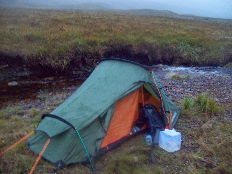
I put the tent up, shoved everything inside and didn't re-emerge for over 12 hours. I wasn't sure how well I'd cope with everything being soaking, but it was nice and warm and dry in my sleeping bag. By the time I was in, it was miserable and dark outside, so I quickly cooked some dinner then tried to get to sleep.
~~~~~~~~~~~~~~~~~~~~~~~~~~~~~~~~~~~~~~~~~~~~~~~~~~~~~~~
Sunday
Corbetts: Beinn Mhic Mhonaidh.
Grahams: Meall Tairbh.
Sub 2000 Marilyns: Beinn a' Chuirn.
Date: 22/09/2013.
Distance: 17km.
Ascent: 1210m.
Time taken: 6 hours 10 minutes.
Weather: Almost continuous rain and clag; some sunshine and clearing in last hour.
Today's plan was to be up and on my way for 7am to have enough time to include Beinn Suidhe in my walk. There wasn't supposed to be much rain today. Opening my tent door at 6am, evertything looked much as it had the night before, so I went back to sleep and decided to miss out Beinn Suidhe.
I woke again an hour later to bright sunshine. Some travellers had turned up, and were setting up a fairground. They seemed to take offence to my presence and were trying to set my tent alight with cigarette ends. It all seemed a bit unfair, but I told them I'd be on my way in an hour and that seemed to calm them down. Then I helped them choose music for the fairground rides...WTF . Actually everything was exactly as last time, and I thought my dream was a subtle way of telling me I'd left my stove on whilst asleep. I hadn't of course, and somehow managed to squeeze back into my dripping clothes after breakfast. The campsite had actually been very comfortable (as much as it is possible to be without a sleeping mat - it will probably make an appearance when we move house next month), and hadn't flooded overnight.
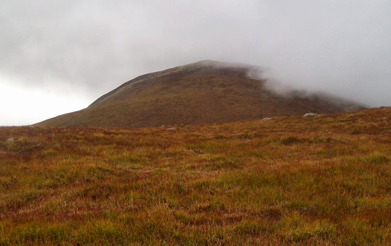
Beinn Mhic Mhonaidh in the morning – do I have to?
A steep but straightforward ascent put me on the top of Beinn Mhic Mhonaidh. Although only a 500m climb, it felt like much more. The views were uninspiring - another one to add to the list of hills to come back to on a nice day (the more walking I do, the longer the list gets )
)
Summit of Beinn Mhic Mhonaidh:
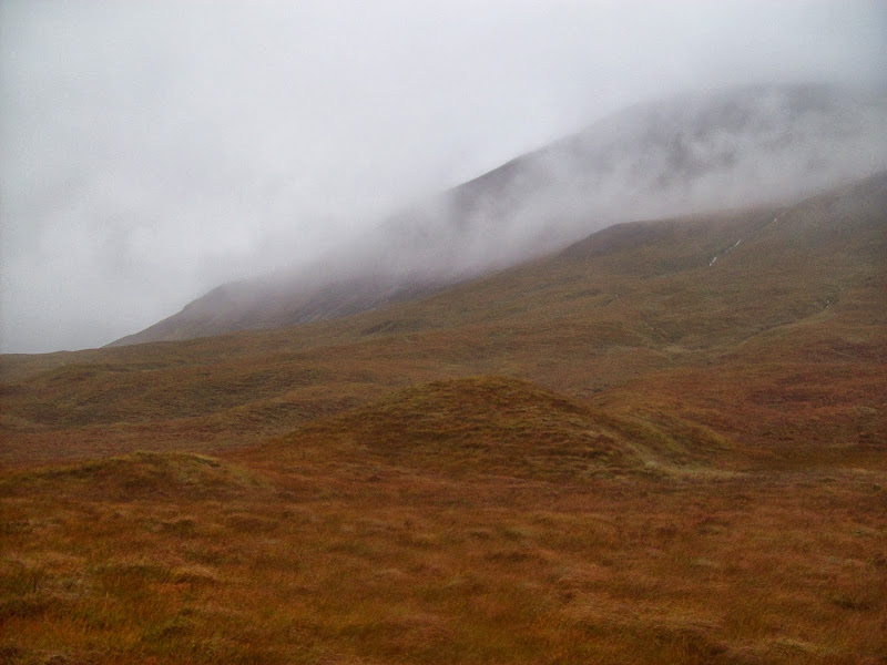
Descending the NW ridge, the cloud cleared enough for me to get a good appreciation of the drop into Glen Strae. It was quite a rough descent towards Beinn a' Chuirn, my next objective. Beinn a' Chuirn was also looking interesting (what I could see of it) the southern face ending abruptly in quite a long cliff face. Oh for some proper views! I was clad I wasn't going over to Beinn Suidhe, as I remembered a report by Kevsbald, showing atmospheric views across the head of Glen Kinglass to the Etive hills. That would all be wasted in this weather.
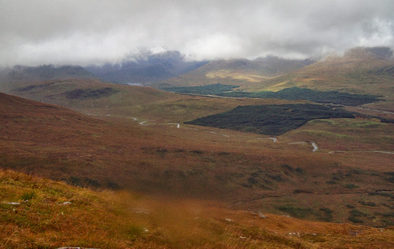
Instead, it was eastward, taking a coupe of bearings to make sure I didn't accidentally descend Gleann Fuar, and over rough ground to Meall an Laoigh. Although there was an occasional clearing of cloud, the relentless rain was pretty tedious, and Meall Tairbh was just another waypoint on the long haul back to the pub.
Another rough descent and reascent onto Ben Inverveigh, and things looked up briefly. I got the occasional glimpse pf the ridge ahead, and the walking became easier on the run-up to the summit. Then more rain and cloud. Until...
Finally some sunshine on the way down Ben Inverveigh:
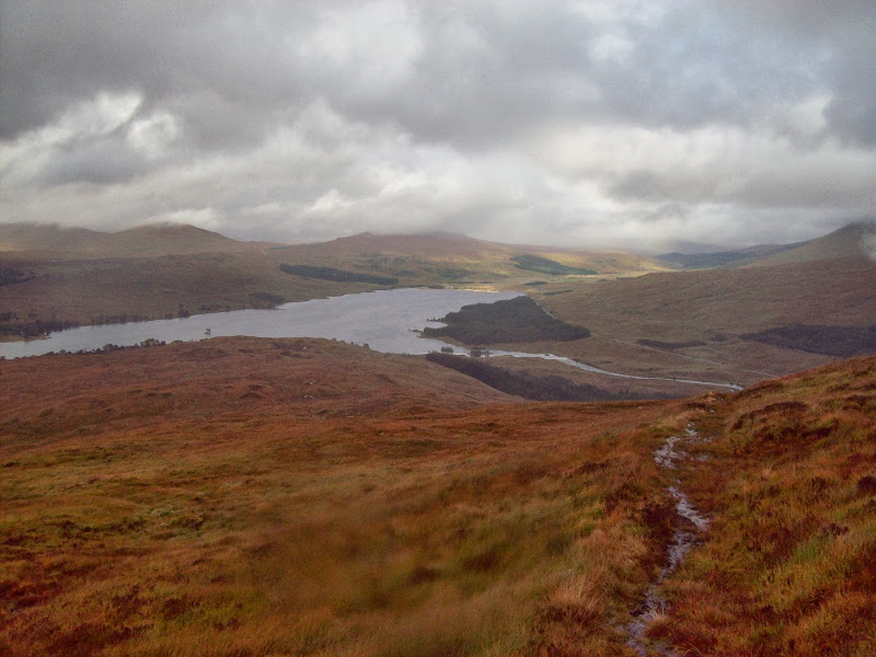
On the final descent to Bridge of Orchy, the sun finally came out. This coincided with one of the more pleasant bits of ridge, which really lifted my spirits . I could finally see Loch Tulla, bits of Stob Ghabhar and Stob Choire Odhair, and most importantly, the Bridge of Orchy Hotel
  .
.
Across to Loch Dochard:
Stob Ghabhar and Stob Chiore Odhair:

The view was still pretty limited, but after hours of sensory deprivation, it was one of the best I've seen. I was going to sit around and enjoy the sunshine, but I could see more rain on the way. I followed a decent stalker's path down towards the WHW, cutting a corner and finally joining it just outside of the woods. I past my first other people of the day, looking rather clean and dry compared to me.
Loch Tulla:
Then for the crafty part of my plan - leaving out Beinn Suidhe meant I had just over 2 hours to kill until my bus came. I had a lovely meal, a couple of pints and sat reading in the bar to pass the time - much more pleasant than 90% of my day out
I didn't really get to test my tent in windier conditions, as they never came. But the whole experience did make me rather wary of multi-day camping trips with no alternative accommodation. The thought of having to put my soaking tent up again and crawl in wearing my soaking clothes didn't exactly fill me with excitement. Luckily I didn't have to.
Saturday
Corbetts: Beinn Bhreac-liath, Beinn Udlaidh.
Grahams: Beinn na Sroine, Beinn Donachain.
Date: 21/09/2013.
Distance: 26km.
Ascent: 1890m.
Time taken: 8 hours 40 minutes.
Weather: Calm, cloudy, occasional breaks. Turning to persistent rain in last 2 hours.
Passing through Fort William on the Saturday morning, the weather looked pretty good in the Streap direction actually. No matter - I had left that map at home anyway. As soon as we passed over Rannoch Moor, the rain started pelting down and I wondered how I'd judged things so badly. Off the bus just after 10am at Bridge of Orchy, and things didn't seem as bad, although rather claggy.
Towards Beinn Bhreac-liath from the A82:
There is a track shown following the river down to the Glen Orchy turn-off, but it doesn't come right up to the village. In the end I just wandered down the verge of the A82 for 10 minutes - not much fun but soon over. I planned to get onto the nose of Beinn Bhreac-liath a short distance down Glen Orchy, and follow the ridge all the way to the summit. There were some nice beginning-of-autumn colours in the glen, although not the full show yet.
Rowan in Glen Orchy:
With the high gusts forecast, I had a mild sense of deja-vu. Along with Kevsbald, Gavin and DaveH, I had been defeated by this hill on christmas eve a couple of years ago. Thankfully the gusts didn't materialise, and it was just down to the clag to provide the similarity.
I climbed a gate at the end of the forestry plantation and headed up the hill. The thigh-high wet grass saturated my boots instantly, and was a little annoying. Once past this, it was an uneventful plod to the summit cairn.
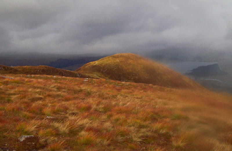
Looking back towards Bridge of Orchy:
The col looked potentially awkward to descend to in the mist, so I took a bearing. I still managed to wander off it though - the sound of traffic told me I was directly over the A85. In the end, the clag cleared briefly to show me that I had dropped below the col, and was traversing endlessly round the hillside beneath it. Not a massive problem, and I was soon on my way up Beinn Udlaidh. It was nice to be able to see something as well, and Beinn Bhreac-liath was briefly lit up by the sun.
Lochan na Bi, Glen Lochy:
Shoulder of Beinn Udlaidh:
Looking back to Beinn Bhreac-liath in a rare patch of sunshine:
By the time I reached the summit plateau, the views were all gone again. It was nice to see the top of the vein of quartz that runs up the hillside from Glen Orchy - my route choice meant I didn't get to follow this. Between that and the ruined mast, I didn't have to worry about whether I was on the correct summit!
Top of the quartz vein that runs up the entire height of this hill:
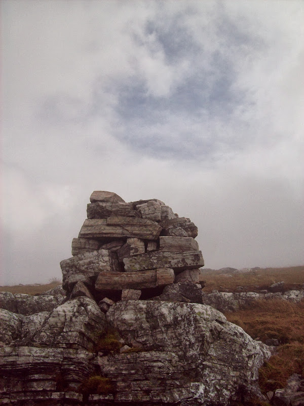
Summit junk – you can guess which summit easily:
Again I took a bearing off, and again I didn't follow it properly. A few minutes later, a second glance at the compass revealed that I was descending to Glen Orchy. Too soon for that, I traced the top of the crags back round to the correct ridge. I would like to have seen more of this corrie, as it is very popular with winter climbers, but the clag won again (apart from a couple of promising blue spots above).
A brief clearing over one of many cairns on the plateau:
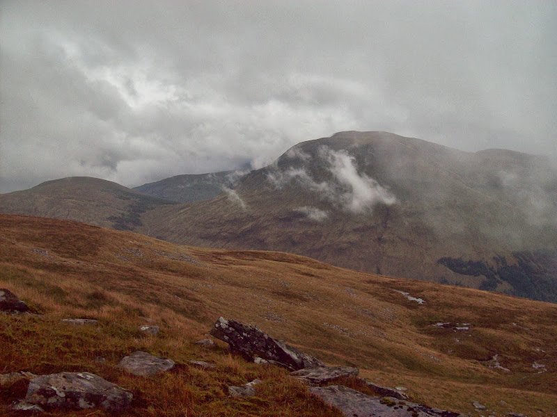
Plenty of well-built cairns led the way off the hill. There is also a faint vehicle track down to Glen Orchy, which I didn't follow. Instead I kept going SW towards Beinn na Sroine and the forest that engulfs it. I had lunch when the cloud broke again, looking back at Beinn Chuirn. That had been a battle to climb last December - I really don't seem to get the best weather when I come to this part of the country!
Beinn Chuirn:
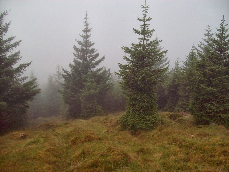
I descended to the plantation and plunged into the trees at a likely looking spot where they were thinner. A look at a google satellite image the day before had shown me that the best route involved descending slightly to the Glen Lochy side of the ridge, before picking up a ride. However the mist was so thick I couldn't tell where on the ridge I was.
Entering the forest of doom:
The result was that after a few minutes, I was reduced to crawling through thick trees and disappearing up to my knees in muddy pools. Not what I had intended! I finally managed to extricate myself and follow a damp but easy ride to the other end of the trees. There is probably a good reason why no-one combines these hills in a single walk
At least the cloud had lifted a little here, giving me my best views of the day down Glen Lochy.
Looking back towards Beinn Udlaidh:
Glen Lochy and Beinn Chuirn:
A short way up Beinn na Sroine, the ridge levels out. I left my bag against the fence and made my way to the summit, where I was back in the cloud again. The only excitement was the remains of an old mast. The best way down to Glen Orchy was directly from the summit, but as the only bridge in the vicinity was further upstream, I went back to my bag and cut down the hillside there.
Approaching Beinn na Sroine:
Glen Lochy again:
Zoom into the forest of doom – you can see the firebreaks I missed if you are ever contemplating the same route:
River Orchy:
The descent was steep and fast, until the final 100m, when I followed a burn through more forest (this stuff wasn't on my map - must get a newer map!). I finally dragged my way through the undergrowth and out onto the road, almost opposite the footbridge at Catnish.
Catnish and Cromadh Mor:
There were a couple of fishermen here - the only people I saw away from the A82 all day. I believe this bridge used to have a reputation for having a locked gate. I was a bit taken aback to find it locked again - for maintnance apparently (by the Forestry Commission - due to re-open in June 2014). There weren't any other crossing places particularly nearby, and I didn't fancy wading today - the Orchy is a pretty big river.
Bridge over the river Orchy near Catnish. Closed for maintenance again:
It looked possible to do a few acrobatics to climb around the gate. I couldn't possibly condone this, so I'll not tell you how I got across, suffice to say my feet didn't get wet
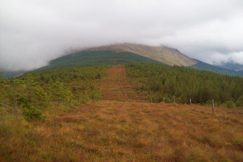
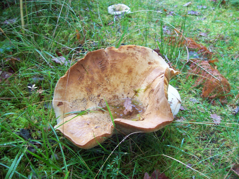
It was a nice change to stroll along the flat on the north bank, and not have to think where to put my feet next. There was some lovely deciduous woodland here, and a good variety of fungi. The path gradually got wetter as I approached the edge of the woods, then it was back onto steep long grass again as I cut a corner on the stalker's path heading up Beinn Donachain.
Fungi:
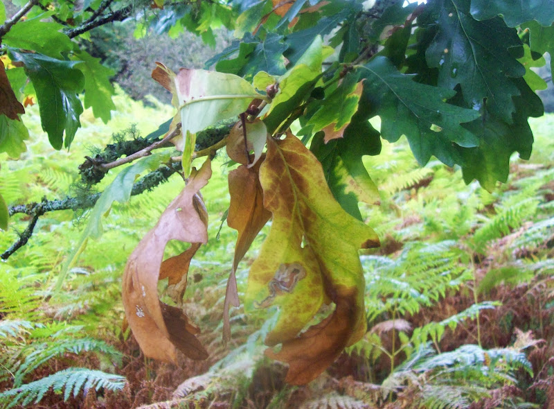
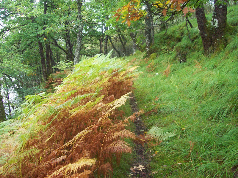
Colours starting to turn along the river bank:
The rain came on here properly for the first time since getting off the bus, and fatigue began to set in. Having wasted the best part of an hour on navigational blunders today, I decided to follow burns and lochans rather than taking any more bearings. I followed a burn right up to Heart Loch, which would have been my camping spot of choice had the weather been better. But no, the rain was on and the clag was down again, so I went on to the summit via another un-named loch. There was a junction of deer fences prior to the last steep haul, so I left my bag there.
Back across the glen to Beinn na Sroine:
I went back to my bag, then quickly retreated down the north side of the hill, toward Beinn Mhic Mhonaidh. It was a shame about the weather. Beinn Donachain isn't a particularly excaptional hill, but from what I could see it did seem to have a nice summit area strewn with lochans, outcrops and small waterfalls.
I had planned to camp on the Donachain/Mhic Mhonaidh col if the weather was poor, as I thought I would be able to shelter from the wind by getting into the edge of the forest. However the forecast high winds had been completely absent, so I didn't worry so much about this.
Nowhere looked particularly appealing for camping as it was all bog and rocks, so I detoured down to the burn as it looked flatter and greener here. No such luck - the area was strewn with massive tussocks with small streams running round them. I was saturated and quite fed up now, and settled for a gravelly bank on the burn. The matted grass showed how high the water level could get if the rain got heavier, but i didn't think it would. The water would have needed to rise a couple of feet before reaching my tent.
Tonight’s campsite:
I put the tent up, shoved everything inside and didn't re-emerge for over 12 hours. I wasn't sure how well I'd cope with everything being soaking, but it was nice and warm and dry in my sleeping bag. By the time I was in, it was miserable and dark outside, so I quickly cooked some dinner then tried to get to sleep.
~~~~~~~~~~~~~~~~~~~~~~~~~~~~~~~~~~~~~~~~~~~~~~~~~~~~~~~
Sunday
Corbetts: Beinn Mhic Mhonaidh.
Grahams: Meall Tairbh.
Sub 2000 Marilyns: Beinn a' Chuirn.
Date: 22/09/2013.
Distance: 17km.
Ascent: 1210m.
Time taken: 6 hours 10 minutes.
Weather: Almost continuous rain and clag; some sunshine and clearing in last hour.
Today's plan was to be up and on my way for 7am to have enough time to include Beinn Suidhe in my walk. There wasn't supposed to be much rain today. Opening my tent door at 6am, evertything looked much as it had the night before, so I went back to sleep and decided to miss out Beinn Suidhe.
I woke again an hour later to bright sunshine. Some travellers had turned up, and were setting up a fairground. They seemed to take offence to my presence and were trying to set my tent alight with cigarette ends. It all seemed a bit unfair, but I told them I'd be on my way in an hour and that seemed to calm them down. Then I helped them choose music for the fairground rides...WTF
Beinn Mhic Mhonaidh in the morning – do I have to?
A steep but straightforward ascent put me on the top of Beinn Mhic Mhonaidh. Although only a 500m climb, it felt like much more. The views were uninspiring - another one to add to the list of hills to come back to on a nice day (the more walking I do, the longer the list gets
Summit of Beinn Mhic Mhonaidh:
Descending the NW ridge, the cloud cleared enough for me to get a good appreciation of the drop into Glen Strae. It was quite a rough descent towards Beinn a' Chuirn, my next objective. Beinn a' Chuirn was also looking interesting (what I could see of it) the southern face ending abruptly in quite a long cliff face. Oh for some proper views! I was clad I wasn't going over to Beinn Suidhe, as I remembered a report by Kevsbald, showing atmospheric views across the head of Glen Kinglass to the Etive hills. That would all be wasted in this weather.
Instead, it was eastward, taking a coupe of bearings to make sure I didn't accidentally descend Gleann Fuar, and over rough ground to Meall an Laoigh. Although there was an occasional clearing of cloud, the relentless rain was pretty tedious, and Meall Tairbh was just another waypoint on the long haul back to the pub.
Another rough descent and reascent onto Ben Inverveigh, and things looked up briefly. I got the occasional glimpse pf the ridge ahead, and the walking became easier on the run-up to the summit. Then more rain and cloud. Until...
Finally some sunshine on the way down Ben Inverveigh:
On the final descent to Bridge of Orchy, the sun finally came out. This coincided with one of the more pleasant bits of ridge, which really lifted my spirits
Across to Loch Dochard:
Stob Ghabhar and Stob Chiore Odhair:
The view was still pretty limited, but after hours of sensory deprivation, it was one of the best I've seen. I was going to sit around and enjoy the sunshine, but I could see more rain on the way. I followed a decent stalker's path down towards the WHW, cutting a corner and finally joining it just outside of the woods. I past my first other people of the day, looking rather clean and dry compared to me.
Loch Tulla:
Then for the crafty part of my plan - leaving out Beinn Suidhe meant I had just over 2 hours to kill until my bus came. I had a lovely meal, a couple of pints and sat reading in the bar to pass the time - much more pleasant than 90% of my day out
I didn't really get to test my tent in windier conditions, as they never came. But the whole experience did make me rather wary of multi-day camping trips with no alternative accommodation. The thought of having to put my soaking tent up again and crawl in wearing my soaking clothes didn't exactly fill me with excitement. Luckily I didn't have to.