free to be able to rate and comment on reports (as well as access 1:25000 mapping).
This weekend we fancied a bit of sea cliff walking for a change, and after wet Saturday came a reasonable Sunday, with best weather forecast for the NW coast. I was all up for visiting Camas Mor - haven't been there before but heard that the shore around Rubha Reidh was full of interesting "features". So I expected sheer drops, arches, sea stacks, beaches... and was not disappointed.

We drove to Melvaig, where there is a good car park at the end of the public road. Even as we passed Gairloch and entered the single track along the coast, views across the sea were already stunning...
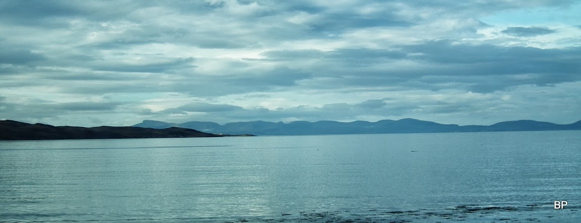
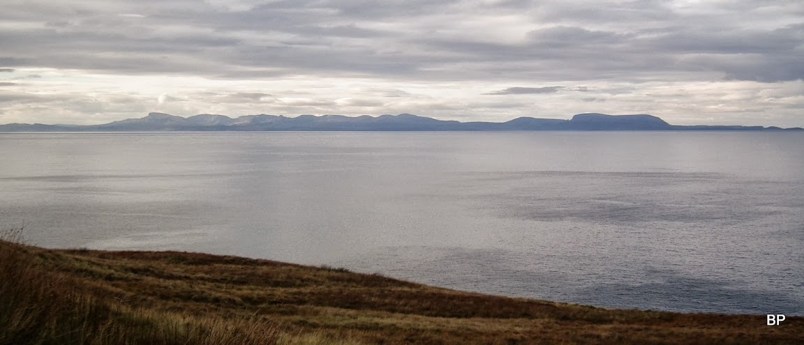
Trotternish Ridge on Skye:
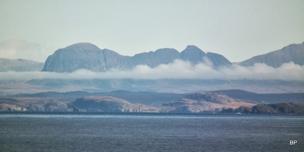
Spooky Torridon hills:

I was taking some photos from the car, which is a bad habit, as they will always come out blurred, but the scenery was breathtaking already - and I was so glad to see some sunshine, after a very misty Beauly morning...

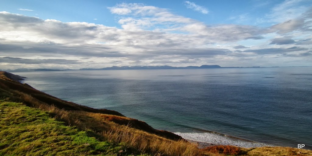
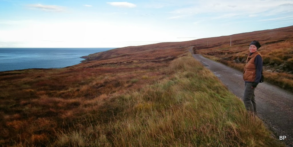
We stopped on a layby just before Melvaig, to record the views - it felt like "on the edge" between land and sea - and we haven't even started the proper walk yet

Melvaig:

The start of the walk is, as mentioned above, a car park at the end of the public road. not that there are ANY signposts to indicate, that the final stretch of the tarmac is private. The only signs placed here inform, that the lighthouse is closed plus there's a 20 mph speed restriction:
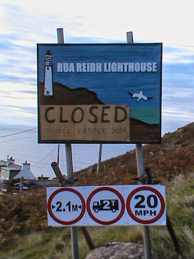
We followed the exact description of WH route and walked from here - and as you will see later, this is the BEST way to do this route. But as we walked on the tarmac, we were passed by a few cars full of lazier walkers, who drove up to Rua Reidh and parked just above the lighthouse. I was confused, so before writing my TR I contacted Paul Webster and he confirmed that the WH description is accurate and the road past Melvaig IS PRIVATE and you are not supposed to drive on it. Which was blissfully ignored by at least a dozen people on Sunday
but maybe they just didn't realize they were on a private road due to lack of signposting.
Our route:
Access issues aside, how would anybody prefer to drive quickly past such views?...
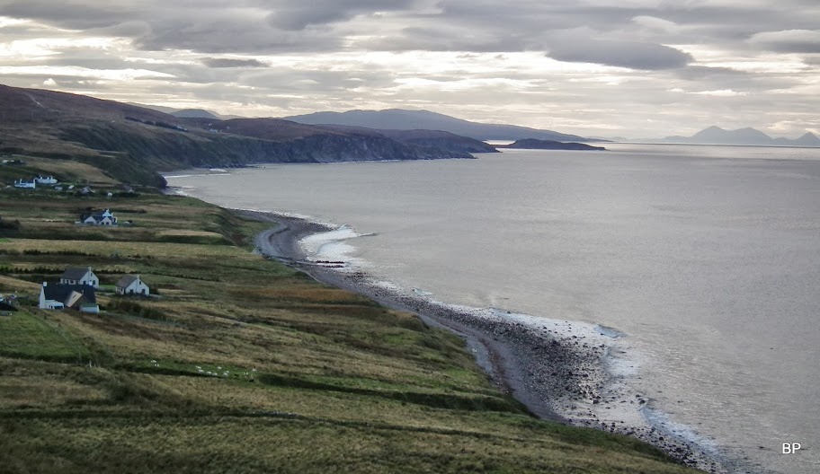
Looking south, back to Melvaig from the cliffs above the village:
Zoom to the southern part of Skye - Broadford Grahams in the middle:

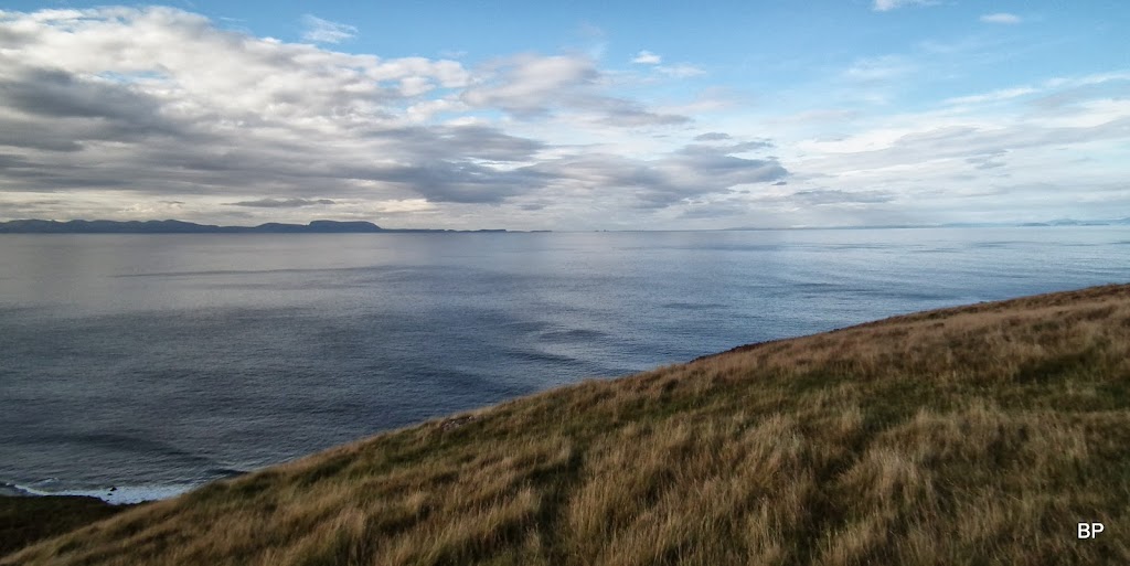
Grass, sea and distant islands...
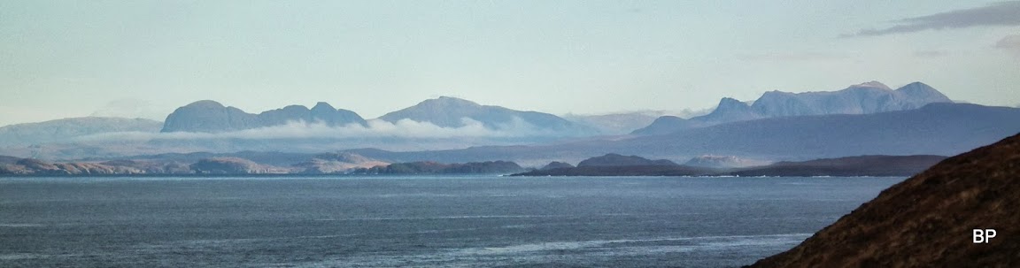
The Trotternish Ridge now in its full glory...
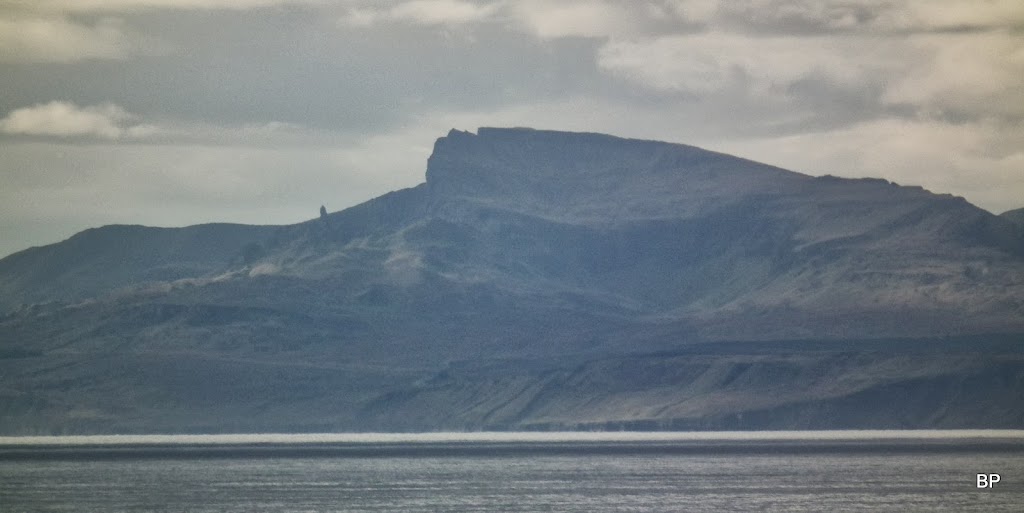
The Storr on Skye, even the Old Man was visible:
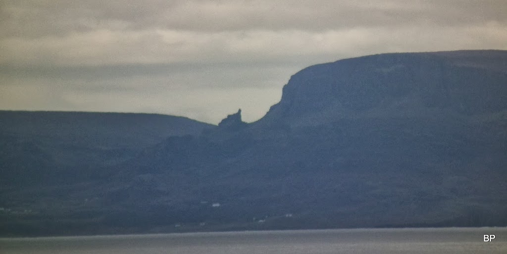
...and a bit further north, another familiar shape - The Prison of Quiraing!
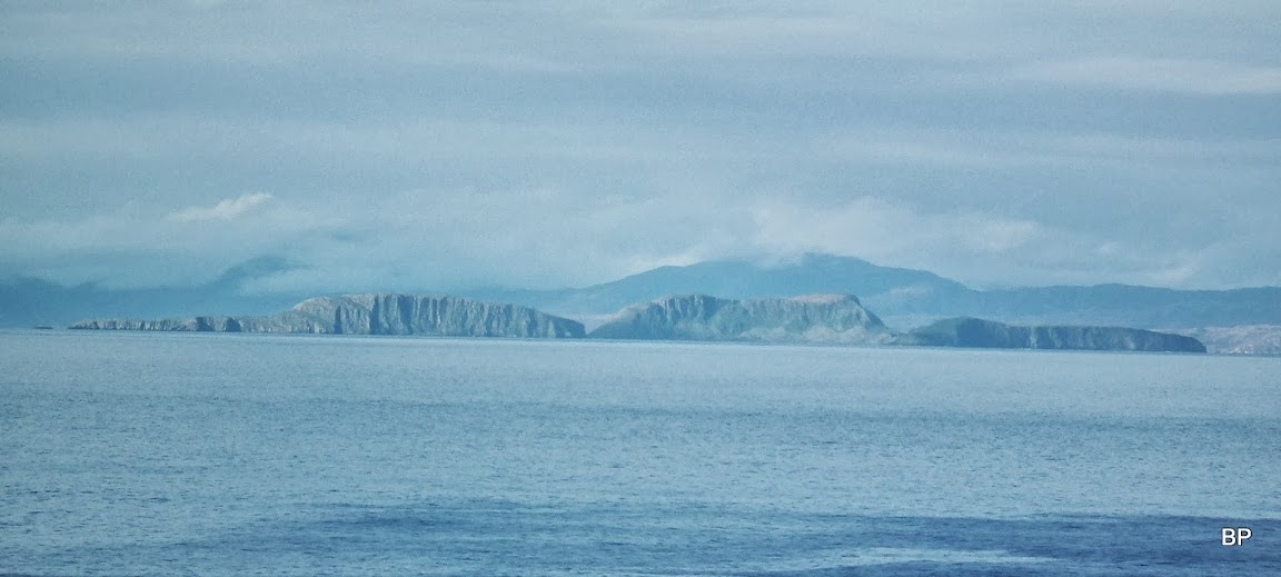
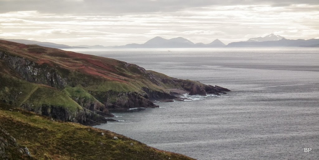
Shiant Islands and the Isle of Lewis behind:
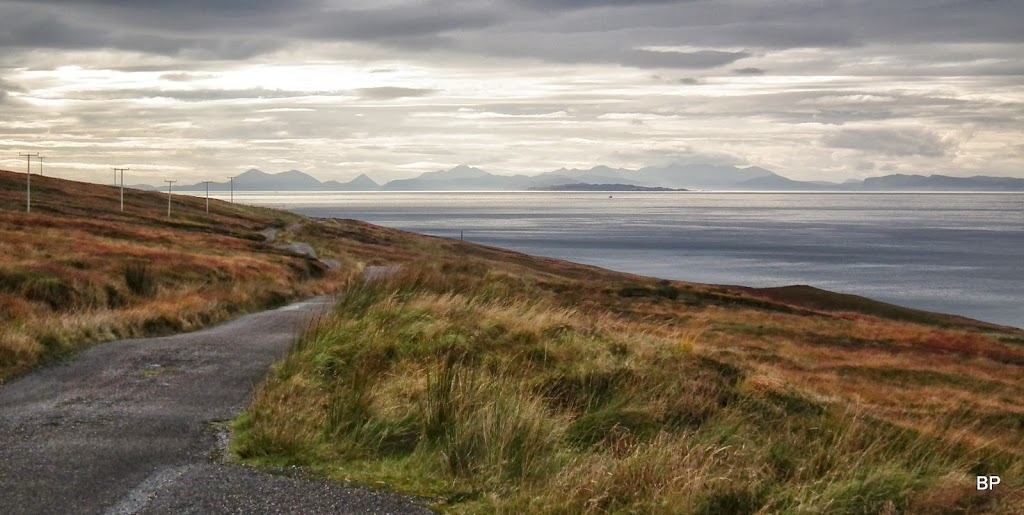
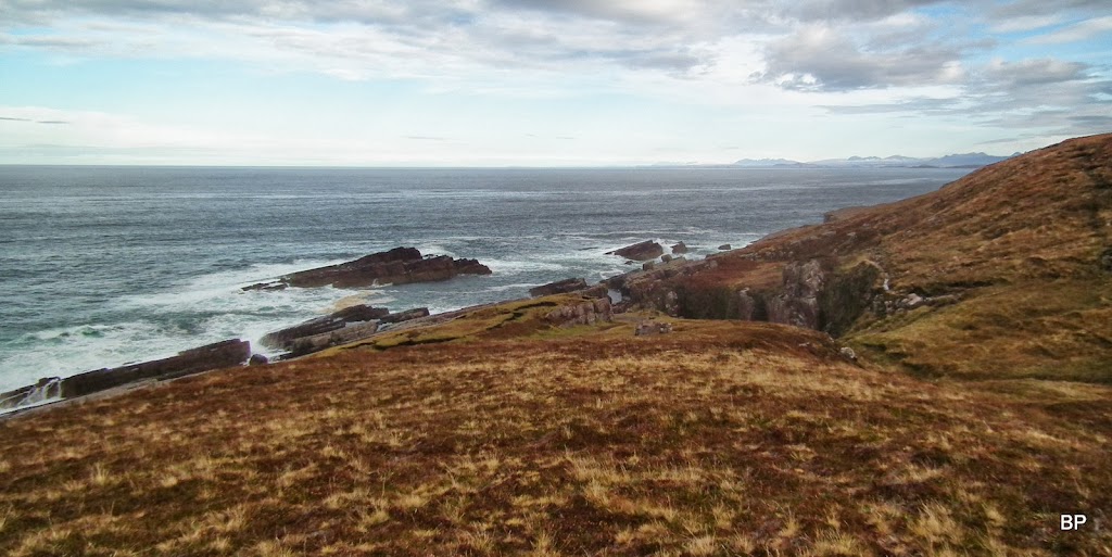
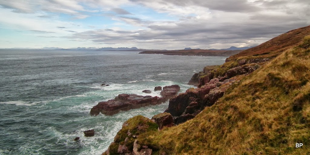
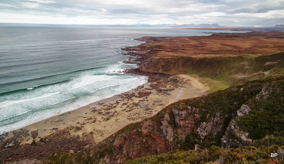
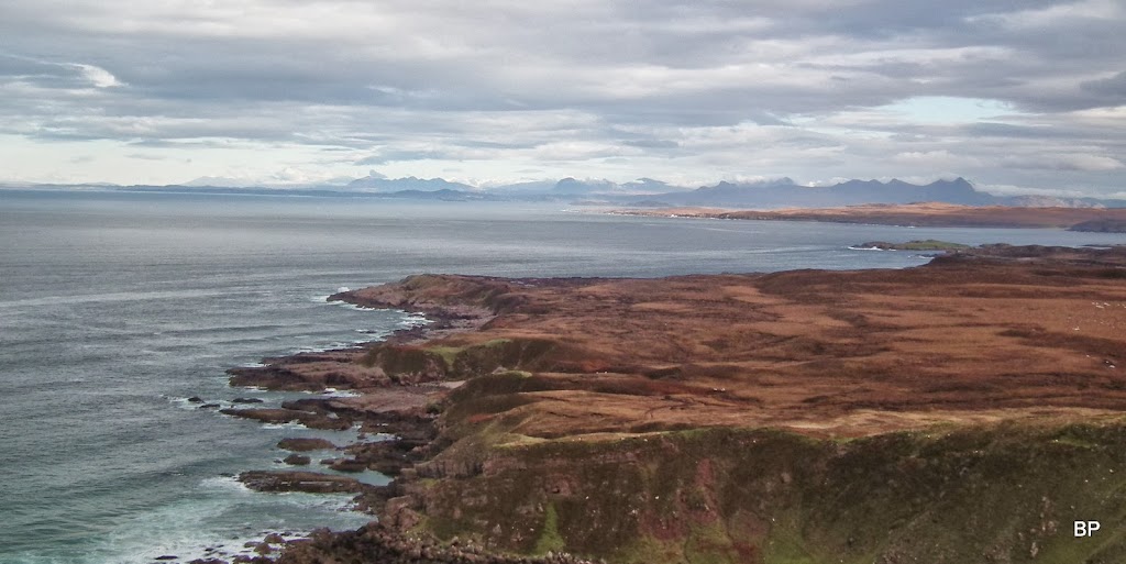
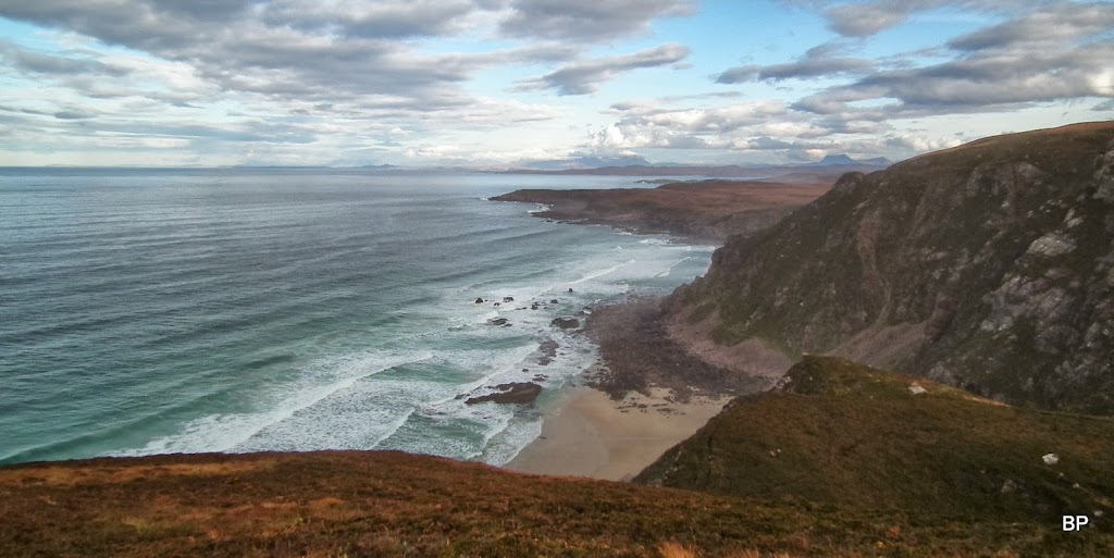
For the first couple of kilometres, the main attraction are the island views across the sea, as the road runs some distance from the edge of the cliffs:
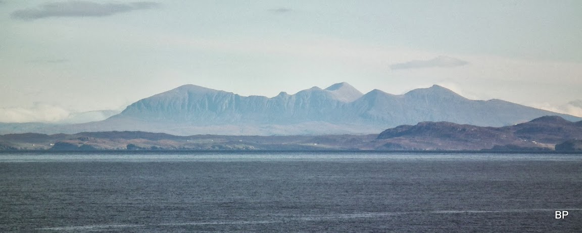
The day was generally bright, but with cloud hanging low on the southern horizon, we managed to take some photos that had a sunset feeling to them... Like this one, Skye Cuillin and lower hills:
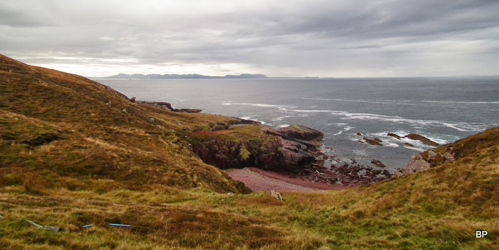
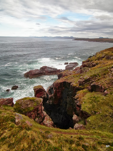
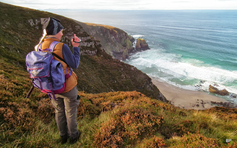
As we neared the lighthouse, the coast became more interesting and at last, we could get close to the edge...
The day was quiet, the sea was in a sleepy mood...
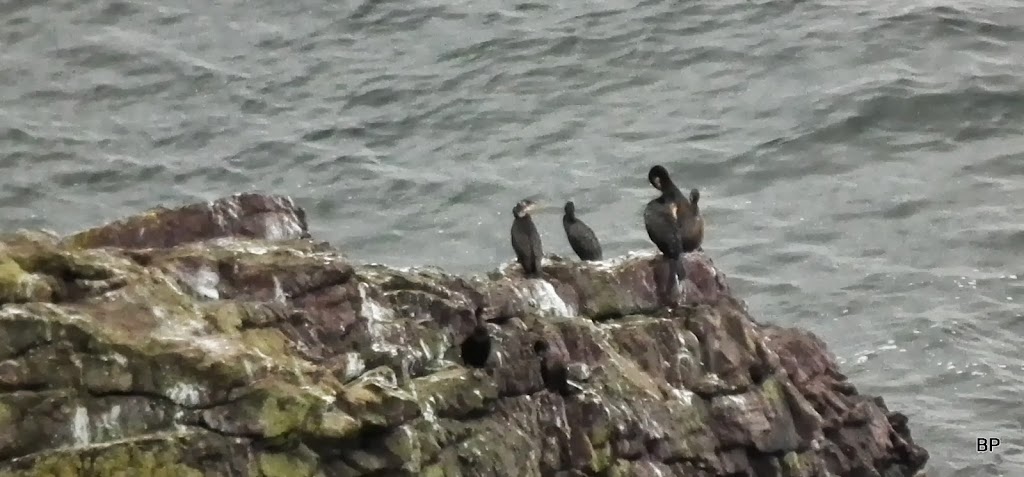
...even shags lazied about:
This corner is said to be a good place for dolphin/seal spotting, but we didn't see any sea creatures other than birds, guess it's the wrong time of the year.
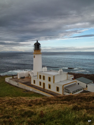
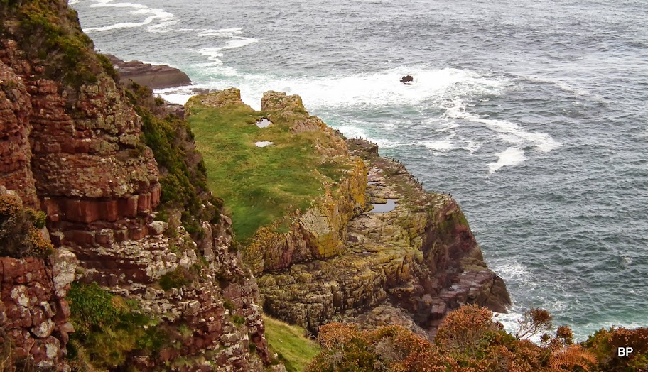
The Rua Reidh lighthouse peeking out from behind another bump. The tarmac road goes only as far as the building.

More cliffs:
The lighthouse is private and not open to the public, so we took a few photos from above...
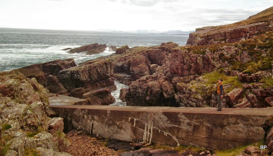
...and continued, on a signposted path, to the jetty, which is built into the "crack" seen in the middle of this photo:
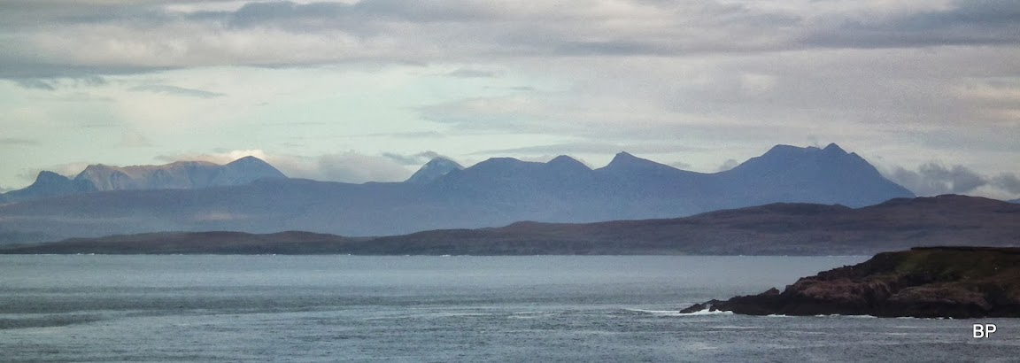
...but i stopped abruptly at some point, having spotted... HAAAA! Guess who? Suilven!
...and another old friend, Quinag, seen from the sheer cliffy side:
Beautiful panorama of Assynt from an unusual angle: Suilven (left), Canisp (middle) Stac Pollaidh and Ben Mor Coigach (right):
The jetty was once the only way of access to the lighthouse (the road was built in the 1960-ties):
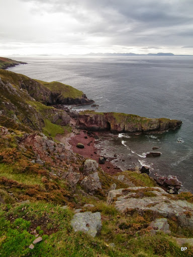
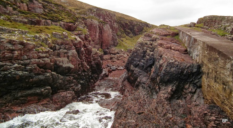
Lots of red sandstone about:
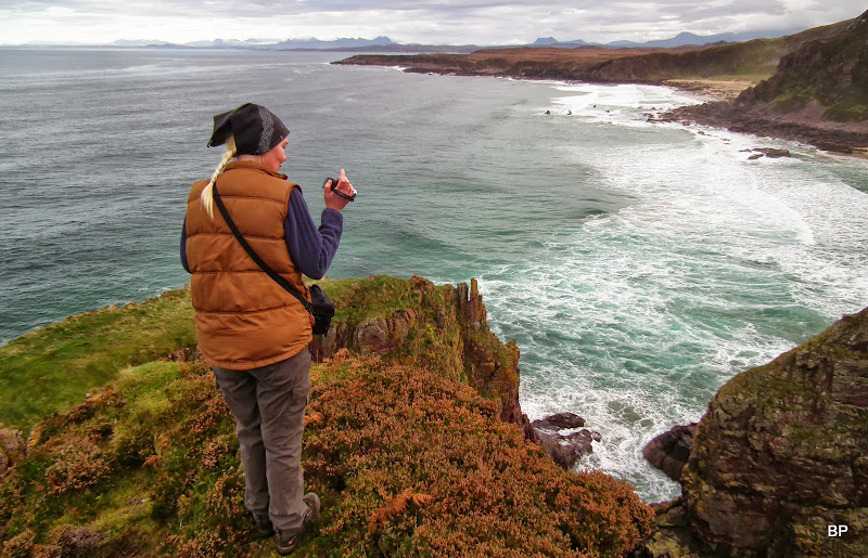
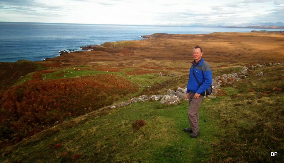
Posing with rock and not so rough sea behind:

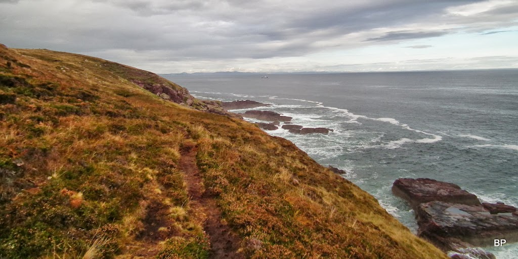
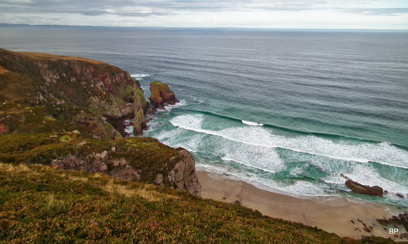
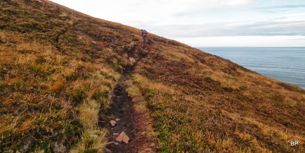
From the jetty we continued east along the cliffs, but here is where the easy walking ends. There are a few paths along the shoreline. We took the lowest one on the way in, as it allowed us to have a good look at all the sea "features". On a dry day, this path would present no problem, but as it had recently rained a lot, the ground was waterlogged, the path was a bogfeast and very slippery, too. It didn't stop us from having fun, but if I can give any advice to future visitors, in dry conditions lurking here would be much safer
But who would care about mud, if you have such views around...
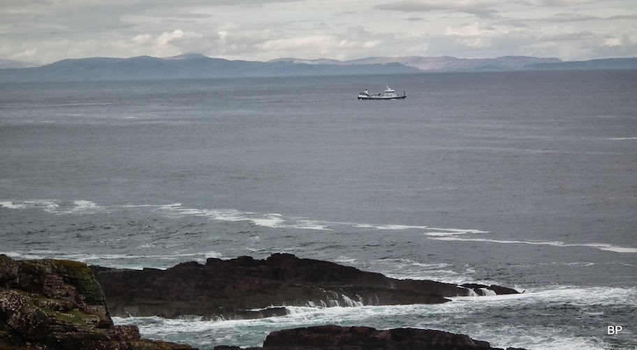
A boat on the horizon and the sea getting a wee bit rougher (wind picked up):
Just outstanding - and the best was yet to come!
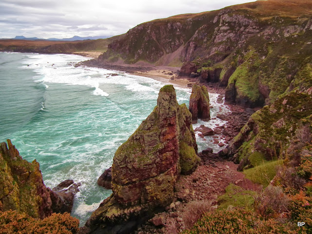
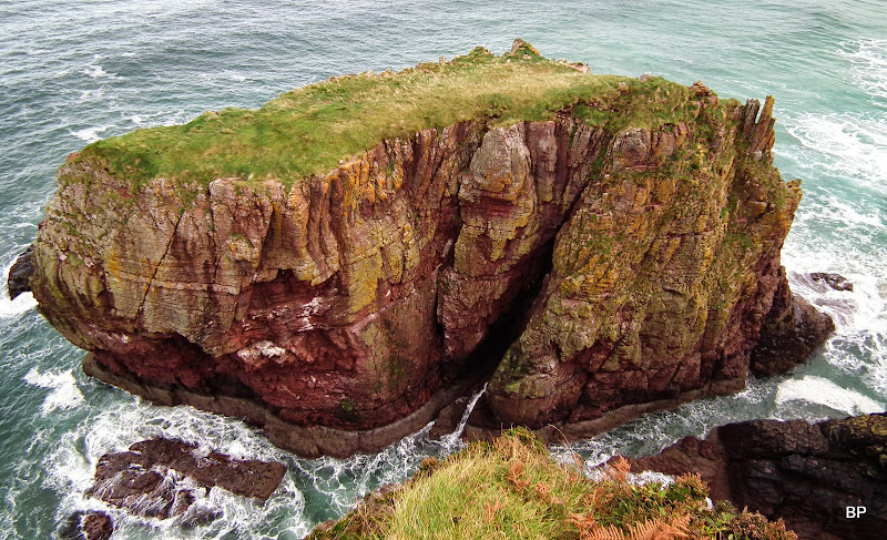
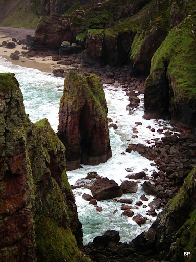
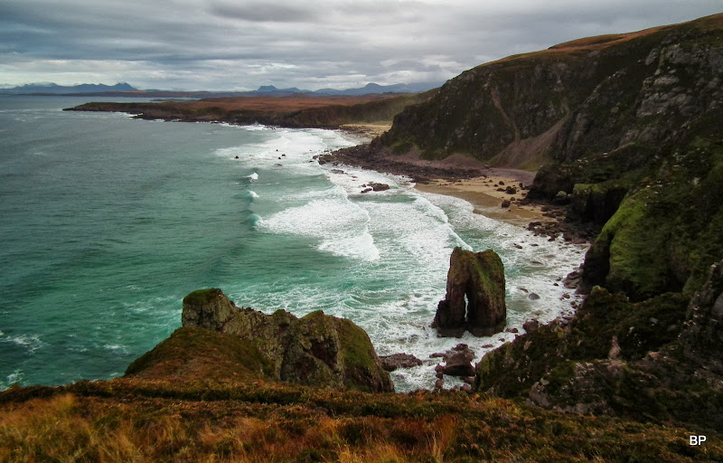
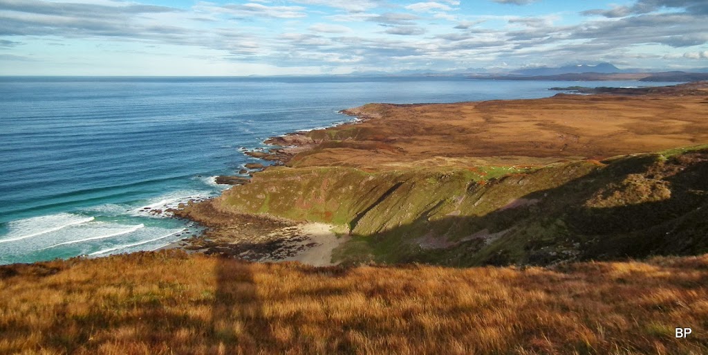
There are three large sea stacks at the western end of Camas Mor. The largest one is called Stac Dubh and is the first one to enter the scene, as one walks from the east:

The path at its DRIEST stage
Mountains, mountains... An Teallach to the right:
The stacks of Camas Mor:
Kevin said "It feels ALMOST like Cornwall":
Shags or cormorants (hard to say from the distance) occupied the lower floors of the sandstone cliffs:
Little black army


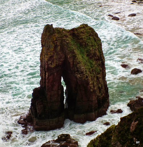
The "needle" with a gap inside, so is it both a stack and a natural arch? Whatever it is, it looks interesting
Too close to the edge

We were very careful, as it was hard to judge where the rock ended...
Wow, that's a big drop. According to our GPS, these cliffs go up to 130m (measured standing just above the sheer drop seen in this picture):

OK, I'm getting boring here... Just one more... Fantastic view:
Zoom to the smallest stack:
The path crosses Allt a'Cluanie (another very muddy section) and then splits into three or four options, we took the one closest to the drops, where we could have a good look down:
The three stack seen from the west:

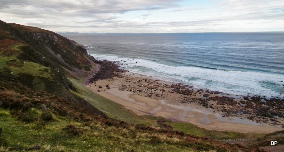
The beach below:
Mountains of the north:
Had the ground been dry, I would surely have scrambled down to the beach - there is a sketchy path at the point where the cliffs are only about 50m high. But we didn't want to risk going down on the waterlogged grassy slopes - we didn't fancy a bumslide on the wet grass!
We found some rocks to sit on just above the ruins of Camustrolvaig. A good place to have lunch, surrounded by sea, cliffs and sheep
The sun came out and the landscape around us brightened with autumn colours:
There is an option to take a different route up to the viewpoint by Maol Breac masts, but as it involves crossing pathless ground with peat hags, we gave it a miss considering the wet underfoot. So return was the way we came, and I was more than happy to see the stacks again:
Almost like Cornwall
On the way back we took a different path, trying to avoid the mud, but all branches were just as wet:
From the lighthouse, the return route was a formality, apart from a few cars overtaking us on the narrow road. At least, wes till had the views...

So no hills climbed this weekend, but a rewarding hike nevertheless. Highly recommended
Meow!
Diabaig-Craig route and Slaggan Bay are next on the list for coastal wanders on the western side - all depends on the weather. Hopefully, we'll manage a few more mountains before the end of the year.
