free to be able to rate and comment on reports (as well as access 1:25000 mapping).
Hill(s): Sgurr Dhomhnuill (888m)OS Map(s): 40Date: Friday 12th March 2010Weather: Light winds, bright and warm  Walkers: Myself, Anne, Stewart & Molly the CollieDistance: 17.3kmAscent: 951mTime: 7hrs 30mins Dog Friendly?: Yes Parking : Lots at the Ariundle Reserve entrance NM 827 634
Anne had suggested when we came back from the November 2009 Corran meet that we should do this hill together and I was most certainly up for it as a) it was my last section 10a Corbett and b) it is just one of those iconic hills.
I picked up Stewart in Inverness and we then met Anne at Corran, taking the 7.50 a.m. ferry over to Ardgour. Whilst the weather had been poor on the drive down, Ardgour looked just great in the sunshine!!
Essem had never been in this part of the country before and he obviously enjoyed the scenery as we drove to Strontian, before turning right immediately after the bridge at NM 814 617, to head up the west side of the river for Ariundle.
It was strange seeing the car park in the daylight as Anne and I had last been here in the dark at the end of a long traverse through Glen Gour and over Beinn na h-Uamha(lowest Corbett) and Sgurr a’ Chaorainn(highest Graham). Today was bright and dare I say it spring was in the air.
The route you take on the track is part of Scottish Natural Heritage’s Ariundle National Nature Reserve and is a grand walk in itself.
On the track Caledonian Pine
Soon after I took the last picture, I saw what looked like a male Capercaillie crash into the deer fence before returning clumsily back up the hill. Stewart also saw it and then a minute or so later we all heard a croaky call which sounded Capercaillie like. Having checked the RSPB’s website
Click Here and listened to the call, I’m 99% certain it was a “Caper” but have e-mailed SNH’s ranger to get more info.
The mixed natural Oak, Caledonian Pine and Birch woodland was beautiful with huge boulders all covered in bright green moss.
Typical burn
To get to the hill you need to take the left fork in the track at NM 849 649 and once you exit the woodland at NM 854 656, the views really open up as you follow an excellent track all the way to old lead mine workings.
Upper Strontian Glen Lead mine workings
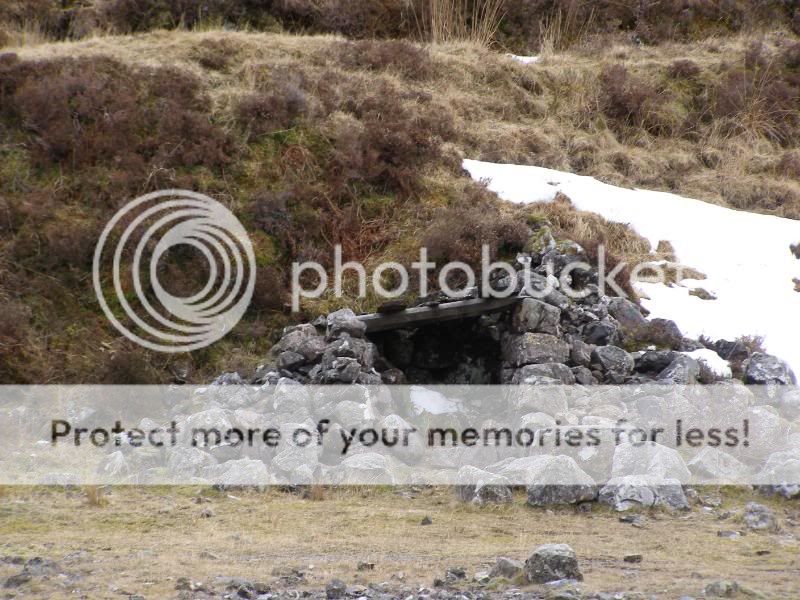 Spoil heaps
There’s a burn to cross but I can’t see it giving any great problems other than in huge spate conditions. The next pic was taken on our descent.
Burn crossing
From here on in it was just a typical Ardgour walk over rough undulating ground to gain the Druim Leac a’ Sgiathain.
Rock outcrop
Don’t forget to look behind as you ascend, as there are some fine views on offer.
Lower Strontian Glen Beinn Resipol zoom
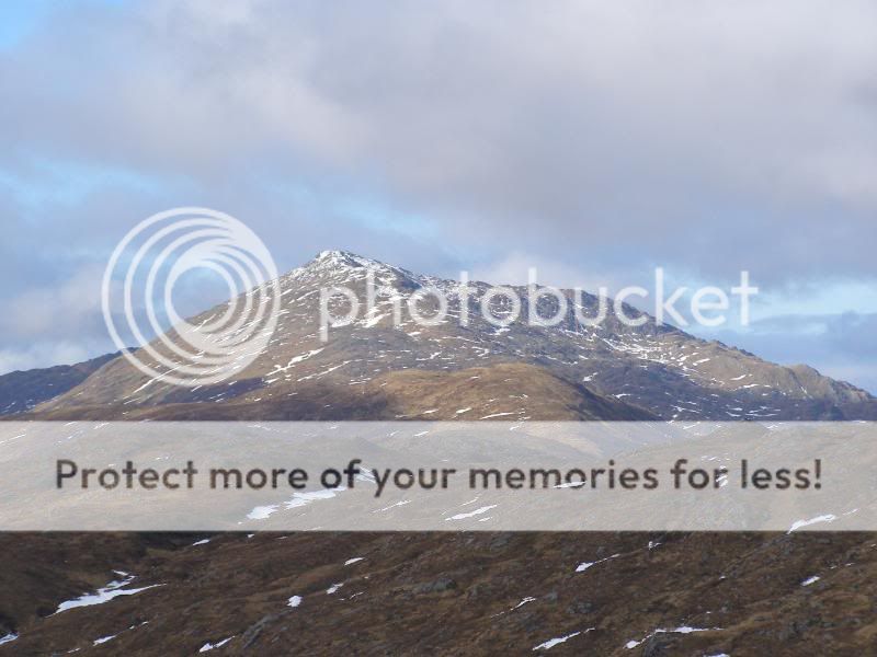
The great thing about this ridge is that you have the summit in your view for much of your way and what a belter it is.
First summit view
The SMC guidebook indicates that you should ascend Sgurr na h-Ighlinn and then descend to the col at NM 889 672 but this involves 160m of ascent and 80m of descent. This seemed wrong as we reckoned there was a fairly level route to the col passing under Sgurr na h-Ighlinn’s steep north face and here it is.
The bypass route
It turned out to be an excellent route choice (I see Kinley has used it as well) and just before the snow ramp seen in the last pic we stuck our crampons on as the snow was pretty hard.
On the move and happy with it  Anne ascending from col
With the ascent ridge now being south facing, the snow was a mixture of hardish patches with softening snow. We were sweating buckets in the sunshine but couldn’t complain.
Molly supervising 

The walk hadn’t been steep at all but the first view of the summit cone was slightly intimidating as it was very steep, rocky and our route had a fair bit of snow. We chose to go up the snowy rake on the right hand side of the picture. What the pic doesn’t show is that the rake is slanting downwards and we had to take a fair bit of care.
Summit cone
No more pics on the ascent as we concentrated on the steep snow climb with one bit of water ice and rock. But then we suddenly saw our goal and the Cheshire Cat syndrome kicked in!
Nearing summit shelter Molly at summit
 Summit icing
 Anne & Cuillin at summit
 Stewart & Cuillin at summit
The summit is a cracker of a viewpoint and we could even see Eigg, Rum, Mull and the Paps of Jura but here are some nearer views.
Gulvain Streap
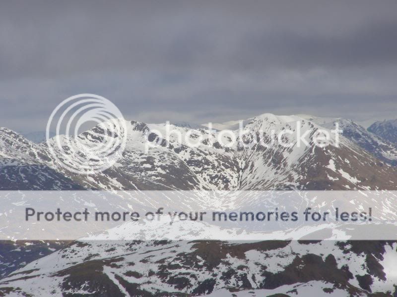 Glen Gour over Beinn na h-Uamha’s ridge
 Beinn Resipol
It was getting a bit chilly at the summit so we decided to go back down to where we had our crampon stop to have lunch. I did take one pic of the descent of the summit cone.
Steep, steep descent
Now back on easier ground we just had a ball soaking in the views and the sunshine.
Sgurr na h-Ighlinn
Stupidly, I hadn’t taken my sunglasses with me and resorted to donning my goggles to relieve the eye strain from the reflected sunshine.
Don’t leave your sunglasses at home!
We had a very leisurely lunch in the sunshine with Stewart also winding up Molly as she played “catch the snowball”. The view from this spot was just great.
Moving off from lunch stop
Kinley did the full horseshoe route of this hill and I think a clockwise ascent would make a very good day out, as long as there wasn’t snow/ice on the NW ridge immediately below the summit.
We had a fine walk back to the track, even though the cloud built up a little. We’d seen a side track on the way in which indicated it was a 40 minute walk to the car park. Just to give a bit of variety we took this way back and it was a very fine route indeed, following the south bank of the Strontian River.
SNH NNR board walk NNR sign
 Strontian river & Sgurr Dhomhnuill
We crossed the bridge over the river here and regained the track at NM 832 638. A few minutes later we met a couple of dog walkers and they were the only other people we saw on the walk.
As we drove back to Corran, we met a posse of cars which could only mean one thing – the ferry was in! I put my foot down to get there before it departed and luck was with us as we rolled up the ramp going at a fair lick.
Corran ferry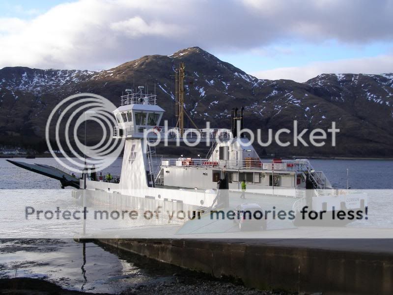
Stewart described the outing as a “real treat of a day” and both Anne and I could only but agree with him. Anne still has to do Carn na Nathrach in order to complete her section 10a Corbetts and I hope she gets just as good a day.
Sgurr Dhomhnuill lived up to every expectation I ever had for it and it was a fitting way to complete the 10a Corbetts – I can’t wait to go back and do the Grahams over there!
