free to be able to rate and comment on reports (as well as access 1:25000 mapping).
This isn't going to be a long story as the whole walk only lasted 3.5 hours. Not that I'm complaining. Better that than a day on the sofa

Last weekend looked promising, especially Saturday and I wasn't put off by strong wind forecast. The best weather was said to be on the eastern side, so we set off to climb Morven, the one near Ballater. The journey itself took almost two hours. Usually when in this area we pay a visit to Glenbuchat Castle, but sadly it's recently been closed due to falling masonry and it won't be re-opened until spring 2015 (according to Historic Scotland's webpage)

I have recently read "Climbing the Corbetts" by Hamish Brown (a great book, not only for Corbetters) and I liked the way he described Morven as
"standing in bold isolation, strangely aloof, strangely neglected, perhaps simply from always being there". Of course, we have noticed this hill before, earlier this year from Culardoch and Mt Keen, the year before from Whitemounth Munros. It was obvious that a solitary mountain like that will have good views in all directions

We used the shortest approach to Morven, from the east via Groddie, as it saved us a few miles of driving.
Our route:
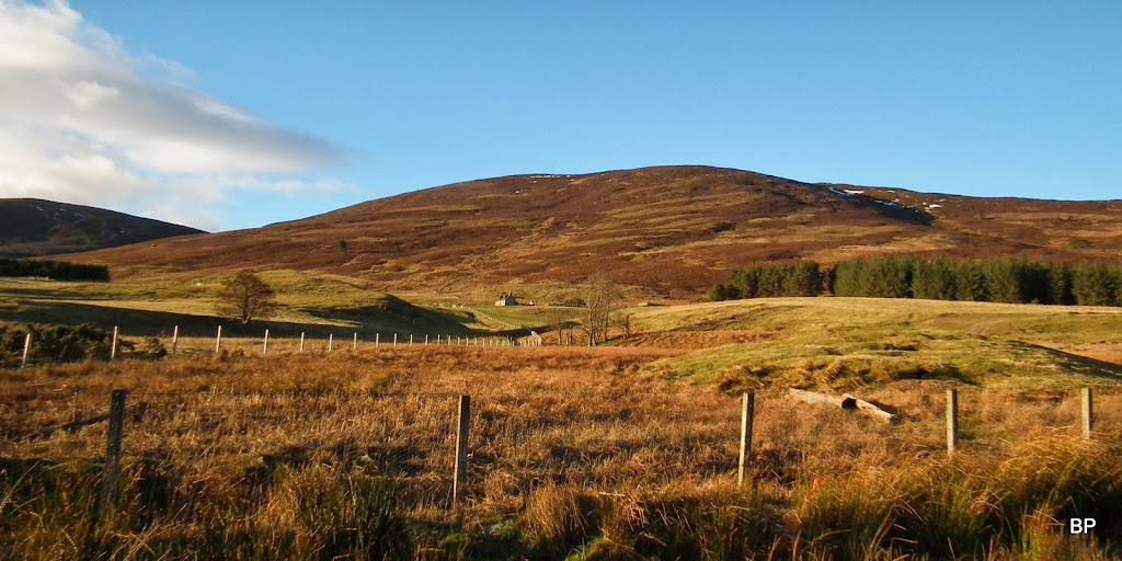
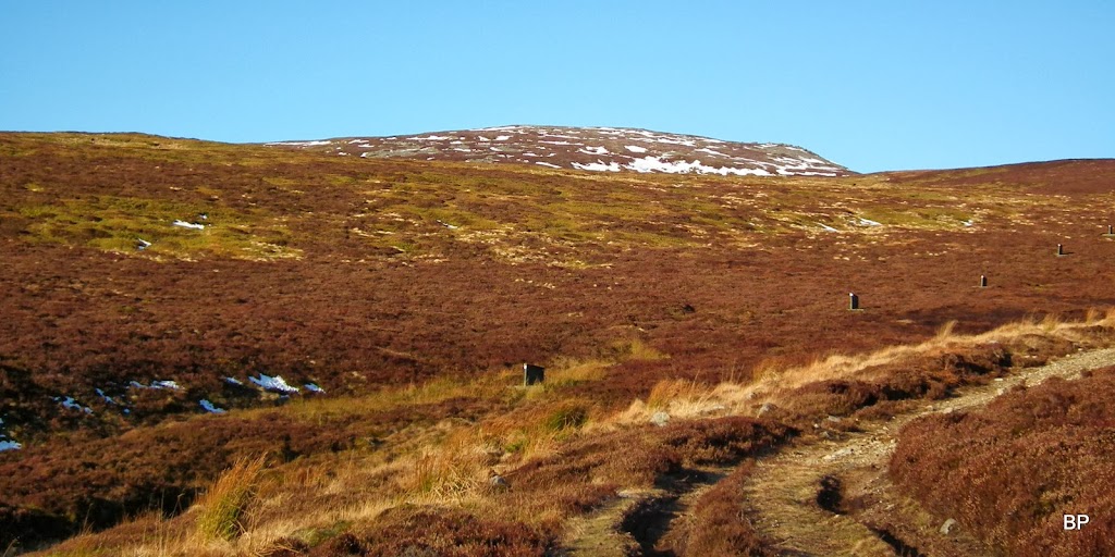
The starting point is from the end of the public section of the road, where it forks into two tracks. From below, the large lump of the Corbett dominated the view:
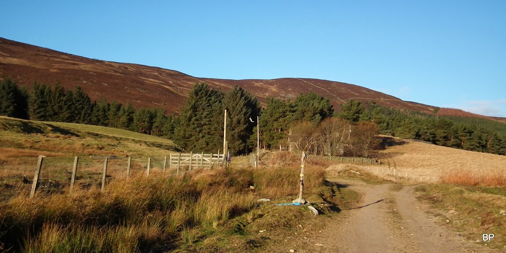
We turned of the track through this gate:
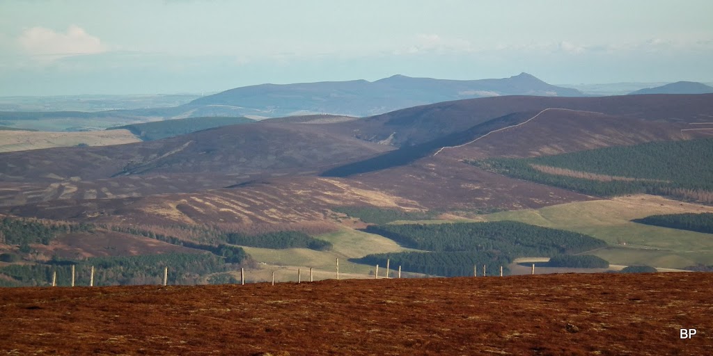
Having crossed one field and climbed a few metres, we looked back to see the long shape of Pressendye (a Graham - to be climbed one day) on the eastern horizon:

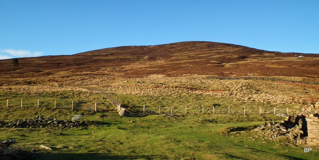
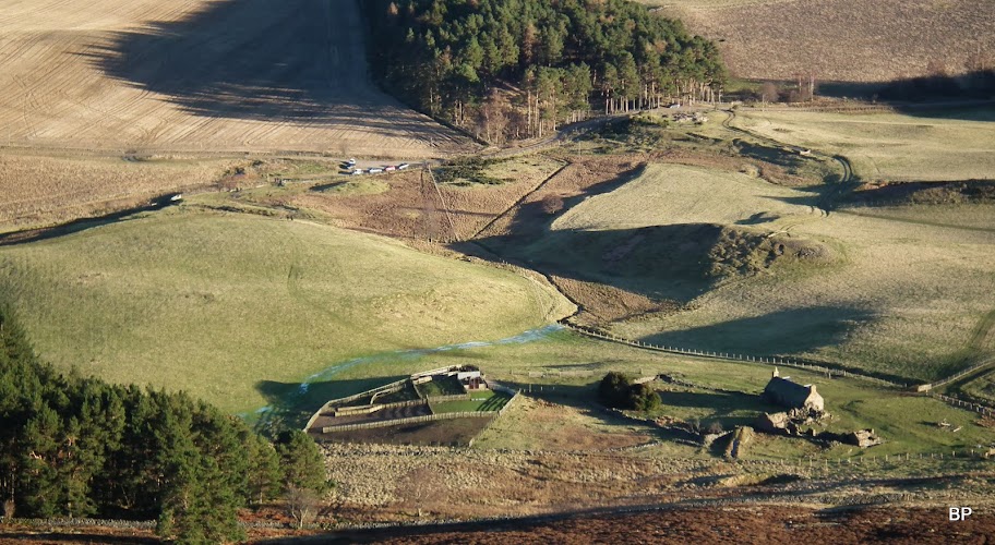
A visit to Balhennie, the abandoned farm, suddenly brought a wave of sadness onto me
I don't know how old this house is, if it is a listed building (probably not), but such a shame it's neglected and left to fall apart.

Kevin noticed an interesting "tool" by the wall of the house, it must have been a cheese press:
Past the farm, we crossed another gate. The ground was wet but half-frozen, so just as well we didn't sink into mud. The day looked superb, with blue sky above, but the wind was already chilly. Well, we were not going to surrender that easily!
We chose the longer route for ascent, the path cutting across the slope, to join Coinlach Burn on the col between Morven and the lower Roar Hill (the latter one has a very appropriate name for a Panther

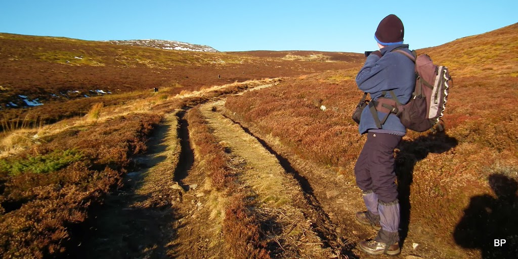
). Whichever path one chooses, views to the east are nice from the very beginning:
The name Morven means "big hill" and even if it's not a very long climb, it still makes muscles sore!
We didn't expect much snow on the higher parts of the mountain and left crampons in the car - just as well. All that was left were a few frozen patches.
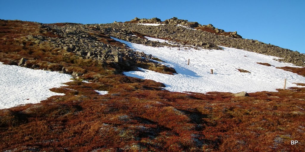
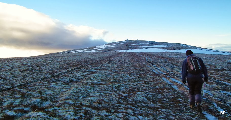
Hmmm... Here's our target!
Looking down the track from just above the col:

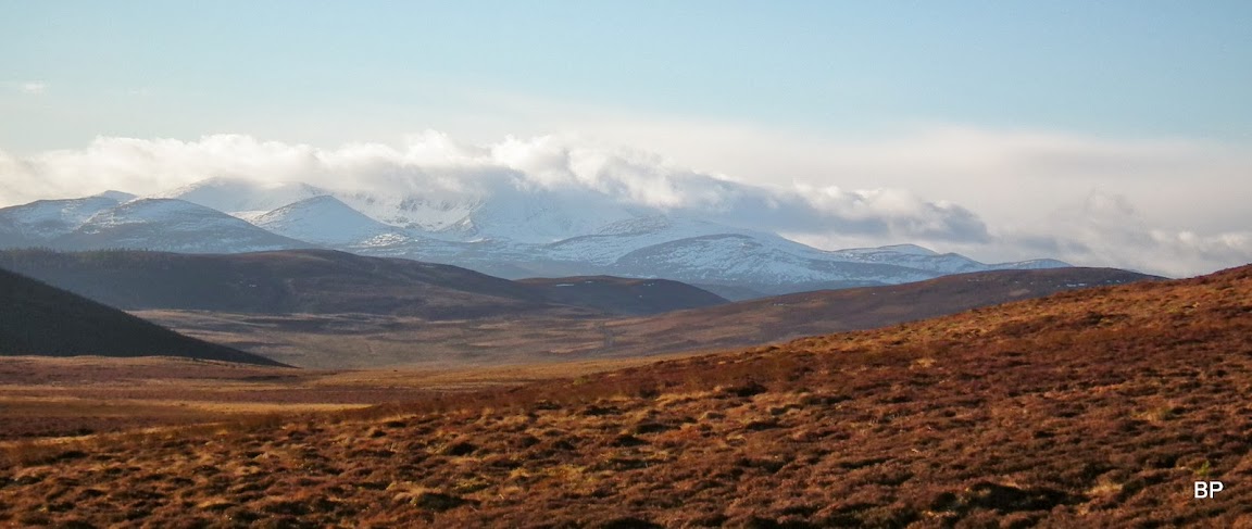
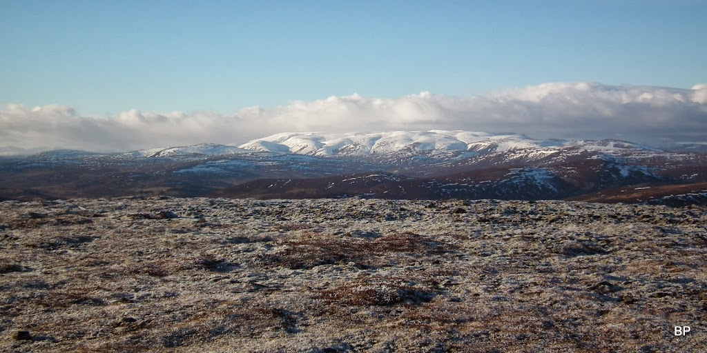
From the col we followed the wide track for a few minutes, but soon we got fed up with it and marched straight towards the summit area, crossing the upper flows of Coinlach Burn. The wind was getting stronger and we kept on going to keep ourselves warm. To the south/west, Lochnagar group loomed on the horizon, partially hidden in cloud:
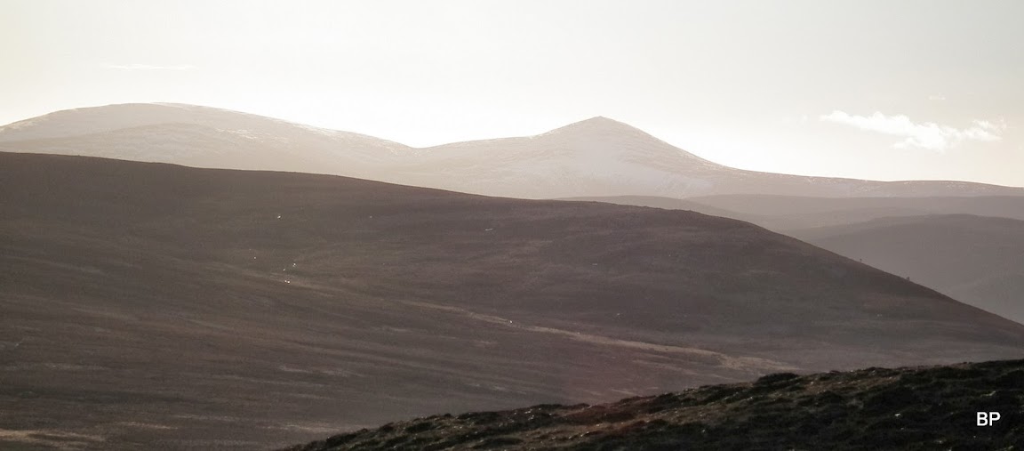
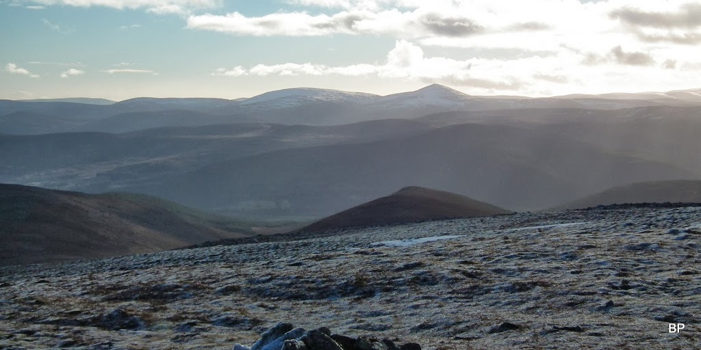
The obvious conical shape to the south - Mount Keen:
We climbed steeply to about 750m, just below the Middle Cairn. Here we saw two other groups of walkers, one going up, one descending along the main path. The Mid Cairn itself looked to me like a good spot to explore, scramble over and pose for "me on the rock" pictures, but sadly I had to give up on such ideas - it was far too windy for scrambling over rocks!
Pressendye again, Bennachie behind it:
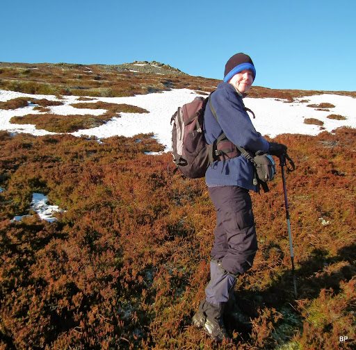
No "me on the rock" photos, just "me with rocks in the background"...
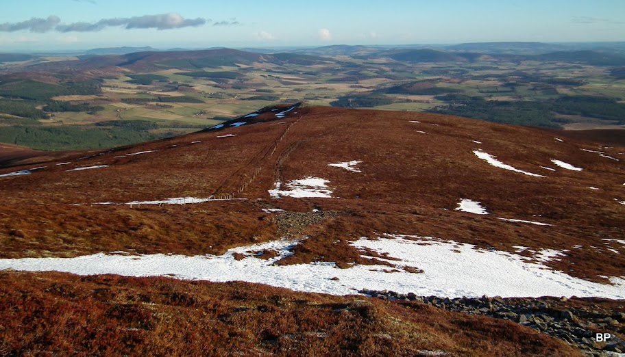
The shortest way up/down the mountain follows a line of fence posts:
We stopped just below the Middle Cairn, to put on additional layers of clothing and zip them up to our noses. As soon as we emerged on the final, short walk to the summit cairn, we were hit by the wind, like a wing of a giant bird. It was blowing straight into our faces! We struggled to make every step...
Eventually, cold and almost blown away, we reached the summit. Originally, we planned tea & cookies picnic here, but we could just as well forget it! We could hardly stand on our feet, and when I took my rucksack off, the wind almost took it! So it was a matter of a few quick snapshots, a 30sec video and we were off, running back down!
Panther looking more like a mummy, wrapped in umpteenth layers:

Beautiful, white Cairngorms on the eastern horizon. Such a shame we couldn't stay on the top for longer to admire this view!
Summit cairn:

South to Mt Keen, the world looking white. Generally, if it wasn't for the wind, it would have been a lovely day...
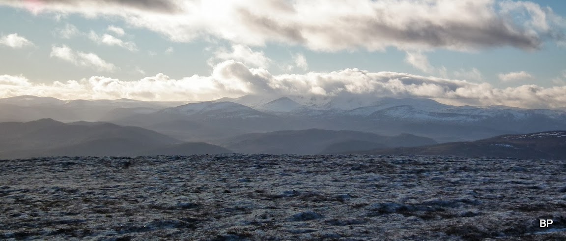
Lochnagar still cloudy, with the more round shape of Conachcraig to the left. The latter is a good winter climb, too:
Kevin, fed up with the gusty wind, retreating his steps down the slope...
We descended Morven using the shortest route, past Mid Cairn and Low Cairn (where the gusts of wind were still too strong to pose for silly photos) and then down the steep path back to the abandoned farm. At least, lower down the wind eased and we could enjoy walking in sunshine:

Balhennie from above:
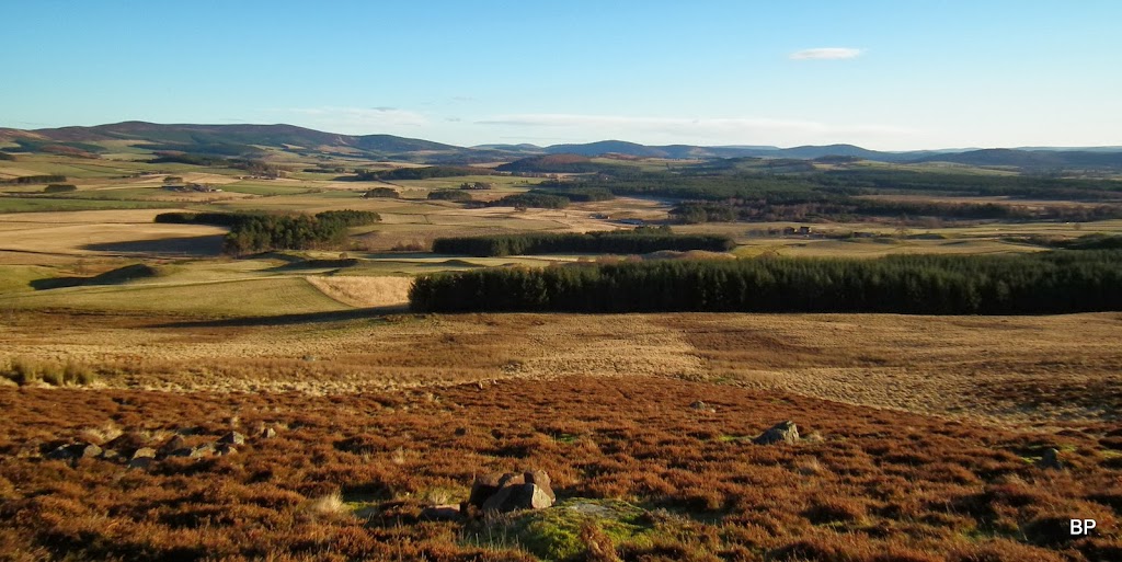
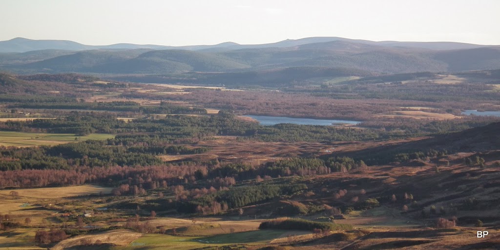
Loch Davan and the hills beyond. Somewhere in that direction, there is one more eastern Corbett to climb - Mount Battock. The time will come for that one, too...
We were back in our car in 3.5 hours. Of course, that mainly due to the wind. We didn't take any breaks, apart from a few short stops for dressing up and pictures. Shame we could not spend more time on Morven, sinking in the views, as superb as they are. But I have no regrets - better a windy hill than no hill at all. Meow!
Driving back, we were caught in a snow storm on the A9:
Oh, how Scottish the weather can be here
!
