free to be able to rate and comment on reports (as well as access 1:25000 mapping).
Although not my first choice, a meeting of minds settled on Beinn Chabhair for the Good Friday walk, and we parked up at the Drovers just after 9am. Research on the route had revealed walk reports often suggested when you did this once you wouldn't be going back again for seconds any time soon. By the end of this walk you could put me in that camp.
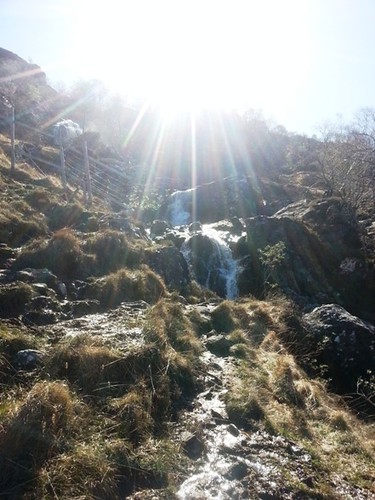
I did do the walk around the outside of the campsite, but I'd say not to bother to others, there a numbers of trees pulled over which make this an unnecessary ball ache. The steep start was anticipated and it fairly directly took you right to the north side of the falls. Not so far on the first of the two 8ft styles for the deer fence was in a bad way but with some care you can still clamber over it.
by
MekonVengence, on Flickr
First 80m done, the sun was already baking me. the path continued it's steep ascent to the 2nd style (also a 8ft job) at 250m. The ground was screaming out it was going to be tricky to descend with so many loose rocks. Over the 2nd style and the last 100m of rocky path was dealt with and a breather could be had.
I had expected a bit of respite from the terrain and nice amble along the burn avoiding a bit of mud here and there before the climb continued proper. That's not really the case, and you now enter a 3KM game of dodge the bog. It was shin deep in places and I was glad I decided to put the gaitors on at the last minute. The terrain is so rugged and knarly - you are up and down like a yo-yo if you stick to the path, or meandering around bogs if you try to cut out the bumps in the ground.
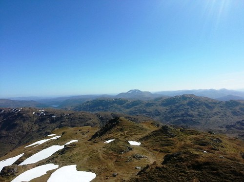
The view back onto Vorlich are very nice, it's not a side of that hill I had looked at before.

by
MekonVengence, on Flickr
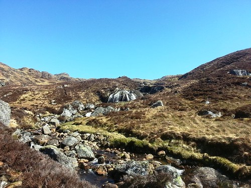
The burn itself is nice with a few interesting waterfalls on the way.
by
MekonVengence, on Flickr
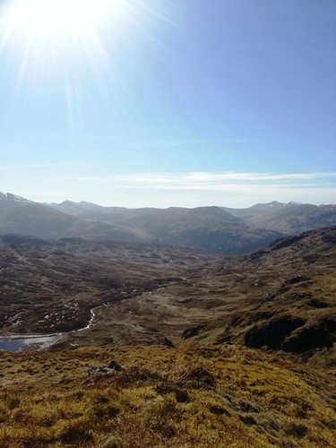
Ben Glas fairly towers over you as you follow the path, an incredibly craggy hill. With the challenges of the wet ground it seemed to take an age to get to 500m and turn off toward Tarmachan.
by
MekonVengence, on Flickr
This time spent in those conditions saps your energy, energy you really need for what comes next. heading North east across the wet ground, the bog becomes more muddy and less swampy as height is gained, then at time the path morphs back into something you can walk on.
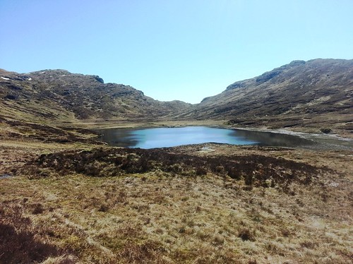
Fording a few small streams and you are at the foot of the gully that takes you to Tarmachan at 700m. This is more "Standard Arrochar steep rocky path stuff". Better time is made here, but with the heat I was already feeling the strain, and a break was had on the soft dry grass at the top. You get your first close look at Beinn Chabhair here.
by
MekonVengence, on Flickr
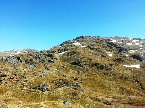
Continuing on you immediately lose 30m and drop down before you can go up again. The first of snow banks we had to cross was here, this one easily avoidable on the left hand side. the route continues in much the same vain, some times it weaves around terrain, and other it takes you up, over, and down, before moving every onward toward the summit. The second snowbank was horribly exposed as a terrain trap, so again this one was avoided, only to the right was an option.
It began to dawn on me just how long we had already been at it and we were still 150m to go, we were looking at 4 hours gone at this point. I decided that it would need to be lunch then attack the summit. Even after some munchies at times I felt horrendous on the last 150m, relentlessness zig-zaging up and over the bumps in the ridge and struggling for breath in the heat. Eventually at about 890/900 you get cut some slack and finally get the amble along the ridge to the small fine summit cairn. Can't say we stayed too long given the time, and we set off back the way we came.
Summit shots

by
MekonVengence, on Flickr
by
MekonVengence, on Flickr

by
MekonVengence, on Flickr
The steep decent back to Tarmachan was fairly straight-forward, the path down is not strewn with loose rocks or anything, so good pace was made. Went direct across the snow banks this time following the steps of others. But looking back I would say avoid the 2nd one again, as it's a traverse and it really does head off over the edge of something at the bottom of it's slope. Opting to go across was a sign of tiredness and poor decision making and I've been ticking myself off about that since yesterday. Too laxy to get equipment out the bag, may as well have left it int he car and saved the weight.
Getting down from Tarmachan to the lochan was ok in part, after getting down the gulley, a more direct route down the heather and grass is easier than the muddy boggy path. From there you have the 3km slog back down to 350m and it's less than fun, all be it quicker than coming up it.
by
MekonVengence, on Flickr
The burn begins to drop away below you and the path leads you around to the right and you finally see civilization again (well, the drovers). At this point, I'm baked and tired after 7 hours in the sun, and the decent was arduously slow. Every step is into loose rocks, and my steps seemed to get smaller and smaller as my confidence ebbed away. 350m vertical in about 500m distance is not an experience in those conditions I'm that keen on repeating. It's not massively dangerous, just friggin unpleasant.
I exited the campsite using the road, no-one seemed to care. At the drovers a hot meal was had along with some iced refreshment. Eventually got back in the car and home to Glasgow about 1 hour later. I felt pretty broken, some blistering on my toes, and a calf muscle injury. I had taken a lot of sun yesterday despite suncream and wearing a cap all day - think I had some mild heat stroke - and I slept with a wet towel wrapped around my head. Looking back on it, sitting here fairly broken, I won't be going up there again. When it was good it was great, but those good bits were too far apart,
