free to be able to rate and comment on reports (as well as access 1:25000 mapping).
I was looking for a different approach to Ben Vorlich as after some consideration the Inveruglas\Loch Sloy ascent just looked like a steep slog. The North West slope looked fairly accommodating - so I just had to get to it. From Butterbridge it would be a 9km walk-in - logical conclusion being to bike this bit in and out.
The bike in and out from Butterbridge
OSM had a track from the col between Stob-nan-Coinnich Bhacain and the North Eastern face of Ben Vorlich, and I planned to ramble up the North West slopes and acquire that track and follow it to the summit cairns.
My hill ascent is below.
The bike in was ok, it's a good ATV stone track all the way. You steadily rise over the length of Glen Kinglas, nothing too steep, and not really undulating as such. Eventually you get to a clearing where the track splits 3 ways and if you take the straight ahead, you will enter the forest and 2.5Km later be popped out at the bottom of Ben Vorlich. This section has some steeper climbs, and undulates quite a bit. Tough going in places. Lots of deer in this area. All streams have bridges, so there is no fording with the bike.
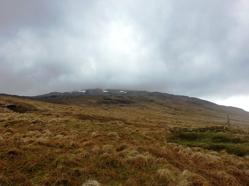
I was able to secure my bike against once of the many dam structures that are on this side of Vorlich to effectively route water into Loch Sloy. The area is full of these dams, bridges, culverts and aqueducts. I started walking immediately, heading for a line to the left of the young tree plantation that is fenced off. Here the ground was wet but gaining enough height so as not to be boggy. In terms of steep it was nothing, a straightforward walk to the col. I used the fence as a handrail following the SE bearing, and then broke to the ESE at the end of the fence @ 475m to get onto the col. The ground was still a little wet, but mostly grass with occasional boulders. Looking off to the right you could see the craggy nature of Vorlich.
by
MekonVengence, on Flickr
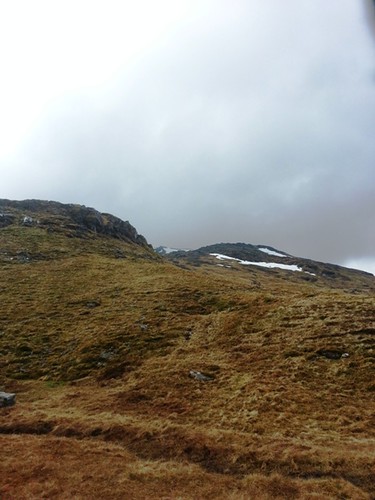
I couldn't say I ever found the OSM path at the col, but I half expected that and was open-minded on rambling across the hill side. End of the day all OSM is saying is someone recorded a gpx and uploaded it. I was happy enough to follow the general direction and hope it took a sensible route through the crags. Best laid schemes of mice and men....snow banks filling gullies were visible and I could see I was heading right for one. When I got up to the first it was steep and deep.
by
MekonVengence, on Flickr
I wanted to avoid, so went low and right and then started up through the crag , but this got very steep very quickly, and I decided that on wet grass between rocks it was a non-starter. So back again and this time lets consider crossing the snow....I had a quandry - the further up I climbed the thinner the distance I had to cross got, but the further I would fall if I slipped. I found a section that seemed to slope in direction of travel and this seemed a candidate. The steepness meant crampons, so I booted up. Two steps later and I backed off, just didn't feel right. Now I had a problem, I didn't want to quit given the big bike ride, but this was some obstacle. I rested and thought it through, I could climb up the left side of the snow bank as the grass was less steep and see what was over the brow, if that could be negotiated I could traverse the crag back on route. if it was more snow bank then the day would potentially be over. I crept up the side eventually gaining the brow, and as hoped the snow bank stopped. The day was saved.
More interestingly I found myself looking at what was clearly a reasonably defined rocky path. So totally lucked out in the end of the day. I would follow this and monitor how far it strayed from the GPX plan. The views here were really good looking Northward across Loch Lomand and the Beinn Chabhair ridge looked great from here. I was so elated I could continue that I didn't stop to take snaps...which was a mistake. Up and onward I went, has to be said I'm getting toward 750m and there has been no real hint of steepness yet on this route. With the path much faster progress could be made. As I went up it was clagged over and I was walking in the cloud, having a defined rocky path again is handy to give confidence in low visibility. My only concern would be if it turned in toward the edges of coire creagach but thankfully it never did. At about 810 this path converged with my GPX route as the path lined up south to run \ head over the tops.
The next snow bank ran down coire creagach so I took a SW bearing along it's sides to get away from the sloped parts until a found a very short crossing point through an island of rock on a pretty level part of ground. I cut some steps rather than crampon up. Now I was off path, but had a clear up hill stretch of grass and a .931 cairn to find. So using the 'just go up the hill' approach I set off. I must have been 200m short when the next snow bank appeared. It was not steep, but was wide - there was no getting away from the crampons on this one.
So I started booting up, full of energy knowing the first top was minutes away, then out of the clag appear two walkers coming across the snow toward me. They seemed relieved to meet someone and said they felt a little lost and not sure if they were on the path to exit the hill, but now they had seen me all was well as they must be going the right way. I asked if they were heading for Ardlui or Stuckendroin, and they replied Inveruglus. At this point I had to give them the bad news they were walking north, not south. They had walked nearly 1km in the wrong direction from the summit cairn. I offered to take them back to the summit cairn and there they could get their bearings South this time.
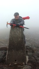
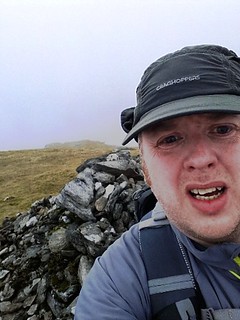
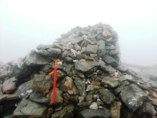
I took in all three tops, .931, .943, and the trig at .941. It was howling with wind on the ridge, and the clag prevented any views. I was just glad to get a munro that I had not fancied from the Loch sloy route. I took a few photos then started heading back North, following my own track.
by
MekonVengence, on Flickr
by
MekonVengence, on Flickr
by
MekonVengence, on Flickr
Good speed was made going down, the clag seemed to follow me to about 600m. I stopped for a bite to eat once at the col, and quickly got myself back on the fence posts and down to the floor of the glen. I didn't feel too bad for the cycle out. The forest was a bit of pain, but then it was about a 4km downhill ride, not going too fast was my biggest concern!
All in a good day out. No views to speak of, but equally, successfully avoided a unremittingly steep ascent route. It was my first bike\hike combination and it's certainly a more enjoyable way to complete a long walkout. In terms of the weather I was glad the much forecast rain never really materialized. Cloud was lifting by 5pm, so in theory a later start would have been better for up top.
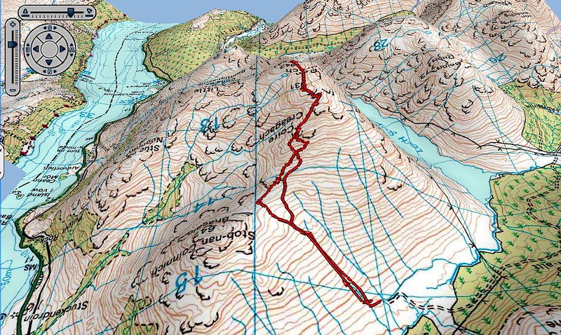
Here is base-camp doing it's 3D thing on the route
by
MekonVengence, on Flickr
