free to be able to rate and comment on reports (as well as access 1:25000 mapping).
I'm getting close to my half way point and Kevin patiently adds hills to reach his double ton. Obviously, I'll get to my target first, but he's picked up speed, too. Most Munros he climbs now are new to him, too (in the first years of our rambling together he repeated a lot of mountains with me). If only he didn't have to fight the hay fever, it would all be perfect...
For our latest "conquest" we chose Sgurr a'Chaorachain and Sgurr Choinnich, the duo of mountains that can be linked to Maoile Lunnadaidh on a very long day, but I didn't want to torture Kevin so we decided to do the "twins" only. These two in themselves are a full days walk, especially if you add 5km to the original route and go astray to trudge through bog... OK, everything in time.
This walk starts from Craig in Glen Carron, from Forestry Commission car park (free of charge but pretty crowded on a weekend day). We just about managed to squeeze in and jumped out... only to be attacked instantly by a hungry swarm of midges. AAAAA!!! Help, I'm being eaten alive!
The first midges this year we encountered on Buachaille Etive Beag, just a few weeks ago, but they didn't bother us too much. This was different - this was black army of bloodsuckers! We quickly grabbed our rucksacks, locked the car and run away from the car park and onto the road. Just as soon as we crossed the road and the railway line, the wee suckers were gone, but I was already scratching myself

Our route:
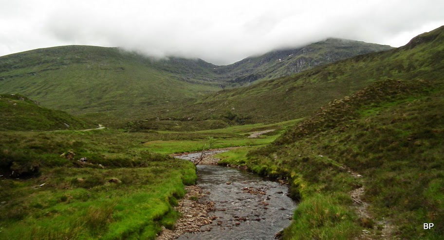
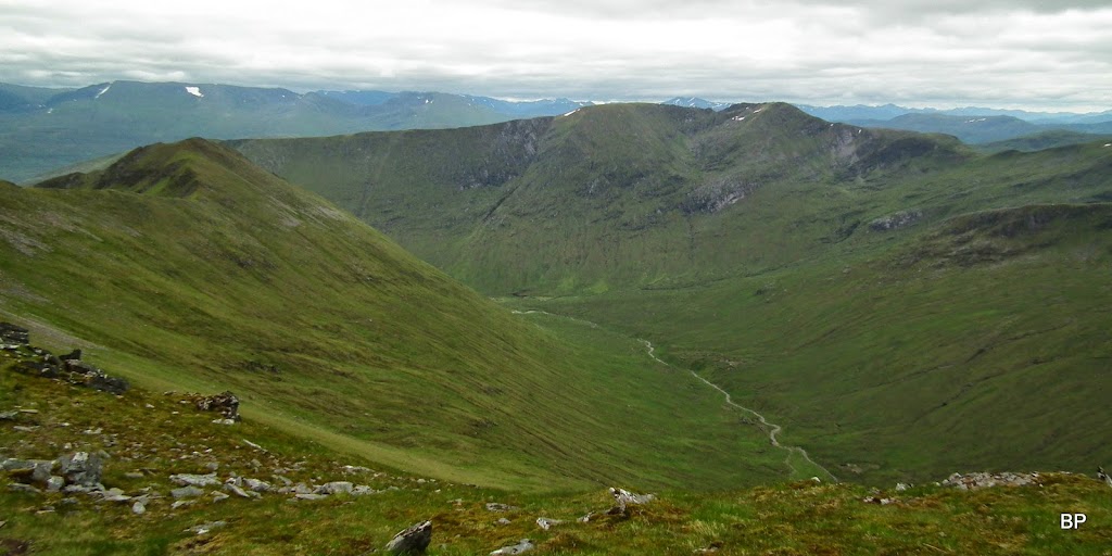
The walk-in was said to be a pleasant stroll, sadly the recent hydro development spoils the landscape

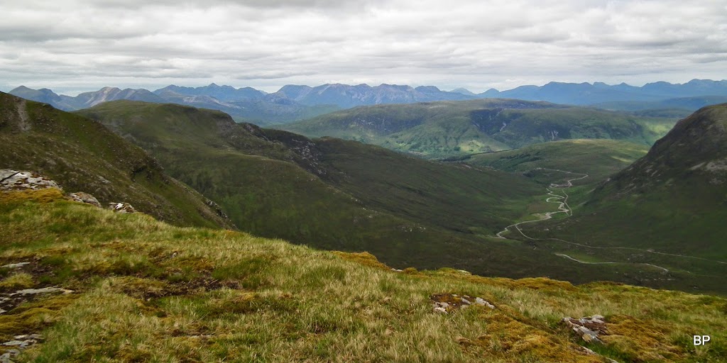
We walked past countless pipes, bits of machinery, bulldozed-over piles of earth and rocks, and eventually were overtaken by a speeding 4-wheel drive. The only positive, the track is well-trodden, so good for bikes (we have that in mind for Maoile). As we climbed a bit on the wide track, some nice views revealed behind us. It was humid, OK, but not too hot, and Fuar Tholl was winking at us

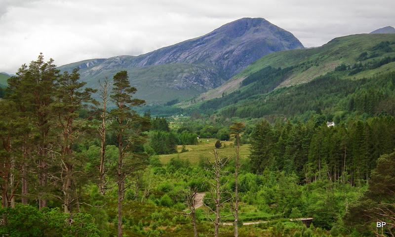
In front of us, if you ignore the roadworks, the main attraction is the steep side of Sgurr nan Ceannaichean, a former Munro now demoted to Corbett. The demotion takes nothing away from the hill apart from its position in the charts, and we enjoyed it last year in winter conditions

not from this side obviously

The hydro work was still on the way (strange they worked on a Sunday) and soon we heard a humming noise coming from the site - don't ask me what sort of machinery it was but it definitely made all the wildlife run away
Views back were getting better:
An interesting perspective to Applecross cliffs:

As far as the steep flanks of Sgurr nan Ceannaichean, the track has been upgraded (even has a waterpipe running alongside it as an additional decoration
):
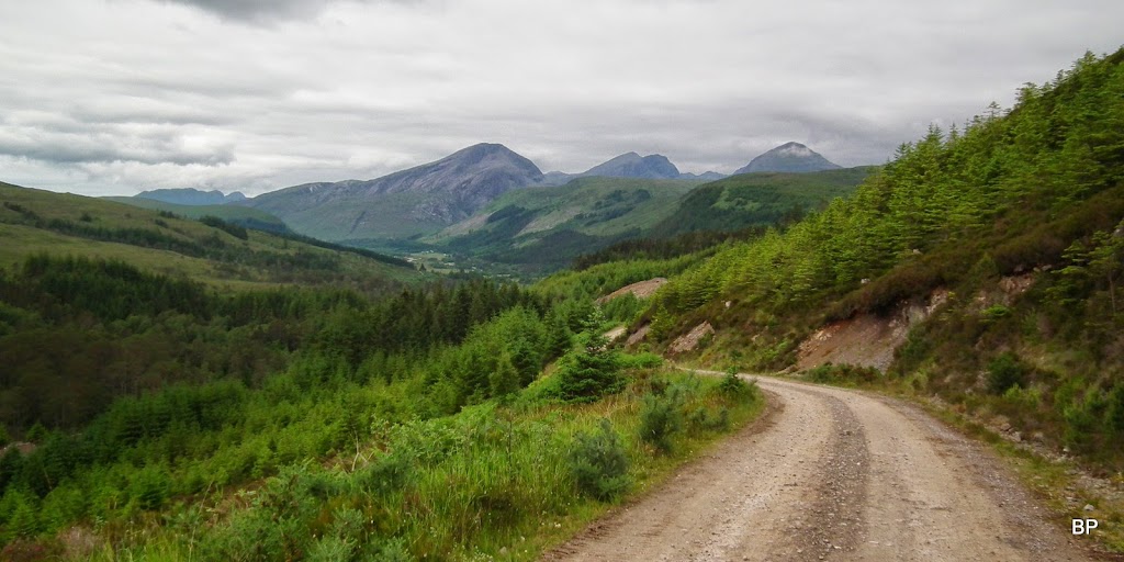
...but as soon as we ventured deeper into the long glen, we left the noise and all the hydro "artefacts" behind. At last, some remoteness... I was convinced we were going to run into people somewhere up on the hills, it was a weekend day and weather was relatively good. At the moment, we were alone:
One last look at the hydro mess and again, the unending debate: is it worth the hassle? The destruction of natural environment?... Maybe when the works are finished, it will all look better. Hope so.

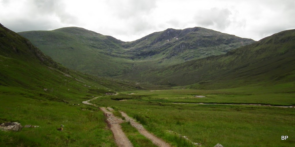
We continued on the track, the river didn't look too much in spate. I was worried having read that it could be impassable after heavy rain and it had actually rained on Saturday...
I must admit, we made a mistake of crossing the river too early

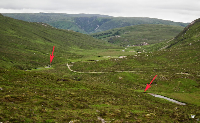
And my fault - I didn't double-check our position on the map. We came across a wire bridge (it even had a little plaque saying "Cross at your own risk" or something like that) and assumed this was the spot to cross. After a few minutes of looking for a suitable place, we managed to get to the other side... now I pulled out the map, got the grid refs from the GPS, and discovered that... we crossed the river about 500m too early!!! And all that because there are TWO wire bridges which we didn't know about
The wrong place to cross:
It wasn't such a disaster, luckily, it only meant that we had to walk the above mentioned half a kilometre along the wrong side of the Allt a'Chonais. The path along the riverside soon dispersed and we were faced with some bad, muddy, gloopy-gloompy terrain. We aimed slightly uphill and started the trudge, hoping to find the stalker's path higher up, which eventually we did. It was the boggiest 500m in my life but not a huge obstacle in the end
A small word of warning - you can save yourself the wet trudge if you make sure you cross the river in the right place. Here is a good illustration. The arrow to the left is where we crossed, the one to the right points at the ford next to the start of the stalker's path:
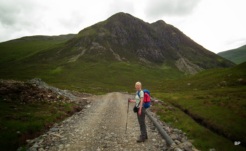
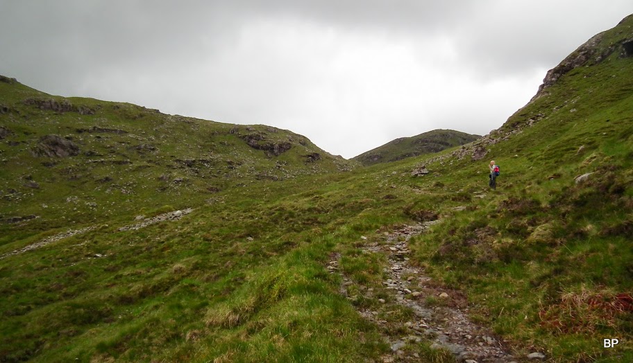
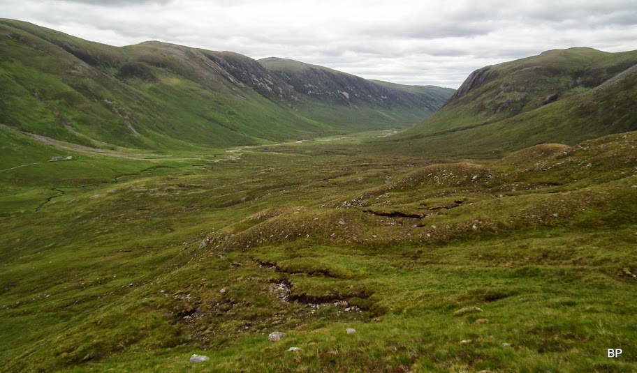
Once on the path, we breathed out a sigh of relief, as climbing was easy now. The path is muddy in places, but nowhere near as bad as the earlier wet experience. The summits were in cloud at the moment, but we hoped for some views and the clag did indeed lift later on:

The path goes all the way to Bealach Bhearnais:
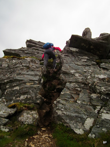
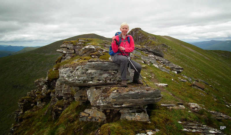
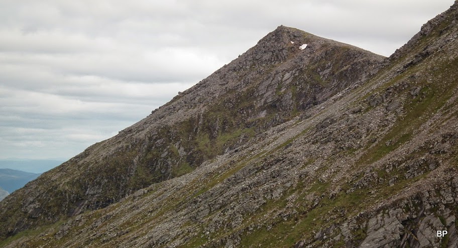
Views from the col are interesting enough, but as soon as I saw the final ridge, called na Aon Pacan-deug, I knew I was in my element!

Mmm... Hmmm... I wonder... How to tackle this?

The slope looks scary but soon I discovered there's nothing technical about it, an obvious path goes all the way up to the summit. On the way, it encounters three rocky "walls" but the rocks are more like steep staircases, it was easy enough to scramble up them. The last of the three walls looks a bit like a chimney:
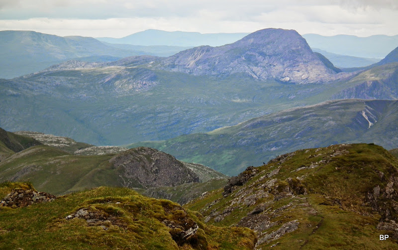
Looking back, the long ridge of Beinn Tharsuinn:
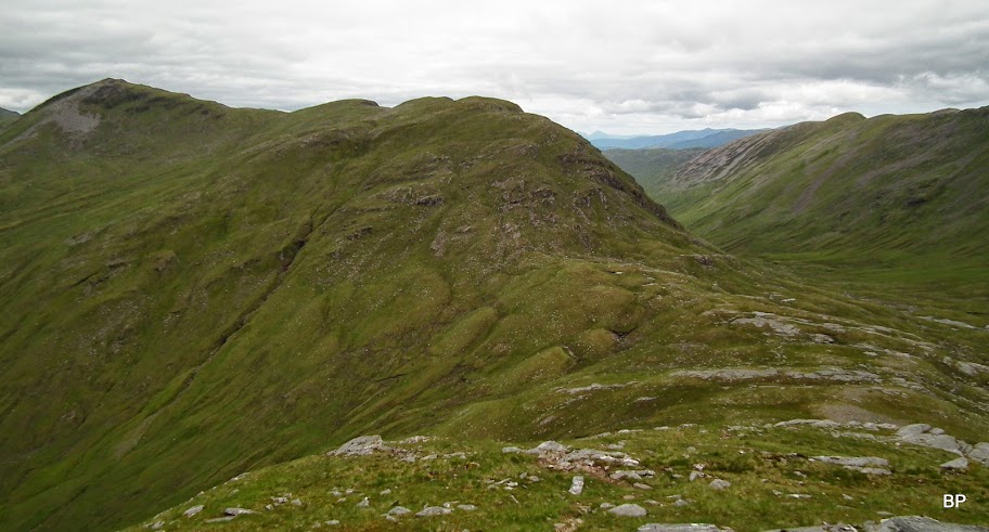
Something pointy on the horizon! Bidein a'Choire Sheasgaich:

Past the final scramble-ish obstacle, Kevin shouted - hey, we're getting some SERIOUS views now!
And he was right...
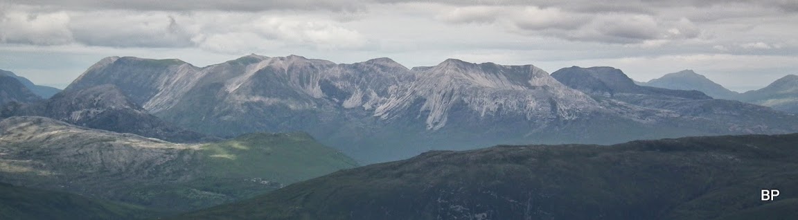
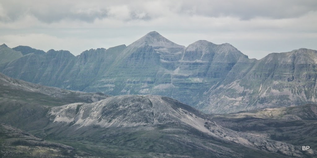
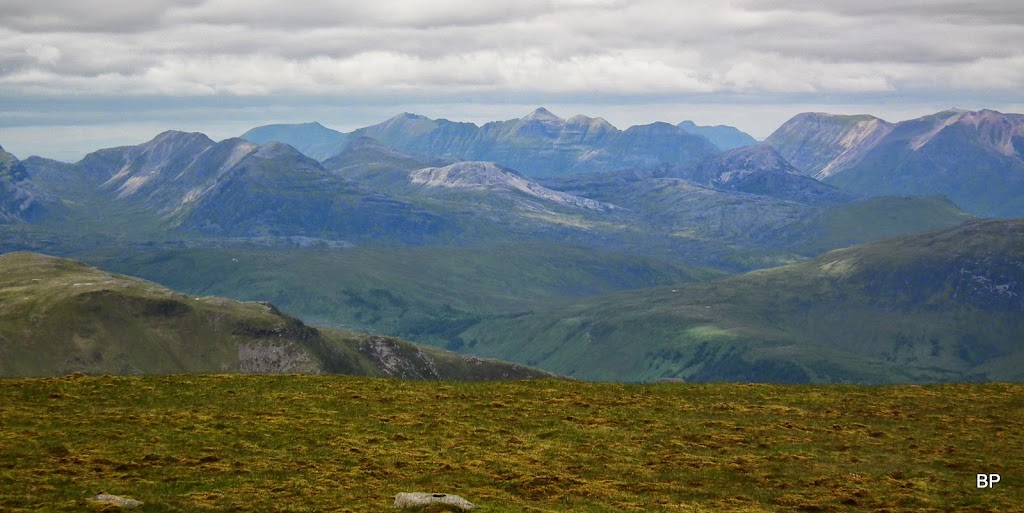
The panoramas were stunning. And all my fav hills well visible! Beinn Eighe, of course, The White Starfish of Torridon:
Liathach, The Beast, still hanging on to the remnants of the cloud:
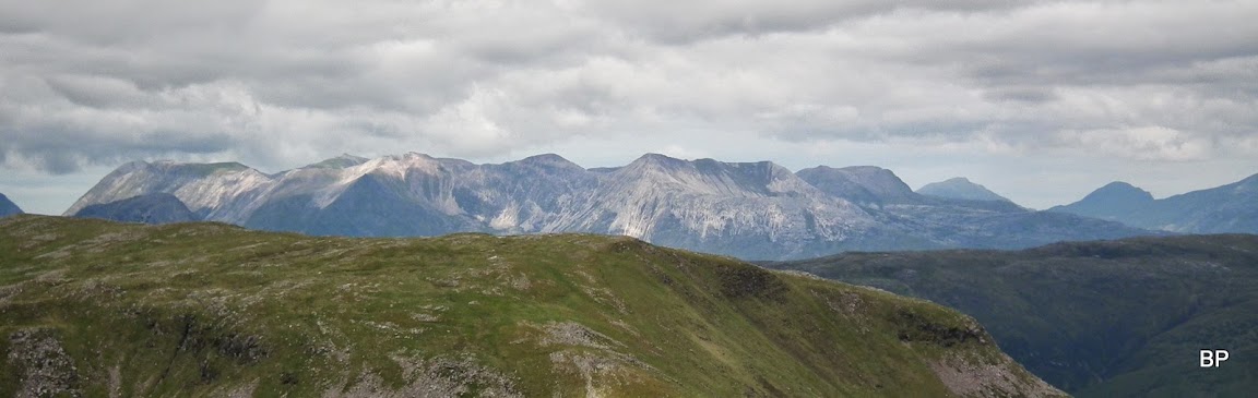
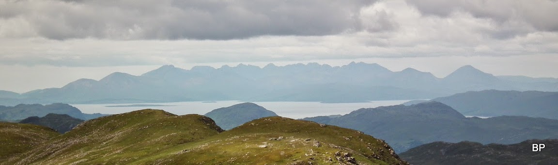
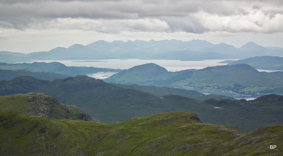
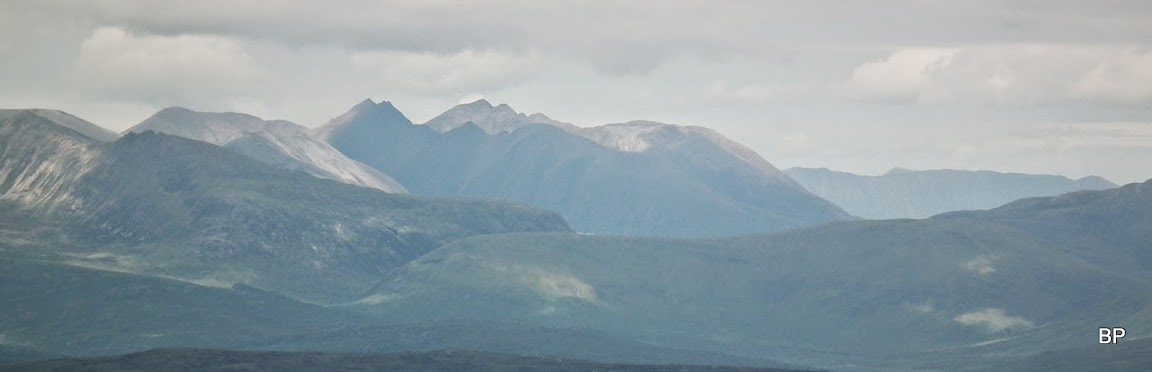
Isle of Skye not too far away, the Cuillin taking the centre stage:
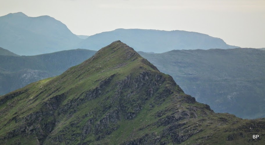
An Ruadh-stac, "The Slabby Thing" as Kevin calls it
Maol Chean-dearg and Beinn Damph peeking from behind it, from this angle they actually look like one long ridge:
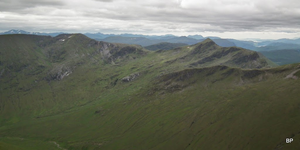
Beinn Liath Mhor, The Unforgettable Ridge

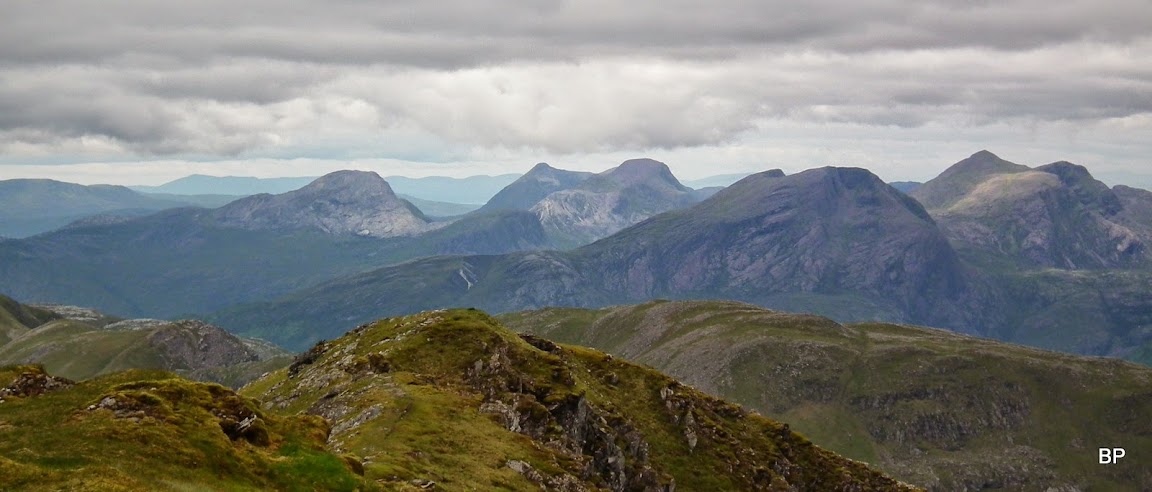
An Teallach and the Fisherfields:
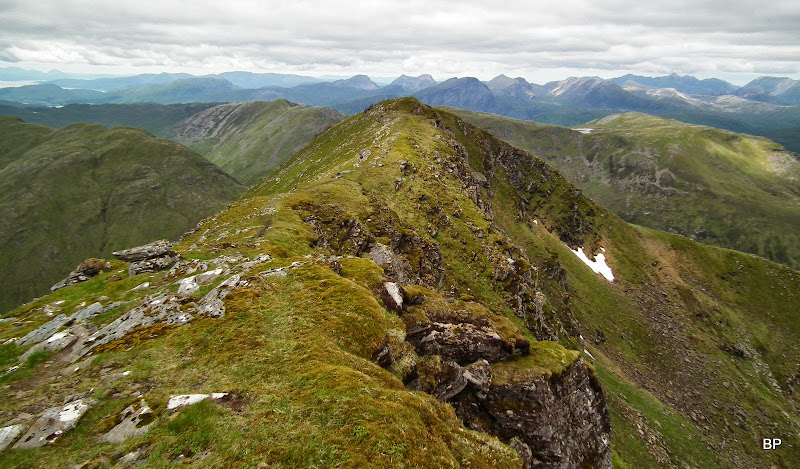
The steep climb ended abruptly and we emerged on a level, but nicely narrow and exposed ridge, leading to the summit. one side of this ridge is vertical, the other quite steep, too. Fantastic place to be (and gaze down
):

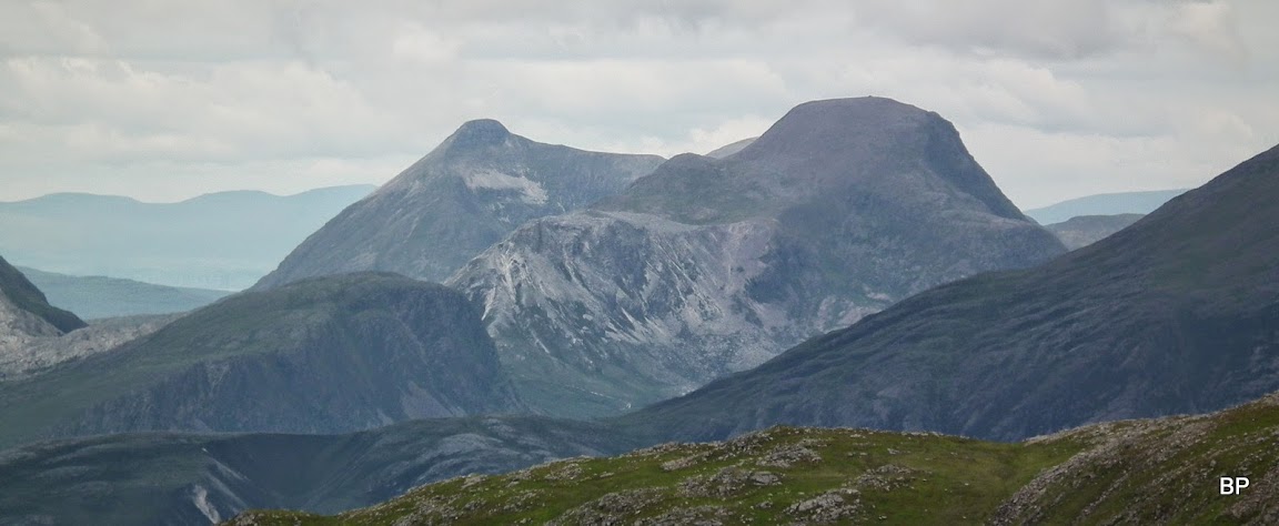
Lurg Mhor, one of the remotest Munros, but having done Seana Bhraigh, I'm not afraid of this one. Bring on another good day:
On the way to the summit, how could I resist "me on the rock" pose? This time it's "me on the rock with a vertical drop on one side":
And that's what I was looking at - some fine vantage point I had
The Cuillin again:
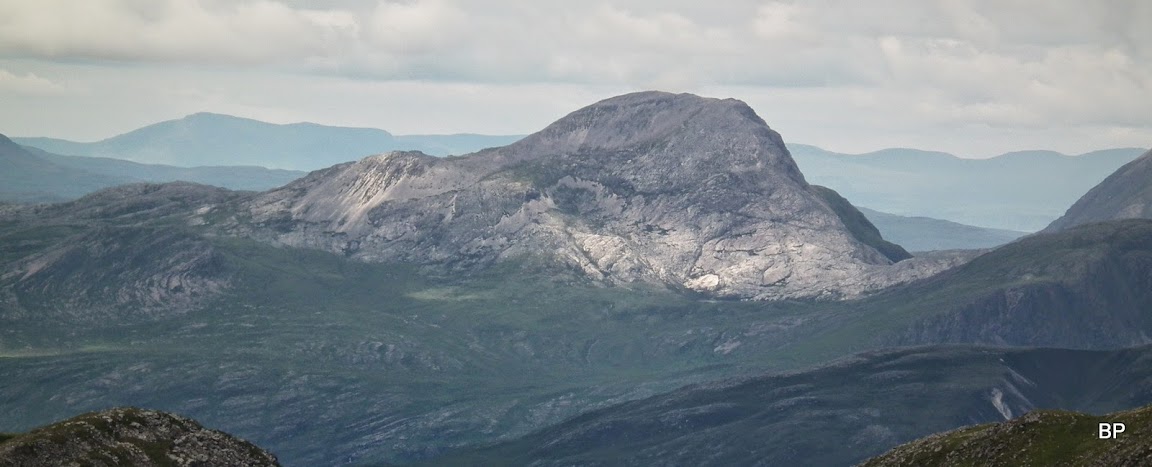
Fuar Tholl and Sgorr Ruadh. I have to go back to FT, we did it in clag and didn't see a thing
apart from the nose

Mr Eighe simply wouldn't let me go...
View north from the summit area, with Torridons and Fisherfields on the northern horizon... Is there a better place to be?

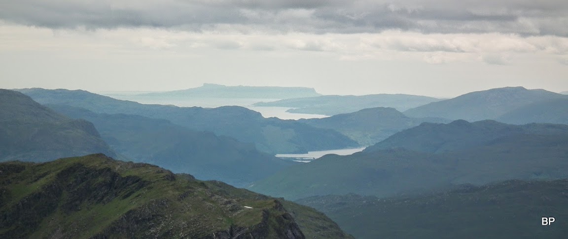
Vistas to die for... Even Isle of Eigg was visible:
Anybody on the summit of Bidein a'Choire Sheasgaich, perhaps?
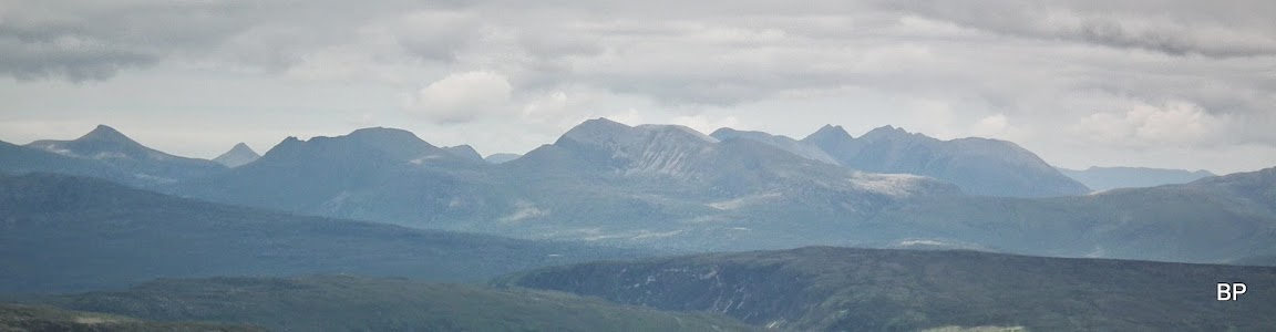
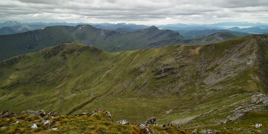
The Coulin peaks or, as I call them sometimes, the southern Torridons once more:
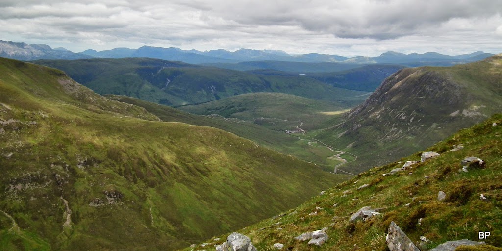
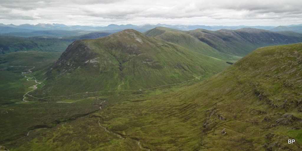
Moruisg and Sgurr nan Ceannaichean, with the Fannichs behind them. The track in the glean can be traced all the way to Glenuaig Lodge - and this is the route to Maoile Lunnadaidh:
Zoom to the Fannichs:
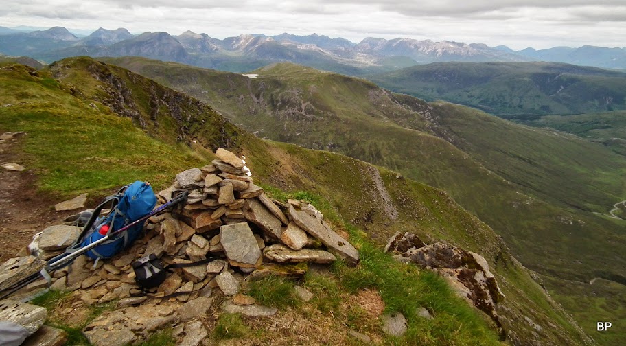
We spent quite a lot of time sitting by the summit cairn, which is perched on the very edge of the cliffs
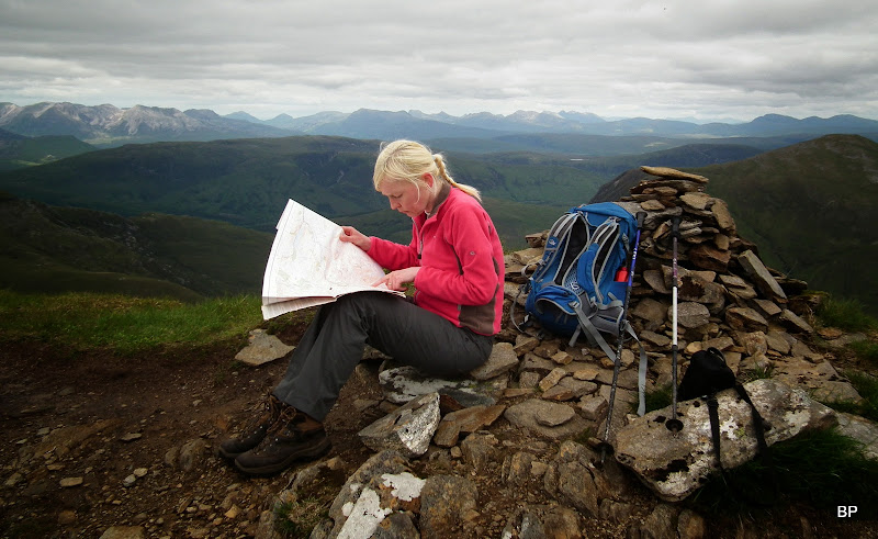
We studied the map and discussed our future trips, including Lurg Mhor and Bidein as well as the two Corbetts next to them. Sgurr na Feartaig on its own seems a nice walk for a shorter day, maybe a winter outing, as long as the crossing of Allt a'Chonais is possible. Still so many mountains left to climb... Will keep us entertained for years to come!
So what's next, Panther?
An Teallach? Done that, been there, but I'd like to visit it again!
Been to this one, too - well worth a second visit!
Yeah, sure, these two must be the next target in the area! A long day, maybe even an overnighter. I like challenges!
This one is scary and I'm glad I don't have to do it again
Although maybe... maybe I'll return one day to scramble over the pinnacles. And make sure Kevin doesn't drag me down shouting - are you mad?
He wasn't shouting this time - quite the opposite. I think he was surprised and overwhelmed by the quality of the views - just as much as I was...
A raven circling the summit:

The final summit cairn vista before we eventually departed for the second peak. An unforgettable view indeed:
The descent to Bealach Coire Choinnich does not require any scrambling, but the path is steep and quite eroded, so we took our time:
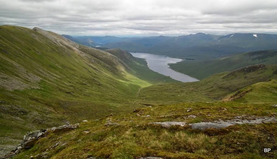
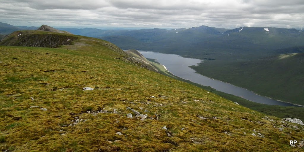
We could see Loch Monar now with all what lay beyond:
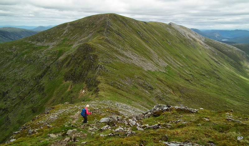
The final climb from the bealach to the second Munro is less than 200m so nothing too tackling. The path is obvious and again, no rocky outcrops to climb over
only a nice, slightly exposed ridge. Something just right for me!
That's what I call hillwalking!

...and that's what I call views worth the effort! Like looking down from a plane. Plus the neverending ridge on the horizon!
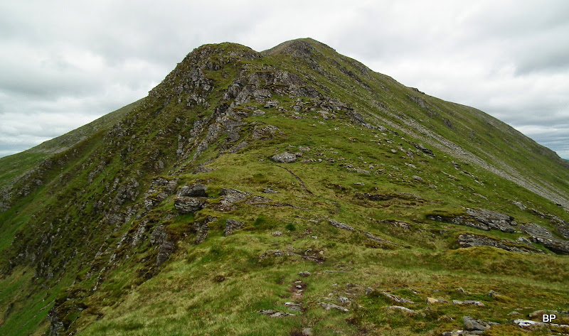
Looking back to Sgurr Choinnich from just below the summit of Sgurr a'Chaorachain:

View north-west with Lurg Mhor and Bidein a'Choire Sheasgaich behind the grassy ridge of Sgurr na Conbhaire:
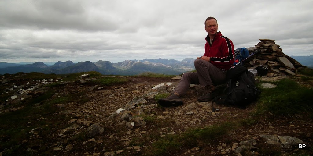
Kevin was the first to reach the summit shelter - I lingered for too long filming the views and admiring the landscape. Soon I run to claim my 138th Munro!
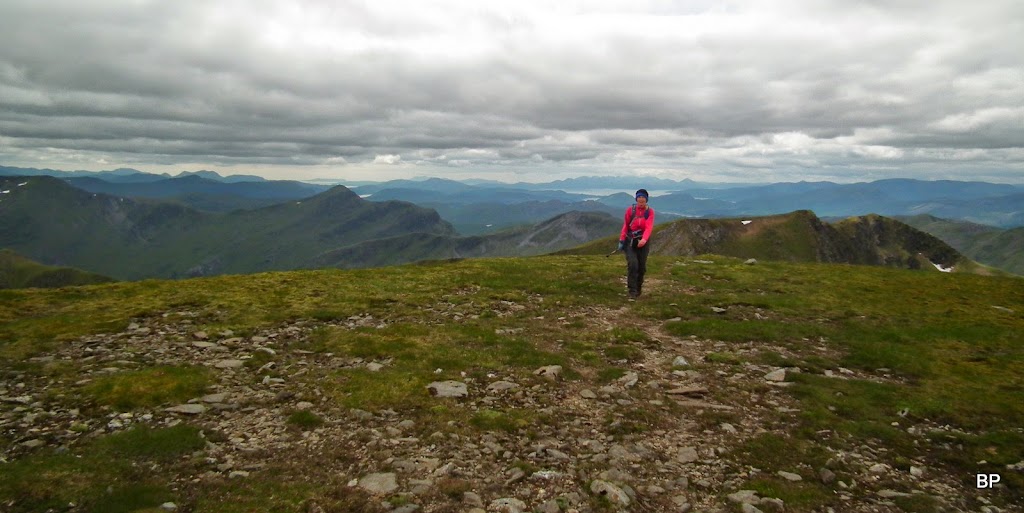
138 done, now only 3 to half way and then... then it will be counting backwards - how many left to completion

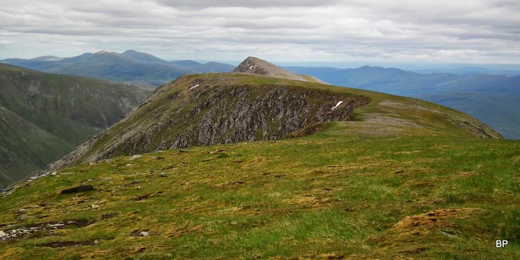
This one is not required, if one is only interested in Munros, not Munro tops. Bidean an Eoin Deirg:
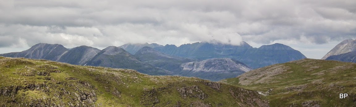
Torridon - panorama:
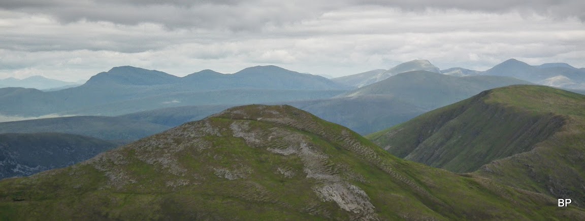
Looking along Loch Monar and the Mullardoch Munros on the horizon:
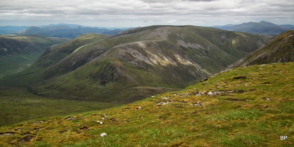
Another "beast" to tame - Maoile Lunnadaidh. My first encounter with this one was in winter conditions, from the summit of Moruisg. It looked just as daunting now - a big, flat-topped but steep-sided leviathan, waiting patiently for all brave walkers ready to fight it...
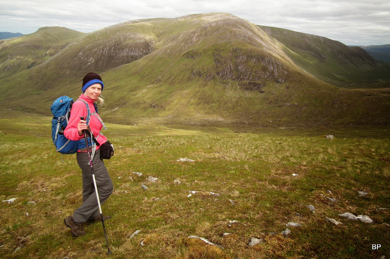
The day was good enough for me to demand some more lurking around
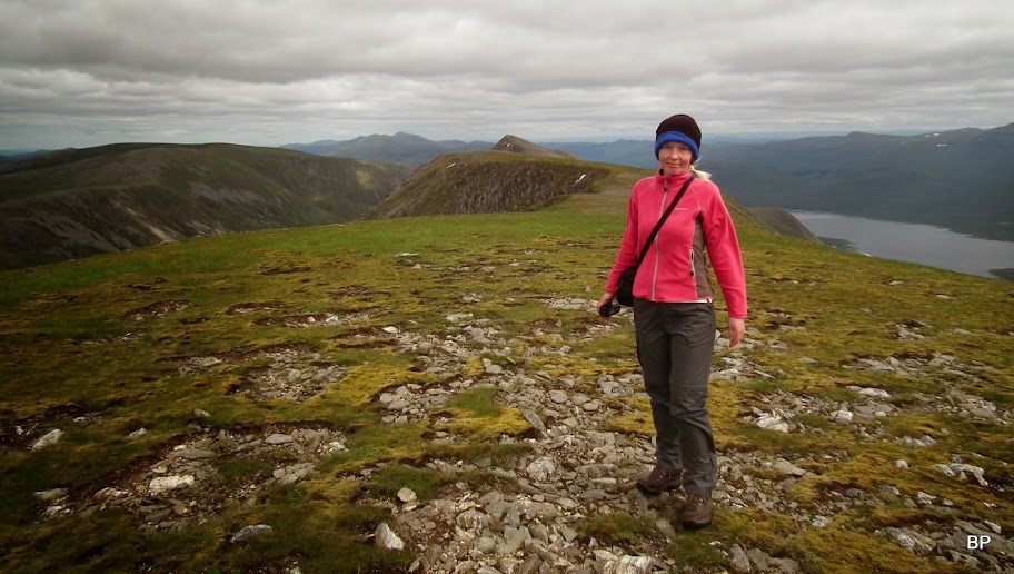
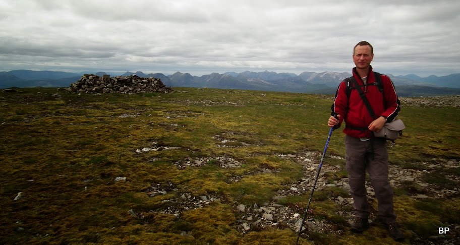
You may be surprised by the presence of a woolly hat, but there was a chilly edge to the wind:
The trig point inside the stone circle has collapsed, but the structure still gives good shelter from the wind. Plus views are great:

Kevin's Munro No. 171
only 29 left to his double ton... I guess I'll get to my half-way first!
WH description suggests returning steeply straight to Polan Budhe, but we didn't really fancy that option, as the grassy slope was wet and slippery
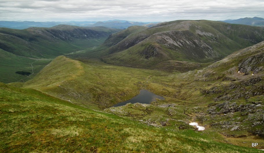
Having checked our watches we agreed we had enough time left to make a longer circuit and descend more comfortably along the eastern shoulder, called Sron na Frianich. This option offers less steep walking and a bonus view down to the picturesque Coire an Lochain Ghainemhaich:
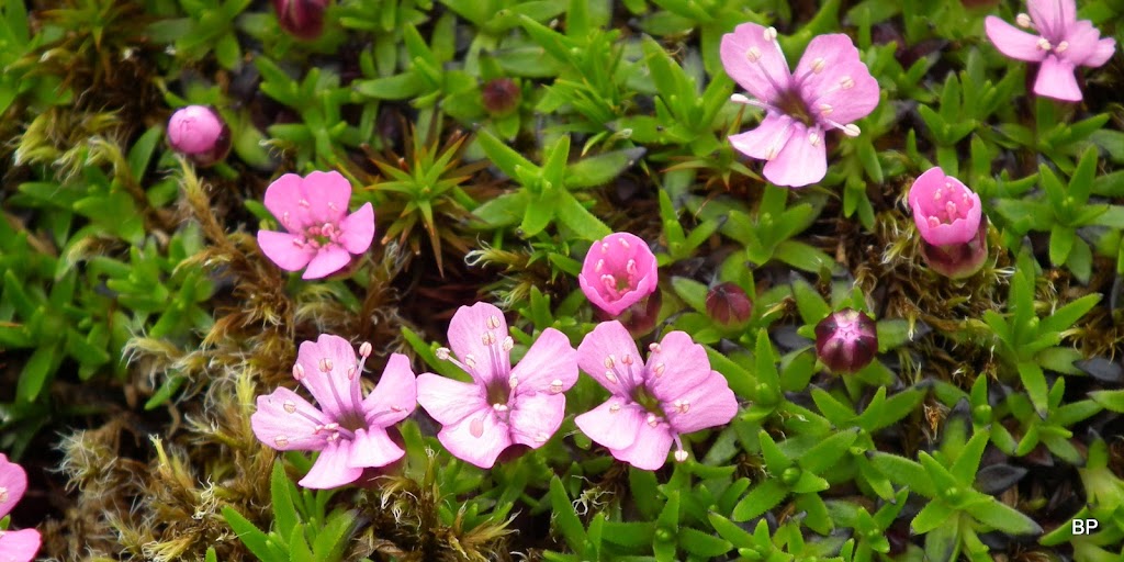
We took our time... There's always something to admire, another excuse to take a break for a quick snap... Even moss campion
Coire an Lochain Ghainemhaich and Maoile Lunnadaidh. On the way down we discussed options for this one and it is most likely going to be a bike trip to the lodge and then a quick, sharp attack on the Munro

The summit of an outlying top, Bidean an Eoin Deirg:
We enjoyed a very nice walk down on grassy terrain, with good views all the way, especially the panorama of Torridon:

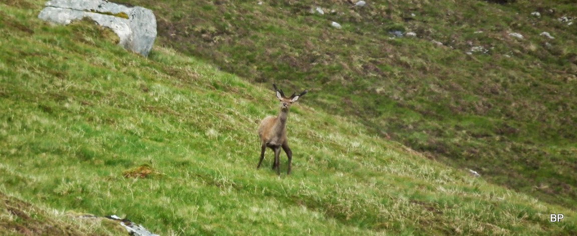
We were also watched
Posing with Sgurr nan Ceannaichean. We checked all possible routes down the northern side of Sron na Frianich. It was negotiable, but very steep and in wet conditions we preferred to stay on safe, less steep ground.
The final bit is...hmmm... how to say it without discouraging anybody... a little swampy
You'll like it if you are a stork though - plenty of frogs
All right, jokes aside - the final 200m of descent are steeper and boggy, too, but nothing too bad, it can be done. We emerged on the track just west of Glenuaig Lodge, next to a small tree plantation. The rest of the return route was now easy
I'm not sure if this is the easier way to descend Sgurr a'Chaorachain, as it adds about 5km to the circuit and it does not avoid all the bog, but it is definitely the more interesting one, so if you have time to prolong your walk, just as well try it. We took 9 hours, but again, we didn't exactly push it too fast. A good pair of M's, not the driest but the views are well worth the trudge. Meow!
