free to be able to rate and comment on reports (as well as access 1:25000 mapping).
I can't post my GPS track as it has some rogue readings due to the reception in the heart of the Cuillin. (My GPS said 33km and ascent 874m but I know they are wrong.)
My route: start at Sligachan Hotel and head down the Glen Sligachan path marked for Camusunary/Loch Courisk for about 5.5 kms. Take a right when you see the Bloody Stone and keep on a secondary path following the Sligachan River (left-hand bank) all the way to its source. That's it! This part forms a huge arc which results in you being enveloped by the North Cuillin Ridge. Magic!
Marsco on the way down Glen Sligachan.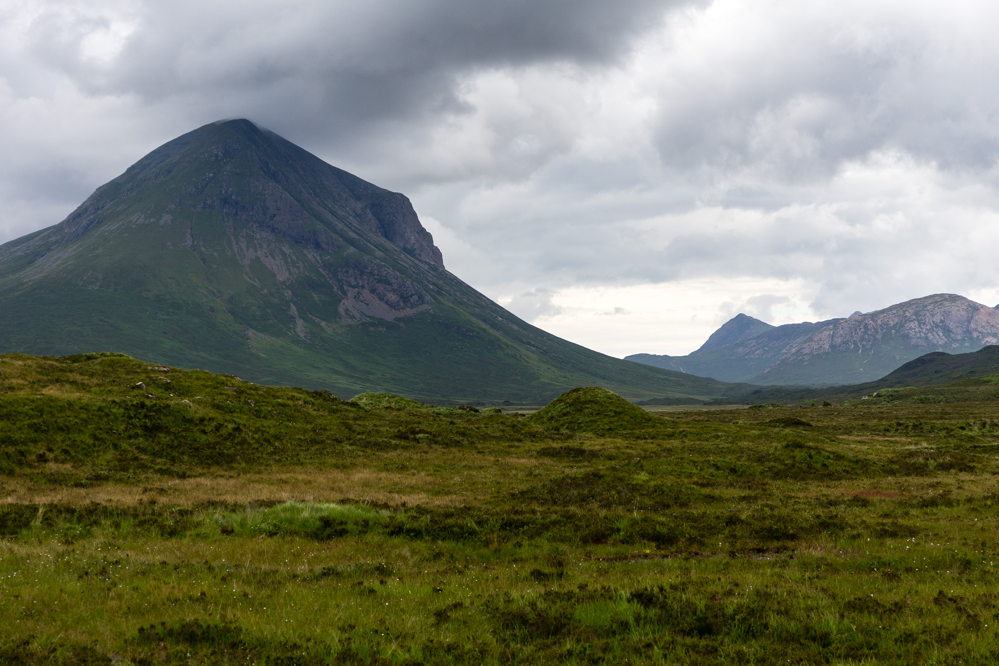 Harta and Lota Corries
 by
anniesmountains, on Flickr
I decided to try this walk after reading various descriptions (some pretty vague) in three different books. Usually the walk is combined with an ascent of Sgurr nan Gillean or rock climbing, neither of which were on my agenda. I just wanted to experience the corries.
I started off late (10:20) for such a long walk and the Glen Sligachan path was quite busy so stopped for a chat a few times. By the time I got to the Bloody Stone it was lunch time. Whatever you read or hear, there is a good path all the way from the Glen Sligachan path on a minor path right in to upper Harta Coire. Actually the path continues up to Lota Coire but is more of a challenge of which more later. Another thing to note is that the map marks Harta Coire as down by the Bloody Stone but one has no feeling of being in a corrie at this point. It's only after the short ascent by the first waterfall that one really gains the corrie so I'm calling that upper Harta Coire.
Approaching the Bloody Stone. You can see the path on the left.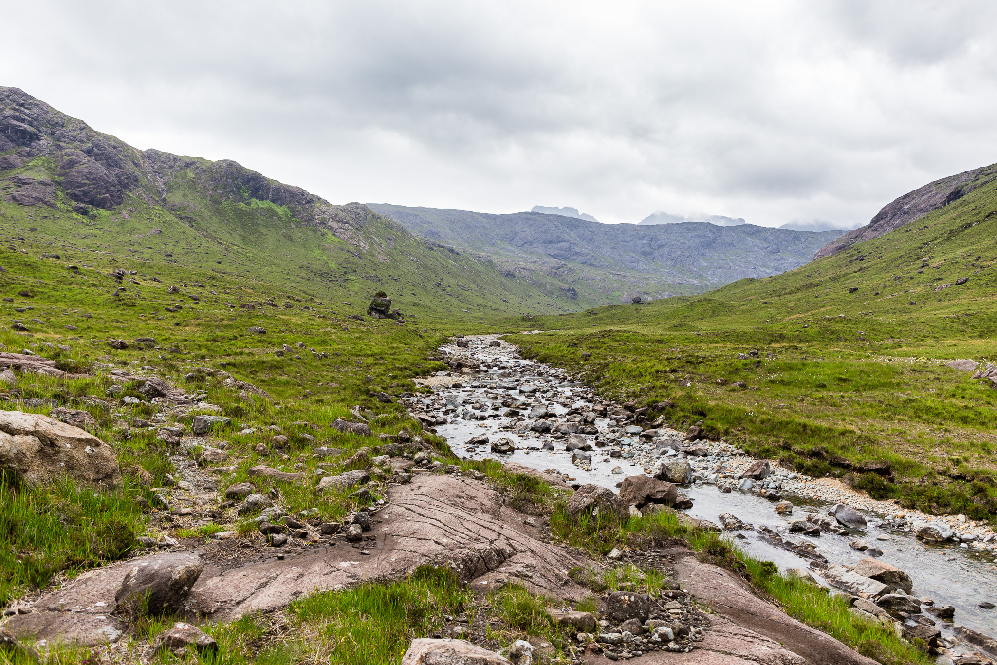 Harta and Lota Corries-4
 by
anniesmountains, on Flickr
As you continue around the bend of the Sligachan River you start to get a feel that you are entering a cathedral. The walls of Druim nan Ramh on one side and the lower slopes of Sgurr na h-Uamha on the other form the foyer and there is the expectation of greater things inside. You really enter the corrie proper after ascending by the small waterfall and at first I wasn't sure which corrie I was in as there didn't seem any way to go further up. An Caisteal (the Castle) doiminates on the left and at this point the Bastier Tooth shows up at the top of the organ. OK, OK, enough of the cathedral metaphor! I've seen many pictures of this part of the Cuillin Ridge from the other side but everything looks just a bit different from this angle. For example, Sgurr a' Fionn Choire is very prominent but Sgurr nan Gillean doesn't amount to much
 Climbing into 'the cathedral'. Drum nan Ramh straight ahead with An Caisteil (the castle) to the right of centre. This is frequented by climbers.
 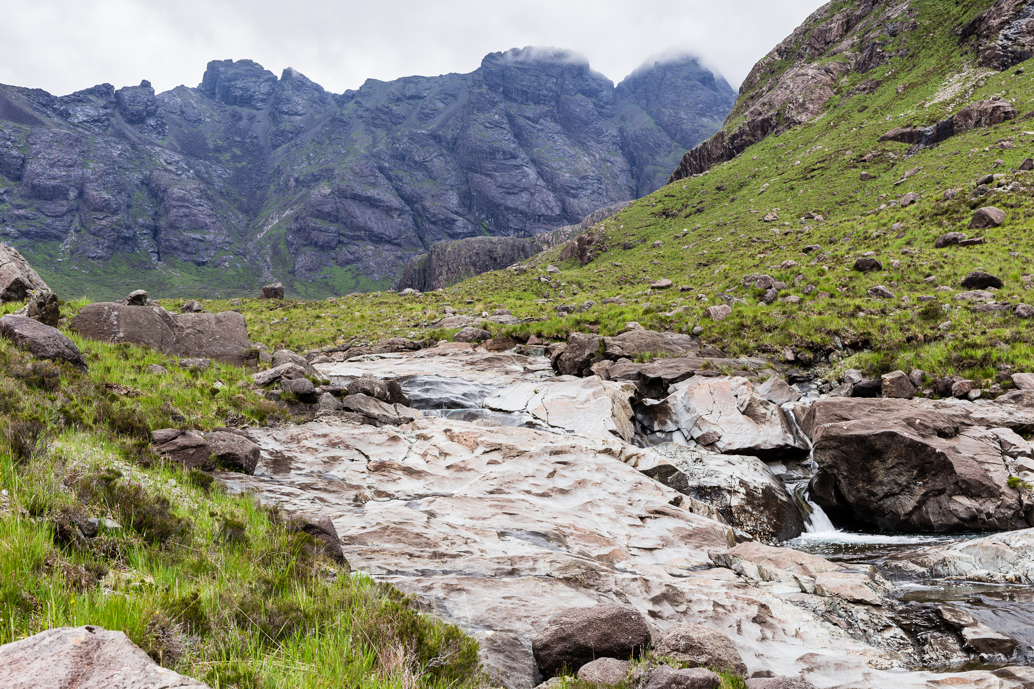 Harta and Lota Corries-5
 by
anniesmountains, on Flickr
From left to right - Bidean Druim nan Ramh then down by the side of its second top is Bealach Harta, the imposing An Caisteal, Sgurr na Bairnich, Bruach na Frithe, Sgurr a' Fionn Choire down the side of which is Bealach na Lice, the Basteir Tooth and finally Am Bastier in cloud. What a view! This is lower Harta Coire. Harta and Lota Corries-6
 by
anniesmountains, on Flickr
View down from upper Harta Coire. Bla Bheinn in the distance and the lower slopes of Sgurr na h-Uamha on the left.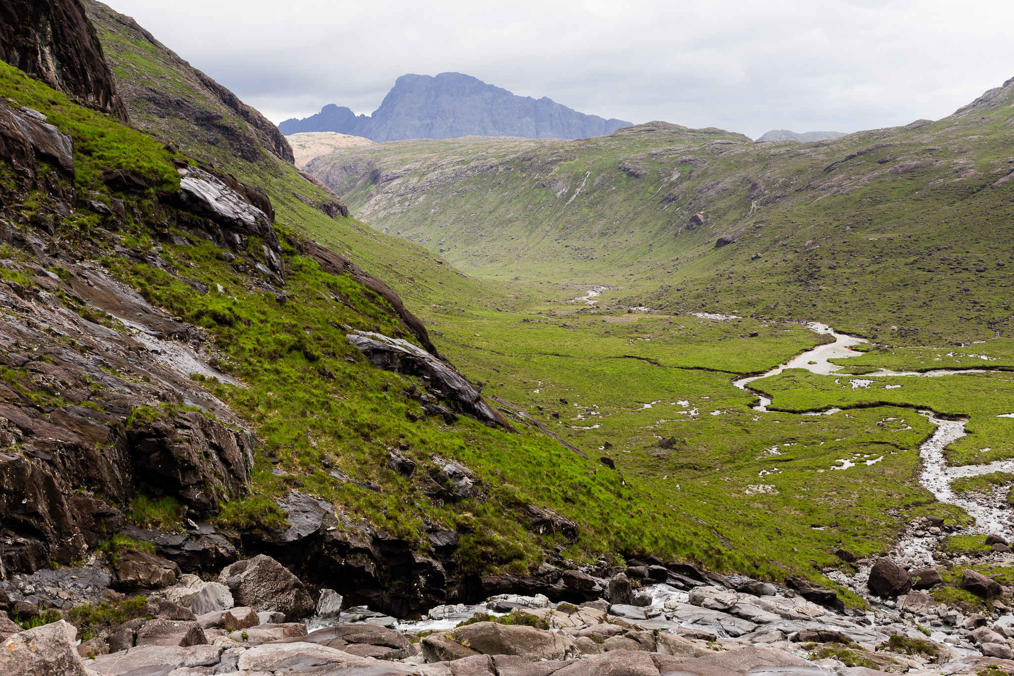 Harta and Lota Corries-7
 by
anniesmountains, on Flickr
The cascades and Sgurr nan Gillean left of centre.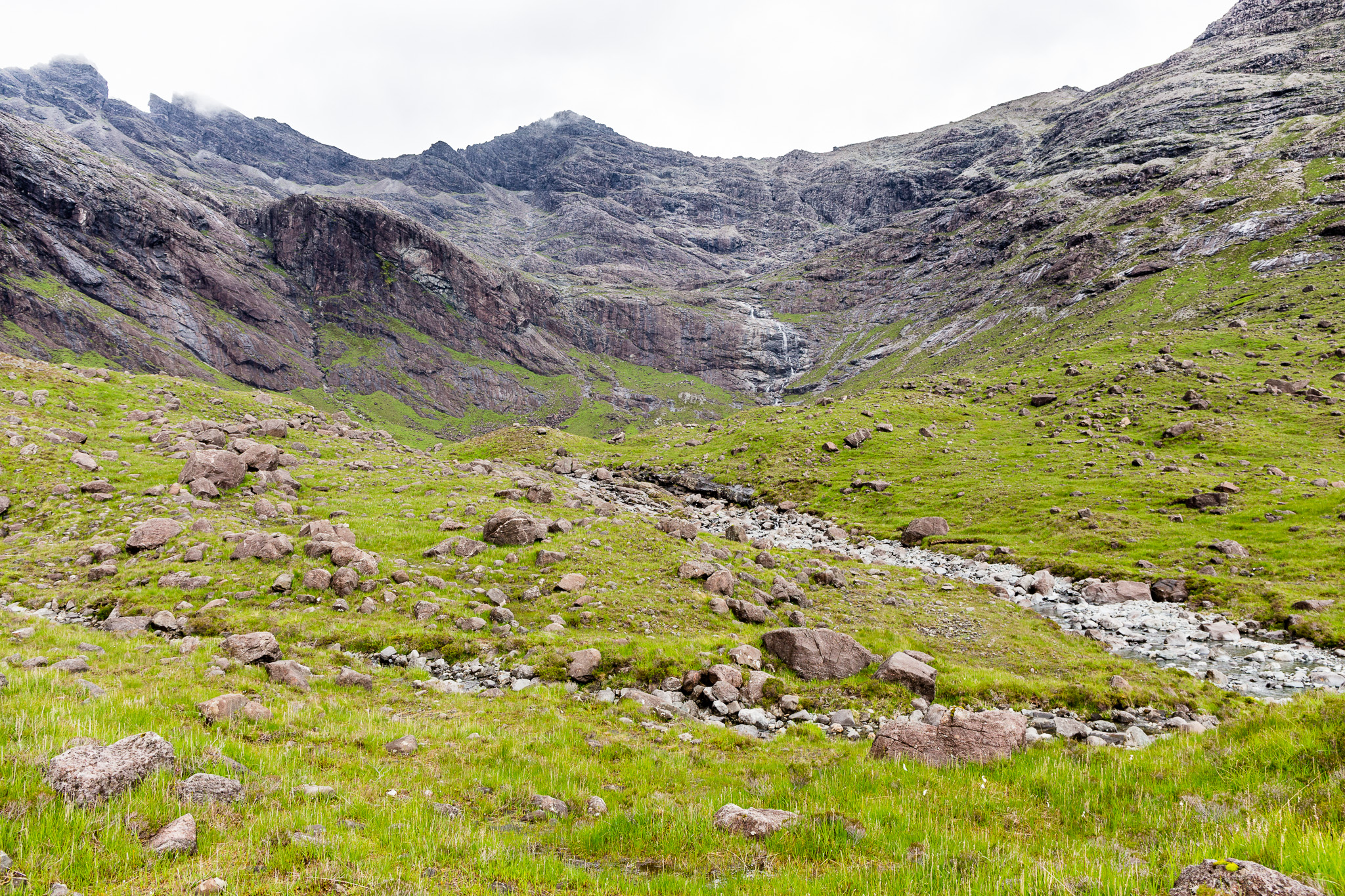 Harta and Lota Corries-8
 by
anniesmountains, on Flickr
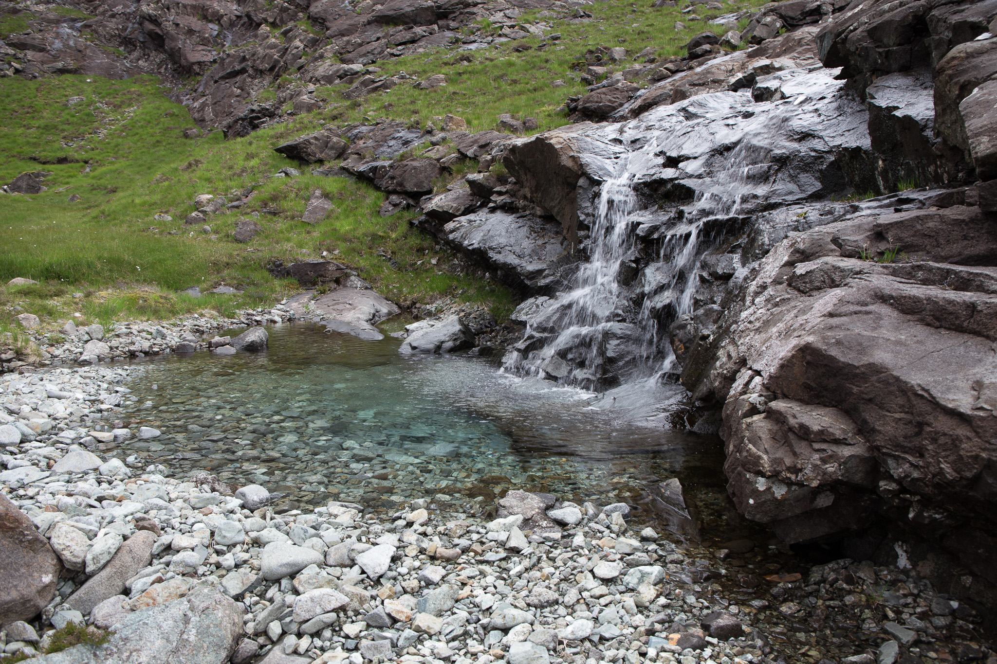
I think the cascades would look amazing if there was a lot more water in them but then it would be more difficult to get into Lota Coire!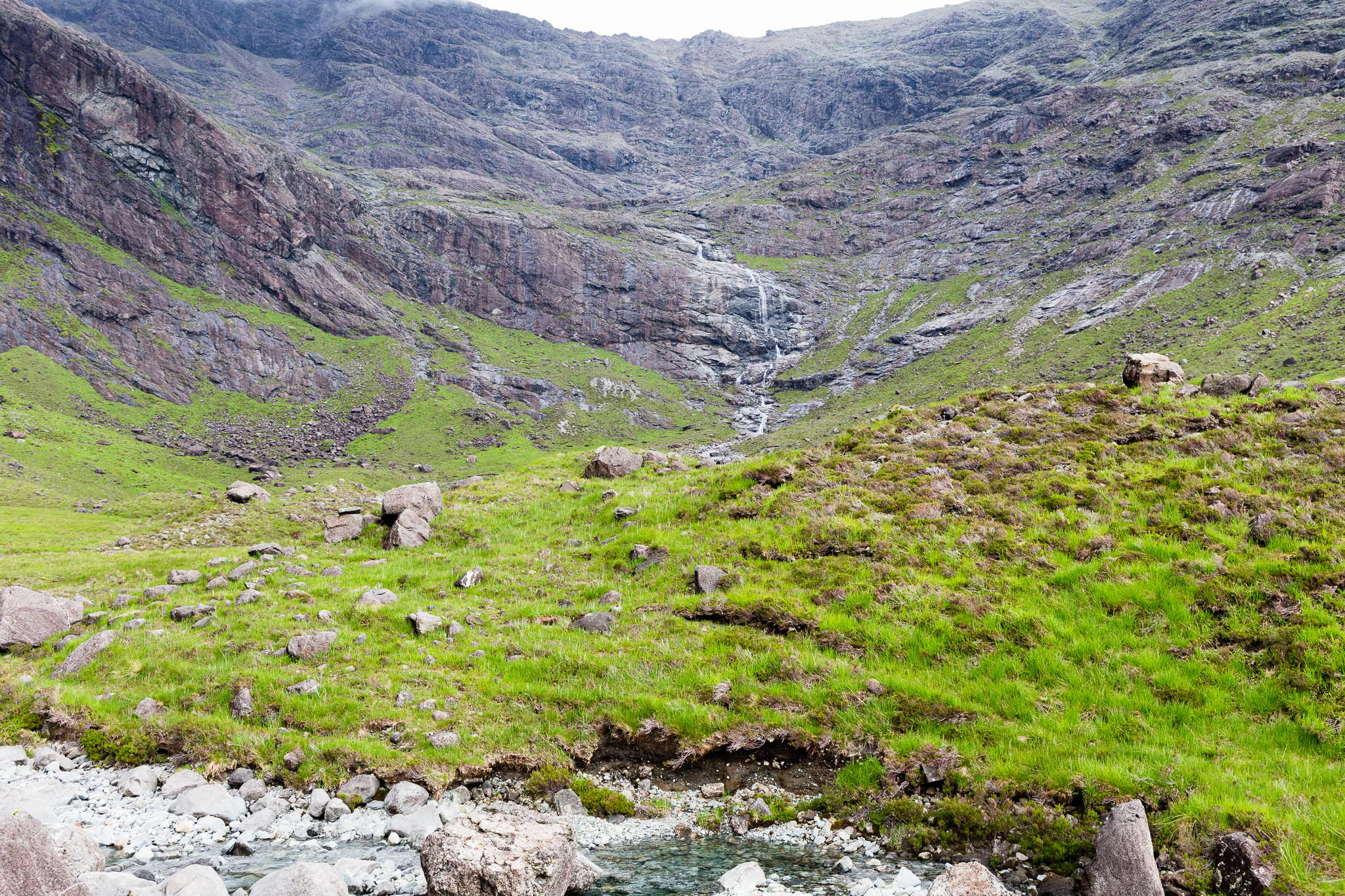 Harta and Lota Corries-9
 by
anniesmountains, on Flickr
Looking back at An Caisteal - it's a huge lump of rock.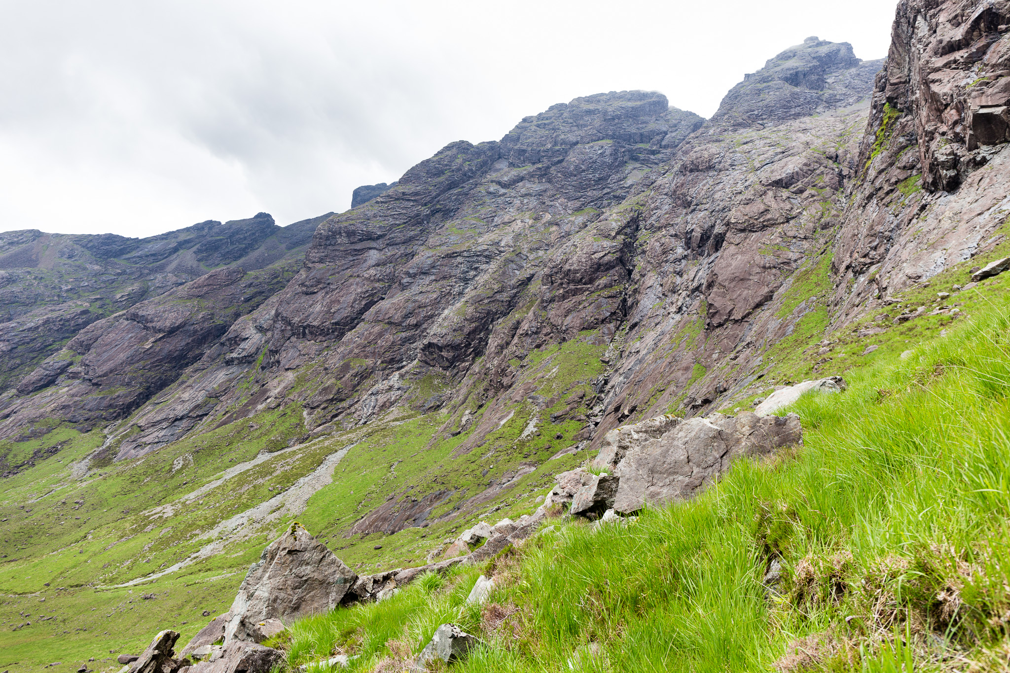 Harta and Lota Corries-10
 by
anniesmountains, on Flickr
After exploring for a while (too long) I headed up by the cascades to see if I could get into Lota Coire. There are a couple of scree paths which proved false starts but then I found a path which seemed to go straight up to the bealach between Sgurr Beag and Sgurr na h-Uamha (Bealach a' Glas-choire). On looking back down I could see a spur further down which I missed that led over to the a rocky scramble over by the slabs next to the cascades. BTW this would be very tricky if the slabs were wet. Water seems to run down many of them and the spur path was pretty exposed. It's a long way down .... I had also read there were cairns but I only saw one when I got onto the rim of the corrie which was really helpful to find the way down.
Going up by the cascades - this is steep in places. I needed both hands on much of it.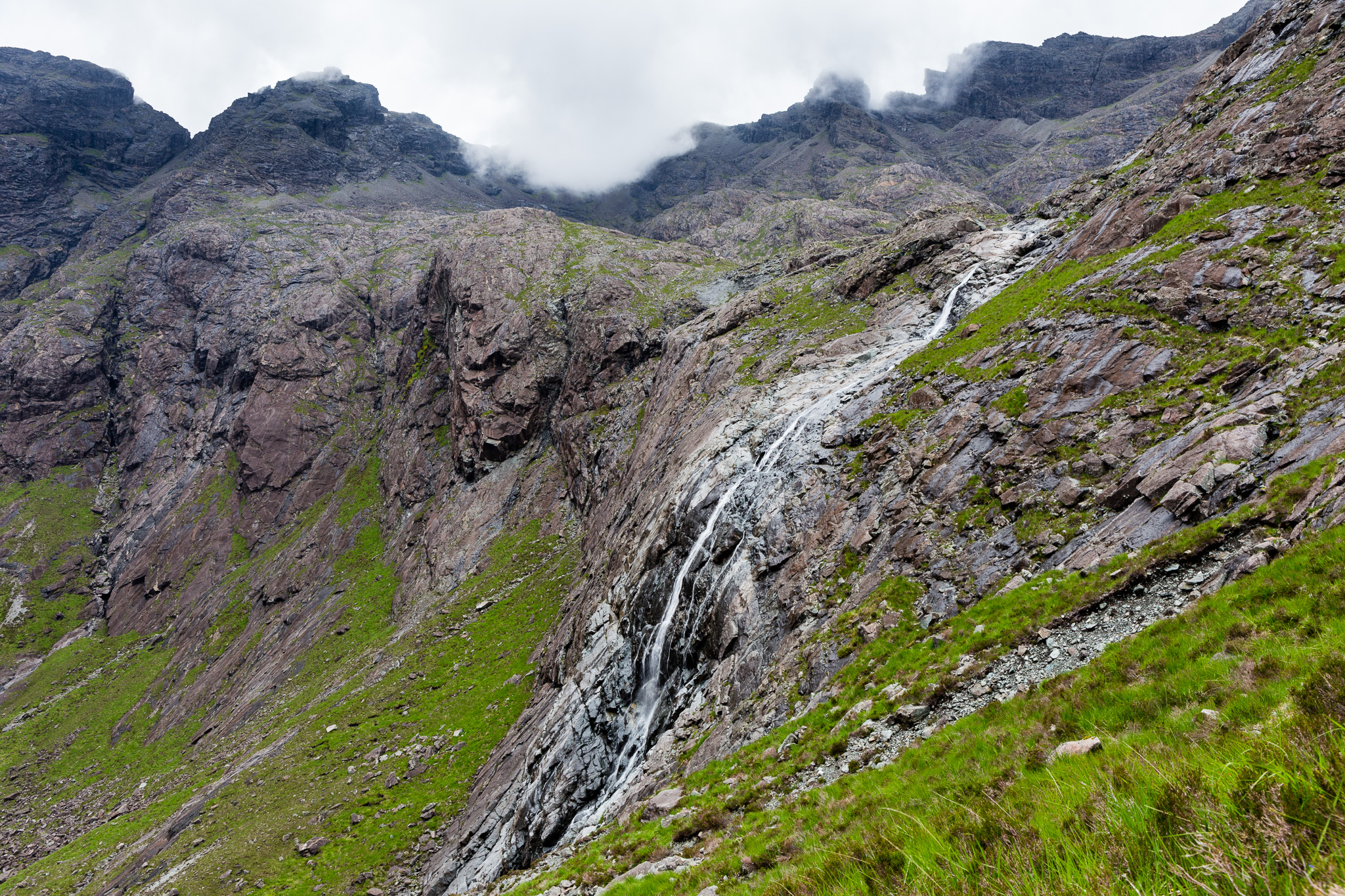 Harta and Lota Corries-11
 by
anniesmountains, on Flickr
The narrow path heading towards the top of the waterfall. So back down I went and scrambled over to this path. You can see it in the lower centre of the picture. There was no cairn at the turn-off so was really hard to see it except from above.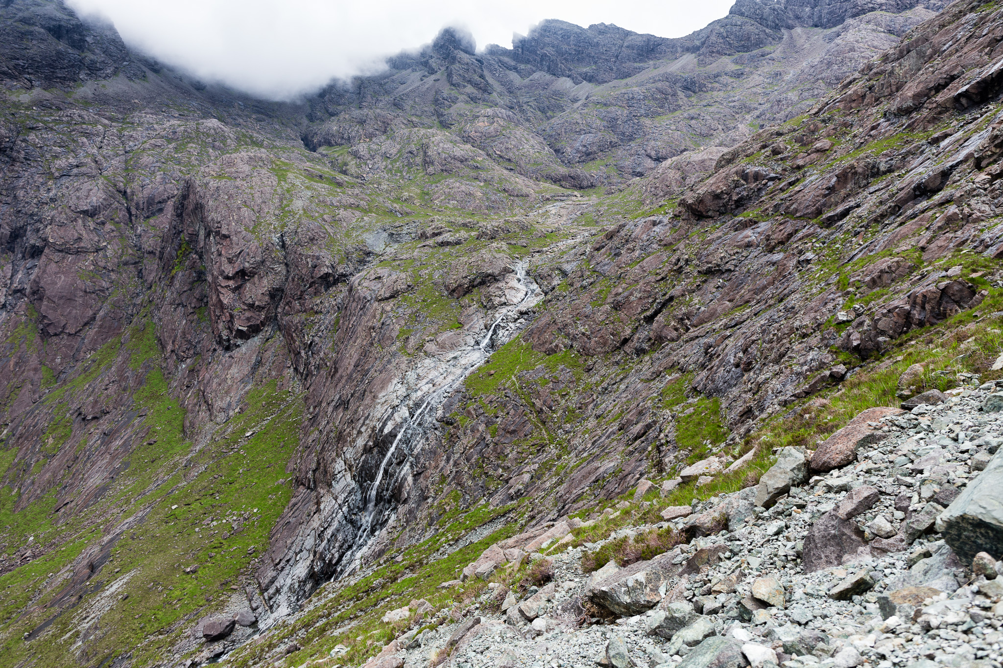 Harta and Lota Corries-12
 by
anniesmountains, on Flickr
In Lota Coire looking up to Sgurr na h-Uamha. You can see a seam that ends at the base of the left top - I believe this is to Bealach a' Glas-choire. I could see a very faint path up by the seam. 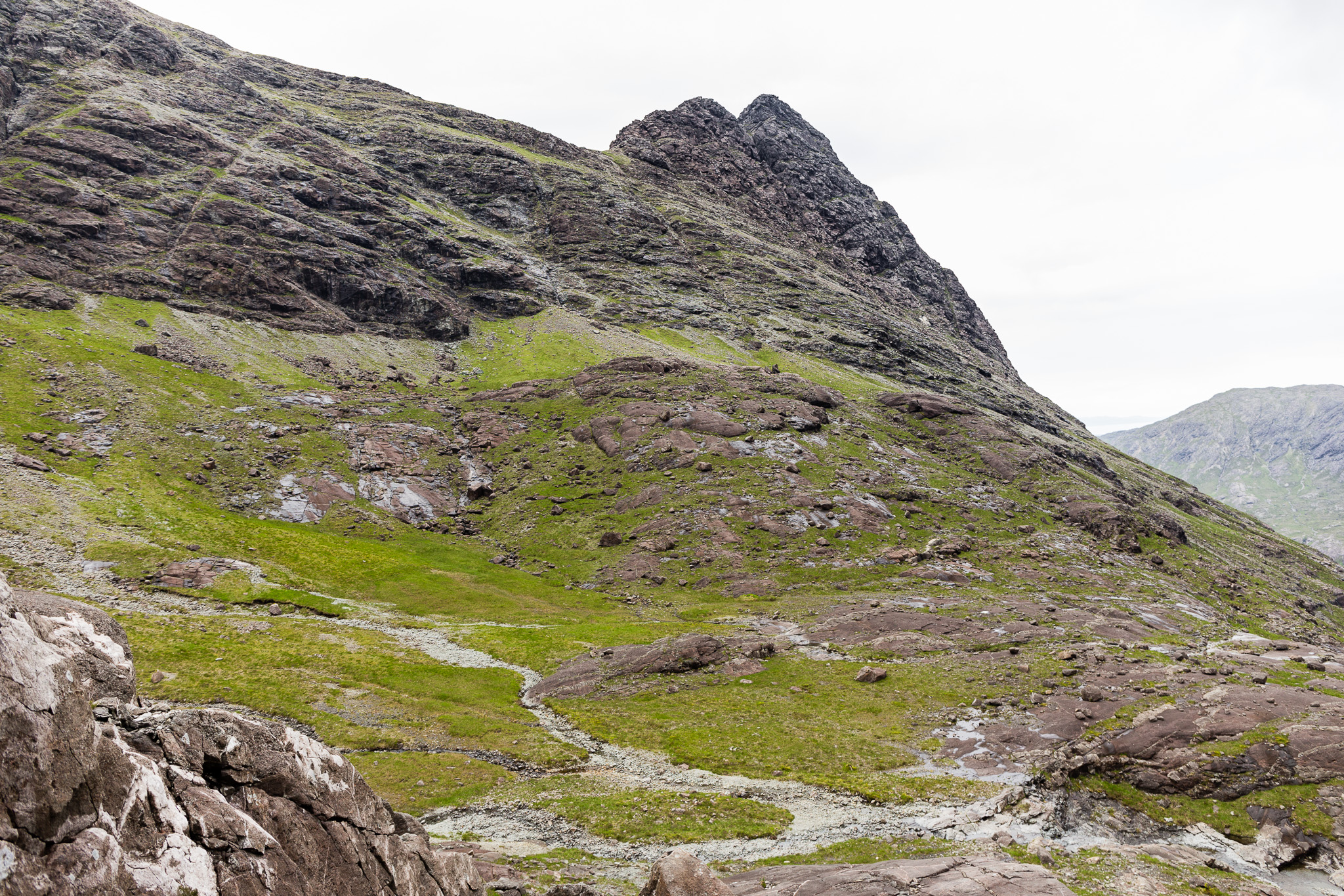 Harta and Lota Corries-13
 by
anniesmountains, on Flickr
I would love to have tried to go up to the Bealach a' Glas-choire and it actually didn't look too bad. Whereas ascents to Bealach nan Lice or Bealach a' Bhasteir looked difficult - from below anyway.
At 500m altitude you can see the tops of the south ridge over Druim na Ramh. 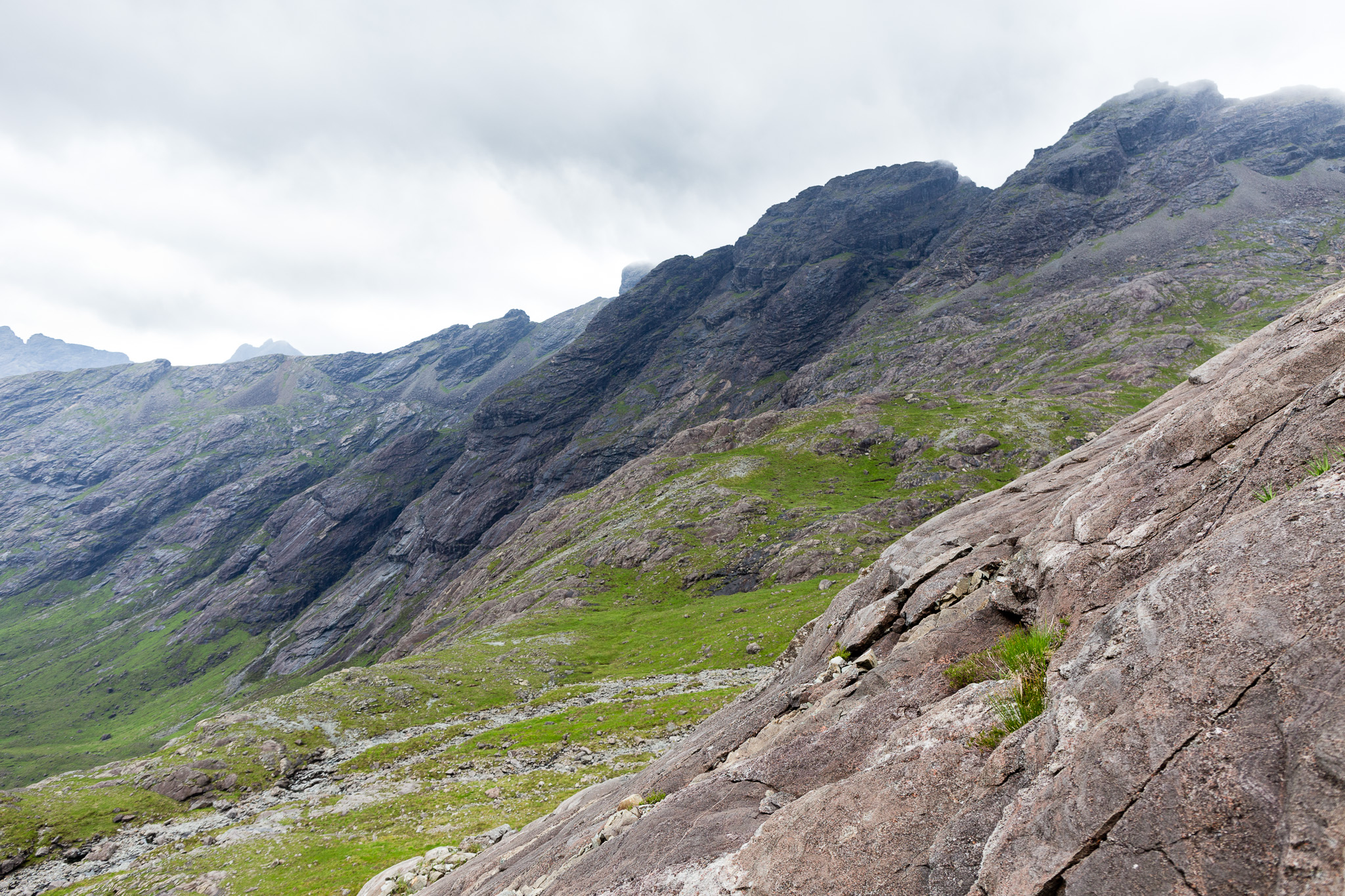 Harta and Lota Corries-14
 by
anniesmountains, on Flickr
Some amazing seams in the rocks. I know nothing about geology but I had never seen anything quite like these before.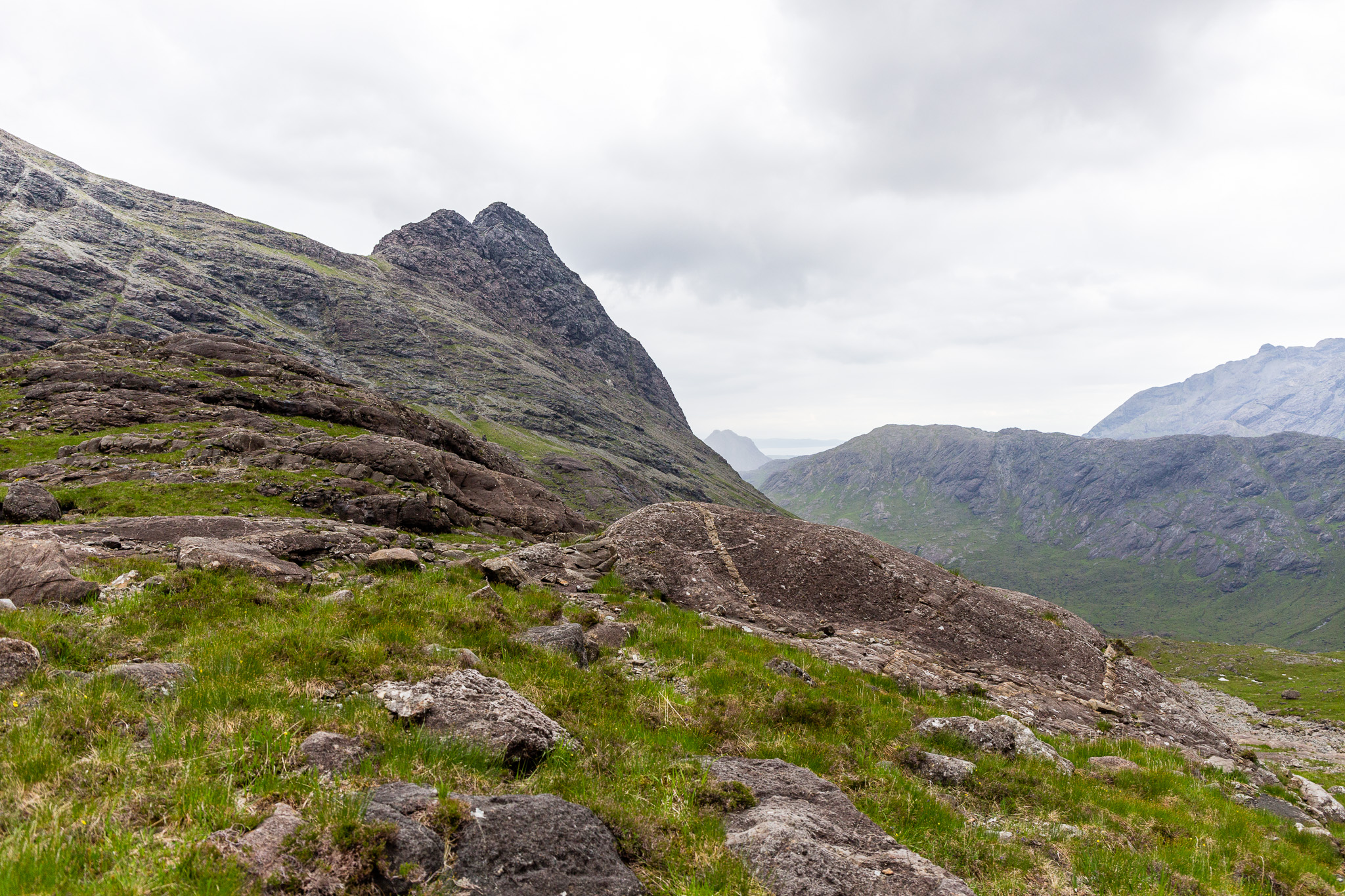 Harta and Lota Corries-15
 by
anniesmountains, on Flickr
Directly below the summit of Sgurr nan Gillean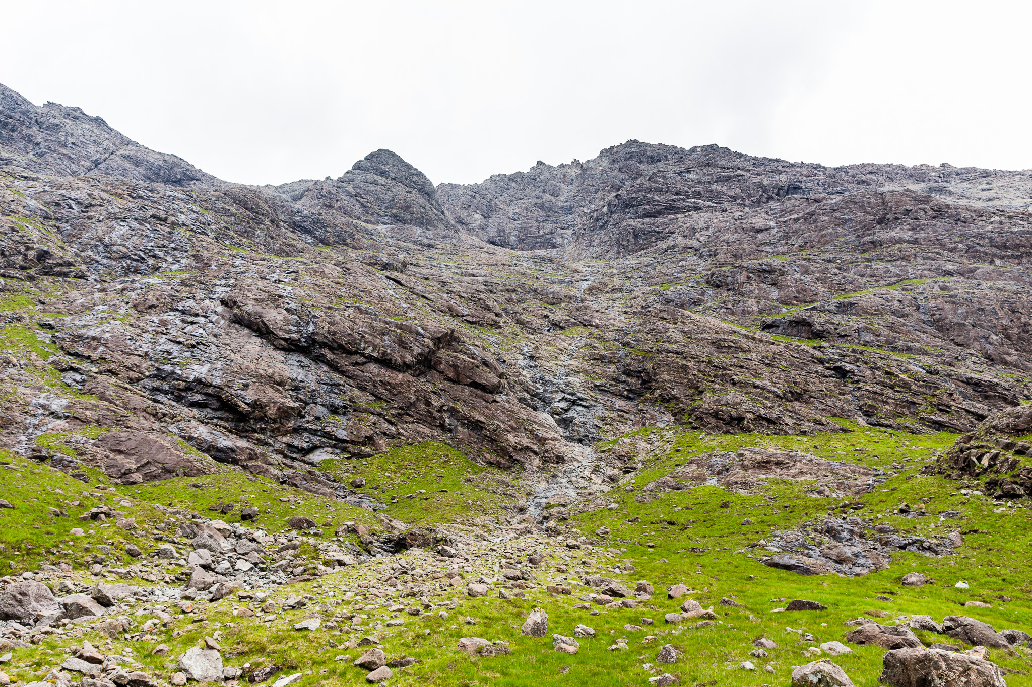 Harta and Lota Corries-17
 by
anniesmountains, on Flickr
Sgurr a' Fionn Choire, Bealach nan Lice and Basteir Tooth from below.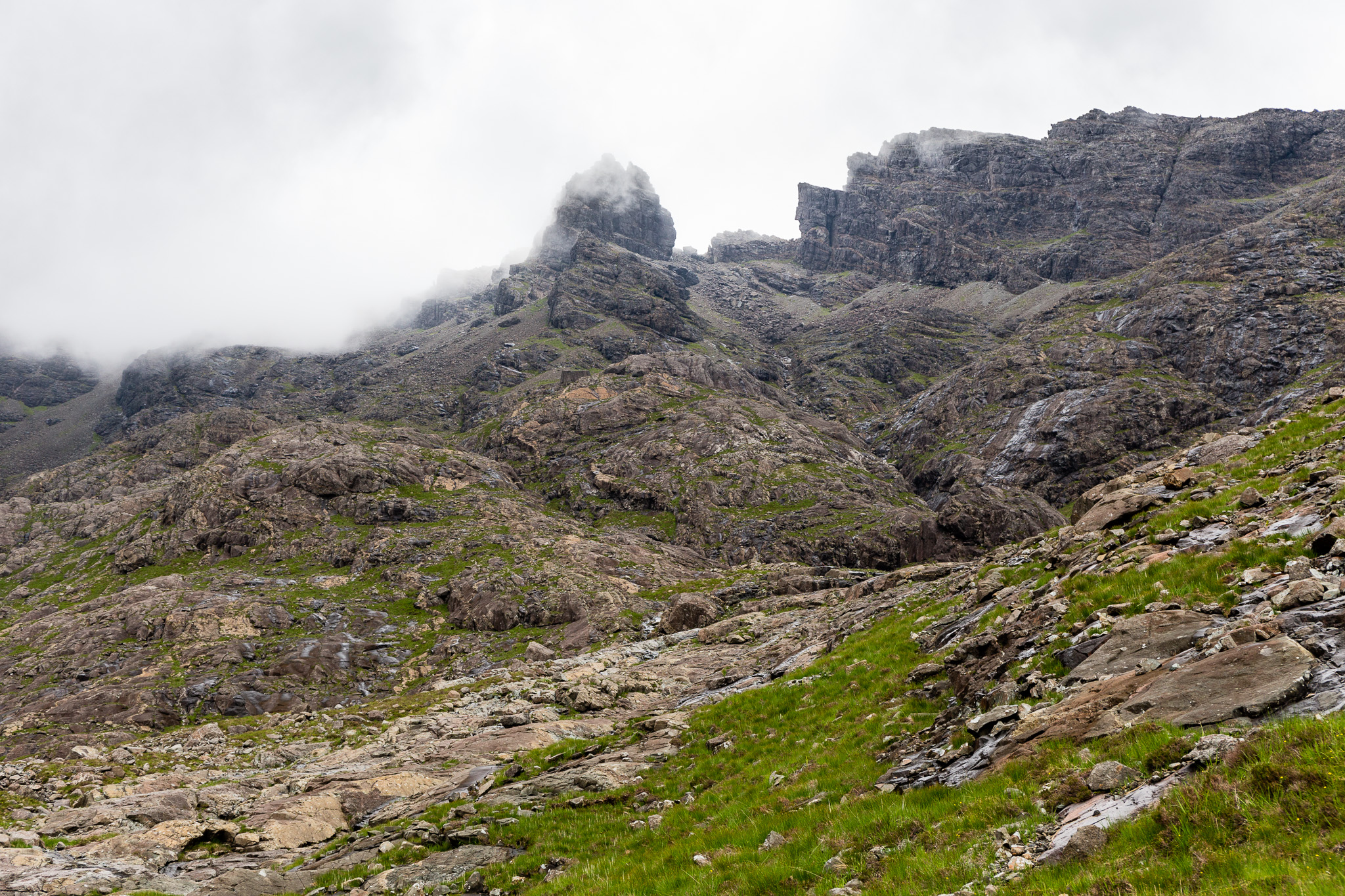 Harta and Lota Corries-18
 by
anniesmountains, on Flickr
 Harta and Lota Corries-19
 by
anniesmountains, on Flickr
Steep descent by the cascades.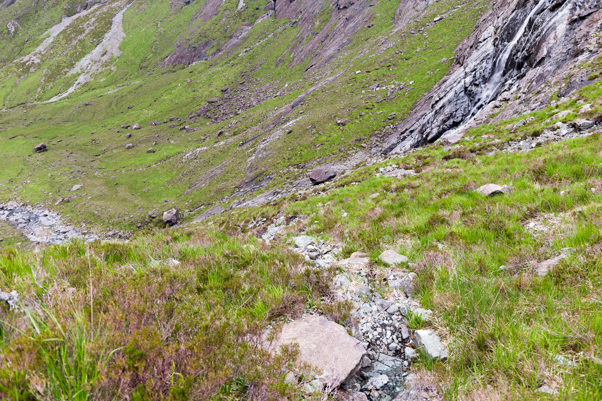 Harta and Lota Corries-21
 by
anniesmountains, on Flickr
The weather closing in and drizzle made the rocks decidedly slippery. I got down just in time.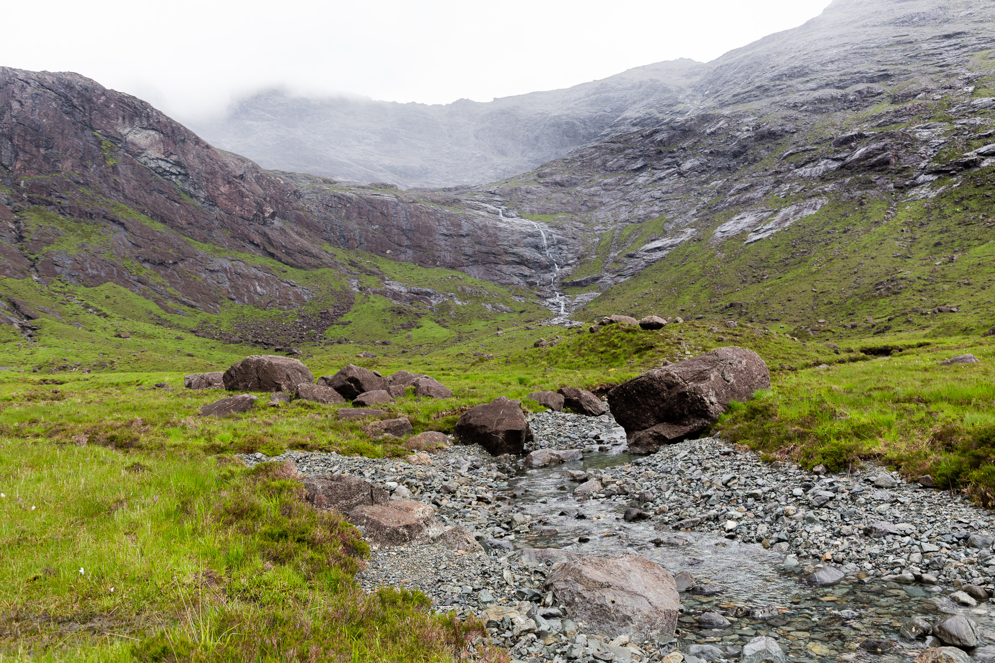 Harta and Lota Corries-22
 by
anniesmountains, on Flickr
From the time I left the Glen Sligachan path I had not seen a single soul - not even on the ridges and I was worried if I did get up on the ridge by Sgurr Beag that I wouldn't find the path down from the Sgurr nan Gillean South-east Ridge. The cloud was coming down and it was just starting to drizzle so I headed down the way I had come.
The Bloody Stone with Garbh-bheinn behind.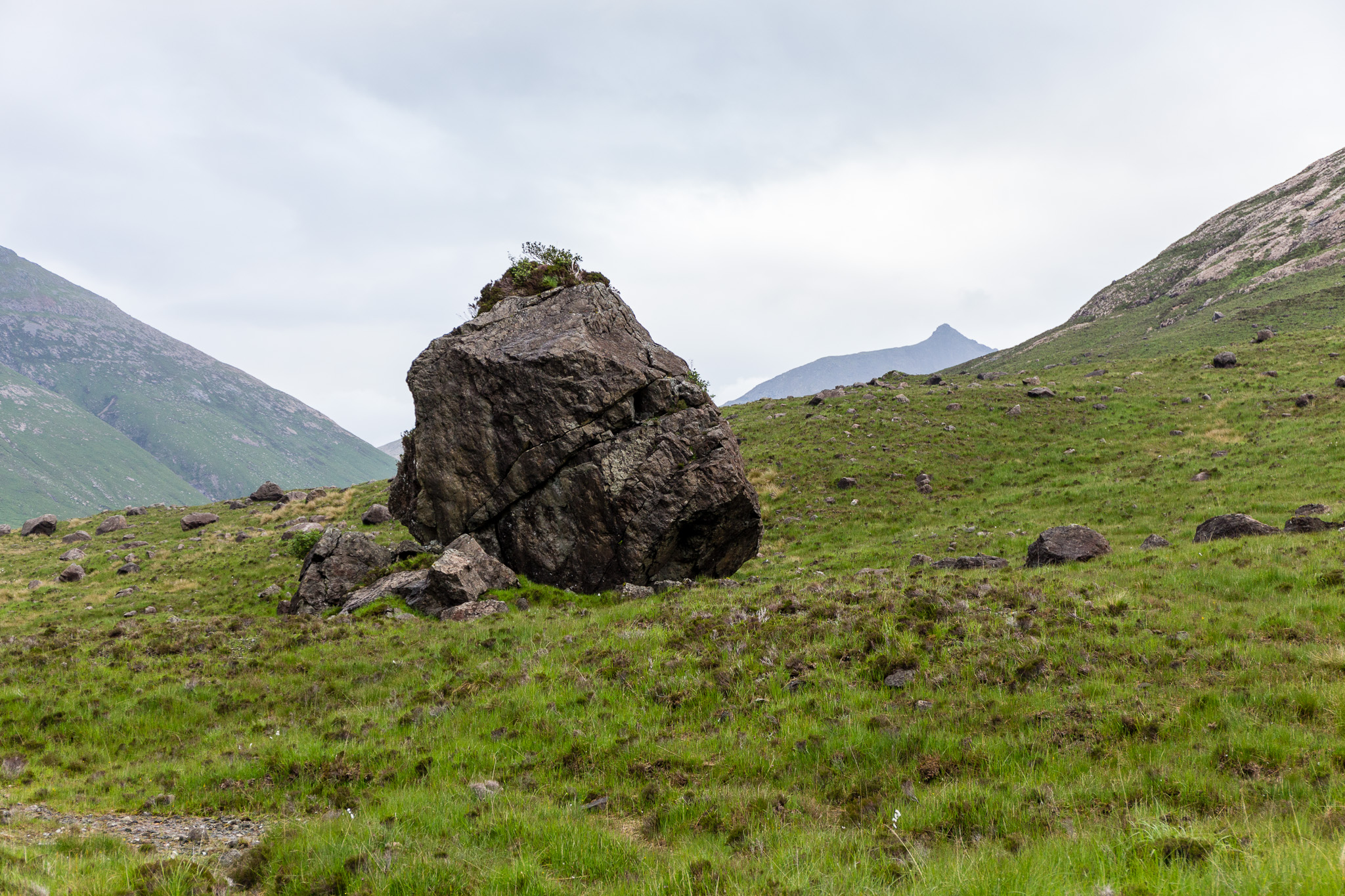 Harta and Lota Corries-23
 by
anniesmountains, on Flickr
Heading towards Marsco and the main path. Harta and Lota Corries-24
 by
anniesmountains, on Flickr
Looking south to Garbh-bheinn, Ruadh Stac, Clach Glas and Bla Bheinn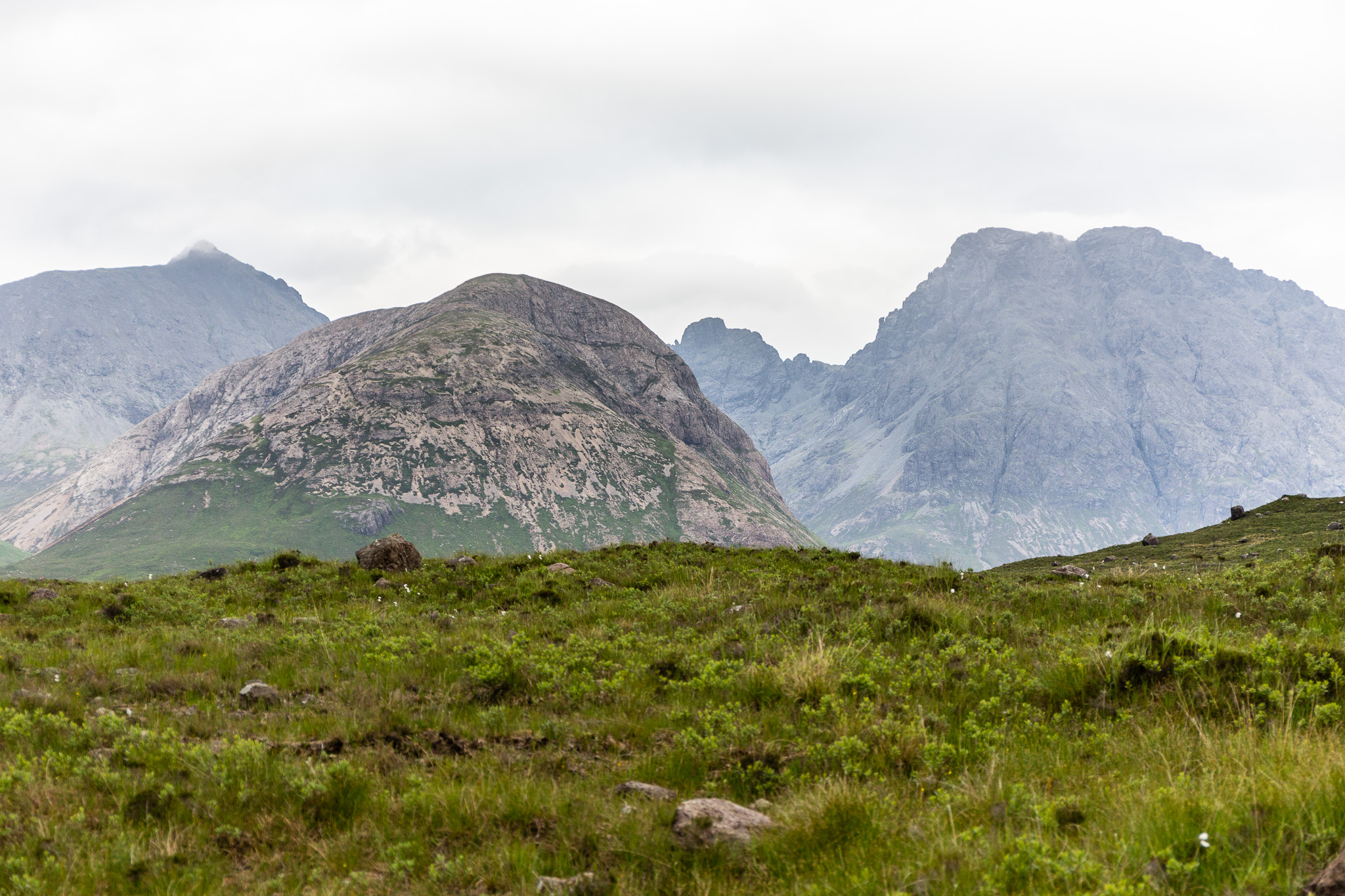 Harta and Lota Corries-25
 by
anniesmountains, on Flickr
The end of the Cuillin Ridge. Sgurr na h-Uamha, Sgurr Beag, Sgurr nan Gillean and the Pinnacle Ridge.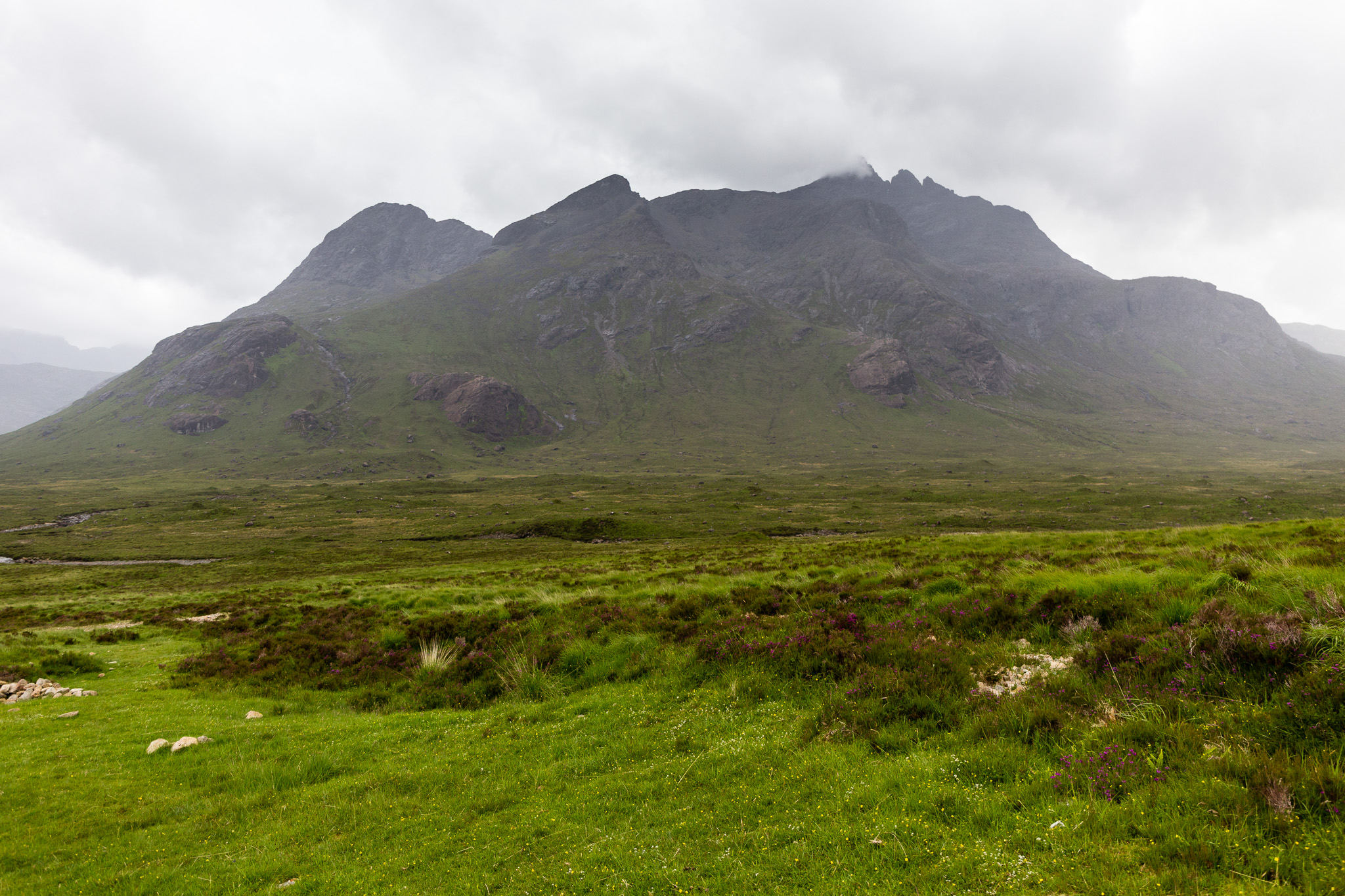 Harta and Lota Corries-27
 by
anniesmountains, on Flickr
The path back to Sligachan seemed much longer than in the morning! Boy it was a long day. I got back to the car almost 12 hours after I left it. And I still had the two hour drive back to Applecross. But it was midsummer and it hardly gets dark.
Last look at Marsco from near Sligachan on midsummer evening.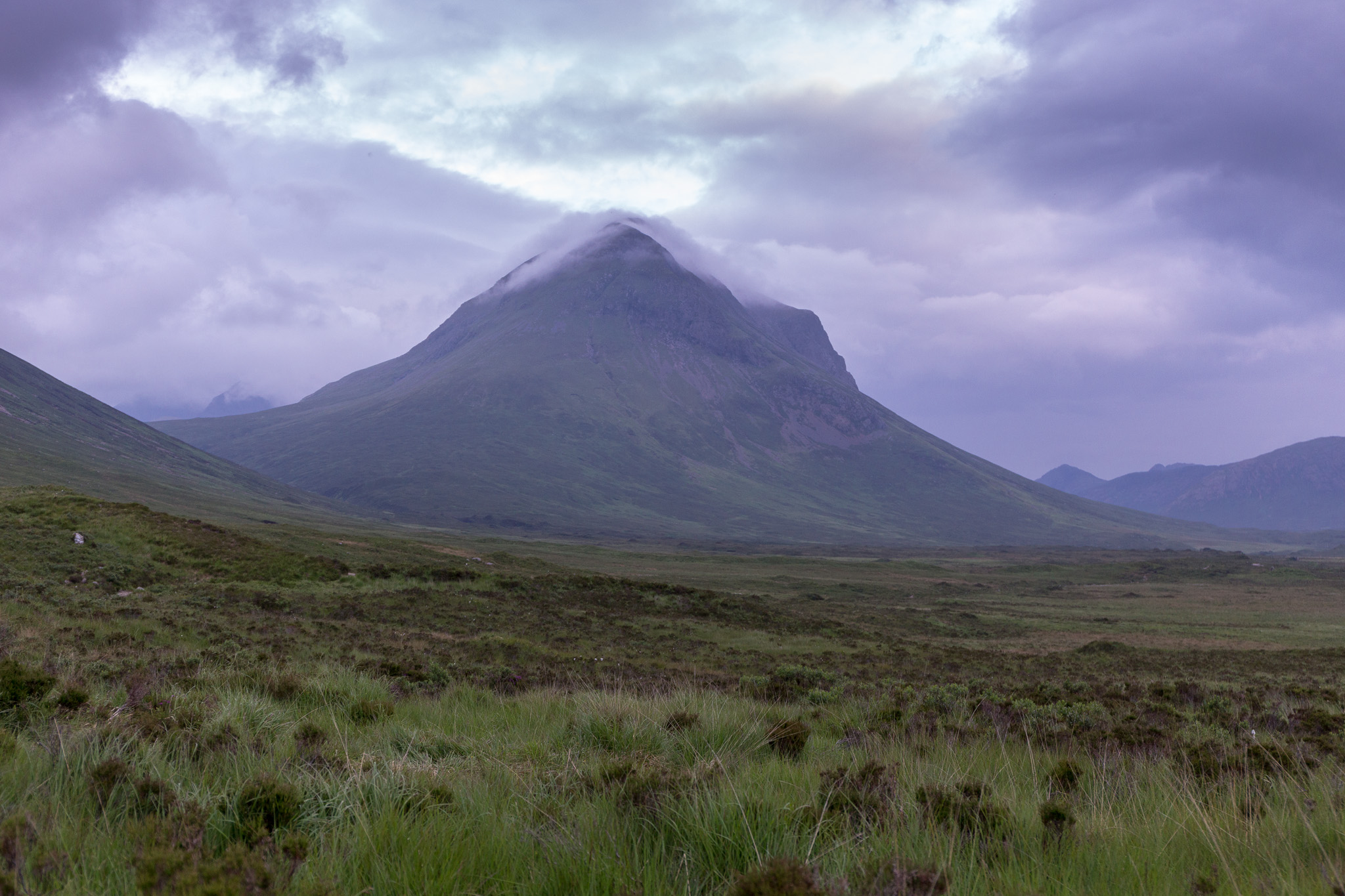 Harta and Lota Corries-29
 by
anniesmountains, on Flickr
