free to be able to rate and comment on reports (as well as access 1:25000 mapping).
Beinn Bhrotain and Monadh Mor. These mountain names had haunted me for a few years. Living in the south of England it isn't easy to think about picking off hills like these when the conditions suit and to be honest they hadn't excited me sufficiently to plan a week long trip around them as the main objective. Add to this a reputation of being remote, bleak, desolate, long and challenging. Beinn Heasgarnaich and Creag Mhor sprang to mind - hills that I'd been putting off. I had also read user reports about the tricky descent into Coire Cath nam Fionn; I wasn't inspired.
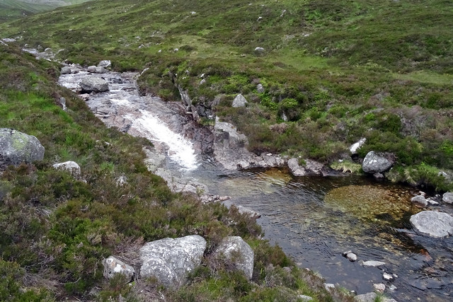
At 7.15 a.m. on an overcast morning I cycled away from a busy Linn of Dee car park. (Don't forget change for the ticket machine). The track to White Bridge is good for a bike and the distance is covered quickly. Things change immediately at the Chest of Dee though as the single track is crossed at frequent intervals by drainage channels necessitating some dismounting but many can be carefully negotiated from the saddle. As I rode along, the melancholy call of curlew was interspersed with the harsher, less liquid call of whimbrel and I managed to spot one. The last time I had seen one was 20 years ago less than five miles away near Inverey.
[
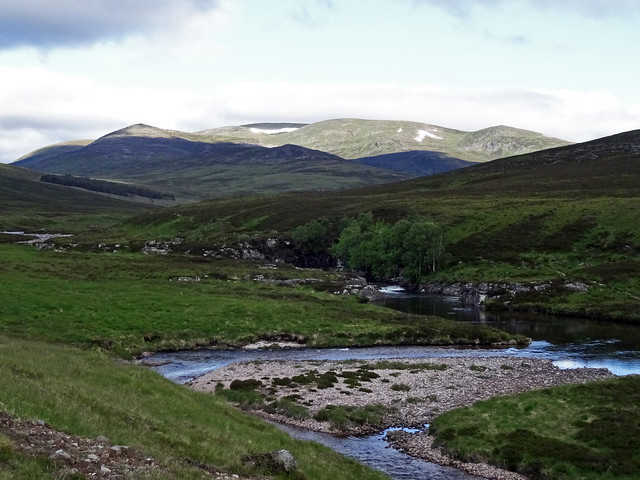 Chest of Dee
 by
Hantswalker, on Flickr][/img]
Progress along this track soon brings into view an almost ever-present but always changing icon of the Cairngorms: The Devil's Point.
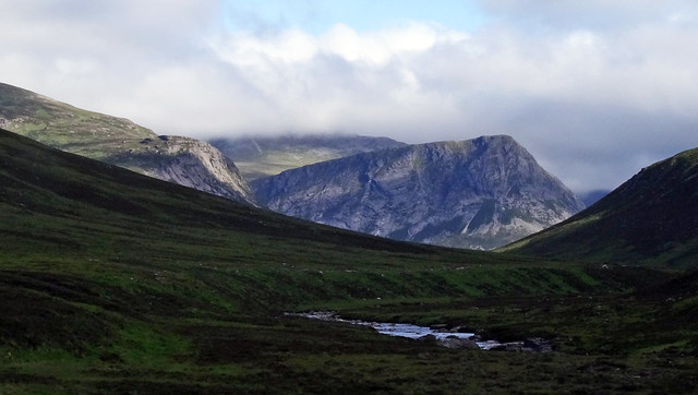 First Glimpse - Devil's Point
 by
Hantswalker, on Flickr
I had decided to drop the bike where the track crosses the Allt Iarnaidh and I must admit to having no temptation to cycle any further. From here a faint path through the heather is followed easily up hill. Odd deer tracks branch off here and there but I followed a course which maintained a steady ascent.
[
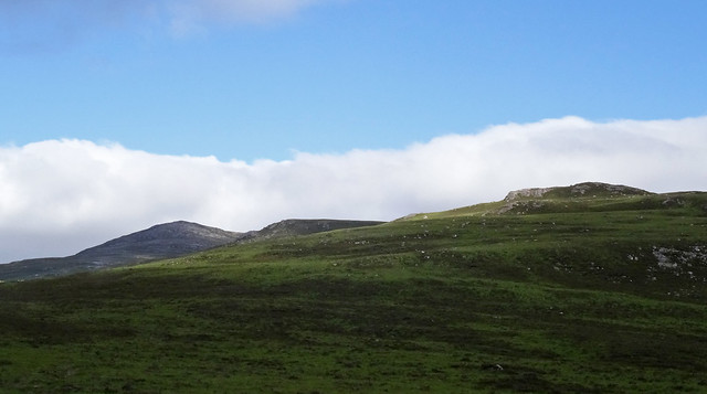 Carn Cloich-Mhuilinn
 by
Hantswalker, on Flickr][/img]
Eventually a much more distinct path appeared which I followed (left) upwards, but it continued down hill the other way so I may well have missed it lower down.
In much the same way that I inadvertently disturbed a family of red grouse a few days earlier en route to Beinn a' Bhuird, today I disturbed ptarmigan.
[
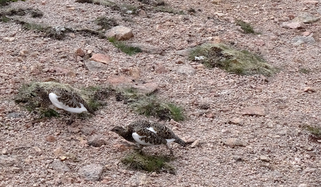 Broken Wing Display
 by
Hantswalker, on Flickr][/img]
I've seen dotterel do broken wing distraction quite a lot - they tend to make a fuss from a short distance and try to get you moving towards them. The red grouse were different in that the hen came up very close, aggressively even.
These ptarmigan had a different strategy - not so aggressive. Hen and cock worked together but at a bit more of a distance. After about 100m the hen went off to collect the chicks but the cock carried on for a good 300m before wheeling off with that signature guttural call.
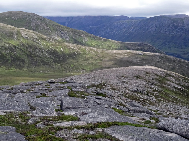
Progress from here was very good and I reached Carn Cloich-Mhuilinn before 9.00 a.m. - 1hr 45min from Linn of Dee.
[
 Slabs
Slabs by
Hantswalker, on Flickr][/img]
The slabby summit isn't spectacular but it is a great view point: much of the route so far can be traced along with the upper Geldie and Feshie burns, Beinn a' Ghlo and the vast tracts of wilderness in all directions.
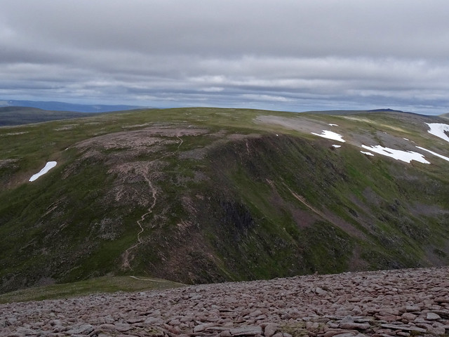
Immediate thoughts however were on Beinn Bhrotain and a distinct track seemed to make a beeline for it although its summit was far back from the skyline and out of sight.
[
 Beeline
 by
Hantswalker, on Flickr][/img]
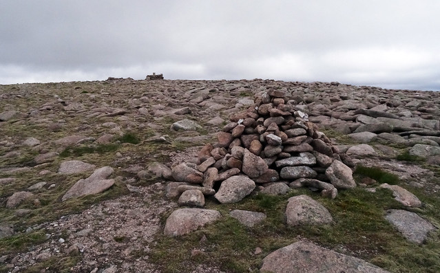
The track in the photo is very easy to follow but boggy ground is encountered so I opted to veer left to the skyline, this being the south ridge which leads directly to the top of Beinn Bhrotain. The going is easy and a large cairn is reached quite quickly but this isn't the true summit which lies a short distance to the north marked by a cylindrical trig point and a windbreak.
[
 Summit
 by
Hantswalker, on Flickr][/img]
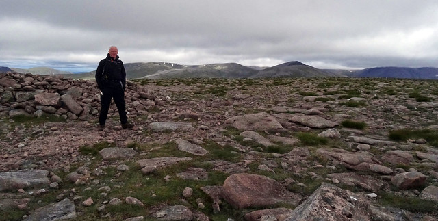
The flat top of the trig point provided a rare opportunity for a selfie with Braeriach, The Angels Peak, Carn Toul and Ben Macdui in the background.
[
 4000ers
 by
Hantswalker, on Flickr][/img]
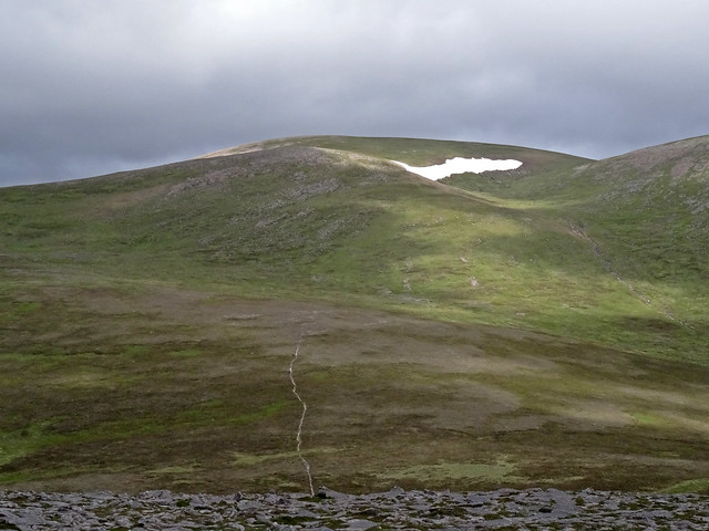
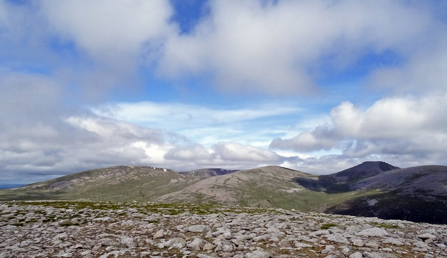
The great bulk of Monadh Mor to the north is exactly what you would expect from examining the map: a long featureless whaleback.
[
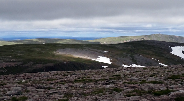 DSC01019
 by
Hantswalker, on Flickr][/img]
Very quickly however attention is firmly fixed three feet in front as a boulder field of precisely weighted and positioned rocks wobbles from step to step in descent most of the way to the bealach at 975m. Looking back up from the bottom, a better line than mine seems to take a route further north, closer to the cliffs. Once the boulders are out of the way it is easy though steep down to the bealach.
[
 DSC01026
 by
Hantswalker, on Flickr][/img]
Now was decision time:
Do I climb Monadh Mor and return here to negotiate the horribly loose corrie headwall down into Coire Cath nam Fionn?
Do I climb Monadh Mor and return here and contour around Beinn Bhrotain back to the bike?
Do I climb Monadh Mor and carry on northward to Loch nan Stuirteag?
For me the choice was easy. I don't like backtracking if I can avoid it and that headwall was deeply unattractive so the Loch won. This route adds distance and time but on a good day in mid-summer it didn't matter. The slope up from the bealach is steep but it zigzags easily onto the plateau. This could be a confusing place in mist and the main summit is set far back. On a good day like this though, views to the Devil's Point continue to evolve and I spent lots of time taking photos.
[
 DSC01028a
 by
Hantswalker, on Flickr][/img]
[
 DSC01030a
 by
Hantswalker, on Flickr][/img]
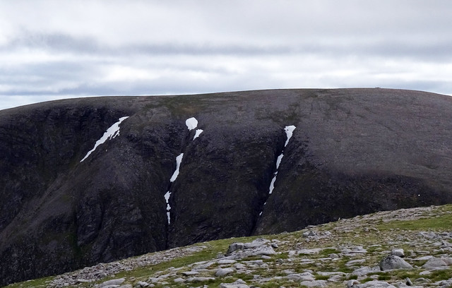
A glance back to Beinn Bhrotain shows how extensive the boulder field is and why there are no other realistic options of descent into Glen Geusachan from that direction.
[
 DSC01035a
 by
Hantswalker, on Flickr][/img]
The summit when it arrives offers little change to the plateau other than views opening to the north. The Angel's Peak looks deceptively close - maybe twenty years ago I could have extended this walk to take it in along with Carn Toul and The Devil's Point making a route of epic proportions.
[
 Summit Plateau
 by
Hantswalker, on Flickr][/img]
And so down to lovely Loch nan Stuirteag with its tiny sandy beaches. This is an idyllic spot. A few days earlier I met a Czech walker on Braeriach. He had walked in from the Linn of Dee, up Glean Geusachan to camp beside the Loch. From there he climbed all the Munros immediately west of the Lairig Ghru along with a few surrounding the Moine Mhor on his muti-day wild camp.
[
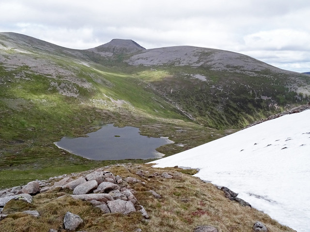 Loch nan Stuirteag
 by
Hantswalker, on Flickr][/img]
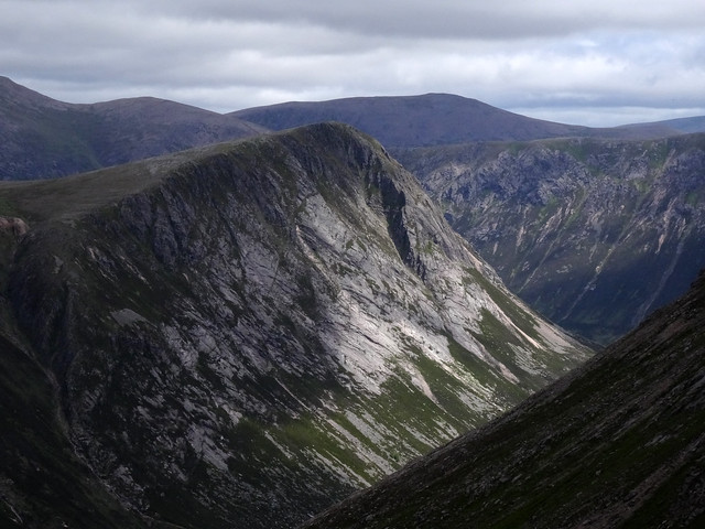
This is the furthest point from the start - 5 hours since I left the Linn of Dee. I was a little apprehensive about the route down to the lower reaches of Glen Geusachan where the path is marked on the map. Almost immediately however a faint track appears and it is easy to follow, giving time and opportunity to savour this tucked away corner of the Cairngorms. Allt Clais an t-Sabhail is extremely fine as it falls from Carn Toul.
Now I could see what I missed by not tackling the headwall of Coire Cath nam Fionn.
[
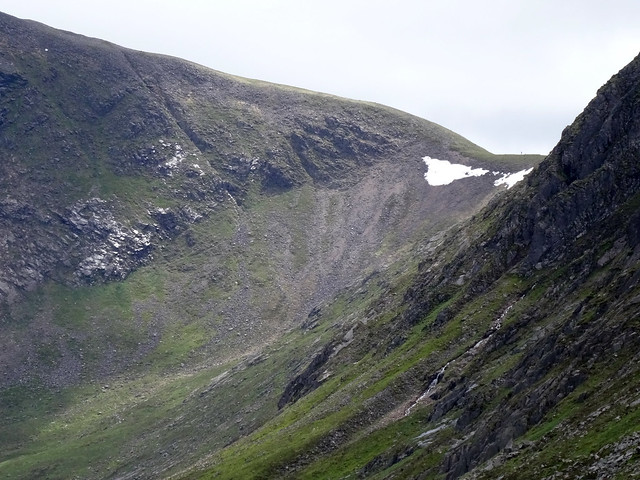 Coire Cath nam Fionn
 by
Hantswalker, on Flickr][/img]
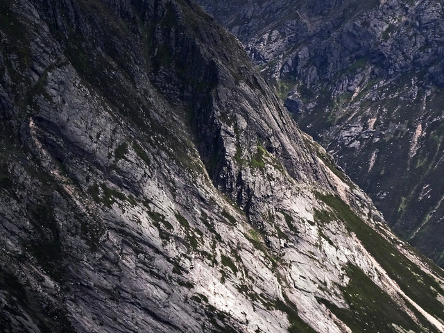
Even before reaching the Geusachan Burn proper there are numerous attractive falls and deep pools. This is a very deep, steep sided glen with imposing mountains all around and I would describe the whole scene as impressive or spectacular but I can see why others describe it as beautiful.
[
 Geusachan Burn
 by
Hantswalker, on Flickr][/img]
The Geusachan becomes a sizeable burn before it meets up with the Dee. The stream is braided and there are the beginnings of small ox-bow lakes. Before and after the confluence with the Dee small lochans are dotted along the raised banks on either side, a welcome spot for wild fowl.
The track beside the Dee is good but not yet of the standard near the Chest of Dee. There are ups and downs but I was back at the bike quite quickly. Now for a word of warning about cycling over the drainage channels on this path. A party of four had dumped their bikes with mine and we set off on the return more or less together. They had hired the bikes and needed to get them back to Braemar before the shop closed so were in a bit of a rush. The back marker, a lady, no doubt felt like me - very tired. I could see her laboured efforts and as she approach yet another channel the inevitable happened: she fell off down the bank toward the river. I caught up and she was none the worse for the ordeal as the heather cushioned her fall. White Bridge is reached in due course and the rest of the ride back to the Linn of Dee is straightforward.
