free to be able to rate and comment on reports (as well as access 1:25000 mapping).
My plan was to climb the Corbett Sgorr nan Lochan Uaine and go on to Beinn Liath Beag after seeing it from Carn Breac last week. I intended to visit the Lochan Uaine on the way to the Corbett. Not quite the way it happened!
The forecast was for a lovely morning with the weather changing to rain in the afternoon. My theory was that if I started early I would be on or near Beinn Liath Beag by the time the rain arrived and I could then make a direct return bypassing the tops or even, don't laugh, carry on to Easan Dorcha and return by the Coulin path - which would have made for a VERY long day and a very exhausted me.
The Fisherman's Hut and Ling Hut from the start of the path. Sgorr nan Lochan Uaine is on the left and Beinn Liath Mhor on the right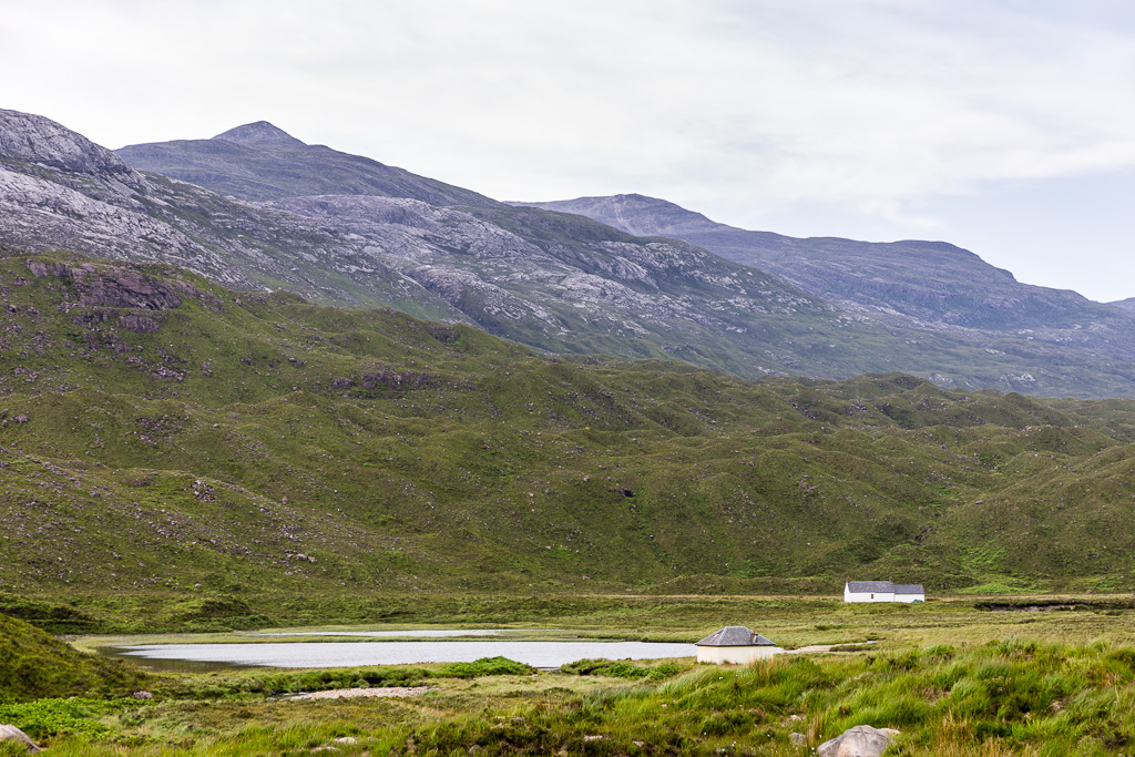 Beinn Liath Mhor and Sgorr nan Lochan Uaine
 by
anniesmountains, on Flickr
So, I set off on the Ling Hut path only to find a tent straddling it at the back of the old house. Glad I didn't leave in the dark
 The tent guy lines straddling the path.
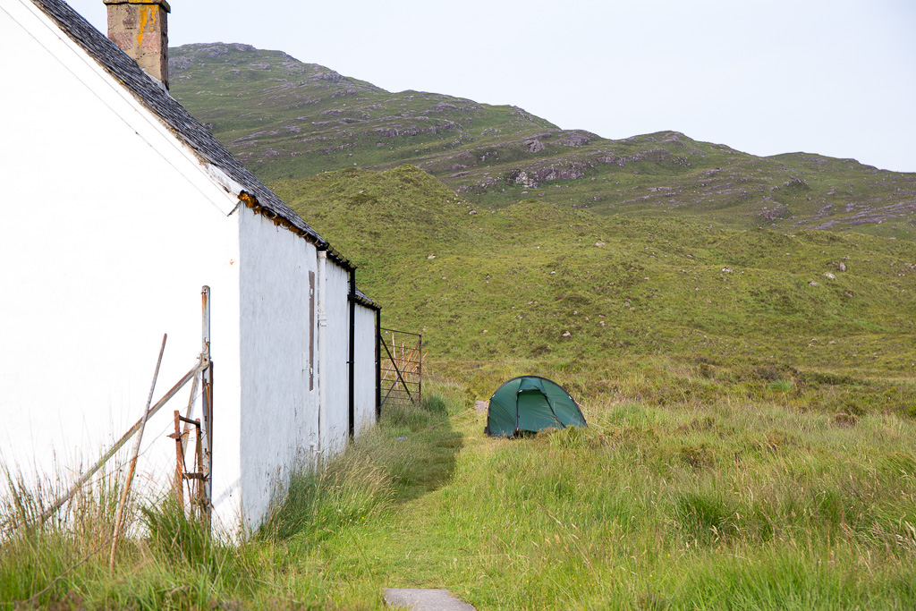 Beinn Liath Mhor and Sgorr nan Lochan Uaine-2
 by
anniesmountains, on Flickr
It was a lovely morning and I stopped to fill up on water a few times in the numerous little burns but when I finally took a break and checked the GPS I discovered I had forgotten to set it to "Tracking On". However the trip data is accurate as is the amount of ascent. On both the 25K and 50k maps, the path takes a sharp turn east at the point I wanted to head for the Lochans so I decided to keep on the path until it petered out and then I would be only about 1km from the Lochans. I had seen them from the summit of Beinn Liath Mhor last year and vowed I would visit them another time.
I knew something was wrong when I saw another path that my path was about to intersect. Also I appeared to be at a meeting of mountains - these being Sgurr Ruadh and Beinn Liath Mhor. I was approaching Coire Grannda. I had missed the turn in the path and what's more, the path continues south and connects with the Coire Lair path (which is not on either map).
Oops, I'm in Coire Grannda.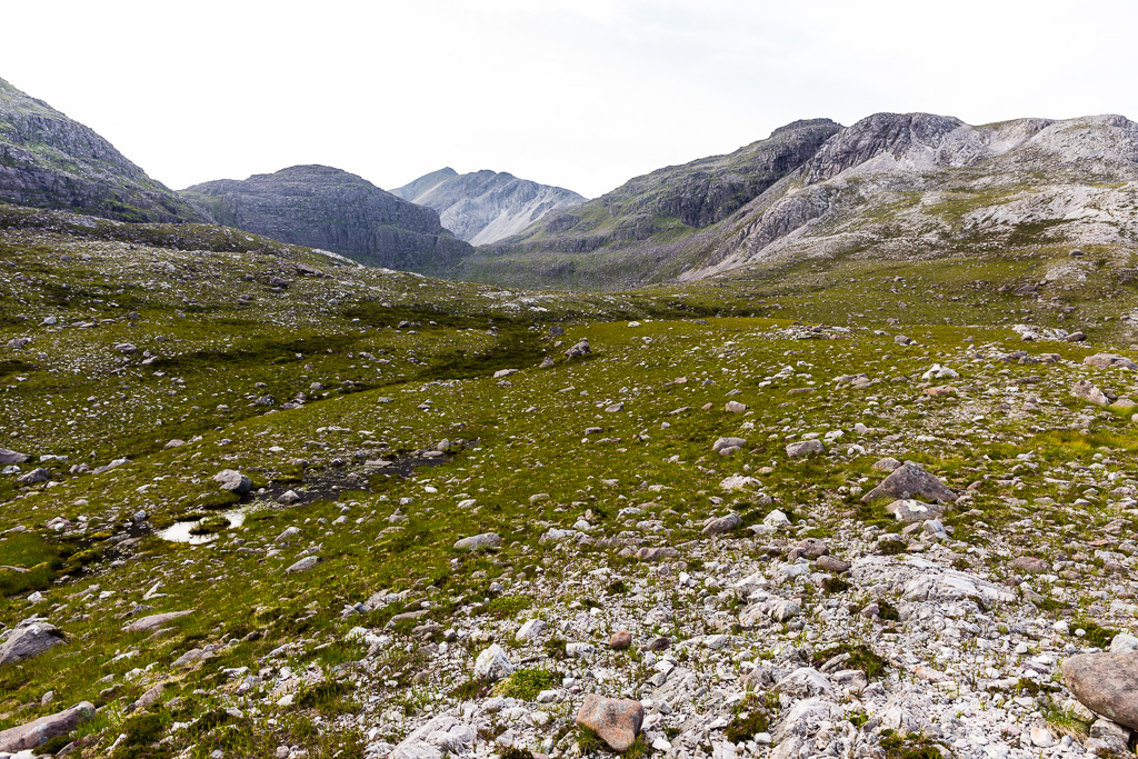 Beinn Liath Mhor and Sgorr nan Lochan Uaine-3
 by
anniesmountains, on Flickr
I soon discovered the easiest way to get back to the lochans was to go up the lovely red sandstone slabs on the west side of BLM. As it would have been pretty awkward to cut across the undulating slabs, it was much easier to go up and before I knew it I was at 740m and I could see the quartzite pile of the summit above me. I might as well just go up as I'm so close, I thought! And so it was. The cloud was already coming in even though it wasn't yet 11 am.
The lovely sandstone slabs with Loch Torridon below. Seana Mheallan is behind the lochan and Beinn Alligin and Liathach form the backdrop.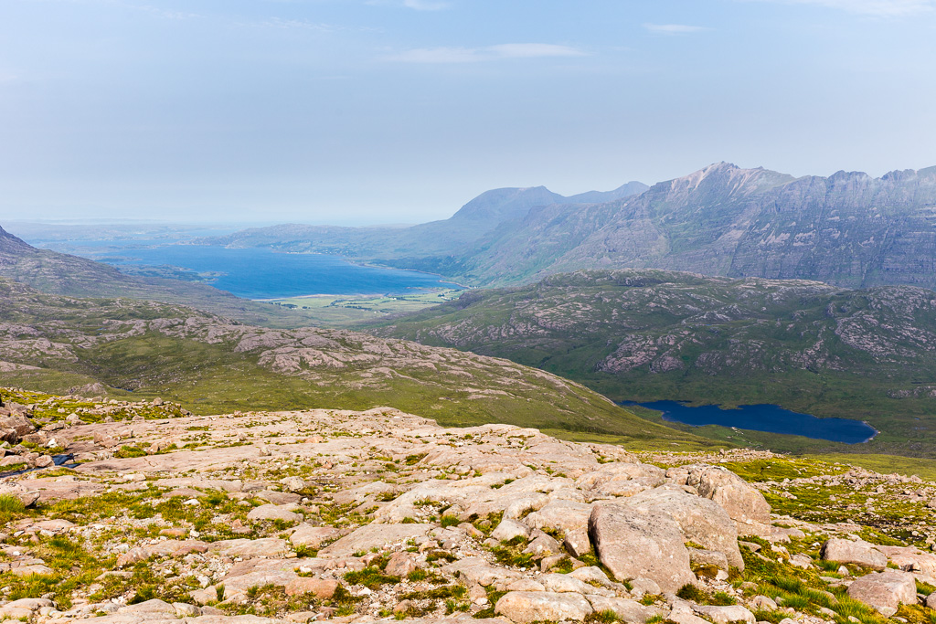 Beinn Liath Mhor and Sgorr nan Lochan Uaine-4
 by
anniesmountains, on Flickr
From the summit cairn looking across to Sgorr Ruadh. Fuar Tholl is on the left, An Ruadh-stac and Maol Cheann-dearg to the right of SR summit then Beinn Damh.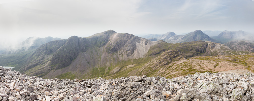 Beinn Liath Mhor and Sgorr nan Lochan Uaine-5
 by
anniesmountains, on Flickr
The ridge of Beinn Liath Mhor with the weather moving in!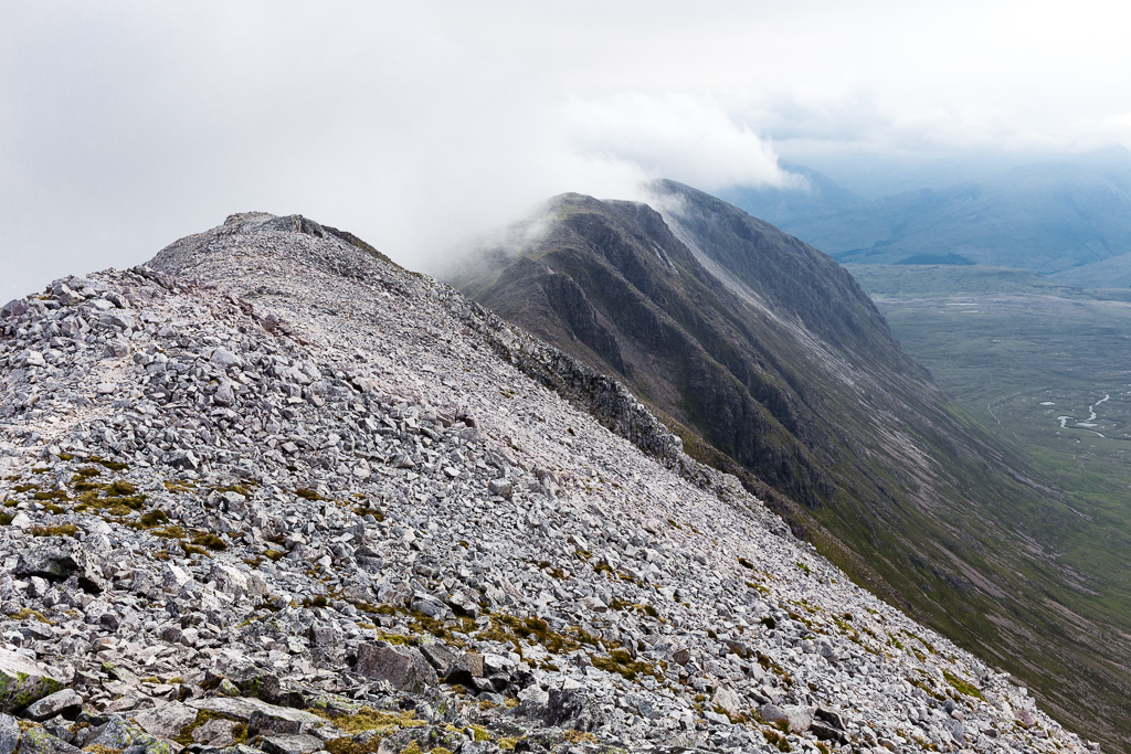 Beinn Liath Mhor and Sgorr nan Lochan Uaine-6
 by
anniesmountains, on Flickr
Fuar Tholl and the Academy Ridge and buttresses of Sgorr Ruadh.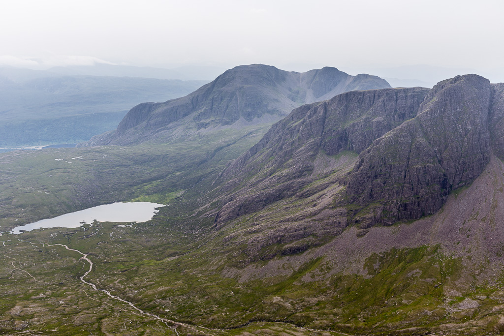 Beinn Liath Mhor and Sgorr nan Lochan Uaine-7
 by
anniesmountains, on Flickr
I had a quick lunch, took some photos, said hello to one man who arrived as I was leaving and headed down straight for the lochans. At about 800m there was a lovely grassy rake all the way down to the small connecting loch. By the time I worked my way through to the other side and on to the slopes of Sgorr nan Lochan Uaine, the mist was down and the rain had started so on with the waterproofs for the rest of the day.
Back on the sandstone and looking up to the quartzite summit top of Beinn Liath Mhor. The man I met is making his way down. This descent is not as difficult as it looks - one has the choice of a scree path or easy scrambling.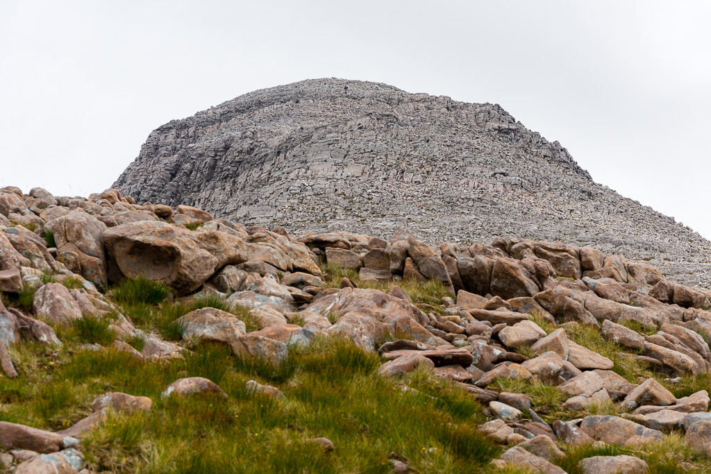 Beinn Liath Mhor and Sgorr nan Lochan Uaine-9
 by
anniesmountains, on Flickr
Almost down at the lochans. This was the last good view of my summit until I got there!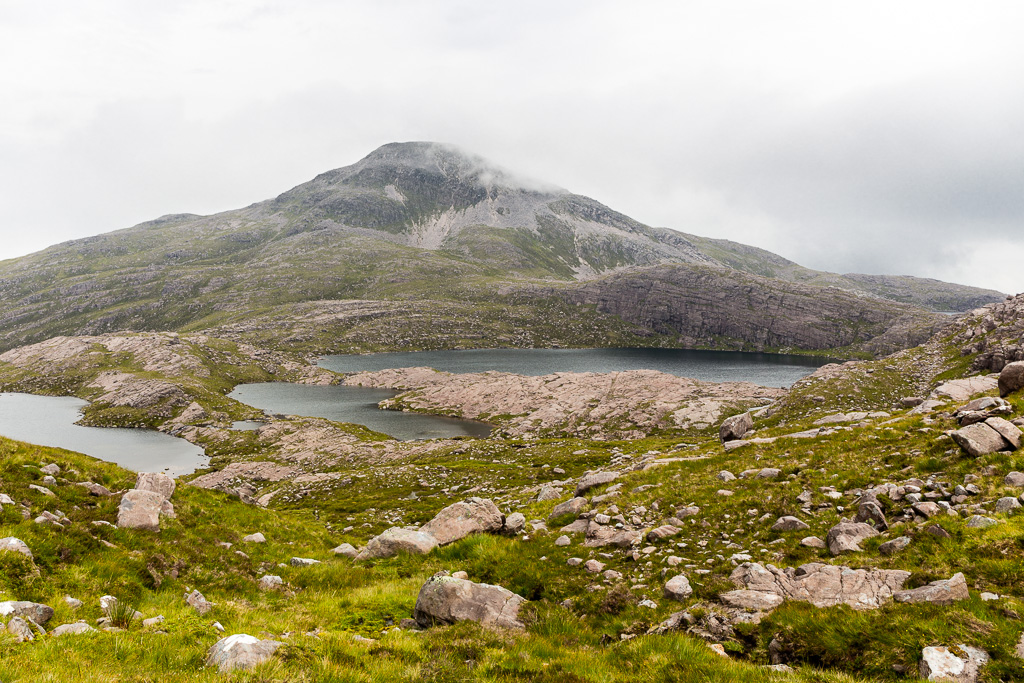 Beinn Liath Mhor and Sgorr nan Lochan Uaine-10
 by
anniesmountains, on Flickr
The lochans are lovely and you can wind your way between or around them. This is the only sight I got of the biggest one as the weather was upon me - but I will be back!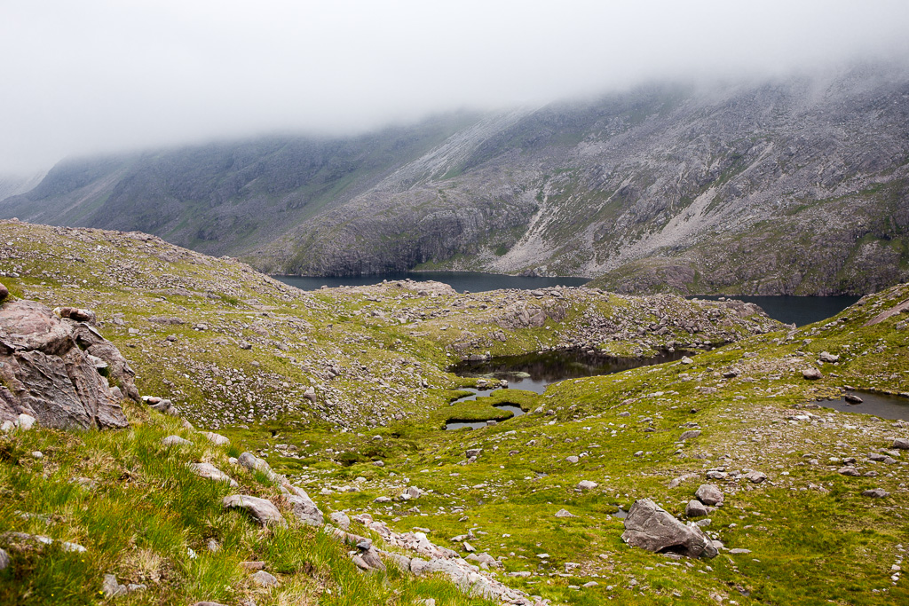 Beinn Liath Mhor and Sgorr nan Lochan Uaine-11
 by
anniesmountains, on Flickr
I managed to find a deer path all the way up which went north and then due east right to the summit cairn. I didn't even have to check the map or GPS until I got there - the deer just know! It was steep but loads of fun. It was four points of contact for two sections of the last leg and every time I saw deer poo I knew I was fine.
The visibility was just few tens of metres so a quick stop at the summit and check the map. I set a bearing only to find there is a path down the north side of the summit. I was very aware that many people go on to do Sgurr Dubh after this hill so knew I had to head west at some point - which I did only to find another path - presumably the one I should have used for the ascent!
This is a joke - some nice lichens on the summit cairn. The visibility was minimal.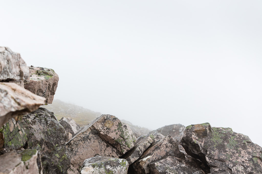 Beinn Liath Mhor and Sgorr nan Lochan Uaine-12
 by
anniesmountains, on Flickr
It was then a matter of losing and finding paths and then following a burn back down to the main path. Liathach and Beinn Eighe were looking very gloomy across Glen Torridon.
What a nice surprise to come out of the mist. It always takes a few seconds to get ones bearings! This is looking towards Coire Dubh Mor between Liathach and Beinn Eighe.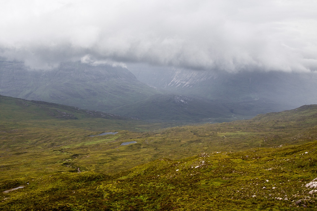 Beinn Liath Mhor and Sgorr nan Lochan Uaine-13
 by
anniesmountains, on Flickr
And again but with Sgurr Ban on Beinn Eighe sticking out of the clouds.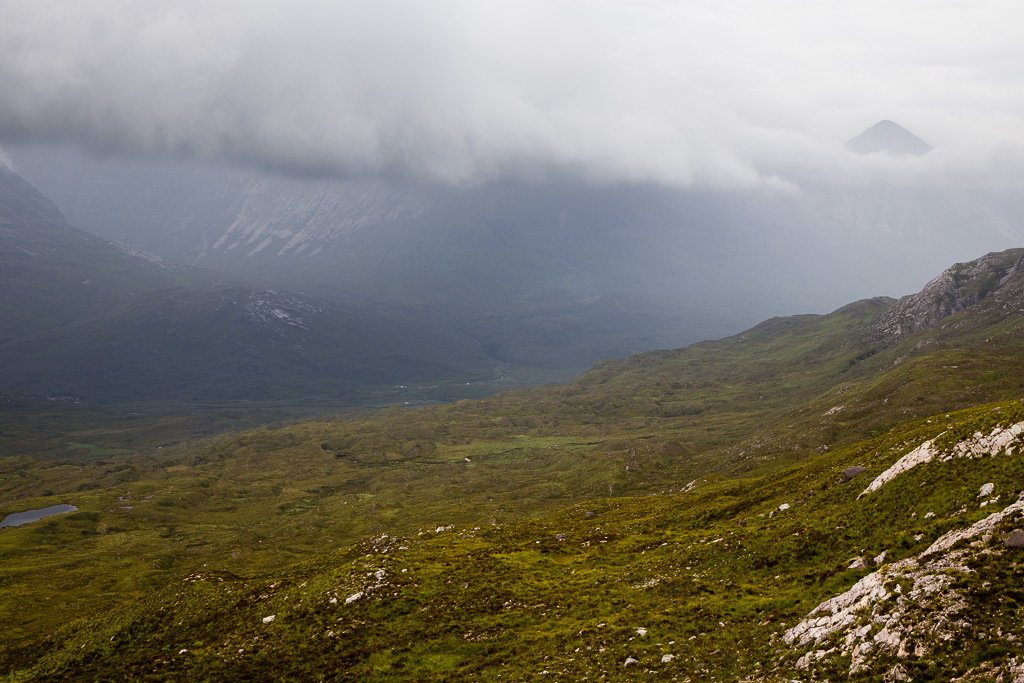 Beinn Liath Mhor and Sgorr nan Lochan Uaine-14
 by
anniesmountains, on Flickr
Liathach living up to its name.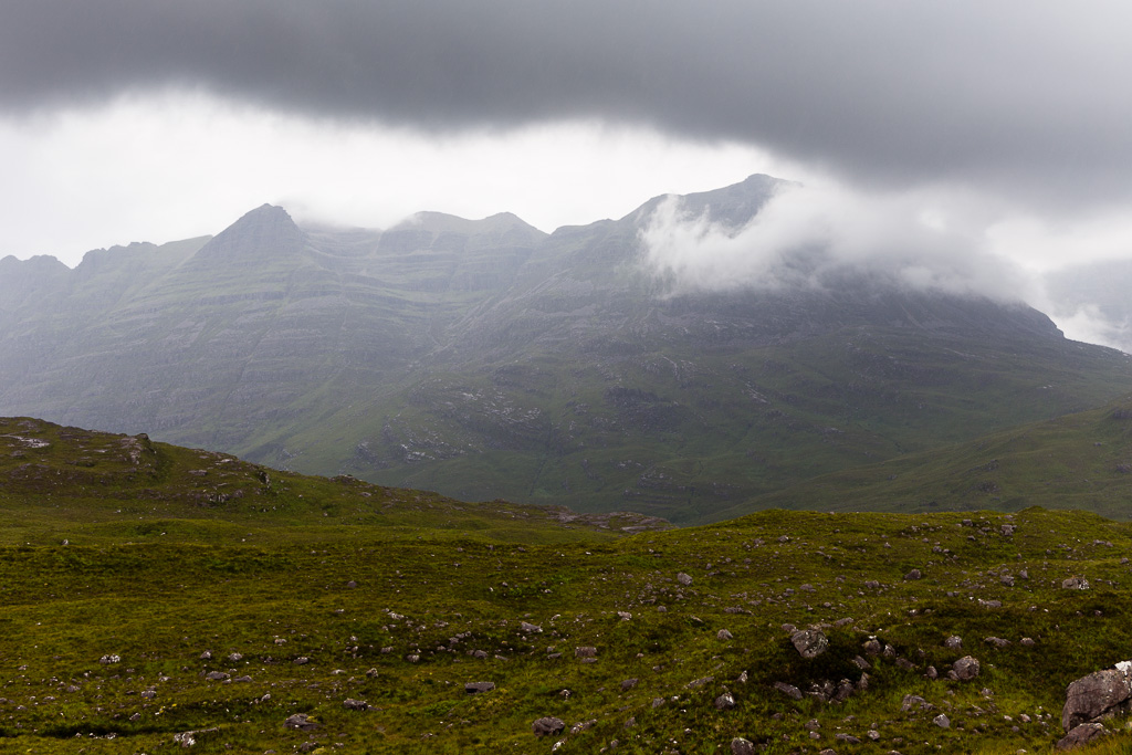 Beinn Liath Mhor and Sgorr nan Lochan Uaine-15
 by
anniesmountains, on Flickr
A ruined croft house and the Ling Hut in the pouring rain.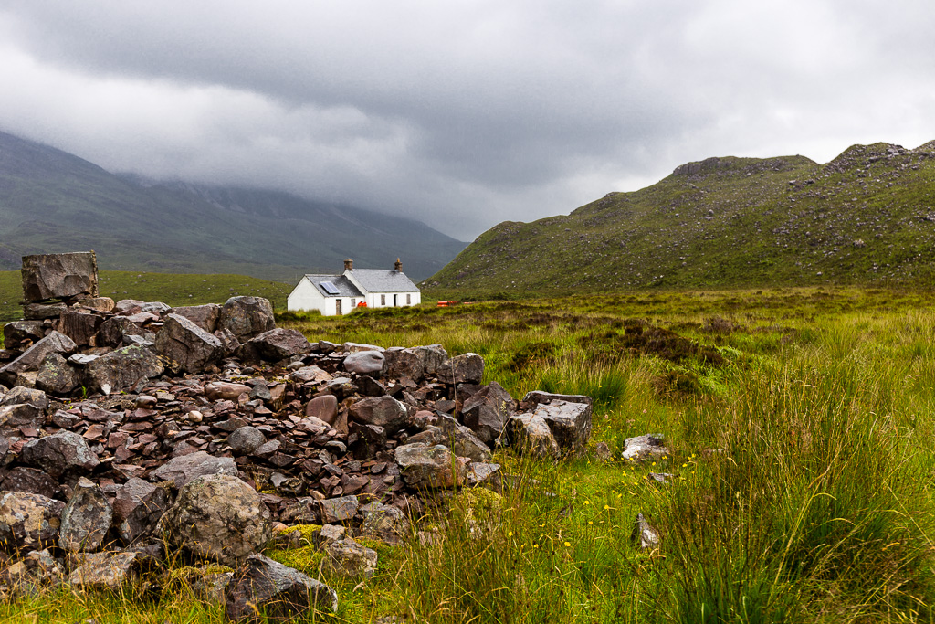 Beinn Liath Mhor and Sgorr nan Lochan Uaine-16
 by
anniesmountains, on Flickr
Well, I really learned not to always trust the paths marked on the OS maps. But I still had a great day and I've now repeated two Munros even though my tally is only eleven.
