Avocetboy wrote:I have spent the last 4 years holidaying in Assynt with my wife and little boy. Due to his age, Hills had to be climbed based on what was possible with a young child.
The first two years we managed Stac Pollaidh, and then progressed to Sgurr un Fhiddleur, Ben Mor Coigach and Cul Mor. However, throughout that time, on every summit we achieved, the ultimate prize, Suilven, was always the dominating hill from every view point.
Problem was, how to tackle it! Not only how to tackle it, but could I tackle it. Steep climbs, big drops, narrow ridge…All of these things leave me feeling uncomfortable, not so much for myself, but for others I am walking with. Ie my wife, child, dog….I have coped with these issues on other hills, but was not sure I would be able to cope on Suilven. Also, the long walk in and out would be pushing the limits that could be expected of a seven year old.
So, a plan was hatched with my good friend and fellow forumite, Boy Vertiginous. A weekend away together in Assynt, without anyone else to worry about apart from ourselves, not only to tackle Suilven, but to also ad a spot of of Wild Camping. Something I have not done since I was a child. And, the icing on the cake, we planned to do this to coincide with the summer solstice to maximize our options of camping sites, low level or high level.
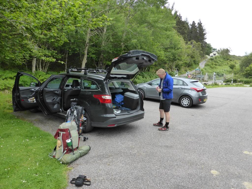
After a week of sorting out my camping kit along with food, emergency kit, multiple phones etc etc. I eventually set of at 3.30am on Friday morning and blasted out 350 miles to hook up with BV in Falkirk. 250 miles further north and 12 hours since setting off from Lincolnshire, we parked up at the small car park in Inverkirkaig. A quick change into appropriate hiking gear and checking of a packs and supplies, we set off at 4.00pm along the excellent path towards the falls of Kirkgaig.
I had been checking the Mountain Weather Forecast all week and this had gone from
Sunshine all weekend, to sunshine and cloud, to sunshine and showers and finally Rain!!!
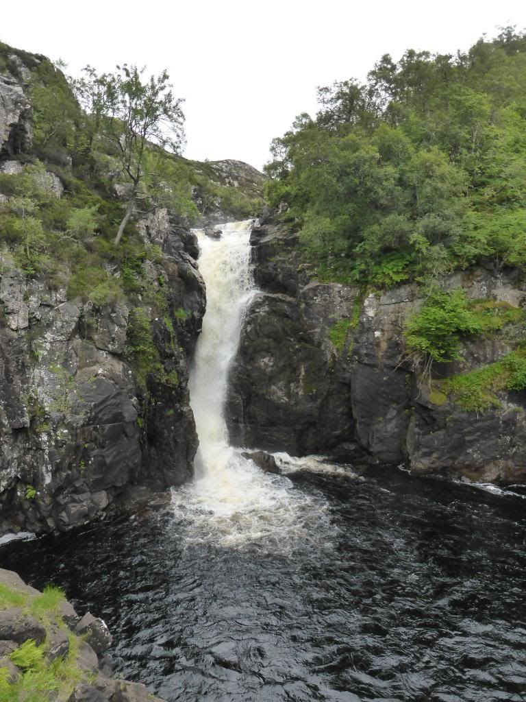
However, we set in mild, bright conditions with, thankfully, no sign of any midges. The walk to the falls was easy going and after an hour we reached the falls and took off our packs to have a look more closely at the waterfalls
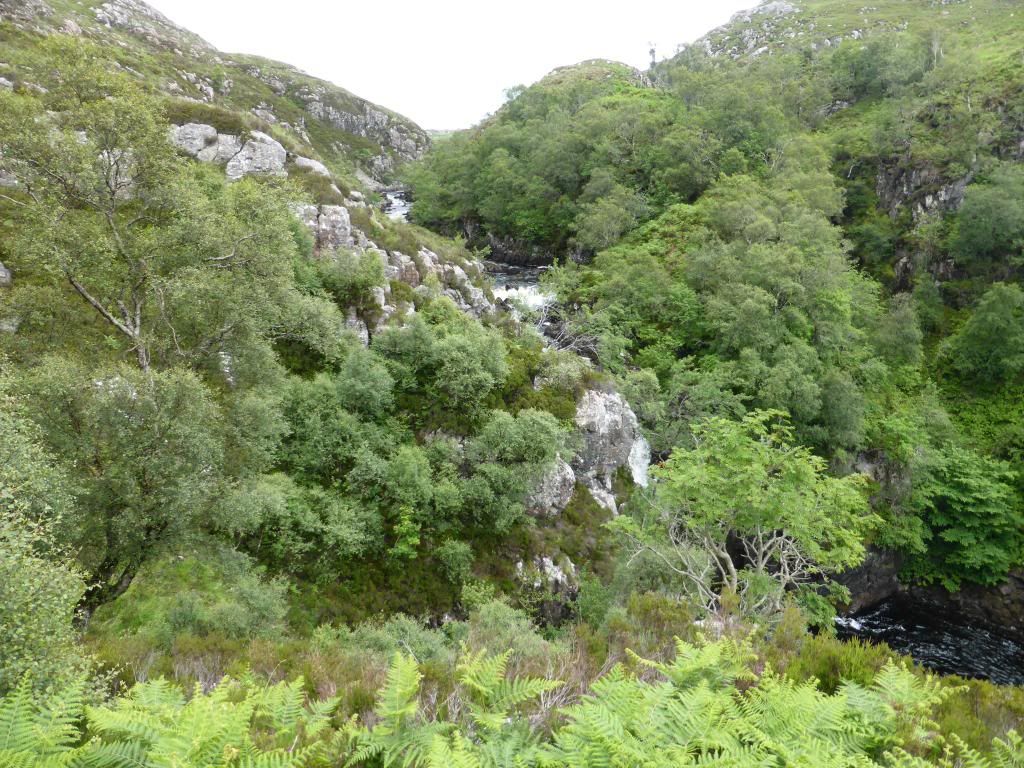
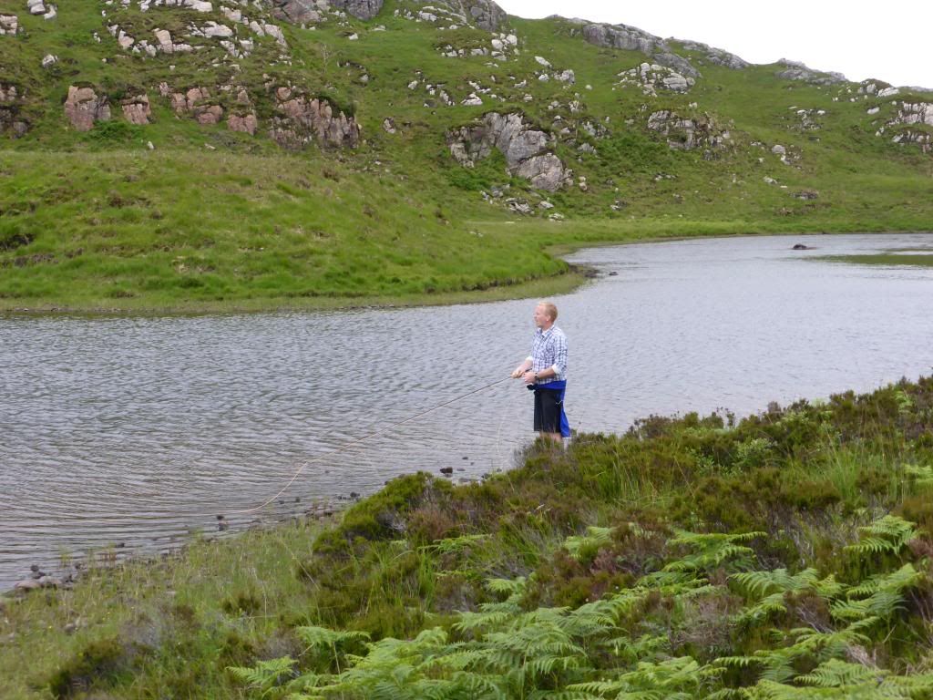
Conscious of the need to gather a small amount of firewood and with trees running out, we diverted off the path to see if we could find some wood by the river. As a result of this we missed the cairn that indicated the path running off the the left, that cut off the loop around the headland jutting out into Fionn Loch. This was only realized when AB noticed brown trout rising and could not resist trying his luck (he had none), whilst I wandered up onto the heather to see how far back we had to track back to get the crossing point at the western end of Fionn Loch.
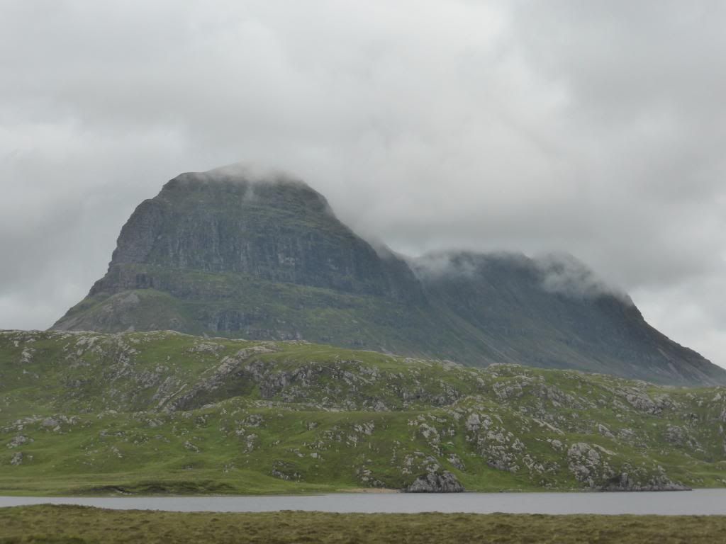
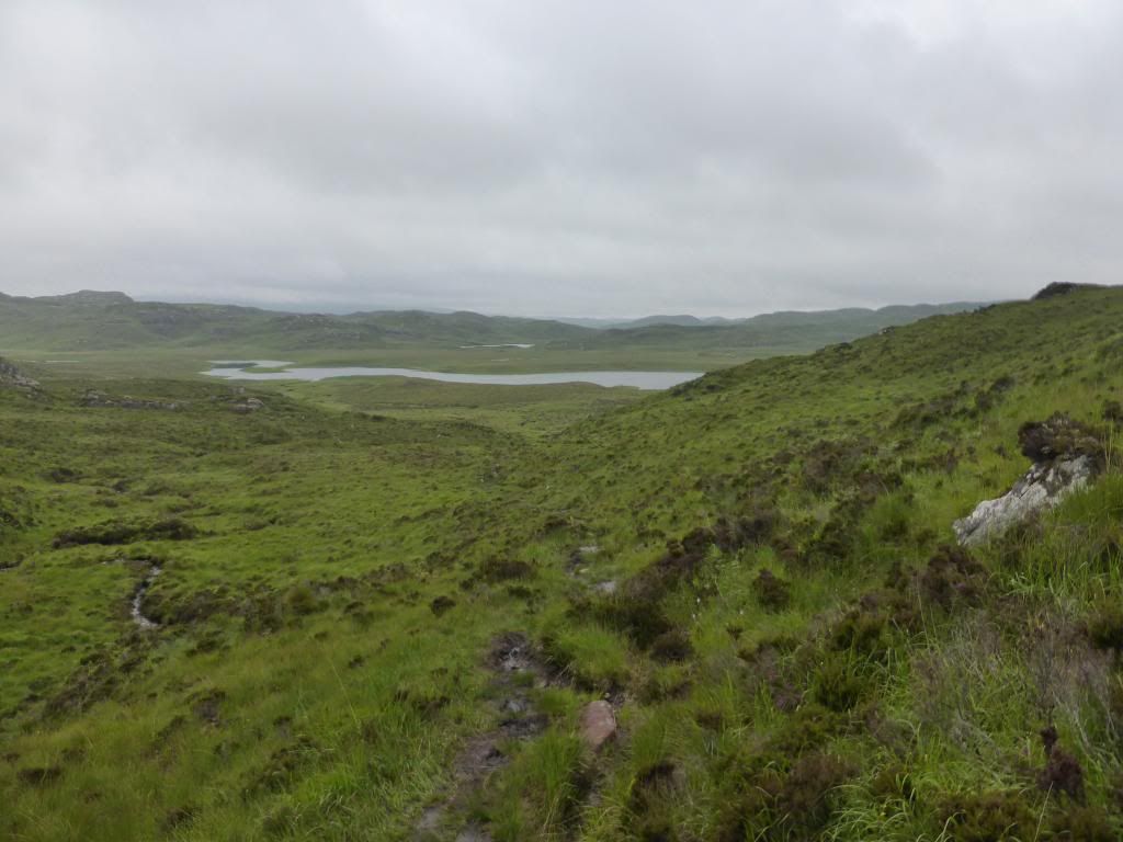
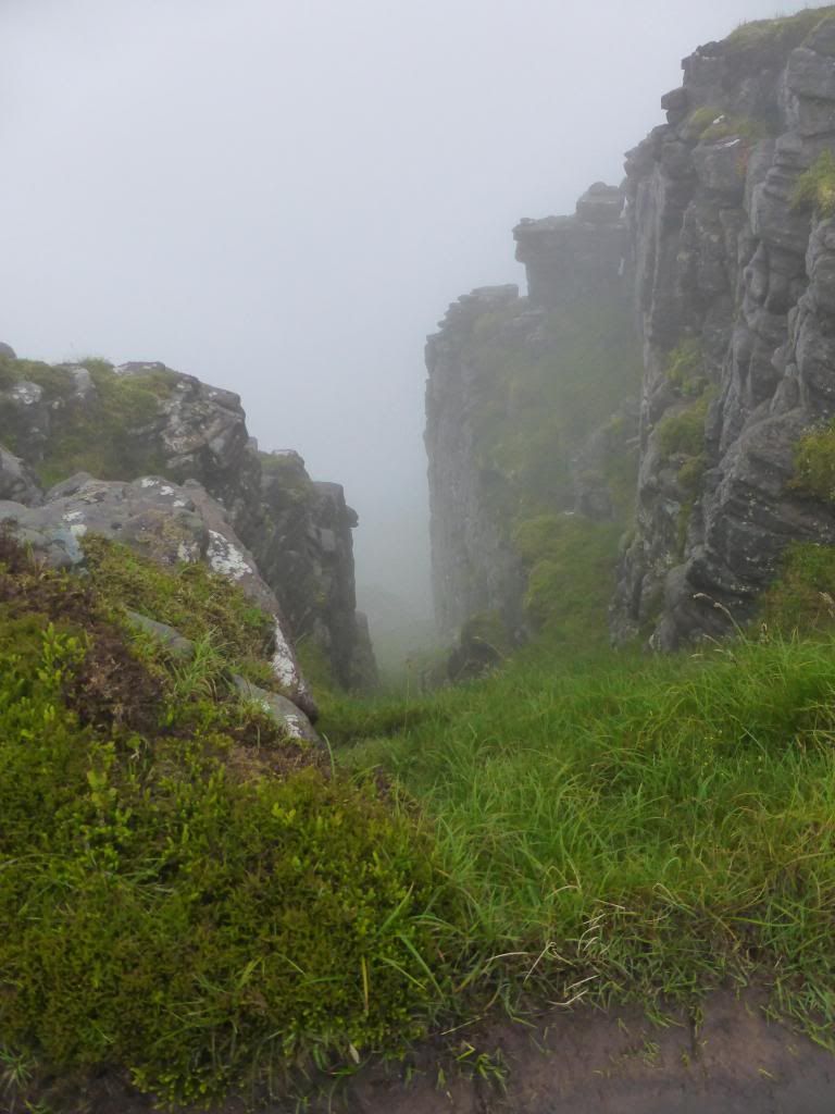
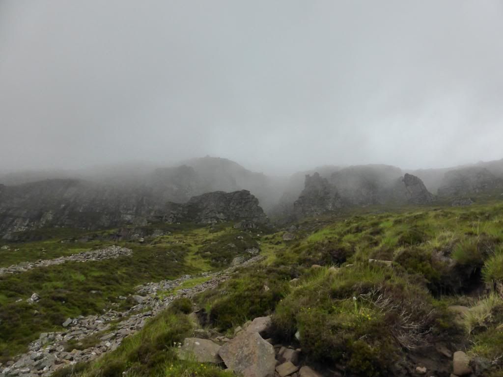
At this point the views towards Suilven were superb.
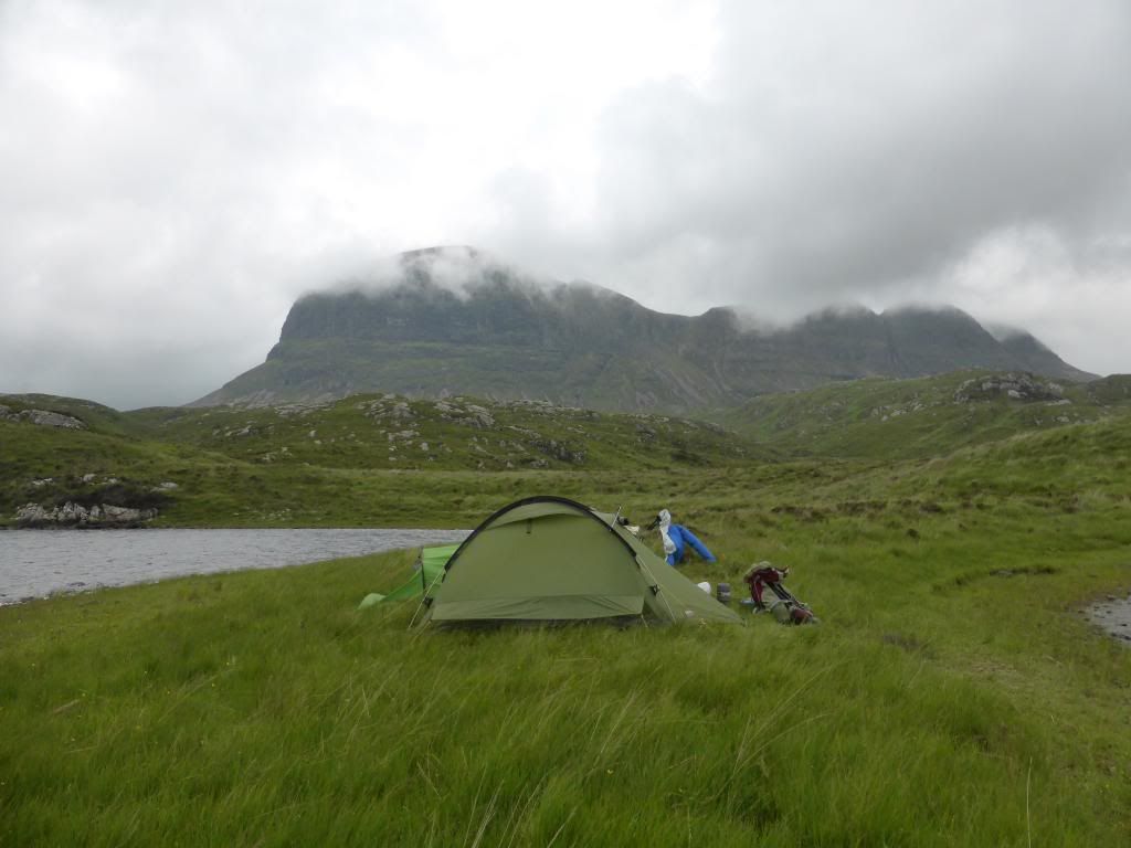
We then endured a trudge over the heather to the edge of the loch and followed the shore all the way round to the crossing point. From here the track snaked along the northern side of the loch over the small hills. It started to rain slightly, at first this was not an issue, but soon it became more persistent and we had to stop to put on waterproofs. Suilven was no longer visible through the rain and low cloud and the path seemed to go on and on, becoming increasingly wet and boggy. It became apparent that my boots had lost all water resistance and my socks were sopping wet. We had studied the map at length prior to this trip and had determined that it looked as if there would be good camping spots at the side of the shore where the path diverted toward the base of his hill. After two hours of trudging through the rain, we eventually reached the cairn where the hill path split off. Luckily, as we reached this point, the rain finally subsided and we were able to locate an excellent spot for our tents on a spur jutting out into the loch
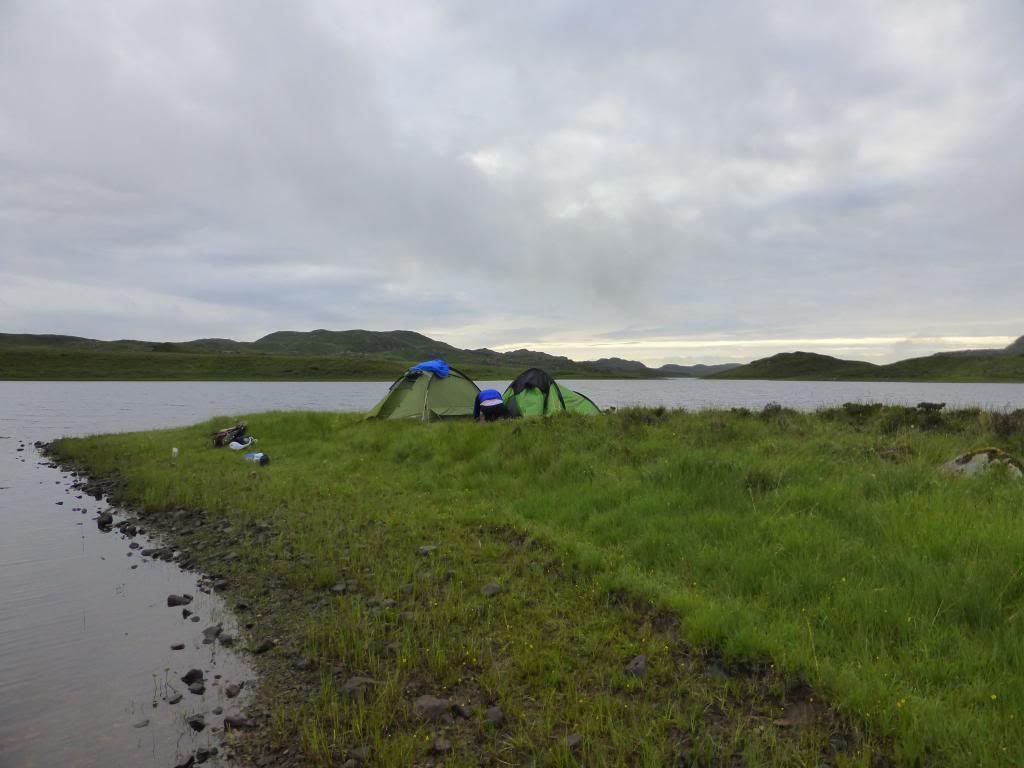
With the rain now stopped, suilven began to reappear through the mist. It was now 9.00pm and we quickly pitched our tents and cooked up some chilli, washed down with a couple of beers . Around 11.00, the rain returned and we were forced to retire to our tents. Seeing as this was my first wild camp, I slept pretty well, waking frequently to here the rain on the tent.
We had intended a very early start, but the sound of the rain kept us in our tents and I eventually opened the flaps when I heard AB surfacing. It was 7.00am and Suilven was no where to be seen!
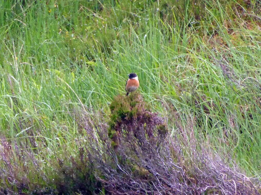
We had some breakfast and packed our things in the tents. We decided to leave all kit at the tents and set off on the mile long path to the base of the hill at 8.00am. The path was wet and boggy and, once again, in no time at all, my feet were soaked. However, the air was mild and although the views were minimal there was a sense of anticipation as we made our way up the slopes, following the course of the Alltan Fearna and watched by numerous very vocal stonechats
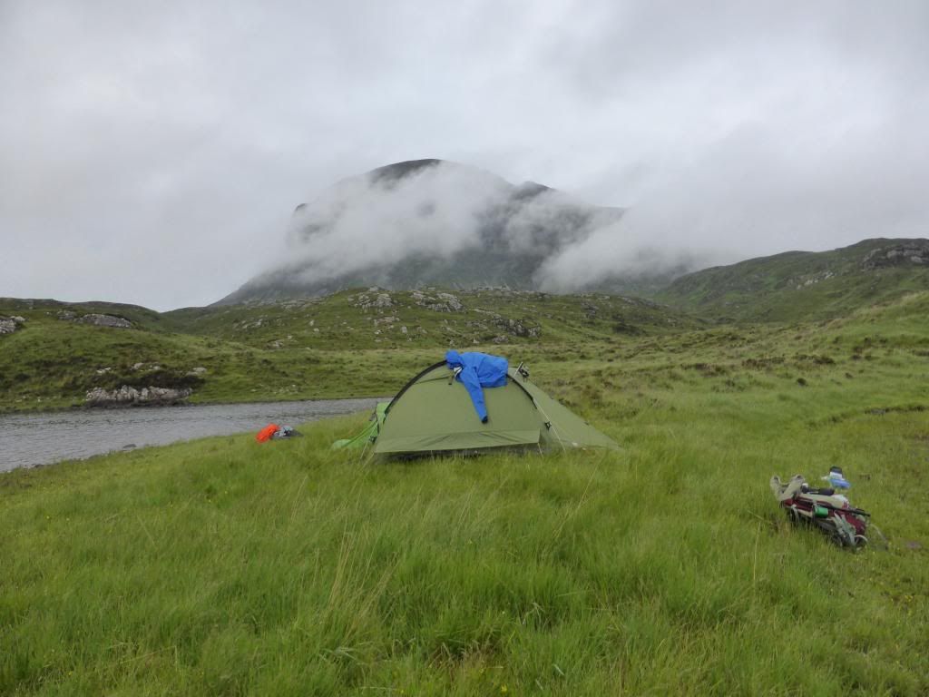
Looking back to our camping spot
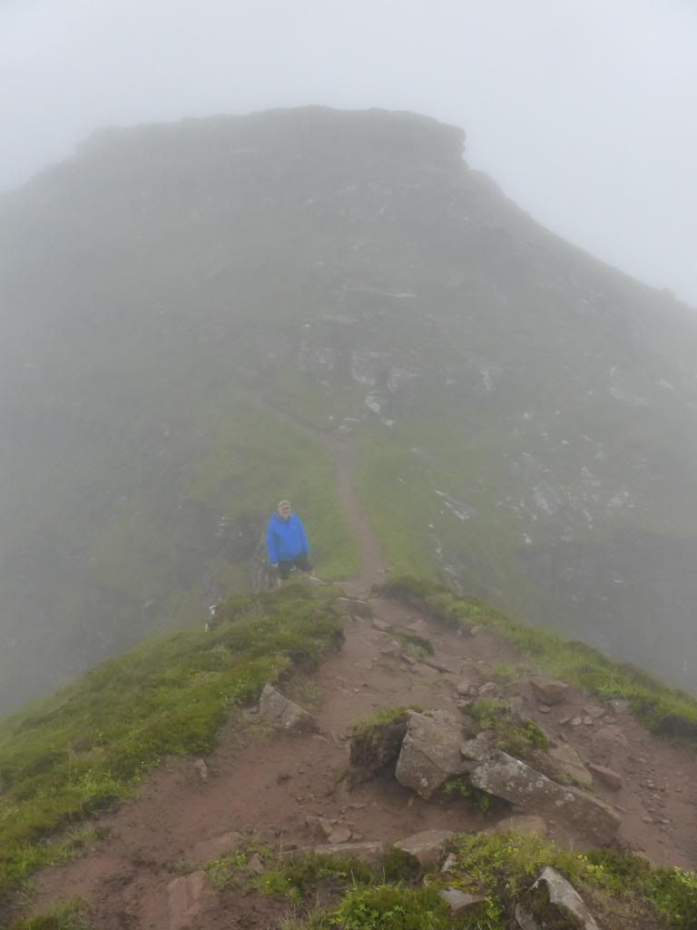
And so to he moment of truth. The climb. The path initially headed straight up the slope. Very eroded, but relatively straight forward. No sense of vertigo, due the cloud and mist. Half way up, the path turned right to traverse the slope at a steady angle, finally, a few zig zags with a couple of enjoyable scrambly bits, and the Bealach was reached. No views at the bealach, but I was amazed at how narrow it was at this point. No more than 3 metres and there, opposite was the path down to Glen Canisp.
BV emerging at the Bealach
It was at this moment I heard voices and 3 figures emerged from the mist from the eastern end of the summit. We had a brief chat. It appeared that they had camped overnight on the summit. Realising that these guys has bigger balls than us! we bid them farewell and a safe return as they headed off down towards Glen Canisp.
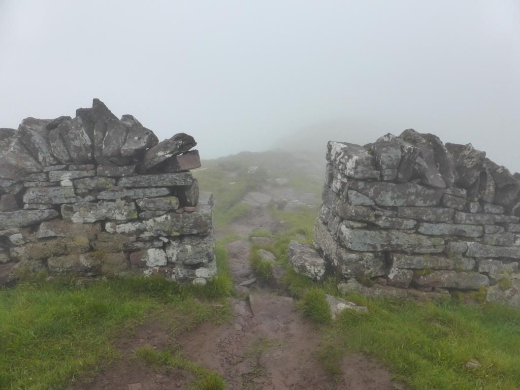
We now headed off towards the main summit of Caisteal Liath, first stopping to admire the wall. I was recently impressed by the wall that runs half way along the ridge of the Fairfield Horseshoe, but this wall is mad! Why!!!!.
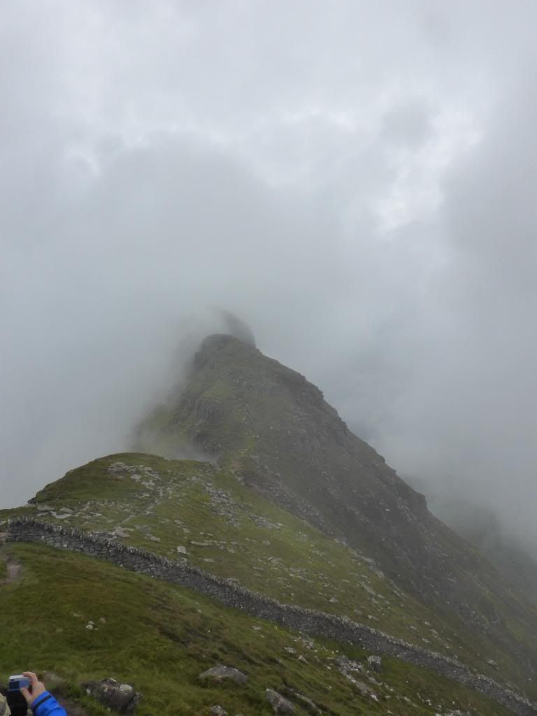
Just past this was my first feeling of apprehension as the ridge narrowed to a metre and then climbed up toward the first "top". However, no need for fears. It was easy and the climb was great.
Hands on scrambling. Loved it. This was followed by a pleasant stroll over the grassy top, but I was slightly concerned as the down climb and path the cut across the eastern flank and then another narrow ridge section. Fears were unfounded though. As always, its easier once you actually do it. There was nothing to fall off! and the final climb up to the summit was brilliant.
And so, at 10.00am on the Longest Day, I had finally reached the summit of Suilven. The anticipated views were non existent, but I was elated. Its always good the achieve goals. BV cracked open a can of beer and the moment was captured.
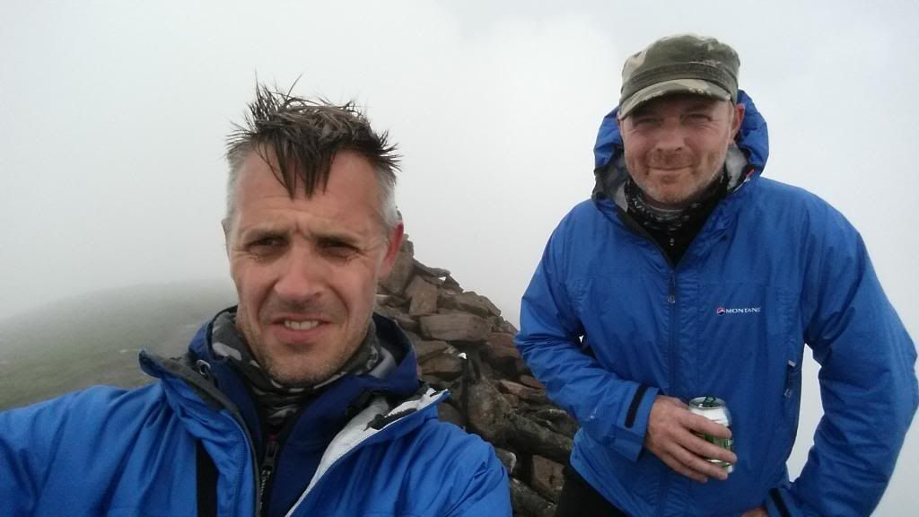
Unfortunately, posting of photo an social media resulted in serious mocking of my tribute to the lead singer of A Flock of Seagulls.!
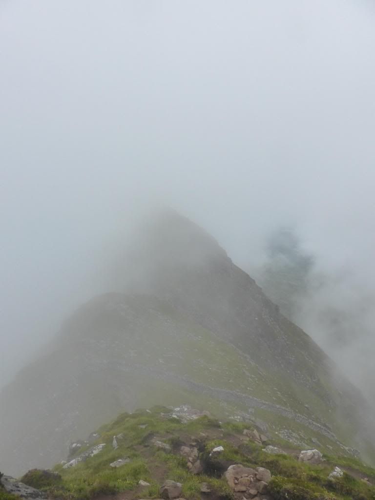
We headed back of the summit and for a fleeting moment it looked as if the cloud was going to lift and the ridge came into view
However, this was not to be. We headed off to wards the eastern summit. At this point, satisfied with all I had achieved and not feeling as adventurous as BV, I opted to try and photo my first ever ptarmigan (failed - it quickly ran away), whilst BV scrambled to the summit of Meall Meadhonach
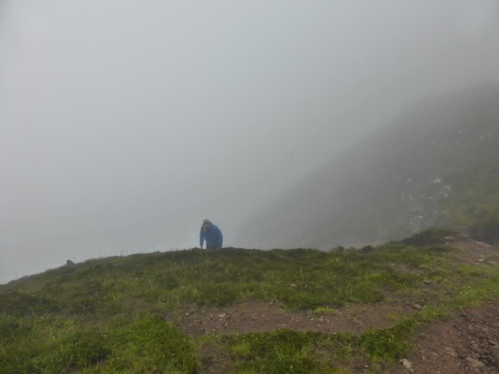
With a better head for heights than me, BV peering into the gloom at the top of the path from the Glean Canisp side!

And so to the descent. Sitting on my own waiting for BV to return, I was slightly apprehensive about the ascent, but, as is often the case having gone up, going down was bound to be OK from a vertigunous point of view, and so it proved to be. And, as luck, or bad luck, would have it, as we descended, the hill began to escape its covering of cloud.
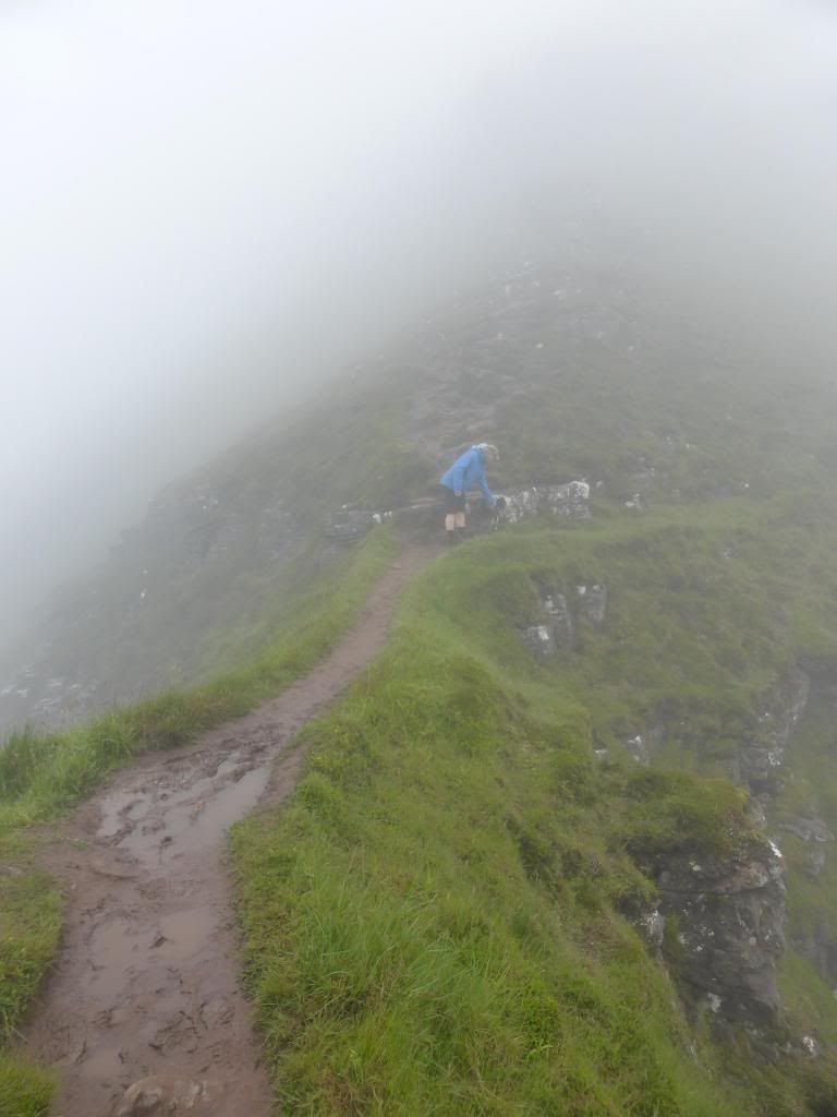
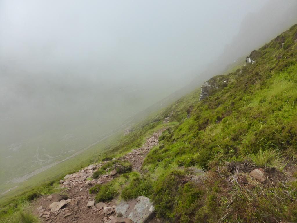
The traverse path of the descent
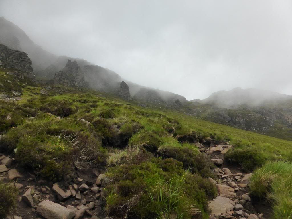
Looking back up, weird and wonderful shapes were beginning to appear through the mist.
It was tempting to go back up and sit it out and wait for the inevitable to clear. But tired legs and the thought of the long walk out kept us on the descent. Eventually we arrived back at the tents, with the summit nearly clear.
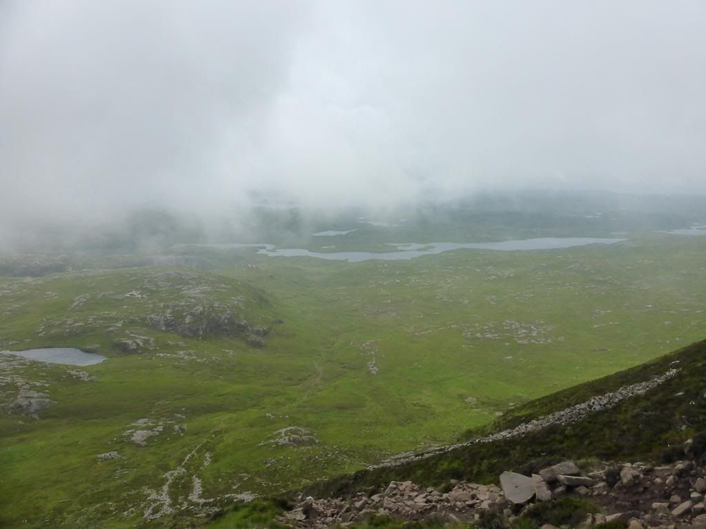
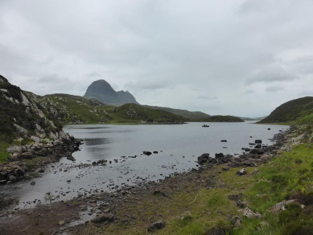
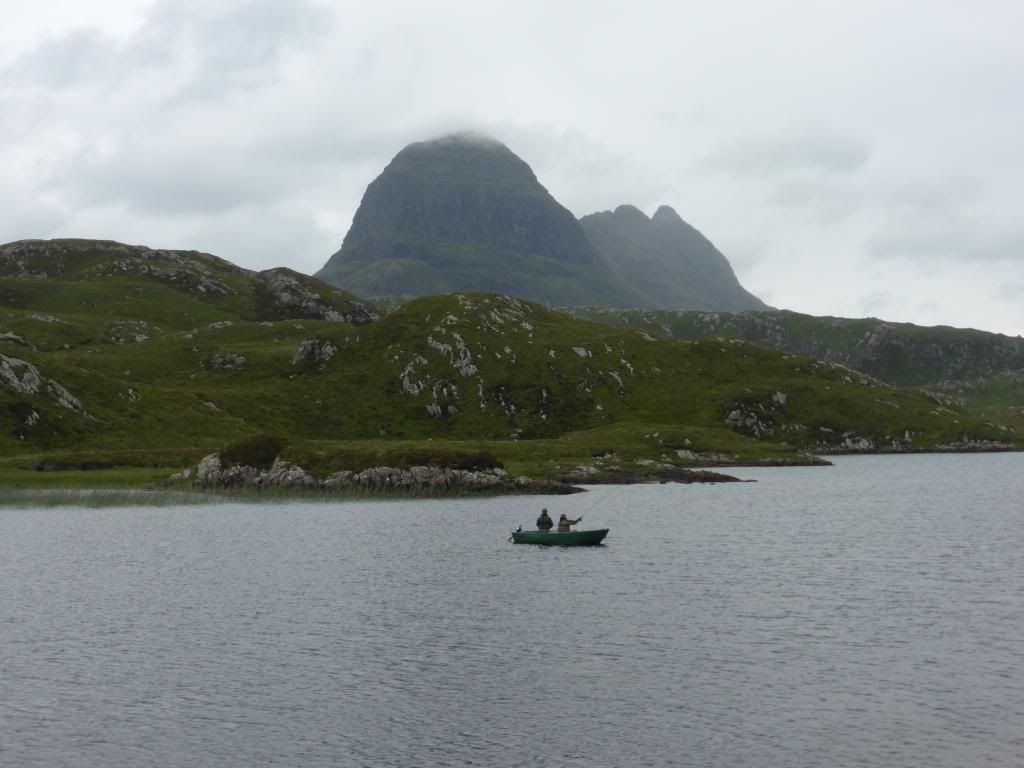
The walk back along Ffion Loch was slow as a result of constantly turning round to witness the mountain, now showing in all its glory
We finally arrived back at the car at 4.00pm, 24 hours after setting off. Despite the lack of views, the rain, the soaking wet feet, the aching back and 80's pop star hair, it had been a truly magnificent 24 hours, one that will remain with me forever. Assynt is the most amazing place.
