
Some hills near Braemar
Corbetts: Ben Gulabin, Creag nan Gabhar, Carn na Drochaide, Morrone, Monamenach
Graham: Badandun Hill
Date: Saturday 27 and early Sunday 28 Sept 2014
Distance: 36km approx
Ascent: 2,950m approx
Time: Move: 9hrs 3mins, Stop: 1hr 7mins
Attendees: me
Having Friday and Monday off, the plan made several months ago was for a camping trip to Moidart. Circumstances dictated otherwise – still trying to shake off a cough and cold ruled out Friday and a poor weather forecast for the north west suggested Moidart wouldn’t be ideal. Shorter walks seemed a better option hence a late change of plan to head for the Braemar area.
Saturday 27 Sept 2014
Drove up past Perth then via Blairgowrie and parked in the wee layby (on the left just north of the Spittal of Glenshee) beside another car. The driver asked for directions to Aberlour (fishing trip) – seems his satnav took him up this way rather than the A9.
Looking back

Got ready and walked on the wee track to the side of the road round the corner to the gate where the main track starts.
Ben Gulabin
Ascent: 450m, Distance: 5.8km, Move: 1hr20mins, Stop: 7mins
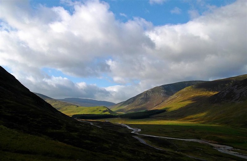
Good track up the hillside – views northwards

Not long before arriving at a fork in the track – turn left and head upwards

Further up turn to the right and on to the summit

Then back down the same way – weather starting to brighten up further down
Back to the car then drove up past the ski centre and stopped in a layby just south of Newbigging.
Creag nan Gabhar
Ascent: 440m, Distance: 2.8km, Move: 1hr6mins, Stop: 14mins
There are various ways to approach this hill including the walk up by Callater Burn. Most straightforward seemed to be from the roadside.
Walked back down the road a little to what looked like the start of a track. Didn’t really come to much so just kept going through the heather with some rocky sections on the way.

Towards Braemar and Morrone

Turned left at the top and headed over some rocks to the cairn

Weather staying reasonable - wind getting up at times

Towards Lochnagar

Towards Ben Avon

Headed more directly towards the car from the summit – found more of a track this time

Back at the car, stopped for a break and some early lunch. Then drove up to Braemar and round to the Linn of Dee – satnav wanted to take me up the old military road then across the Victoria Bridge to Mar Lodge – didn’t seem quite right. Still some spaces in the car park at Linn of Quoich.
Carn na Drochaide
Ascent:560 m, Distance: 6.7km, Move: 1hr42mins, Stop: 13mins
Set off around the same time as a few other walkers – think they were heading towards Allanmore. Headed towards a gap in the trees (middle of the photo) then found a track leading up the hill towards Carn Dearg.

Continually lost and found the track on the way up


Reasonably clear but windy at the top


Then back down the same way – solitary tree on the way down

Drove back round to Braemar. Stopped to text home and have a break and some more lunch. Then drove to the car park just past the bridge at Auchallater.
Morrone
Ascent: 630m, Distance: 9.8km, Move: 2hr4mins, Stop: 15mins
Walked along the roadside initially then crossed down to the bridge over the Clunie Water. Then left over another wee bridge, alongside the fence then up to pick up the main track up the hillside.

Patterns on the other side of the A93

Onwards and upwards

Higher up turn right towards the summit

Loch Callater

Communications mast

Memorial plaque

Inside

Mar Lodge and Linn of Dee

Trig point

Loch Phadruig

Descended the same way – Auchallater and car park in the distance

Back at the car park I met a walking party – they had been on four of the munros to the east of Glenshee, had walked back down Jock’s Road and were waiting for their tour bus.
Now just after 5pm, had an initial think about heading down to Auchavan for Monamenach as it was turning into a nice evening. However, it would take a wee while to get there and I’d probably end up walking back in the dark so decided to leave it until the following day.
Sunday 28 Sept 2014
Monamenach
Ascent: 450m, Distance: 5.6km, Move: 1hr22mins, Stop: 11mins
Little in the way of parking spaces so parked just past Auchavan on the potholed road which leads to Dalhally – beside the river before the bridge.
Set of early before dawn initially with a head torch. Back up to Auchavan and past the houses. Found the track but initially missed the shortcut to the left – then across the field, on to the main track and followed it up the hillside.

Lots of deer on the skyline but with hardly any light the photos are blurred. Stags bellowing on the hillside. Followed the track until it ended, turned right and headed up to the summit.
In the clag for the last wee bit and at the summit cairn

No sign of it clearing so headed back down. Cleared a bit lower down.


Auchavan to the right, car and bridge to the left

Looking brighter over to Badandun Hill

Back up to Monamenach

Back to the car with the weather looking reasonably promising. Hardly any wind. Drove down the road to the end of the Fergus farm track and parked on the verge leaving the farm road clear.
Badandun Hill
Ascent: 420m, Distance: 5.0km, Move: 1hr29mins, Stop: 7mins
Set off up the farm track – clear view of the hill in the distance

Followed the track through the farm, up through the tress then on to open ground. Went further up the track until finding a suitable place to cross.
Then up the hillside through the heather

Looking back

Nearing the top, the mist rolled in and the rain had started.
No views at the top

With the rain getting heavier, decided on a more direct route back down to the trees above the farm.
Still raining and misty as I got back to the car

Back at the car it was now just on 10am. Had hoped to go on to the two Grahams, Mount Blair and Mealna Letter (Duchray Hill). Waited a wee bit but there was no sign of the clag and rain clearing. Drove down the road to where the Mount Blair route starts – still raining and very misty – couldn’t see any of the tops. Had absolutely no wish to start either of the walks in rain/clag, see nothing and return in rain/clag so decided to leave them off.
Changed into dry clothes, drove home. Needless to say the weather cleared up considerably near Blairgowrie and was very nice around Gleneagles. Back home in time for lunch – meant I could watch some of the golf and miss the traffic on the A9.
Graham: Badandun Hill
Date: Saturday 27 and early Sunday 28 Sept 2014
Distance: 36km approx
Ascent: 2,950m approx
Time: Move: 9hrs 3mins, Stop: 1hr 7mins
Attendees: me
Having Friday and Monday off, the plan made several months ago was for a camping trip to Moidart. Circumstances dictated otherwise – still trying to shake off a cough and cold ruled out Friday and a poor weather forecast for the north west suggested Moidart wouldn’t be ideal. Shorter walks seemed a better option hence a late change of plan to head for the Braemar area.
Saturday 27 Sept 2014
Drove up past Perth then via Blairgowrie and parked in the wee layby (on the left just north of the Spittal of Glenshee) beside another car. The driver asked for directions to Aberlour (fishing trip) – seems his satnav took him up this way rather than the A9.
Looking back
Got ready and walked on the wee track to the side of the road round the corner to the gate where the main track starts.
Ben Gulabin
Ascent: 450m, Distance: 5.8km, Move: 1hr20mins, Stop: 7mins
Good track up the hillside – views northwards
Not long before arriving at a fork in the track – turn left and head upwards
Further up turn to the right and on to the summit
Then back down the same way – weather starting to brighten up further down
Back to the car then drove up past the ski centre and stopped in a layby just south of Newbigging.
Creag nan Gabhar
Ascent: 440m, Distance: 2.8km, Move: 1hr6mins, Stop: 14mins
There are various ways to approach this hill including the walk up by Callater Burn. Most straightforward seemed to be from the roadside.
Walked back down the road a little to what looked like the start of a track. Didn’t really come to much so just kept going through the heather with some rocky sections on the way.
Towards Braemar and Morrone
Turned left at the top and headed over some rocks to the cairn
Weather staying reasonable - wind getting up at times
Towards Lochnagar
Towards Ben Avon
Headed more directly towards the car from the summit – found more of a track this time
Back at the car, stopped for a break and some early lunch. Then drove up to Braemar and round to the Linn of Dee – satnav wanted to take me up the old military road then across the Victoria Bridge to Mar Lodge – didn’t seem quite right. Still some spaces in the car park at Linn of Quoich.
Carn na Drochaide
Ascent:560 m, Distance: 6.7km, Move: 1hr42mins, Stop: 13mins
Set off around the same time as a few other walkers – think they were heading towards Allanmore. Headed towards a gap in the trees (middle of the photo) then found a track leading up the hill towards Carn Dearg.
Continually lost and found the track on the way up
Reasonably clear but windy at the top
Then back down the same way – solitary tree on the way down
Drove back round to Braemar. Stopped to text home and have a break and some more lunch. Then drove to the car park just past the bridge at Auchallater.
Morrone
Ascent: 630m, Distance: 9.8km, Move: 2hr4mins, Stop: 15mins
Walked along the roadside initially then crossed down to the bridge over the Clunie Water. Then left over another wee bridge, alongside the fence then up to pick up the main track up the hillside.
Patterns on the other side of the A93
Onwards and upwards
Higher up turn right towards the summit
Loch Callater
Communications mast
Memorial plaque
Inside
Mar Lodge and Linn of Dee
Trig point
Loch Phadruig
Descended the same way – Auchallater and car park in the distance
Back at the car park I met a walking party – they had been on four of the munros to the east of Glenshee, had walked back down Jock’s Road and were waiting for their tour bus.
Now just after 5pm, had an initial think about heading down to Auchavan for Monamenach as it was turning into a nice evening. However, it would take a wee while to get there and I’d probably end up walking back in the dark so decided to leave it until the following day.
Sunday 28 Sept 2014
Monamenach
Ascent: 450m, Distance: 5.6km, Move: 1hr22mins, Stop: 11mins
Little in the way of parking spaces so parked just past Auchavan on the potholed road which leads to Dalhally – beside the river before the bridge.
Set of early before dawn initially with a head torch. Back up to Auchavan and past the houses. Found the track but initially missed the shortcut to the left – then across the field, on to the main track and followed it up the hillside.
Lots of deer on the skyline but with hardly any light the photos are blurred. Stags bellowing on the hillside. Followed the track until it ended, turned right and headed up to the summit.
In the clag for the last wee bit and at the summit cairn
No sign of it clearing so headed back down. Cleared a bit lower down.
Auchavan to the right, car and bridge to the left
Looking brighter over to Badandun Hill
Back up to Monamenach
Back to the car with the weather looking reasonably promising. Hardly any wind. Drove down the road to the end of the Fergus farm track and parked on the verge leaving the farm road clear.
Badandun Hill
Ascent: 420m, Distance: 5.0km, Move: 1hr29mins, Stop: 7mins
Set off up the farm track – clear view of the hill in the distance
Followed the track through the farm, up through the tress then on to open ground. Went further up the track until finding a suitable place to cross.
Then up the hillside through the heather
Looking back
Nearing the top, the mist rolled in and the rain had started.
No views at the top
With the rain getting heavier, decided on a more direct route back down to the trees above the farm.
Still raining and misty as I got back to the car
Back at the car it was now just on 10am. Had hoped to go on to the two Grahams, Mount Blair and Mealna Letter (Duchray Hill). Waited a wee bit but there was no sign of the clag and rain clearing. Drove down the road to where the Mount Blair route starts – still raining and very misty – couldn’t see any of the tops. Had absolutely no wish to start either of the walks in rain/clag, see nothing and return in rain/clag so decided to leave them off.
Changed into dry clothes, drove home. Needless to say the weather cleared up considerably near Blairgowrie and was very nice around Gleneagles. Back home in time for lunch – meant I could watch some of the golf and miss the traffic on the A9.