free to be able to rate and comment on reports (as well as access 1:25000 mapping).
Total time: 5 hours 7 minutes
Walking: 3 hours 32 minutes
Stopped: 1 hour 35 minutes
This hill has been on my list for a while and I put it near the top after reading The Rodmeister's account of his walk with all the superlatives - just made it irresistible! Well, when the days were longer, the bigger hills and those further away kept calling but now the days are short and it was Thanksgiving Day (which means I get a day off midweek), so the Money hill it was!
The weather forecasts were mixed but it looked like West was Best.
I parked at the burial ground on the wee road to Morvich. Just across the road is a gate which takes you up on the hill path.
Beautiful Beinn Fhada (west end) from the car park. Sgurr an Airgid
 by
anniesmountains, on Flickr
Looking back to Sgurr an t-Searraich, the burial ground and causeway. Sgurr an Airgid-2
 by
anniesmountains, on Flickr
There is a great path all the way up to the bealach. It zig-zags easily up the hillside and no part of it is very steep. Also, there are lots of flattish parts so one can get one's breath back and look back at the amazing views.
Sgurr an t-Searraich across the causeway, Sgurr Mhic Bharraich in the other side of Loch Duich.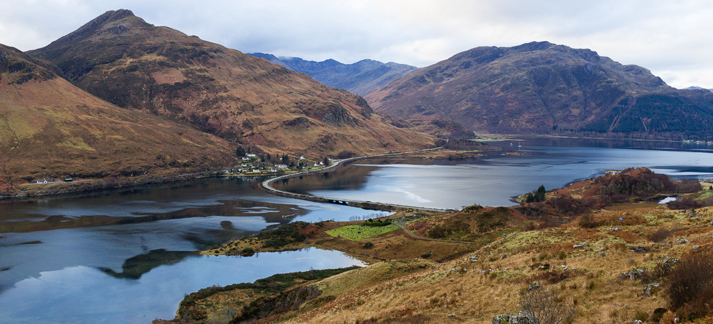 Sgurr an Airgid-3
 by
anniesmountains, on Flickr
To the south-east, Beinn Fhada dominates the view and is now high on my list for next year. I would dearly love to walk this west ridge but apparently there is a 'bad step' which is probably not within my capabilities
 Morvich and Beinn Fhada.
 Sgurr an Airgid-4
 by
anniesmountains, on Flickr
Gaining height, one starts to see Gleann Lichd which eventually leads into Glen Affric.
BF, Strath Croe, Morvich and Gleann Lichd.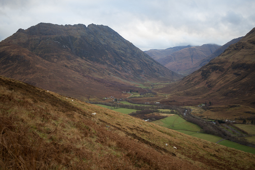 Sgurr an Airgid-6
 by
anniesmountains, on Flickr
And again, zoomed in.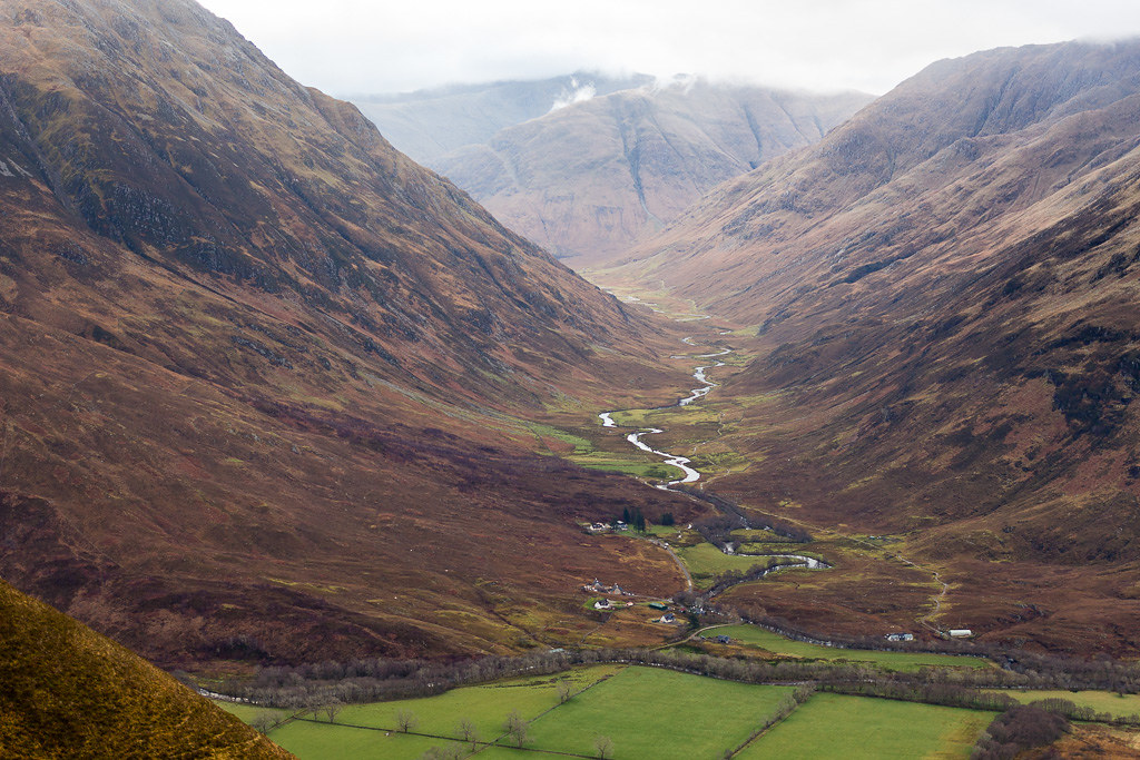 Sgurr an Airgid-7
 by
anniesmountains, on Flickr
To the west is mighty Beinn Sgritheall hiding behind Mam Ratagan and its top also appears as you gain height.
Beinn Sgritheall and Beinn a'Chapuill with Ratagan village by the loch-side.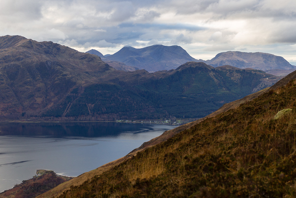 Sgurr an Airgid-8
 by
anniesmountains, on Flickr
Higher up, the houses and cars look like toys! I just started to see the Saddle and South Shiel ridge when the cloud gradually dropped to hide the tops.
The Saddle is just about visible.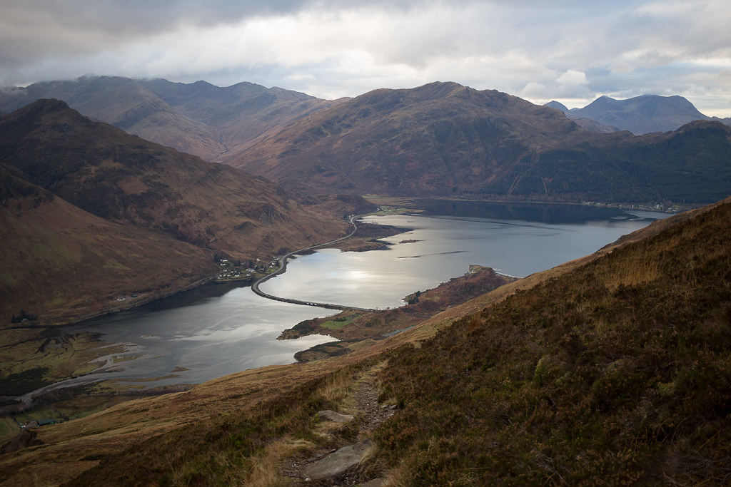 Sgurr an Airgid-9
 by
anniesmountains, on Flickr
At the bealach there is a nice cairn so even in mist one would know where to start the descent. On the map it looks like the path continues but it wasn't obvious to me as the only branch seemed to be the one heading left for Sgurr an Airgid!
The cairn at the bealach. You can't see the summit from here as it's set back quite a bit. Sgurr an Airgid-10
 by
anniesmountains, on Flickr
As the cloud dropped, the light and rays changed the landscape.
Rays over Coire na Criche. Sgurr an Airgid-11
 by
anniesmountains, on Flickr
A' Glas-bheinn and Beinn Fhada (west end).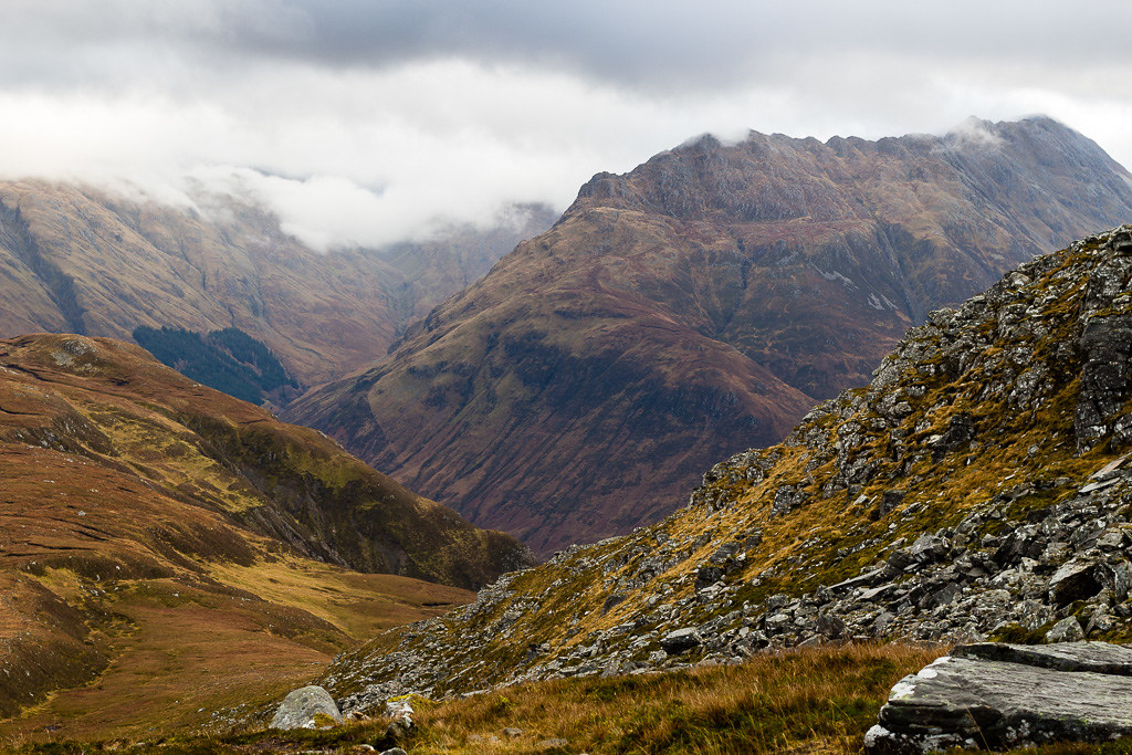 Sgurr an Airgid-12
 by
anniesmountains, on Flickr
As the weather was closing in I took as many photos as possible when I got up on the summit ridge.
The Torridon and Achnashellach hills - sun shining brightly on Beinn Damh.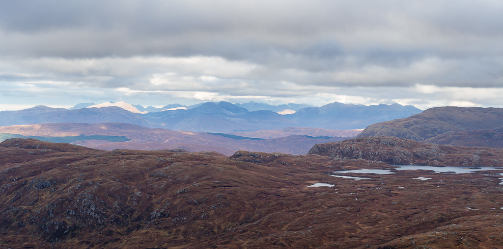 Sgurr an Airgid-13
 by
anniesmountains, on Flickr
The Applecross hills.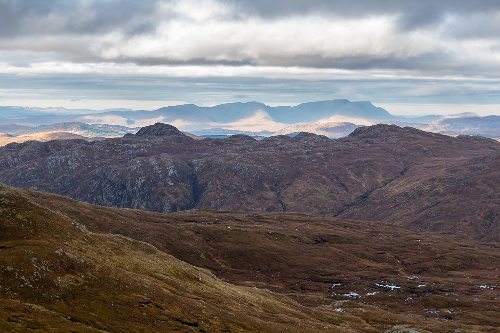 Sgurr an Airgid-14
 by
anniesmountains, on Flickr
Weather closing in on Skye. Sgurr na Seamraig right of centre.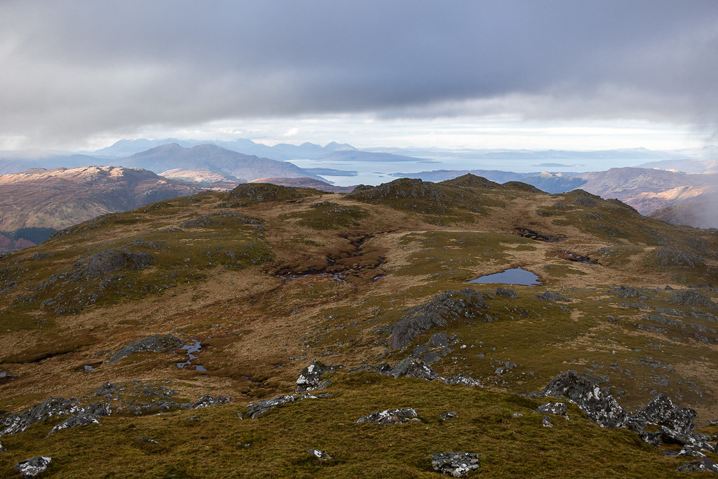 Sgurr an Airgid-16
 by
anniesmountains, on Flickr
Looking over to the Mam Ratagan road - Beinn Sgritheall now in the cloud. Sgurr an Airgid-17
 by
anniesmountains, on Flickr
From just past the summit you can look down over Loch Duich. 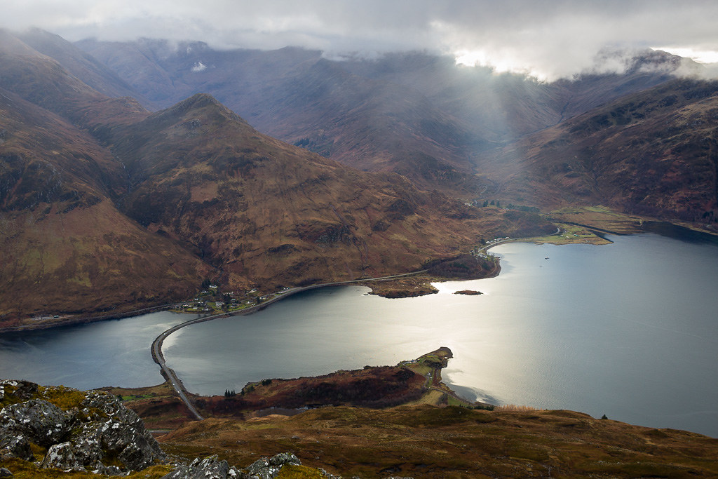 Sgurr an Airgid-18
 by
anniesmountains, on Flickr
By this time the cloud was in and out and I went back to the summit with the intention of going on to the subsidiary top of Sgurr na Seamraig which is only a hop and skip away but looks to be a good viewpoint to the north and west. However, after waiting five minutes I knew there wasn't much chance of the cloud lifting so just headed back down the hill.
Summit trig point.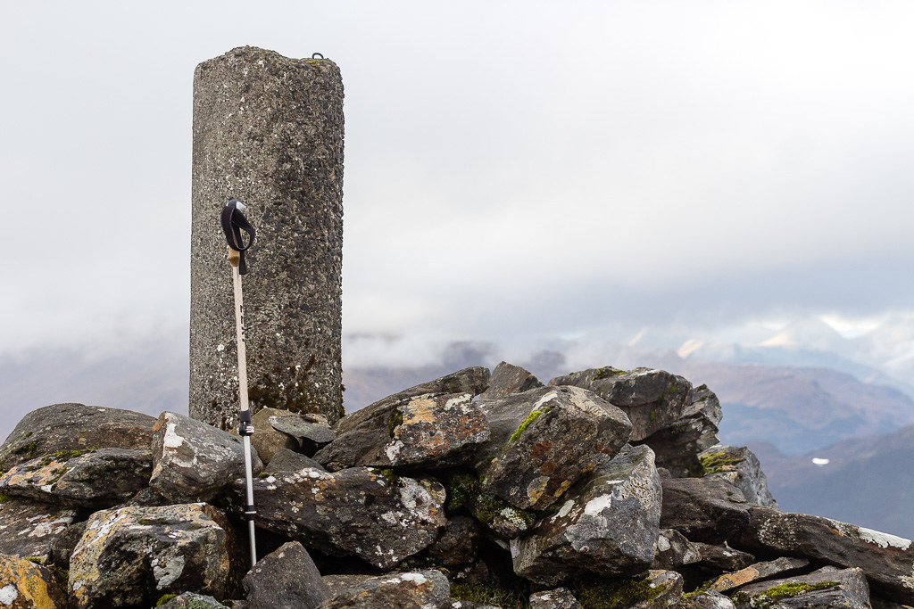 Sgurr an Airgid-19
 by
anniesmountains, on Flickr
As I was descending from the summit plateau I met three people from Wisconsin who were up there to celebrate Thanksgiving! They were on the way up but doubt that they got any views at all from the top.
The cloud creeping down the hillside.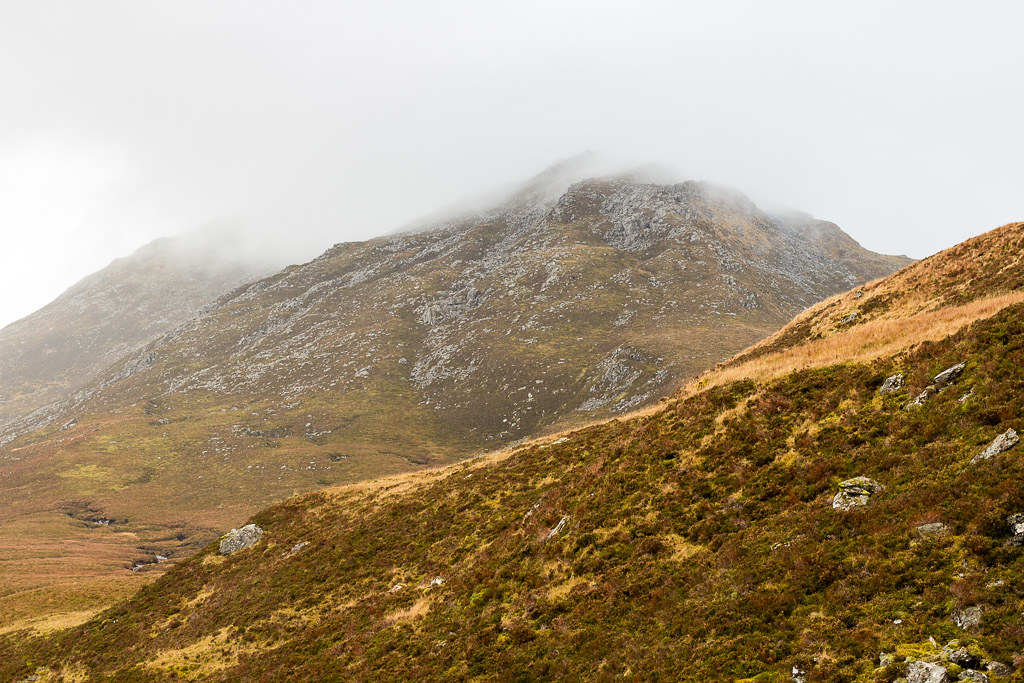 Sgurr an Airgid-20
 by
anniesmountains, on Flickr
Beinn Fhada looking grand. Can't wait to go up there! Sgurr an Airgid-21
 by
anniesmountains, on Flickr
Morvich and Gleann Lichd.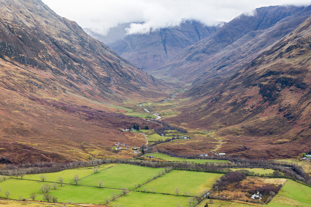 Sgurr an Airgid-22
 by
anniesmountains, on Flickr
Beinn Fhada. Enough said! Sgurr an Airgid-23
 by
anniesmountains, on Flickr
I made pretty quick work of the descent (as the path is so good) and just after going through the gate in the deer fence met the local shepherd going up to gather the sheep in. We were having a chat when we heard the skirl of the pipes way down below in the burial ground. Wow, goose bumps all around! Apparently, some people were filming something but nevertheless I finished my walk to the sound of the bagpipes on a truly Scottish hillside. (I hope the Americans heard them).
"And on a hillside, a Scottish hillside, You'll see a piper play his soldier home."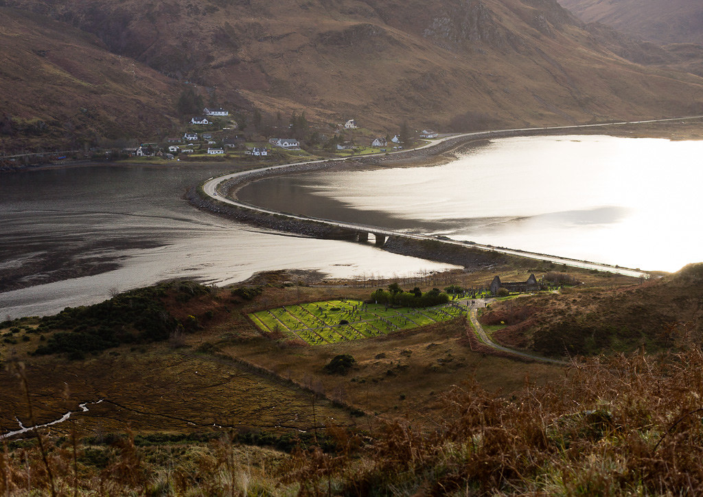 Sgurr an Airgid-24
 by
anniesmountains, on Flickr
Fantastic half-day outing - highly recommended.
