free to be able to rate and comment on reports (as well as access 1:25000 mapping).
To prepare for an ascent of Slioch, I thought I'd have a day out on Beinn Dearg! Ha, I think I got it the wrong way around.

This is one amazing but steep hill - Beinn Sgritheall hasn't got a look in. If it were a Munro it would probably be buzzing but I didn't see a living soul all day - just a couple of ptarmigan and a few deer, oh and lots of dead frogs - more later.
I knew at my pace this was a whole-day expedition so I set the alarm for 4:45 and was at the start ready to go at 7:10 am. It was a glorious morning and the walk up Coire Mhic Nobuil was lovely. Lithach looked magnificent on my right and Beinn Dearg looked formidable on my left. There is an easy ascent of Liathach (well, relatively speaking) up the back (north side) which I had considered before I knew I was capable of doing the hard way!
From the path looking back to Beinn Alligin.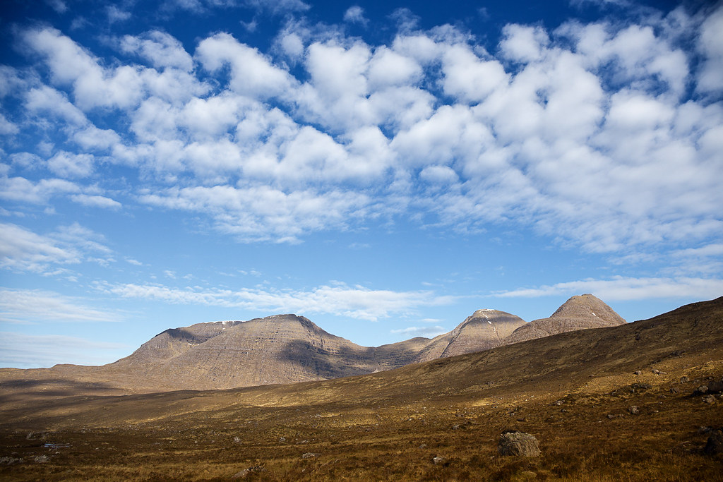 Beinn Dearg
 by
Annie MacDonald, on Flickr
I was doing the circuit anti-clockwise - this is looking up to the summit, which you can't see from here. The Castle is the top of the band of rocks on the right above the deep gully.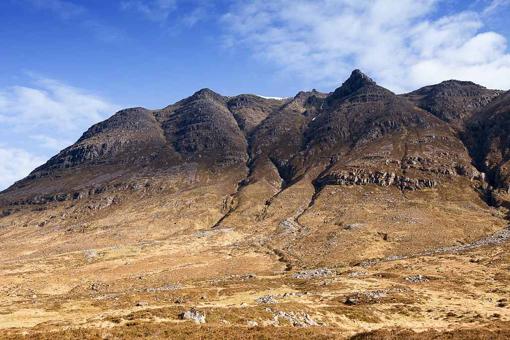 Beinn Dearg-2
 by
Annie MacDonald, on Flickr
Malky-c has a link in his report to a report on another webside which stated the walkers had descended near a small gully which looked a better bet than their route, so I decided to give it a try on the ascent. I get very fed-up walking long distances on low-level paths, so I could attain the ridge sooner this way.
The route up is the line up the centre. Only near the very top did I have to detour slightly to the left to bypass some rocks in the gully.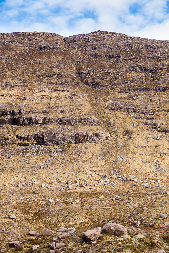 Beinn Dearg-3
 by
Annie MacDonald, on Flickr
Sail Mhor on Beinn Eighe as I was about to leave the path. Beinn Dearg-4
 by
Annie MacDonald, on Flickr
To say it is steep is an understatement. I soon packed my walking pole into the rucksack and it was all-fours all the way up except for two occasions where I managed to stop to take some photos. Otherwise it was pretty relentless. Near the top I followed the deer track off to the left to bypass a rock but other than that it was straight. It was quite a relief when the slope eased and I was soon on the ridge.
About a third of the way up. It's hard to appreciate how steep it is from the photo.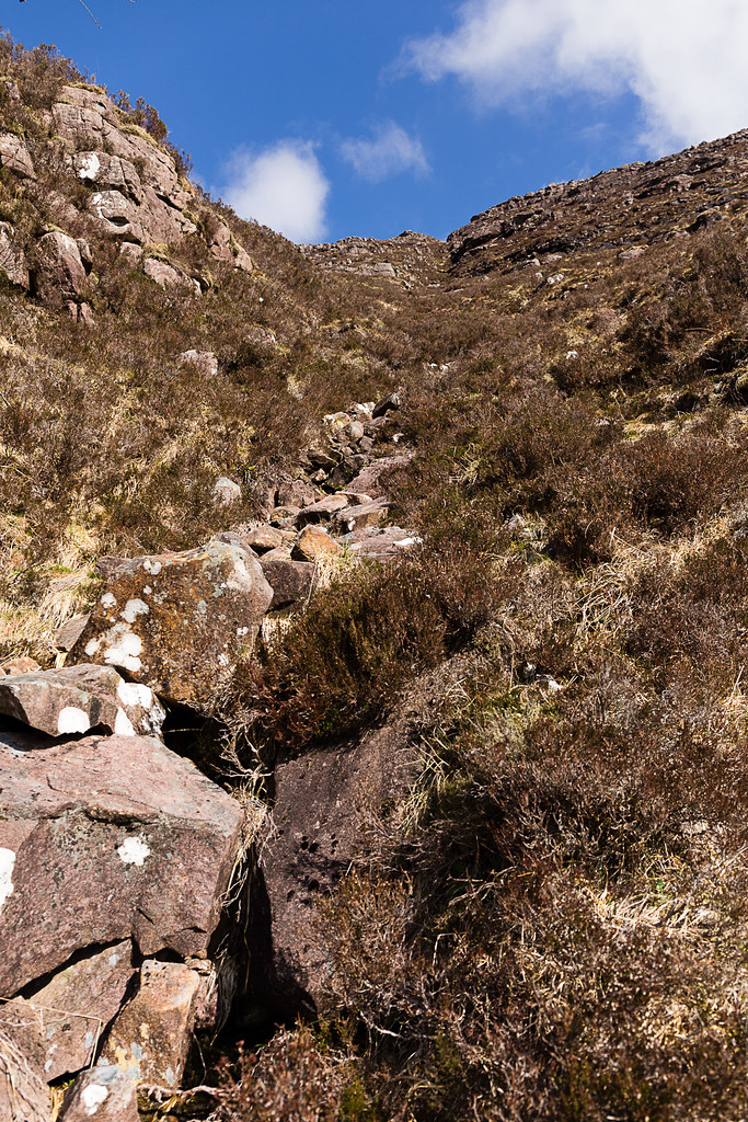 Beinn Dearg-5
 by
Annie MacDonald, on Flickr
All of a sudden there you are on the ridge! Looking across the corrie to Liathach.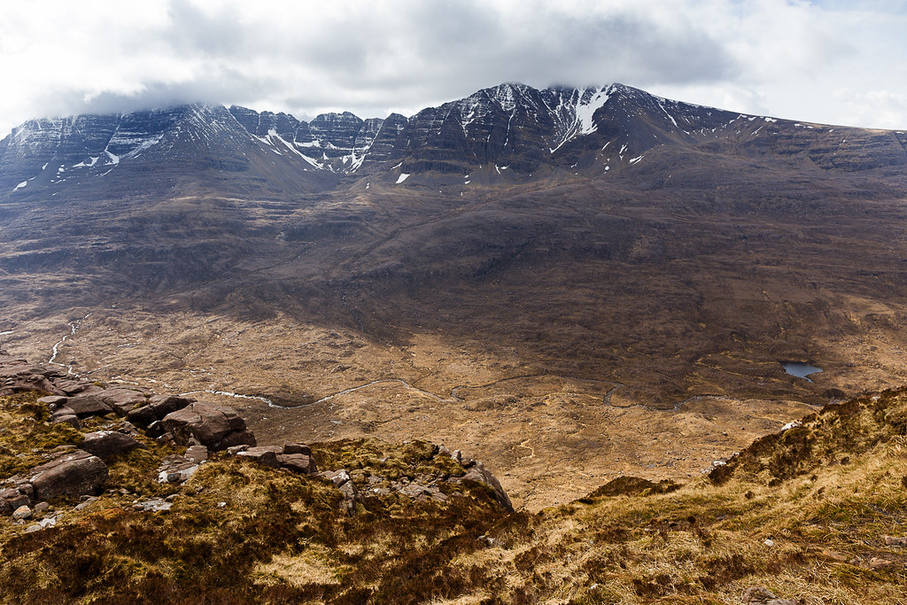 Beinn Dearg-6
 by
Annie MacDonald, on Flickr
The gap between Beinn Eighe and Liathach. I was just thinking this scene has not changed for millennia. 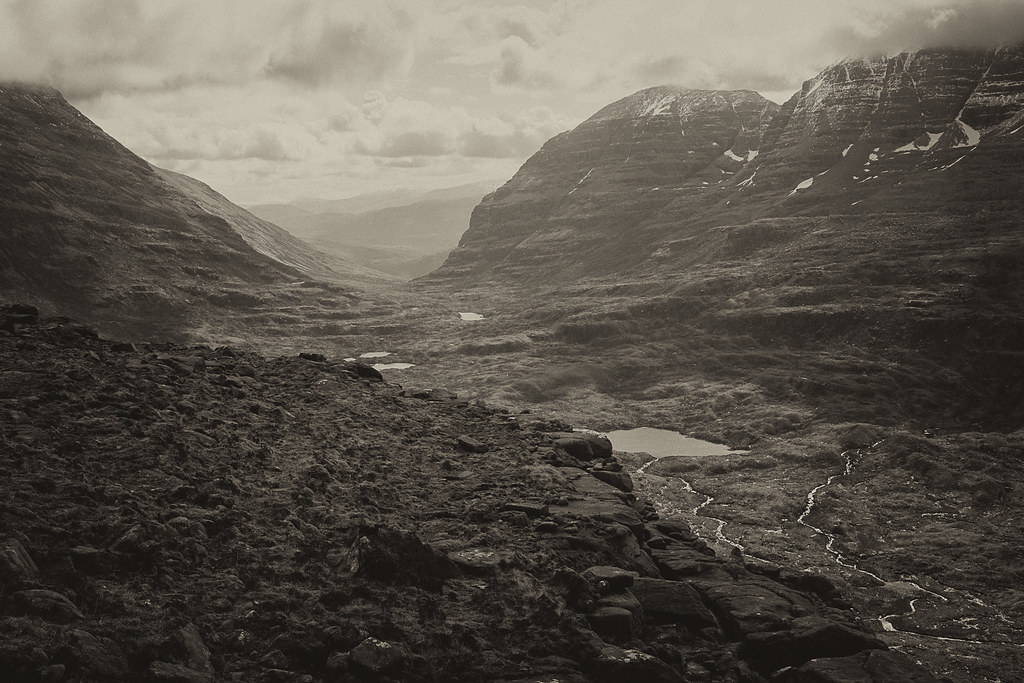 Beinn Dearg-7
 by
Annie MacDonald, on Flickr
Looking west - first sight of the Beinn Dearg ridge. You can see the lump of black rock that is the Castle on the left.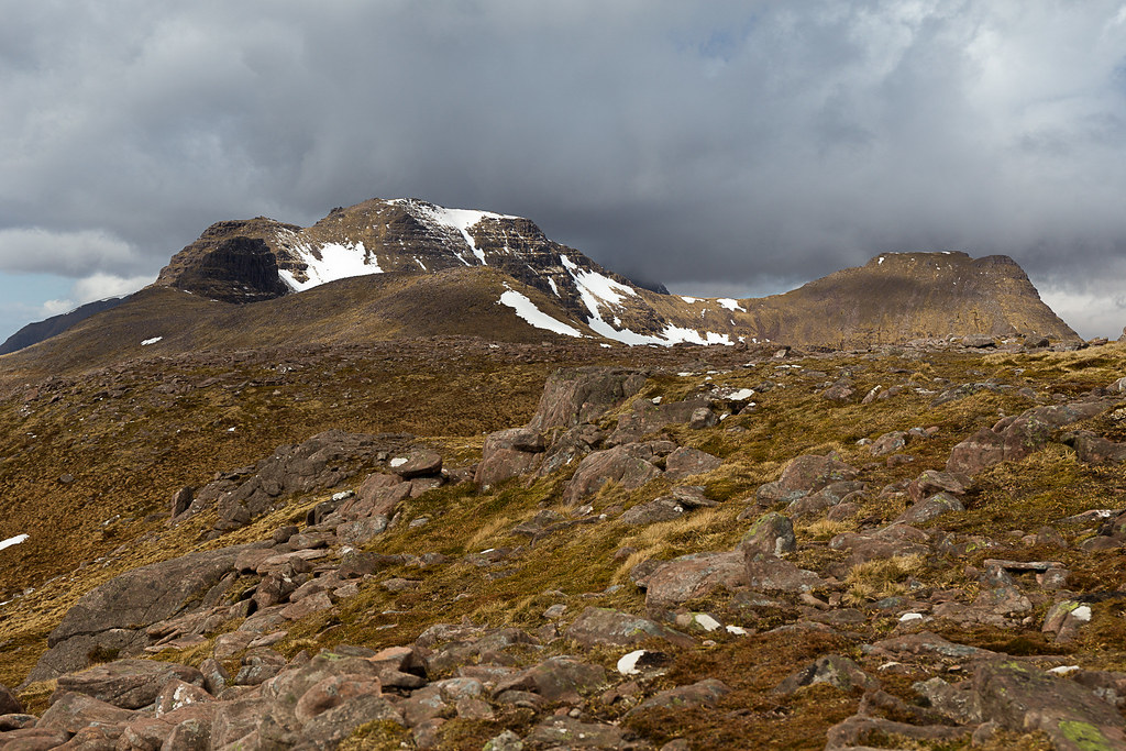 Beinn Dearg-8
 by
Annie MacDonald, on Flickr
And what a fantastic ridge it is. I came up at the lowest point and there are huge sandstone slabs reminiscent of Beann A'Chearcaill (where I was last week). After some photos I took a right (east) and headed for Carn na Feola.
I had a short early lunch here but I was getting more and more worried about the "Castle" which was looming in the distance. I got a bit of a shock when I first saw it as I had expected it to be smaller - it's a tall looming tower of rock the north side of which plunges down into the An Coire Mor.
Lunch view over to Liathach.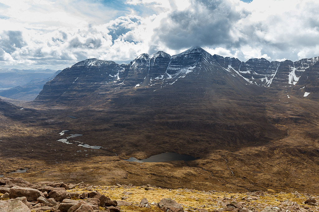 Beinn Dearg-9
 by
Annie MacDonald, on Flickr
The views of Baosbheinn, Beinn an Eoin, Beinn Eighe and Beinn a'Chearcaill are fantastic from the far north-east point of Beinn Dearg.
Baosbheinn and Beinn an Eoin with Loch na h-Oidhche in between. Loch a'Bhealach is to the left. The visibility was fantastic and you can see the Isle of Lewis and the Shiant Isles.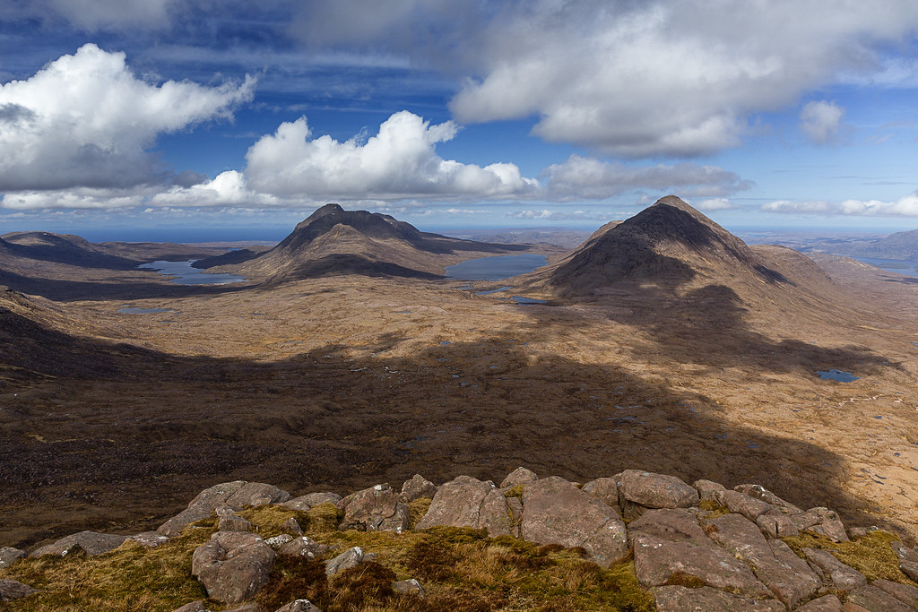 Beinn Dearg-10
 by
Annie MacDonald, on Flickr
Beinn a'Chearcaill, Slioch and Meall a' Ghiubhais.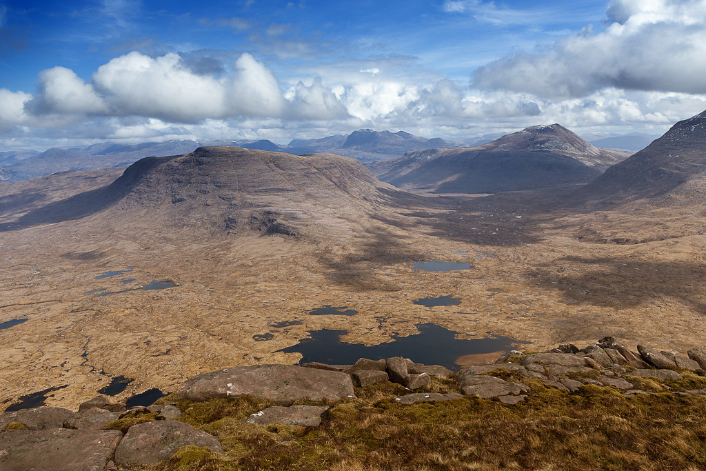 Beinn Dearg-11
 by
Annie MacDonald, on Flickr
Beinn Eighe is so close. Ruadh-stac Mor on the left and Sail Mhor with Coire MhicFhearchair in between.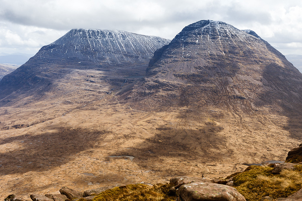 Beinn Dearg-12
 by
Annie MacDonald, on Flickr
Looking west along the whole Beinn Dearg ridge. I have to get to the very north-west tip to descend!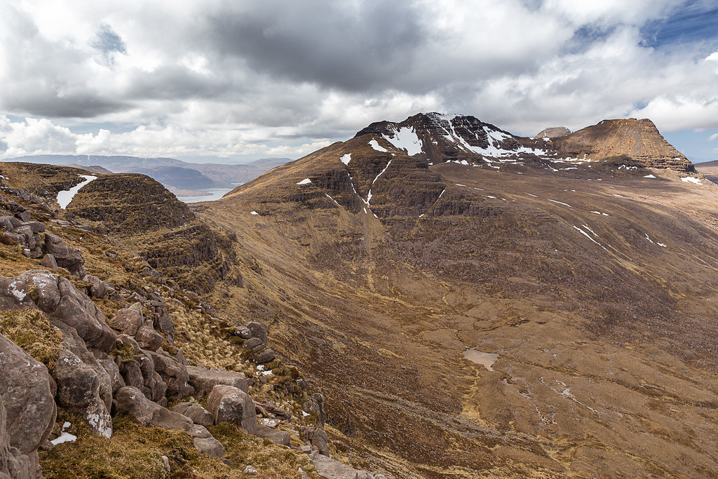 Beinn Dearg-13
 by
Annie MacDonald, on Flickr
The cairn on Carn na Feola with Spidean a'Choire Leith and the pinnacles behind.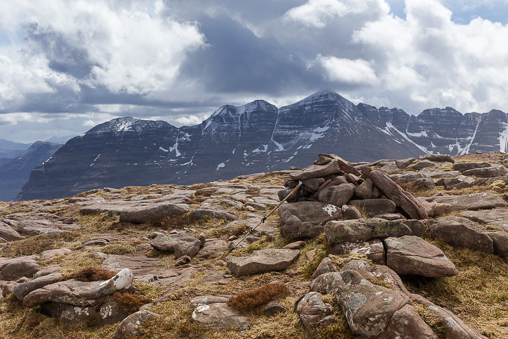 Beinn Dearg-14
 by
Annie MacDonald, on Flickr
On the return I passed a few small lochans and noticed they seemed to contain a lot of dead frogs. In fact I saw only two live frogs and probably about thirty dead - I'm assuming that the bad spell of winter weather recently cut off their oxygen supply as these shallow pools would have been frozen over and covered with snow. The frogspawn was also inert so there will not be many frogs on Beinn Dearg this summer

Back to the bealach of Coire Beag and then a shortish climb up to the peak between the two corries. This is where the views of the corrie below really opens up and the Loch a'Choire Mhor was quite a spectacular surprise. It had huge chinks of ice (covered with snow) floating in the dark, dark water. However, I also woke up to the fact that one of the by-pass options of the Castle was cut off - the steep northern slopes were totally covered in snow. Aaaaargh! I didn't stop long here as my nemesis was now looming and had to be faced one way or another.
The unnamed top between Coire Beag and An Coire Mor.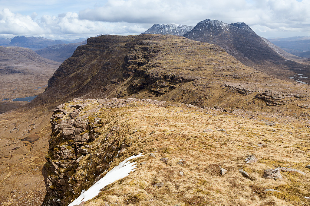 Beinn Dearg-15
 by
Annie MacDonald, on Flickr
Loch a'Choire Mor with the summit behind.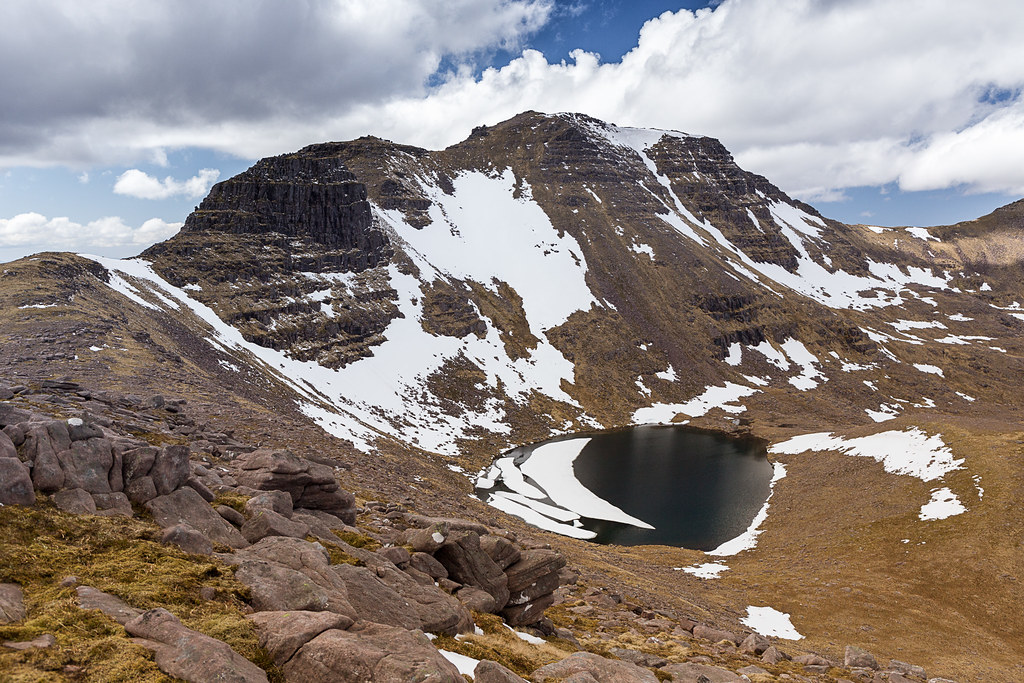 Beinn Dearg-17
 by
Annie MacDonald, on Flickr
The main reason I took the anti-clockwise route was so that I could assess the up-climb rather than the down-climb and this turned out to be a wise decision. At the base of the tower it looked huge and it also appeared that it got more complicated the higher up the terraces went (there are three). I'm not too frightened by exposure but what does worry me is that I might become cragfast. There wasn't another soul on the hill and I fairly quickly made the decision to take the by-pass path on the left. I actually like a bit of scrambling but what worried me was that my legs might not have enough reach to get to all the steps/holds - I'm 5ft 2in. So by-pass it was.
The Castle up close. I decided on the by-pass to the left.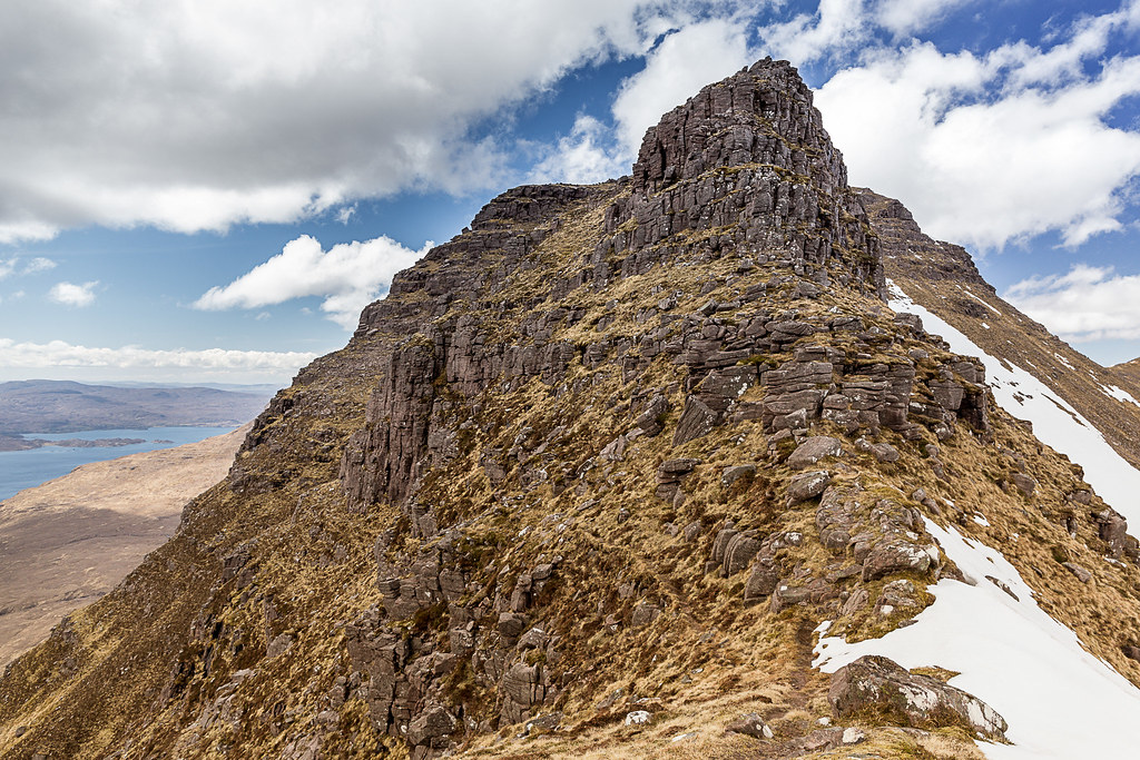 Beinn Dearg-18
 by
Annie MacDonald, on Flickr
Well, I did remember seeing in BP's report that the by-pass does not mean that the towers don't need to be descended (in the other direction). Well, this turned out to be true, as the path I took does not seem to be evident from the west side and involved quite a bit of very steep re-ascent. As for the 'path' itself, what to say? It's most definitely a deer trod on a terrace which itself slopes at a steepish angle towards the abyss below. So, one has to take one step at a time on a very narrow (4 - 5 inches maybe) path on a sloping ledge - it took a tremendous amount of concentration and nerve!
However, there was one small shelf where I stopped and got the camera out. I think it's the only time I looked down! Here are the photos.
I found a small spot where I could stop and take photos. Looking back the way I had come ...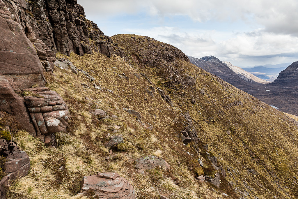 Beinn Dearg-19
 by
Annie MacDonald, on Flickr
... and the way ahead.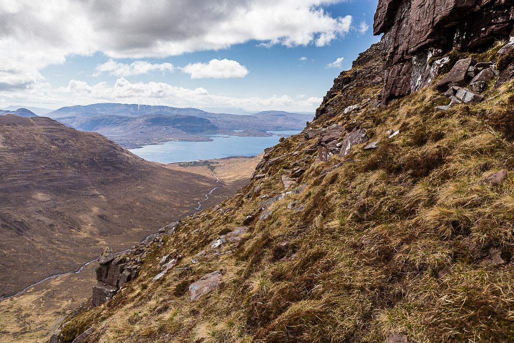 Beinn Dearg-20
 by
Annie MacDonald, on Flickr
... and looking down into the gully.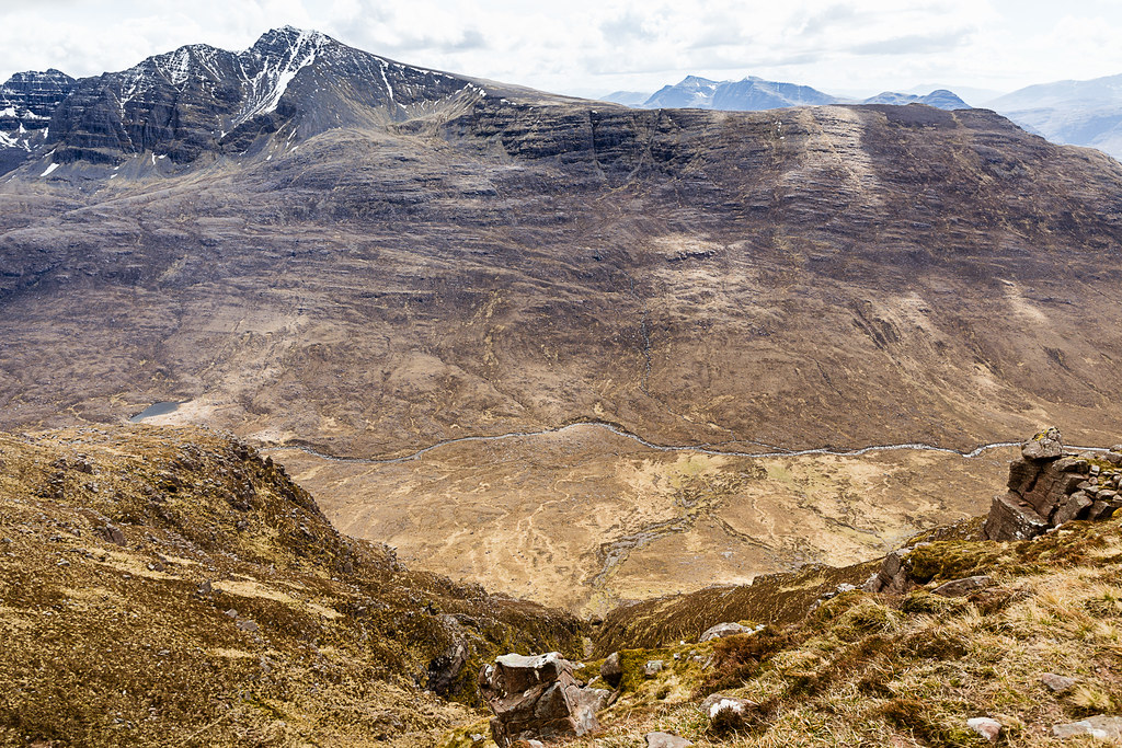 Beinn Dearg-21
 by
Annie MacDonald, on Flickr
I carefully carried on around the shelf and then joined a gully which was opening out to a fan shape towards the bealach on the west side of the Castle. I still had the very steep ascent but it was no steeper that the main ascent so I was on more familiar territory. Boy, was I happy when I got to the bealach, but I didn't stop until I got up to the next spot where I could put my back-pack down and thank my lucky stars that all was well.
Looking back to the bealach where I surfaced (so to speak!). I'll post some extra photos in a comment to mark my route - for anyone else who wants to try it!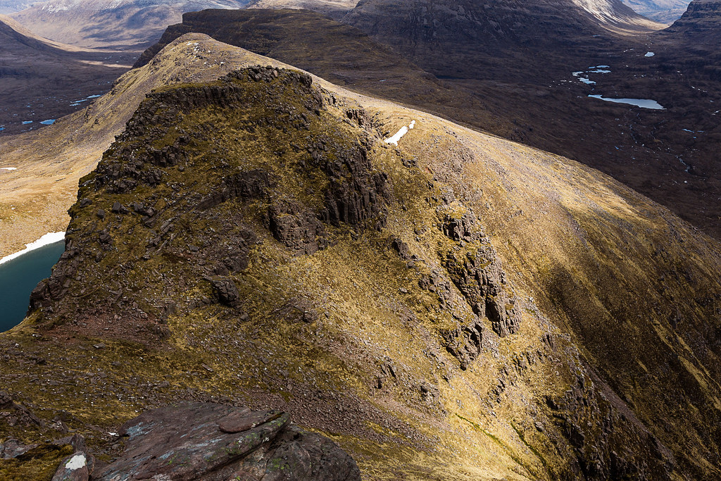 Beinn Dearg-22
 by
Annie MacDonald, on Flickr
There's a little promontory which affords some more amazing views of the west end of Liathach and the summit ahead to the north.
My car is somewhere down there in the woods. Beinn Bhan is behind Beinn Shieldaig and the Cuillin in the distance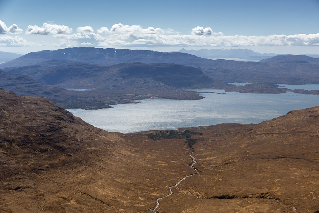 Beinn Dearg-23
 by
Annie MacDonald, on Flickr
So just a wee walk and clamber over some rocks and there's the summit cairn. The top itself is broad and grassy with plenty rocks behind which to shelter from the wind (it wasn't very windy - just a bit cold in the breeze) so I picked a spot across from Beinn Alligin and had lunch proper. By now it was 3pm and I had been on the go for almost 8 hours! I really enjoyed my lunch as I believed it was plain sailing from now on and called my sister to tell her I was past all the difficulties and not to worry about me.
 Looking back.
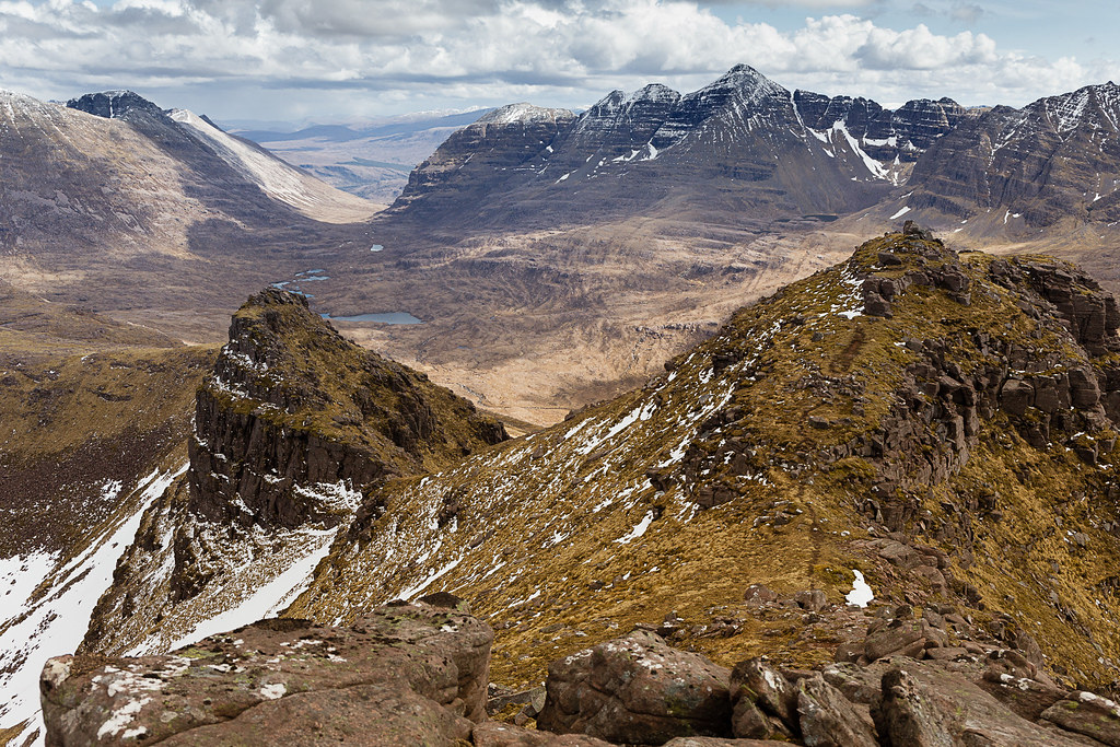 Beinn Dearg-24
 by
Annie MacDonald, on Flickr
Liathach from the summit. Beinn Dearg-25
 by
Annie MacDonald, on Flickr
Over the west end of Liathch are Maol Chean-dearg, An Ruadh Stac, Beinn na h-Eaglise and Beinn Damh.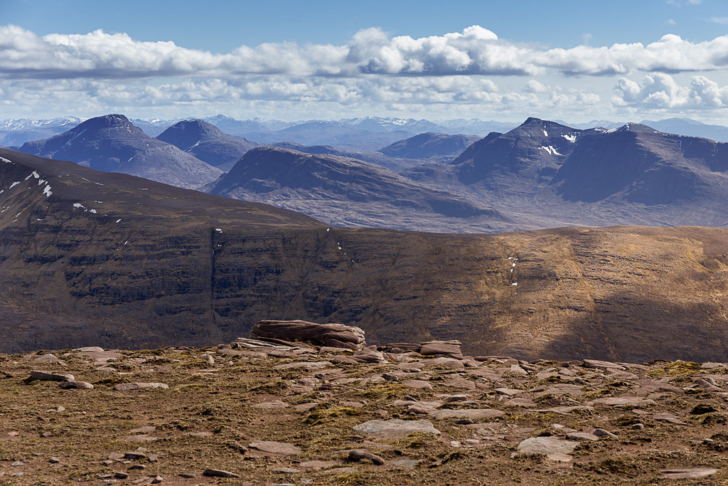 Beinn Dearg-26
 by
Annie MacDonald, on Flickr
The cairn and Liathach.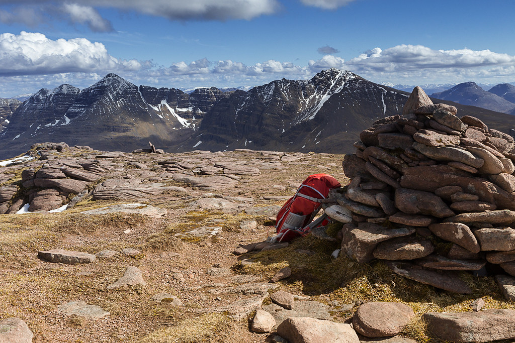 Beinn Dearg-27
 by
Annie MacDonald, on Flickr
I set off refreshed down from the summit plateau towards Stuc Loch na Cabhaig and clambered down some rocks when the path bore right to get round a pillar (this part is quite steep) to the north side which, of course gets no sun and a very exposed part sloping down to the right was covered in snow. No footprints and an enormous drop down to An Coire Mhor on my right. The snow was wet and very slippery and I had no idea if there was ice underneath. I don't know why I didn't think of going back a few metres and look for an alternative way on the left side which was in full sun, but no, I spent some time with my lone walking pole trying to make 'steps' for my boots that had a semblance of being flat. This I did and sheepishly took the three or four steps which got me safely across - otherwise I would not be here to tell the tale. I don't know if I 've described it for a proper visualization, but that was the only time I was truly frightened throughout the day. In retrospect, I see that I should have paused and looked for an alternate way to get past this section.
Yet another bealach on the ridge - looking up to the last climb - Stuc Loch na Cabhaig.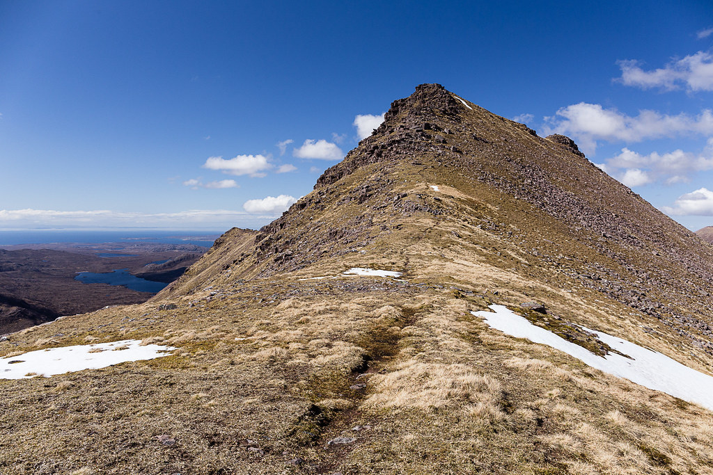 Beinn Dearg-28
 by
Annie MacDonald, on Flickr
And looking back. The snowy bypass was to skirt the nobbly bit to the right of centre on the skyline.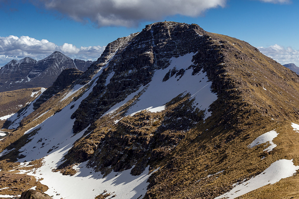 Beinn Dearg-29
 by
Annie MacDonald, on Flickr
From then on it was plain sailing up to the Stuc. This really is the most northerly point of Beinn Dearg but there is a small rib out to the north-east which I decided to leave be as I was needing to get down and I knew it would be quite a steep descent. I could see the Beinn Alligin path tantalizingly close but a long way down.
The northern tip of Beinn Dearg looking towards Baosbheinn and Beinn an Eoin.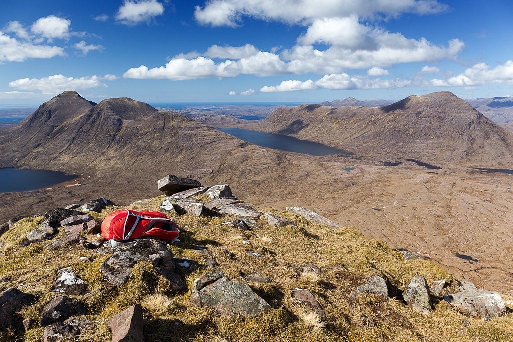 Beinn Dearg-30
 by
Annie MacDonald, on Flickr
Beinn Alligin with the lengthening shadows.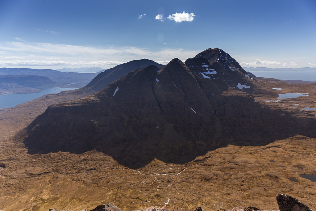 Beinn Dearg-31
 by
Annie MacDonald, on Flickr
Looking back to Stuc Loch na Cabhaig.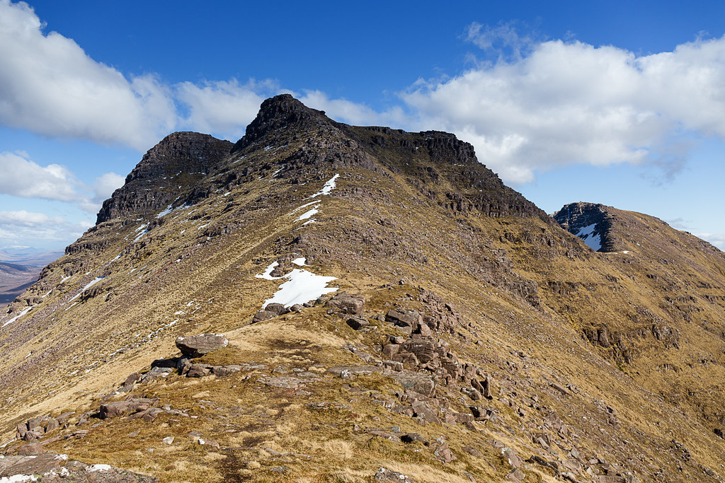 Beinn Dearg-32
 by
Annie MacDonald, on Flickr
The first part of the descent was on a pretty well-defined path which zig-zagged down on an unstable, sandy surface. Yuck. So I decided to abandon that and go for the steeper but deer-friendly option in a west-south-west direction. The going was slow and steep but fairly safe and simple compared with what I had confronted earlier in the day. Once down into the corrie there was no wind and it was a beautiful warm evening. A few deer grazed where a shieling had evidently been (no photo) and I easily progressed down the Beinn Alligin path back to the car park. I had a wee chat to a German/ Dutch couple who were camping in the woods near the road - what an evening they had - warm, sunny, no midges and in the foothills of Beinn Alligin/Liathach with an abundance of cool Allt a' Bhealach water. They were the first people I had seen all day.
My route down was left of centre. Steep but with no problems.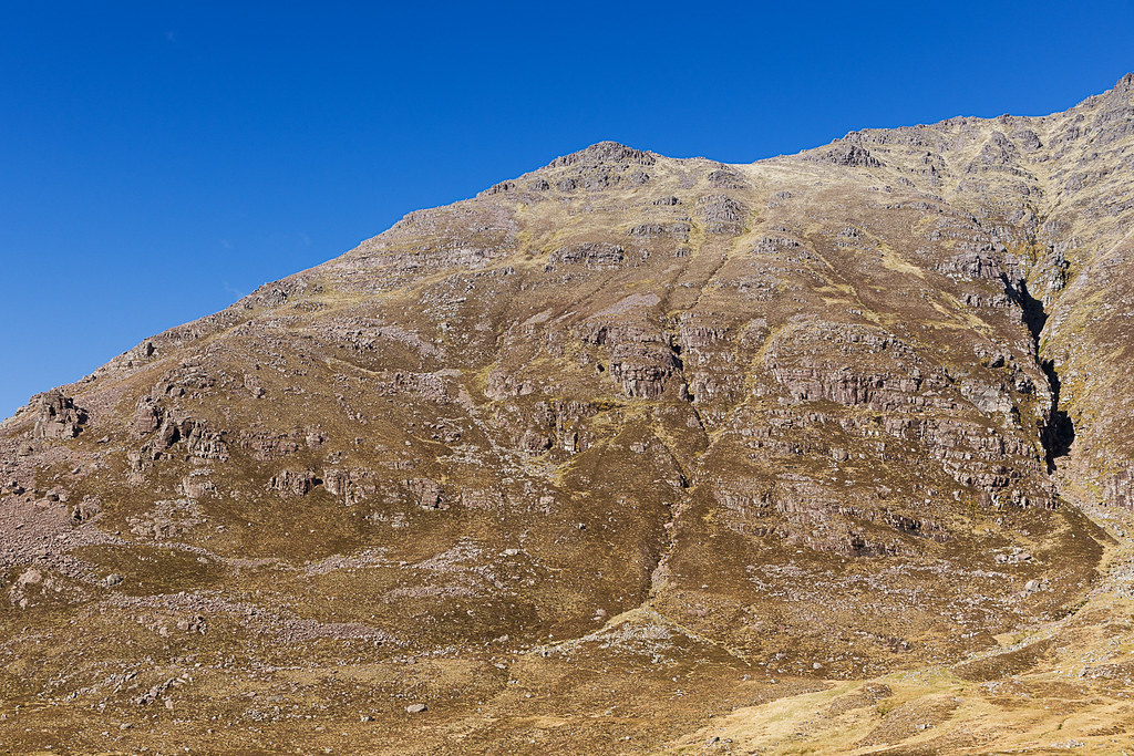 Beinn Dearg-33
 by
Annie MacDonald, on Flickr
Almost at the path - the steep, steep sides of Beinn Dearg on the left.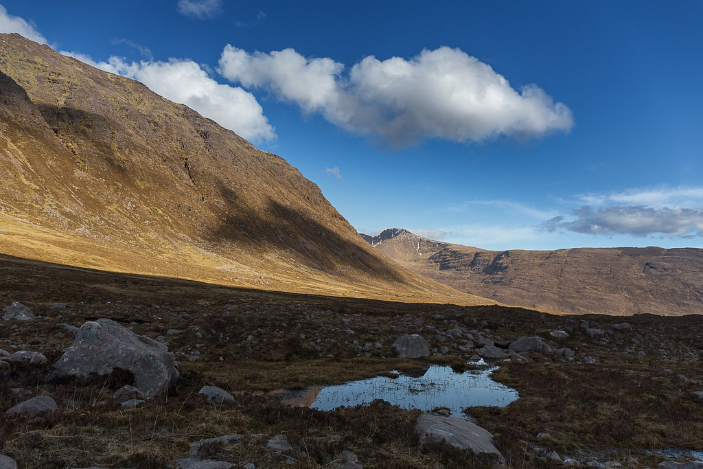 Beinn Dearg-35
 by
Annie MacDonald, on Flickr
This has to be one of the most exciting hills in the Highlands and I'll probably be back one day - yes, honestly

I was pretty tired when I got home - as much from the prolonged periods of concentration as from the physical exertion!
(Note: Flickr has had some major changes and it appears that the GPS data is not included in the EXIF data - sorry about that - it's definitely there in Lightroom.)
