free to be able to rate and comment on reports (as well as access 1:25000 mapping).
Another trip from the Falkirk Community Trust's splendid outdoor programme. The sun was shining, the air was balmy and Craig, our great leader, confidently predicted we would be back at the minibus by 6pm, latest. I whispered to Sandra - no chance, add at least an hour, if not two. She looked at me knowingly! We left the car park at Keiloch and cycled to about 1.5km short of the ruins of the Slugain Lodge.
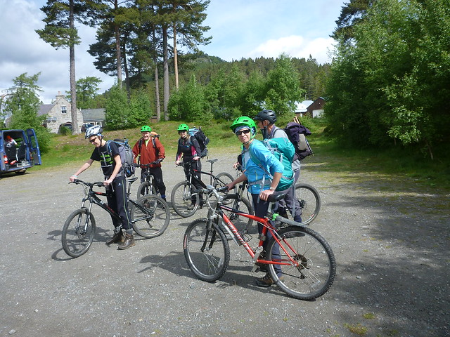 P1070987
 by
Emmanuelle Tulle, on Flickr
Of course we missed the turn off for Slugain. Follow all signposts for Glen Quoich and Slugain until the signpost which says Glen Quoich - take the track there. The woodland changes too: from lush green, tall and elegant pine and deciduous trees to native birches and wild flowers. The track is OK, a bit rocky in places, but passable and it hugs the Allt an t'slugain.
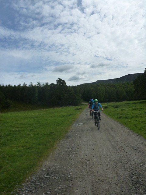 P1070992
 by
Emmanuelle Tulle, on Flickr
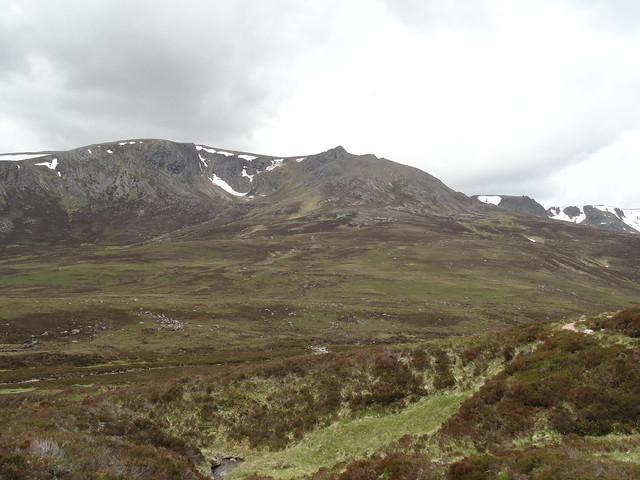
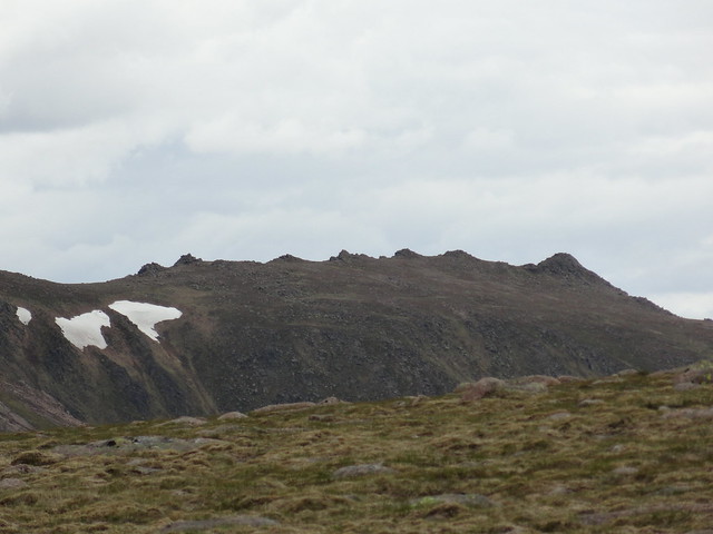
Beinn a'Bhuird came into view after a while and the cycle through the fairy glen was really quite pleasant. We eventually dropped off the bikes and continued on foot by the low path past the ruins initially and then up to just beneath Carn Eas.
 Fairy Glen with Beinn a'Bhuird peaking out
 by
Emmanuelle Tulle, on Flickr
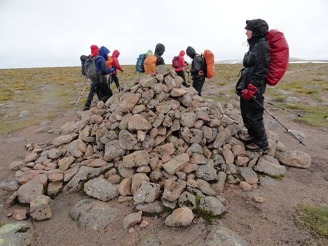
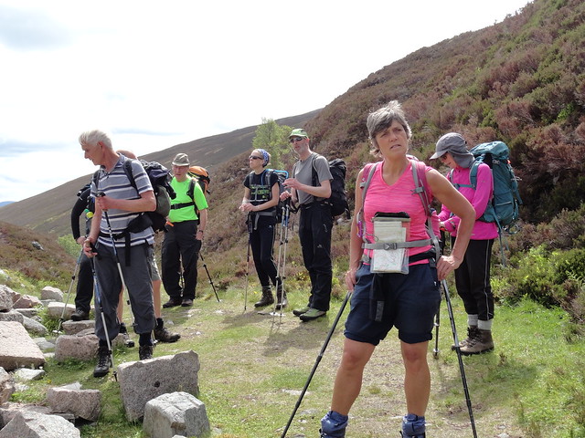 The gang
 by
Emmanuelle Tulle, on Flickr
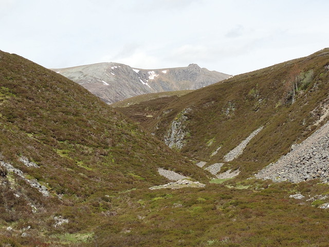
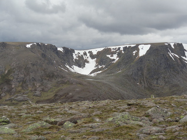
We had a short break and admired the views across to Coire na Ciche and the many specimens of dwarf cornels lying here and there by the path. The clouds were coming in but remained high and it still felt quite muggy.
 Coire na Ciche, Beinn a'Bhuird
 by
Emmanuelle Tulle, on Flickr
We then hurled ourselves up to Carn Eas and our efforts were rewarded by a brisk but easy walk across the summit plateau of Ben Avon but also some nice views of Beinn a'Bhuird behind us.
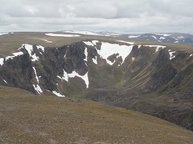
 Dubh Lochan, Beinn a'Bhuird
 by
Emmanuelle Tulle, on Flickr
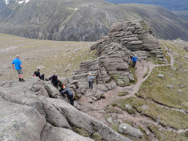
Three of us made a quick detour to the tor of Stob Dubh an Eas Bhig, just for the hell of it

, whilst the others wisely headed for Leabaidh an Daimbh Bhuidhe. What a strange landscape - such flatness disturbed and I suppose given interest by these lone tors which from a distance look fairly unassuming but close up are actually quite substantial structures.
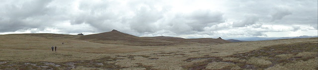 Ben Avon pano
 by
Emmanuelle Tulle, on Flickr
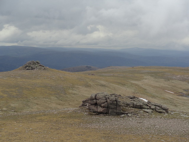 Minor tors, Ben Avon
 by
Emmanuelle Tulle, on Flickr
 Ridge to Stob an t Sluichd
 by
Emmanuelle Tulle, on Flickr
I reached the true summit last, put my rucksack down and scrambled easily up to the tallest outcrop. This gave superb views of the whole area and was a fine reward for a fine and relatively easy trek.
 Standing on the summit, Ben Avon
 by
Emmanuelle Tulle, on Flickr
 Choire Garbh
 by
Emmanuelle Tulle, on Flickr
Lunch beckoned at the foot of the tor and we soon set off again towards the sneck. The North Top of Beinn a'Bhuird could just be discerned. Given that it is about 5km away gives a good idea of the reasonable quality of the air and of the featurelessness of the summit plateau. All this was soon to change.
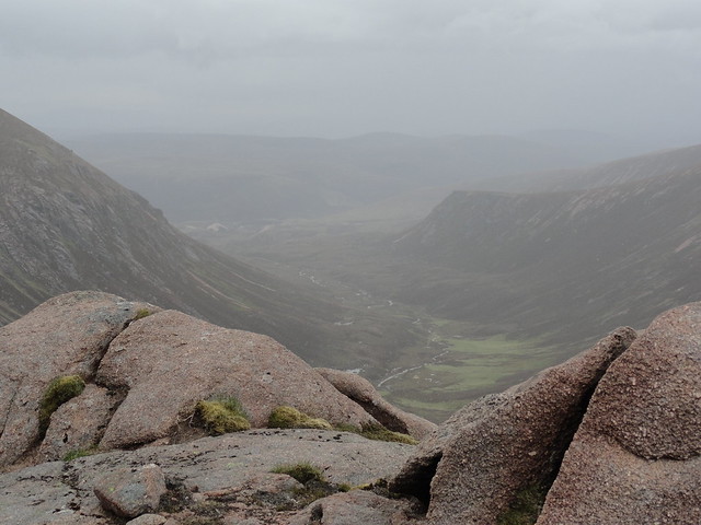
Just as we were about to begin the descent to the sneck, the rain came on. So people stopped to begin to waterproof themselves. I waited till a bit later, in the shelter of rocks which was also my cue to take a pic or two of the view down Slochd Mor and the tendrils of water running into the Avon.
 2015-06-25 16.14.37
 by
Emmanuelle Tulle, on Flickr
Then the weather became positively grim and there was nothing to do but keep one's head down and climb up to Cnap a'Cleirich. Some rushed to 'tick' it, I preferred to just plod on, figuring that one day I'd come back in better weather and make a point of ticking all the prominences of this unusual landscape. From there it takes a good 15 minutes to reach the summit cairn. We didn't linger as the rain was by then pretty unrelenting and it was like looking through a misty windscreen.
 North Top, Beinn a'Bhuird
 by
Emmanuelle Tulle, on Flickr
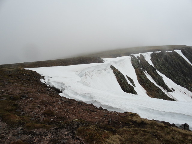
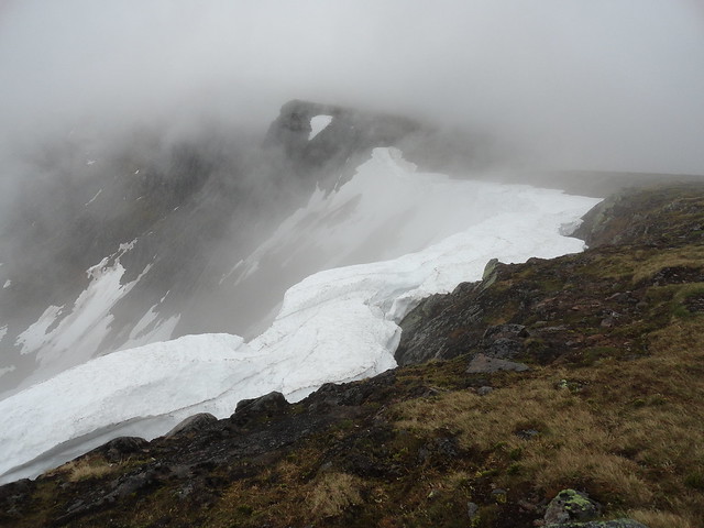
However occasionally the mist would thin and give us great views of the huge cornicing that was (at time of walking) still shrouding the two corries which are gouged into the Beinn. These were more than cornices - they were proper snow fields, breached by impressive crevasses, although they didn't look close to melting through and collapsing. If I had time, I would love to go back in August to see how big they still were. I reckon they will last out till the next snows unless we get a long heatwave. The mist cleared for long enough to give us a view into Dubh Lochan and its smaller partner. I stopped for more pics, letting the others rush ahead of me, including two who raced to the South Top! On the way down to Carn Fiaclach, our progress was barred by a large snow field down which Craig, Sandra and I slid on our waterproof-clad bums, to our great delight - an easy 100 yards! We came out of the clag a wee bit further down and rejoined the path proper. Great views of Ben Avon opened up to us. After we forded the Quoich Water, we had another 3km to the bikes by the high path. I never had the opportunity to go in search of the howff but I have a fair idea of where to go and look for it

Next time...

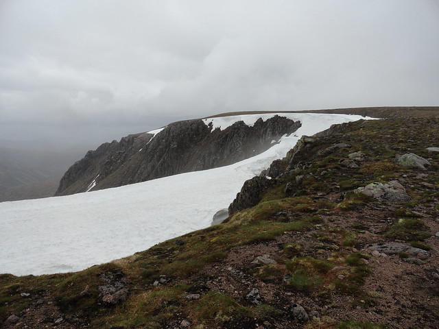 Snow hanging off the rim of Coire nan Clach
 by
Emmanuelle Tulle, on Flickr
 2015-06-25 17.33.26
 by
Emmanuelle Tulle, on Flickr
 Crevasses and mist rising up the Coire
 by
Emmanuelle Tulle, on Flickr
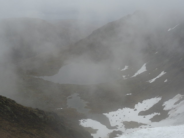 Dubh Lochan
 by
Emmanuelle Tulle, on Flickr
Back to the bikes. We shed some layers as the weather had improved again and the glide back down to the forest paths saw me back at the car park about half an hour later. It was 8pm by the time the last of the 9 cycled in. I was right
The midges were a bit annoying (I have experienced much worse) so we didn't linger. We all piled into the bus and drove to Braemar in search of a chippie (nae luck
). So back to Falkirk in the last of the light.
