free to be able to rate and comment on reports (as well as access 1:25000 mapping).
Sub 2000 ft Marilyns: Bin of Cullen, Knock Hill, Fourman Hill, Meikle Balloch Hill.
Date: 18/07/2015.
Distance: 5km/2km/5km/6km
Ascent: 210m/220m/270m/270m
Time taken: 50 min/30min/80min/80min.
Weather: Sunny but very breezy on the summits.
Having Saturday to myself and access to the car (a rarity for both at the same time), I had hoped to do a bike-and-train assisted traverse from Glenfinnan to Loch Arkaig, but the weather forecast seemed to be telling me otherwise.
I quite fancied some of the lowland Aberdeenshire Marilyns, but I'd never felt them to be worth the drive from Inverness. I suppose I assumed one day I'd take my bike out to Keith or Huntly on the train and pedal round a few of them. However the car was just far too convenient, so I set off in it after lunch, stopping at the Speyside Brewery in Forres on the way through for some of their excellent Bow Fiddle Blonde (they were shut actually but I managed to get some in the Co-op down the road)
I decided to go up the Bin of Cullen first. I took a slightly circuitous route to the foot (as I'd never been through Buckie before, or strayed north of the A96) and parked up near Braidbog at 3pm. An easy wander through the woods on forestry tracks took me to the upper part of the hill. There were a few families and dog walkers about.
Woods beneath the Bin:

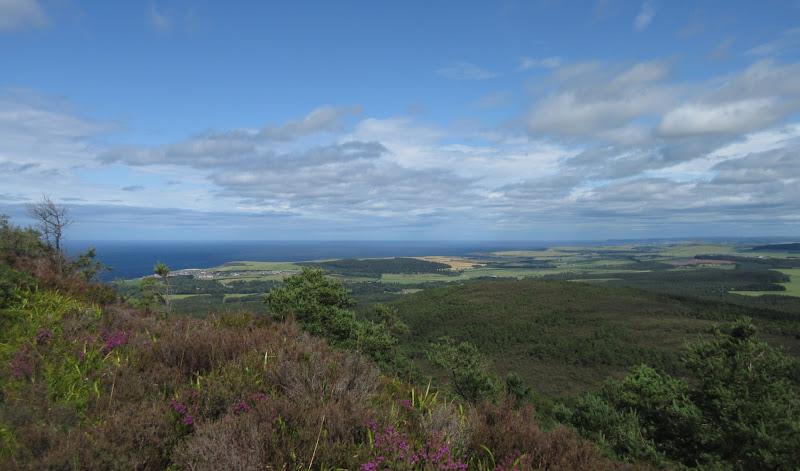
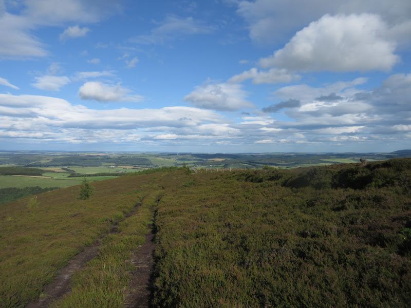
The path zigzagged up through thinning trees, but I followed a shortcut straight up. Soon I was above the trees with views out over the North Sea. Sutherland looked wet and claggy, but I was in the sun. Nice views up and down the coast.
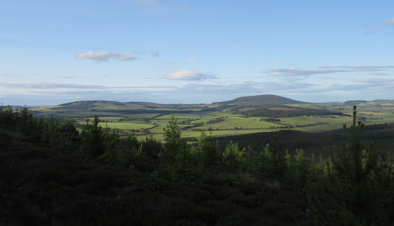
NE from the summit:
Knock Hill to the south:

West across Spey Bay:

SW to Corryhabbie and Ben Rinnes:
Cullen:
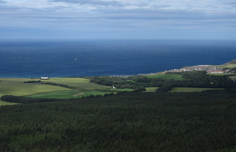
…and Cullen Viaduct:

Then it was back down the same way. Below the treeline, the walking was pleasant but lacking in views. Next stop was Knock Hill. I had a quick look at my road atlas and probably chose the most direct way to it
Knock Hill from Newbigging:

-----------------------------------------------------------------------------------------------
I planned to park up next to the A95 and walk to Knock Hill, but it turned out that the track to Swilebog was actually tarmacked, and didn't have any 'private' signs along it. That cut the length of the walk by almost half! I parked up at a small area of hardstanding and followed the marked path up the hill - obvious if a little boggy and trench-like in places.
East across Glenbarry:

Bin of Cullen from the summit of Knock Hill:

Summit sculpture:

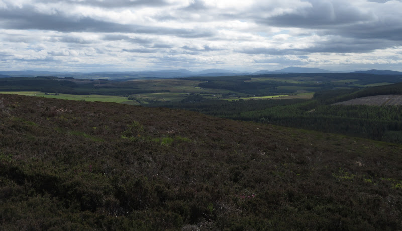
Glen Rinnes hills:

This is probably the most prominent of the lowland NE hills, but the dome shape makes it a fairly unvaried walk, albeit with good views of the surrounding countryside. While it was warm and sunny on top, the wind was also so ferocious that it was quite difficult to stand still long enough to take a photo to the west. At this point I was quite glad I wasn't on top of Streap! I returned the same way, being low on imagination today.
Descending back to Swilebog:
-----------------------------------------------------------------------------------------
Fourman Hill was a short drive away via the attractive village of Milltown of Rothiemay. There were definitely comparisons to be made with rural Shropshire around here. I'd had similar thoughts when working down there 3 years ago.
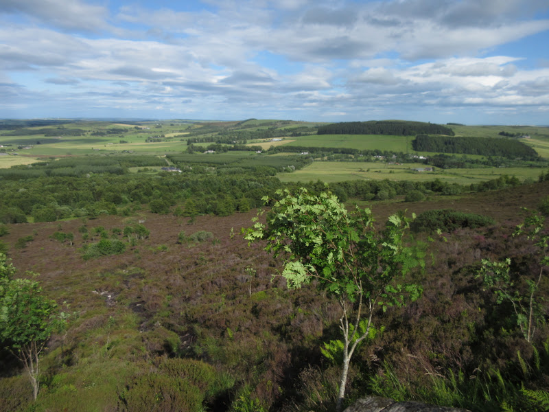
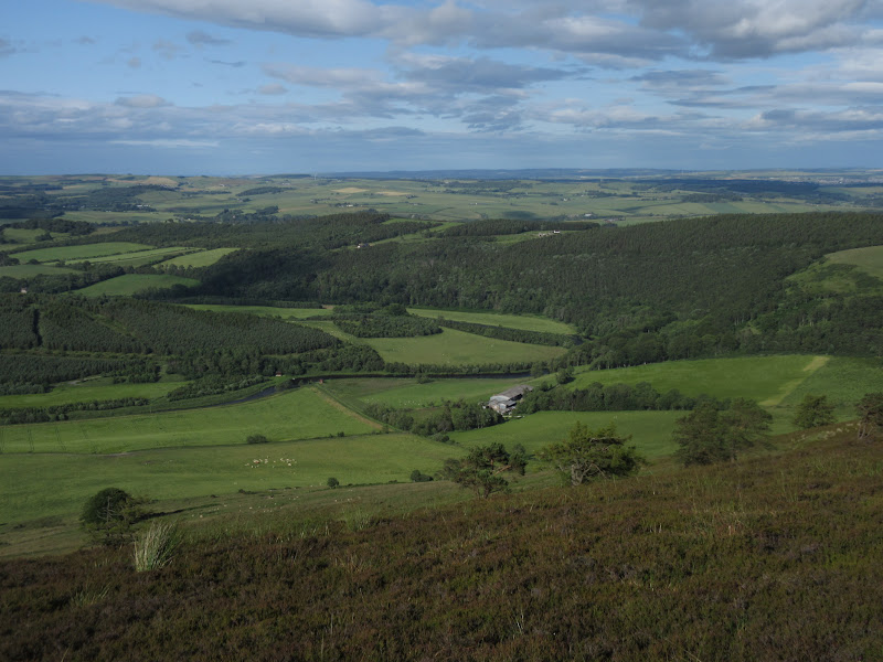
I parked up at a layby an short way into the woods after Corniehaugh. On the opposite side of the road, a track led up into mixed woodland and climbed up to Fourmanhill. After breaking out of the trees, the views out over the valley of the Deveron dominated - this is a larger river than I'd realised.
River Deveron:

…with Knock Hill in the background:

Once level with Fourmanhill, I discovered I could have driven up there if I had approached from the A97. However I had quite enjoyed the walk up from the river, and it made the route a little longer and more varied.
Fourmanhill:

The Deveron again:

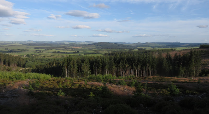
At the end of the tarmac, I had intended to contour the hill by a track on the north, then strike up to the summit. However there seemed to be a decent enough path along the top of the ridge so I followed that.
On the E shoulder of Fourman Hill:


Sure enough, it took me nicely to the summit, which was overrun with gorse (I remembered this from
litljortindan's report, although not soon enough to remember to put long trousers on

). Some of the more recognisable Aberdeenshire and Moray hills were on view, but the River Deveron dominated.
Tap o’ Noth and The Buck:

Bennachie:

Turriff:

I cut straight down to the north through thick heather to meet the contouring track, and followed this back to Fourmanhill high above the river. This was my favourite part of the day. Soon I rejoined my outward route and dropped back to the car.
As you are probably aware, my wildlife identification skills are rudimentary at best, however I think I see more in rural lowland areas like this than I do in the middle of nowhere. Petty sure I spotted a couple of buzzards and some yellowhammers. Too slow with the camera as usual.
Corniehaugh farm:
Knock Hill again:

---------------------------------------------------------------------------------
Despite a wrong turning, it didn't take me long to reach Meikle Balloch Hill. As I hadn't really looked at anyone's reports in much detail, I wasn't sure what the options were here. It appeared that my route up from Burnmouth Farm to the north was probably not much used.
Parking near Burnmouth Farm:

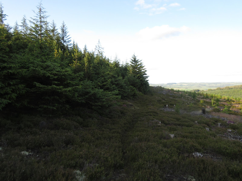
I followed a fairly unexciting forestry track past a couple of junctions before getting impatient, as the tracks wind around a lot. I took the first right, crossing Paties Burn and passing one of the intakes for Herricks water works. In order to get onto the correct track, I took a shortcut though a very heathery thinning in the forest.
I didn't have a proper map with me; just a screenshot of a bit of 1:50k OS on my phone, which didn't help much. Although the summit was only 100m above me, the hillside looked unpromising - a mixture of felled and newly replanted trees. I followed the track south to the point I would have ended up at if I hadn't bothered with the shortcut, then followed an unpromising looking line through felled trees, where some tree-felling machinery had passed before. I thought this was going to end in tears, but it wasn't too bad, and led me to a small band of thick conifers protecting the summit.
Felled area could be a disaster:
…but actually turned out quite easy in the end:
A small path contoured round these trees and before long I was ascending into bright sunshine. It was a nice time of the evening. I went slightly beyond the trig point for better views west - I think the true summit was here as well.
Knock Hill:
Ben Rinnes:
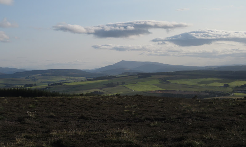
The weather was clearing up on the big hills. I hadn't been able to spot these earlier, but they were now appearing on the distant horizon.
Some of the big hills finally out of the clag – Cairngorm…

…Ben Avon…

…and Mount Keen:

Tap o’ Noth:

There was lots of new path work on the summit - what looked like a cairn from a distance turned out to be a pile of gravel for new path surfacing. I followed one of these routes to the NE for a different descent. I would be able to get to within 200m of the car on tracks before I'd have to take another shortcut through the forest.
Summit of Meikle Balloch with Knock Hill in the background:

Keith:

Knock Hill:

Descent from Meikle Balloch:

I was glad I took this route, as I saw a badger make a break for it and run across the track just as I was about to take my final shortcut

. The only badgers I have seen recently have been dead on the side of the road, so a good spot, I thought.
Back at the car before 8:30pm. A short distance down the road, a woman had managed to get a trailer stuck while trying to take a tight bend onto a bridge. It took about 30 minutes to help her out before I could be on my way. Then it was a quick chip stop in Nairn and then home.
The summit of the Bin of Cullen was well worth a visit, but as a complete walk, Fourman Hill was my favourite of the day as it had a lot of variety in a very short distance. The other two were pleasant enough, but I can't imagine making the effort to go back up them again.
