free to be able to rate and comment on reports (as well as access 1:25000 mapping).
Sunday the 12th of July, forecast: wet, showery, passing cloud. The best option: hot cocoa, slippers, newspaper. If you have a few pounds extra, maybe cinema and popcorn. Our idea of spending the day: two Corbetts, hundreds of peat hags and wet feet!
Yeah, sure, laugh if you want! My mountain obsession has already entered the severe stage...
We were desperate to squeeze something out of that wet weekend, Saturday was a no-no due to high winds, Sunday seemed a bit better so we packed up and drove to Glen Roy, where one can pick & mix different combinations of Corbetts and Grahams. We have been here before, to climb Beinn Iaruinn and I had good memories of the place. But that was a different summer altogether (2008 I think), hot and sunny. We scrambled up the steepest possible route up Iaruinn, sweating and swimming in high bracken, but views from the summit were well worth the effort.
Not to be this time, I thought when we drove up the glen. Cloud was holding on to the summits and I was getting ready to enter the world of clag. Well, nothing you can do about general weather patterns. If summer is c***p, it is and no amount of moaning can change it!
We decided to do the Eachach Carn Deargs, mainly because they looked a bit less steep on the map than the other Carn Dearg further down the glen. I guess whoever named these hills didn't have very vivid imagination, giving the same name to three similar steep-sided lumps!
Our route followed WH suggestion, up Glen Turret, over the two Corbetts and then down along the gorge of Allt Dearg. Simple as it sounds, it's mostly pathless and quite swampy, including a large area of peat hags on the first (western) of the two Red Hills.
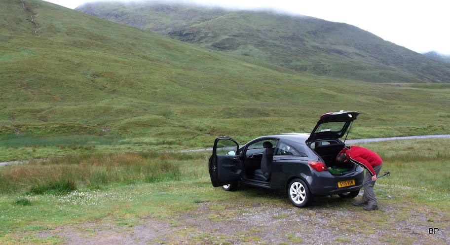
There's a good place to park on the grass just before a cattle grid, at the end of public road in Glen Roy:
This bridge gives access to the other Carn Dearg, which can be combined with a Graham, called Leana Mhor. One can park by the bridge as well. So this is a target for our next visit in this glen.

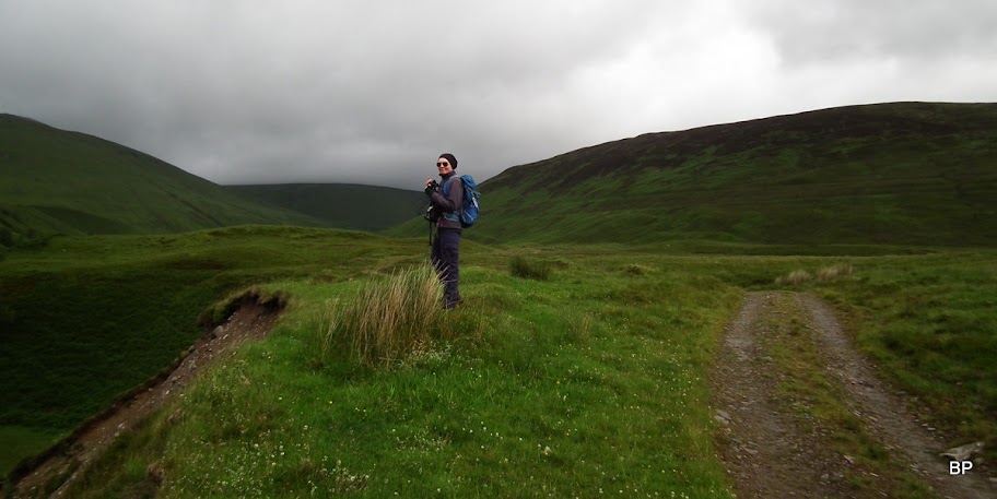
Walking begins on a good track (access to Brae Roy Lodge):

Ready for action:

Only as we prepared to leave, Kevin discovered he didn't take his GPS

It would be very useful in clag, but we decided we could just as well manage without it. It was then back to old times, with map and compass only. Needless to say that we had no problem navigating later on, even though the upper plateau on the first Corbett is rather featureless and can be misleading.
Past the Brae Roy Lodge, we came across this cute stony bridge:

We crossed the bridge and continued on the track into Glen Turret, admiring the meandering River Turret:

As you see in this picture, the cloud was still low and looked pretty dark... I held little hope for summit views at that point.
The track becomes more boggy as it enters the upper glen, and later it deteriorates to a wet path. Because it had rained the previous day and night, vegetation was wet, too, and the soil was saturated. Gloomp-gloomp-gloomp. Oh, how nice.
We reached the lonely chimney:

Looking back towards upper Glen Roy, not much improvement:

We kept pushing, hoping that maybe later on weather gods will be more favourable...
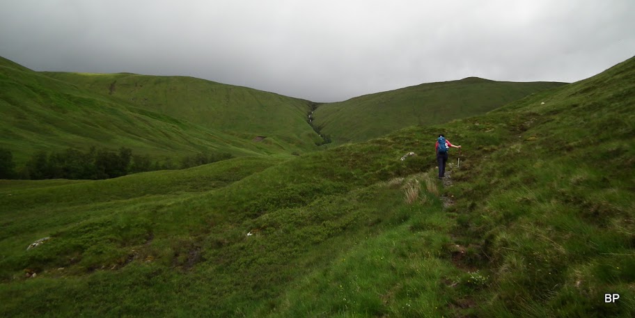
I was concerned about crossing Allt Eachach as rivers were in spate (no surprise here), but luckily, there is a footbridge. Our route up follows the slope on the right side of the gorge seen here in the middle:

It started raining when we reached the second "lonely chimney":

Past the footbridge, the path peters out and we tackled the slope face-on. We tried to zig-zag up just to make it easier - the grassy ground was so wet and slippery, that we needed some good balancing skills to stay upright

At least the shower remained behind us:

Surprisingly the cloud was beginning to lift and I noticed that the summit of our second target hill was now clag-free. With a bit of luck, we may get at least some views!

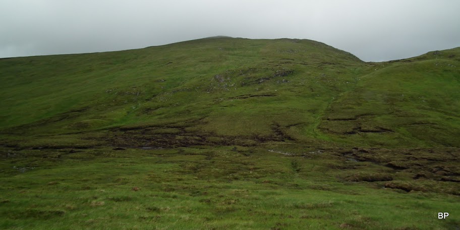
The first 200m of ascent are the steepest and once on higher plateau, the angle eased. We couldn't see the summit of our first hill as it was still in cloud, but we saw what awaited us before we could claim another Corbett... Guess what?
The lovely peat hags:

Some of these canals are to wide to jump over and in given wet conditions, too muddy to walk across them. So we spent a large chunk of time looking for the best way across. After Carn nan Tri-tighearnan training, it wasn't that difficult after all!

When we neared the summit, it started raining again, this time the rain was thicker and lasted longer. We walked over the first top and eventually spotted the summit cairn emerging from the mist. It was a cold and unpleasant place when we arrived, so we just snapped a few summit photos...

...before moving on to the second hill. The idea was to descend to the col between the two Corbetts. We walked out of the cloud and saw what was still to come... Hmmm, it's just Scotland for you - more peat hags!

As we began to descend, I realised that my feet were wet in my boots. Obviously, my old, well worn Berghauses started to leak!

By the end of the day I had two lakes inside, with my socks completely soaked. Yeah, that's Scotland for you
We noticed a small group of rocks and descended towards them. The rain has stopped so we sat down on a large boulder to stretch our legs and have some hot tea. We could see the peat hags in front of us could be avoided (mostly):
We managed to find the easiest way across the hag area and tackled the final uphill of the day. Another shower passed by, leaving me soaked from every angle

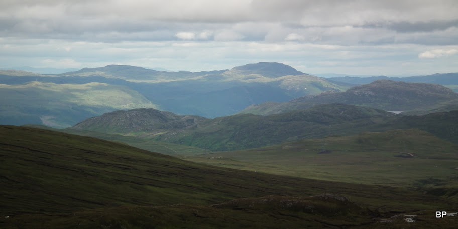
The cloud was shifting around and from time to time, lifting to reveal the higher peaks nearby. We caught a glimpse of Loch Lochy Munros:

Ben Tee zoomed:

The ascent from the col is less than 200m, after some dancing-balancing on saturated ground we reached the summit. Bingo! 98 Corbetts for me, 99 for Kevin. On the next duo we will be celebrating our respective centenaries! Lucy bagged her 8th and 9th Corbett.

At least cloud was above the top and we could take a short break for photos. We couldn't see the full extent of the views, but given current conditions, we were happy to grab whatever was on offer!
To the north, some gloomy sky, but also some sunshine:

Zoom:
Towards Corrieyairack Pass:

Back to Glen Roy:

Our break on the summit of the second Carn Dearg was interrupted by a very Armageddon-like cloud coming in quickly from the south. We wanted to get down before it reaches us - it really looked spooky!
The end of the world is coming, brace up!

We started descending due south, jumping over peat hags (less frequent here, thankfully), but we stood no chance outrunning the Armageddon cloud. As the rain came again, we had to gear up for the wet experience...

Watch out for the four horseman!

We picked our way slowly, slipping and sliding on saturated ground, poor Kevin lost his balance and fell to all fours, thankfully no damage done apart from dirty trousers. The rain passed eventually, when we reached the first of parallel roads, we followed it for a short distance, crossed a small stream and found our way down across a large field of bracken. Then back to boggy moorland again:

Almost there! The track we aimed for follows River Roy:

Once in the glen, walking back to the car was a formality. My feet were swimming but I was in good mood regardless.
River Roy:

Not a bad day after all, even with far too much water around. I'm happy we saw some views and practised our navigation skills once more, this time without the modern gadget. I would suggest though, for any Corbett bagger, to tackle the two Deargs in dry conditions - it makes things so much easier. Despite the hags & bogs, these are friendly mountains and, what I found rather surprising, very green. Why are they called Deargs, then? Another hill mystery

In my next story I will return to Munros (at last!) and visit the Mamores. And there is more rain to come
Meow!
