free to be able to rate and comment on reports (as well as access 1:25000 mapping).
As readers to this forum might have gathered there was a walkhighlands meet recently

Day 1 of the 2015 Summer meet at Aultguish was a bit of a slow start for me. I’d hoped for a better forecast than eventually presented with the night before. Had that been the case then Liathach was definitely on the cards. As it was that part of the world didn’t look too appealing, so I opted instead for the Strathfarrar Corbett Beinn a’Bha’ach Ard.
But not before a half hour stop in a layby on the A9 to compose and send a work email to a client first……..

By the time I parked up at the cottage at Milton and got myself booted up it was nearly 11.00 a.m. Thankfully you can do this walk without the need of seeking the permission of the “Keeper of the Gate”
 P1200391
 by
Pete Riedel, on Flickr
 P1200393
 by
Pete Riedel, on Flickr
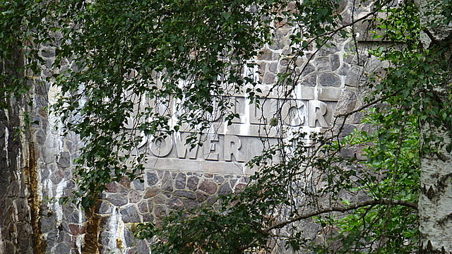
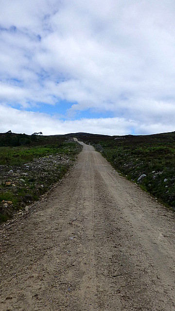
Beinn a'Bha'ach Ard from near the start of the routeIt’s a good walk along the private road up to the power station at Culligran. I was wanting to take a photo of the tunnel entrance, just because it’s an impressive sight. There was a man in a florescent top wandering about the entrance though and I didn’t want him thinking I was a weirdo
So my photo was a bit disguised by the trees

 P1200398
 by
Pete Riedel, on Flickr
Culligran Power StationFrom the power station it’s a case of taking the good landrover track that wends its way up through the trees. It certainly helps make good progress of this part of the climb, up to the modern looking building where I assume the small dam is.
 P1200400
 by
Pete Riedel, on Flickr
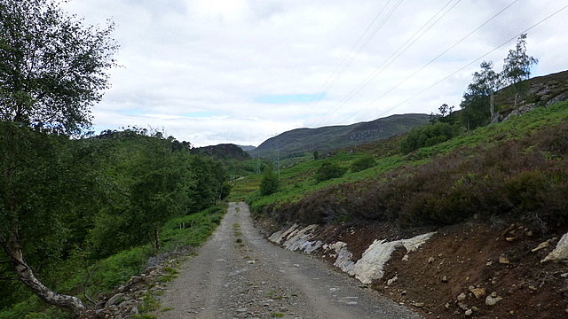
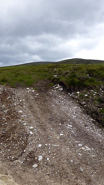
The initial well worn landrover trackI’d understood from this point it would be a boggy, heather clad tramp up to nearby the summit. As it happens though a nice ugly looking hill track has been created which, while not the most aesthetically pleasing addition to the hillside, does make for a speedier progress upward than I would have experienced had I been traipsing over heather (be under no illusion though, boggy, clumpy, heather clad traipsing will feature on this hill soon enough

).
 P1200407
 by
Pete Riedel, on Flickr
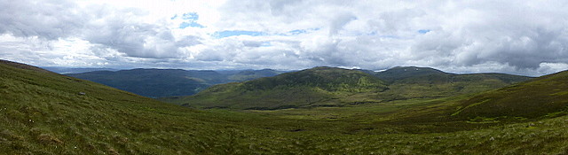
The less attractive new track - speedy progress nonetheless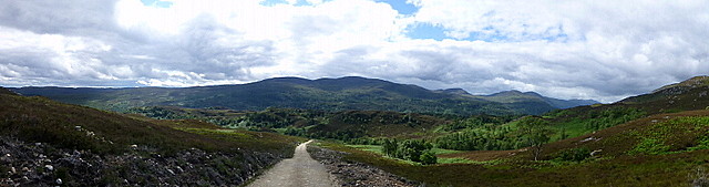 P1200409
 by
Pete Riedel, on Flickr
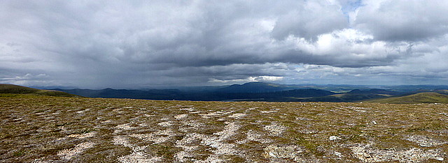
Pano looking backJust before the ugly hill track terminates, close to the Allt Doire Bhuig, the time comes to take to the hillside……………..let the bog trotting begin
I was (loosely) following what could be described as an ATV track. Boggy in very many places, often non-existence in many other places. I was probably making better progress than I thought, but in truth this stage of the walk wasn’t the most fun I’ve ever had. Got to say that this approach doesn’t necessarily show the Corbett in its best light and it certainly seemed reluctant, appearing as a very minor, uninspiring mound ahead of me.
 P1200412
 by
Pete Riedel, on Flickr
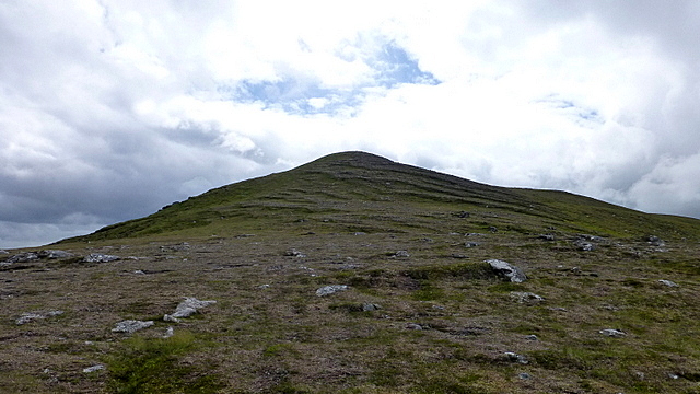
The start of the bog trotting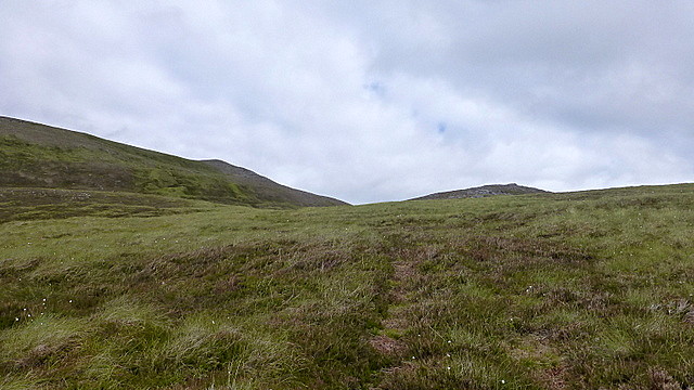 P1200416
 by
Pete Riedel, on Flickr
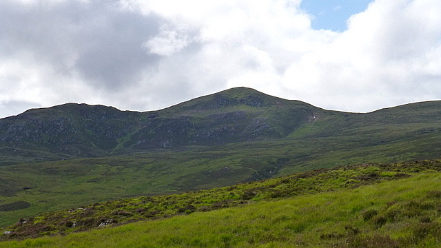
The reluctant CorbettThankfully the views in all other directions were making up for that though, improving as height was gained

 P1200419
 by
Pete Riedel, on Flickr
 P1200436
 by
Pete Riedel, on Flickr
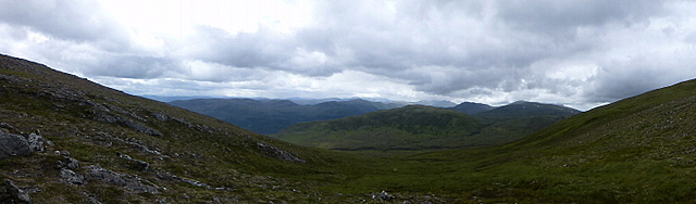
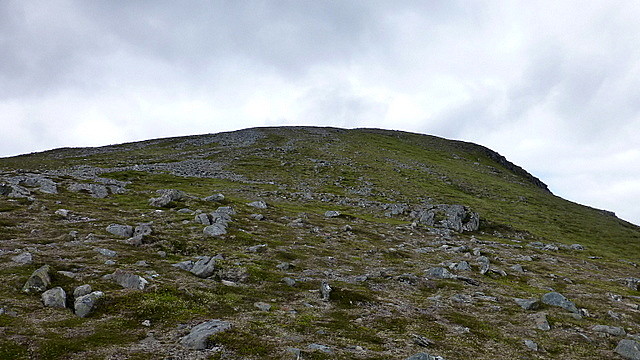
I was aiming for the saddle between Beinn a’Bha’ach Ard and Creag a’Gharbh-Choire where I was hoping for better ground to aide my final climb to the Corbett summit. Thankfully I wasn’t to be disappointed. The tough ground was replaced by short, spongy grass, with the odd bit of rock as well. All in all an easy final climb to the top and the cairned shelter
 P1200438
 by
Pete Riedel, on Flickr
 P1200440
 by
Pete Riedel, on Flickr
 P1200442
 by
Pete Riedel, on Flickr
The final climb to the summit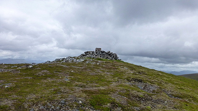 P1200446
 by
Pete Riedel, on Flickr
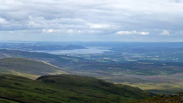
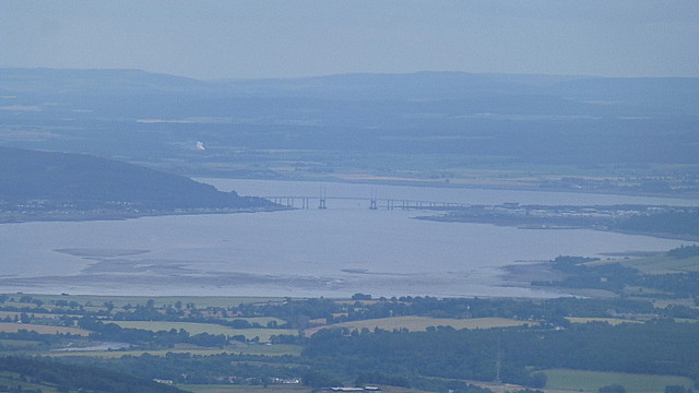
Summit cairnFrom the summit there were good views of the Cromarty and Moray Firths as well as the route ahead across Sgurr a’Phollain and Carn na Gabhalach. I’d have hung around a bit longer, but the earlier warm sunshine had been replaced with a stubborn layer of cloud and a chilly wind.
 P1200449
 by
Pete Riedel, on Flickr
Strathconon and beyond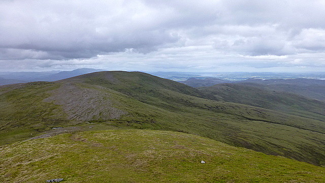 P1200451
 by
Pete Riedel, on Flickr
The route aheadSo I was soon heading ahead to complete the circuit. Great views as before.
 P1200458
 by
Pete Riedel, on Flickr
View back to the summit from the route down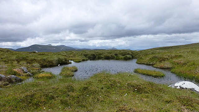 P1200460
 by
Pete Riedel, on Flickr
Mountain water feature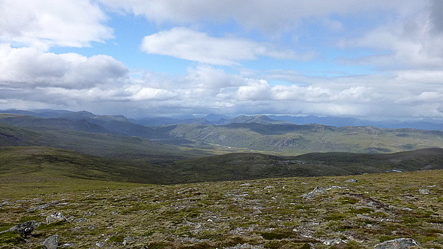 P1200474
 by
Pete Riedel, on Flickr
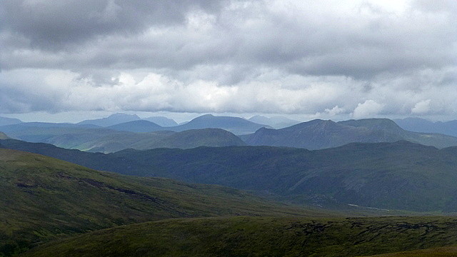
Even had a nice shot of what was to be my Saturday hills – the Strathconon Corbetts of Meallan nan Uan and Sgurr a’Mhuilinn.
 P1200477
 by
Pete Riedel, on Flickr
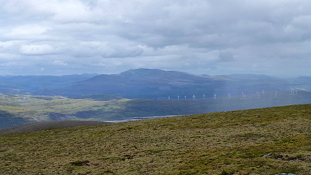
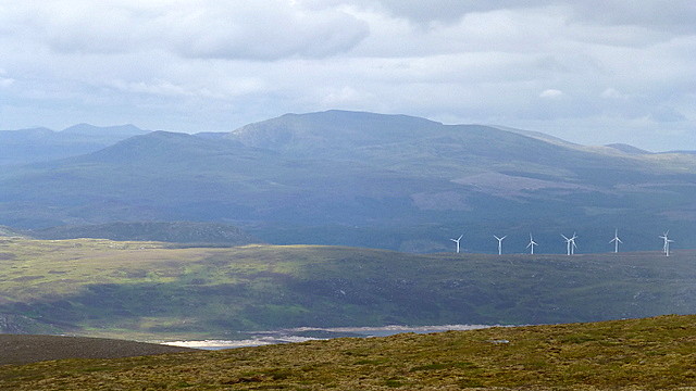
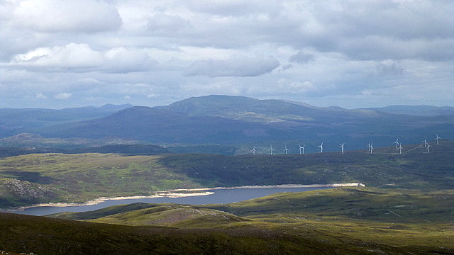
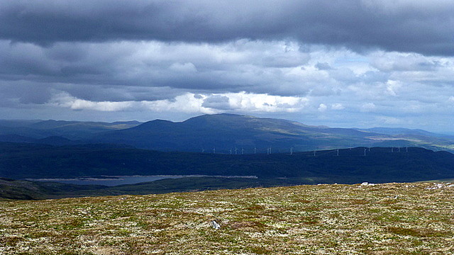
Meallan nan Uan and Sgurr a’MhuilinnUnfortunately the views toward Ben Wyvis and Little Wyvis across the Orrin Reservoir were sadly ruined by a hideous wind farm

Wind farms to one side the going was now much better, with a reasonable excuse of a path to follow along the top.
 P1200490
 by
Pete Riedel, on Flickr
 P1200493
 by
Pete Riedel, on Flickr
 P1200506
 by
Pete Riedel, on Flickr
 P1200529
 by
Pete Riedel, on Flickr
 P1200532
 by
Pete Riedel, on Flickr
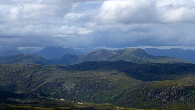
 P1200537
 by
Pete Riedel, on Flickr
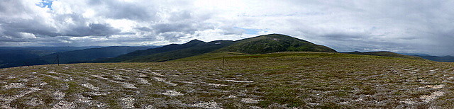
Nice view back along the ridge I'd walkedThe descent off Carn na Gabhalach unfortunately heralded a return to rough, tough walking. OS maps suggest a good path to be followed, but the reality is something very different. Sometimes there was a path, but mostly it was just tufty heather, pretty much down to Loch na Beiste.
Had a slight mishap on the route down when I stepped on what I thought was heather, only to it disguised a nasty hole with a vicious rock in it. Thankfully all I suffered was a bit of a scrape down the shin rather than anything worse
 P1200544
 by
Pete Riedel, on Flickr
Beinn a'Bha'ach Ard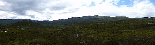 P1200550
 by
Pete Riedel, on Flickr
Loch na Beiste is a cracking spot, giving great views back to the Corbett – showing it at its best for sure. The remainder of the walk back to the car was less cracking. Route descriptions I’d seen suggested the path was better than what I’d suffered so far on the way down, but I would beg to differ. May be it was my route finding, but there were still some charming boggy bits to navigate.
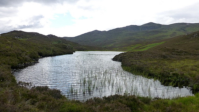 P1200552
 by
Pete Riedel, on Flickr
Loch na Beiste P1200554
 by
Pete Riedel, on Flickr
Almost back at the carSoon enough though I was back at the car at Milton Cottage and then heading to Aultguish for the meet for the obligatory beer or two and good conversation
So that's one report down, just two more to do
