free to be able to rate and comment on reports (as well as access 1:25000 mapping).
(no. Not that one. Its little brother (sister?) from across the way: the one on Stob Ghabhar. Still waiting for my brave hat to arrive – it’s on order – to do the “other” one.)
So the Fri pm MWIS forecast says (and I do quote directly): “GREATER than 90% chance of clear summits.” WOOHOO! Then, a bit further down the page is this, which I don’t think I’ve
ever seen before: “Beware sunburn”!!! Like a shot, I’m on the email to Evie, saying “We ARE on for tomorrow, right?” (How could we possibly not be??). She confirms, and the go/no go decision for the pencilled-in, weather-dependent plan from earlier in the week – Stob a’ Coire Odhar and Stob Ghabhar from Victoria Bridge – quickly becomes an enthusiastic GO.
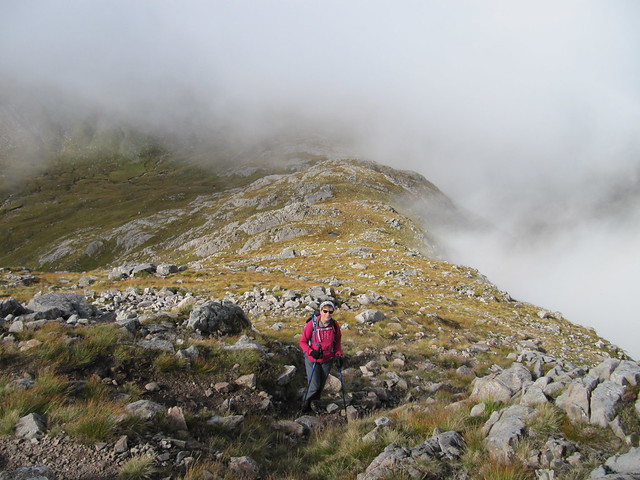
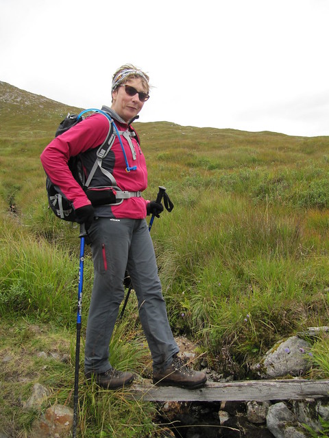
Evie is always early, and so is I, so we’re on the trail by 7:45. There’s a lot of mist about, but Evie assures me that “our” summits are in the sunshine, confirmed by her early morning drive across Rannoch Moor. I’m also confident that any lingering morning mist is to burn off by around 9:00am, so sayeth the BBC (as I check my watch to see that it’s just past 9:00, and the clag is, if anything, getting thicker as we ascend).
Just as we reached the top of Stob a’ Coire Odhar, the mist melted away into the most stunning inversion views in all directions. What a treat! Well worth the wait. We sat awhile, and had our first lunch, then made our way back down into the mist toward the bee-lich between the two hills. We were confident and hopeful that the mist would again rise, or burn off, as we ascended toward Stob Ghabhar, but our faith in the way-too-optimistic MWIS words was misplaced. We weren’t to see much of the sun again, or anything other than the quickest glimpse of wider surroundings, until we were well back down the hill.
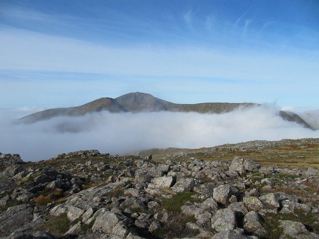
Stob Ghabhar rising up out of the mist
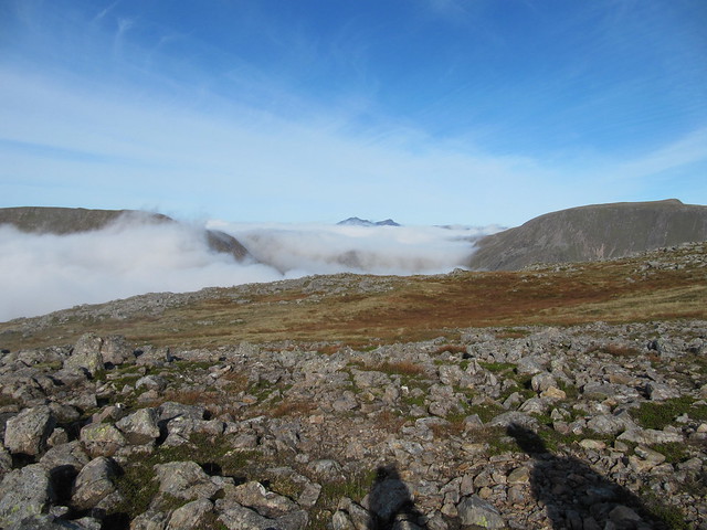
wow...Ben Cruachan, perhaps?
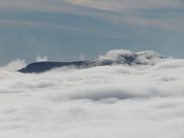
wow, wow, wow
and wow, wow, wow again
down to the bealach, mist encroaching again
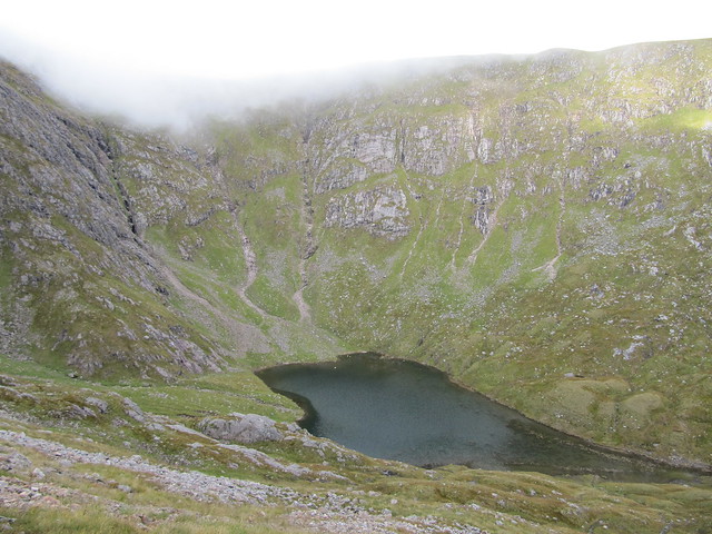
lovely lochan
The ascent to the ridge was rather exciting – there was a bit of scrambling, as well as a fair bit of steep and scrabbly scree. We agreed that we were happy to not be coming down the same way. We reached the ridge and looked across the baby Aonach Eagach, which didn’t look too bad. It wasn’t, really, and we made our way carefully across, picking a grassy bypass path-of-sorts for one short section, rather than going right over the top. Mightily impressed with our own bravery

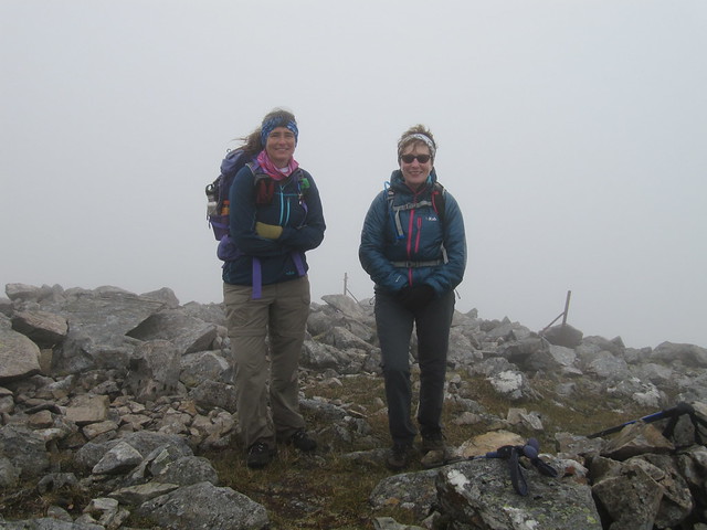
, we were soon at a cairn that marked the descent path (we discovered later), then finished the short climb to the top of Stob Ghabhar. A couple who had leap-frogged us several times was already huddled down in the shelter cairn, celebrating their compleation. Another couple arrived shortly after us – Evie was astounded (dismayed? appalled? horrified?) at the number of people on the hill as compared to her lonely north-er ones – and the six of us crowded into the shelter, and commented once again how “off” MWIS had been. I daresay that it was one of the main topics of conversation that took place on these two hills throughout the day.
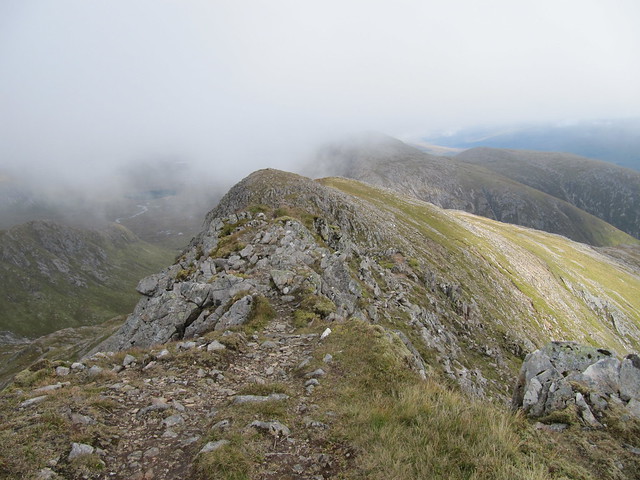
back over the scrambly bit of the ridge, which is mostly hidden between the bumps
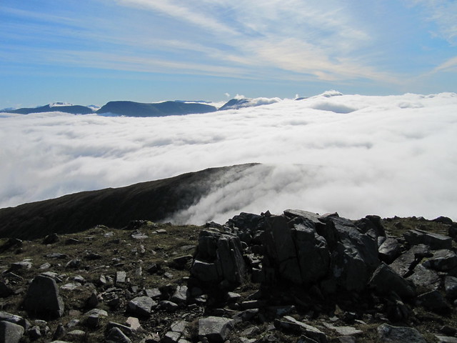
the "view" at the top. Can't believe that I didn't take any people pics above the inversions -- doh!
The descent was a fairly relentless down, down, down – not many flattish sections to give the legs/knees a break – but there was a good path for most of the way. Until we lost it, that is, and ended up on the wrong side of the waterfall we were meant to descend next to. But we continued down the grassy slope we found ourselves on, and decided that the route we’d taken was likely to have been less arduous than following the “official” path, which had been billed in the walk description as “very steep and eroded.” A couple of river crossings (water levels very low), a jaunt back along the stalkers’ path to the green hut, and the final leg along the road back to the car park; thus endeth another fabulous day in the hills. In spite of the weather – which, tbh, wasn’t bad at all, except that expectation had been set unrealistically high. Best of all, I felt back on form physically -- the worrisome issue with my hip seems to have sorted itself and it gave me nae bother throughout, which is a huge relief.
Evie wearing her brave hat -- that slat is only about an inch wide!
Left cars, 07:45; first hill, 10:15; second, 12:30; back to cars, 14:45
