free to be able to rate and comment on reports (as well as access 1:25000 mapping).
A full weekend of hillwalking beckoned, keen to bring my tally of Munros into the teens before I stopped for my winter break (the remaining hills are either far or in clusters). So I treated myself to a weekend on Skye seeing as the forecast was very favourable indeed. Day 1 Bla Bheinn following the walkhighlands route (Day 2 Bruach na Frithe, coming soon).
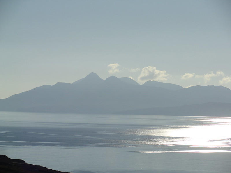
After a night in the Broadford Backpackers Hostel (mediocre but it would have to do), I set off early on the road to Elgol. There was frost on the bracken, the sun was shining low but clear on the slopes and some mist lingered in the glens.
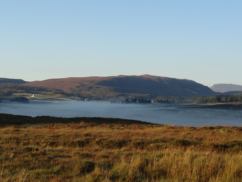 mist in the glens
 by
Emmanuelle Tulle, on Flickr
What a glorious start to the day. I had never been on this road before so it was an adventure. Soon enough the Munro I was coveting rose into view, its north flanks and Clach Glas basking in sunshine. What a fantastic prospect! It remained in my sight all the way to the head of Loch Slappin. I had to stop and take a pic of this

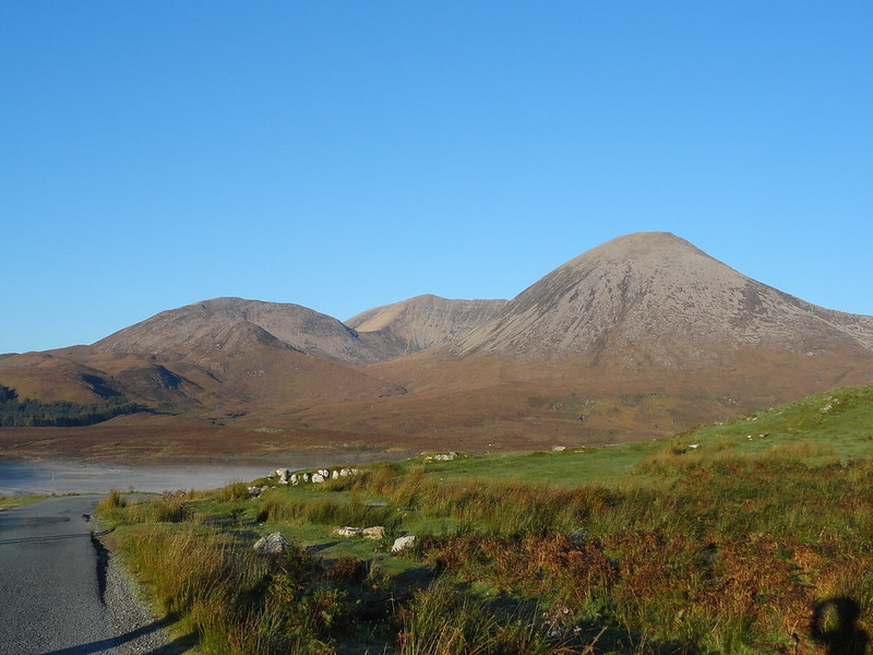 DSC04347
 by
Emmanuelle Tulle, on Flickr
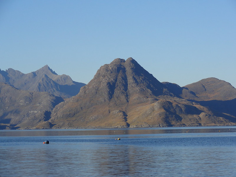
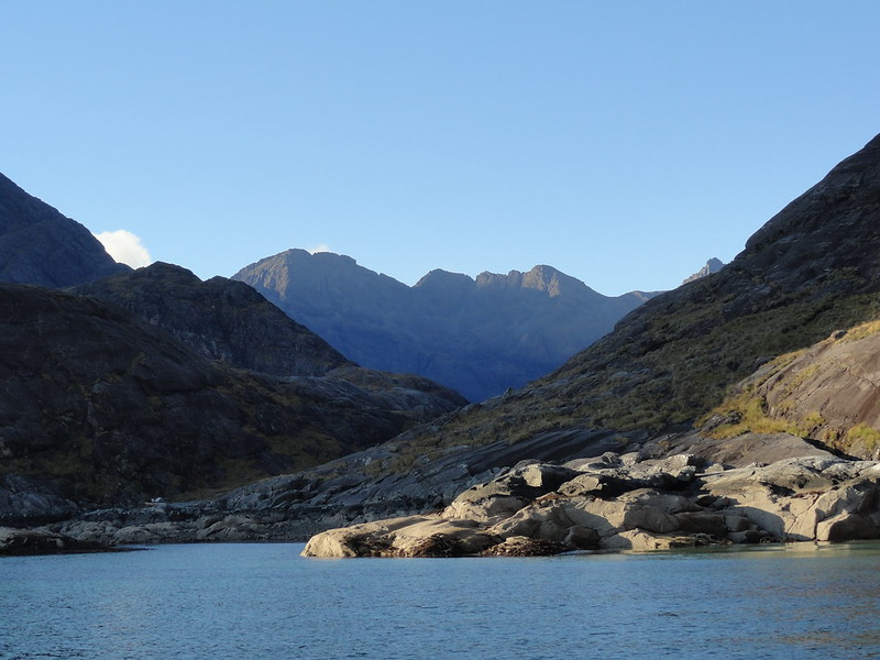
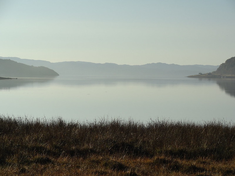 Loch Slappin
 by
Emmanuelle Tulle, on Flickr
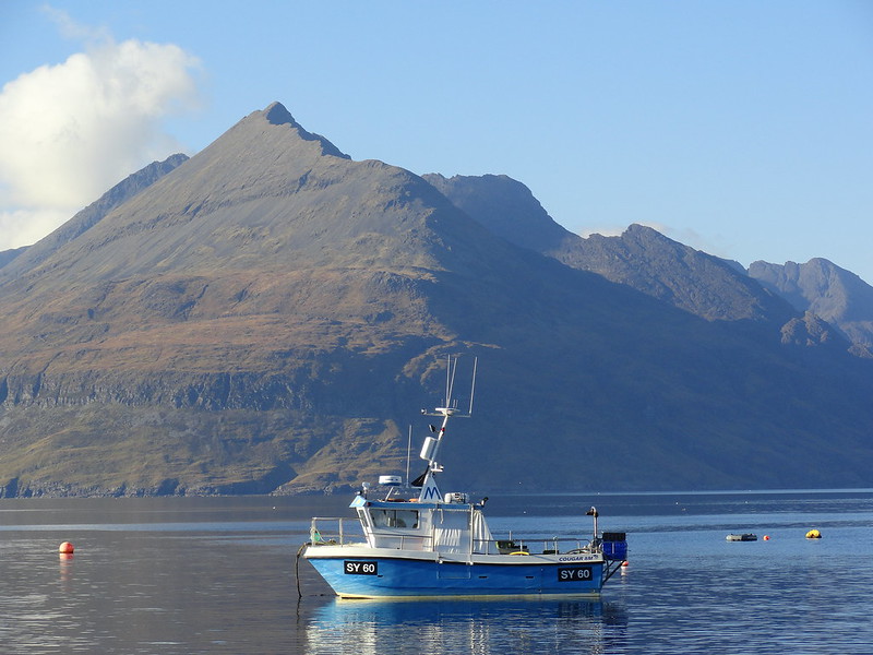
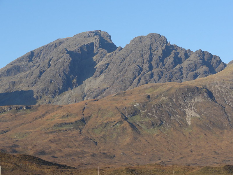 DSC04349
 by
Emmanuelle Tulle, on Flickr
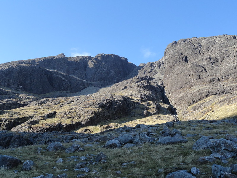
I parked the car in an already fairly busy car park but I wasn't in any hurry so I took my time. All kitted up I walked back to the tarmac and found the good path which runs along the burn. There were no navigational difficulties and after the huge distances and expansive but featureless vistas of the western Cairngorms, I knew this would be a short day. So why hurry? The play of light and shadow in the low October morning sunlight was giving the crags of this single but complex Munro the demeanour of a mountain not to be messed with. Nonetheless the going is very easy at first until things steepen up as the path veers south west up Coire Uaigneich. But no problems... until you get into the 'grassy bowl'.
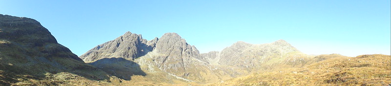 Pano, from the path
 by
Emmanuelle Tulle, on Flickr
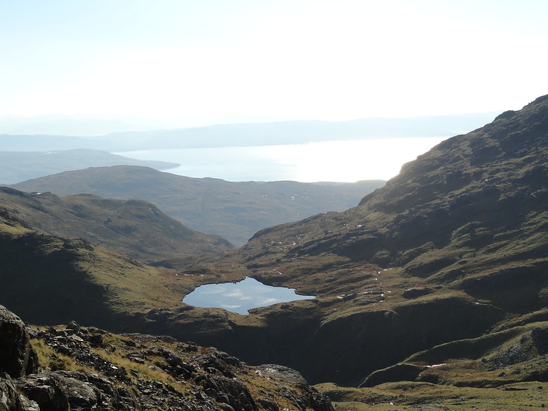 From the grassy bowl
 by
Emmanuelle Tulle, on Flickr
A short intermission - as I was leaving the car park, a couple of guys were crossing the cattle grid in their black VW. A young couple had left ahead of me (into the heather). As I sauntered along, I became aware of a party 5 people ahead of me. The young couple were behind me. I caught up with the 5 people just as they were crossing the Allt na Dunaiche for the second time. They were a bit of a motley crew and tbh I didn't think they were headed for the summit as at least one of the party didn't seem fit enough and they had only one rucksack between them. So god knows where they kept their pieces and water! A while later I became aware of heavy and fast bootsteps behind me and the two guys I had passed as I was setting off had caught up and were flying up the path! The young couple were behind somewhere but I wasn't really keeping tabs on them. However as a solo walker, when I do meet people I like to keep track of them. Just in case...
When I got to the grassy bowl, I intended to follow the walkhighland descriptions which also happened to be the route I had chosen: up the shoulder on the right. As I emerged onto the flatter ground, I noticed that the two chaps were heading for the scree slope at the head of the corrie, between the south ridge and the lower summit. hmmm. That took me by surprise. The slow fives also headed in this direction. hmmm again. The description was quite clear: the way was to the right, not into the corrie. In fact it stated very clearly that I shouldn't follow the path that went straight on but take a right. So that's what I did. Why were these people going the other way? That shouldn't have been a big issue because after all there are more ways up a mountain than one! However my description said that I should head for a wide scree field. Really? I kept looking back and forth between the stone chute which came off the shoulder and the scree fields that lay at the head of corrie. The latter were huge. The one I was heading for was a wee bit scrawny in comparison but also objectively it wasn't really very large at all. But I proceeded anyway. And then the description told me not to follow a path that appeared to go right (OK, but I never saw one, so I wouldn't have anyway) and to go left instead, up a crag. hmmm. On all fours I made my way up over boulders and tussocks and the scrambling that I thought awaited me was mixed to say the least. And I don't mind saying that it was not an easy ascent. But it was quick. And then I looked down into the bowl, and noticed the young couple heading straight on.

What did they all know I didn't?
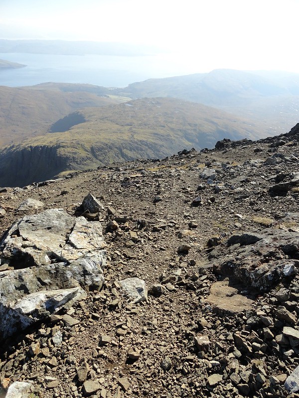
I eventually reached flatter ground, that is, I had emerged onto the shoulder proper and here the description promised that the going was now easier. Yeah, for about 5 minutes! The shoulder was broad and just one big scree slope, some fine, some medium, some boulderish, but all very loose. There was a path at first and my grip on the scree was firm. But then things got a little bit less stable. The slope steepened, the scree increased in size and was very unstable and I chose to stay close to rocks on the left to get some hand holds as I assessed the risk of slipping uncontrollably back down as reasonably high. I never saw the cairn that the description mentions. I have no idea at what point in the route this cairn was supposed to be in the lunar landscape that is the eastern reaches of the summit. I did take time to admire in awe the spires and crags which formed the east side of the hill. Really spooky. In clag, they would come across as threatening

I looked straight up looking for the route. I had reached another rock on to which to latch myself and then rather than go too far left, which looked perilous, I went straight up and sometimes a little bit to the right, as advised. Then the ground became easier to read and I felt confident about going left as I knew that this was where I would find the summit cairn and trig point. And sure enough, a few minutes later, the summit came into view, and with it the two guys who had bombed past me on the path an hour or so earlier. They had just arrived and I followed a minute or two later!
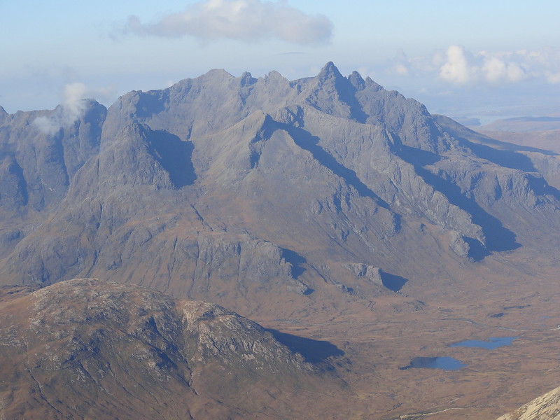
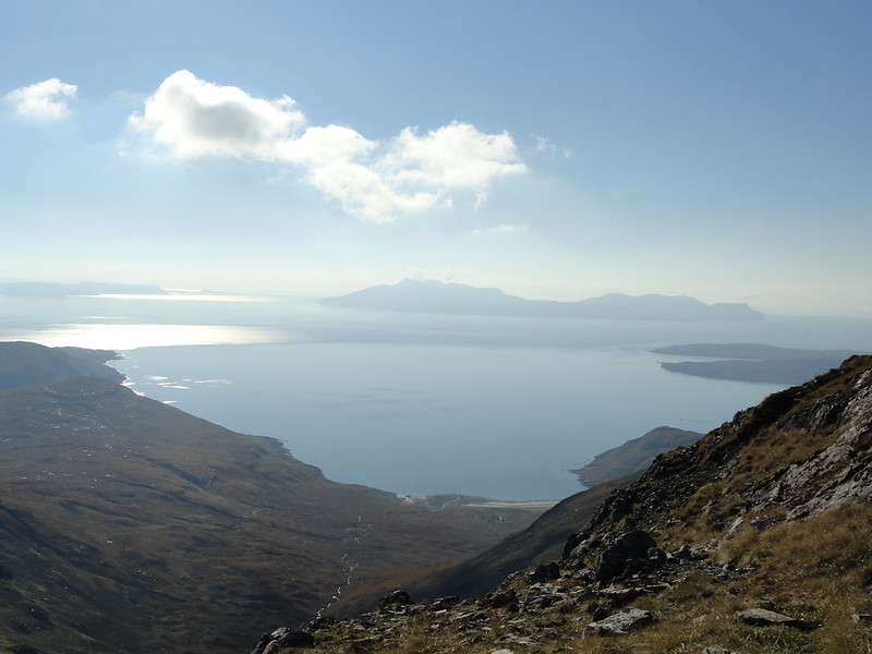
The view from the summit was stupendous. Not a cloud, bright blue sky, the sun reflected in the calm flat sea and throwing up its rays to dazzle us. In an arc from left (SW) to right (NE), the Cuillin ridge with the Inn Pin sticking up like a wee sticky up thing at an odd angle, the Basteir Tooth, Am Basteir and Sgurr an Gillean. I knew that Bruach na Frithe was partly concealed from my viewpoint. And then continuing the arc, the full length of Glen Sligachan and its lochs and lochans, Marsco, Geinn Dearg Mor behind it and Garbh Bheinn. Looking south, I could see Loch Hourn and Ladhar Bheinn (it took me a while to work it out), Rum, Eigg, Canna and apparently due south, Ardnamurchan. Who knew??? I was absolutely gobsmacked. And what a pleasure to see the Cuillin from this angle. I felt privileged to have this tremendous vista literally at my feet. Everywhere I turned there was something to point at and to admire. I snapped away but also simply gazed. It was compelling. I fell into an easy chat with the two chaps who clearly intended to go back by my route of ascent (good luck!). No, there is no back climbing. Just wrap your toes round those stones and keep these buttocks clenched for added stability
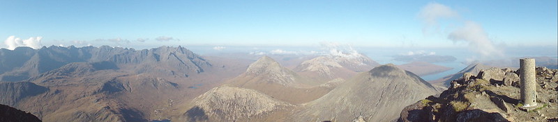 pano from summit looking NW
 by
Emmanuelle Tulle, on Flickr
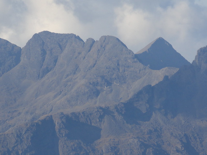
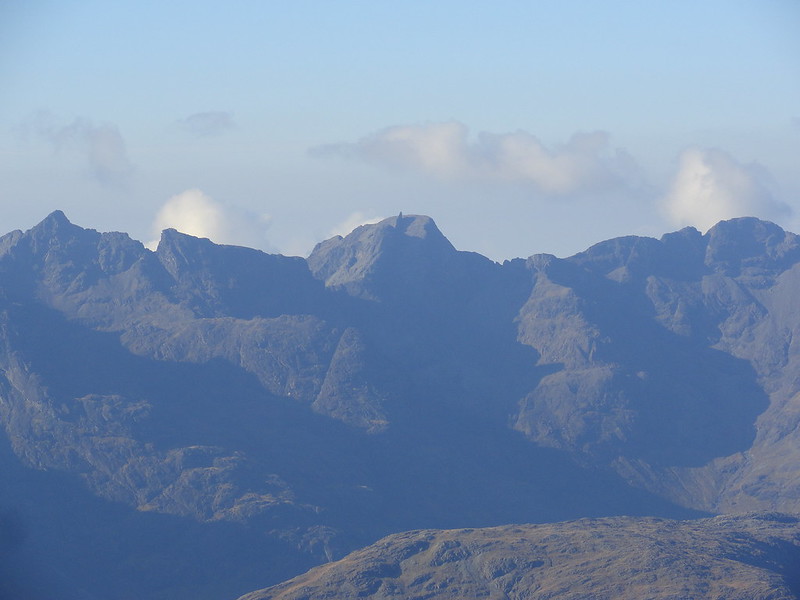 Mid ridge with In Pinn
 by
Emmanuelle Tulle, on Flickr
 DSC04364
 by
Emmanuelle Tulle, on Flickr
It was sunny, but also nippy. There was still some frost in the shady side of the cairn, so after half an hour I started shivering a little and I had no flask of hot tea to warm my bones. At this point, a chap appeared from the same direction I had come. And you know what? He had no map and no compass, just his phone

Ah well.
 DSC04366
 by
Emmanuelle Tulle, on Flickr
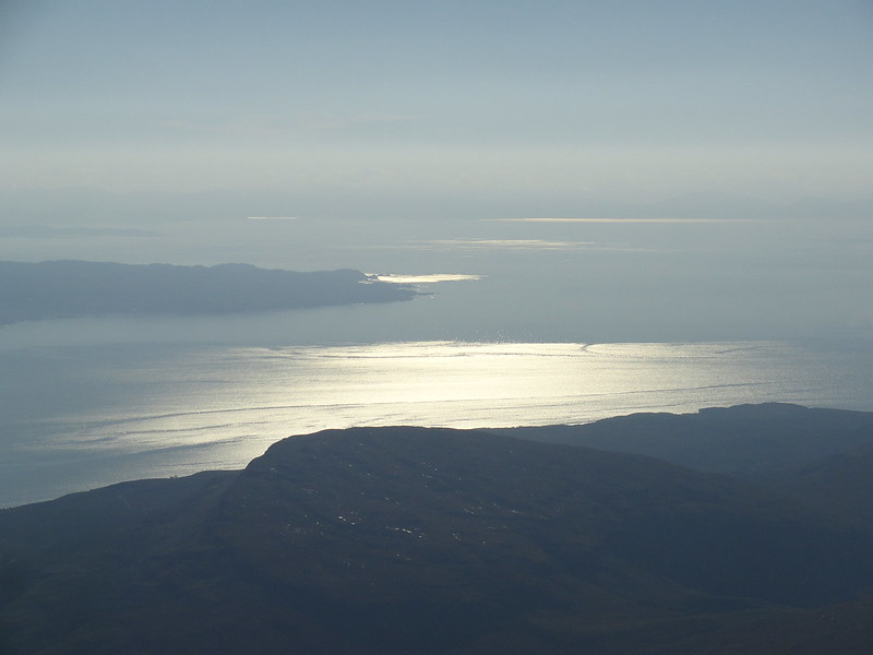 Looking south-ish
 by
Emmanuelle Tulle, on Flickr
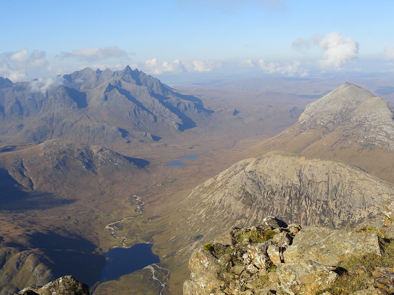 Glen Sligachan
 by
Emmanuelle Tulle, on Flickr
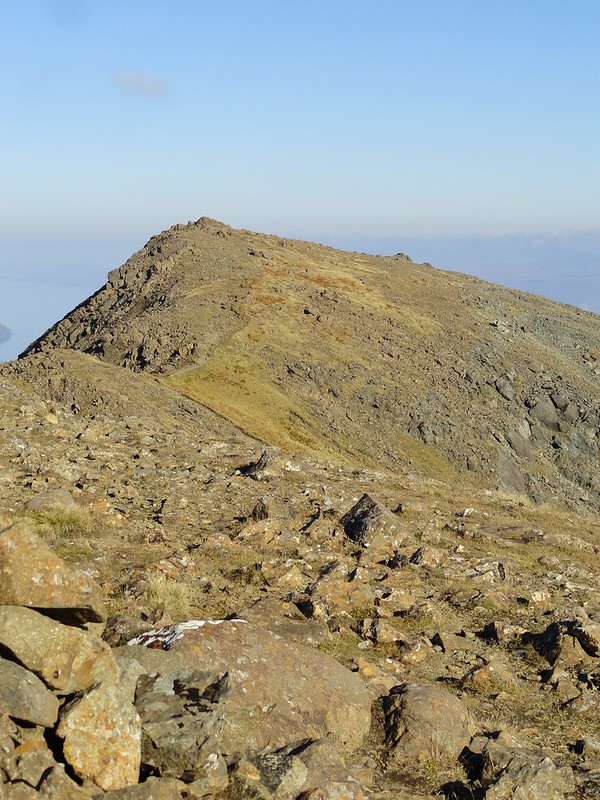
Reluctantly I took my leave of the summit and decided to return via the south summit (924m) to make it a loop. There is a little bit of down scrambling but it's OK. However the climb up on the other side requires more care with foot and hand holds but also to find the best line up. There isn't much distance but it has to be reckoned with. And then the cairn is almost there. And, to my surprise, I saw that the party of five had made it! One of them could have been their guide and he asked me what it was like going back the other way. Don't even think about it, I said! not with that crew in tow
I meant it.
 Looking back
 by
Emmanuelle Tulle, on Flickr
I lingered for a while and suddenly the young couple appeared. I mention them because we started chatting (I like chatting
) and they admitted that they had intended to come up the same way as me but had been confused by the route description and couldn't figure out which was the large scree field they were supposed to climb up as there were so many! They did see me, but too late, they had already walked far into the corrie! That made me feel a bit better - it wasn't just me hint hint hint walkhighlands!
 The way back
 by
Emmanuelle Tulle, on Flickr
The way down was unsteady in places but on the whole a lot easier going than the route of ascent - not as steep and a more defined path with less unstable scree. The rest of the walk was completely uneventful and apart from a Spanish guy walking up with a rucksack which was so big I could have fitted in it, where it not for the camera and camping gear he had packed it with, I sauntered down on my own and was soon back at the car. Only 6 hours and that's because I chatted a lot
 2015-10-17 14.15.12
 by
Emmanuelle Tulle, on Flickr
 Afternoon sunlight
 by
Emmanuelle Tulle, on Flickr
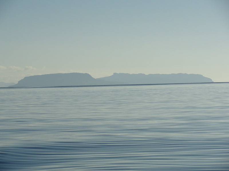
 Rum
Rum by
Emmanuelle Tulle, on Flickr
I got the gear away and put a wee plan I'd hatched on the way down into action. I turned my steering wheel right, rather than left, and drove to Elgol to see what was what. It's a great drive with beautiful views and on arrival in the outskirts of the village suddenly the Cuillin move into view. The village itself, in the sunshine, is picturesque and enticing - who wouldn't want to live in such lush surroundings. Until you start the descent to the small harbour and then you notice the scrawny trees hanging on to the steep slopes, their branches and what remained of their leaves frozen as if in a permanent wind tunnel. But today the sunlight and calm conditions softened the harsh contours of the cliffs. It was truly beautiful (have I said this already?
) I parked in the car park directly facing the Cuillin and sauntered down to the jetty. The place was bustling! And then we all looked up, and there was a sea eagle circling over us, the sunlight catching its white tail feathers and the yellow markings under its wings. Fantastic! A first for me. The Bella Jane boat was moored at the end of the jetty and 10 minutes later I was on board for a completely unplanned mini cruise to the entrance to Loch Coruisk! We hadn't been gone 10 minutes that our attention was drawn to two shy porpoises gliding easily in the waters about 100 yards to our left, their black backs and fin glistening with each appearance. Another first! And after we lost track of them we turned our attention to the majestic Cuillin amphitheatre ahead of us and the islands behind us, until we got to the seals. We picked up a family and returned to Elgol.
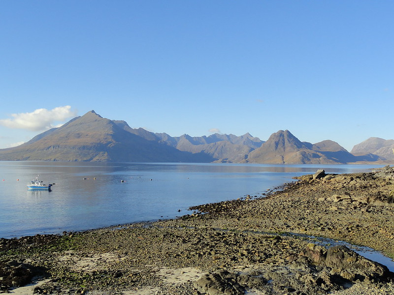 The Cuillin, from the shore at Elgol
 by
Emmanuelle Tulle, on Flickr
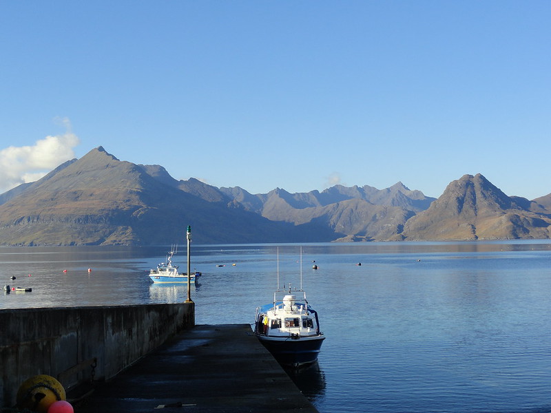 The Bella Jane boat
 by
Emmanuelle Tulle, on Flickr
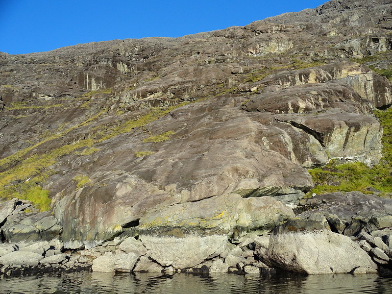
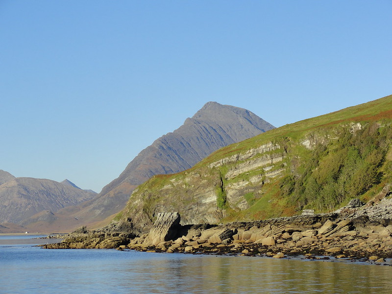 Bla Bheinn's south ridge
 by
Emmanuelle Tulle, on Flickr
 Sgurr na Stri
 by
Emmanuelle Tulle, on Flickr
 Sgurr nan Eag
 by
Emmanuelle Tulle, on Flickr
 Eigg
Eigg by
Emmanuelle Tulle, on Flickr
 Bad step
 by
Emmanuelle Tulle, on Flickr
 2015-10-17 16.53.59
 by
Emmanuelle Tulle, on Flickr
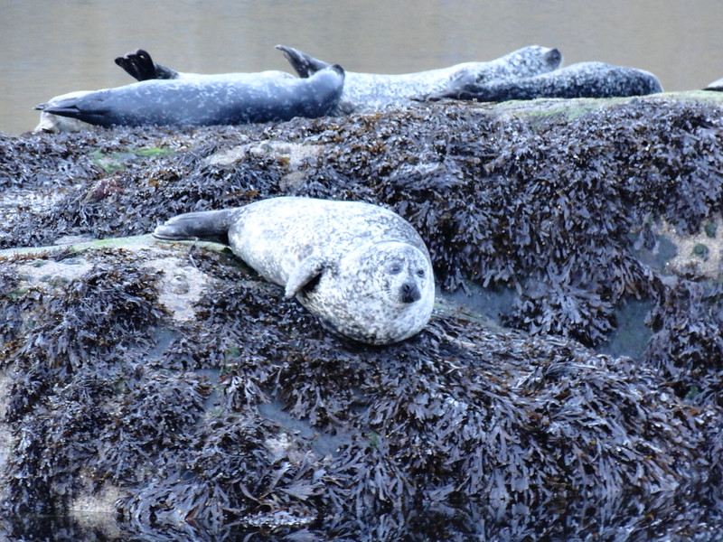 Common seals
 by
Emmanuelle Tulle, on Flickr
To finish - a superlative day which filled me with profound happiness and deep satisfaction. And just as well for I wound up in the Donallie Hotel later that night to watch the rugby. The odds weren't good but I hoped for the best. As it turned out I needed the full store of contentment I gathered during the day to deal with the thrashing that the mighty All Blacks inflicted on my team. Quelle raclée!
