free to be able to rate and comment on reports (as well as access 1:25000 mapping).
'
Glen Etive, alas, Glen Etive, ... lovely was its wood when we arose, a dwelling of the sun was Glen Etive.'Not quite! We turned off the A82 down the single track road, hardly able to see 100 metres ahead. The fog was an absolute pea-souper, and had been virtually all the way from Stirling! However, we were confident that our quarry of Stob Coir an Albannaich and Meall nan Eun would be well above the clouds. We'd had a taster on the way up, just at Auch. Beinn Dorain had momentarily poked her head through the cloud, and we
had to stop for a snap.
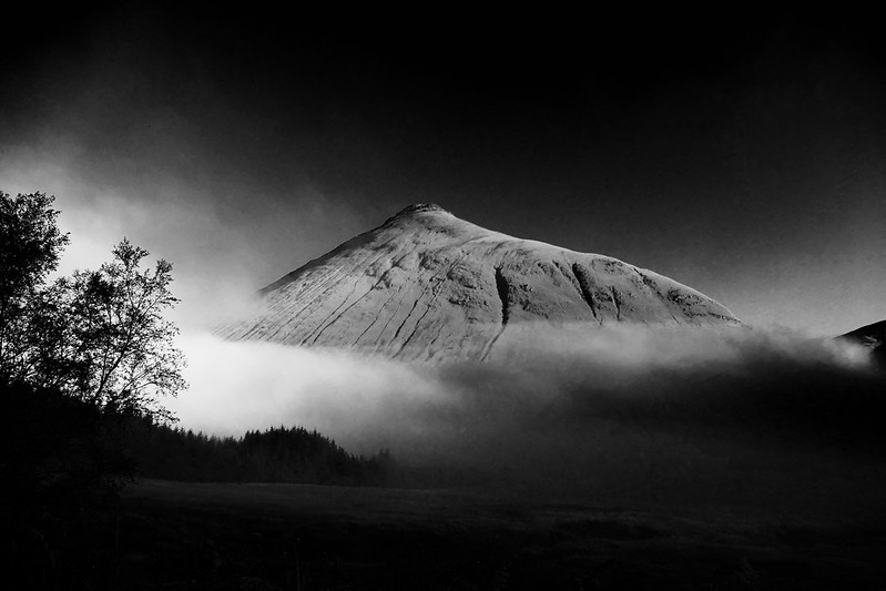 Beinn Dorain, emerging from the mist
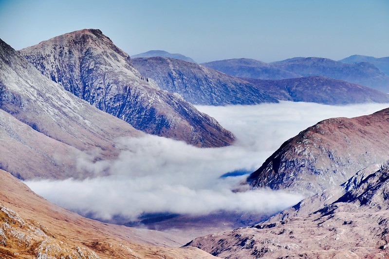
From there it was driving through thick mist all the way across Rannoch Moor and down Glen Etive. There was no hint of what lay above until well down then glen. The closer we got to the loch, the more that the weather Gods smiled upon us.
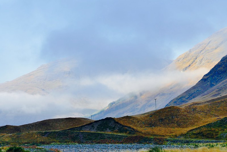 The cloud finally starts to lift as we drive down Glen Etive
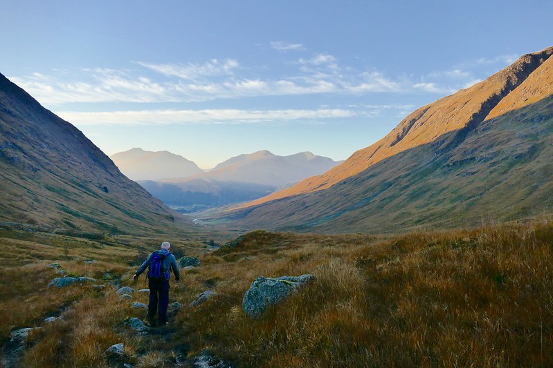
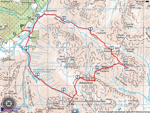 The route
We parked up in a little lay-by beside the Coiletir track and went on our merry way. It was quite brisk there, despite the sun. What little wind there was funneled down the glen and searched through our base layers. Time to go!
Unfortunately the old way of doing these hills, through the Coiletir croft, is now closed to walkers. A rather helpful 'please obey our privacy' sign is erected on the gate, but - less helpfully - the 'path' it directs you to round the side of the croft is anything but. It's an extremely boggy mess, and unless you've got gaitors and very good boots, you're going to get your feet wet before you even start. It is one of the most unpleasant starts to a walk you can imagine. However, this would all be forgotten later in the day.
The map I posted above is not strictly accurate with regards our route. We decided that, rather than going up past the Robbers Waterfall we would go right up the 40 degree grassy slope of Beinn Chaorach. We figured that though it would be far steeper, it is quite a bit shorter, and would save time. Hmm. Not sure it ended up like that in the end! Starting from more-or-less sea level, every metre gained on this hike is earned. There's none of the starting above 300 metres here! The hike up onto the summit of Beinn Chaorach was an energy-sapping slog, but extremely good for the fitness. My companion was at this point struggling, so I offered to carry his bag and my own. Even at this I was still quicker, so I decided to make a comedy Benny Hill video of him coming up the very steep slope...
 Click for Benny Hill video...
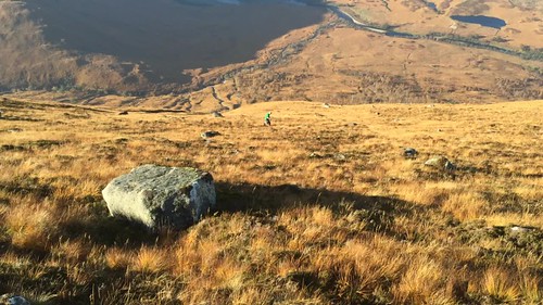
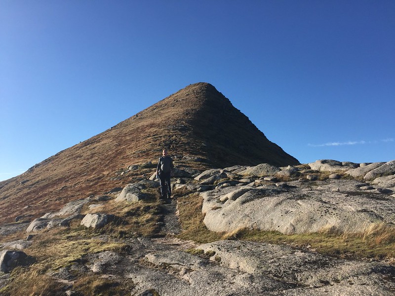
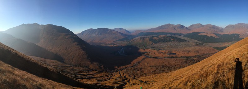 The view down to where we started. Note steepness of ascent! Ben Starav on the left
Once we were on the plateau we noted just how warm it was compared to when we set off. There was a noticeable difference in temperature, and we were in base layers. In November! The views, though, really started to open up.
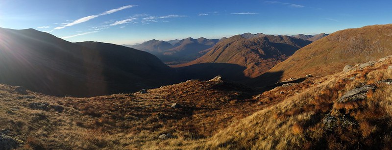
 The view down to Glen Etive, with Buachaille Etive Mor on the left
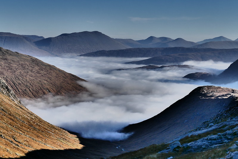 Towards the Bridge of Orchy hills
The walk across to the summit ridge of Stob Coir an Albannaich is very straightforward, and the apparent false summit is merely a couple of hundred metre ridge walk.
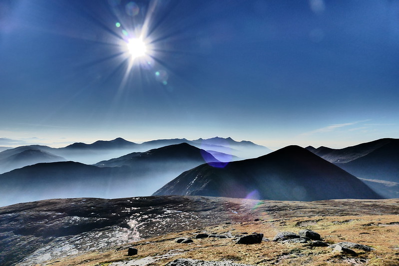
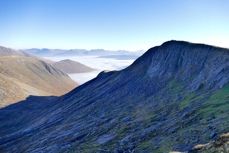 The summit of Stob Coir an Albannaich, with stunning views south
After reaching the summit we stood - agog - at the views in every direction. Truly, this was one of the most stunning days either of us had known on the hill.
 Towards Ben Cruachan
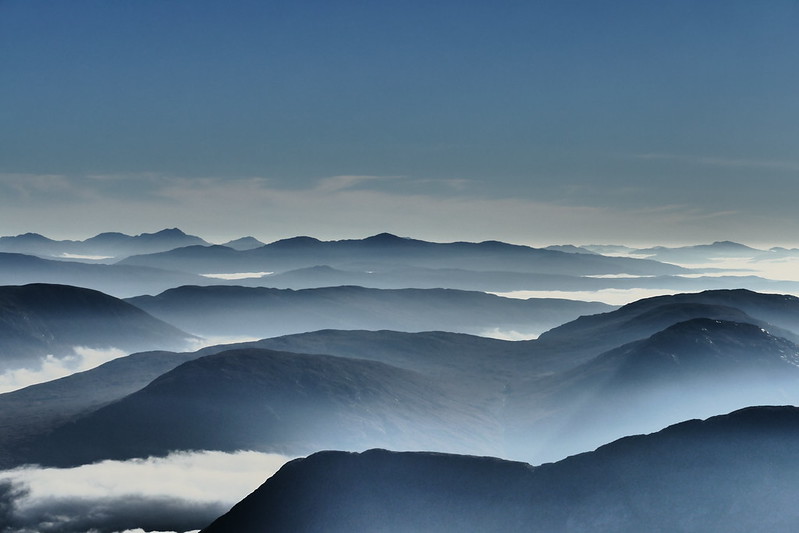 The view out west...
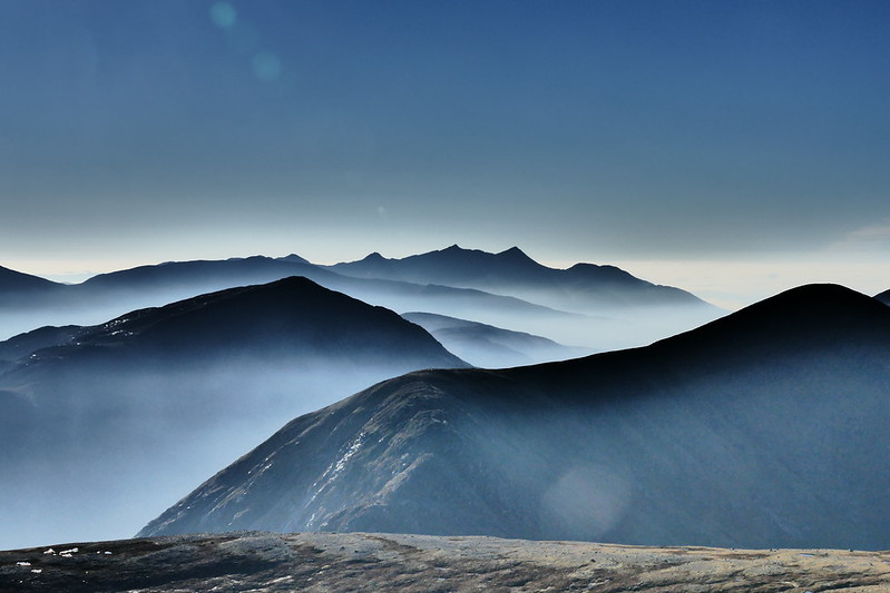 The very photogenic Ben Cruachan
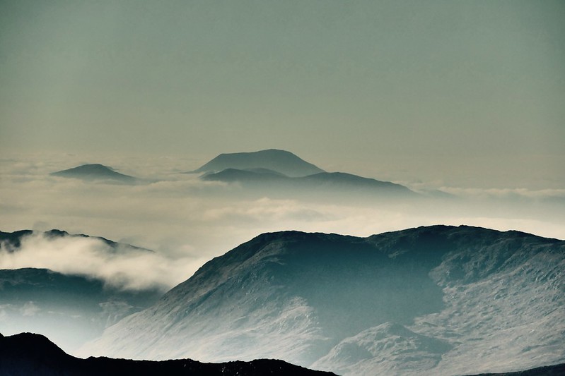 Mull's Ben More. Forty one miles distant
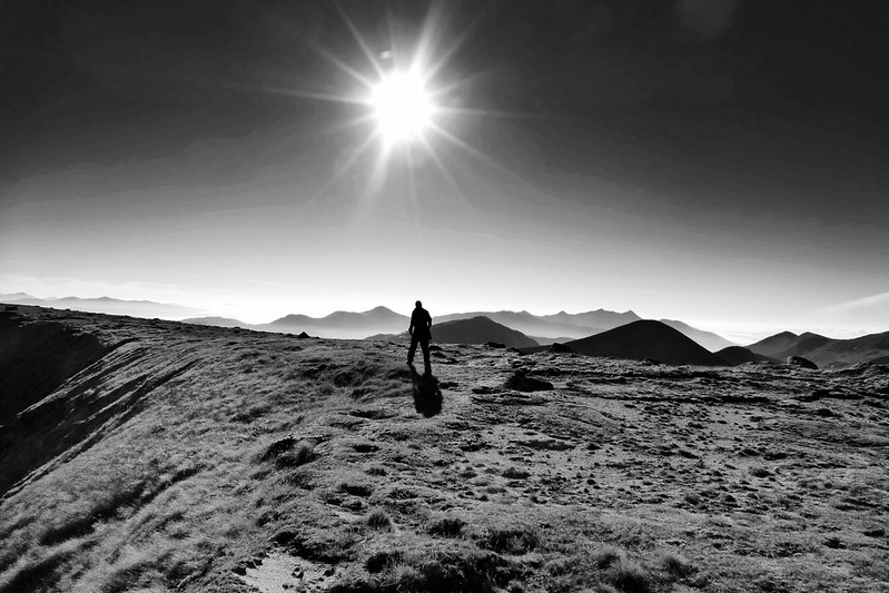 Approaching the summit
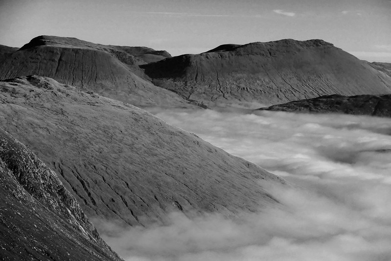 Towards the Bridge of Orchy hills
It was very difficult to tear ourselves away from the summit, but we knew time was marching on and that we had a long way to go still. From the summit, a well-worn path winds down the steep side of the hill, and the second peak of Meall nan Eun teased us from across the bealach. There's a small cairn that indicates the route off, though I should imagine in misty conditions the descent would require careful route-finding.
 About to descend to the bealach, with the summit cone behind us
The descent is a little tricky, but not too bad. Before long we were making our way up towards Meall nan Eun, but the path here is very indistinct and most of the time we were walking on virgin ground (or so it seemed to us).
The views from the top of the hill were also stunning, though the reduced height made it less spectacular. However, this is a relative term! Yesterday's weather meant that
any view was a cracker.
 A very distant Ben More, Crianlarich
The route off Meall nan Eun, down Coirean Riabhach and ultimately Glen Ceitlein, is pretty treacherous. The initial descent into Coirean Riabhach is extremely steep and rough. Though there aren't any really big cliffs, there are lots of little gullies and 10 foot drops, all of which can cause mischief. On top of that, we ground and tussock-y grass meant that this was a real challenge, even for someone who's sure-of-foot. The veiws, though, were stunning as the light started to wane.
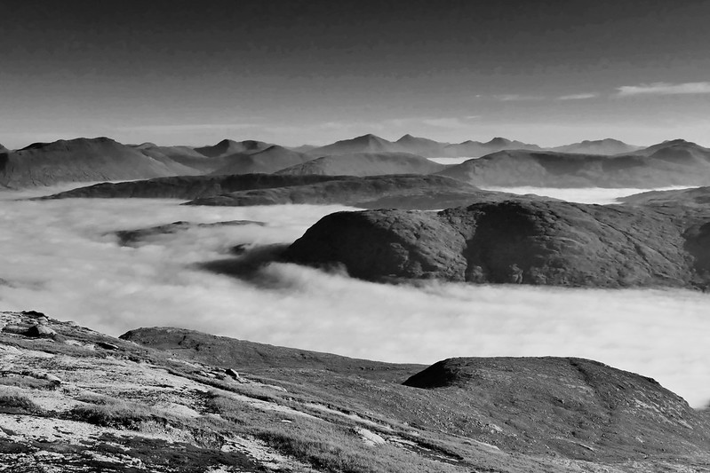
 The view from Meall nan Eun, as we were about to descend into Coirean Riabhach. Glen Ceitlein in the distance
Glen Ceitlein itself is essentially a bog! A 'path' of sorts winds itself back down to the head of the glen, and to the Land Rover track. It was a bit of a trudge to be honest, but the views continued to make up for it.
 Glen Ceitlein
The final walk back was on a good track, and we had taken about 7 hours to do the round. This wasn't very quick for a relatively short distance, but the terrain and the amazing views meant that quick progress was not top of our agenda!
Probably the most visually impressive day I've ever had on the hill. A full set of pics can be found here:
https://www.flickr.com/photos/28183399@N03/sets/72157660816518071