free to be able to rate and comment on reports (as well as access 1:25000 mapping).
And so it begins - swapping the north for the south. For the next few months it's Donalds (plus Grahams and New Donalds - it gets a bit confusing

) A new lexicon - Gaelic swapped for Galwegian and South Scots, farmland instead of (mostly) wild hillsides and deer; turning the car South rather than North - all this will take a bit of getting used to. I have spent some time in Galloway before now and confess to a real liking for this part of the country. So naturally, when it comes to getting started on our new voyage of discovery, we choose the Galloway Hills. This week I reckoned we should try for Cairnsmore of Fleet (the most Southern Graham) and a wee quickie for Sunday when the forecast was less favourable - Millfore.
I had decided to stay at Creebridge Campsite - unlike further north, many campsites down in this part of the world stay open year round. Newton Stewart would be a convenient base for both our chosen hills. I couldn't belive that it took almost 3 hours to drive the 110 miles down to Newton Stewart (mind you it didn't help that I took the wrong turning and went through the centre of Ayr rather than bypassing it). I don't much like the windy road from Girvan to Newton Stewart in the dark, especially when it's raining heavily as it was on Friday, but we arrived safely just before 6 to a rather bemused campsite owner, who was never-the-less very friendly and helpful. There were no other campers (really - surprise, surprise

) and there didn't seem anyone in the static vans either. We pitched up in a small paddock area and settled down for a cool evening - a tasty aubergine stew proved some relief against the cold.
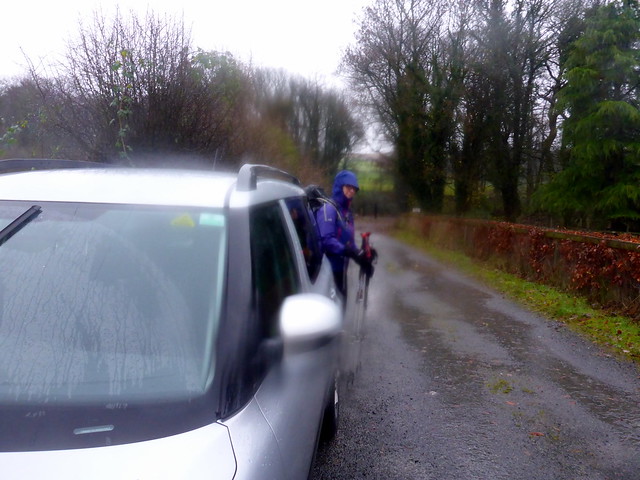
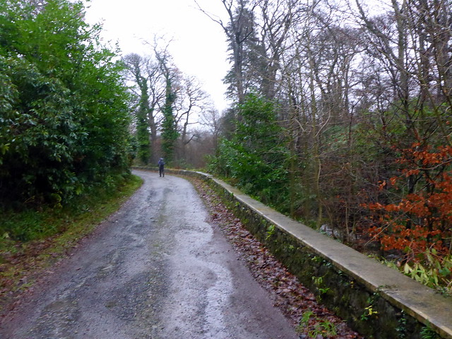
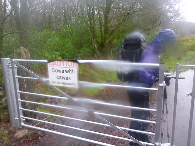
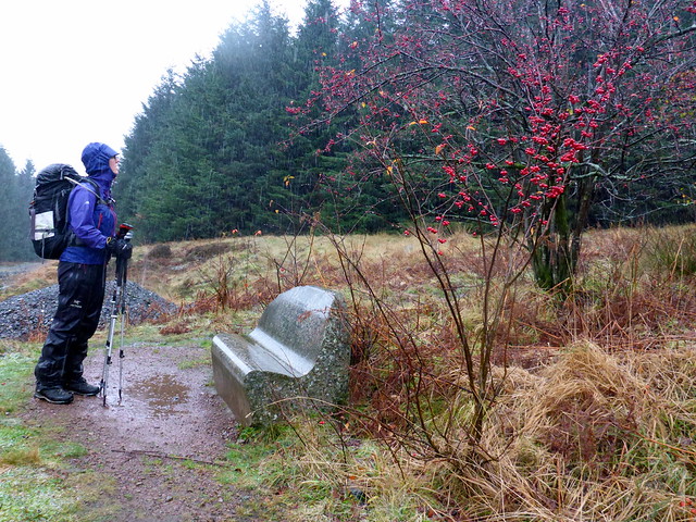
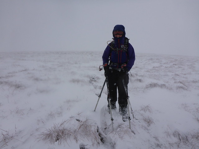
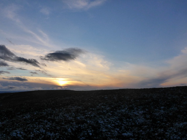
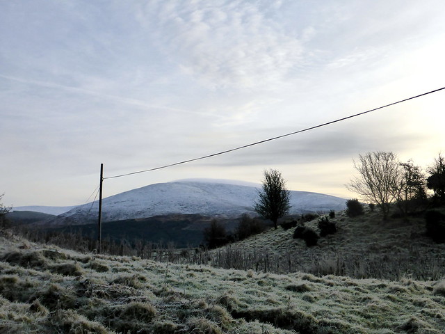
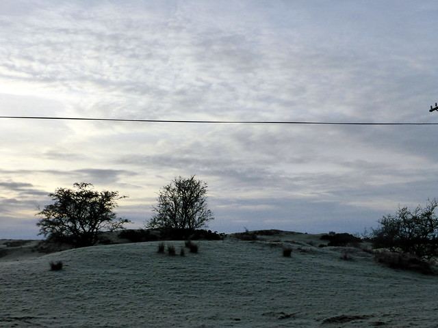
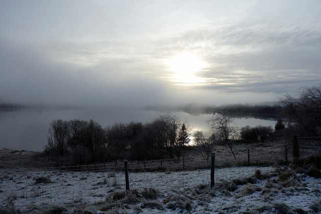
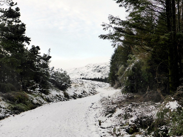
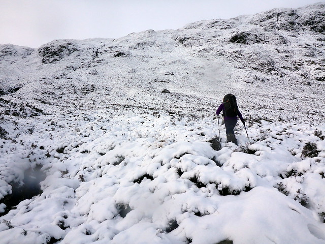
The rain came on heavy about 4 in the morning and didn't stop. It was less than enthusiastically I emerged from the warm sleeping bag into the chill damp air of the tent to make breakfast, even less enthusiastically I sorted out the rucksack contents and prepared to head off. There is a rather strange parking spot past the farm that boasts a 'P' sign but not really any spaces.... we emerged into the dreich weather and set off along the roadway to Cairnsmore Farm. There are clear signs for the "Hillwalk", which lead you through a wooded copse, the ground russet with fallen autumn leaves. Across an (empty) field then into a plantation, walking up a soggy firebreak. We reach a seat made of a huge lump of granite, dedicated to Rosemary Pilkington - a lovely setting with the green of the pines and the vivd red of the rowan berries.
Setting off
 P1110593
 by
Al, on Flickr
 P1110595
 by
Al, on Flickr
 P1110597
 by
Al, on Flickr
 P1110598
 by
Al, on Flickr
 P1110599
 by
Al, on Flickr
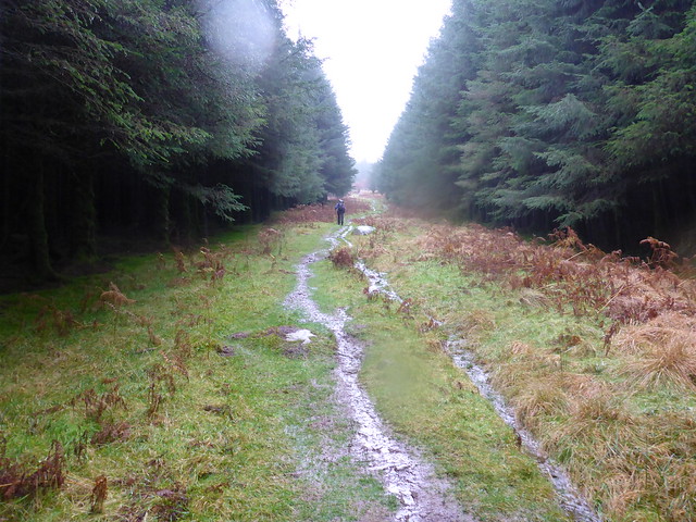
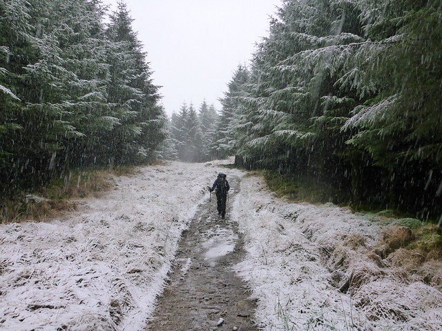
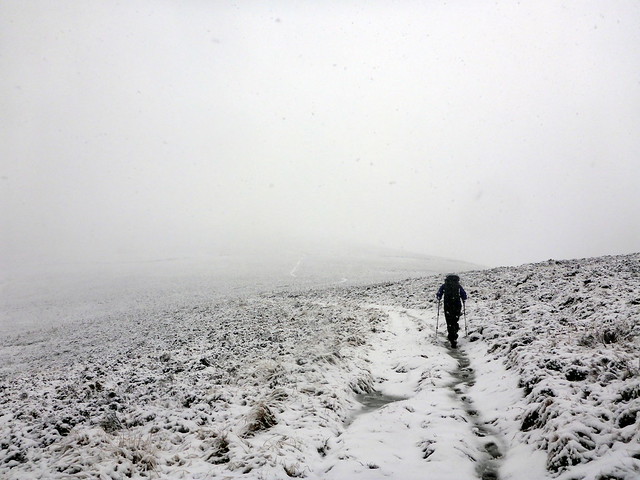
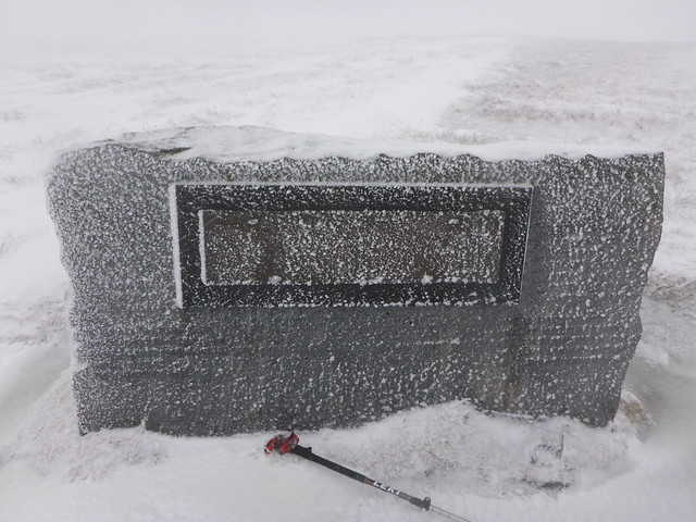
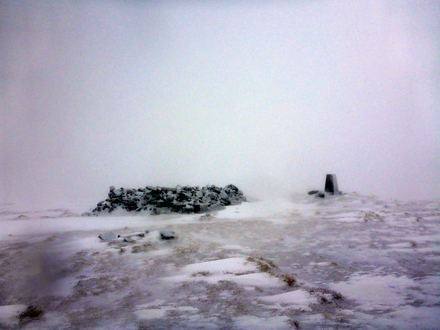
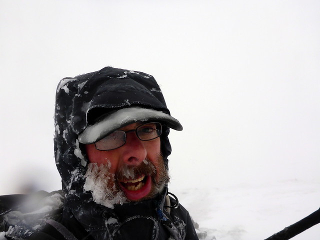
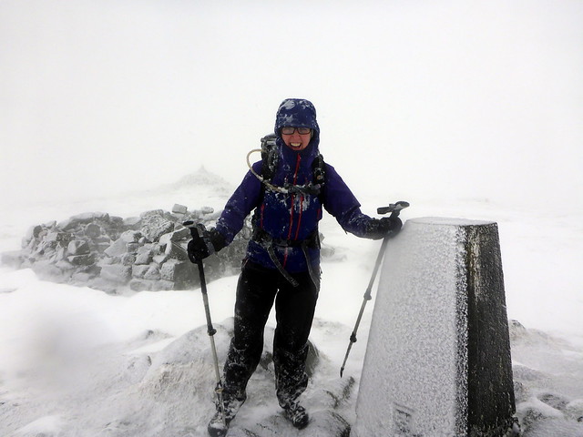
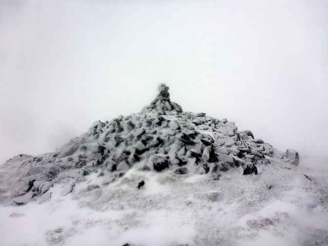
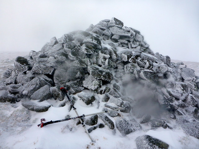
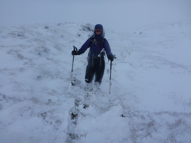
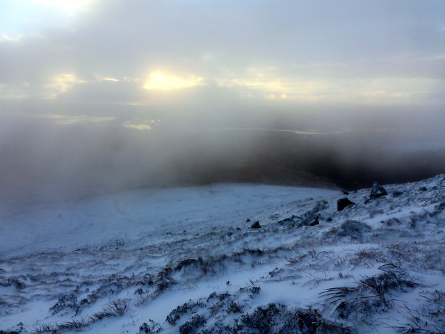
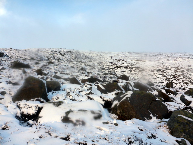
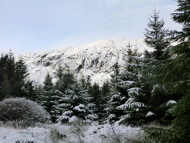
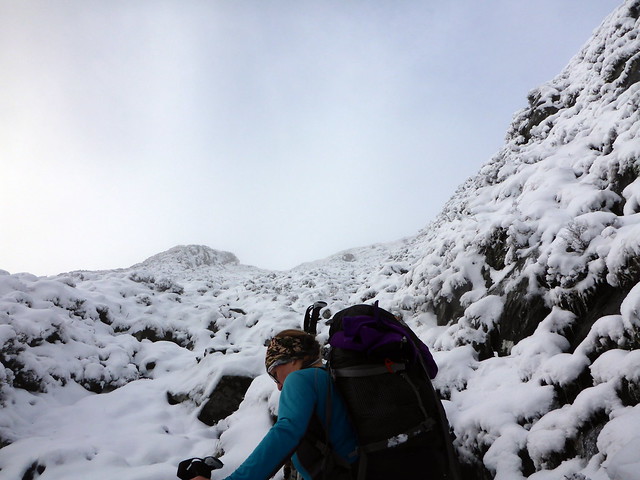
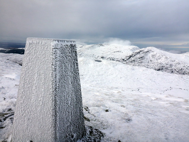
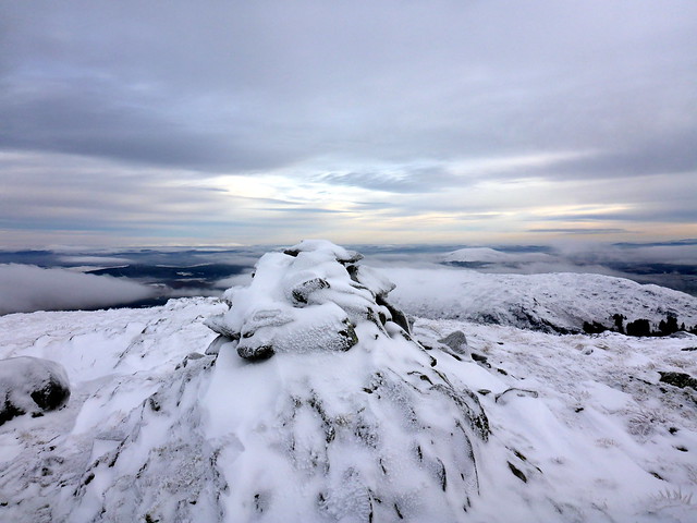
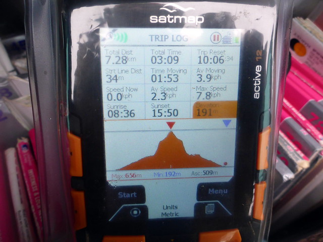
From here on we were into snow - falling heavily between the trees. The pines kept us sheltered from the wind - all was quiet as we tramped up the hillside, the silence of the snow was all around. When we emerged from the treeline at around 400m all was white. We could make out the track running as a whiter line against a blank field. The wind was more evident here and rose as we laboriuosly climbed. Heathery tussocks were blanketed in soft snow, making the going heavy. The wind by now was vicious, blasting snow against faces. I reached the memorial cairn for an astonishing 8 aircraft crashes into this hill (sadly the writing was obliterated by snow and ice). A short distance off was the trig point with a welcome looking shelter - however the wind blew stright through the gap in the wall, rendering the weather protection worthless. We walked over to the Bronze Age stony cairn and set up our Bothybag to shelter from the elements.
 P1110600
 by
Al, on Flickr
 P1110601
 by
Al, on Flickr
Monument
 P1110602
 by
Al, on Flickr
 P1110603
 by
Al, on Flickr
 P1110604
 by
Al, on Flickr
 P1110605
 by
Al, on Flickr
Bronze Age cairn
 P1110606
 by
Al, on Flickr
Shelter!
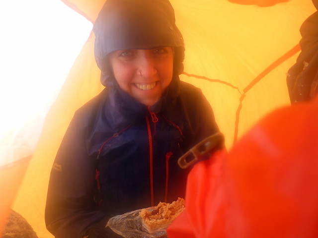 P1110607
 by
Al, on Flickr
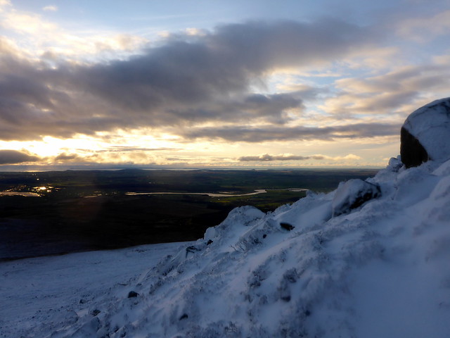
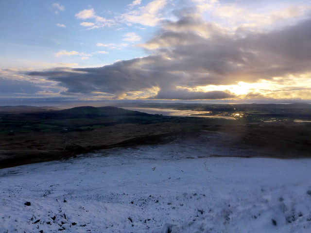
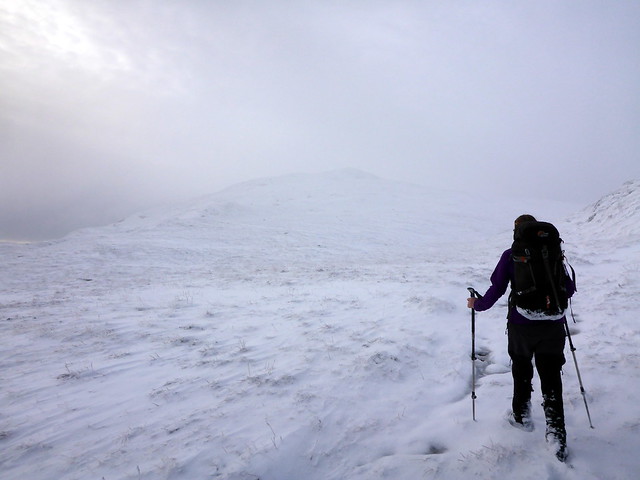
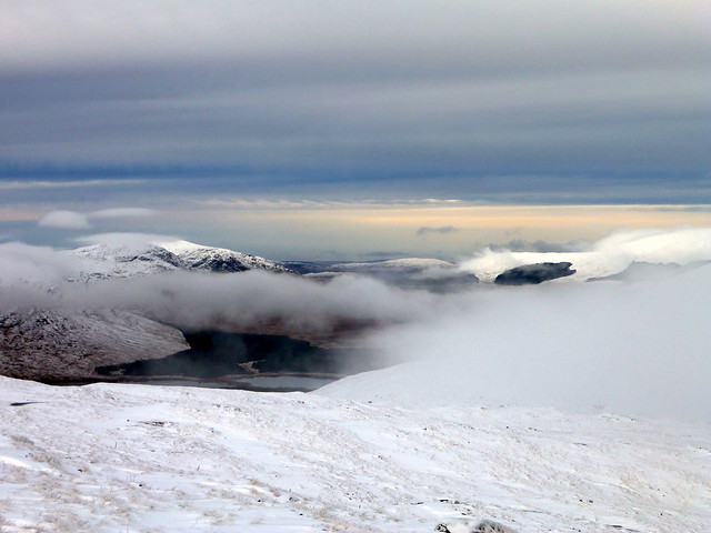
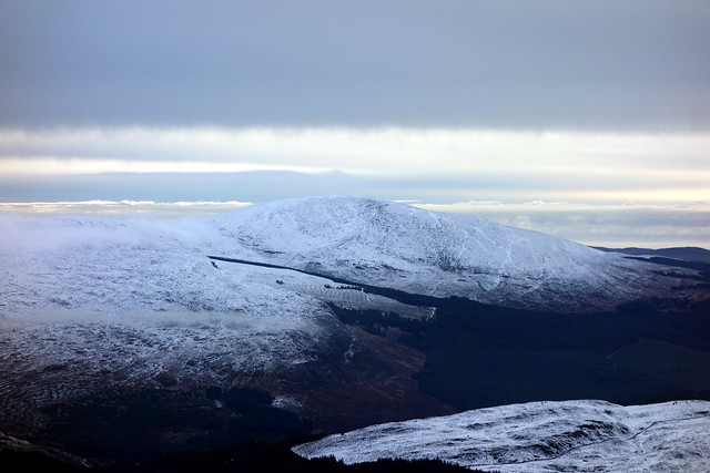
Our task after emerging fed and watered, was to head over to Meikle Mulltaggart. This involved a descent of 150m down snowy slopes then a short climb to the uncairned top of this New Donald. Unfortunately at the dip between the hills I managed to 1) cross a fence and sink up to my knees in freezing cold bog, cunningly camouflaged by snow and 2) set off back up Cairnsmore rather than Meikle Mulltaggart in the poor visibility. It dawned on me when my GPS read 600m and we should have been almost at the top of the hill, when all I could see was slopes rising upwards into the white. Cursing, I turned round and we retraced our steps then achieved the top. Then back up towards the top of Cairnsmore, bypassing the cairn itself on the way to our final objective of the day, Knee of Cairnsmore. We struggled with poor visibility and a wind that was really strong by now, blowing us to the side. We met a fence line which helped keeping on track and pressed on along the edge of a corrie we couldn't see. Finally we changed direction turning due south reaching the large cairn. What should we do - head back along to the path we'd come up on, or go down the shoulder of the "Knee" as it were. We opted for the latter and set off down an unusual runnel with large stones on either side. As we dropped in height we dropped under the clag and caught sight of Wigton Bay and golden glimmering sunshine on the water. Unfortunately the going became challenging - the deep snow hid holes in the heather and rocks and it took quite a time to descend. We were making for a path shown on the map, but this seemed to be something of a virtual path rather than an actual one and the terrain underfoot was boggy heather. No matter, it was by now a lovely afternoon, with a big sky ahead of us, the sun putting a golden lining into the clouds. We could see behind us the hill that we'd climbed as we plodded down towards the Graddoch Burn where we did meet a track and continued on our way back down to Cairnsmore Farm and joined our outward route. Darkness fell just as we got back to the car and shed our wet boots.
Top of Meikle Mulltaggart
 P1110608
 by
Al, on Flickr
Knee of Cairnsmore
 P1110609
 by
Al, on Flickr
 P1110610
 by
Al, on Flickr
 P1110612
 by
Al, on Flickr
 P1110616
 by
Al, on Flickr
 P1110617
 by
Al, on Flickr
Challenging underfoot
 P1110618
 by
Al, on Flickr
 P1110623
 by
Al, on Flickr
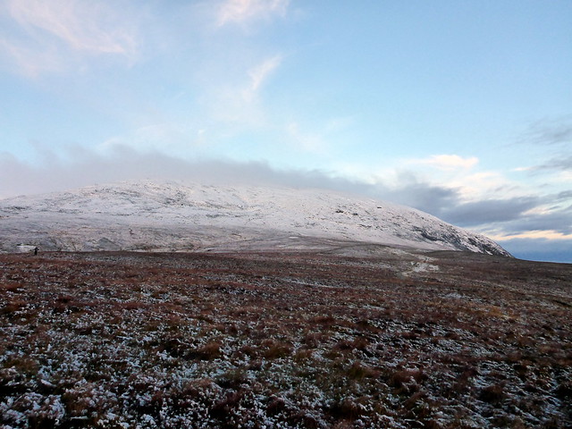
Cairnsmore
 P1110622
 by
Al, on Flickr
Track
 P1110627
 by
Al, on Flickr
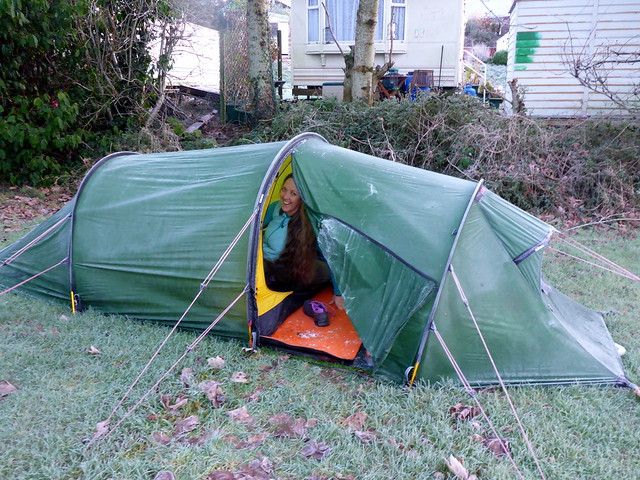
Returning to the tent it was a clear sky above, we knew it was going to be a cold night. I briefly thought of heading into Newton Stewart to see what culinary delights were on offer, but instead made a Madras that we enjoyed in the tent, the condensation filling the air. Too cold to set off out into the night. A wee nip (Port Askaig 100 degree proof) to fend off the cold and into the sleeping bag. it was indeed a cold night - when we woke in the morning there was ice not only on the tent outer, but the inner too. The water bottle contained shards of ice and it was even worse in the car where we'd dumped the wet outer clothes - everything was frozen solid and the inner side of the car windows were thick with ice. A bit of time with the engine running and the heater on, whilst we tried to fold away a tent that was frozen solid like cardboard, did the trick and we were set to go.
Icy tent
 P1110630
 by
Al, on Flickr
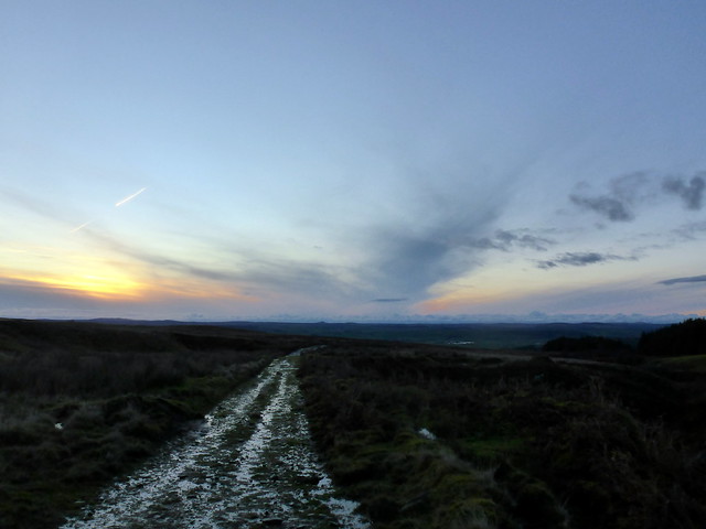
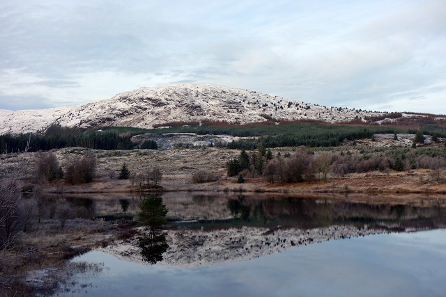
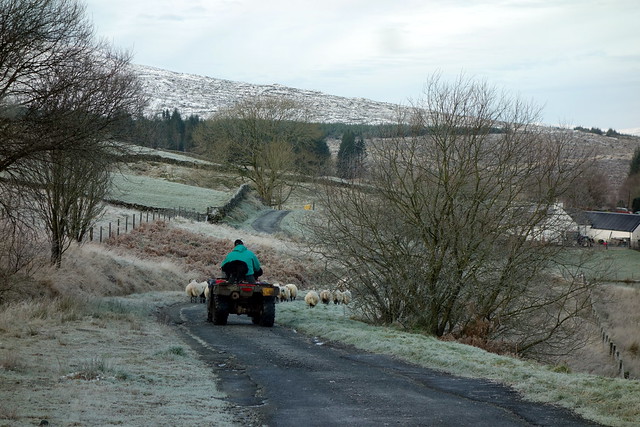
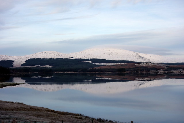
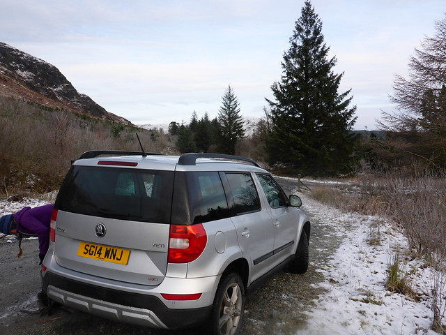
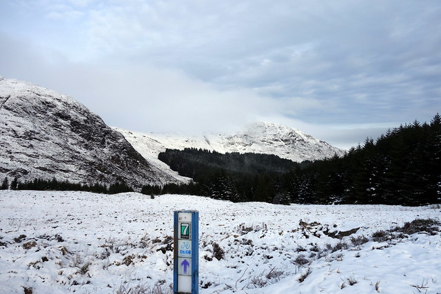
Today's chosen hill was Millfore, the eastern outlier of a group of four Donalds, of which we've done the central two - Curleywee and Lamachan Hill. We drove up the New Galloway road, turning off just west of Clatteringshaws Loch onto a single track road, covered with ice in parts. It was a fabulous morning, clear and crisp, tree and grasses covered with a dressing of frost. areas of mist bringing a sense of mystery to the landscape. I had to stop a couple of times driving around the loch to take a snap or two of the Rhinns of Kells reflected in the still icy waters. We were held up by a shepherd driving a flock of around 50 sheep along the road with a quadbike, a very keen collie perched on the back. After the sheep headed into their pasture we drove on, reaching the turn in the road just shy of Craigencaillie House and parking up. There's a track which runs into the woods for a couple of kilometres - actually it would be possible to drive up this and leave the car just where you head off across the hillside for Millfore, but we wanted to stretch our legs.
Cairnsmore, from the road
 P1110632
 by
Al, on Flickr
A fine frosty morn
 P1110633
 by
Al, on Flickr
Clatteringshaws
 P1110636
 by
Al, on Flickr
Rhinns of Kells
 DSC00115
 by
Al, on Flickr
 DSC00118
 by
Al, on Flickr
Rural roadjam
 DSC00119
 by
Al, on Flickr
 DSC00120
 by
Al, on Flickr
parking spot
 P1110638
 by
Al, on Flickr
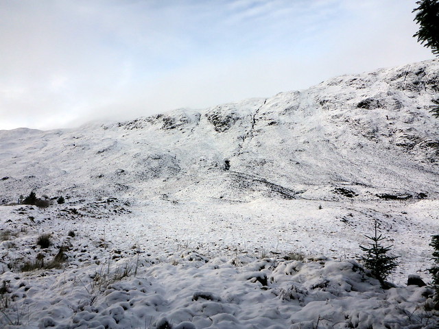
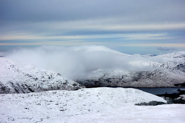
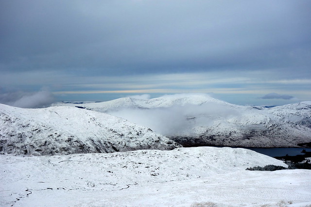
The path was covered with a thick layer of frost and a record of the other, non-human, road users - a set of fox tracks was joined by another; signs of scuffles; a vole or similar small creature running at right angles; the tiny branching stamp of bird feet. We reached a post signaling the cycleway and set off into the snow. Once more it was heathery tussocks covered by snow that was 4-6 inches deep. There's a ridgeline - the Buckdas of Cairnbaber and we elected - or rather I suggested - we go the direct route up, following a streamline. It was quite steep in places but all good fun. We reahed a flatter area at the top and could see Millfore rise against the sky over to our left. More galumphing through snow and we reached the summit. The wind was cold here, chilling us despite the bright day to the point of needing to donn belay jackets whilst we ate lunch, enjoying the splendid scenery - north over to the Merrick, south to Cairnsmore of Fleet and the dull silver of Wigton Bay. Strips of mist and cloud lent character to the views. We traced our steps back down to the track then breezed along back to the car. A fine day out, a fine start to our Donald adventures.
Frosty track
 P1110640
 by
Al, on Flickr
Buckdas of Cairnbaber
 P1110641
 by
Al, on Flickr
 DSC00121
 by
Al, on Flickr
We headed up to the left of the streamline
 P1110642
 by
Al, on Flickr
 P1110643
 by
Al, on Flickr
 P1110648
 by
Al, on Flickr
Millfore up to the left
 P1110650
 by
Al, on Flickr
View north
 P1110653
 by
Al, on Flickr
 P1110655
 by
Al, on Flickr
 P1110656
 by
Al, on Flickr
 DSC00131
 by
Al, on Flickr
 DSC00132
 by
Al, on Flickr
View east
 P1110658
 by
Al, on Flickr
Cairnsmore of Fleet
 DSC00129
 by
Al, on Flickr
The Merrick
 DSC00133
 by
Al, on Flickr
 DSC00134
 by
Al, on Flickr
 P1110661
 by
Al, on Flickr
