
Mullwhaurchur Circuit
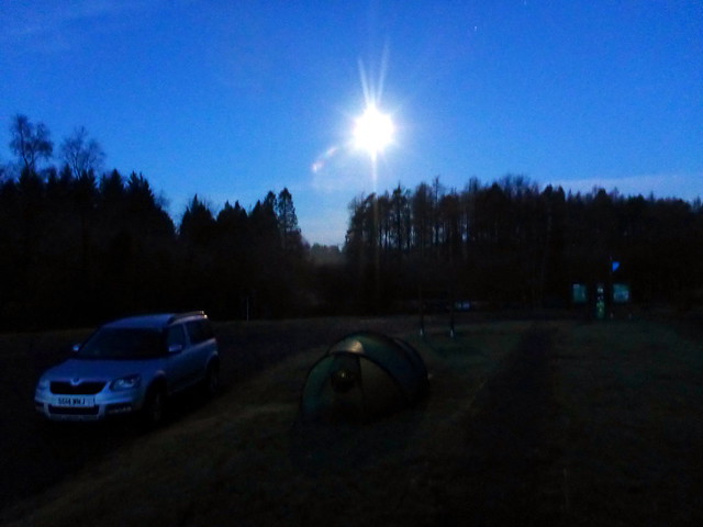
For the Xmas season we managed to find one full hill day. Allison was working til 3ish on Saturday, so I arranged to collect her and head off to the Galloway hills after work. It had rained all day and continued to do so, heavily, as we drove the miles down to Glen Trool. I was encouraged however by the positive forecast for Sunday which promised dryness, even sunshine  I wasn't sure where we should pitch - assuming the campsites to be closed for the festivities, so we ended up pitching in the car park at the Glen Trool Visitor Centre - perfectly serviceable and not a car passed us by all evening. So much for the "Dark Sky Park" as it calls itself - the moon blazed down white light all night. That didn't stop me from having semi-hallucinatory dreams of carsfull of yobs driving up in the middle of the night, music blaring etc etc.
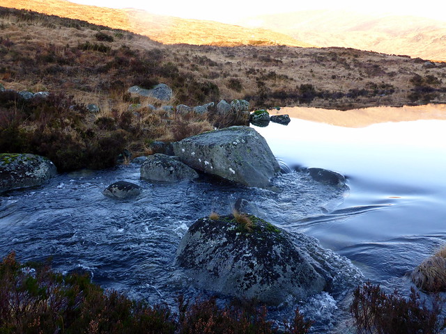
Early morning, moon still shining bright
 P1110705 by Al, on Flickr
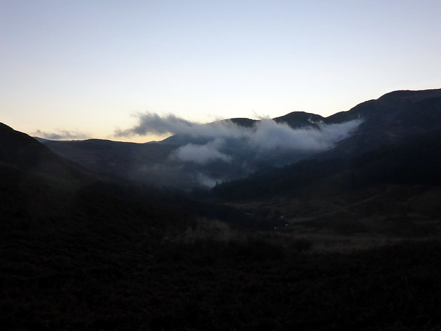
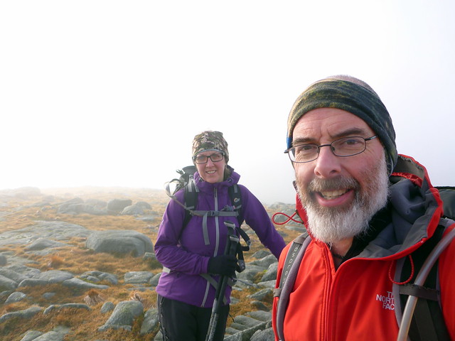
Up at 7ish to a dry but cool morning - some frost on the tent. The moon was still in evidence, as were a few stars as we drove the 3 miles to The Bruce's Stone and prepared to set off - another car joined us with a guy who headed off in the same direction, but a good deal quicker. i wanted to get the 3 Donalds - Craignaw, Dungeon Hill and Mullwharchar - but couldn't decide whether to return around Loch Enoch or head up The Merrick, taking advantage of the better track back to the car park from there. It would also allow Allison to get the New Donald of Benyellary which I had claimed on an earlier walk. We'd see how it went.
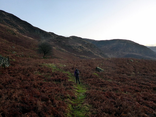
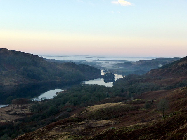
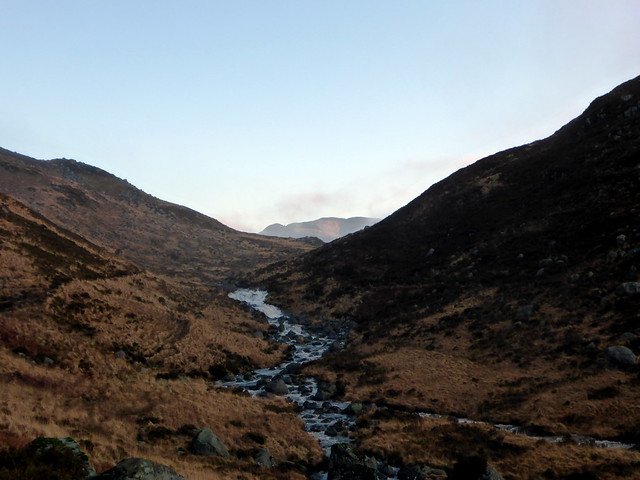
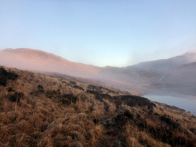
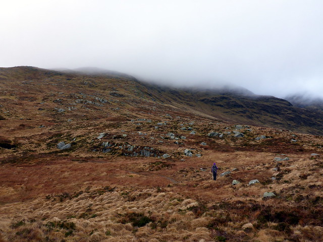
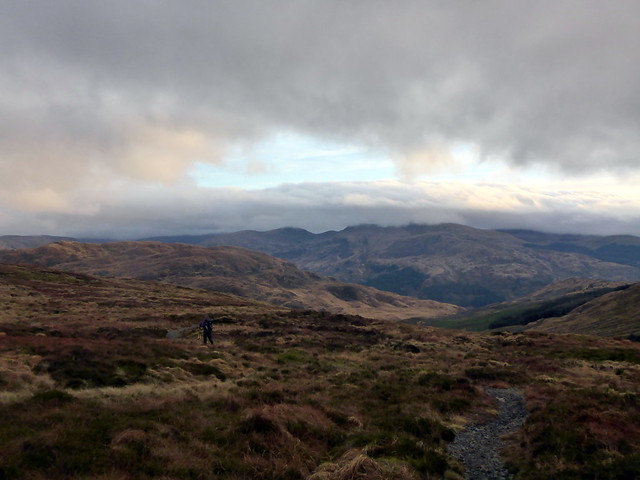
The start of the walk heads down hill, never a good feeling at the outset of a walk. We set out along the signed path, boggy in places, that eventually runs alongside the Gairland Burn and up to Loch Valley. The weather was lovely, after all the recent rain, the view back to Loch Trool with Luce Bay beyond pretty, with areas of low cloud on the water. I rapidly shed a couple of layers of clothing in the sunshine. We skirted round Loch Valley and crossed over Mid Burn to gain the lower slopes of Craignaw. A hill full of knobbles and crags, but easy enough to navigate in today's visibility. Up to the summit - some nice views over our onward route, Merrick topped with cloud.
Towards Curlywee
 P1110710 by Al, on Flickr
 P1110711 by Al, on Flickr
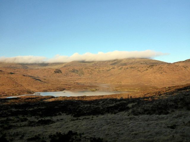
View back along Loch Trool
 P1110712 by Al, on Flickr
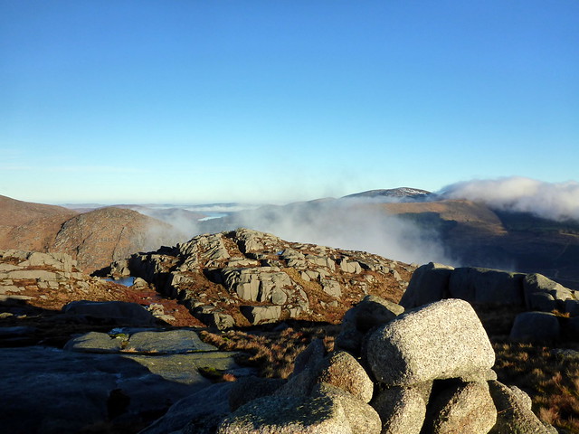
Craignaw ahead
 P1110717 by Al, on Flickr
 P1110724 by Al, on Flickr
Craignaw
 P1110727 by Al, on Flickr
 P1110730 by Al, on Flickr
Crossing Mid Burn
 P1110731 by Al, on Flickr
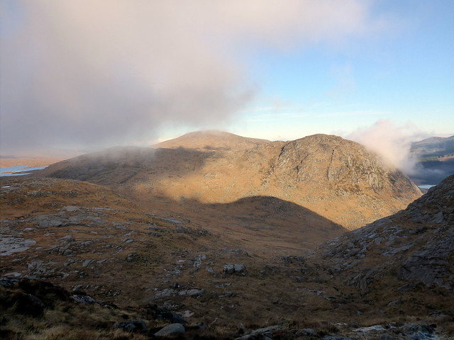
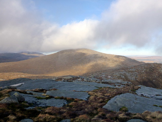
Over to Merrick/Kirriereoch
 P1110732 by Al, on Flickr
 P1110734 by Al, on Flickr
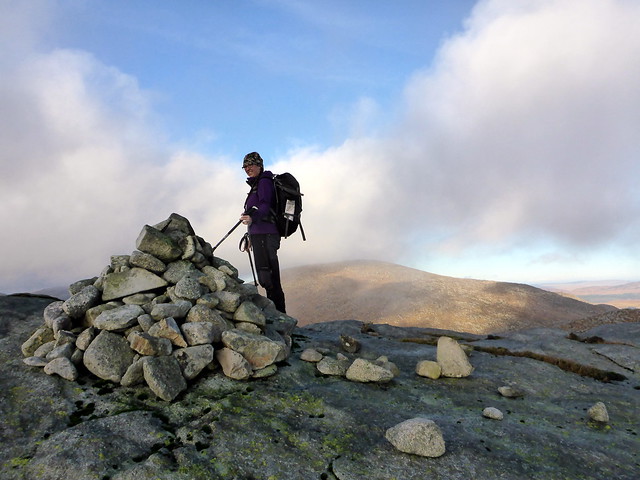
Summit Craignaw, Mullwharchar ahead
 P1110736 by Al, on Flickr
Some snow on Corserine
 P1110737 by Al, on Flickr
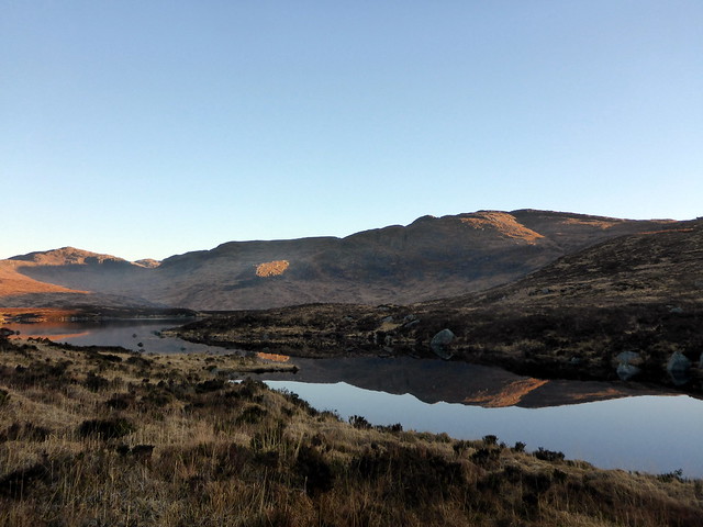
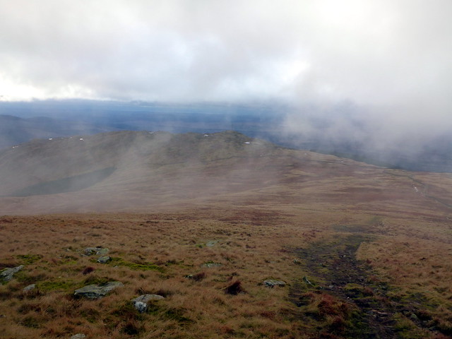
We descended steeply, through the crags and made for our next target, Dungeon Hill. There's quite a loss of height if you stray into Nick of the Dungeon, so we contoured round the north side of Craignaw and picked up a faint path which led to the summit of Dungeon. We paused for some lunch - although the sun was still out it was chilly when we stopped. Refreshed we set off again for Mullwharchar - apparently one of the more remote Donalds, so good to get it undertaken without a thick covering of snow to wade through. At the summit it was time to decide which route we were taking back - Allison didn't put up too much resistance to the idea of The Merrick. In fact it was an easy amble, 350m maybe, but not much to it. Clag was around us from about halfway up - my third time up The Merrick, my third time with no view
Dungeon Hill
 P1110740 by Al, on Flickr
Coming off Craignaw
 P1110741 by Al, on Flickr
Craignaw from the north
 P1110743 by Al, on Flickr
Dungeon summit
 P1110745 by Al, on Flickr
Mullwharchar
 P1110746 by Al, on Flickr
Tentacles of Loch Enoch from Mullwharchar
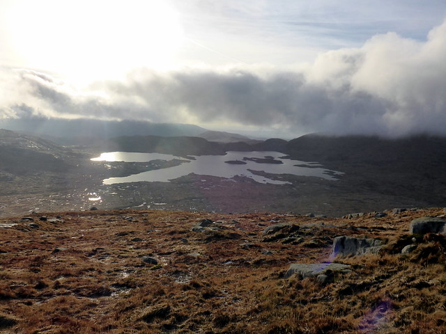 P1110749 by Al, on Flickr
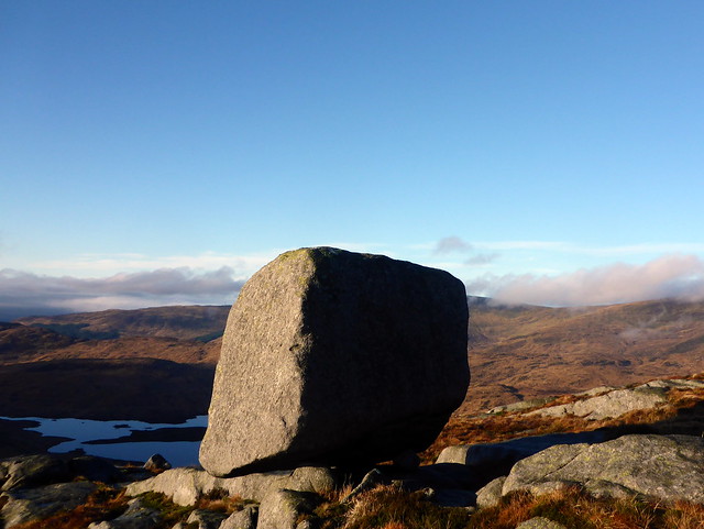
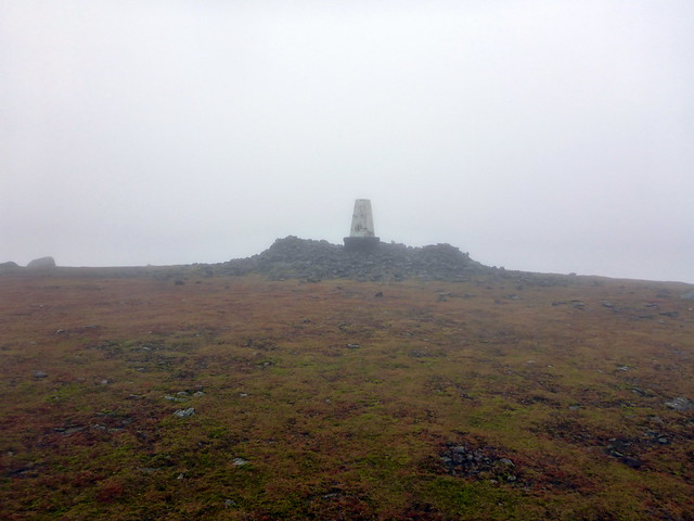
Summit Mullwharchar
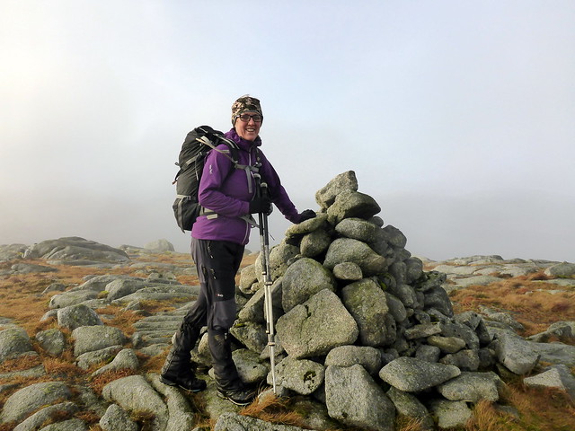 P1110751 by Al, on Flickr
 P1110752 by Al, on Flickr
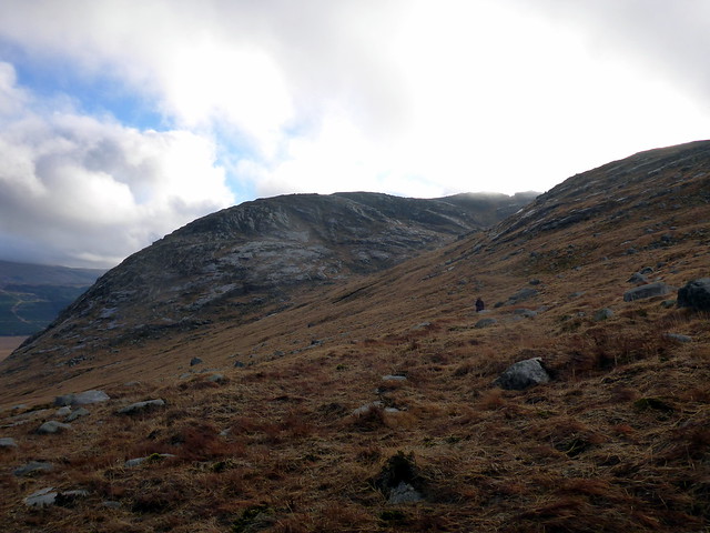
Up Redstone Rig
 P1110754 by Al, on Flickr
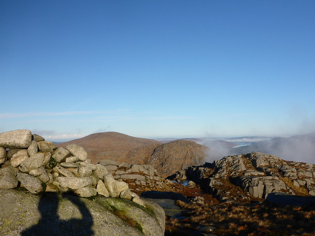
Merrick summit
 P1110755 by Al, on Flickr
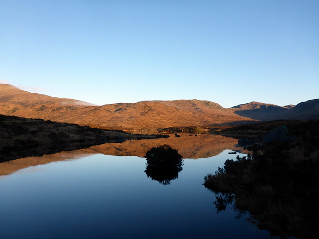
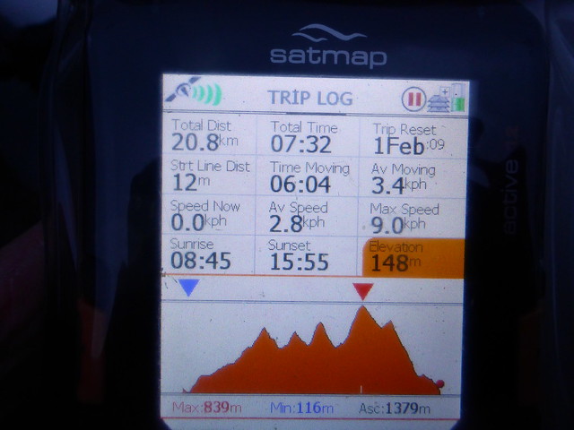
Once we reached to trig point it was simply a matter of following the path along the Neive of the Spit to Benyallary, then down the hillside. We dropped below the clagline, views over to Lamachan Hill, down into the treeline and past the Forestry Commission bothy at Culsharg - we peeked inside - it's bare but serviceable. The path from there back to the car park is in a state of some disrepair - lots more erosion than I remember from a few years back. However, we made it back in seven and a half hours, a really good stretch of the legs after the festive overindulging.
Heading down from Benyellary
 P1110758 by Al, on Flickr
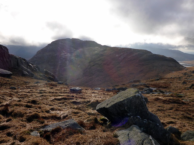
Lamachan Hill
 P1110760 by Al, on Flickr
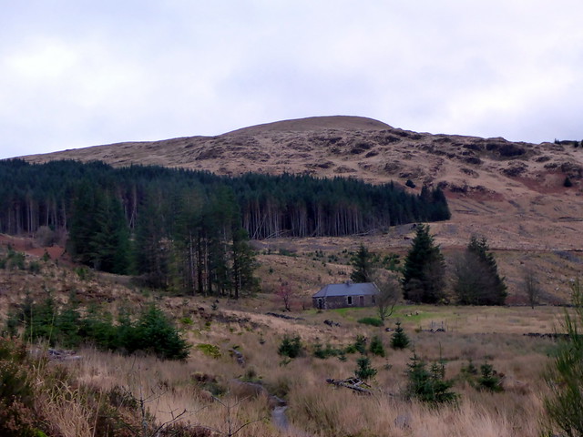
Culsharg Bothy
 P1110761 by Al, on Flickr
Stats
 P1110763 by Al, on Flickr
Early morning, moon still shining bright
P1110705 by Al, on FlickrUp at 7ish to a dry but cool morning - some frost on the tent. The moon was still in evidence, as were a few stars as we drove the 3 miles to The Bruce's Stone and prepared to set off - another car joined us with a guy who headed off in the same direction, but a good deal quicker. i wanted to get the 3 Donalds - Craignaw, Dungeon Hill and Mullwharchar - but couldn't decide whether to return around Loch Enoch or head up The Merrick, taking advantage of the better track back to the car park from there. It would also allow Allison to get the New Donald of Benyellary which I had claimed on an earlier walk. We'd see how it went.
The start of the walk heads down hill, never a good feeling at the outset of a walk. We set out along the signed path, boggy in places, that eventually runs alongside the Gairland Burn and up to Loch Valley. The weather was lovely, after all the recent rain, the view back to Loch Trool with Luce Bay beyond pretty, with areas of low cloud on the water. I rapidly shed a couple of layers of clothing in the sunshine. We skirted round Loch Valley and crossed over Mid Burn to gain the lower slopes of Craignaw. A hill full of knobbles and crags, but easy enough to navigate in today's visibility. Up to the summit - some nice views over our onward route, Merrick topped with cloud.
Towards Curlywee
P1110710 by Al, on FlickrP1110711 by Al, on FlickrView back along Loch Trool
P1110712 by Al, on FlickrCraignaw ahead
P1110717 by Al, on FlickrP1110724 by Al, on FlickrCraignaw
P1110727 by Al, on FlickrP1110730 by Al, on FlickrCrossing Mid Burn
P1110731 by Al, on FlickrOver to Merrick/Kirriereoch
P1110732 by Al, on FlickrP1110734 by Al, on FlickrSummit Craignaw, Mullwharchar ahead
P1110736 by Al, on FlickrSome snow on Corserine
P1110737 by Al, on FlickrWe descended steeply, through the crags and made for our next target, Dungeon Hill. There's quite a loss of height if you stray into Nick of the Dungeon, so we contoured round the north side of Craignaw and picked up a faint path which led to the summit of Dungeon. We paused for some lunch - although the sun was still out it was chilly when we stopped. Refreshed we set off again for Mullwharchar - apparently one of the more remote Donalds, so good to get it undertaken without a thick covering of snow to wade through. At the summit it was time to decide which route we were taking back - Allison didn't put up too much resistance to the idea of The Merrick. In fact it was an easy amble, 350m maybe, but not much to it. Clag was around us from about halfway up - my third time up The Merrick, my third time with no view
Dungeon Hill
P1110740 by Al, on FlickrComing off Craignaw
P1110741 by Al, on FlickrCraignaw from the north
P1110743 by Al, on FlickrDungeon summit
P1110745 by Al, on FlickrMullwharchar
P1110746 by Al, on FlickrTentacles of Loch Enoch from Mullwharchar
P1110749 by Al, on FlickrSummit Mullwharchar
P1110751 by Al, on FlickrP1110752 by Al, on FlickrUp Redstone Rig
P1110754 by Al, on FlickrMerrick summit
P1110755 by Al, on FlickrOnce we reached to trig point it was simply a matter of following the path along the Neive of the Spit to Benyallary, then down the hillside. We dropped below the clagline, views over to Lamachan Hill, down into the treeline and past the Forestry Commission bothy at Culsharg - we peeked inside - it's bare but serviceable. The path from there back to the car park is in a state of some disrepair - lots more erosion than I remember from a few years back. However, we made it back in seven and a half hours, a really good stretch of the legs after the festive overindulging.
Heading down from Benyellary
P1110758 by Al, on FlickrLamachan Hill
P1110760 by Al, on FlickrCulsharg Bothy
P1110761 by Al, on FlickrStats
P1110763 by Al, on Flickr