free to be able to rate and comment on reports (as well as access 1:25000 mapping).
It was back to the Galloway hills this weekend. I'd planned two fairly lengthy circuits - one taking in 6 summits round Windy Standard, the next 5 round Coran of Portmark. Ambitious in the prevailing conditions forecast for the weekend...snow and rain. Those plans were dealt another blow when Allison came round with her stuff on Thursday night and was clearly in much pain with a sprained back. Oh dear

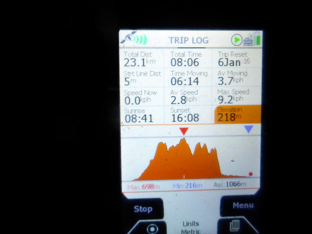
We got away from work just after 3 in Friday and I had hopes to be pitched at the tiny farm campsite at Hawkrigg before the light entirely disappeared - situated 4 miles past Carsphairn this would be perfectly suited for the weekend plans. I was mildly alarmed to see a number of cars with several inches of snow on them coming up from the south. By the time we reached Saltcoats, the main road had been closed due to snow and we began a tiresome diversion through Saltcoats itself, crawling at a snail's pace or just sitting at lights. It didn't improve much all the way to Ayr - in fact it took 3 hours to reach Dalmellington - a mere 60 miles from where we set off. And there was hardly any snow on the road, certainly nothing my 4x4 with winter tyres would shrug at

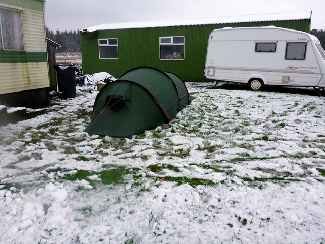
. As a result it was after 6.30 when we finally reached Hawkrigg. The farmer, a cheery bloke from the Black Country, said he'd not put us in the camping field as we'd need gills, but instead we could camp on a bit of lawn near the house. We were happy to get the tent up, on top of a couple inches of snow, and set about making some dinner. A fairly peaceful night followed, no more snow fell.
 P1110838
 by
Al, on Flickr
We chatted to the farmer for a bit before leaving in the morning then set off for Craigengillan, on the Water of Ken for our first walk. My original plan had been to take in Beninner then do a circuit of Moorbrock, Windy Standard, Alhang and Alwhat. I'd rethought this as there would be a lot of re-ascent and a river crossing to do Beninner, so decided to exclude this and add on Meikledodd and Blacklorg. Much depended on how deep the snow was up top. We parked by Old Craigengillan Cottage - which seemed empty - maybe a holiday let. Not very welcoming for parking around this neck of the woods, but I reckoned I wouldn't be too obtrusive alongside the cottage wall. I hummed and hawed about whether to take snow shoes or not - in the end deciding not to encumber ourselves. We set off up the track past a few houses - easy going with just a dusting of snow. Across a ruined bridge then joining up with the estate road to Moorbrock House, which seemed deserted as we passed by. It looked like the clag was down to about 350m - we'd not be seeing much today. We took a forest track to the left which wasn't shown on the map - this took us past a couple of watchtowers before ending unhelpfully in the middle of the wood. The close-planted conifers offered no way through, but we regained the intended track by means of a handy firebreak. Although the snow was now a few inches deep it was still easy making headway with the firm track under the snow to give traction. We turned off to the right after roundin Green Hill and pressed on a rougher track, harder going. We reached the motley collection of rocks that marked the summit of Moorbrock at around 11.45 and continued over Keogh Rigg (a Donald Top) where we stopped for a bite to eat before pressing on through the clag towards Windy Standard. This involved passing the Deil's Putting Stone and the Bitch Hole, both of which, fortunately were obscured by the mist

As we neared Windy Standard there was the eerie sound of the turbines without being able to see the machines. Eventually they did emerge faintly from the clag. We picked our way around them and made for the trig point.
 P1110839
 by
Al, on Flickr
 P1110840
 by
Al, on Flickr
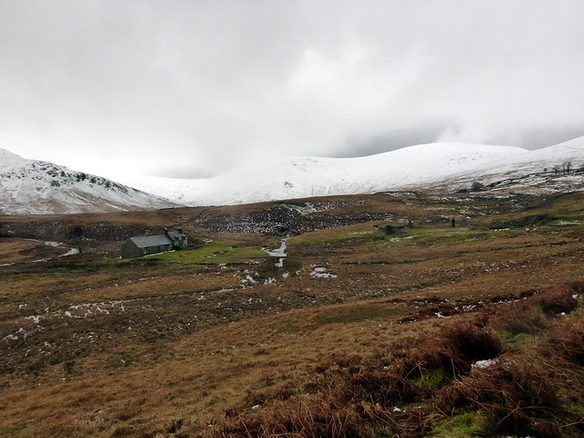
Moorbrock estate
 P1110841
 by
Al, on Flickr
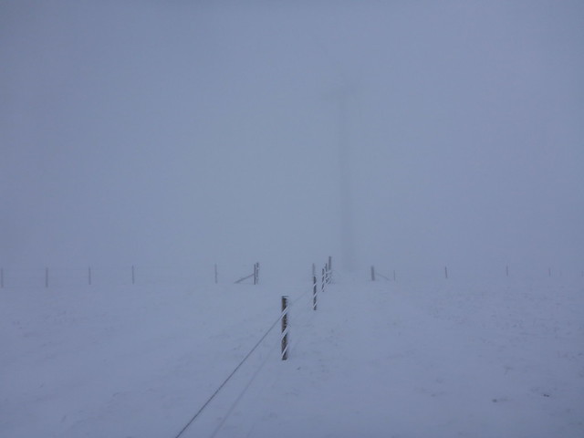
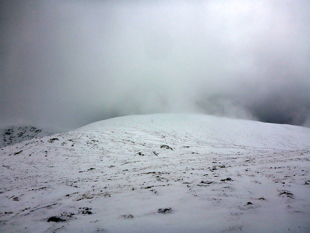
Into the clag
 P1110842
 by
Al, on Flickr
Sinister sentry post
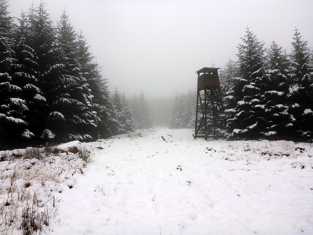 P1110843
 by
Al, on Flickr
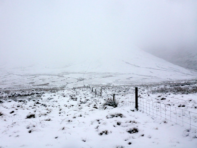
Moorbrock summit
 P1110845
 by
Al, on Flickr
Keogh Rig
 P1110846
 by
Al, on Flickr
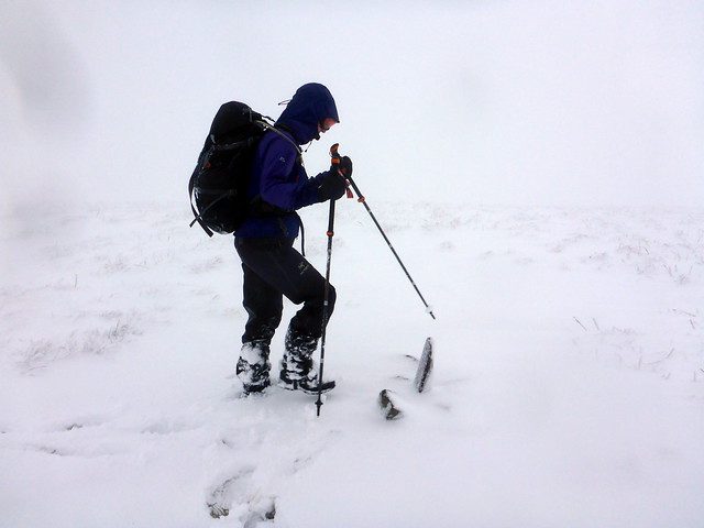
The plan now was to go over Alhang and Alwhat, cutting the route short by descending off Ewe Hill - Allison was starting to struggle and it would add on several km of plodding though wet snow to add the other two hills. We dropped out of the clag as we went down from Windy Standard to see a fenceline dropping down towards Alhang and then rising straight back up into the clag. The terrain was wet and tussocky and I don't think snowshoes would have been much of an assist on this. Allisonwas becoming more laboured by the minute and i| started to have some concerns about whether we'd get off the hills by nightfall - I wasn't troubled about walking the 6km along the road in the dark, but I didn't want to still be on the hillside. Another tiny carin marked the top of Alhang and we pressed on the short distance to Alwhat. No cairn at all, just a confluence of fence lines at the summit. With some relief we set off downhill, hoping that this would allow Allison a chance to recover her energies. At the 505m point we were faced with a re-ascent - either we could go across Mid Rig or continue down Ewe Hill as intended - either way we had another 80m to go back up. This was not greeted with much enthusiasm by my partner
I thought she must have keeled over in the snow as it took so long for her to catch me up on Ewe Hill - I could see her hipflex muscle was also playing up with walking through the snow. She looked done in. I was now genuinely concerned for her, and about getting off the hill in the remaining light. I transferred most of the items in her rucksack to mine and insisted she eat a chocolate/marzipan bar. She hates marzipan and replied that it was disgusting, but it did provide her with enough energy to get going again. We were soon up to the small cairn and could start off downhill, past the sparse forestry plantation by Quarrel End and down a very slippy hillside (wet grass with wet snow on top of it in the fading light - not good if you are trying to avoid slipping and further twisting your back). We got to the road at the bottom - from here on it was straightforward - Allison's marzipan-energy allowed her to make a good pace back along the road and we were back at the car in another hour's walking - the second half of that in headtorch light.
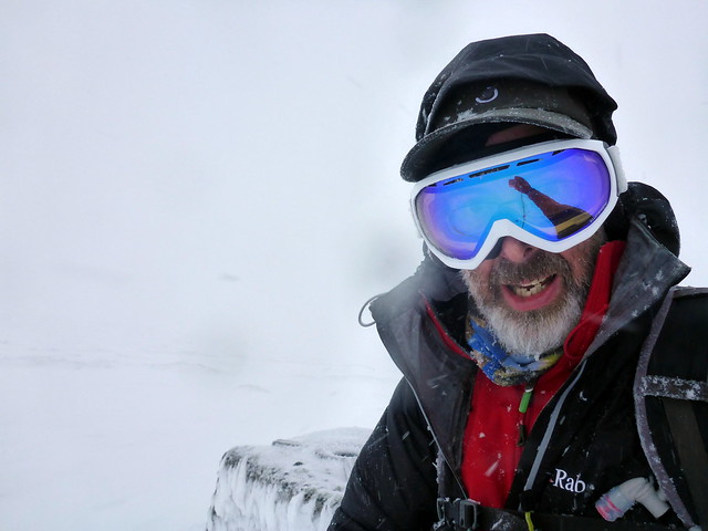
Approaching Windy Standard
 P1110847
 by
Al, on Flickr
Ghost turbine
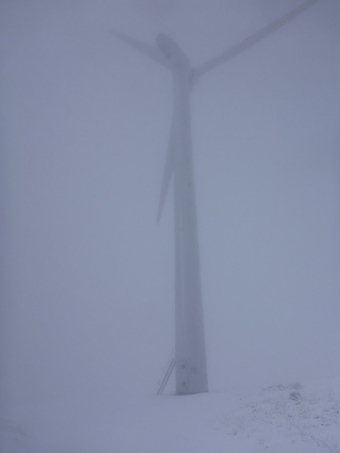 P1110848
 by
Al, on Flickr
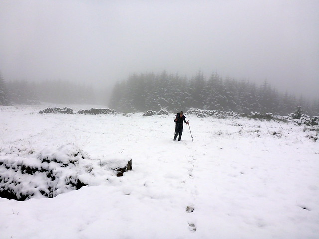
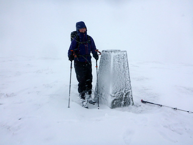
Summit- Windy Standard
 P1110849
 by
Al, on Flickr
 P1110850
 by
Al, on Flickr
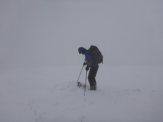
Descent/ascent to Alhang
 P1110851
 by
Al, on Flickr
Alhang
 P1110852
 by
Al, on Flickr
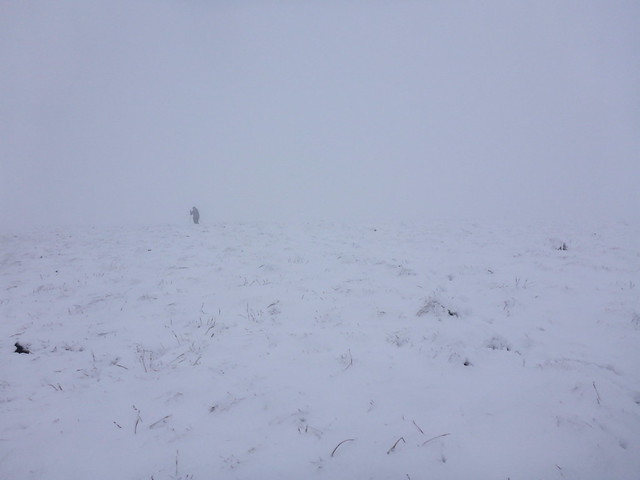
Summit Alwhat
 P1110853
 by
Al, on Flickr
Descent towards the road
 P1110854
 by
Al, on Flickr
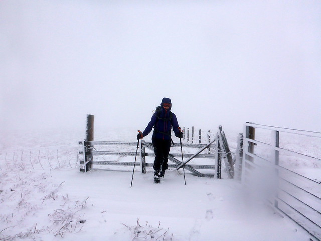
A welcome sight
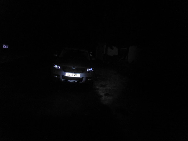 P1110855
 by
Al, on Flickr
 P1110856
 by
Al, on Flickr
I had been a bit worried that the snow, which we'd encountered on the hills, would have lain at road level, making the journey home uncomfortable, but there was a slight thaw on and the road was snow free. Back at the tent I whipped up a mean chili which was gratefully received. Then the rain started. It rained all night, sometimes pouring, sometimes just drizzling, but always raining. Morning came. Rain continued. I knew that my plans for today were likely to be out the window - no way was Allison going to be able to manage another 20plus km walk - and if the rain was falling as snow higher up it would make any hills unlikely. There was no way I was leaving the warm dry sleeping bag to try and dissemble the tent in that kind of weather, so we waited to see if it would go off, which it eventually did around 10.45. Packing the very wet tent away, squelching on the waterlogged grass as we got the various bits and bobs back in the car I thought we might try Coran of Portmark, without the other hills (Bow, Meaul, Carlin's Cairn, Cairnsgarroch) I had originally intended. We drove up to the parking area at Bridge-end and, with some dismay, saw that the surrounding hills were very white indeed. Ach well, we can go and do a spot of reconaissance if nothing else.
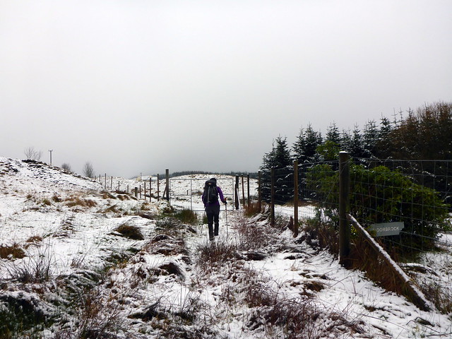
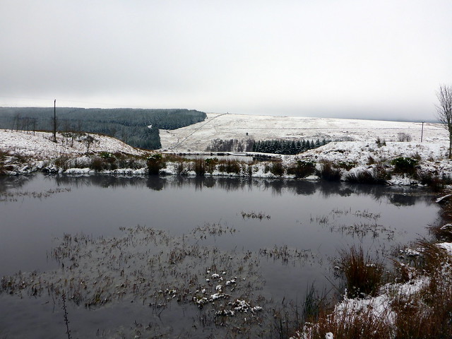
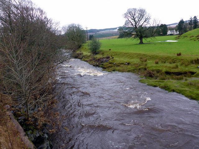
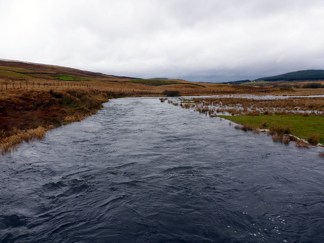
Gearing up we set off across the main road and along the farm road to Holm of Daltallochan. The surrounding landscape was waterlogged - a group of 5 swans were sailing on a large puddle in one field. The rivers were swollen and rapid - good job we were not trying to cross any of them today. Up past the farm at Garryhorn and along the track towards the leadmines - apparently there used to be 50 dwellings around here, a school and a kirk. Only a few now, mostly ruins. The track was very wet, numerous rivulets and streams coursing beneath our feet. We continued up the track which was increasingly submerged beneath a white blanket. This was taking quite a while. Ahead of us, Coran looked white and aloof, I started to doubt that we'd make it much further. In any case there was little point in just doing Coran of Portmark if we didn't do Bow as well - achieving these two hills would allow a shorter circuit over Carlin's Cairn, Meaul and Cairnsgarroch from the Forrest Bridge side. We got up to the 481m point and paused for lunch. The snow was now getting up to knee-high and it looked like being significantly deeper higher up. Although we did set off again up the hill - only 150m more to ascend - I thought that it would be mental to try and achieve this under the various impediments facing us today and turned around, much to Allison's relief - she was game for continuing, to give her credit, but it would have been at great cost. Instead we retraced our steps and set off home in the light - horrible driving conditions as we passed Ayr, up the M77 - heavy rain and very dark skies.
So less achieved this weekend than I'd hoped, looks like we might be revisiting Hawkrigg in the near future to settle the scores

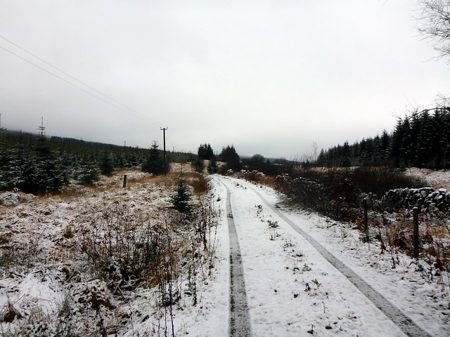
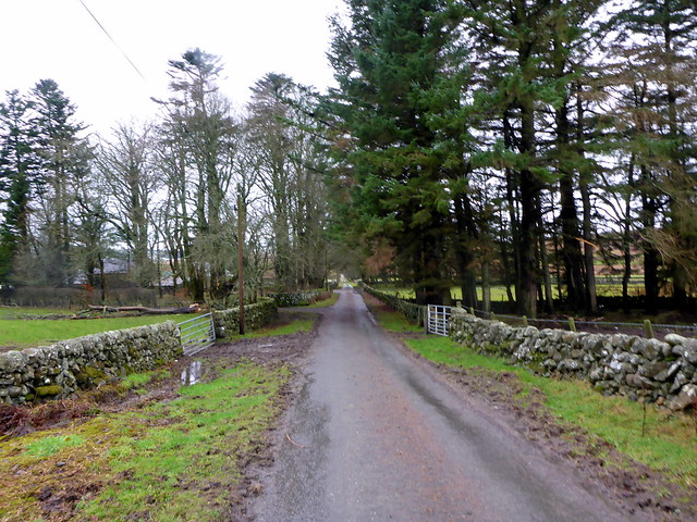
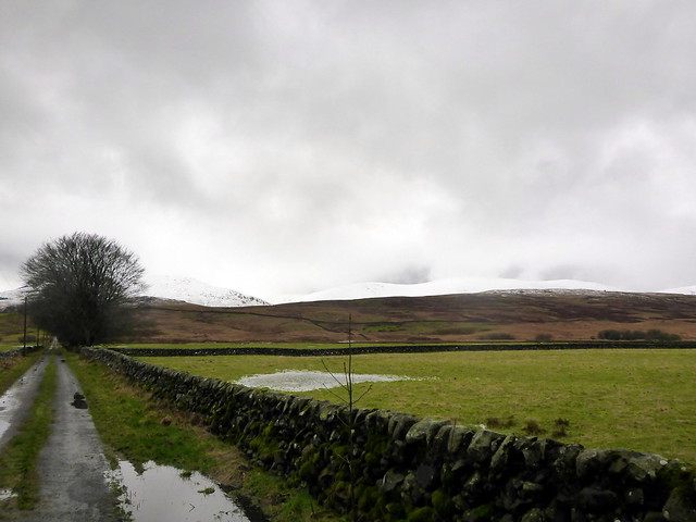
Lane of Carsphairn
 P1110858
 by
Al, on Flickr
Road up through Holm of Daltallochan
 P1110860
 by
Al, on Flickr
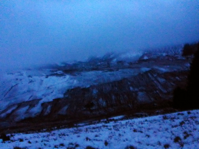
White of Coran of Portmark in the distance
 P1110861
 by
Al, on Flickr
 P1110862
 by
Al, on Flickr
 P1110863
 by
Al, on Flickr
 P1110865
 by
Al, on Flickr
Leadmines
 P1110866
 by
Al, on Flickr
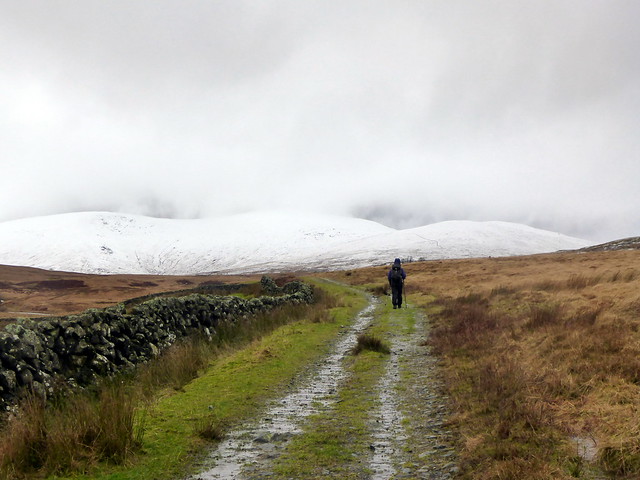
A summit too far
 P1110869
 by
Al, on Flickr
 P1110870
 by
Al, on Flickr
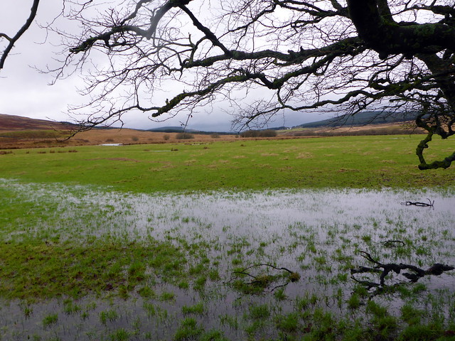
It's wet down here
 P1110873
 by
Al, on Flickr
