free to be able to rate and comment on reports (as well as access 1:25000 mapping).
Corbetts: An Ruadh-stac
Date walked: 26/08/2007
Time taken: 4 hours
Distance: 14km
Ascent: 990m
Weather: Showery, turning fresh and sunny
The first in a trio of retrospective reports from the Coulin forest between Strathcarron and Glen Torridon (this might be getting tedious but I hope to produce some current trip reports in the near future!).
I'm definitely guilty of claiming just about every part of the Highlands as my favourite, but this area is one of my favourite favourites. Quieter than Torridon, with very individual summits and a great network of stalker's paths. This looked like it would be my last weekend in the hills as a free man, with stag do and wedding lined up in the weeks following (I did actually manage a quick dash up the Cairnwell too, but that's no way to remember my final days of freedom. Best just to lie, like people do when they're asked what the first record/CD they bought was

).
Anyway, with the weather looking good, I was over at Coulags in little more than an hour, parking just over the bridge on the north side of the road. Lots of people seem to park on the corner right at the gate for Coulags, perhaps unaware that there is a decent spot 100m further on. As if to welcome me, a heavy shower of rain started.
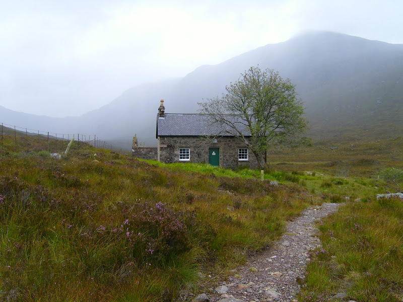
I ignored it and started walking anyway. The path beyond Coulags was very well maintained, and before long I was at the Coire Fhionnaraich bothy. I had a poke around in here while waiting for the rest of the shower to stop. It did fairly promptly, and the corrie looked a lot less bleak afterwards. I soon took a left fork up a wide, slightly eroded path which led me up to Bealach a Choire Ghairbh. This path zigzags up to the 3 sided bealach, making light work of the first half of the ascent.
Coire Fhionnaraich bothy:

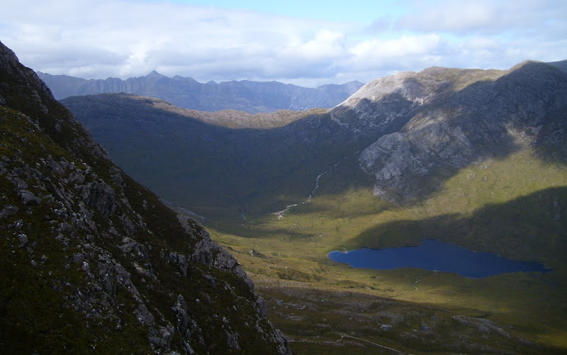
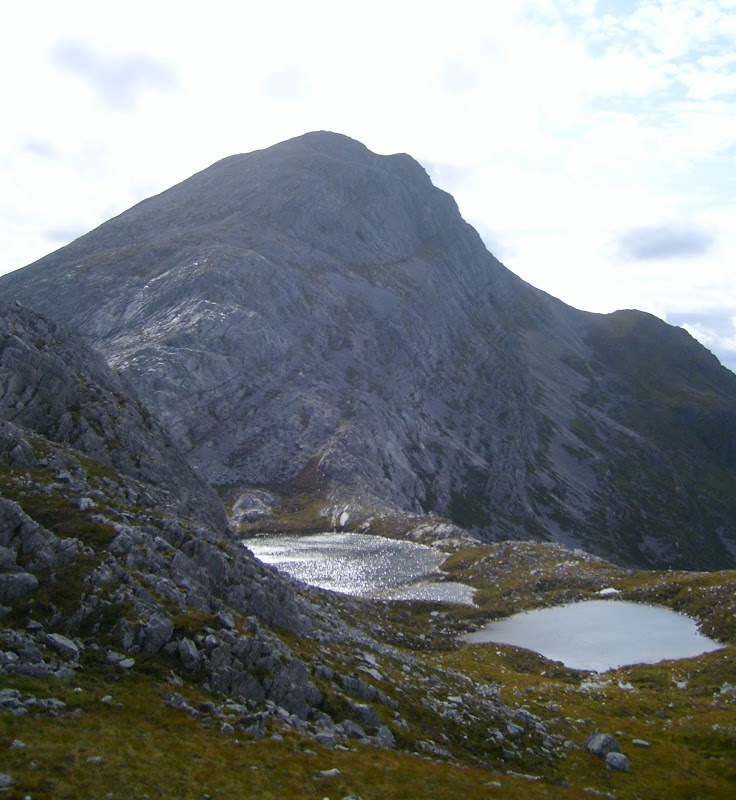
The view at the bealach was spectacular, with a spread of lochans and bare rock. My hill reared up steeply beyond. Despite its name, there is very little red about An Ruadh Stac compared to its surrounding neighbours, as it is formed entirely of gleaming quartzite. This apparently makes the ascent rather awkward in damp conditions, but the sun had come out and dried everything off rapidly, so I had no issues.
Looking up the east ridge of An Ruadh Stac from Bealach a Choire Ghairbh:
Lochans on Bealach a Choire Ghairbh:

My route contoured to the south of the lochans immediately beneath An Ruadh Stac and led me through a break in the crags. The going from here was steep and a bit crumbly, but there was nothing particuarly difficult, and in half an hour I was on the summit.
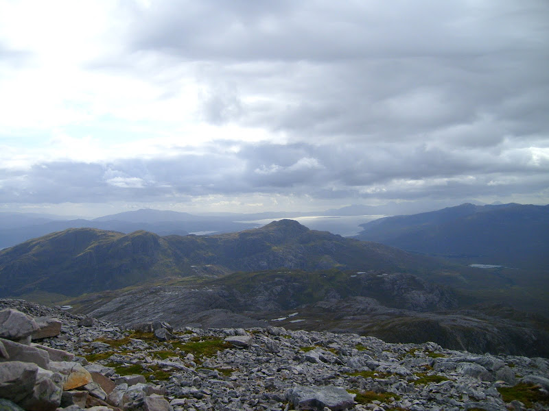
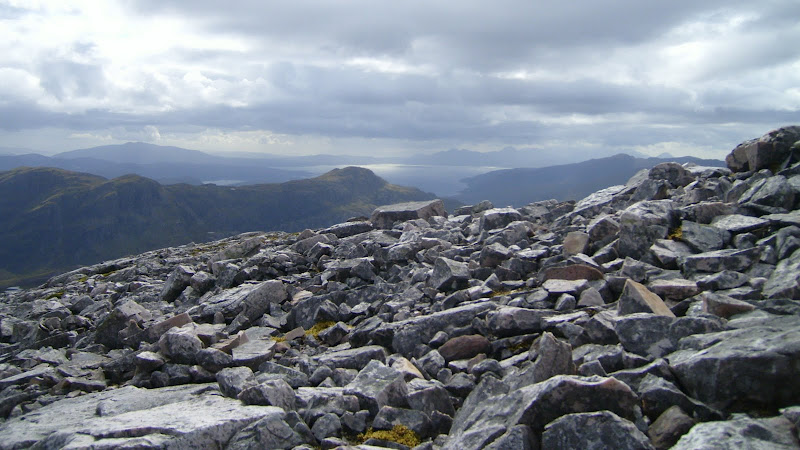
Looking across Sgurr a Gharaidh to Skye:
Beinn Bhan from the summit:

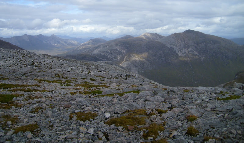
Sgorr Ruadh, Beinn Liath Mhor, Sgorr an Lochan Uaine and Beinn Eighe:
Down the east ridge to Sgorr Ruadh:

In contrast to the route up, the summit was very flat. Sgurr a Gharaidh was the next peak to the west, although I didn't know its name at the time. A hard day out on it in January this year led to RCFC and I wondering about the feasibility of combining it with An Ruadh Stac.
I enjoyed my time on the summit and hung around for some time, before returning by the same ridge to Bealach a Choire Ghairbh. The descent wasn't much more difficult than the ascent. I had the time to continue to Maol Chean-dearg, but the inclination had left me earlier in the day.
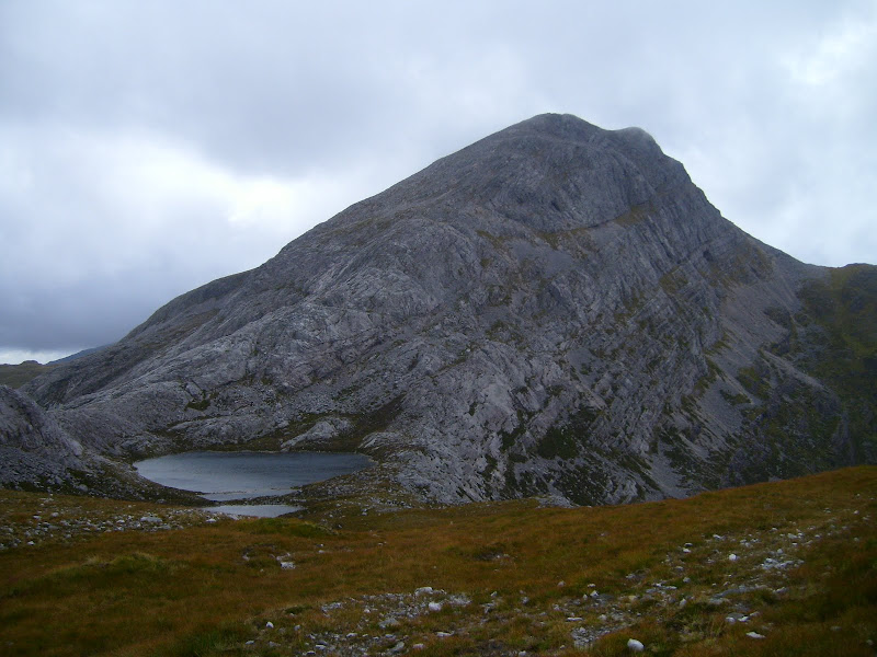
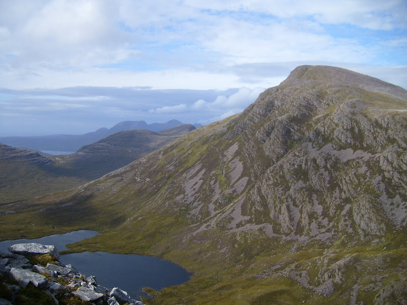
Maol Chean-dearg and Loch an Ruadh-stac:
Looking back up the E ridge of An Ruadh Stac:

Beinn Damh:

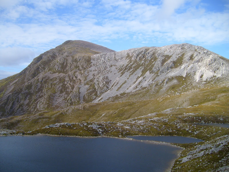
Maol Chean-dearg across Bealach a Choire Ghairbh:
Instead, I decided to take a minor diversion over the summit of Meall nan Ceapairean. This added a bit of variation, and gave a short section of pathless walking, crashing back down the heather to the bothy.
Looking back to An Ruadh Stac:
North to Liathach: