
Three in Glen Isla
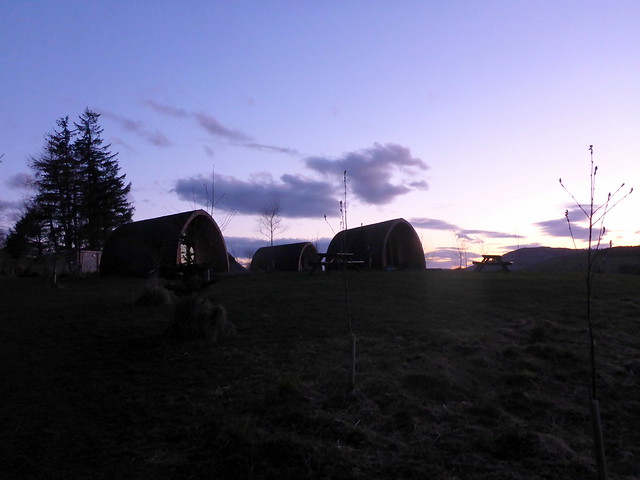
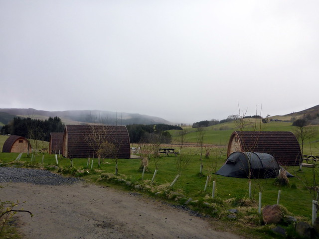
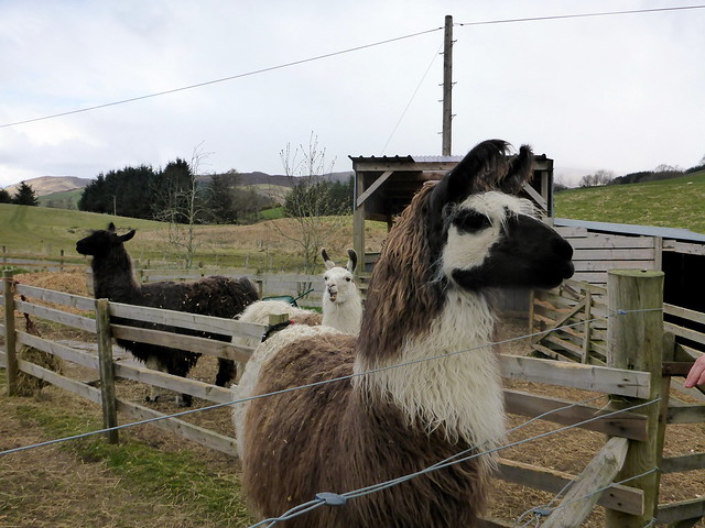
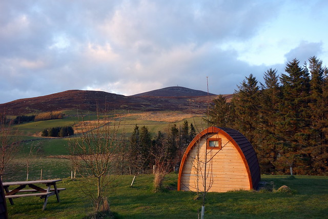
As Allison's rehabilitation continues, we reckoned she might manage some gentler eastern hills, preferably with tracks. Glen Isla seemed a suitable candidate for the weekend - three Grahams all nestled in close to one another, nothing too steep involved. Also, various permutations about how they could be climbed. I found an excellent campsite nearby - http://www.ecocampglenshee.co.uk/ which promised llamas and all sorts of luxuries for £10 pppn. Managed to take some time back from work and get away early enough on Friday to arrive by tea time. We pitched in beside the pods (no-one staying in them over the weekend) and had our meal. Spoke to Simon who runs the site, and who recommended going up Mount Blair from the south, rather than the north approach generally favoured. I reckoned we had enough time to get up and back on Friday evening, in the late sunshine. So we set off.
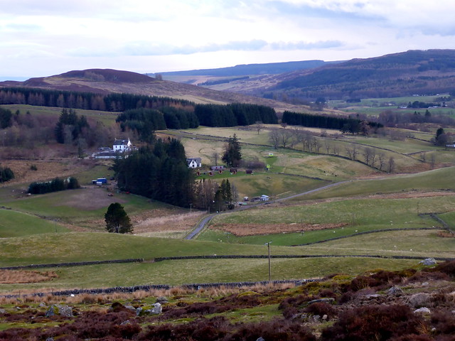
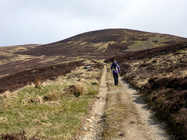
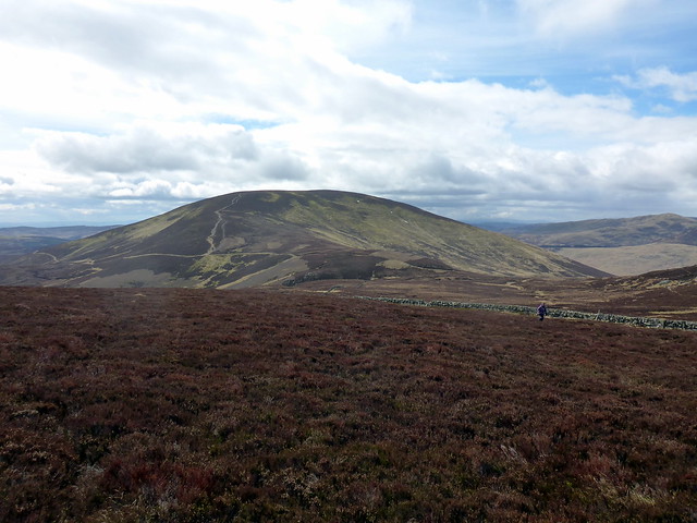
Mount Blair
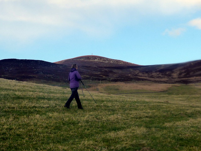 P1120897 by Al, on Flickr
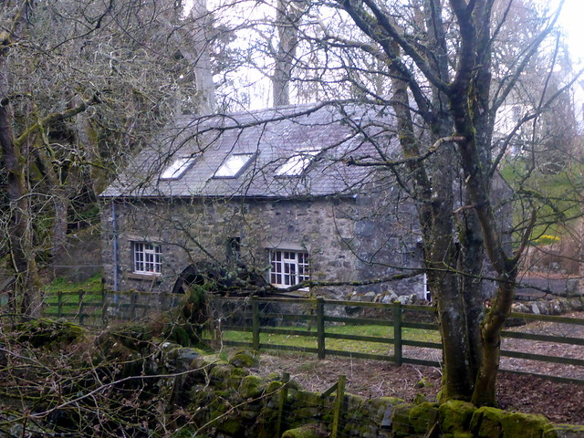
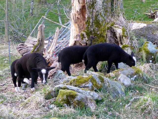
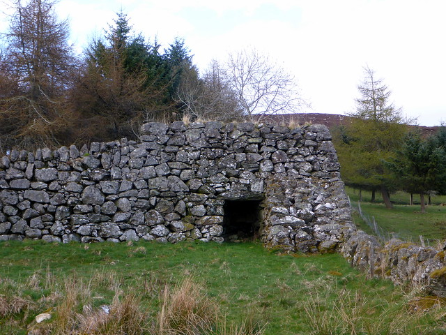
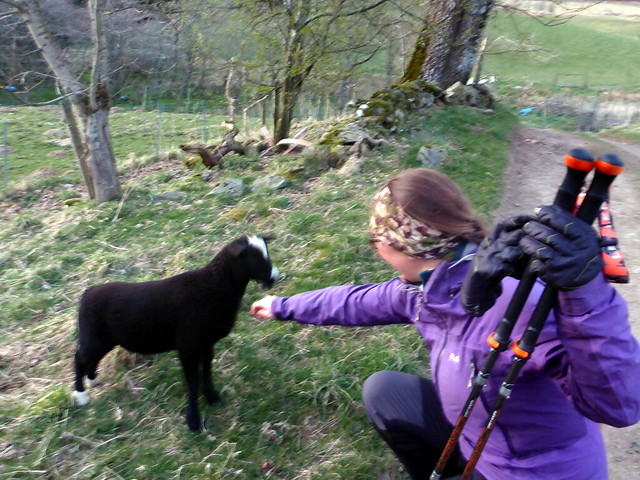
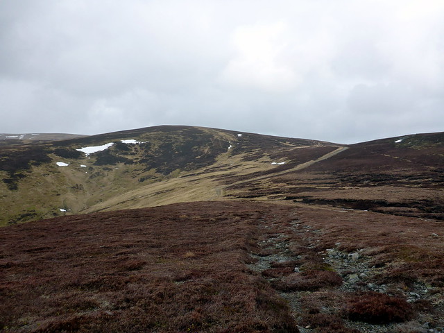
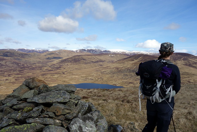
I decided to try one of my infamous "short cuts" to get started, rather than following Simon's instructions about walking along the road til coming to a small pool...this ended up in a traipse over a boggy field with electric fences and an ignominious return to the road to go along the way we'd been advised in the first place. The route turns up through some cottages/farm buildings to Boreland, passing a house with a waterwheel and some cute black lambs with white socks and noses who were intent on investigating our progress. Up a farm track past a limekiln and some bemused cows and onto the hillside. Views were good as we climbed - we could make out the Lawers range and beyond that away to Ben Mor/Stob Binnien. We skirted to the right of Coire Goibhre where the going became a little boggy, then headed up over heather to a stone wall. On the east side of the wall was a clear path which made going easier and we followed this to the well decorated summit - a trig point, prehistoric cairn, circular view indicator (recently restored) as well as the transmitter mast which permits identification of Mount Blair for miles around. We enjoyed the low sunlight striking the snow on the Glenshee hills before turning and following our path down, staying closer to the fence as we went down Over Craig to avoid the marsh. The setting sun burnished the bellies of the few clouds as it sank. A bit chillier in the afterglow we hastened back to the warmth of the tent Allison stopping to pet the lambs when we walked by. And the donkeys. And the llamas
 P1120900 by Al, on Flickr
 P1120901 by Al, on Flickr
Limekiln
 P1120902 by Al, on Flickr
View down to the Ecocamp
 P1120903 by Al, on Flickr
 P1120906 by Al, on Flickr
 P1120909 by Al, on Flickr
Summit
 P1120912 by Al, on Flickr
View Indicator
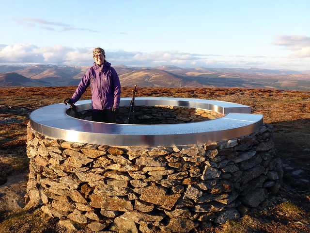 P1120914 by Al, on Flickr
 P1120916 by Al, on Flickr
 P1120918 by Al, on Flickr
 P1120919 by Al, on Flickr
 P1120920 by Al, on Flickr
 P1120921 by Al, on Flickr
 P1120922 by Al, on Flickr
inside the bothy
 P1120923 by Al, on Flickr
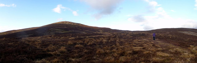
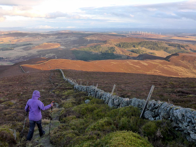
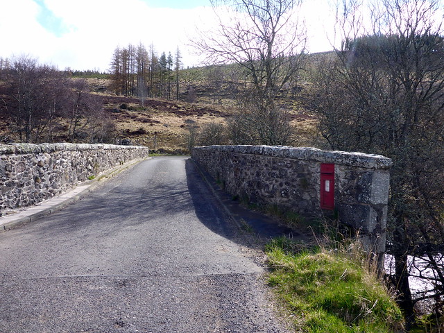
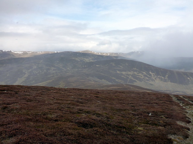
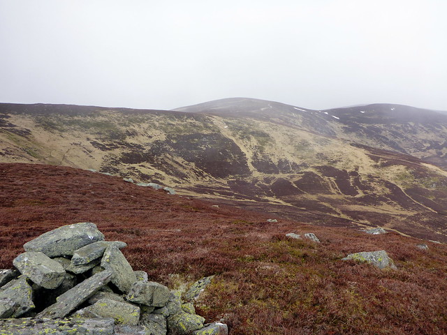
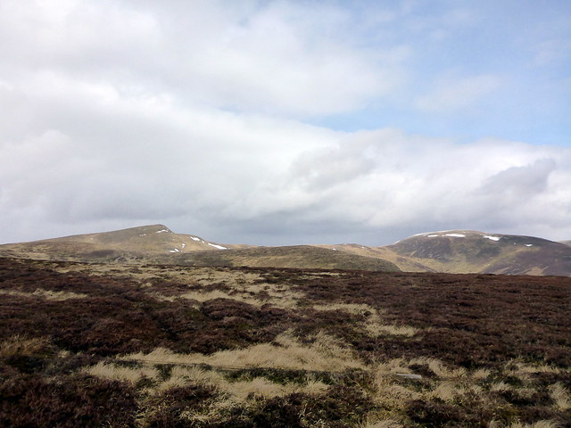
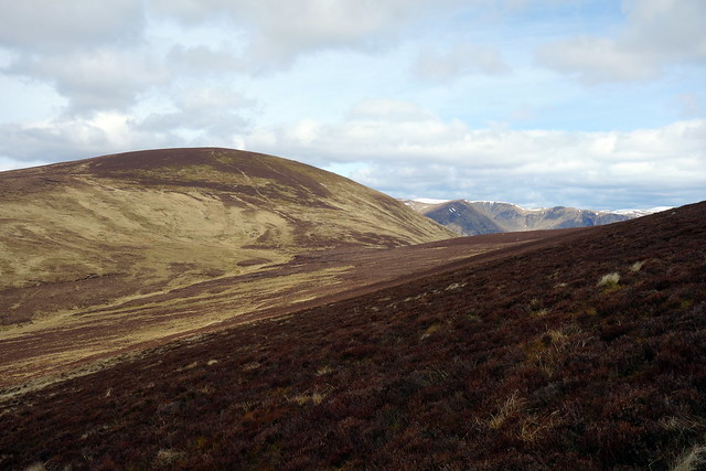
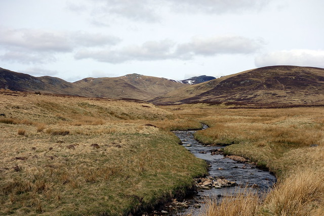
After a really chilly night we woke to find the day overcast and cold. I'd decided we'd tackle Badandun Hill today, alomg with some SIMMs to the north of it. I wasn't entirely sure of the final route, having planned to come off the ridge after Craigie Thieves but noting the way might be impeded by forest plantations. Anyway, we set off and parked just where the road splits at Little Forter and walked across Bridge of Forter (which has its very own letterbox) and through a gate to the left of the bridge. This was wrong - we wanted the Cateran Trail path which meant crossing a squelchy tussocky bit of ground and joining the path somewhat higher up. I could see snow and hail coming down from the north as it did episodically throughout the entire day. We followed the track up by the Knaps and along the side of Badandun Hill, gradually rising until we were at the 740m summit. Right on cue the weather closed in and a vicious hailstorm set about us, carried on icy air from the Cairngorm Massif. We didn't hang about long up there, continuing along the track in a northernly direction, heading for Bodnasparet, what used to be known as a Graham Top, but now renamed a SIMM. We paused for lunch before tackling this beast, I was annoyed at having left my thermos in the car - a hot coffee would have been very welcome.
Saturday morning
 P1120925 by Al, on Flickr
Llamas
 P1120926 by Al, on Flickr
Wall letterbox
 P1120927 by Al, on Flickr
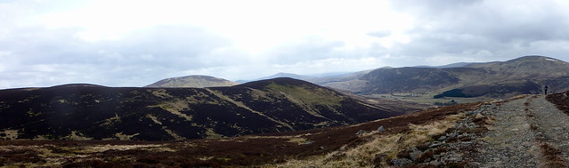
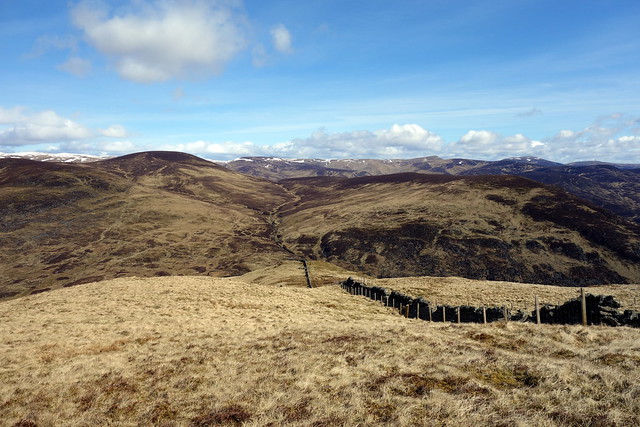
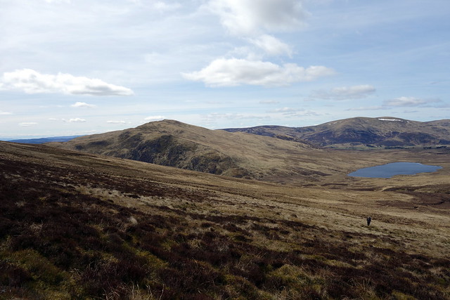
Looking north - Badandun hill on the left
 P1120931 by Al, on Flickr
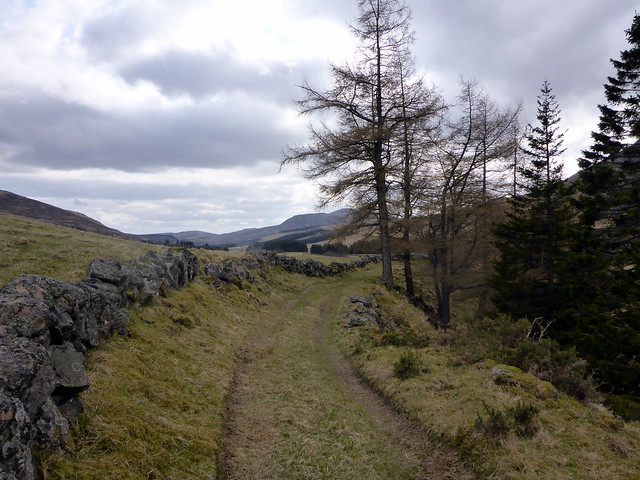
Good track
 P1120932 by Al, on Flickr
Mount Blair
 P1120933 by Al, on Flickr
View South
 P1120934 by Al, on Flickr
Summit - cue hail
 P1120936 by Al, on Flickr
onwards
 P1120937 by Al, on Flickr
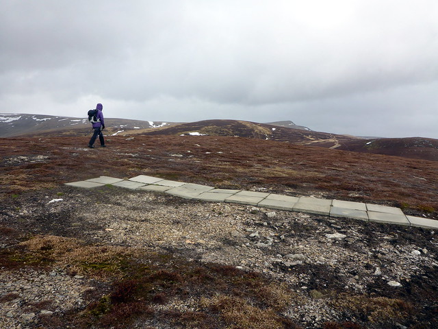
We left the track and followed a wall line close to the top of Bodnasparet. Over to our left rose Craig Lair - a mere sub-simm so not worth the effort We rejoined the path and headed to Mid Hill which had the unusual feature of a number of paving slabs laid out. Home made helipad? Patio?? Your guess as good as mine. Up ahead loomed Mayar and Driesh - on another day I might have been tempted to pay a visit to at least Mayar....however this was rehab. We continued on the track to Bawhelps, the highest point of the day at 830m...not quite what one expects when setting out to do Grahams.
View to North side of Badandun
 P1120939 by Al, on Flickr
Summit Bodnasparet to Bawhelps
 P1120940 by Al, on Flickr
Summit Mid Hill
 P1120941 by Al, on Flickr
Paving Slabs - Mid Hill
 P1120942 by Al, on Flickr
Bawhelps
 P1120943 by Al, on Flickr
Mayar & Driesh
 P1120944 by Al, on Flickr
Summit Bawhelps
 P1120947 by Al, on Flickr
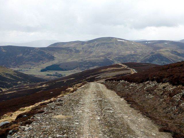
It was decision time - I'd been looking at the walk over to Craigie Thieves and the routes back from it and decided that it would be preferable for my companion to cut that particular Simm out and return to Mid Hill, which had a nice track descending to Dalhally, from whence we could walk along beside the River Isla and back to the car. This proved a good choice as the going underfoot was good. We had to skirt round to the south of the cottage at Dalhally and through an opening in the fence, avoiging the way through the grounds of the cottage, marked "private" - a wee sign would have been appreciated. Over to our right, as we joined the river, the snow-lined peaks of Creag Leathaid and Glas Maol impressed. We picked up another good track alongside the river and trotted back about 5km to the car.
Descent route
 P1120948 by Al, on Flickr
 P1120950 by Al, on Flickr
 P1120955 by Al, on Flickr
 P1120957 by Al, on Flickr
 P1120958 by Al, on Flickr
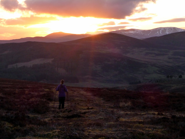
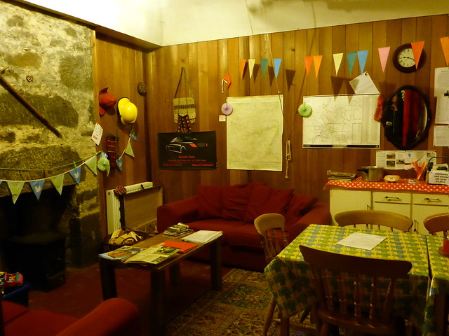
It was a sunny but cold evening, which we passed in the bothy with the log burner on for a while then headed for bed. One drawback of the Ecocamp is that the various animals make a hell of a racket...the hens began crowing at just after 5am - the largest cockerel making the biggest noise, but echoed a couple of octaves higher by a very small, but plucky, cockerel. Sun was up and it looked a good weather day, though still cold.
Saturday Night - Mount Blair
 DSC00204 by Al, on Flickr
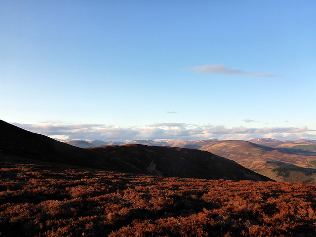
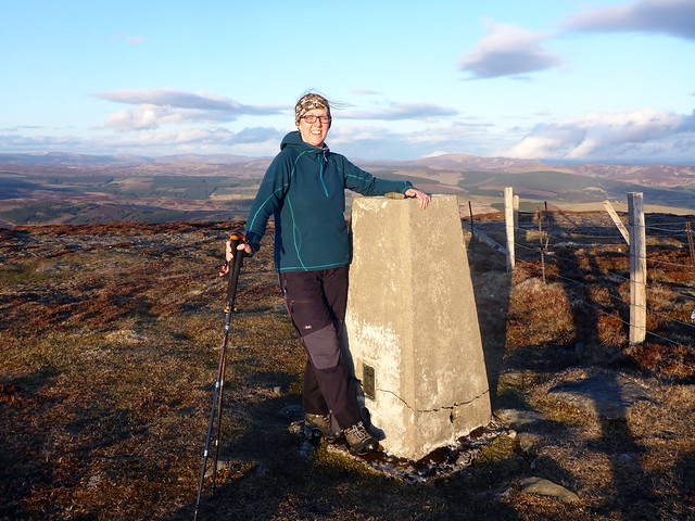
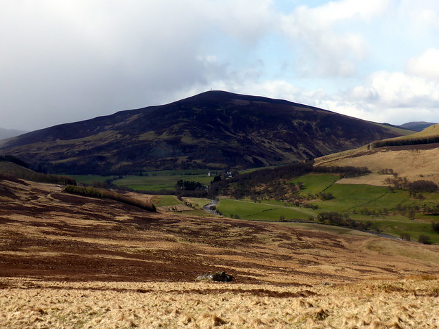
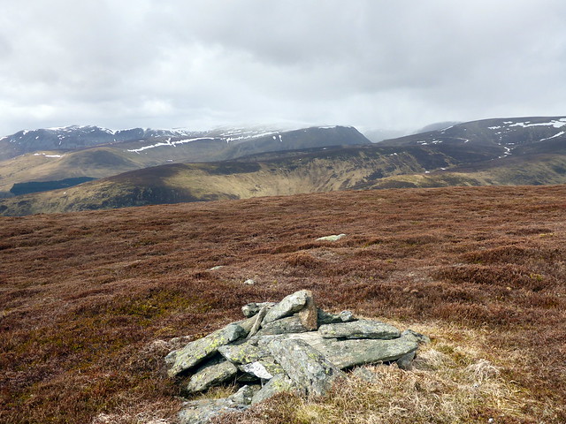
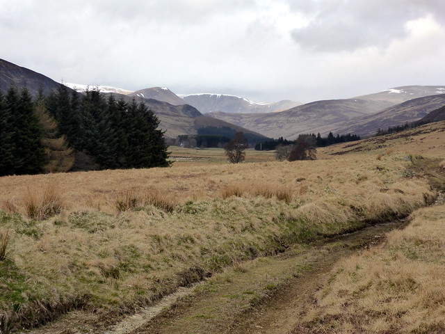
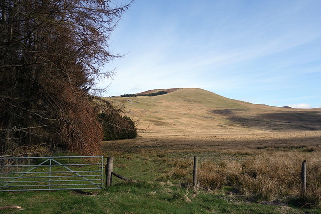
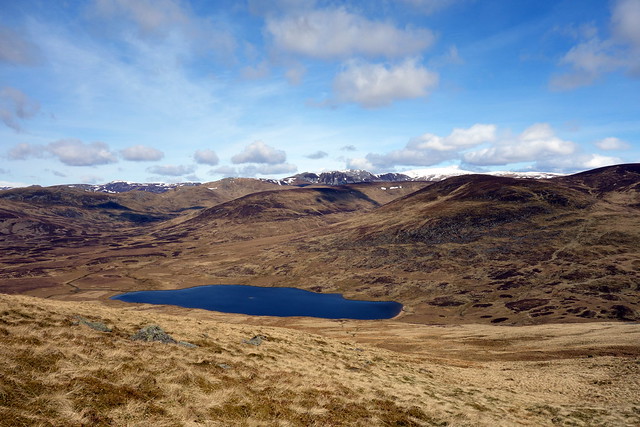
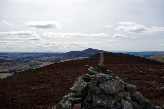
We packed up and drove back towards Forter, parking just after the Welcome to Angus sign to take on today's challenge - Duchray Hill (also called Mealna Letter...why it has two names is unclear to me). We walked through the gate and along the east side of the trees, over swampy ground, although this improved as we started to climb up the gentle slopes of Cairn Derig. Good views behing us of Mount Blair. We followed the wall up to the summit and stepped over the wire to the cairn, which is not at the highest point. It was icy away from the shelter of the wall, as the wind was still coming directly over the Cairngorms to hit us. Below us Loch Beanie gleamed - I thought it might be quite nice to walk past it and return by the Cateran Trail, rather than down the east of the hills as I had originally intended.
Start of walk - up Cairn Derig
 DSC00206 by Al, on Flickr
Mt Blair
 DSC00207 by Al, on Flickr
Summit Duchray Hill looking NW
 DSC00210 by Al, on Flickr
Loch Beanie in view
 DSC00212 by Al, on Flickr
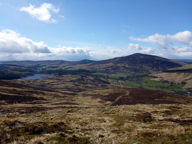
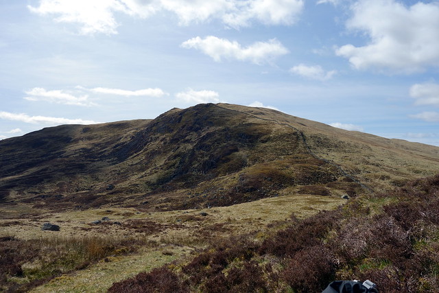
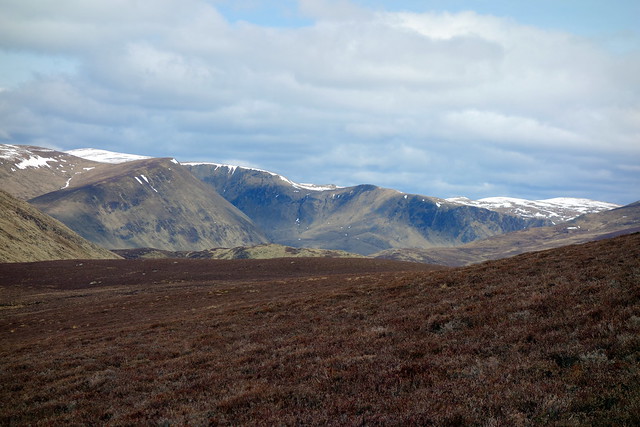
We dropped down the northern side of the hill, by Ewe Crags with the intention of taking in the top of Creagan Caise Hill, another Simm. This involved an initially steep descent then some boggier terrain following the fence line. We parked our bums in a sheltered spot for lunch, then headed across the Beanie burn and up the gently sloping hillside. To our left rose Monamenach, with its southern outlier Craigenloch Hill nearer us. Views up to the southern coire of Glas Maol dominated the skyline. We made the summit then headed back down for Loch Beanie - not as boggy as it might have been, though still soggy in places.
Creagan Caise to the right, Monamenach to the left
 DSC00213 by Al, on Flickr
Loch Beanie
 DSC00214 by Al, on Flickr
Looking back on Ewe Crags
 DSC00216 by Al, on Flickr
Heading up Creagan Caise, Duchray behind
 DSC00218 by Al, on Flickr
Monamenach
 DSC00219 by Al, on Flickr
To Glas Maol
 DSC00221 by Al, on Flickr
Summit
 DSC00223 by Al, on Flickr
Loch Beanie
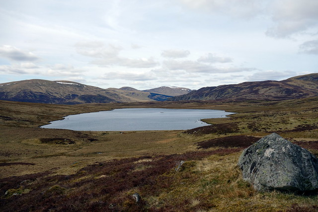 DSC00226 by Al, on Flickr
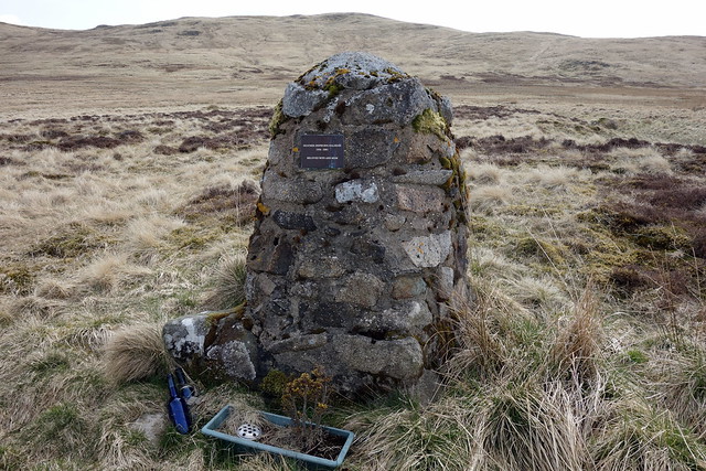
We walked along the side of the loch towards the boathouse passing a cairn - maybe a burial spot? replete with funereal decorations. The path took us on, across and along the north side of the Allt Mor. We could see the Glenshee Outdoor centre ahead and somehow lost the trail, coming up against a multitude of fences. The simplest plan, to cross the river and head south to join the Cateran Trail, was impeded by several deer fences, so we stuck it out heading through Inverreddie Farm, past a large memorial cross on a hillock before joining the Cateran Trail properly. Lapwings flurried and called, chasing the crows. The path took us alongside the Shee Water eventually past the architectural whimsy of Dalnaglar Castle (available for rental for your high society wedding) and back to the B951 and our waiting car.
Memorial/Grave?
 DSC00227 by Al, on Flickr
 DSC00228 by Al, on Flickr
Memorial Cross
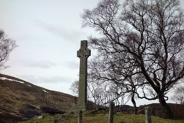 DSC00230 by Al, on Flickr
Dalnaglar Castle
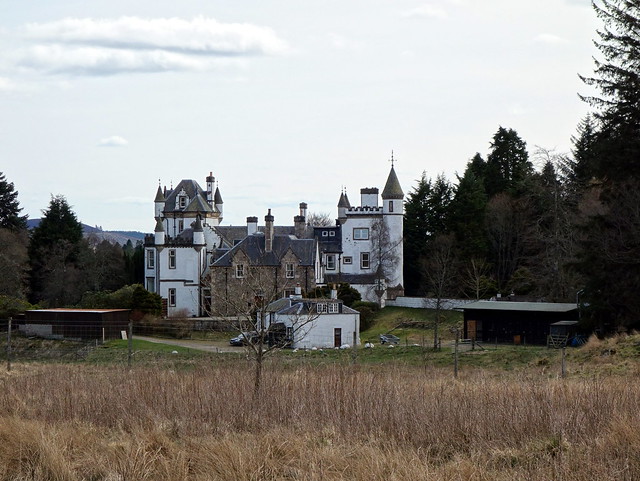 DSC00231 by Al, on Flickr
 DSC00232 by Al, on Flickr
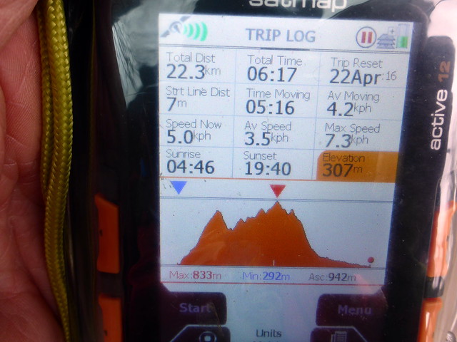
So not the quickest way to do these 3 hills - Malky's route manages all 3 in a mere 18km and 4.2 hours while we took 50km and 15 hours, but we did get some interesting scenery and of course, a few more Simms
Mount Blair
P1120897 by Al, on FlickrI decided to try one of my infamous "short cuts" to get started, rather than following Simon's instructions about walking along the road til coming to a small pool...this ended up in a traipse over a boggy field with electric fences and an ignominious return to the road to go along the way we'd been advised in the first place. The route turns up through some cottages/farm buildings to Boreland, passing a house with a waterwheel and some cute black lambs with white socks and noses who were intent on investigating our progress. Up a farm track past a limekiln and some bemused cows and onto the hillside. Views were good as we climbed - we could make out the Lawers range and beyond that away to Ben Mor/Stob Binnien. We skirted to the right of Coire Goibhre where the going became a little boggy, then headed up over heather to a stone wall. On the east side of the wall was a clear path which made going easier and we followed this to the well decorated summit - a trig point, prehistoric cairn, circular view indicator (recently restored) as well as the transmitter mast which permits identification of Mount Blair for miles around. We enjoyed the low sunlight striking the snow on the Glenshee hills before turning and following our path down, staying closer to the fence as we went down Over Craig to avoid the marsh. The setting sun burnished the bellies of the few clouds as it sank. A bit chillier in the afterglow we hastened back to the warmth of the tent Allison stopping to pet the lambs when we walked by. And the donkeys. And the llamas
P1120900 by Al, on FlickrP1120901 by Al, on FlickrLimekiln
P1120902 by Al, on FlickrView down to the Ecocamp
P1120903 by Al, on FlickrP1120906 by Al, on FlickrP1120909 by Al, on FlickrSummit
P1120912 by Al, on FlickrView Indicator
P1120914 by Al, on FlickrP1120916 by Al, on FlickrP1120918 by Al, on FlickrP1120919 by Al, on FlickrP1120920 by Al, on FlickrP1120921 by Al, on FlickrP1120922 by Al, on Flickrinside the bothy
P1120923 by Al, on FlickrAfter a really chilly night we woke to find the day overcast and cold. I'd decided we'd tackle Badandun Hill today, alomg with some SIMMs to the north of it. I wasn't entirely sure of the final route, having planned to come off the ridge after Craigie Thieves but noting the way might be impeded by forest plantations. Anyway, we set off and parked just where the road splits at Little Forter and walked across Bridge of Forter (which has its very own letterbox) and through a gate to the left of the bridge. This was wrong - we wanted the Cateran Trail path which meant crossing a squelchy tussocky bit of ground and joining the path somewhat higher up. I could see snow and hail coming down from the north as it did episodically throughout the entire day. We followed the track up by the Knaps and along the side of Badandun Hill, gradually rising until we were at the 740m summit. Right on cue the weather closed in and a vicious hailstorm set about us, carried on icy air from the Cairngorm Massif. We didn't hang about long up there, continuing along the track in a northernly direction, heading for Bodnasparet, what used to be known as a Graham Top, but now renamed a SIMM. We paused for lunch before tackling this beast, I was annoyed at having left my thermos in the car - a hot coffee would have been very welcome.
Saturday morning
P1120925 by Al, on FlickrLlamas
P1120926 by Al, on FlickrWall letterbox
P1120927 by Al, on FlickrLooking north - Badandun hill on the left
P1120931 by Al, on FlickrGood track
P1120932 by Al, on FlickrMount Blair
P1120933 by Al, on FlickrView South
P1120934 by Al, on FlickrSummit - cue hail
P1120936 by Al, on Flickronwards
P1120937 by Al, on FlickrWe left the track and followed a wall line close to the top of Bodnasparet. Over to our left rose Craig Lair - a mere sub-simm so not worth the effort
View to North side of Badandun
P1120939 by Al, on FlickrSummit Bodnasparet to Bawhelps
P1120940 by Al, on FlickrSummit Mid Hill
P1120941 by Al, on FlickrPaving Slabs - Mid Hill
P1120942 by Al, on FlickrBawhelps
P1120943 by Al, on FlickrMayar & Driesh
P1120944 by Al, on FlickrSummit Bawhelps
P1120947 by Al, on FlickrIt was decision time - I'd been looking at the walk over to Craigie Thieves and the routes back from it and decided that it would be preferable for my companion to cut that particular Simm out and return to Mid Hill, which had a nice track descending to Dalhally, from whence we could walk along beside the River Isla and back to the car. This proved a good choice as the going underfoot was good. We had to skirt round to the south of the cottage at Dalhally and through an opening in the fence, avoiging the way through the grounds of the cottage, marked "private" - a wee sign would have been appreciated. Over to our right, as we joined the river, the snow-lined peaks of Creag Leathaid and Glas Maol impressed. We picked up another good track alongside the river and trotted back about 5km to the car.
Descent route
P1120948 by Al, on FlickrP1120950 by Al, on FlickrP1120955 by Al, on FlickrP1120957 by Al, on FlickrP1120958 by Al, on FlickrIt was a sunny but cold evening, which we passed in the bothy with the log burner on for a while then headed for bed. One drawback of the Ecocamp is that the various animals make a hell of a racket...the hens began crowing at just after 5am - the largest cockerel making the biggest noise, but echoed a couple of octaves higher by a very small, but plucky, cockerel. Sun was up and it looked a good weather day, though still cold.
Saturday Night - Mount Blair
DSC00204 by Al, on FlickrWe packed up and drove back towards Forter, parking just after the Welcome to Angus sign to take on today's challenge - Duchray Hill (also called Mealna Letter...why it has two names is unclear to me). We walked through the gate and along the east side of the trees, over swampy ground, although this improved as we started to climb up the gentle slopes of Cairn Derig. Good views behing us of Mount Blair. We followed the wall up to the summit and stepped over the wire to the cairn, which is not at the highest point. It was icy away from the shelter of the wall, as the wind was still coming directly over the Cairngorms to hit us. Below us Loch Beanie gleamed - I thought it might be quite nice to walk past it and return by the Cateran Trail, rather than down the east of the hills as I had originally intended.
Start of walk - up Cairn Derig
DSC00206 by Al, on FlickrMt Blair
DSC00207 by Al, on FlickrSummit Duchray Hill looking NW
DSC00210 by Al, on FlickrLoch Beanie in view
DSC00212 by Al, on FlickrWe dropped down the northern side of the hill, by Ewe Crags with the intention of taking in the top of Creagan Caise Hill, another Simm. This involved an initially steep descent then some boggier terrain following the fence line. We parked our bums in a sheltered spot for lunch, then headed across the Beanie burn and up the gently sloping hillside. To our left rose Monamenach, with its southern outlier Craigenloch Hill nearer us. Views up to the southern coire of Glas Maol dominated the skyline. We made the summit then headed back down for Loch Beanie - not as boggy as it might have been, though still soggy in places.
Creagan Caise to the right, Monamenach to the left
DSC00213 by Al, on FlickrLoch Beanie
DSC00214 by Al, on FlickrLooking back on Ewe Crags
DSC00216 by Al, on FlickrHeading up Creagan Caise, Duchray behind
DSC00218 by Al, on FlickrMonamenach
DSC00219 by Al, on FlickrTo Glas Maol
DSC00221 by Al, on FlickrSummit
DSC00223 by Al, on FlickrLoch Beanie
DSC00226 by Al, on FlickrWe walked along the side of the loch towards the boathouse passing a cairn - maybe a burial spot? replete with funereal decorations. The path took us on, across and along the north side of the Allt Mor. We could see the Glenshee Outdoor centre ahead and somehow lost the trail, coming up against a multitude of fences. The simplest plan, to cross the river and head south to join the Cateran Trail, was impeded by several deer fences, so we stuck it out heading through Inverreddie Farm, past a large memorial cross on a hillock before joining the Cateran Trail properly. Lapwings flurried and called, chasing the crows. The path took us alongside the Shee Water eventually past the architectural whimsy of Dalnaglar Castle (available for rental for your high society wedding) and back to the B951 and our waiting car.
Memorial/Grave?
DSC00227 by Al, on FlickrDSC00228 by Al, on FlickrMemorial Cross
DSC00230 by Al, on FlickrDalnaglar Castle
DSC00231 by Al, on FlickrDSC00232 by Al, on FlickrSo not the quickest way to do these 3 hills - Malky's route manages all 3 in a mere 18km and 4.2 hours while we took 50km and 15 hours, but we did get some interesting scenery and of course, a few more Simms