free to be able to rate and comment on reports (as well as access 1:25000 mapping).
The evening before my departure, I did some research and discovered that the Carnachuin Bridge was swept away on 3 September 2009. The Walkhighlands site says "Do not attempt to cross the Feshie at the bridge site". More about this later....
I parked at the end of the public road on the west side of the River Feshie and cycled up the good road surface as far as the bridge at GR NN850964. The path up the east side was greatly improved only to be washed away in places making some sections very difficult, especially with a bike. I would not want to follow this path in the dark. Here, the erosion was easily bypassed but other sections required strenuous crossings of the obstacles, including a steep drop and pushing the bike up the other.
I found on this trip that a bike can be a blessing or a curse, though I would have to concede that overall, it saved me a significant amount of time. I completed the two Corbetts in around 8 hours and 50 minutes; well short of the 10 hours 30 minutes estimated walking time and that included food stops on both peaks, stopping to talk to other walkers and numerous photo stops.
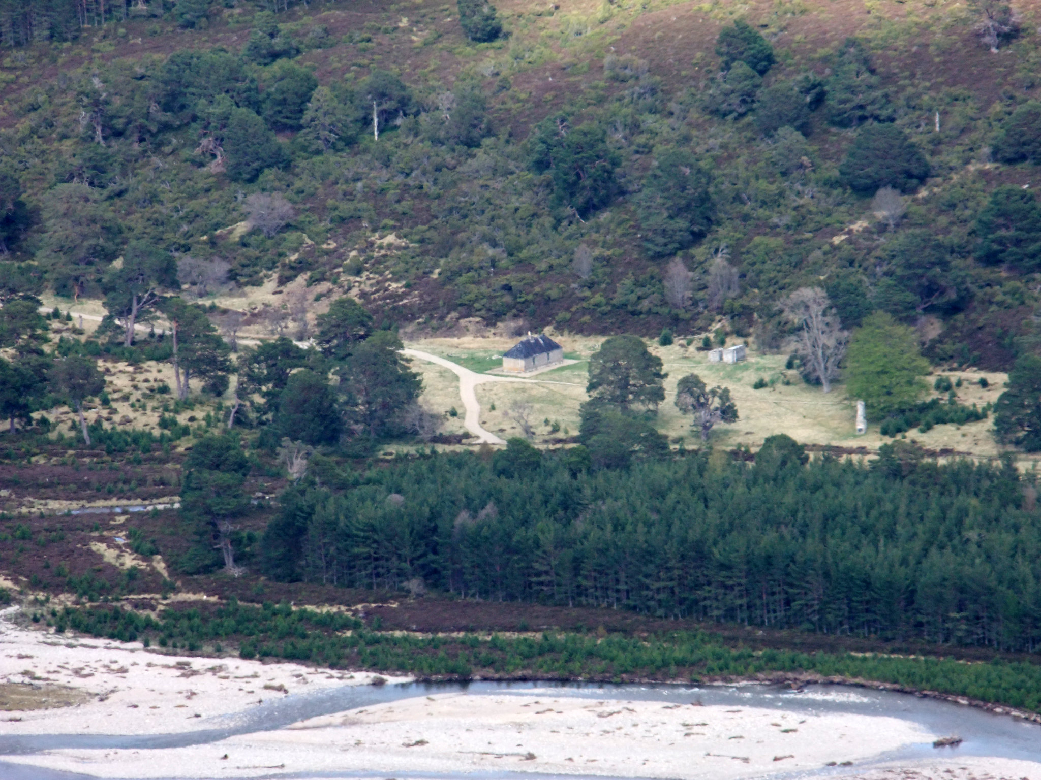
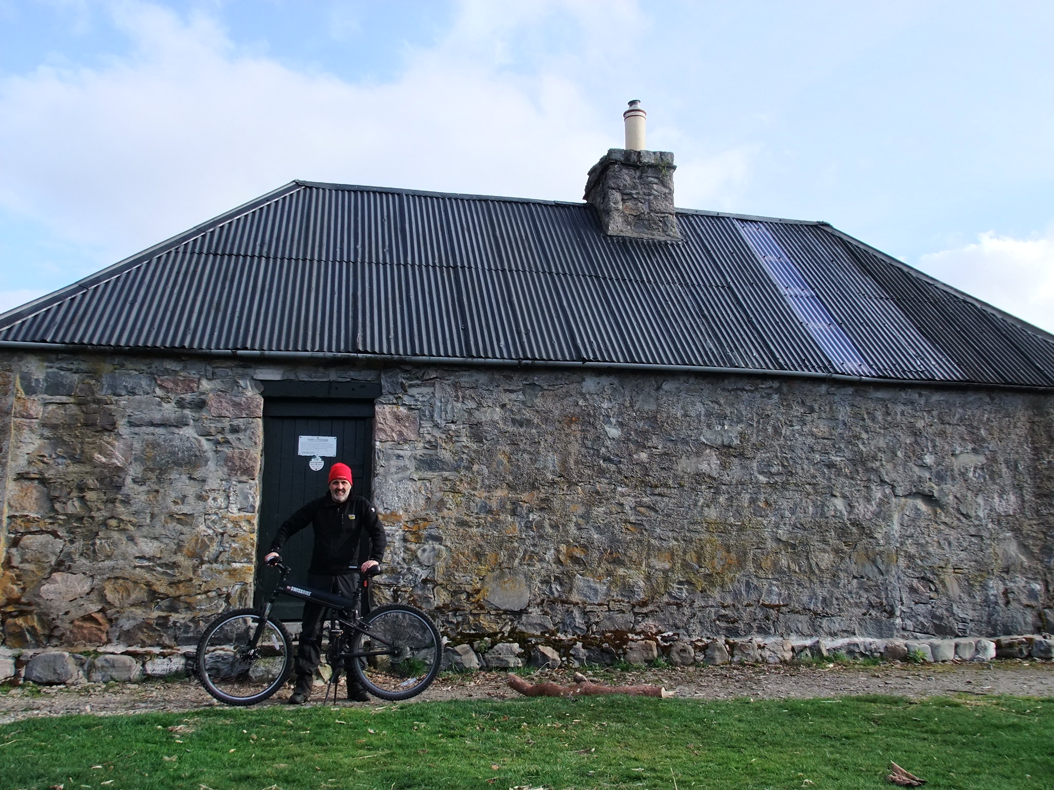
I arrived at Ruigh Aiteachain sometime after 10 p.m. to find smoke coming out of the chimney - there was someone in residence!
The residents were two young men from Montreal: Rafael and Lambert. They were splendid company and it was interesting hearing about their route northwards through the highlands (Scottish National Trail).
Near to Ruigh Aiteachain is a chimney stack which is all that remains of Landseer's bothy where the great artist stayed. There were frescoes on the walls but all that remains is the fireplace and chimney. Attempts are being made to prevent the chimney from falling down due to its historical interest.
Monarch of the Glen (Sir Edwin Landseer 1851)
I woke up to a fine morning. I took my time as windy conditions were meant to die down by midday and as the days are so long at this time of the year, I could afford to take my time. I decided not to walk 3 km downstream to use the bridge but to try to find a way to ford the Feshie. I took the track to the remains of the Carnachuin Bridge. I went upstream a short way to where it was shallower and then took a diagonal route towards the far end of the bridge. It was shallower upstream but had a steep bank with gorse bushes to negotiate. It was hard work lifting my bike up onto the rotting platform that was once one end of the bridge but I successfully reached the west side of the Feshie with only a small amount of water trickling into my boots.
![DSCF9019.JPG]()
![DSCF9020Panorama.jpg]()
![DSCF9027.JPG]()
![DSCF9030.JPG]()
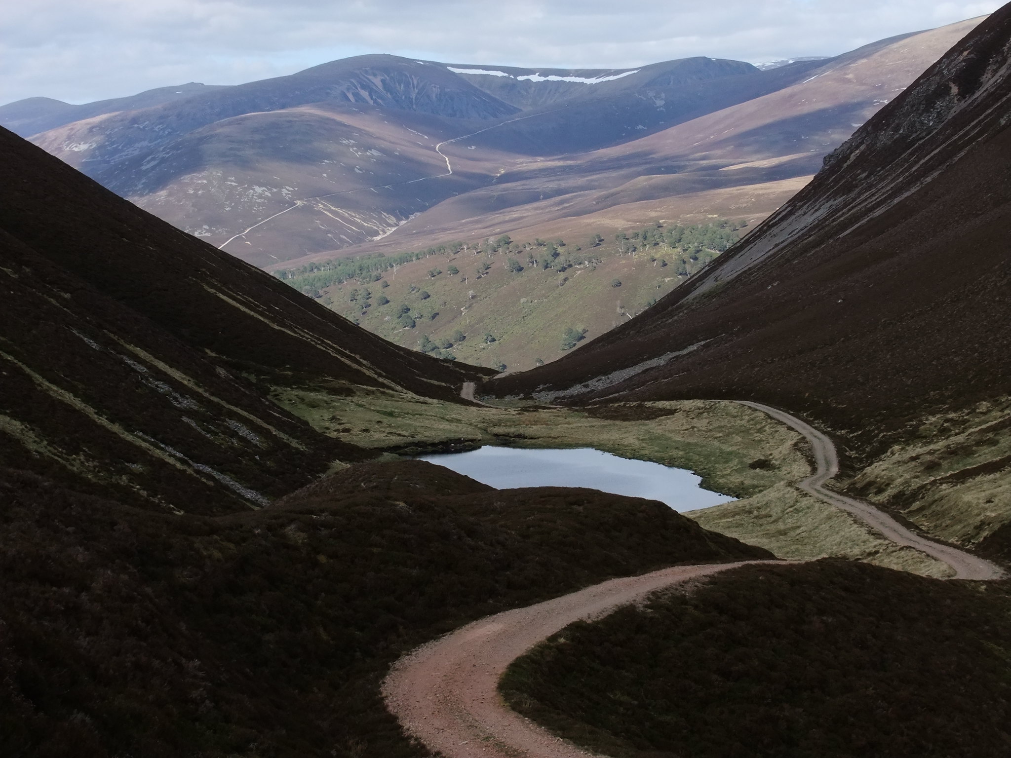
The bike ride to Lochan an t-Sluic was straightforward, though I had to push my bike up the steeper sections. I had considered camping near at Lochan an t-Sluic rather than using the bothy. This is the best time of year for camping; long days, not too cold and no midges! However, I could not remember too much about the bothy and wanted to check it out again.
I was pushing my bike more than riding it, in the knowledge that I would not be pushing it back down. I stopped several times to take photographs before reaching Meall an Uilt Chreagaich at 847m. My bike is usually abandoned in the glen and this is the highest I have taken it. Am I now a true mountain biker? Probably not!

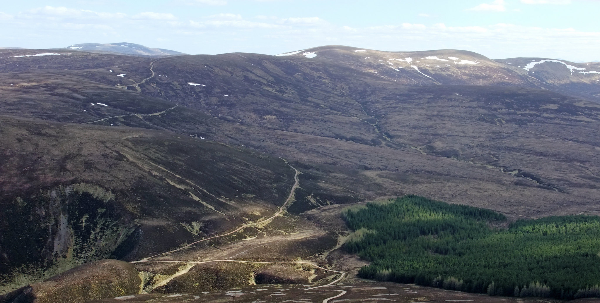
Looking east: The track leading from Glen Feshie to Mullach Clach a'Bhlair is clearly visible with the summit being to the right. The main mass of hill visible here is Meall Dubhag.
Looking west: Meall Chuaich being the the round dome shaped hill to the left. The cleft in the far distance is the window between Creag Meagaidh and Stob Poite Coire Ardair/Carn Liath.
Looking SSW from Meall an Uillt Chreagaich towards Leathad an Taobhain. The Corbett is the left hand lump which is 10m/30ft higher than the right hand lump.
The track seems to skirt around the hillside and a path off to the left leads down to a ruin at the bealach. Meall Chuaich is seen to the right.
The continuation path oddly bypasses the large round pillar that forms the trig. point. I took some summit selfies and sat with my back to the trig. point to eat half a buttered Soreen loaf. Sitting on the lee side of the trig and facing the sun was very pleasant with views of Beinn a'Ghlo, Beinn Dearg and Schiehallion. The view below however looks across to Mullach Clach a'Bhlair with Braeriach, Sgor an Lochain Uaine and Carn Toul in the far distance.
The panoramic shot below shows Beinn Dearg (Blair Atholl) to the right; the shapely peak is possibly Beinn a'Ghlo. Possibly Carn an Fhidhleir and An Sgarsoch in the middle distance to the left with the trio of Carn an Righ, Beinn Iutharn Mhor and Carn Bhac (Glen Ey) beyond. At least, that is my best guess, as these hills are not particularly distinctive. I'm open to alternative suggestions.
The panorama below is very much easier. From left to right: Sgor Gaoith, Mullach Clach a'Bhlair, (higher and further away, behind Mullach Clach a'Bhlair) Braeriach, Sgor an Lochain Uaine, Cairn Toul and Beinn Bhrotain. Ben Macdui is behind Cairn Toul.
Perhaps one selfie too many? I must have done the hills a lot faster fifteen years ago; not only was I fitter but I took very few photographs - often none at all! Now, I mess about with a tripod and setting the time delay on the camera.
When I eventually left the summit, I picked up the nice little path and looked ahead to my next objective: Carn Dearg Mor. I was going to take the track up to the saddle and then follow the skyline to the summit but a short way up the track, I opted for a more direct approach up pathless heather.
Arriving back at the bike, visibility seemed to be improving, so another stitched panorama of Sgor Gaoith, Mullach Clach a'Bhlair, Braeriach, Sgor an Lochain Uaine, Cairn Toul and Beinn Bhrotain.
Looking north: Meall Chuaich, Meallach Mhor and Carn Dearg Mhor. Meallach Mhor could be included with Leathad an Taobhain and Carn Dearg Mor but I climbed that hill on a short winters day in December 2015. I'm glad that I did the hill separately as it was an opportunity to visit Glen Tromie and two hills were a big enough day!
![DSCF9117Panorama.jpg]()
In the photograph above, the track can be seen contouring the hillside before dropping down to the Slochd Mor. I took the left turn to head for Carn Dearg Mhor but abandoned my bike at the lowest point in the track and continued on foot. I could see a group of walkers resting below the summit and I made my way up the heather slopes towards them. It turned out to be a group of around seven women. Most seemed determined to give me a wide berth, but the tailenders didn't get away quickly enough and were forced to make polite conversation. I was glad of the excuse to rest as I had become quite breathless and my legs were tired. We discussed routes and identified the surrounding hills. They seemed unaware of there being a bothy in Glen Feshie and asked where it was on their map. Our pleasant conversation allowed time for more glucose and oxygen to be delivered to my screaming quads and it was then a short and easy push to the summit, where my eye was instantly drawn to the distant Creag Meagaidh and Coire Ardair. The window appears directly above the summit of Meallach Mhor, which may appear quite insignificant here but is quite remote and offers a challenging day in December when the days are short and there is full winter conditions.
![DSCF9128Panorama.jpg]()
Yet another summit selfie....
There were still chilly northerlies, but after a bit of food, I followed a faint track northwards and then dropped a short way off the east side of the hill to see if I could see Ruigh Aiteachain. This photograph was taken on full zoom. The small building to the right is the toilet and the chimney stack further right is the remains of Landseer's bothy.
 DSCF9136
 by
stevemannmoscow, on Flickr
.... zooming out for this shot of the Braeriach ridge.
 DSCF9138
 by
stevemannmoscow, on Flickr
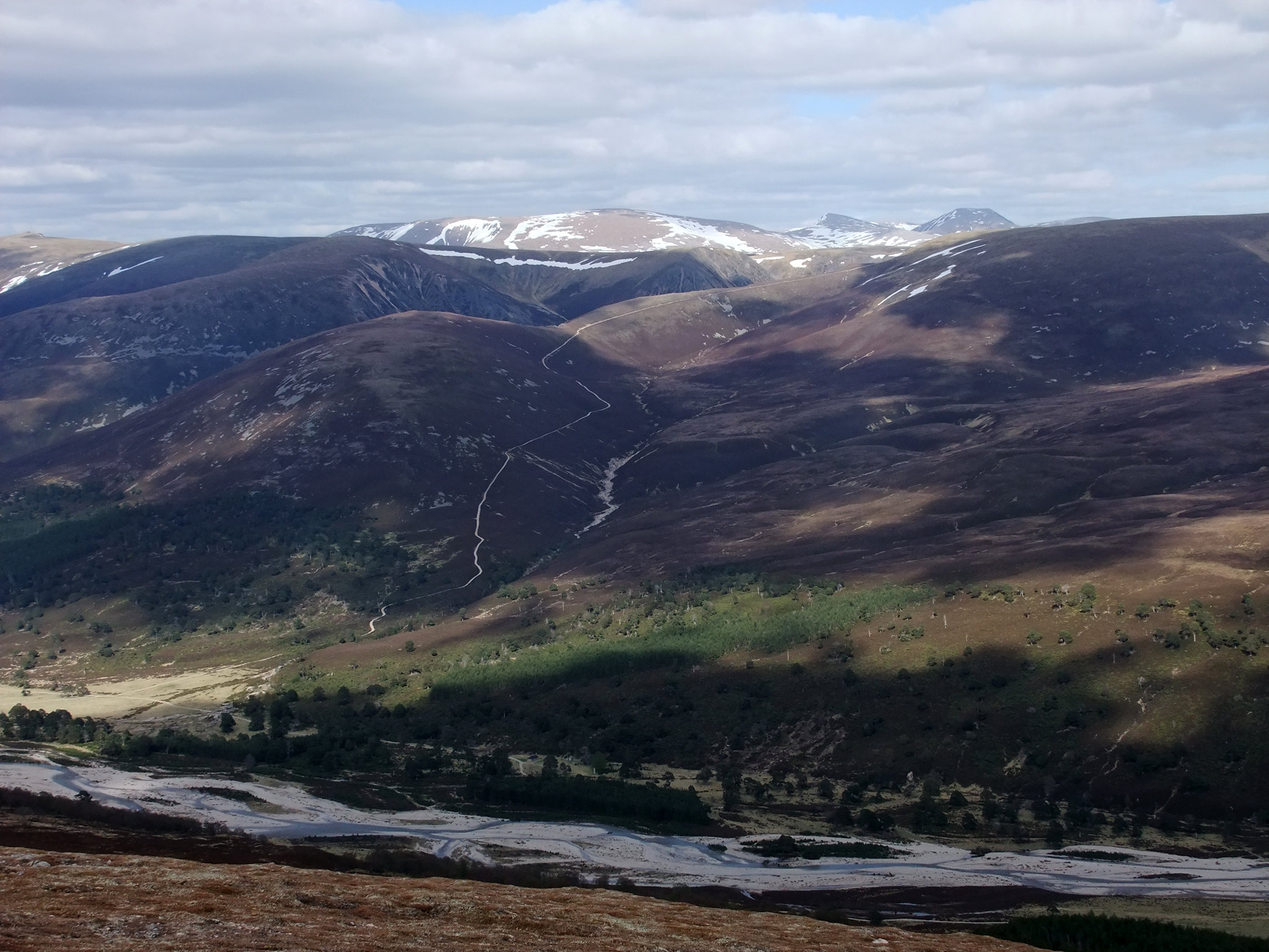
Sometimes it is good to look back at where one has been. The cycle route is clear. The summit of Leathad an Taobhain is centre with Beinn Dearg to the left.
 DSCF9144Panorama
 by
stevemannmoscow, on Flickr
Returning to The Slochd, it was in places a steep and loose ride back down to Glen Feshie. I am not as confident on a bike as I was as a kid and I applied the brakes for most of the way.
 DSCF9149
 by
stevemannmoscow, on Flickr
I forded the river about a mile short of the remains of the Carnachuin Bridge. The crossing was fine but there was soft, shaley, and a lot of vegetation to negotiate, including a lot of spiky stuff. At the end of a longish day it was hard work pushing the bike across such terrain and I was glad to eventually reach the track. From there, it was a short, easy ride to Ruigh Aiteachain. The route had taken around 8 hours and 50 minutes. It could be done in less if the Carnachuin Bridge was to be re-built!
 DSCF9152
 by
stevemannmoscow, on Flickr
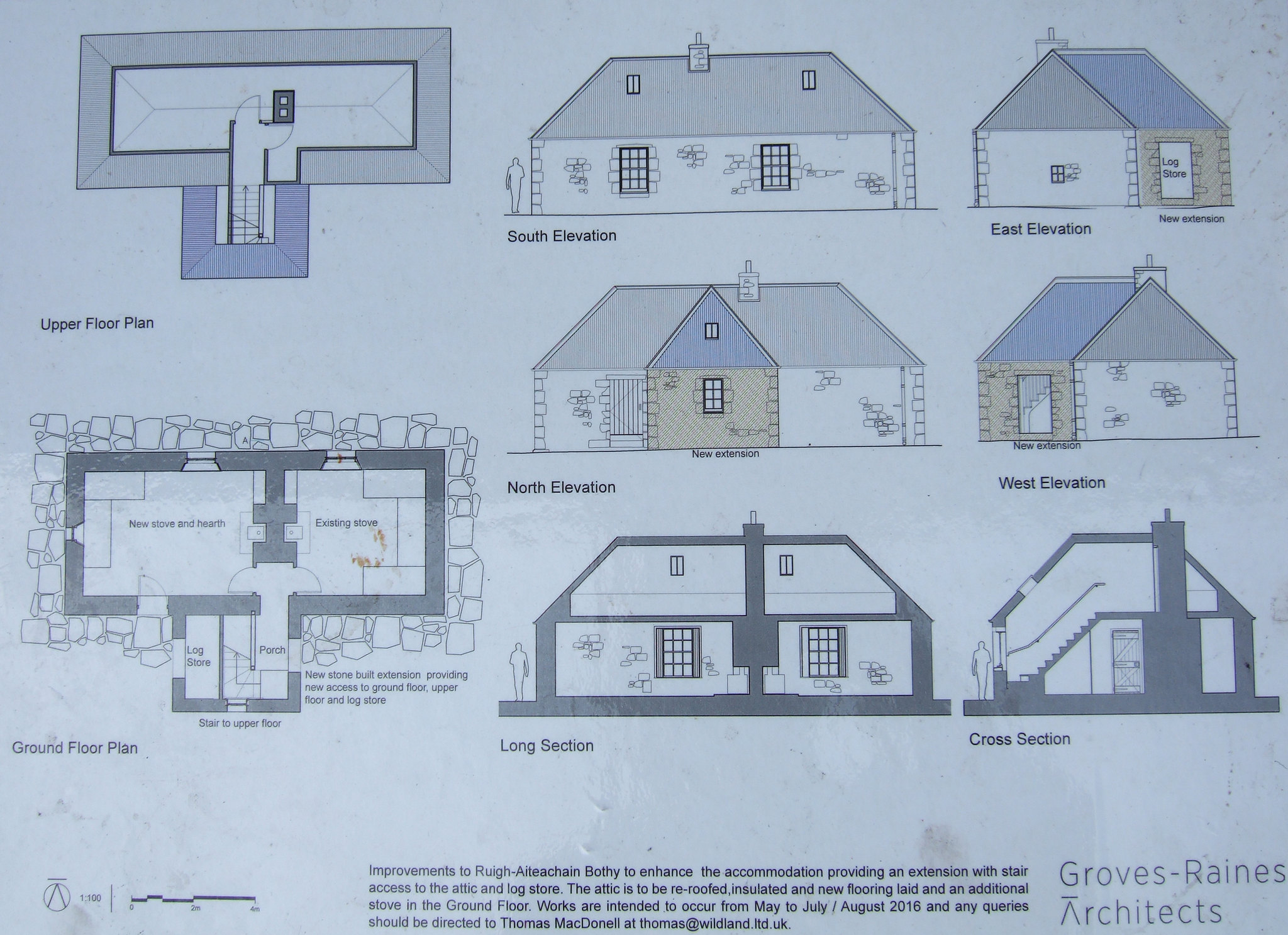
Inside the bothy, I found the laminated plans for an upgrading of the bothy. The work is to be done over the summer months of 20176 and should make an already fine bothy into something really special.
 DSCF3528
 by
stevemannmoscow, on Flickr
Usually any attempts on my part to use an axe or saw results in failure but the blade on the saw looked quite new and I made relatively light work of sawing up some firewood. However, The thick branch was a bit too much for me!
At around eight, heard someone approaching the bothy and as the door squeaked open, a voice called "Hello? Anybody home?" The new arrival was Ivan who comes from the French Alps but lives in Inverness. He once worked on a farm and he soon had the big log sawn up into sections of a perfect length for the stove. This meant that plenty of wood was left for the next visitor.
Ivan was travelling light with no stove or mug. It seemed that his engine ran on just white bread and wine gums. We talked about the route up from Auchlean, climbing and various places around the Highlands. Time soon passed and it was time to 'hit the sack'.
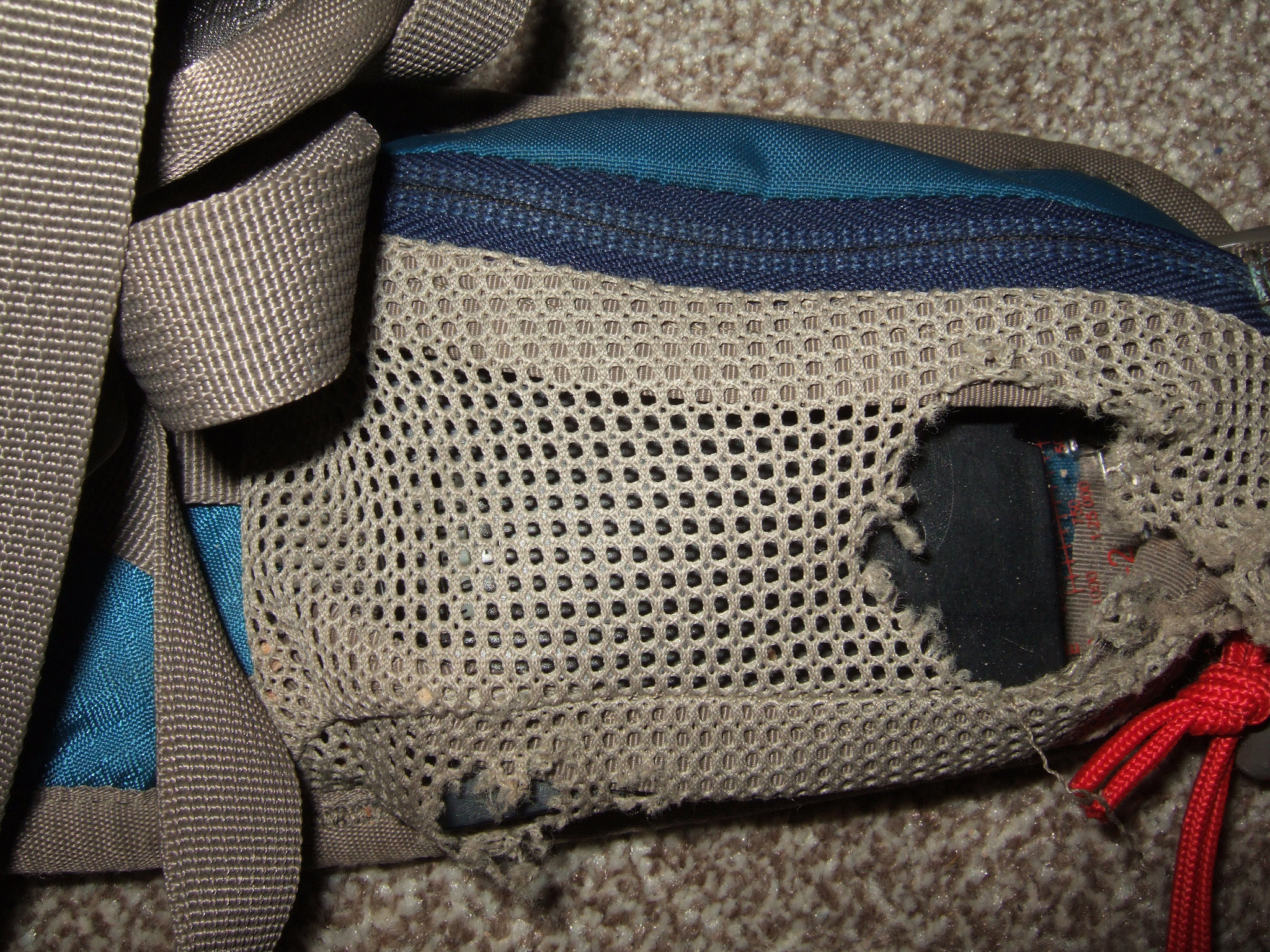
In the morning, Ivan commented on the mice activity during the night. I had put my food into a roll-top bag and hung it up on a nail out of the way of the mice. I usually hang up my rucksack too but failed to do so on this occasion. Later, Ivan was to notice a hole in one of the hipbelt pockets. I had left a small packet of miniature chocolate digestive animals in the pocket and the little bastards had bitten through the mesh to eat the biscuits! Ggggrrrrr!
 DSCF3539
 by
stevemannmoscow, on Flickr
I will need to take the rucksack to Betty. She seems to be able to work wonders with a needle and thread.
We seemed to get on well and I asked Ivan if he would like to join my for a quick ascent of Ord Ban and a bike ride around Loch an Eilein. I could then drop him off in Inverness.
On the bike ride to the car, we visited a small memorial to the "Dogs of War" with American and British flags.
Doing a bit of research on the internet, I found this:
"A team of 40 dogs which helped derail Nazi nuclear weapons operations have been remembered in a special ceremony.
The dogs were taken from America to train with troops on a Highlands country estate, for a mission which saw the Allies sabotage Nazi heavy water operations in Norway.
Sisters Nola Grant and Maureen Clark carried out a poignant ceremony at Glenfeshie Estate in Badenoch in tribute to the team.
In 1942 the sisters’ father Murray Clark was just sixteen when he trained with the dogs in Scotland. Nola said: “He knew that it was a top secret mission. In leaving home, he could not tell anyone about it.”
The Norwegian operation was hailed as the most successful of its kind during the war and was immortalised in the 1965 movie The Heroes of Telemark."
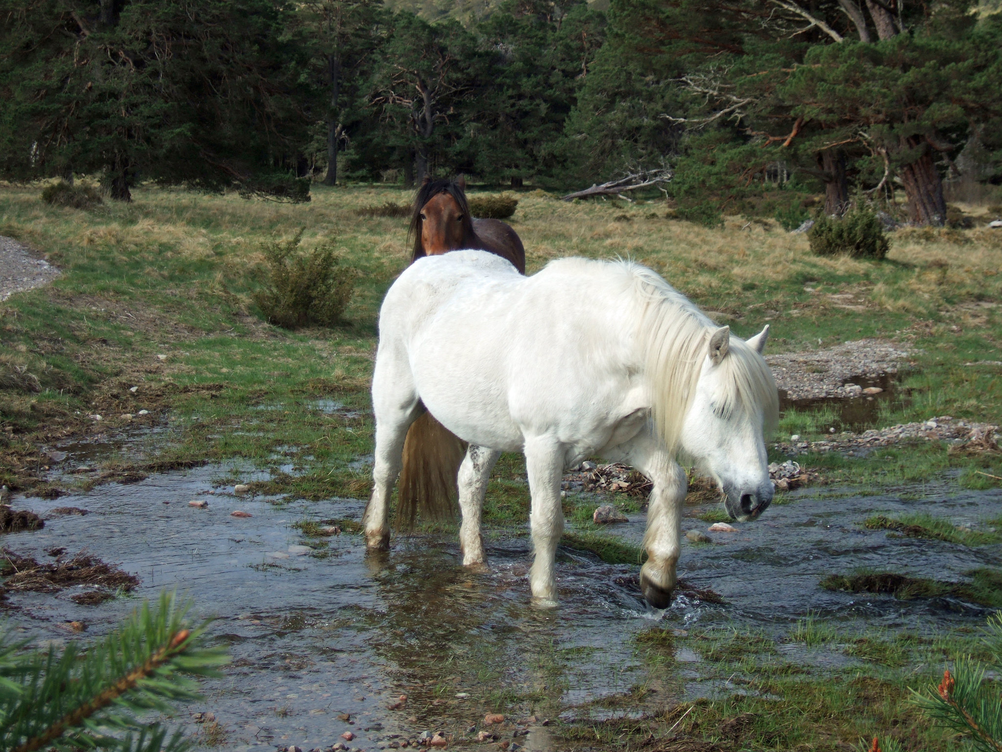
There were three ponies grazing in the glen. Presumably they are used to bring shot deer down off the hill.
 DSCF3531
 by
stevemannmoscow, on Flickr
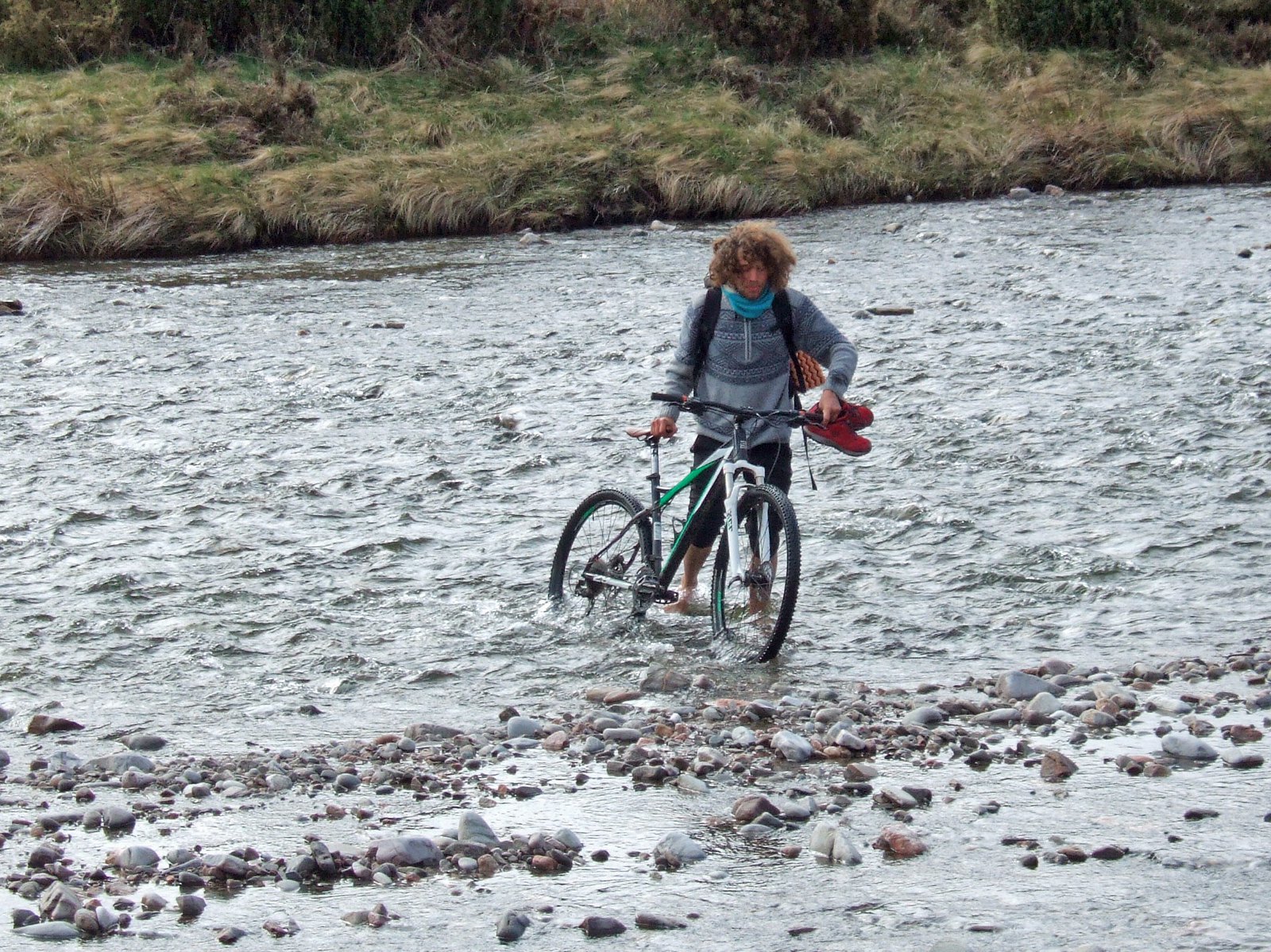
We forded the river at the bridge to join the path up to the private estate road. I did not worry too much about wet feet as I knew that I could change into dry footwear once back at the car. Ivan went across in bare feet.
 DSCF3533
 by
stevemannmoscow, on Flickr
A report for Ord Ban and Loch an Eilein to follow!
