free to be able to rate and comment on reports (as well as access 1:25000 mapping).
I had written quite a rambling report for this trip last night, but rather than use the sensible 'save' option, I accidentally clicked on another page and lost the lot. D'oh! Anyway, it was probably too long and boring, so here is the abridged version.
Lucky me - I got a site visit to Kilchoan as part of a project I am working on. While it had been in the pipleine for weeks, typically the actual date was chosen at the last minute. I left home at 7am with the notion that I could be finished by lunch time, giving me the rest of the afternoon to go for a walk somewhere. The options were endless (I've never been to Arnamurchan before), but I ended up settling on Ben Resipole, as this had long been on my 'must do' list.
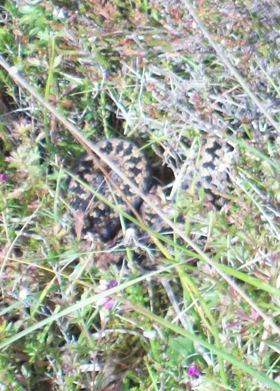
Prior to all that, I had to get on with some work. I'll not go into detail, other than to say it involved lots of tramping through bog looking at watercourses that might provide Kilchoan with a new drinking water source. At one point, I almost stepped on an adder! The following photo shows why I tend to leave the wildlife photography to others:
Adder:
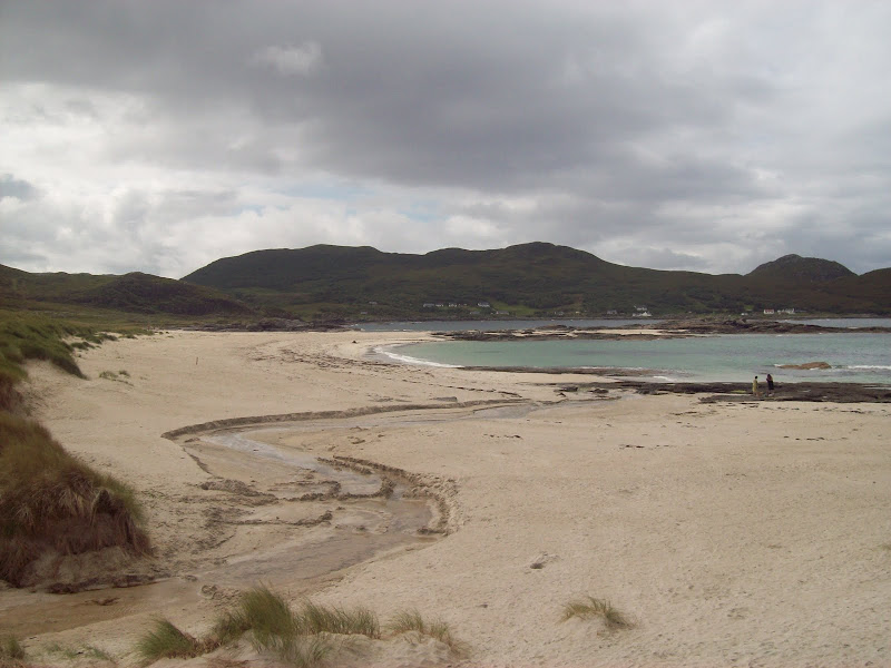
The downside with this kind of visit is the small amount of time available for non-work stuff. I wanted to visit lots of places, but settled for Sanna in the end (convenient, as my last site visit was only a couple of miles back up the road). I didn't really have the time to do the place justice, as hours could be spent wandering over rocky outcrops and along the coast, but it made a nice lunch spot nonetheless.
The beach at Sanna:
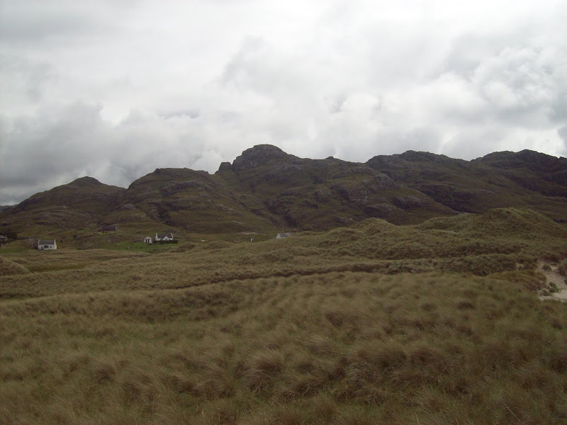
Meall Sanna:
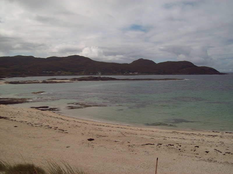
Sanna Bay and Portuairk:
And so onto the hill. In my mid teens, before Munro Fever set in fully, I had chipped away at the edges of Ardgour and Moidart. My dad had a fascination with this area at the time, so we did Garbh Bheinn, Rois Bhein, Sgurr Ghuibhsachain and others, but never penetrated the middle of the area. More recently, with areas such as Torridon, Kintail and Affric closer to home, I have found this area (section 10A to baggers) just as elusive. Today was no exception, as I didn't really have enough time to get right into the heart of it, but I had been eyeing up Ben Resipol for quite a while.
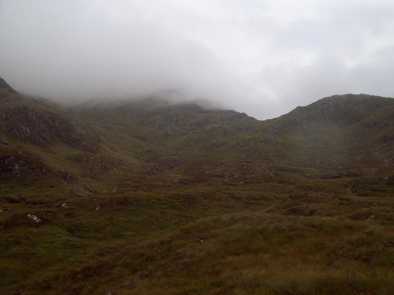
The map didn't really show any particular route which looked better than any others, so I went for the standard path from Resipole. The weather was quite showery at this point, with the summit buried in cloud, but with things changing so continuously, I thought I might get some views later on.
The path was very pleasant low down, passing through birch woodland along the side of the Resipol Burn. Towards the dge of the woodland though, it got boggier and boggier. Once out on open ground, it was probably wetter than the surrounding ground! I passed a family who had aborted their walk, partly due to the lack of views, but mainly due to the bog. I got the impression that they were not too familiar with the underfoot conditions in the Highlands. "Welcome to Scotland!" I told them

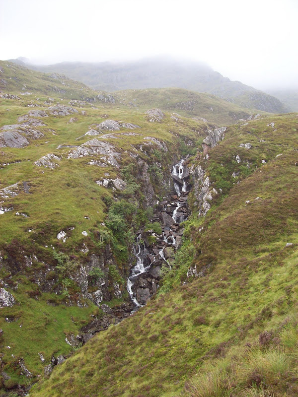
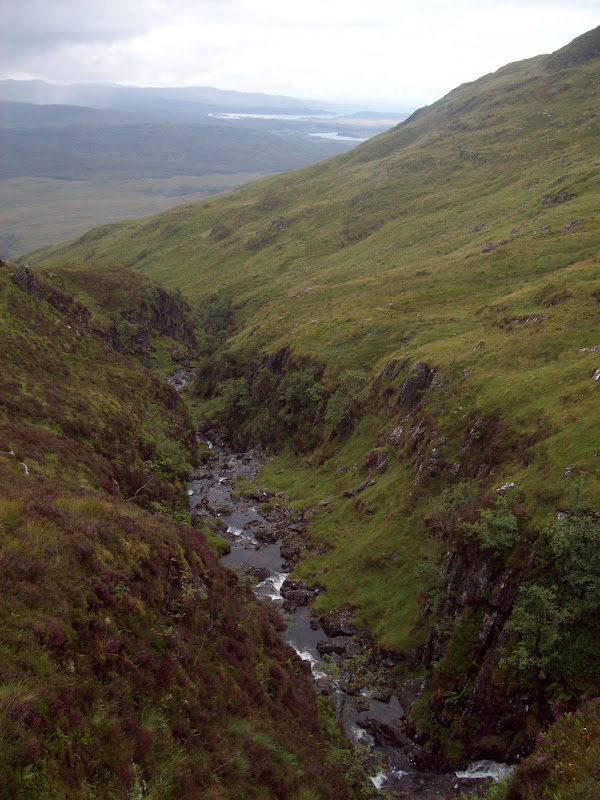
Fortunately the route was pleasant and varied, with a lot of the height gain next to an impressive gorge. This led all the way into the upper corrie, at which point I was almost in the cloud. The only disadvantage with this route was that the views were a bit constrained.
Looking up the gorge of Allt Mhic Chierain:
W down Allt Mhic Chierain:
Looking towards Acharacle on ascent:
Cloud on summit on ascent:
I had intended to move onto the rocky western nose of the summit, but ended up just following the path all the way up the burn. The summit had a massive sprawling cairn, and the remains of a trig point (unmarked on the OS map, strangely). I had a second lunch and sat around for 15 minutes or so in the hope that the cloud might clear. Disappointingly it didn't.
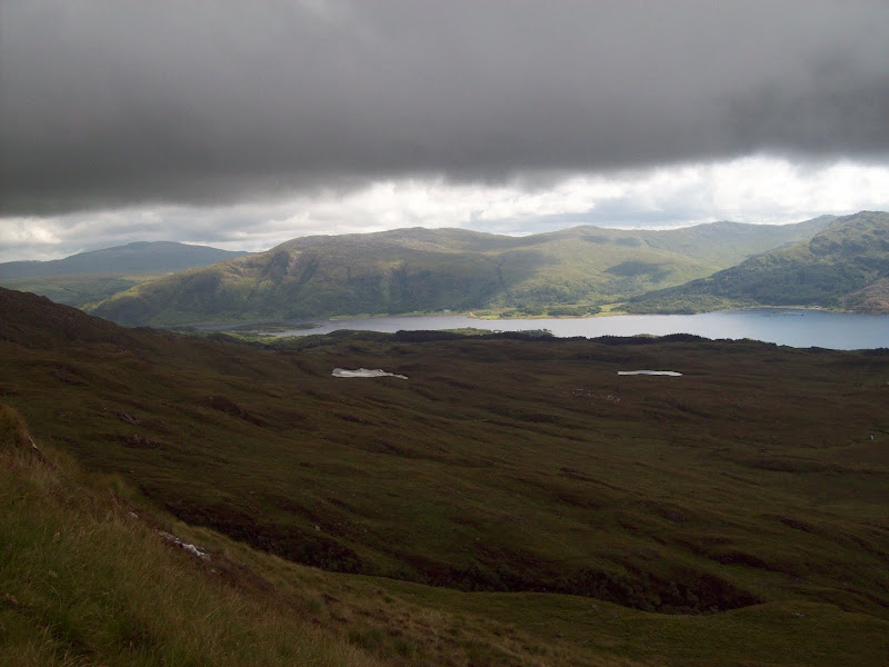
For the descent, I decided to vary the route slightly, heading for the little lochan just N of the summit, then onto Carn Mor na Comhdhail and the western shoulder. The lochan was shrouded in mist, but looked as though it could be a delectable spot for a break, or even a high camp. Beyond this, I was slipping and sliding around on wet grass and rock wondering why I had bothered with this route.
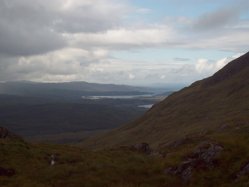
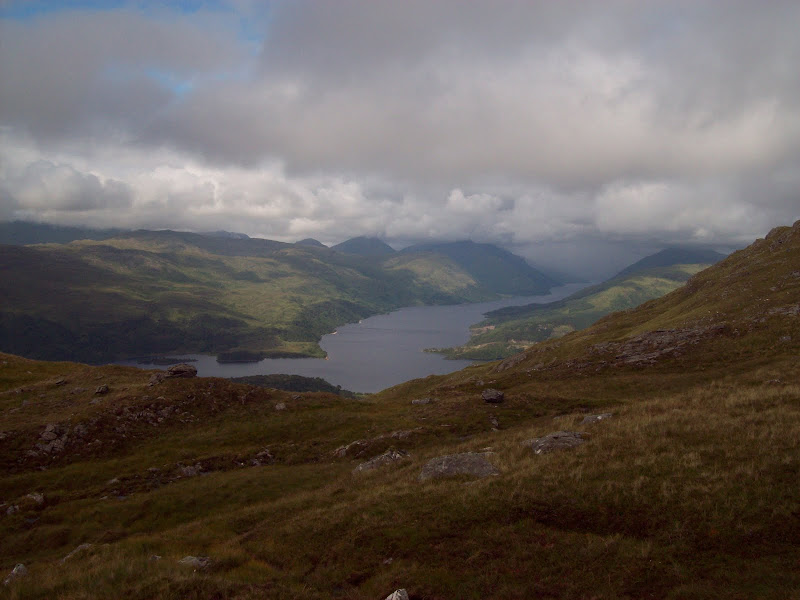
It all became obvious at about 600m, as I broke out of the cloud and had brilliant unhindered views over Loch Sunart, Arnamurchan, Eigg and Loch Shiel. As I was on more open ground than the ascent route, the views were much better.
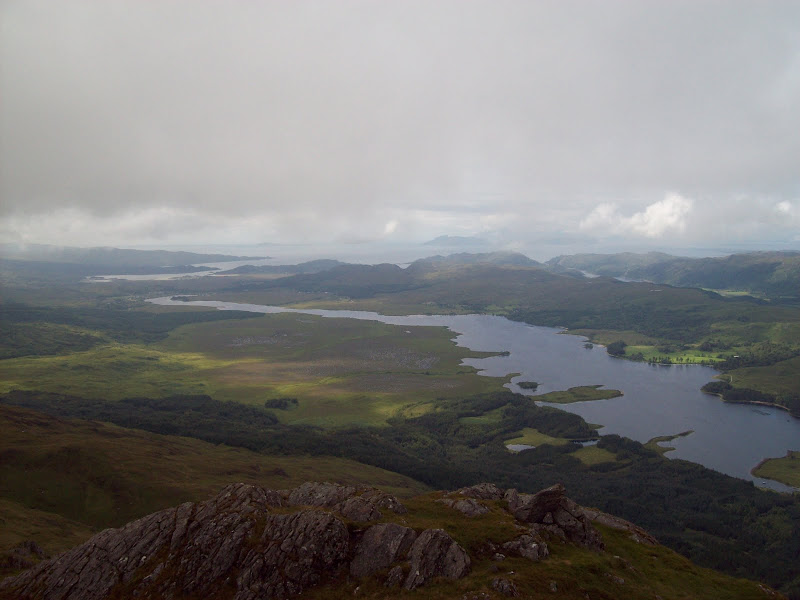
Loch Shiel, Claish Moss, Acharacle and Eigg:
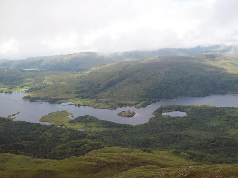
Looking across Loch Shiel to Glen Moidart:
Zoom to Eigg:

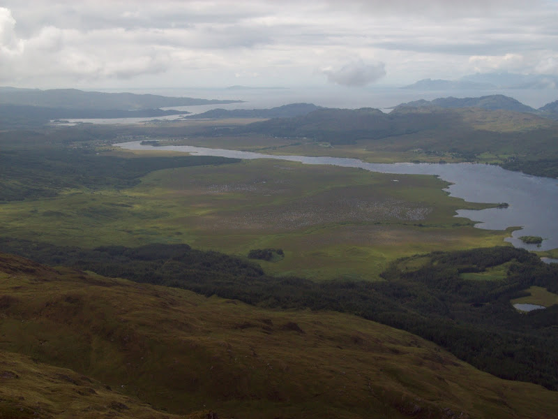
Loch Shiel, Kentra Bay and Eigg again:
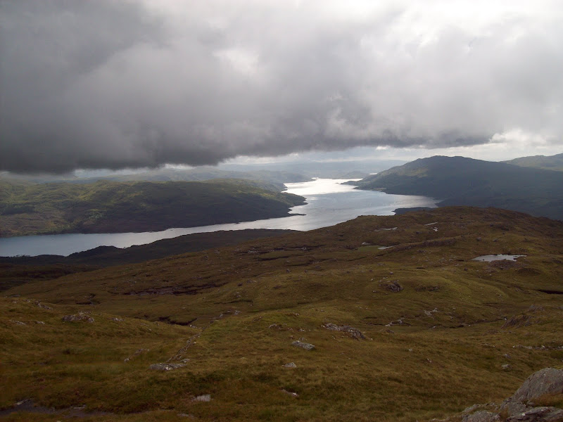
Loch Sunart:
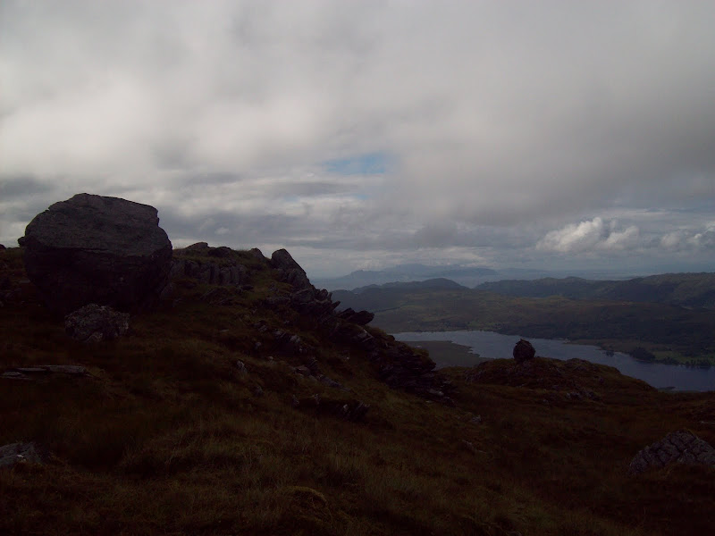
I dawdled about on the ridge, enjoying the views and unwilling to drop back down to the ascent path straight away. I walked out to Meall Mhic Chiarain, where a number of erratic boulders were perched on the ridge, and views up Loch Shiel opened up. Glenfinnan looked to be in the centre of a very heavy shower. One of the most unusual things about the southwest end of Loch Shiel is Claish Moss, a massive expanse of wet marshland. I can't think of many other west coast locations that have this sort of habitat.
Looking up Loch Shiel towards Glenfinnan:
An erratic, plus Rhum finally emerges from the cloud:
Across Loch Sunart to Morvern:
A fairly straightforward descent over thick heather took me back to the route of ascent at the edge of the woodland.
Initially, this hill had seemed a bit of an anti-climax, as part of the appeal was the extensive views from the summit. Fortunately, the views on the descent made up about 40% of what I was hoping to see, so the day turned out very well. I took the Lochailort route back home, as I have only been round this section of coast a couple of times before, and it also saved on what would probably have been a long wait for the Corran ferry. Passing An Stac, I was almost tempted to park up and climb this too, until I realised that I had run out of food, and probably wouldn't get home until after 11pm!
