free to be able to rate and comment on reports (as well as access 1:25000 mapping).
[*disclaimer - I know that Ben More Coigach lies outwith Assynt in reality, but in my mind, Assynt starts with Coigach and reaches up to Kylescu, sometimes beyond. I also believe Foinaven and Arkle are included in it sometimes. It's my story, so my rules

]
Assynt - a place of magic, a place of many layers of memory. From teenage family holidays to ventures up with my own family, to the first walking holiday Allison and I took together back in 2013, Assynt has always resonated. A place like no other I've found, a land of majestic mountains, blue lochans, tranquillity for the soul. I've always loved it. Well - until our ill fated "summer" holiday last year when we spent most of a fortnight in Assynt and surrounds climbing Corbetts and got 1 good day out of 16. Minus 10 degrees on Breabag in June, I ask you

So Assynt and me had a falling out and I started to see the beauty in other places: Knoydart; Skye; Torridon. But somewhere the feelings were still strong for Assynt. We've been reading "At the Corrie of the Green Lochan" again recently and that pulled on a few heartstrings. So a visit was probably a good idea to see what had become of that love.
The possibility of a 3 day weekend beckoned and the weather forecast for the Northwest was reasonable. Dammit - let's go

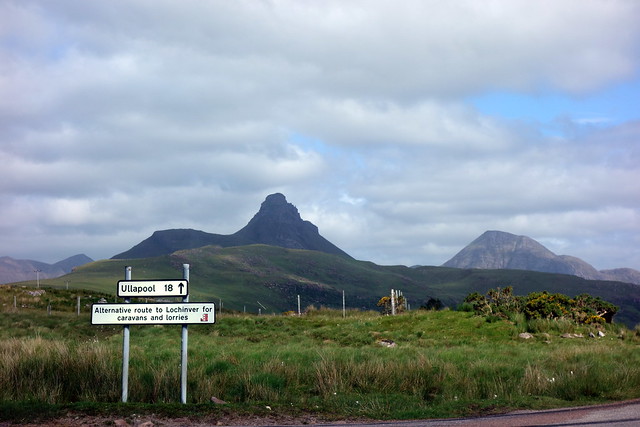
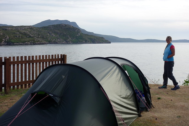
Driving up on Thursday afternoon to Ardmair Campsite stopping off at the M&S at Perth for some deli food, pitching the tent in that very stony ground by the seafront, being eaten by midges til we incarcerated ourselves in the tent inner. There was some excitement - Ben More Coigach was the chosen delicacy for the following day and we could look at it from the tent - dark buttressed wall rising due north of the campsite. I had somehow thought that Ardmair would be really close to the start of the route - silly me - I was vexed to discover that it would be 25 windy miles to Culnacraig, past Achiltibuie. Potrt a Bhaigh campsite would have been nearer and had the possible advantage of less midges. Oh well....
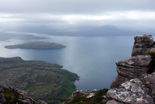
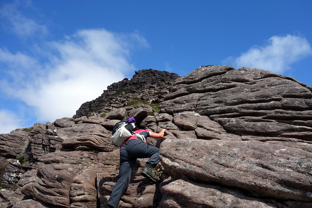
Friday was overcast and cloudy - I'd hoped for better. Oh well. We drove the twisty miles to Culnacraig, having risen early and after a couple of wrong turns arrived at the parking area just before the settlement. The ridge of Spiecien nan Garbh-coireachanloomed to our right. Walking down into the settlement we made the mistake of going through the gate. Don't. Pass to the left of the house by the bridge onto a sheep track which bypasses the houses and takes you a little way up the hill. Next, cross the grassy ground and get to the other side of the Allt nan Coisiche, aiming to ascend along the southern side of the gully. There is a path here which takes you onto flatter ground from 400m until the paths go every which way as soon as the rocky crest of Garbh Coireachan is reached. Easy to pick a way through then onto a fine narrow ridge. There are pinnacles along the way and you can make it as interesting as you wish on the good dry sandstone. Up ahead the mountain goes into a Y shape, one limb heading to the pyramidal top of Spiecein Coinnich, the other along to Sgurr an Fhidhleir. To our right lay the Summer Isles in a mirror calm sea.
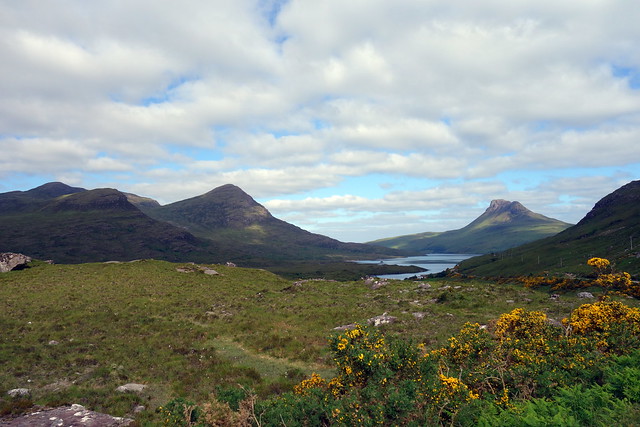
Arriving at the parking spot - view to Summer isles
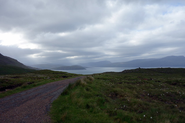 DSC00947
 by
Al, on Flickr
An unexpected find in Culnacraig
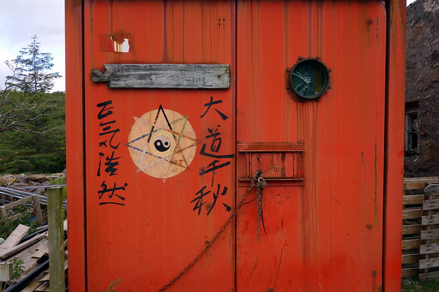 DSC00948
 by
Al, on Flickr
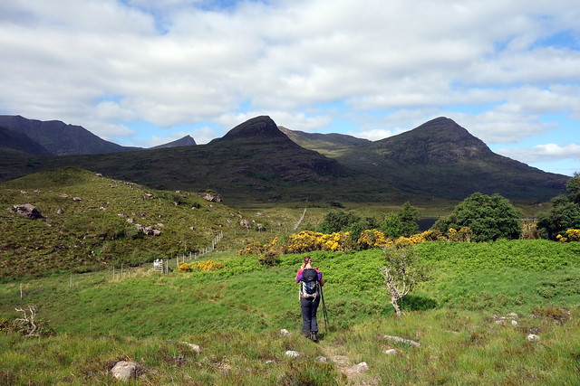
Setting off - Garbh Coireachan in backdrop
 DSC00949
 by
Al, on Flickr
 DSC00952
 by
Al, on Flickr
Silver light on the water
 DSC00953
 by
Al, on Flickr
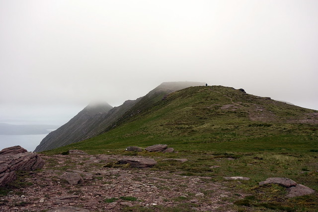
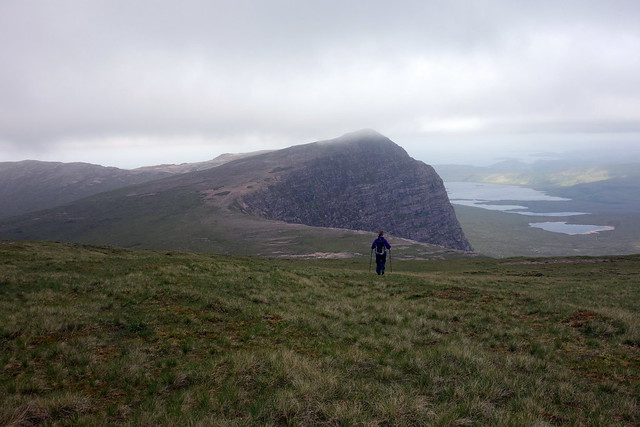
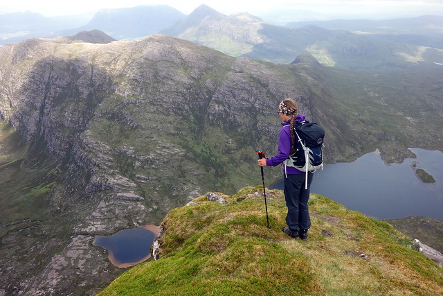
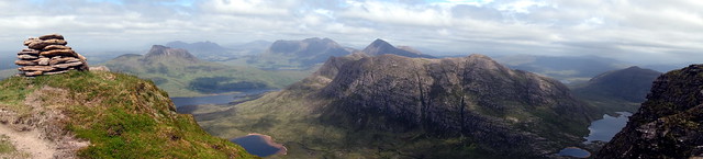
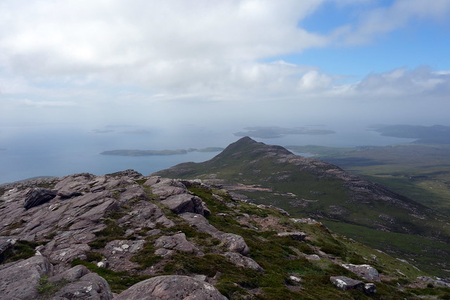
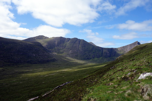
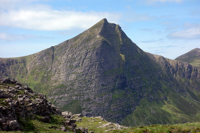
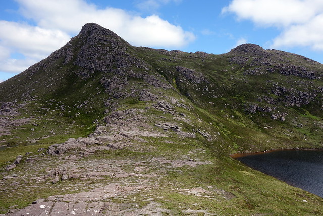
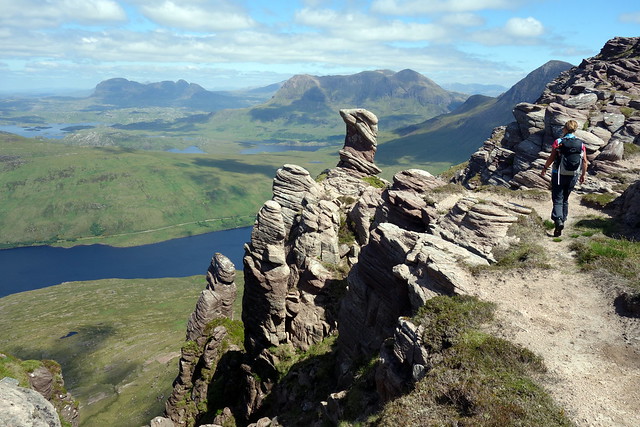
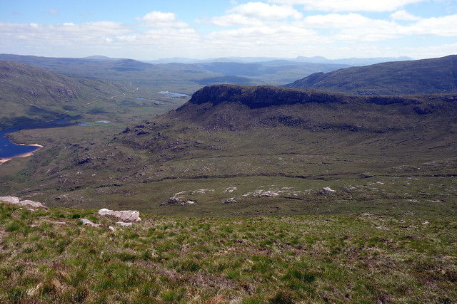
Ridge, view to Ben More Coigach
 DSC00959
 by
Al, on Flickr
 DSC00960
 by
Al, on Flickr
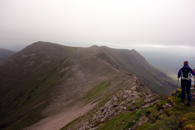
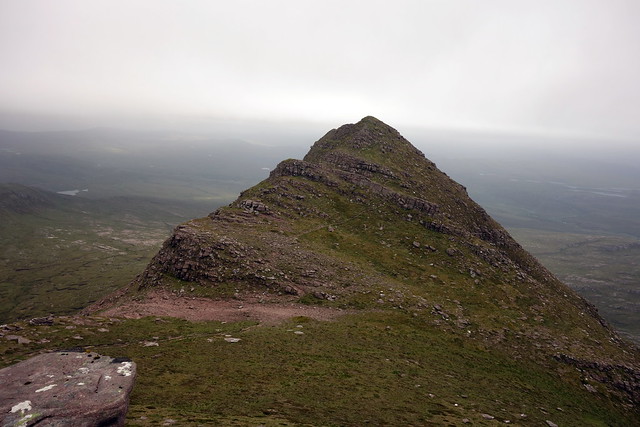
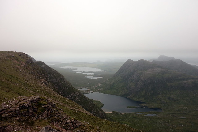
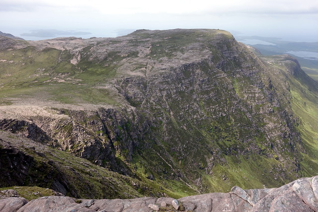
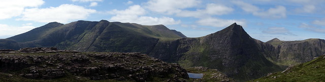
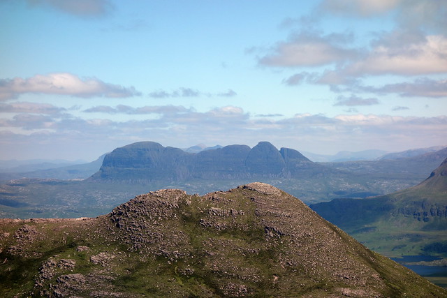
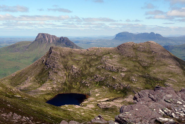
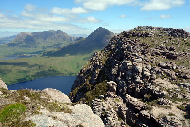
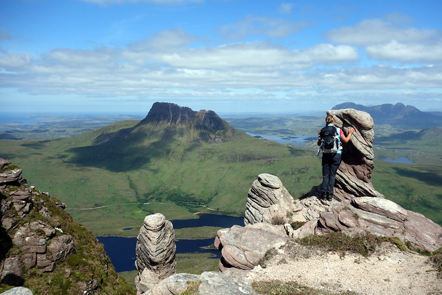
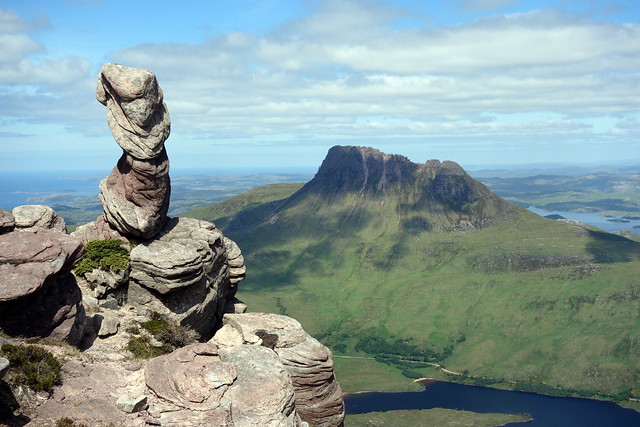
After fun on the ridge we headed for the flat top of Ben More Coigach. In the distance I was disappointed only to see outlines of Suilven, Stac Pollaidh etc in the mist. We crossed back to our right to resume the ridge onto Spiecein Coinnich, meeting another walker in the process coming the opposite way. There's a fine lift up to the narrow top from a small bealach. From here we skirted round the eastern ridge, heading for Sgurr an Fhidhleir, meeting another couple of walkers. And we could see a group on top of Fhidhleir. Busy hill today. The prow of Fhidhleir soars impressively skywards, although the ascent is straightforward. We could see a climber about half way up. Grand views to Lochan Tuath, with the surrounding mountains becoming a little more visible in the mist. There are several rock projections on the way up which the more courageous might wish to clamber onto. The top is flanked by sheer drops on both sides
View to Fhidhleir from Coigach
 DSC00963
 by
Al, on Flickr
Looking back along the ridge
 DSC00965
 by
Al, on Flickr
Spiecein Coinnich
 DSC00966
 by
Al, on Flickr
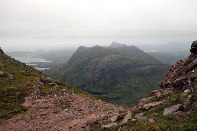
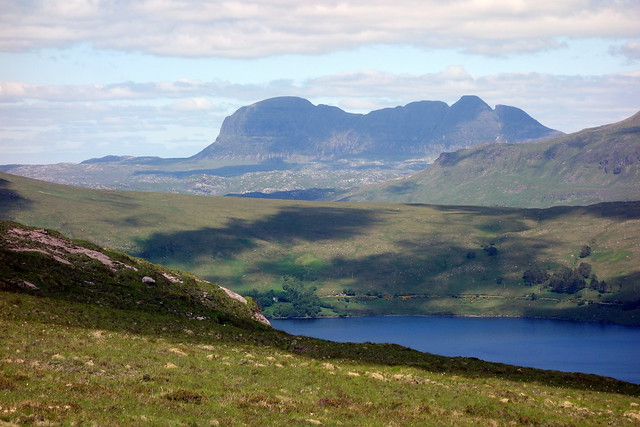
Cul Mor
 DSC00969
 by
Al, on Flickr
Lochan Tuath
 DSC00970
 by
Al, on Flickr
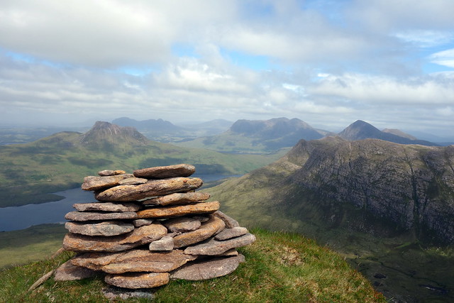
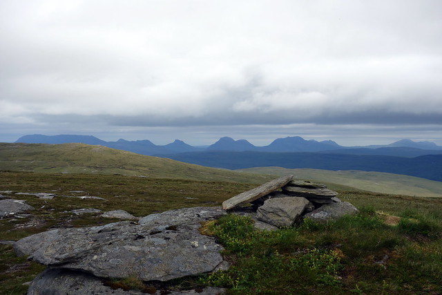
Top, Coinnich
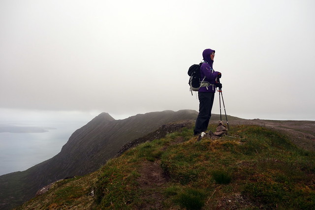 DSC00972
 by
Al, on Flickr
Moth
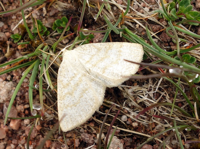 DSC00973
 by
Al, on Flickr
Onwards to Fhidhleir
 DSC00974
 by
Al, on Flickr
 DSC00979
 by
Al, on Flickr
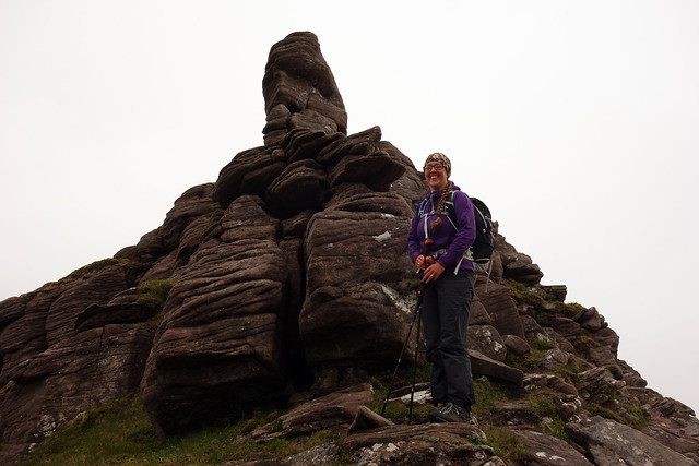
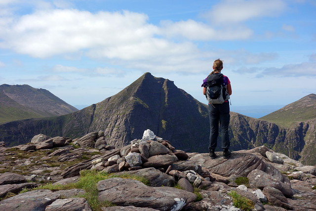
Narrow summit of Fhidhleir
 DSC00984
 by
Al, on Flickr
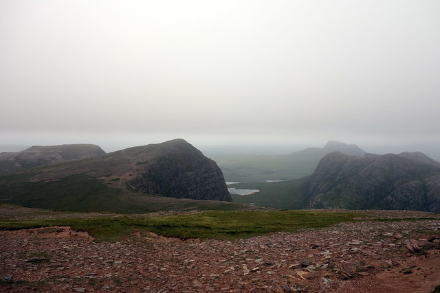
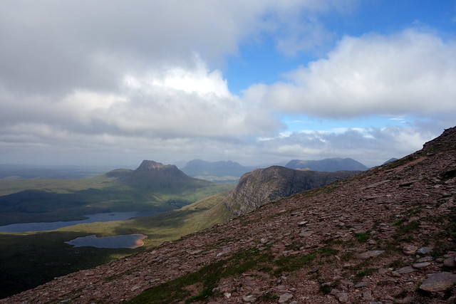
From here there is a choice of routes - you can drop down into Coire Reidh or continue along the horseshoe to visit another 2 simms. You can guess which route we took. Heading down to the dip with the 648m northern top of Fhidhleir we passed a hill runner who was going at a fair pace. When we reached the cairned summit there were fine views to Pollaidh, Suilven, Cuinneag - MacCaig's "huddle of anvils" just peeping out and the ocean beyond. Well worth a visit.
On to the N Top
 DSC00986
 by
Al, on Flickr
 DSC00987
 by
Al, on Flickr
Looking back at Fhidhleir
 DSC00990
 by
Al, on Flickr
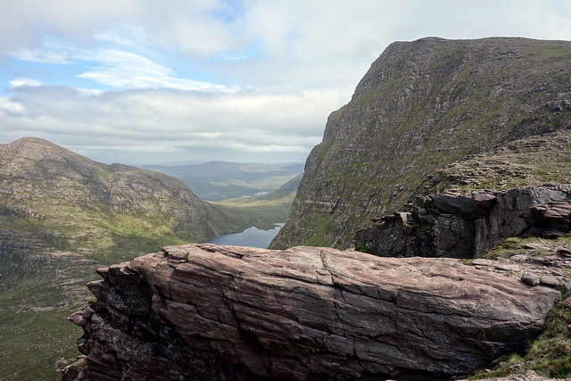
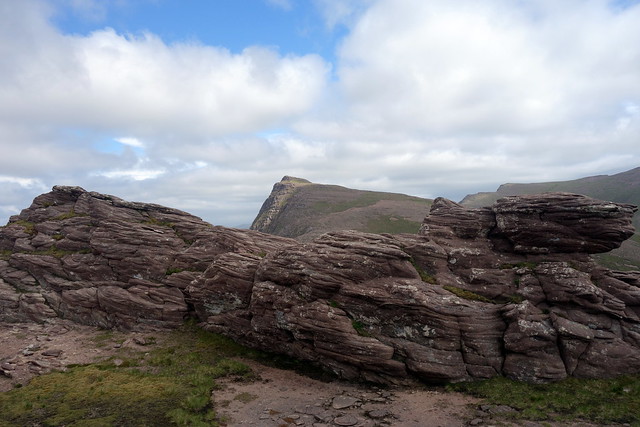
Rock promontory
 DSC00991
 by
Al, on Flickr
What do rocks find to talk about after so many aeons?
 DSC00993
 by
Al, on Flickr
Loch Tuath
 DSC00994
 by
Al, on Flickr
 DSC00996
 by
Al, on Flickr
Summit, Fhidleir North Top
 DSC00997
 by
Al, on Flickr
 DSC00998
 by
Al, on Flickr
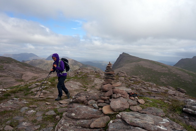
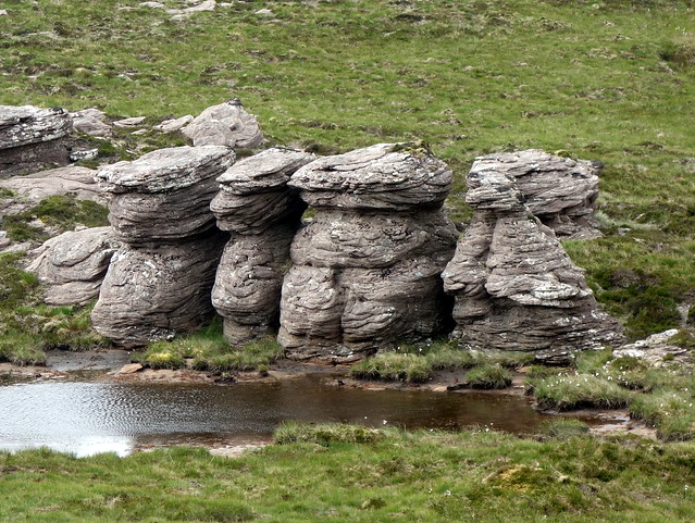
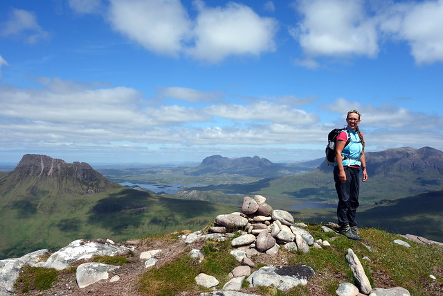
Next was the rocky top of Beinn na Caorach. By this time there was even some blue sky. A drop northwest into the glen took us to the final top of Conmheall. We passed some more odd sandstone formations by the wee lochan, looking like eldrich figures watching the turf islands in the lochan race each other. From the top we could see the car park. We returned to the south to come off the last hill, there being significant crags and drops off to the west - would make a good ascent route though. Followed the Allt Tarsuinn back to the car, picking up a trail about halfway.
Ben Caorach
 DSC01003
 by
Al, on Flickr
 DSC01006
 by
Al, on Flickr
Conmheall
 DSC01008
 by
Al, on Flickr
 DSC01009
 by
Al, on Flickr
 DSC01010
 by
Al, on Flickr
 DSC01013
 by
Al, on Flickr
This was a cracking hill - in its own right as a circuit and with views to cherish. We both felt buoyed in spirits by the day. I have become more concerned about the aesthetics of hill routes as I've got longer in the tooth and like to try and get the best out of a hill. If we'd done this from Bhlugassary as most of the folk we met seemed to, we'd have had a shorted circuit, got both Grahams, but missed out on a fine ridge and some breathtaking (even in misty conditions) views. The whole horseshoe is definately worth it, and doesn't add much time on really. On the way back to the campsite I admit to stopping the car a few times to take pictures out of the window.

 DSC01016
 by
Al, on Flickr
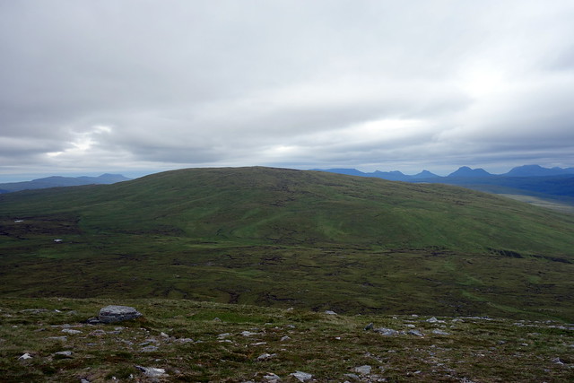
Beinn an Eoin/ Coigach
 DSC01017
 by
Al, on Flickr
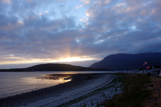
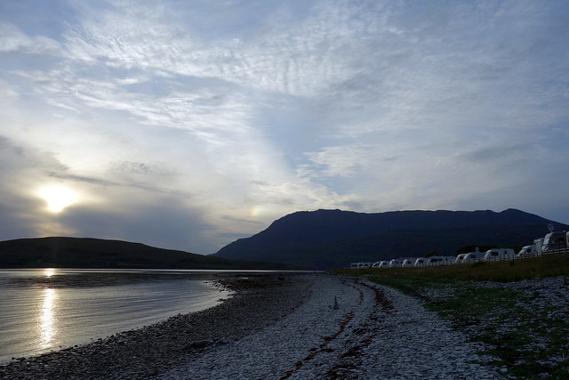
Sunset at the campsite
 DSC01021
 by
Al, on Flickr
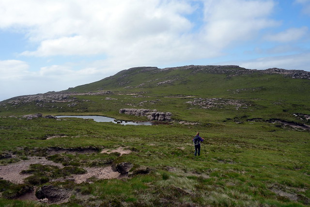
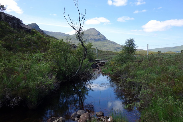
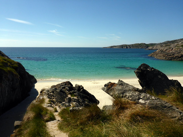
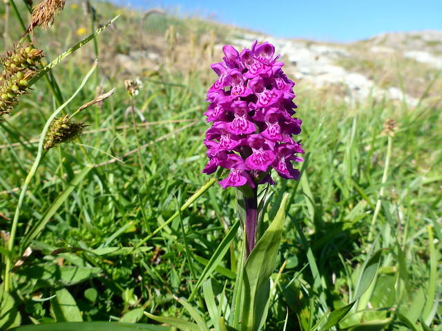
Saturday was set aside for Beinn an Eoin, near neighbour of Coigach. The forecast had been so-so, but i could tell as a walked back from my 7.30 shower at the campsite that it was going to be a fine day. Blue skies with fluffy white clouds. Sunshine, in Assynt - yeah! We drove back along the Drumrunie road to the southern end of Loch Lurgainn. The SMC book suggests you can squeeze into a passing place by the water's edge, but I didn't think there was enough room and we drove 1km back to the parking area. Walking an extra kilometre in this landscape, on a sunny morning is no hardship. We arrived at the passing place and followed a foottrail down through gorse and bracken to a gate with an alarming sign. Passing through we continued along a good path that basically goes round the south of Feur Loch and follows the Allt Claonaidh. we continued on this a bit too long, as we were intending to climb up the Cioch Beinn an Eoin, but headed northwards, aiming for the 393 point along the ridge. A coiled adder hissed and uncoiled rapidly, darting away to a subterranean lair. A bit further on I spotted shed snakeskin. There were many sundews, pads held aloft to trap midges - good on you, wee carnivorous plants. As we walked, the prow of Fhidleir remained visible, poking out above the ridge of Eoin.
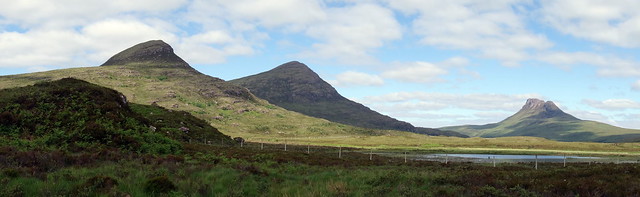
Coigach encircling Beinn an Eoin
 DSC01022
 by
Al, on Flickr
Nice morning for a walk - Loch Lurgainn
 DSC01023
 by
Al, on Flickr
Cioch of Beinn an Eoin (centre)
 DSC01024
 by
Al, on Flickr
Worrying notice
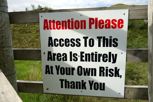 DSC01025
 by
Al, on Flickr
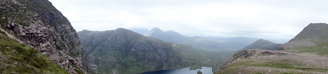
Eoin, Tuath & Polly
 DSC01027
 by
Al, on Flickr
Lots of...
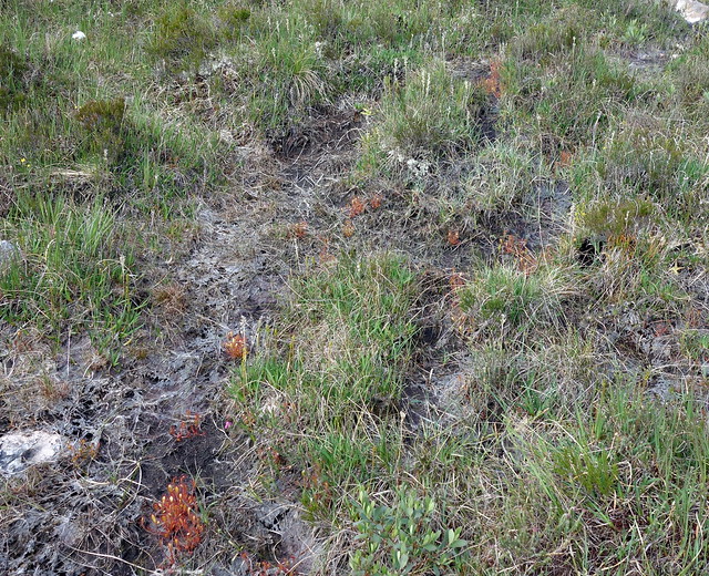 DSC01029
 by
Al, on Flickr
...sundews
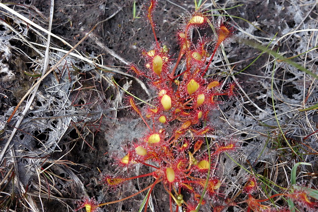 DSC01030
 by
Al, on Flickr
Cioch
 DSC01033
 by
Al, on Flickr
Shed snakeskin
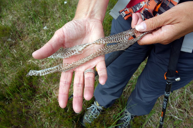 DSC01034
 by
Al, on Flickr
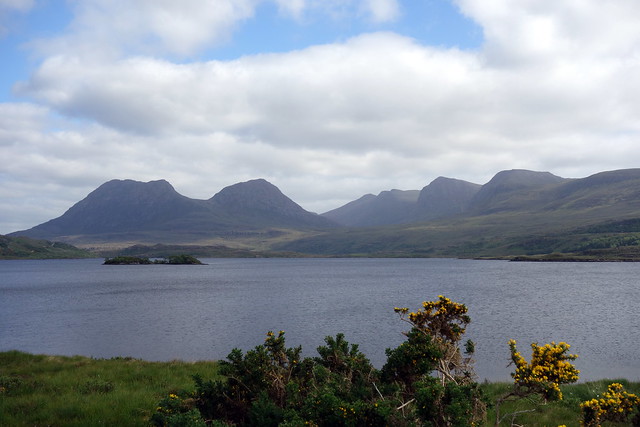
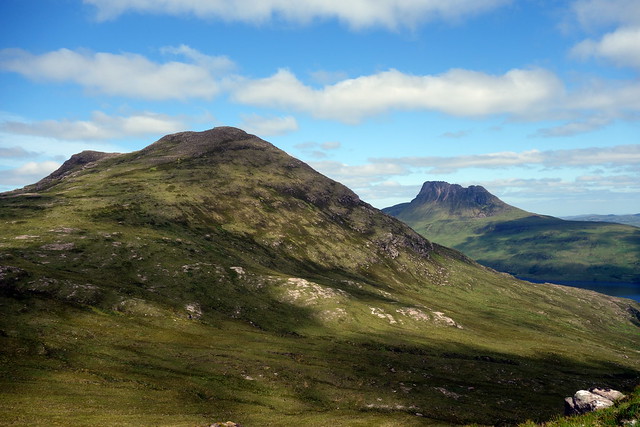
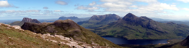
We began climbing along the side of the ridge, aiming for the halfway point. We could see another walker coming up from our left. Once we reached the broad ridge crest the eye was smitten with Cul Mor & Beag, Stac Pollaidh and Suilven, suddenly appearing like tasty treats in a chocolate box. Walking up to the uninspiring summit of Eoin, the views made up for the hill being a nonentity otherwise. I was back in "Assynt is Heaven" mode - on days like this I don't think it can be beat. Looking down at Loch Lurgainn I remembered having a wash after climbing Stac Pollaidh when we wildcamped by the shores in a den of midges and ticks.
Up to the crest
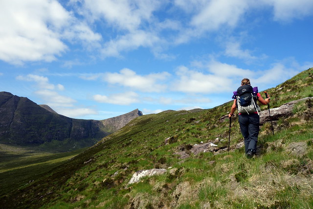 DSC01035
 by
Al, on Flickr
Coigach/Fhidhleir
 DSC01036
 by
Al, on Flickr
 DSC01037
 by
Al, on Flickr
Beinn an Eoin
 DSC01038
 by
Al, on Flickr
 DSC01040
 by
Al, on Flickr
Fhidleir
 DSC01044
 by
Al, on Flickr
 DSC01045
 by
Al, on Flickr
Sgurr Tuath in the foreground
 DSC01048
 by
Al, on Flickr
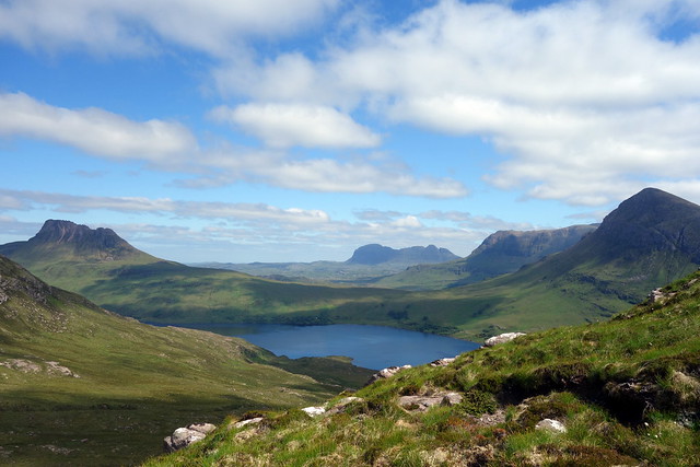
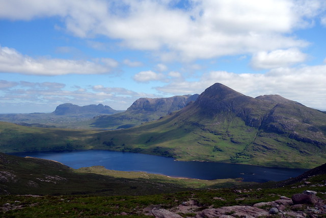
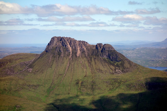
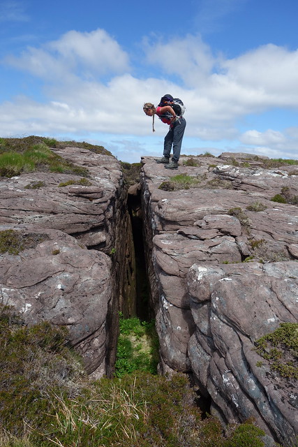
Pressing on over the next rise, Sgurr Deas we could see Sgurr Tuath ahead, across an unnamed lochan. Even though this failed to reach 600m, and hence was no simm, it should definately be climbed for reasons that will become obvious. A steepish grassy descent from Deas led us to the bealach and we had a look at the shoulder up Tuath - lots of playful sandstone crags. We had much fun scrambling about on them. On the hill top there's a cleft that suddenly opens up - looking gingerly down it did not appear to have a bottom, so if doing this hill when snow lying - be very aware, or you might take the quick route down. Continuing towards the summit you pass a cluster of outrageous stone pinnacles, which look directly across the loch at the master of outrageous pinnacles, Stac Pollaidh herself. We paused for lunch, which was longer than usual given the sights to behold, then got to the top.
 DSC01049
 by
Al, on Flickr
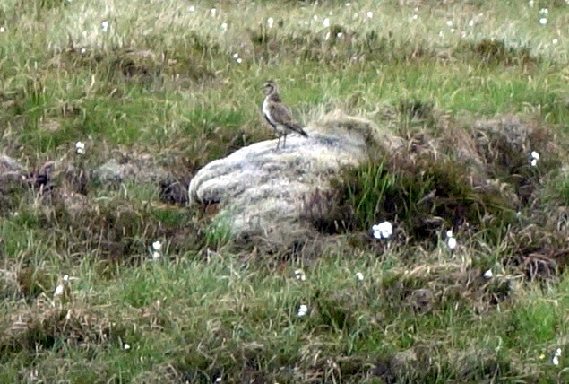
Happy weasel
 DSC01050
 by
Al, on Flickr
Tuath/Suilven
 DSC01052
 by
Al, on Flickr
Tuath - how could you not bother climbing this?
 DSC01054
 by
Al, on Flickr
Pollaidh
 DSC01058
 by
Al, on Flickr
Scrambly fun
 DSC01061
 by
Al, on Flickr
 DSC01062
 by
Al, on Flickr
Cleft - much scarier in reality
 DSC01064
 by
Al, on Flickr
 DSC01071
 by
Al, on Flickr
Pinnacles
 DSC01072
 by
Al, on Flickr
 DSC01074
 by
Al, on Flickr
 DSC01075
 by
Al, on Flickr
 DSC01076
 by
Al, on Flickr
We came off south into Coire Beinn an Eoin and followed the river along. I guess this is normally a boggy route, but in the present dry conditions it provided fine walking. We headed for the northern tip of Cioch Beinn an Eoin and around 120m followed a flatter countour back towards Feur Loch. We avoided having to cross the deer fence, joining up with the outward trail and returning to the car in an elated state.
Descent route
 DSC01078
 by
Al, on Flickr
 DSC01081
 by
Al, on Flickr
 DSC01083
 by
Al, on Flickr
Looks a bit like Stac Pollaidh!
 DSC01085
 by
Al, on Flickr
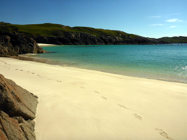
By this time it was gone three. The sky was blue and the air was beautifully warm. We bathed in scent from the gorse, which decorated the roadsides with its yellow jewels. What to do on a summer's afternoon in Assynt? You were right - we drove more windy miles to Lochinver to buy some cool drinks and crisps then the short distance to Achmelvich. My original plan had been to stay at Ardmair 2 nights and Achmelvich the third - I was kicking myself for not having done that now given the weather. We walked along to the furthest sandy beach, the one I used to frequent as a kid and had a lovely hour or two, paddling in the crystal clear water, sitting with the sun on skin. This is just so perfect, thought I, that a mere matter of 5 or 6 hours driving shouldn't keep me from coming up here whenever the urge takes me and the weather is like this. Assynt - you are fully forgiven 9at least until the next wet weekend
)
 P1130210
 by
Al, on Flickr
 P1130211
 by
Al, on Flickr
 P1130212
 by
Al, on Flickr
 P1130215
 by
Al, on Flickr
Reluctantly we pulled ourselves away from the beach at 6pm and drove back to Ardmair, looking at all the mountains on the way down the road. A tasty tea, some sitting in the sun watching the sky change, clouds form and disperse over the bay. Hmm - life is good.
Ardmair
 DSC01087
 by
Al, on Flickr
Coigach
 DSC01088
 by
Al, on Flickr
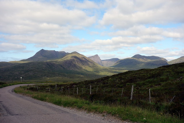
The forecast for Sunday was a cloudy day with rain later. I had toyed with various possibilities. We could head up Stac Pollaidh and get to the proper summit, which we didn't do last time, but I was still feeling too much of a scaredy-cat to do that. We could drive up towards Ben Stack and do that fine hill - but wrong direction for an already long drive home. I rummaged through the SMC book and came up with Beinn Breac (or Meall Dubh as WH would call it), an outlier of the Dearg range accessed from Inverlael. On the road home, nice gentle slopes - should be fine. Of course, adding in its two Tops (Simms, naturally) of Carn Mor and Meall Dubh brought the distance up to 22km or so, but a lot of that was on track. We gathered our stuff up at the campsite and headed off a short distance past Ullapool to the walkers car park at Inverlael. Quite busy already with folk presumably doing Dearg or Seana Bhraigh (or maybe even just having a walk up the glen - imagine!). We started out of the footpath at Balblair, enjoying the forest smells and sounds, the water flowing in the river bed, the birdsong. Continuing on to the merging of the tracks at Glensguaib, we chose the track that rises up Druim na Saobhaidhe that one could take for Seana Bhraigh. Memories came back of the time we'd walked in on this track in the late evening, camping high just shy of Seana Bhraigh at 10.30 at night in the mist and stillness- I think our first high wild camp - and headed off to summit Seana at 8am fortified by a single malt for breakfast. None of that today

Towards Beinn Dearg
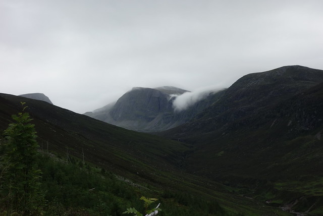 DSC01092
 by
Al, on Flickr
View back along the Glen, An Teallach hiding
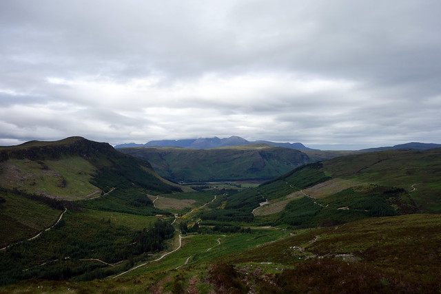 DSC01094
 by
Al, on Flickr
The excitement that is Carn Mor, Seanna Bhraigh in backdrop
 DSC01096
 by
Al, on Flickr
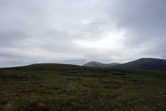
The going was easy and gentle and we climbed inexorably to 550m or so. The normally gushing river was muted and crossings couldn't have been easier. We reached the SW shoulder - if shoulder can be used for such a gentle incline - of Carn Mor and left Gleann a'Mhadaidh behind. I upset a hind that had been sheltering behind a peat hag and which scrambled to her feet, glared at me before running off. A while later we emerged at the grassy summit of Carn Mor, which provided good views to that elusive summit of Seana Bhraigh. On the other side, the hills of Assynt poked up into the low cloud.
Summit, Carn Mor
 DSC01099
 by
Al, on Flickr
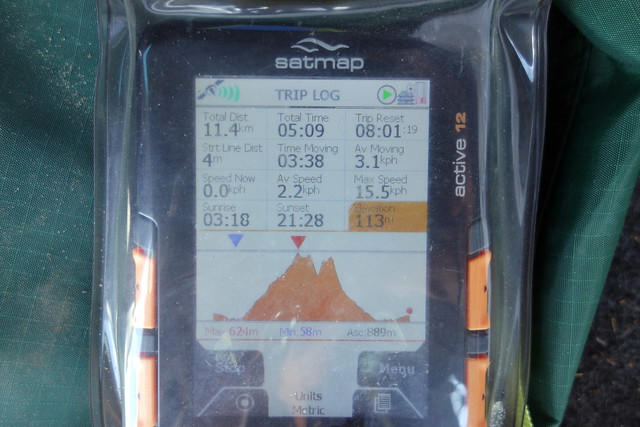
We had lunch and set off NW to the unnamed (on the map) summit of Beinn Bhreac which is the Graham. A potentially boggy bealach between the hills, again made easy by the dry weather. not much to say about Beinn Bhreac, only that the Assynt hills seemed a little nearer. On across Coire Siolar, the only sound the piping of plover - sometimes singly, sometimes in stereo. The top of meall Dubh was attained and we walked southwest off the hill to meet thetrack running alongside the Allt Badan Seasgach. A multiplicity of tracks was visible in the floor of the glen below. The track led us to the forestry plantation and down to rejoin the lower track by way of an unmarked path that threads through the young trees. Back at the car in 6 hours and a little bit for the drive home. About 10 minutes after we set off the rain started and followed us down the road - a dreich ending to a lovely weekend.
Beinn Bhreac
 DSC01101
 by
Al, on Flickr
Plover
 DSC01102
 by
Al, on Flickr
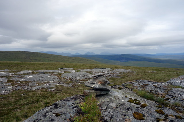
Summit Bhreac, Assynt Hills
 DSC01104
 by
Al, on Flickr
 P1130221
 by
Al, on Flickr
Summit Meall Dubh
 DSC01107
 by
Al, on Flickr
 P1130225
 by
Al, on Flickr
 DSC01109
 by
Al, on Flickr
