
Hebrides tour day 3: Back to North Uist
Sub 2000 Marilyns: Crogearraidh na Thobha, Crogearraidh Mor.
Date: 21/07/2016.
Distance: 2.5km + 4.5km.
Ascent: 155m + 235m.
45 minutes + 1 hour.
Weather: Humid, breezy and showery
Time to head home from my rather fortunate work/holiday visit to Barra. There had been some sun as I left the island on the ferry back to Eriskay, but by the time I arrived, the cloud had lowered, and even tiny Beinn Sgiathan was in the clag. I now had about 5 hours before I needed to be in the ferry queue at Lochmaddy - plenty of time for a bit more looking about. The low cloud meant I abandoned any plans to go up Easabhal on South Uist, instead hitting the road north.
One of my mum's cousins lives at the Benbecula end of North Uist, so I spent a bit of time trying to find their place based on a rather sketchy address scribbled on a bit of paper. I failed, but wasn't too worried - I'm due back here in a couple of weeks anyway. I carried on north hoping that maybe Eabhal or the Lees were clear of the low cloud, as I really fancied one of these walks. They weren't, and I wasn't fussed about going up them in the clag, so I headed off for one of the lowest Marilyns in the country - Crogearraidh na Thobha. This looked to be in a great spot overlooking Lochmaddy and South Harris, and involved driving through the watery wasteland that had interested me so much the other day when viewing it from Beinn Mhor.
Sound of Harris ferry from Cheesebay:

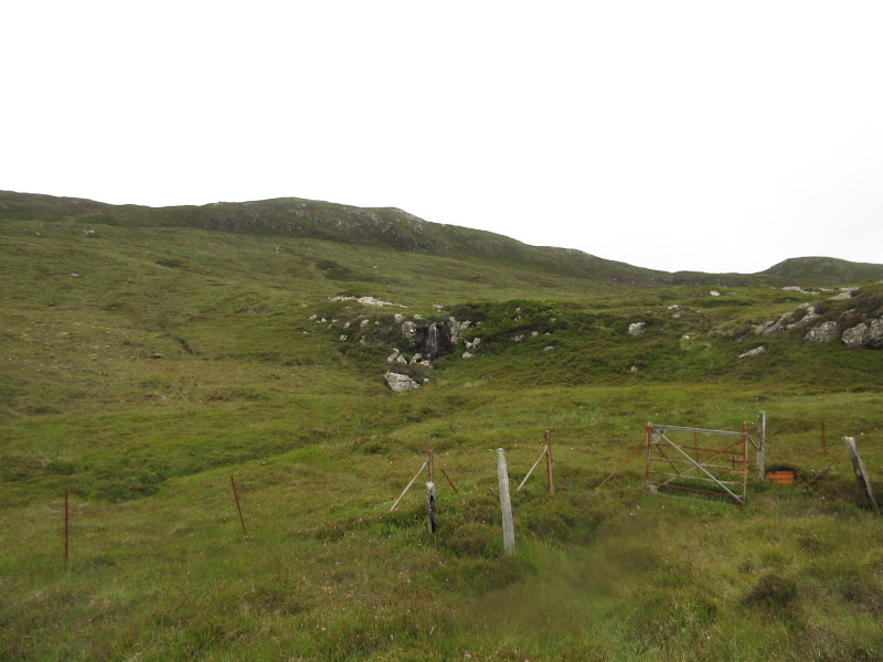
The road to Cheesebay looks like the road to nowhere, but as usual in these islands, you are never that far from life, and there was a bit of a community down at the end of the road (as well as a pretty hefty fish farm). Parking at the end of the road, it was a quick ascent to the heathery hillside above the loch. There was even a sketchy path in places.
Heading up Crogearraidh na Thobha:
Fish farm and South Harris:

Sound of Harris coming into Bernaray:

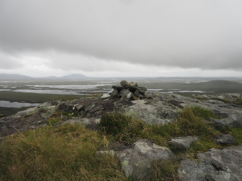
The path disappeared on the steeper summit slopes and it was a fight through the deep heather for a short while - one of the disadvantages of the hill being so low. Before too long I was on the haggy plateau with the trig point close at hand. It was pretty breezy and the cloud had moved in, but fortunately it didn't descent completely. After a break, I walked to the other end of the plateau round some peat hags for the view back over to the main body of North Uist. Top stuff, despite the deteriorating weather.
Looking west to Croagearraidh Mor and Mairabhal:

Cheesebay:

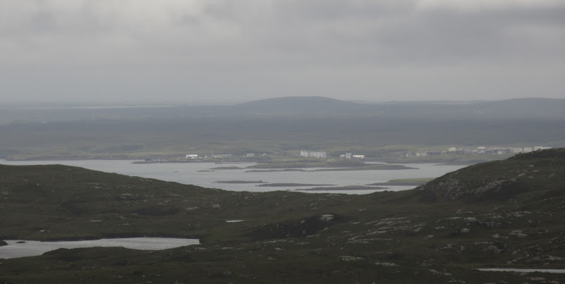
Zoom to Lochmaddy:
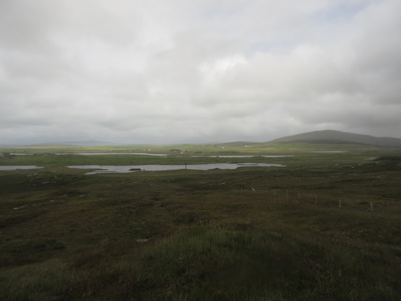
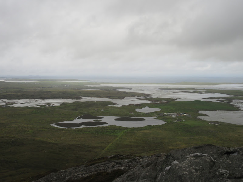
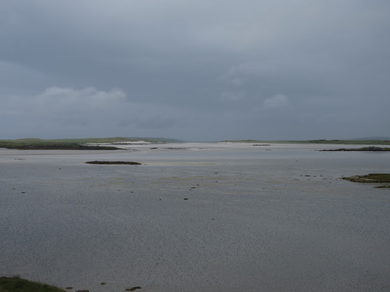
Lochs and lochs:

Crogearraidh Mor:

I dropped back off the plateau through more deep heather and soon rejoined my outward route. Interesting little summit, despite being pretty indistinct. The heather and hags would perhaps put me off exploring this little peninsula further though.
Back down to the coast:


Back to the car, and with more time left before the ferry, I thought I might as well give Crogearraidh Mor a bash - it is a very prominent looking pimple despite being less than 200m high. I parked on the verge near one of the few bits of woodland hereabouts and climbed over a gate.
Beinn Mhor from the beginning of the Crogearraidh Mor ascent:
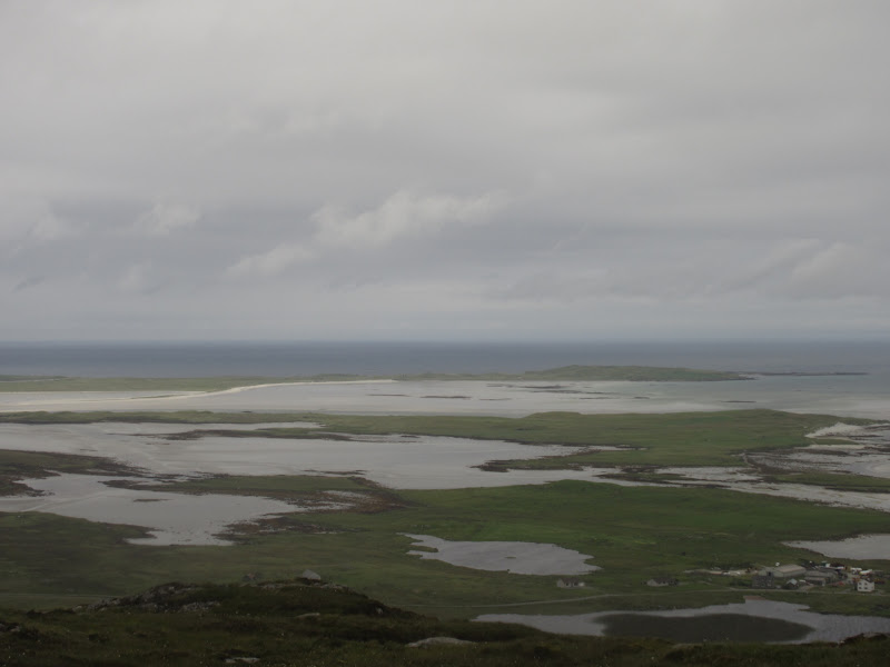
Traigh Athmor:

I expected this to be similar to Beinn Mhor the other day but the ground seemd softer and wetter - perhaps the intervening weather had helped with that. One fence to climb before being confronted by the final pimple. This was steep and required a couple of damp scrambly moves.
Steep section at the summit:

As expected the views were wide ranging, but blocked to some extent by the worsening weather. A shower hit me from the south just after I arrived so I didn't hang around long. However I fancied trying to ride out the shower for more views, so I decided to head over to the adjacent summit of Maari. A little heathery in the col, but this was easily achieved.
Mini cairn made from flakes of gneiss:
Looking down on Ahmore:
NE past Beinn Mhor towards Cheesebay:

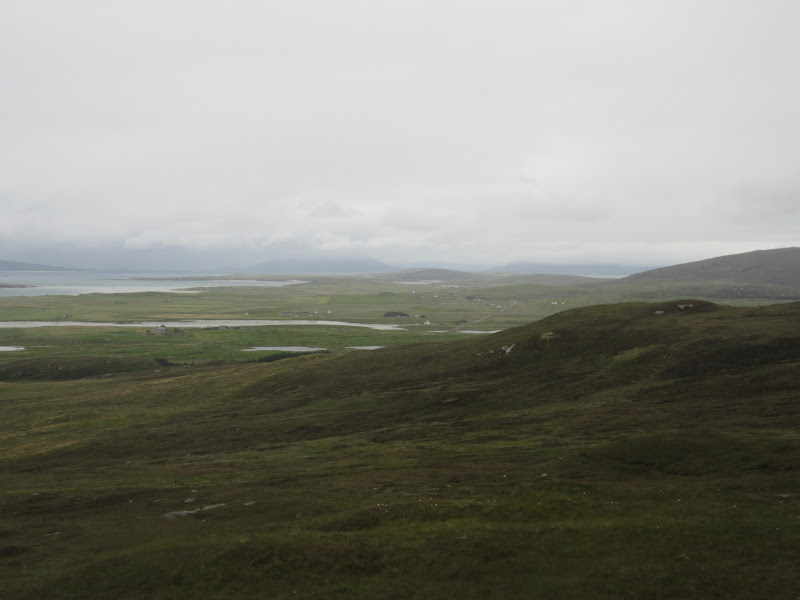
Eastern North Uist hills – North Lee, South Lee and Eabhal:

Crogearraidh Mor:

…with Beinn Mhor and Bernaray behind:

Orasaigh:
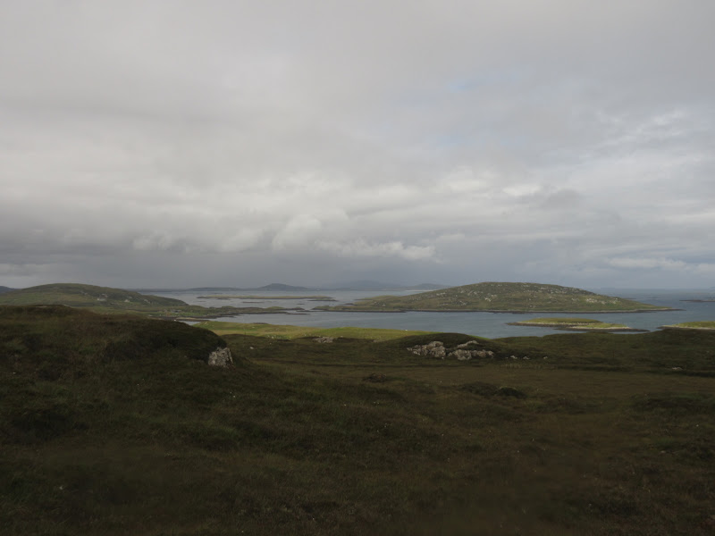
Looking towards Bernaray:
I could see a track descending to Loch Aoinghais then Ahmor, so I dropped down to it for the novelty of walking on a path. More showers came in, although the walk back along the road to the car was drier.
Crogearraidh Mor from the descent to Ahmore:

Loch Aonghais:

Traigh Athmore from the road:
I drove round to the ferry terminal at Lochmaddy, where I pretty much dozed off in the car while waiting to board. After eating on the ferry, I did the unthinkable and went for a nap rather than standing out on deck - while the weather wasn't brilliant, it wasn't bad either, and there were views to be had.
At one point close in to Uig, some evening sunshine appeared on the northern Trotternish. Despite my tiredness, I got a coffee and contemplated driving back over the Quiraing road, perhaps with a stop off for another short walk. Fortunately the weather had moved in by the time I was driving off the ferry, and I did the sensible thing and hit the road home instead, joining the slow queues of traffic heading for Kyle. I was completely knackered by now (from the overall lack of sleep rather than the rather modest amount of walking I'd done over the last couple of days), but what a trip .
.
Date: 21/07/2016.
Distance: 2.5km + 4.5km.
Ascent: 155m + 235m.
45 minutes + 1 hour.
Weather: Humid, breezy and showery
Time to head home from my rather fortunate work/holiday visit to Barra. There had been some sun as I left the island on the ferry back to Eriskay, but by the time I arrived, the cloud had lowered, and even tiny Beinn Sgiathan was in the clag. I now had about 5 hours before I needed to be in the ferry queue at Lochmaddy - plenty of time for a bit more looking about. The low cloud meant I abandoned any plans to go up Easabhal on South Uist, instead hitting the road north.
One of my mum's cousins lives at the Benbecula end of North Uist, so I spent a bit of time trying to find their place based on a rather sketchy address scribbled on a bit of paper. I failed, but wasn't too worried - I'm due back here in a couple of weeks anyway. I carried on north hoping that maybe Eabhal or the Lees were clear of the low cloud, as I really fancied one of these walks. They weren't, and I wasn't fussed about going up them in the clag, so I headed off for one of the lowest Marilyns in the country - Crogearraidh na Thobha. This looked to be in a great spot overlooking Lochmaddy and South Harris, and involved driving through the watery wasteland that had interested me so much the other day when viewing it from Beinn Mhor.
Sound of Harris ferry from Cheesebay:
The road to Cheesebay looks like the road to nowhere, but as usual in these islands, you are never that far from life, and there was a bit of a community down at the end of the road (as well as a pretty hefty fish farm). Parking at the end of the road, it was a quick ascent to the heathery hillside above the loch. There was even a sketchy path in places.
Heading up Crogearraidh na Thobha:
Fish farm and South Harris:
Sound of Harris coming into Bernaray:
The path disappeared on the steeper summit slopes and it was a fight through the deep heather for a short while - one of the disadvantages of the hill being so low. Before too long I was on the haggy plateau with the trig point close at hand. It was pretty breezy and the cloud had moved in, but fortunately it didn't descent completely. After a break, I walked to the other end of the plateau round some peat hags for the view back over to the main body of North Uist. Top stuff, despite the deteriorating weather.
Looking west to Croagearraidh Mor and Mairabhal:
Cheesebay:
Zoom to Lochmaddy:
Lochs and lochs:
Crogearraidh Mor:
I dropped back off the plateau through more deep heather and soon rejoined my outward route. Interesting little summit, despite being pretty indistinct. The heather and hags would perhaps put me off exploring this little peninsula further though.
Back down to the coast:
Back to the car, and with more time left before the ferry, I thought I might as well give Crogearraidh Mor a bash - it is a very prominent looking pimple despite being less than 200m high. I parked on the verge near one of the few bits of woodland hereabouts and climbed over a gate.
Beinn Mhor from the beginning of the Crogearraidh Mor ascent:
Traigh Athmor:
I expected this to be similar to Beinn Mhor the other day but the ground seemd softer and wetter - perhaps the intervening weather had helped with that. One fence to climb before being confronted by the final pimple. This was steep and required a couple of damp scrambly moves.
Steep section at the summit:
As expected the views were wide ranging, but blocked to some extent by the worsening weather. A shower hit me from the south just after I arrived so I didn't hang around long. However I fancied trying to ride out the shower for more views, so I decided to head over to the adjacent summit of Maari. A little heathery in the col, but this was easily achieved.
Mini cairn made from flakes of gneiss:
Looking down on Ahmore:
NE past Beinn Mhor towards Cheesebay:
Eastern North Uist hills – North Lee, South Lee and Eabhal:
Crogearraidh Mor:
…with Beinn Mhor and Bernaray behind:
Orasaigh:
Looking towards Bernaray:
I could see a track descending to Loch Aoinghais then Ahmor, so I dropped down to it for the novelty of walking on a path. More showers came in, although the walk back along the road to the car was drier.
Crogearraidh Mor from the descent to Ahmore:
Loch Aonghais:
Traigh Athmore from the road:
I drove round to the ferry terminal at Lochmaddy, where I pretty much dozed off in the car while waiting to board. After eating on the ferry, I did the unthinkable and went for a nap rather than standing out on deck - while the weather wasn't brilliant, it wasn't bad either, and there were views to be had.
At one point close in to Uig, some evening sunshine appeared on the northern Trotternish. Despite my tiredness, I got a coffee and contemplated driving back over the Quiraing road, perhaps with a stop off for another short walk. Fortunately the weather had moved in by the time I was driving off the ferry, and I did the sensible thing and hit the road home instead, joining the slow queues of traffic heading for Kyle. I was completely knackered by now (from the overall lack of sleep rather than the rather modest amount of walking I'd done over the last couple of days), but what a trip