free to be able to rate and comment on reports (as well as access 1:25000 mapping).
Alternative title: kmai opens up a can o’ whup ass on Kintail. (But Kintail gets in a few kicks, as well!) I’ve long held this area up my sleeve when it comes to hill bagging: lots of hills, of all sizes, in a fairly small area. Finally, the time was upon me. I’d booked a small studio self-catering apartment at the Jac-O-Bite, on the shores of Loch Duich, just past Shiel Bridge, starting with the long Easter weekend. Cue the good weather, please. And settle in, it’s a long entry: Seven walking days taking in 10 Munros, 2 Corbetts, and a Graham, plus two rest/tourist days. There is much to tell.
Fri 14 April
Munro: Ciste Dubh
Corbett: Am Bathach
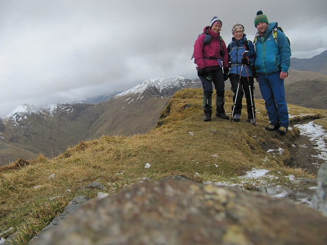
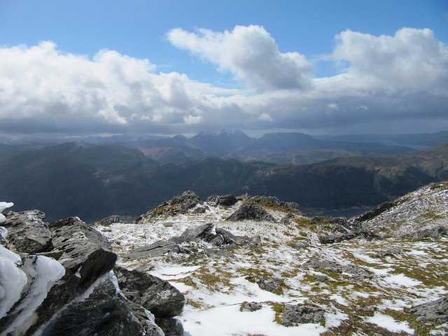
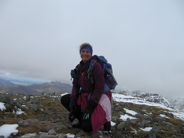
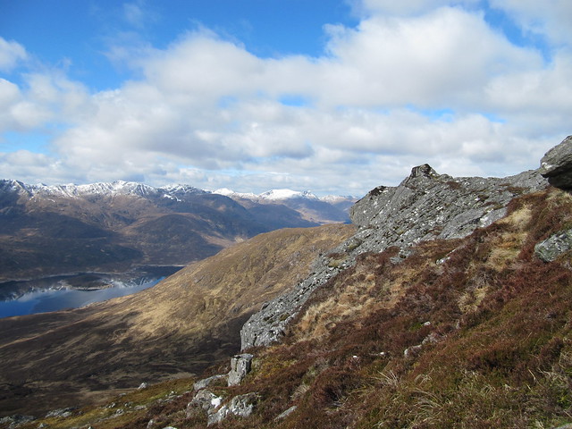
6.5hrs / 12.5 km / 984 mI was early, of course, but Evie and Ewan pulled up behind me about 10 minutes after I landed, and I we were on our way by ~9:30. It was a steep pull (ala Kintail) up to the first top, which was the first of many false summits—a fact that Evie, having previously done this route, had conveniently forgotten.
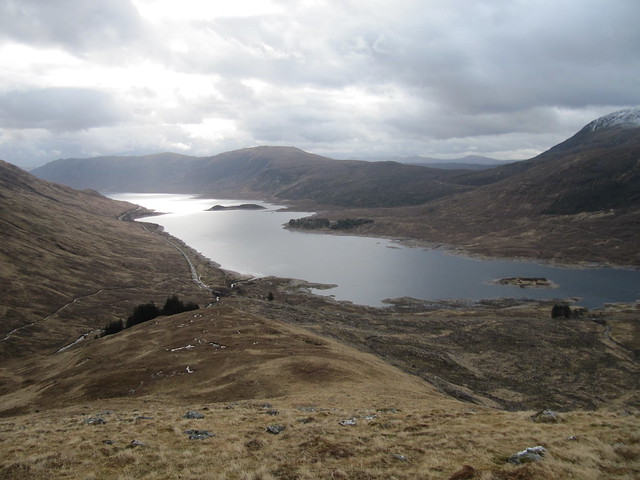
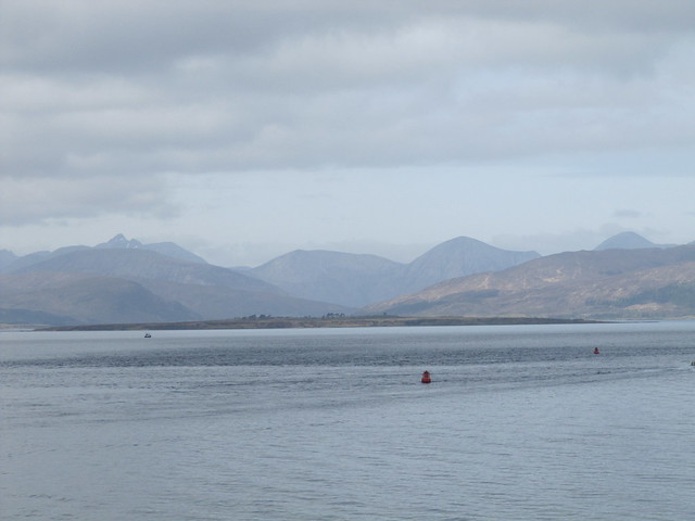
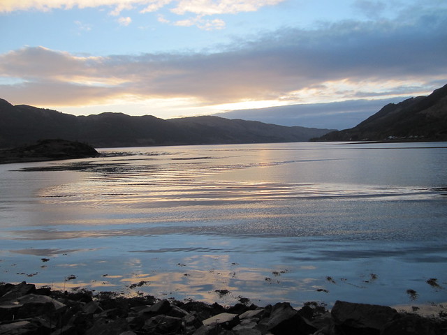
early view back over Loch Cluanie
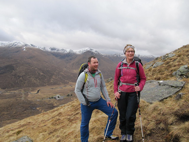
Mum and son; SGSR backdrop
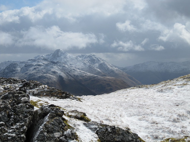
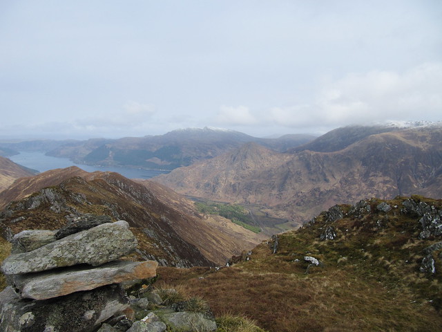
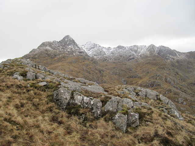
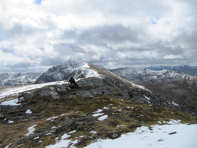
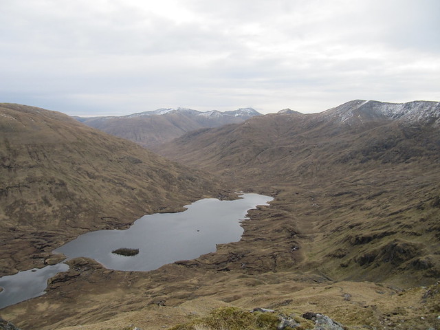
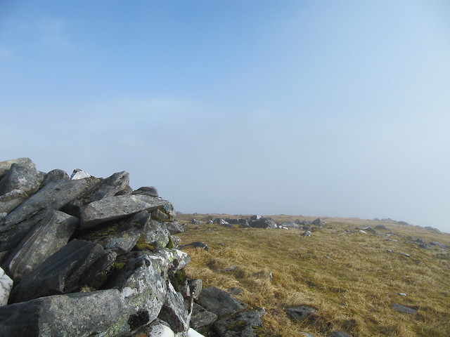
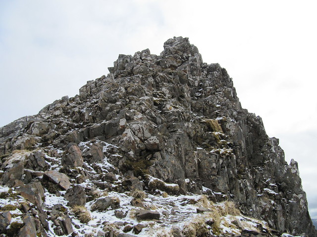
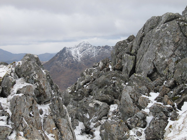
We reached the summit of Am Bathach around 11:15, and from here, could finally see the magnificent Ciste Dubh laid out before us. After a fair old drop (of course) down to the Bealach Choinnich. We stopped there for a bit of lunch, and planned our attack route, up to the right of a large crag, over steep wet ground (every man/woman for him/herself), before finding our way back onto a dryer, eroded, and still fairly steep path.
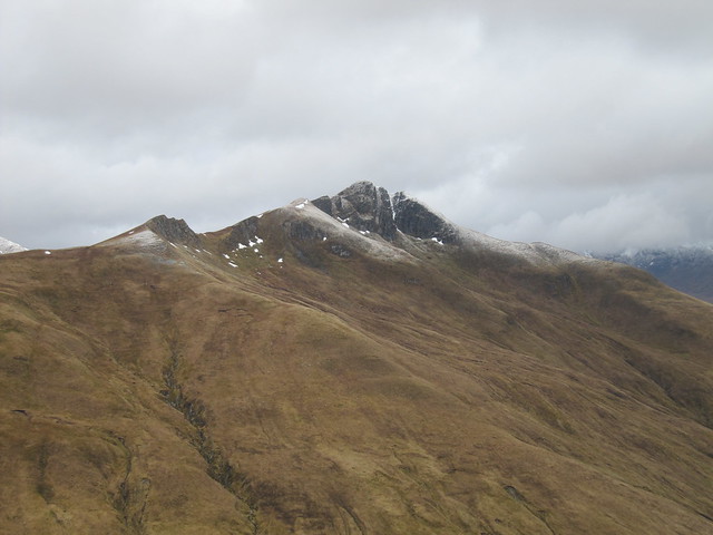
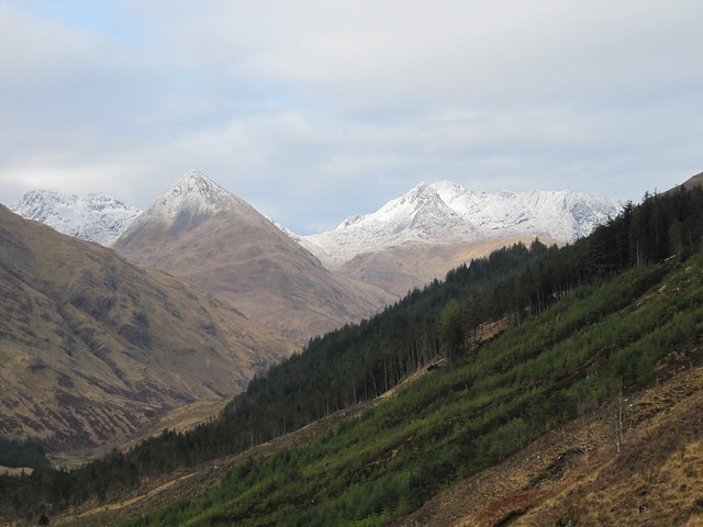
impressive hill
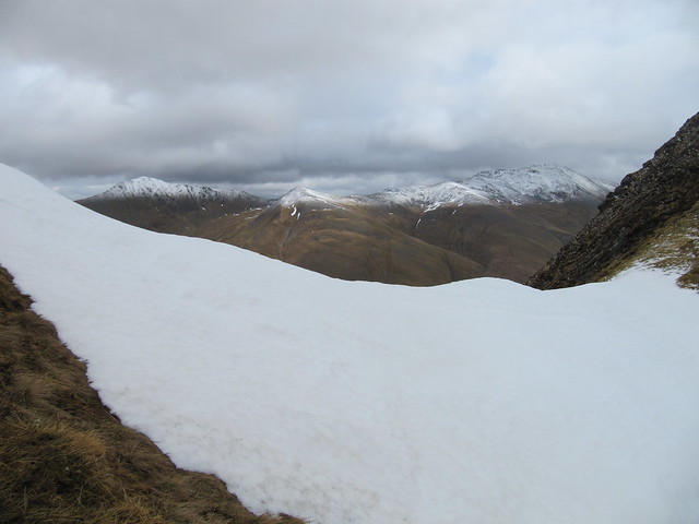
across to oh...those two...done last year with Evie and Lynne -- I liked the snow lines through the snow field
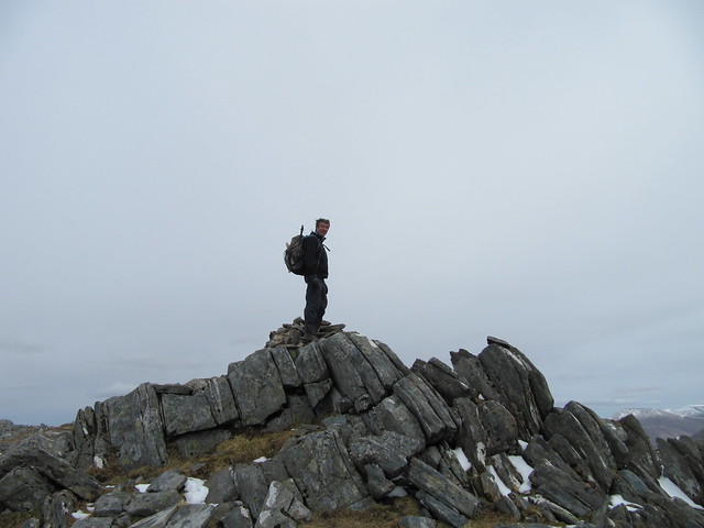
The small pointy bump of An Cnapach taunted us from our right, and we left it for the time being, with the option of going over it on the way back. Which I bravely did, I’m happy to say (it wasn’t at all scary).
summit shot
The long and boggy walk from the bealach was just that. Evie and Ewan both ended up with wet backsides, leaving a great deal of pressure on me to provide a similarly spectacular spill. I’m happy to say that on this day, I managed to keep to my feet. We returned to the cars around 4pm.
I scurried along to check into my accommodation, only to find no one on site. A leisurely settling-in became a rather hurried “just dump everything for now and have a quick shower,” as no one showed up until about two minutes before the restaurant was to open for the evening service. A fine day was topped off with dinner at the Kintail Lodge Hotel. That first beer was mighty tasty, at the end of a long and dry Lent.
Sat 15 Apr
Corbett: Sgurr an Airgid
5.75 hrs / 9km / 818mOn Friday night at dinner, based on having a gander at the upcoming forecasts, we’d decided to have an easier day today, leaving open the possibility of doing the Sisters Ridge on Easter (which was due to be better, weatherwise).
A late start to provide a badly needed lie-in to the overworked Ewan saw us parking up at the church cemetery car park around 10:30. The path here was obvious, we could see it zigzagging its way up the side of the hill as Evie drove across the causeway.
on the way up; nice view over Loch Duich
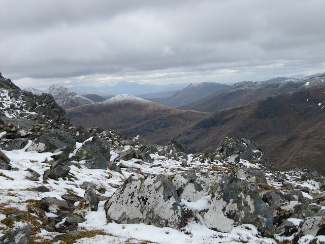
It was a good path up, as we’d seen, and it traversed and wended its way gently up the hill. The ascent was followed by a flat and boggy moor section, and finished off with a fine rocky ascent to the top.
lunch stop on the boggy moor bit
view back over Ewan, A'Ghlas Beinn, and Beinn Fhada
There were killer views in all directions, and had it not been quite so Baltic, I daresay that we’d have spent some time exploring; it’s that kind of hill. One I’d definitely return to, on a sunny warm day.
from the top; out over the sea toward the Cuillin
this might be zoomed toward...The Saddle, perhaps? not sure
never one to pass up a photo op with the help of a flat rock...
Evie had heavy-leg syndrome throughout this walk, and Ewan was still knackered, so we tabled the idea of doing the Sisters on Sunday, and made an alternate plan instead.
Sun 16 Apr, Easter
Graham: Biod an Fhithich
Munro: Sgurr na Sgine
9hrs / 12 km / 1071 mBaF with Evie, Sgurr na Sgine on my own.
We set off from “the layby” around 8:45. It’s another steep climb up to the first col, but the path is good, as it winds its way agreeably and zigzaggedly up the side of the hill.
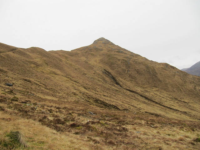
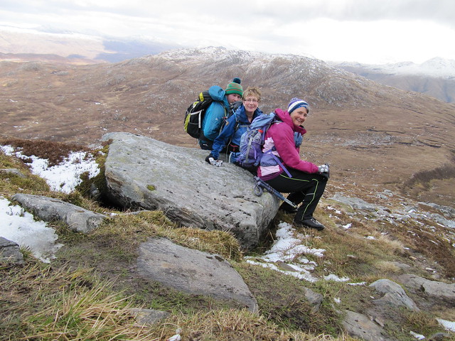
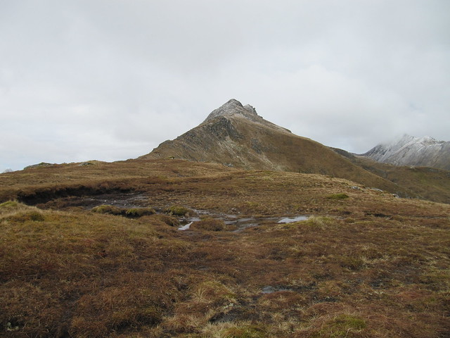
there's our wee Graham
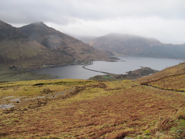
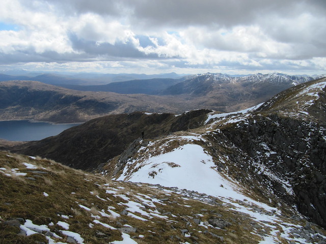
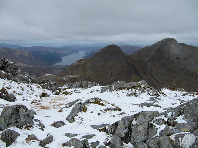
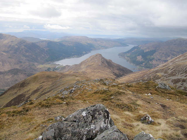
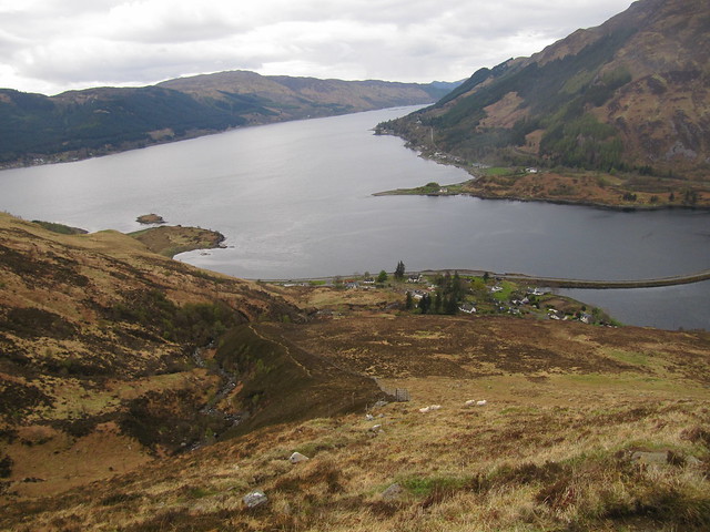
The view from Biod an Fhithich (11:45) was lovely—down over Loch Duich, down across the ridge you could wander over to end up at Shiel Bridge, and over Sgurr an Airgid, where we’d been the day before.
over Loch Duich
We spent a few minutes oohing, aahing, and identifying landmarks before making our way back to the col between BaF and Meallan Odhar, where Evie and I said our goodbyes. She was off to collect Ewan from the hotel and head home, whilst I was on my way to bag The Saddle and Sgurr na Sgine, via the not Forcan Ridge. At least that was my plan.
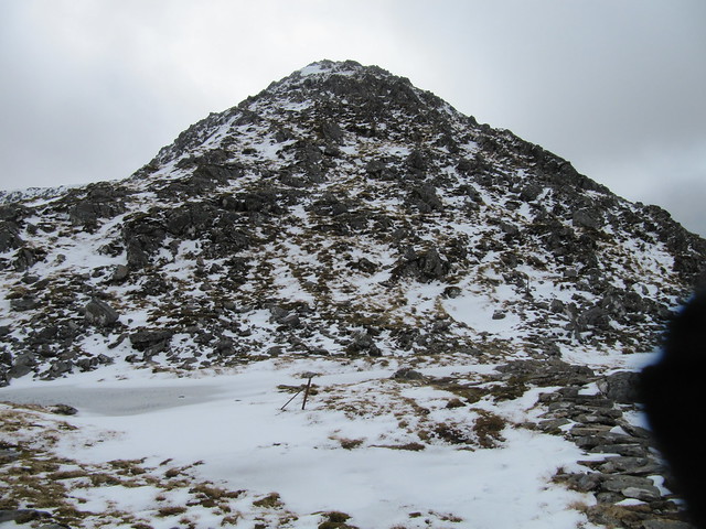
As I made my way along the drystone dyke (that is, the bypass path), I debated which hill to take on first. I finally decided to head for SnS, for two reasons: I wasn’t meeting anyone (who would have alternatively come across the ridge) at the top of The Saddle, and I also knew that I’d be retracing my steps on the descent, as opposed to coming down the steep and punishing face of Faochag. It was a stiffer climb up to The Saddle, but further out to SnS (with a lot of up and downing as well, I’d find out).
the way up to SnS (I must stop photographing my glove...)
across to the Forcan Ridge and The Saddle (note the location of the wall, which will later become an issue)
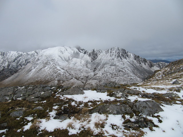
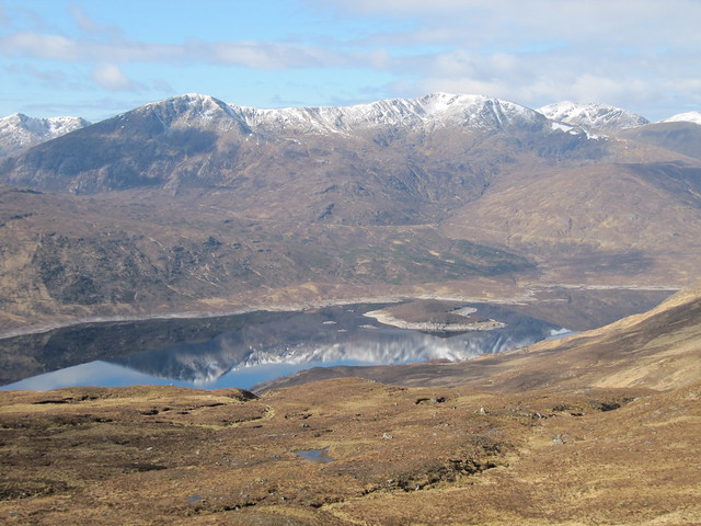
I reached the summit of SnS at 1:30, and enjoyed tremendous views over the SGSR, over to Knoydart, and beyond to Skye.
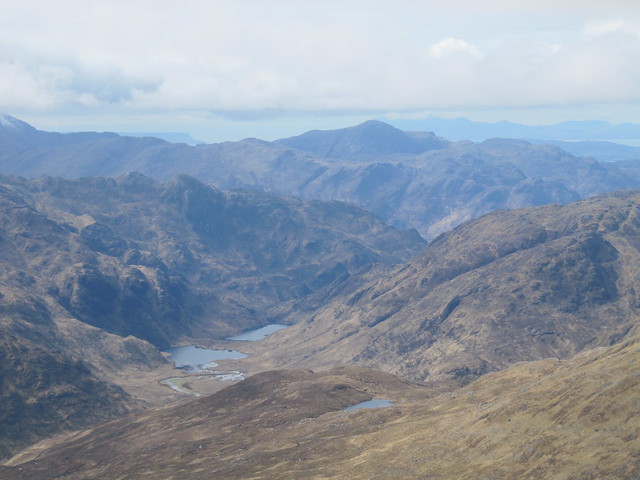
toward Knoydart; loved these lochans!
summit SnS; SGSR in the cloud in the background
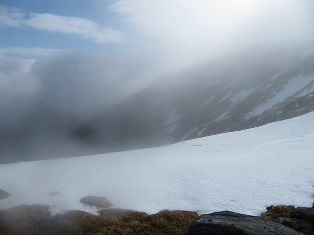
I tried not to think too much about the steep and rocky descent back down the wee lochan between the two hills, which I knew would be time consuming for me. Followed by the very steep pull up to The Saddle, which would also be time consuming for me. I set a time limit; if I returned to the lochan/bealach by 3pm, I’d go ahead and carry on up the second hill; otherwise, I’d leave it for another day. I fully intend on returning to this route anyway, because I’d like to do the ridge—but I definitely wasn’t going to do it on my own when there was still a fair amount of snow about!
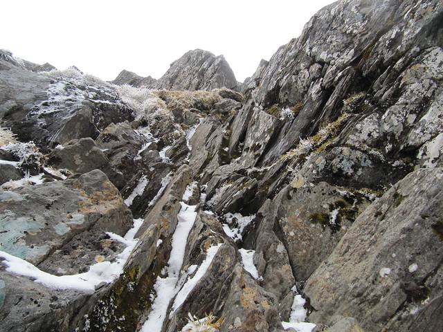
On the advice of the three guys with the three dugs, one of whom (dog, not guy) I could hear yapping during the entire route, I followed along the fence posts. It was steep to begin with, but became steeper and steeper, until I was clawing at grass and slushy snow, and slipping back with nearly every other step. This couldn’t be right, could it? I was well outside of my comfort zone (an understatement; I was sh** scared), and came closer to being “crag-bound” than I ever want to be again. I couldn’t seem to find any purchase, and I was reluctant to go any higher for fear of having even more dangerous ground to descend. Large crags were blocking my view, and I couldn’t tell whether I was above or below where I was meant to meet the wall and traverse across. I wasn’t very far below the ridge. All thoughts of making it to the summit disappeared, as I wanted nothing more than to be back down to the wee lochan and to be able to make my way off the bloody hill. I cautiously made my way back and forth several times before telling myself that I had to go
down to make any progress. I sat on my bottom, and tried to scootch down. In my desperation to maintain as much contact with the hill as possible, any concern about getting soaked to the skin became insignificant. It seemed just as slippery on my backside as on my feet, and I’m sure I’m must have screeched a girly screech as I slid uncontrolled for a couple of meters. In this oh-so elegant manner, I finally managed to reach slightly more level ground, but it seemed by this time that I’d forgotten how to stand up straight to walk. I was greatly relieved to finally reach the lochan, and bypass path, and made my way back to the car without incident, but with legs that continued to shake all the way down.
back up at the Ridge
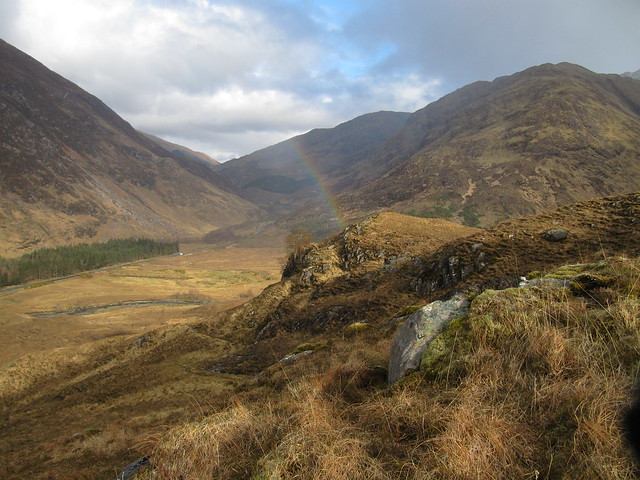
rainbow on the way down
I stopped by the campsite at Shiel Bridge to say hi to Andy, and we made plans to meet a bit later for drinks and dinner, and to make a plan for the next day. I’d assured him that ice axe and tampons weren’t needed.
 Mon 16 Apr
Munros: Sgurr nan Conbhairean, Carn Ghluasaid, Sail Chaorainn
7.25 hrs / 17km / 1367m This ended up being a longer and harder day than either of us thought it would be. We set off from Lundie ~9:15; the ascent was uneventful, as we enjoyed the bright sunshine, and the views over the loch, across to the ridge, and to other various hills.
SGSR over a still-as-glass Loch Cluanie
and again
The surprise came at the "true" summit cairn of Carn Ghlusaid, when the ground dropped away steeply and suddenly into a dramatic corrie.
wow; didn't see that coming!
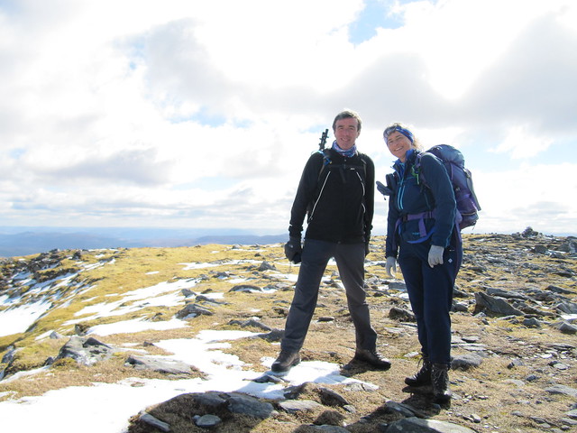
first summit
next target
It was a steep ascent between the first and second Munros; my legs were heavy, and my progress slow. Andy’s “not-moving time” stat was probably three times as much as mine, given how long and how many times he waited for me. From the highest, middle Munro (Sgurr nan Conbhairean), the third one (Sail Chaorainn) was much lower, and looked like a doddle. Until we began making our way out to it, and realized that there was another rather steep descent that we’d need to reascend on our way back.
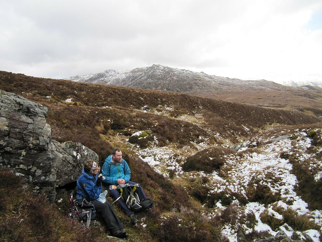
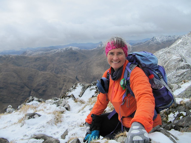
Andy tucking into his lunch; looking from the SC summit cairn back over SnC
But the view from SC was good, and we spent a bit of time there, soaking it all in and scoffing our lunches. The reascent didn’t seem as arduous as the first one had been, and we eventually made our way ‘neath SnC, where the ridge narrowed, and became rather airy for a time. There was a wee traverse across to the broad shoulder we’d descend, and it was snow-covered and *slippery*!! Not to mention the near-vertical drop down to Gorm Lochan far below us. Eeeek. Great concentration required. Followed by little sit-down, enabling my wobbly knees to recover.
the narrow ridge-y bit
For a while, from there, the descent was gentle and enjoyable, and on a good path. But then. A steep and pathless section through wet and slippery grass. A river crossing, and then a seemingly endless march down the old military road to the radio mast from which we’d begun our original ascent. For once, I wasn't annoyed by man-made fugliness on a hill, as it indicated that the car was just a short distance away.
We met later at the Kintail Lodge for dinner and drinks. The venison with haggis mash and various veg, was really yummy, but left me still hungry. And disappointed that there weren’t any puds comprising chocolate. Who doesn't have a chocolate dessert option?!
 Tues 17 Apr
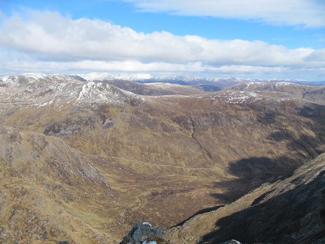
Munro: A’ Ghlas Bheinn
8 hrs / 17km / 1070mWith Andy. Nice hill, longish walk in to the bealach that offered great views over Loch a’Bhealaich, and in the general direction of Glen Affric.
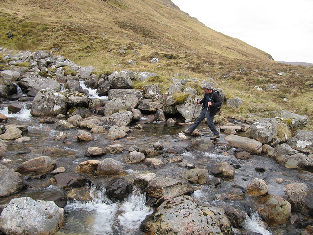
river crossing time!
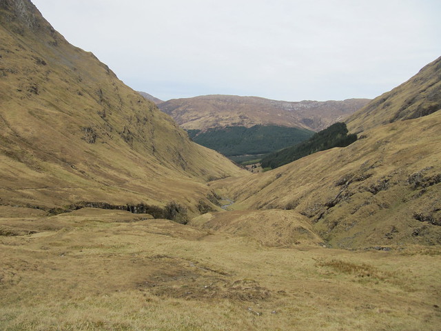
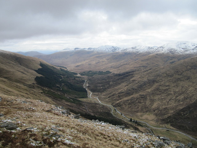
back doon the glen we'd come up
Loch a’Bhealaich, toward Glen Affric
From the bealach, there were several very steep up sections, and a few down sections and it was much further to the summit than you’d think (or hope). Again, we had good views from the top. It was a steep descent off the summit through crags, Karen cautious, moany, and muttering as per usual.
summit shot
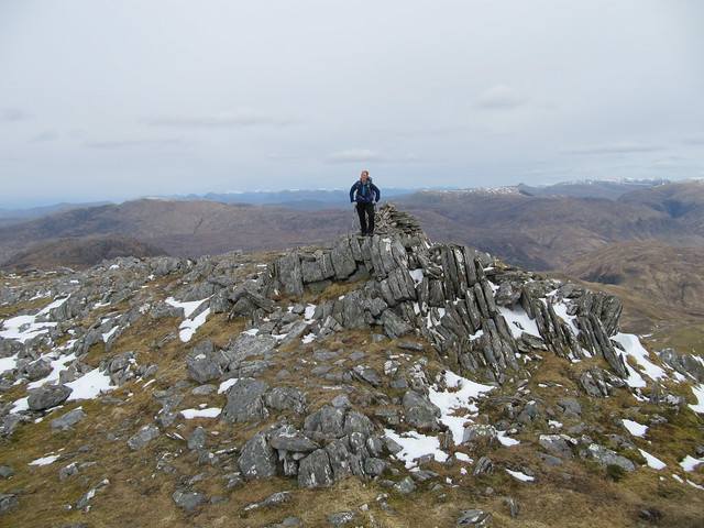
my turn
We stopped for lunch once we’d negotiated the trickiest descent, and then carried along over a couple of other bumps, and squelchy moor between. We bypassed the final high point on a good “elephant track.”
Once we were down on the good path leading to Glomach Falls, we decided to carry on, as long as we were only a couple of km away. All was well, the path undulating gently across open and desolate moorland. We couldn’t yet hear any rumbling water indicating falls anywhere nearby, and once we finally spotted the river, and the gorge down which it flowed, it was far below us, our until-then gently undulating path zigzagging steeply down, to the tune of about 200m. All of which, of course, would need to be reascended on the return. I told Andy to carry on, and that I’d meet him somewhere along the return route. My legs just didn’t weren’t up to that much more up and down after what we’d already done, and at that point, I didn’t care HOW impressive those damn falls might be! So I turned around and ambled leisurely along to the Bealach na Sroine, parked myself on the comfiest rock I could find, and waited until Andy returned with tales of all the glory I’d missed (I still didn’t have any great regrets).
From here, it was still a long traverse across the hillside, until we finally descended into the forest, and then continued on to close our loop. From that point, it was another couple of long kms back to the Outdoor Centre.
Wed 18 Apr
badly needed day of unwalking!I hadn’t slept well the night before, and awoke early, tired to the bone. I was quite happy to look out in the morning and see rain coming down the loch, and the mist down over Sgurr an Airgid, which I could see from my window. Guilt-free no walking! I crept back into bed with my kindle and dozed for another hour or so. Eventually, even though the weather had improved, I got into the car, and drove to Kyle of Localsh, a place I’ve driven through multiple times, on the way to Skye, but have never stopped in, ‘cept for petrol. I had a wee wander around the village, poking my head into a shop or two (there’s not much there, tbh), and settling into a bakery for a bacon-and-egg roll and a(nother) coffee. I didn’t worry too much about having a second breakfast; I felt I’d earned it after the two big days previous.
I walked along the cycle track to the bridge (all the time humming the Skye Boat Song, as I tend to do, rather annoyingly, whenever in the area), and carried along it. There’s a small causeway before you actually get to the bridge, and I’ve always thought that there are great views from there, across the water to Kyleakin, north toward Wester Ross, and once you gain a bit of height, across to the Cuillins. So I took a few photos, but must say that the traffic whizzing by wasn’t too pleasant.
across the water to Kyleakin
zoomed to the Cuillin, from the bridge
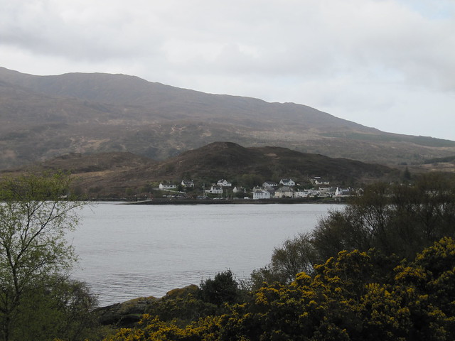
From there, I had a wander through the lovely community woodland called the Plock. Stopped in at the Co-op for a few things, then drove the single track to Plockton.
view over the bridge, from the Plock
Purely by coincidence, an artist from Ratagan, Helen Robertson, whose address I’ve been carrying around, and who was on my to-visit list during this trip, was holding an exhibit at The Square in Balmacara, which is just off the A87. So I stopped in and had a wee chat with her. Her paintings look like photos, and first caught my eye at the B&B in Lochcarron where I’ve now stayed a couple of times. They’re just lovely, but quite expensive (at least for someone who’s never really bought any “real” art), and for now, I made do with buying several note cards that I might frame. I took Helen’s business card, and the details for a beautiful depiction of the Five Sisters, in the hope that I might feel flush enough one of these days to treat myself.
I had a wander around Plockton, complete with a large order of chips, and returned to home base from there. The forecast for the next day was dry, but with low cloud; MWIS says virtually no chance of cloud-free summits.
from the Plockton harbour
Thurs 20 Apr
Munro: Bheinn Fhada
6 hrs / 16.82 km / 1032mI thoroughly enjoyed this walk. The forecast wasn’t brilliant—dry, but low cloud—however, since I’d seen Beinn Fhada both from Ciste Dubh a few days prior, and from A’Ghlas Beinn the day before, I wasn’t too fussed about having views from the top. I and awoke feeling very ready to go after having a no-hill day. I delayed-texted Andy to let him know what my plans were, as I was up and out before 7am.
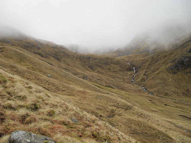
before going into the clag
I knew the first part of the path well, it was the same one we’d used for A’Ghlas Bheinn two days prior. My plan was to simply go up and down the stalkers’ path, and leave the circular route for another, better weatherwise, day. There’s not really much more to say, I *didn’t* have views from the top, although the top of the cloud level must have been right around 1100m (the height of the hill); I could see blue sky and sunshine above, but nothing at the level where I was, nor any of the surrounding hills.
summit cairn; blue sky above...
...but only the merest glimpse of what lies below
The path was a delight; it wound its way gently up the hill, levelling off through several hanging valleys. I went slightly wrong when I reached the bealach; the good path carried on, while my route needed to carry me more upward, along the crest of the hill, and onto the great plateau with the plunging north corries immediately to my left. My error was soon corrected, and I made my way to the summit cairn. There wasn’t much to stick around for, so I took a couple of photos (of nothing), and made my way back down to the stalkers’ path. I was back at home base by around 1pm. However, during the day, there was no heat to be had, and only a tepid (at best) shower on offer. Ugh.
Fri 21 Apr
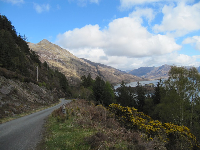
exploring the Glenelg peninsulaI’d so had my heart set on the SGSR. MWIS said 60% cloud-free summits, which sounded pretty darn good to me. But the Met Office/BBC local forecast was somewhat direr (rain, rain, rain, rain. And wind.). Andy convinced me that we should wait and see what it was like in the morning, and I do have to admit that when I peeked out the window, it was unquestionably foul. That’s that, then. So into the car, a quick stop into the craft fair in Dornie (several years ago, on my St Kilda trip, I’d bought a perfectly sized Harris tweed over-the-shoulder handbag, and used it a lot. I’ve been looking for a replacement ever since), and then along the road to Glenelg. This is a place I’ve always wanted to visit, based mostly on reading Gavin Maxwell’s
Ring of Bright Water. I kept thinking I’d get out and have a bit of a wander (the weather improved later in the day), but other than a quick jot around the headlands to watch the ferry dock and unload, and a bit of exploring around the Glenelg brochs, it just seemed to never happen.
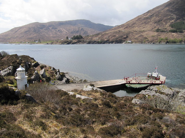
the ferry, and across to Kyle Rhea
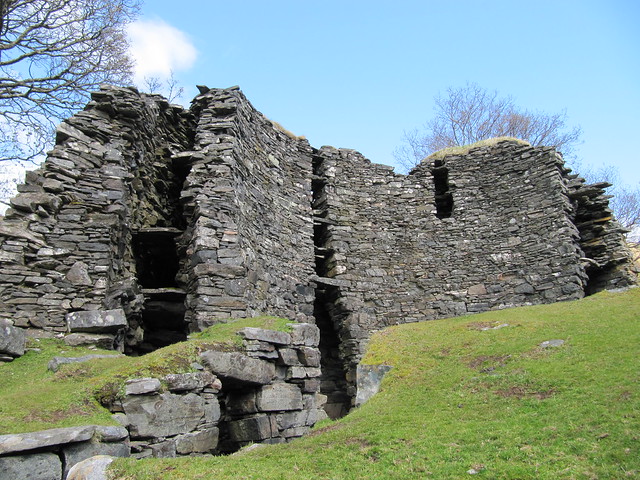
the taller of the two brochs; I forget what it's called
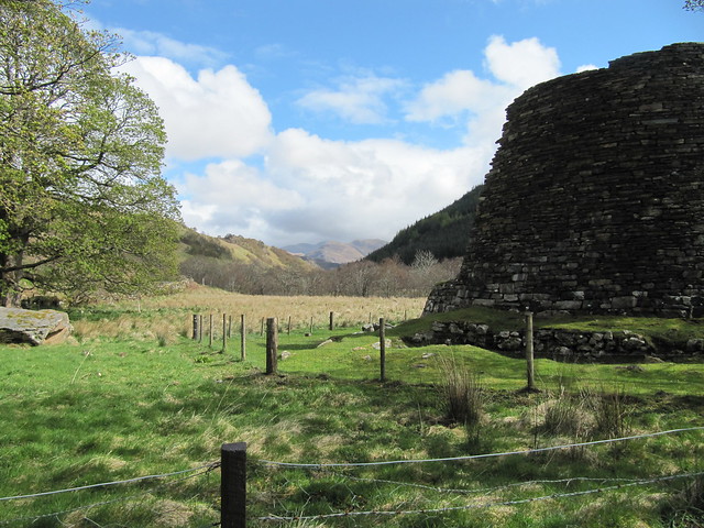
and the other one...smaller but more complete. And what a lovely glen...
I drove nearly to Arnisdale, close enough to have a gander at the steep Beinn Sgritheall, and to take in the amazing panorama over Loch Hourn and Knoydart, including Ladhar Bheinn. Geographically, this area is really interesting, as it takes in parts of Skye, Knoydart, and out to Eigg and Rum.
Beinn Sgritheall
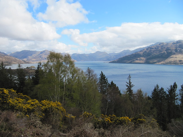
across to Knoydart
As I drove back over the Bealach Ratagan, the sun was out, and the Five Sisters were completely out of the cloud. Sigh.
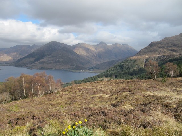
Five Sisters on what turned out to be a lovely evening
Oh, one other thing I did today: flagged down the Citylink bus to see if he’d let me off at the start point for the Sisters Ridge on the morrow. He assured me that he could, although he said I’d pay for the privilege (£7.90!). That was sorted then, I had a potential plan, given that Andy was headed to the WH meet in Kinlochleven and wouldn’t be available for chauffeuring.
lovely sunset that evening
Sat 22 Apr
Munros: Sgurr na Ciste Duibhe, Sgurr na Carnach, Sgurr Fhuaran (that is, the Sisters)
8.25 hrs / 12km / 1385mThis is probably the hardest 12km I’ve ever done; there was just no chance whatsoever to “get your stride on” as, except for the first couple of kilometres at the beginning of the ridge, you’re constantly ascending or descending, much of the time cautiously over boulders.
I boarded the bus a few minutes before 9:00, and was on my way up the hill by around 9:15, after shouting at the driver to let me off; he was mindlessly on his way to the Cluanie, or perhaps beyond, even though he’d assured me that he knew where it was I wanted to be dropped off.
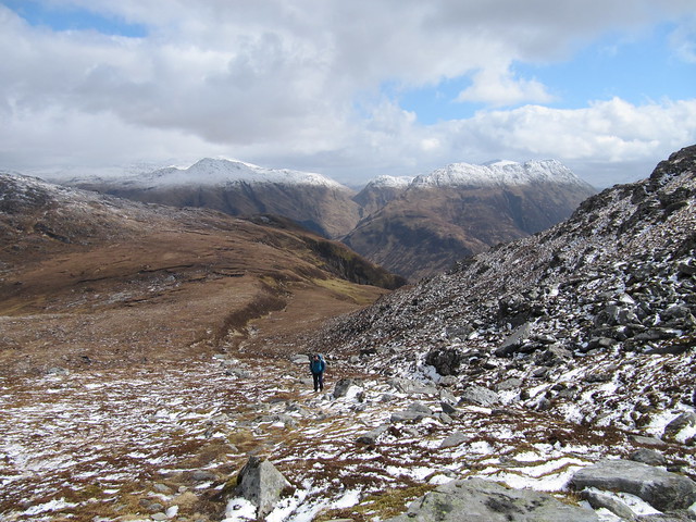
As when climbing up to the Brothers Ridge, I didn’t mind the ascent. It’s steep, boggy in places, eroded in other places, and both boggy and eroded in some places, but progress is quick and discernible.
going up...over to Faochag, The Saddle, and the Forcan Ridge
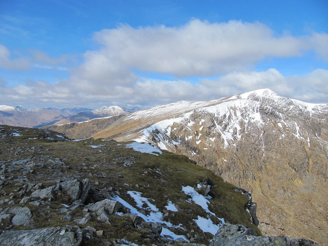
I reached the bealach a bit more than an hour after setting off. It took a while to relax into the rhythm of being on the ridge. It’s a fair distance (I think the WH desc says 3km) to the first Munro, Sgurr na Ciste Duibhe (12:30), after going up and down various tops and bumps.
Sgurr nan Spainteach ahead
nice!
There were a couple of scary (for me) down climbs that I’d been happily (??) unaware of; I think the first one was between Sgurr nan Spainteach and SnCD. I don’t remember exactly where the second one was; perhaps the descent off of SnCD.
looking back up first scary down climb
looking back up second scary down climb
It all became a bit of a blur after reaching SnCD. It wasn’t that I wasn’t enjoying myself, because I was. The terrain simply demanded concentration. There were great views throughout, and I took many photos, many over hills I’d already visited during this trip. And many across to the elusive SGSR as well. As much as I’d had my heart set on doing this one earlier in the week, I now don’t mind still having it left to look forward to.
summit SnCD; yet-to-do SGSR behind
Other than sitting for a few minutes at the Bealach na Craoibhe, between M1 and M2, I didn’t really stop all day. I never felt particularly hungry, so didn’t have a lunch stop; just paused on occasion to take in some liquid or make a minor clothing adjustment.
two big hills yet to climb up and down...
The up and downing continued. The ascent to Sgurr Fhuaran was particularly leg-burning! By this time, I’d stashed my poles, and was happy to have the full use of my hands to clamber over boulders looking for interspersed bits of path.
Forcan Ridge again
Ben Nevis in the background
I was relieved to reach the top of SF, but could see that there was still a fair bit of work ahead of me; Sgurr nan Saighead was more than 100m lower than SF, but the drop to the Bealach Bhuidhe between was another 100m or so, so that meant more ascending for tired legs. With a sigh of exasperation (my ex-stepson used to say, when he was quite little, “no more fun, please”), I scrambled up to the top of Beinn Bhuidhe, and could finally see the descent route laid out before me. It looked a long way.
finally time to start heading downhill
Earlier in the day, I’d not ruled out visiting the much-less-visited fifth sister, Sgurr na Moraich, but decided to make the final determination only when necessary. Um, yeah, not gonna happen. Sorry ‘bout that, SnM, ‘nother time perhaps. I now fully understand why you’re rather neglected.
The stalkers’ path on the descent, once I’d reached and crossed over the Allt a Chruinn, was pure joy (and no, I’m not being sarcastic). It was well-made, and zigzagged efficiently down the last few hundred metres. How happy was I to finish at the door to my accommodation?
nearly there...
So thus endeth a thoroughly enjoyable and productive week. Thanks to Andy, Evie, and Ewan for good company, lively banter, and for keeping pace, whether I was mostly ahead or mostly behind (I was mostly behind). I had a great time, did much (but not all) that I’d hoped for and intended, was duly exhausted, and had two large bagsful of dirty, wet, whiffy laundry to show for my efforts. I now have a much better knowledge of Glen Shiel and the surrounding areas, and can’t wait to go back to do more.
