free to be able to rate and comment on reports (as well as access 1:25000 mapping).
I've already walked Stob a'Choire Odhair on a much better day than today, so I didn't see any point in retracing my steps and my time is constrained with travelling to and from Edinburgh, so decided to walk straight up and back down Stob Ghabhar. As I walked towards the hill I toyed with the idea of walking directly up the grassy bank rather than beside the waterfall or even returning that way to save time, but I know only too well that route finding and avoiding bog or crags can make direct routes even more time consuming so I decided to follow the prescribed route. A small cairn on the path marks the turnoff for the ford and after a scramble down to the burn it is a simple couple of steps and then a scramble back out. I could see the path leading up to the waterfall and followed it easily.
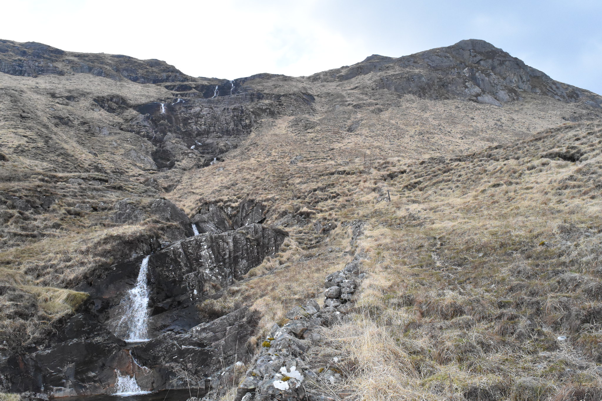 Waterfall at Creag an Steallaire
 by
Joe Kincaid, on Flickr
It is steep at the waterfall and the path winds its way up the slope. I stopped to look at the final waterfall that can be seen from down below.
 Top waterfall
 by
Joe Kincaid, on Flickr
I then stayed on the same side and got to a point where I had to climb up over a smooth boulder with only a little notch to place my foot and grass to pull myself up. Not a good moment, so made a mental note, there must be a better way on the other side, not going to go back down here. At the top of the waterfall, it was so windy, the water was being blown back up the hill. A good look at where to go from here, another fence line that isn't marked on the map, the path pretty much follows it to the top. Good views back to Loch Tulla opening up but looking back I get blasted by the wind so just keep going up, wind assisted. Not good enough to photograph unfortunately, you barely see it.
It stayed overcast which was a pity but otherwise the wind was biting and half way up I stopped to add another two layers and put my hoods up. Better yet gloves too. The path cuts over below the ridge line and this kept the wind off for a bit.
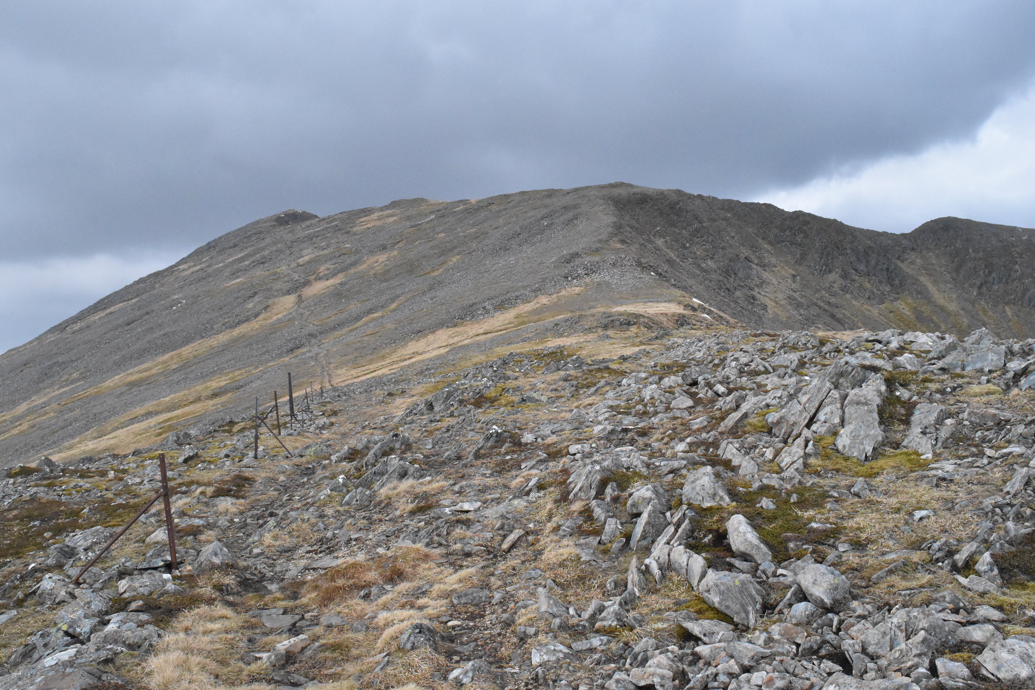 The route to top ridge
 by
Joe Kincaid, on Flickr
Finally got to the top of the ridge and snow, the summit clear ahead.
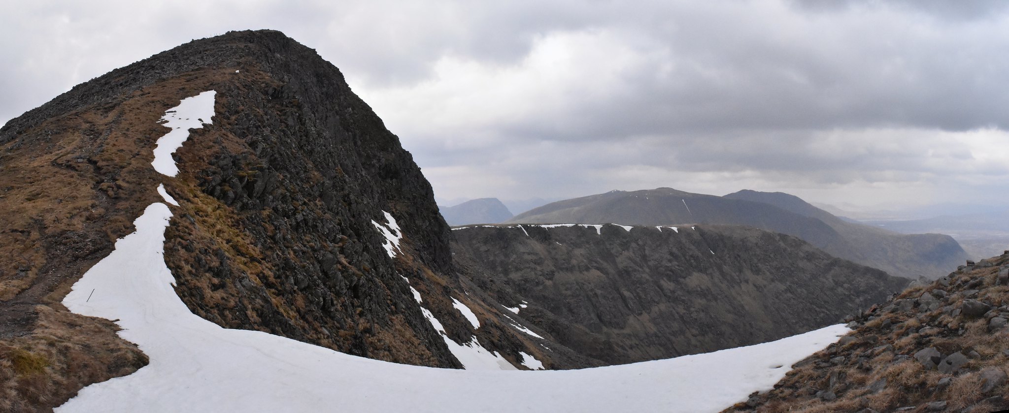 The final climb
 by
Joe Kincaid, on Flickr
A short walk and up to the pile of boulders at the top. Great views all around now. The wind didn't let up though.
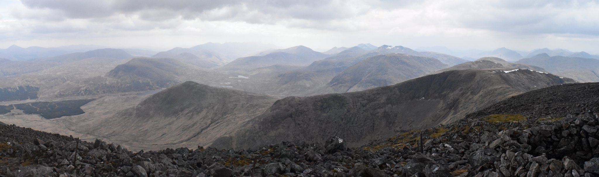
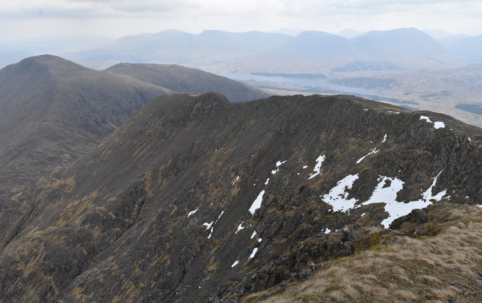
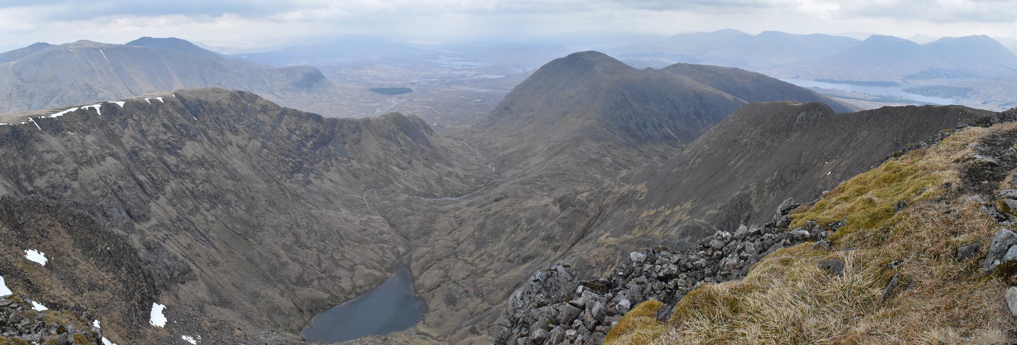 Coirein Lochain and Stob a'Choire Odhair
 by
Joe Kincaid, on Flickr
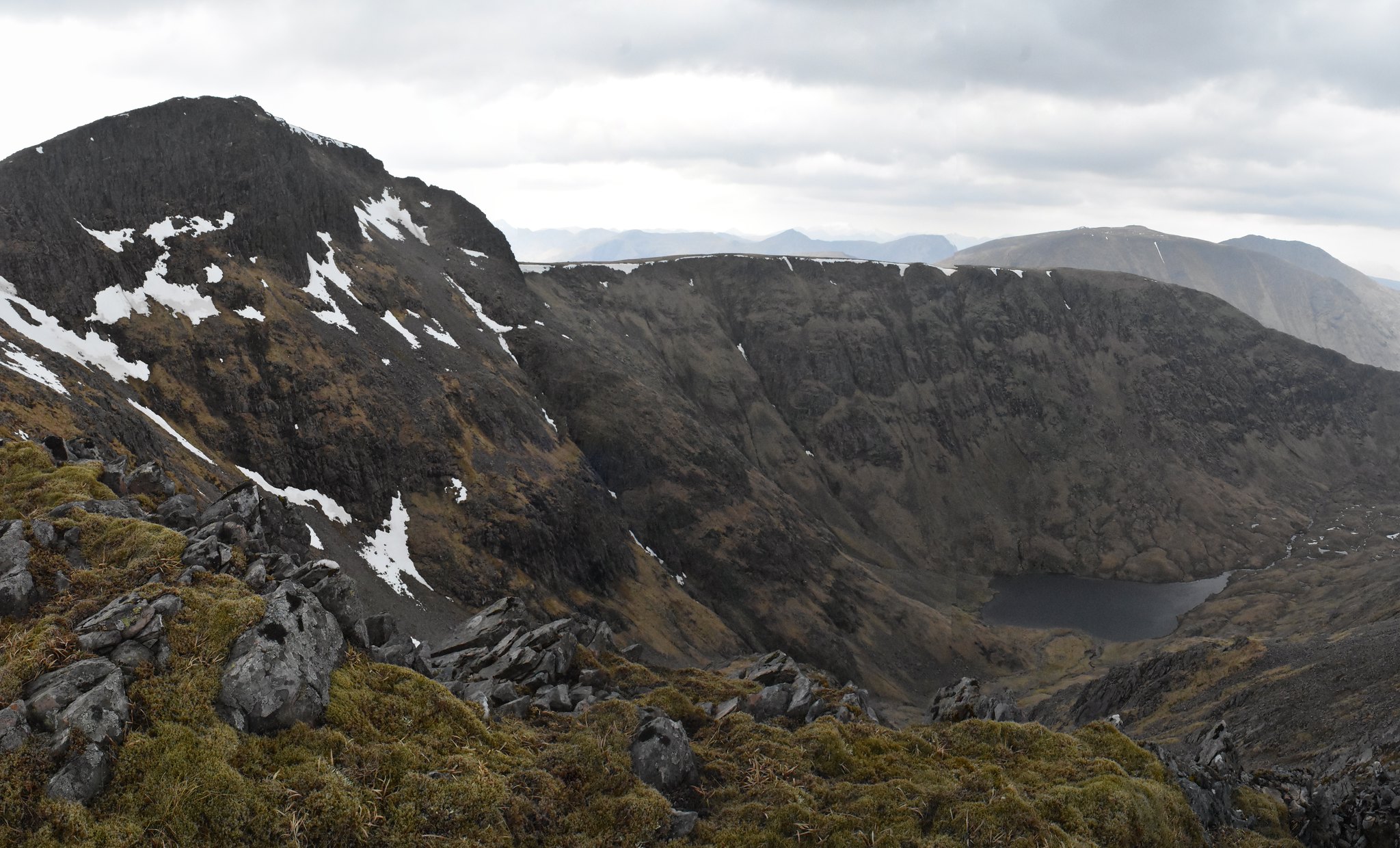
 Coire Ghabhar
 by
Joe Kincaid, on Flickr
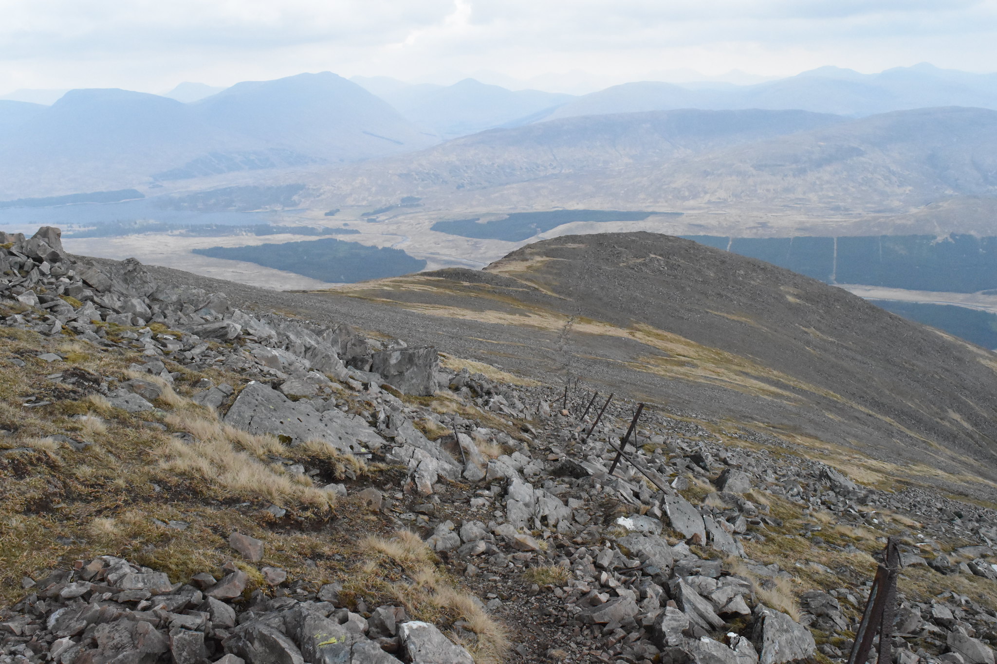
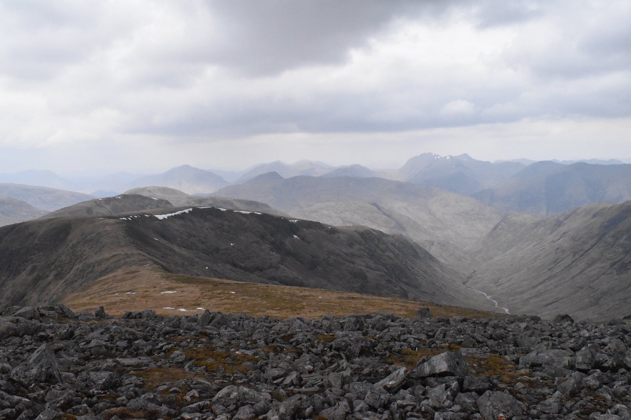 Route to Sron a' Ghearrain
 by
Joe Kincaid, on Flickr
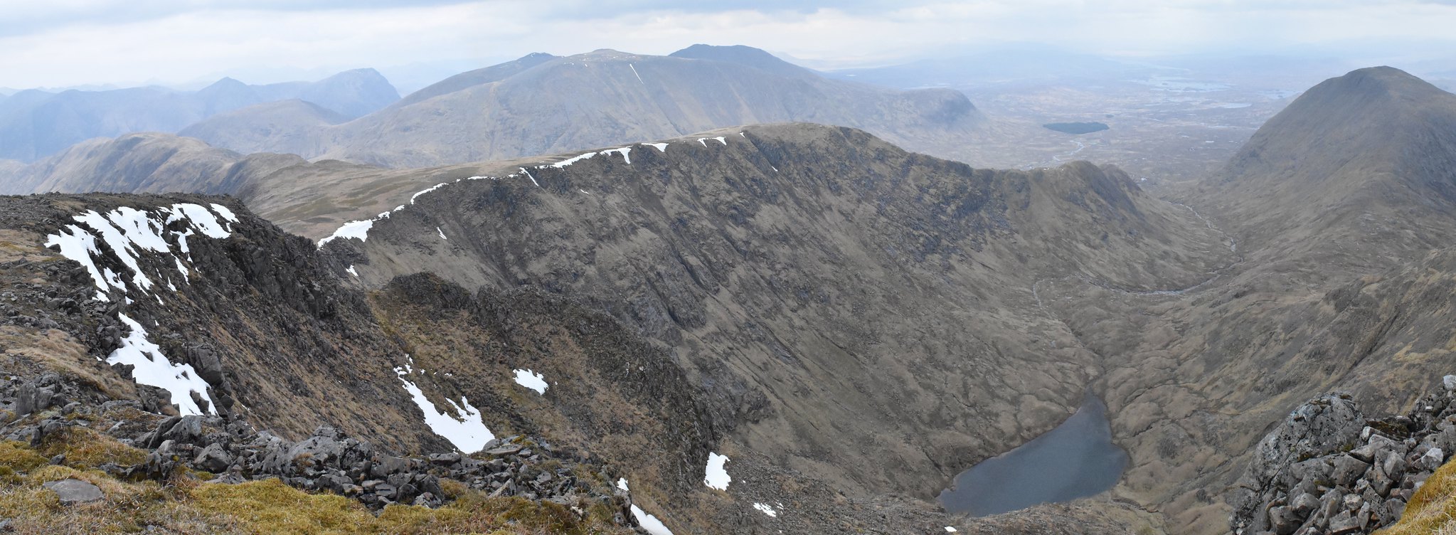 Coirein Lochain
 by
Joe Kincaid, on Flickr
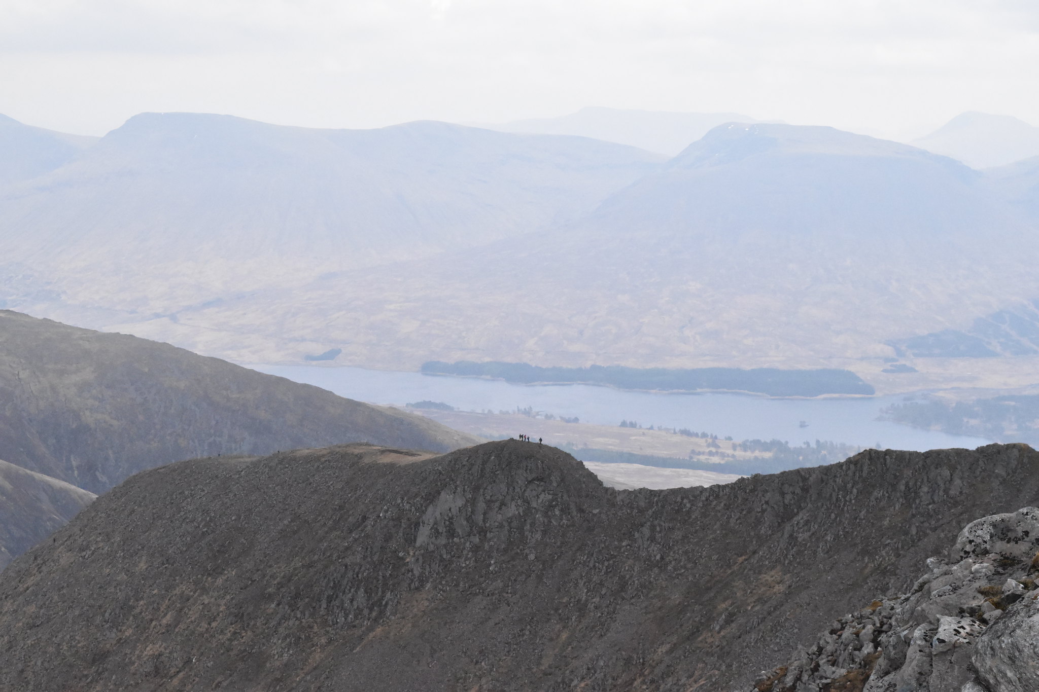 Walkers on Collour Buttress
 by
Joe Kincaid, on Flickr
 The whole ridge route to summit
 by
Joe Kincaid, on Flickr
After looking all around and walking over to take pictures, I headed back down. Others were coming over the buttress so after a quick chat with each group I walked down to get a view back to the top.
 The top from ridge
 by
Joe Kincaid, on Flickr
I contemplated going back that way, but needed to get back so rejoined the path I had come up and headed back down. Once out of the wind behind the ridge, got out my flask and had lunch, scotch broth, lovely warm soup.
 Route back down to waterfall
 by
Joe Kincaid, on Flickr
Then back down to the waterfall. I kept to this side of the falls and sure enough a deep gully of a path down to the bottom of the top waterfall and I simply walked over to where I had taken a photo of it and then retraced my route back to the ford, the dodgy boulder drop avoided. As with the last time I walked this path it feels like you are never getting back to the carpark as it is a bit tedious after all the excitement of the hill. Good time made and back in Edinburgh for tea.
