free to be able to rate and comment on reports (as well as access 1:25000 mapping).
Myself and my friend Grant decided on Friday that we would try and get out as at that point the weather forecast looked good and we were keen to stretch our legs. Grant suggested we try Beinn Chabhair as it wasn't too far to travel (about an hour) and I liked the look of it so we left the west end of Glasgow at 8am and arrived at the Drovers at quarter to 9. After a false start where we forgot the map, we began what was quite a steep ascent behind the Bein Glas farm in which we quickly gained height. We stopped to take a picture of the waterfall which was in full flow and then carried on up the path.
We soon got on to more level ground and after stopping to read the directions we found the path which follows the burn although at times the path disappeared in the bog. The cloud cover was very low in the Glen but visibility was still quite decent once we started following the burn. After a brief stop for a roll next to one of the many waterfalls we passed, we marched on knowing that we would have to begin a steep climb soon.
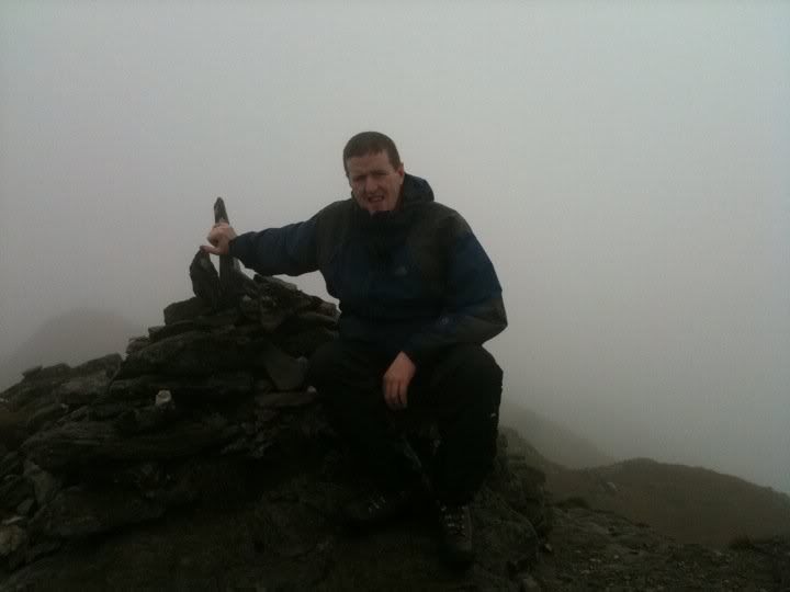
We followed the path as it veered off to the left just before it met Lochan a' Chaisteil and this was where it started to get very steep. The cloud was also quite thick at this point so we couldn't see much in front of us but the path was easy to follow. After what felt like an endless series of ups and downs in the path we saw the first cairn. Having read reports on here and other sites, we knew that the 2nd and higher cairn was a short distance away and we had a bit of a spring in our step as we walked towards it. This was also the first time we felt the wind all day and after posing for the obligatory photo, we quickly made our way back down and stopped for a quick lunch.
Once we got back down to Lochan a' Chaisteil we picked up the pace a bit and marched through the bog as by this point our feet were soaking so more water wouldn't have any effect. We passed a few people close to the top who looked exhausted and we knew how they felt and then we passed a big group further down followed by two individual climbers. The final descent was a wee bit tricky because of the water running through the loose boulders but we were back at the car before we knew it.
It was a long hard slog to the top and there were times when the sight of another buttress appearing through the cloud was the last thing I wanted to see but I'm glad we stuck with it. Roll on the next mountain!