free to be able to rate and comment on reports (as well as access 1:25000 mapping).
Another day of good weather was forecast, so we took the opportunity to explore this area of famous basalt landslip scenery on the Trotternish peninsula.
First we went for a pit-stop in Portree.
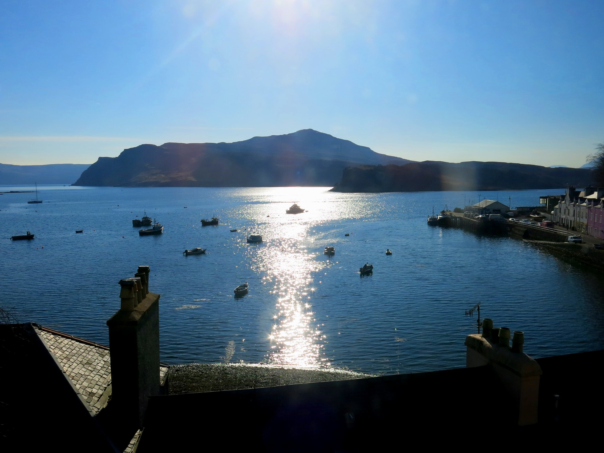 IMG_5489
 by
Half Man Half Titanium, on Flickr
Then we drove northwards, to be greeted by the classic view of The Storr.
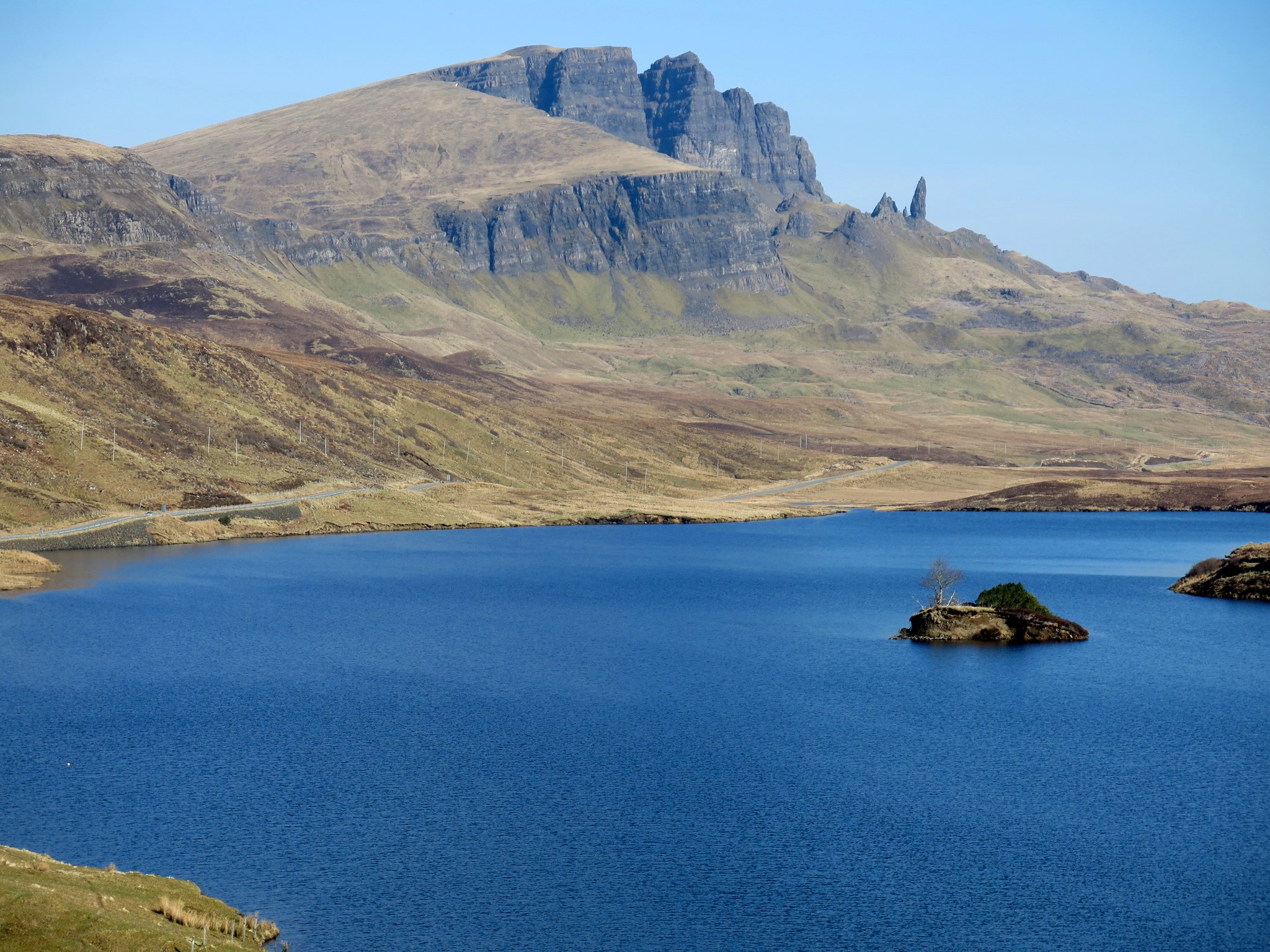 IMG_5501
 by
Half Man Half Titanium, on Flickr
We were soon at the 249m high point of the road between Staffin and Uig, where there is a large car park. From there we took the clear, level path north-east. In two minutes we were looking down on the hairpin bends of the road.
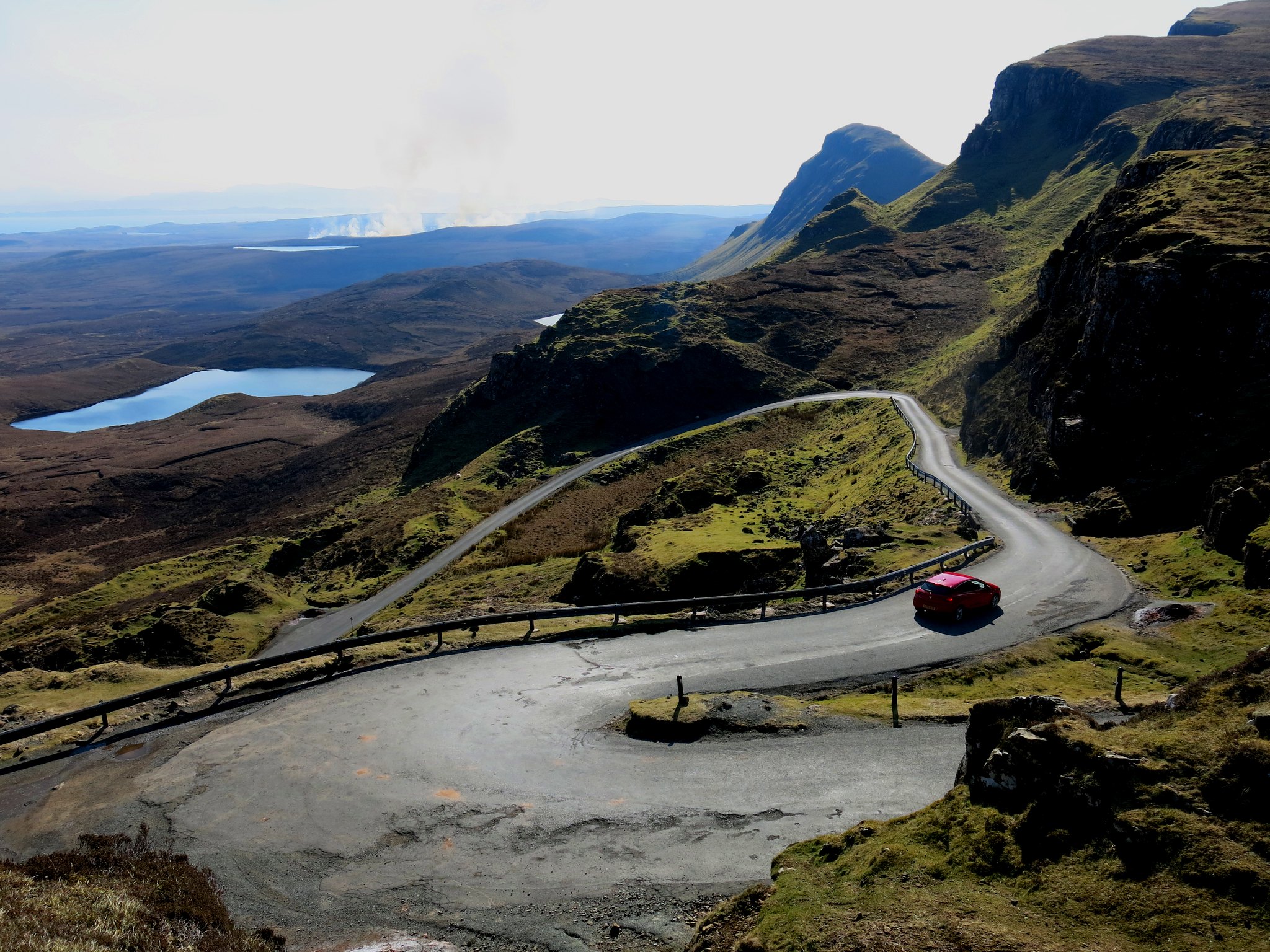 IMG_5508
 by
Half Man Half Titanium, on Flickr
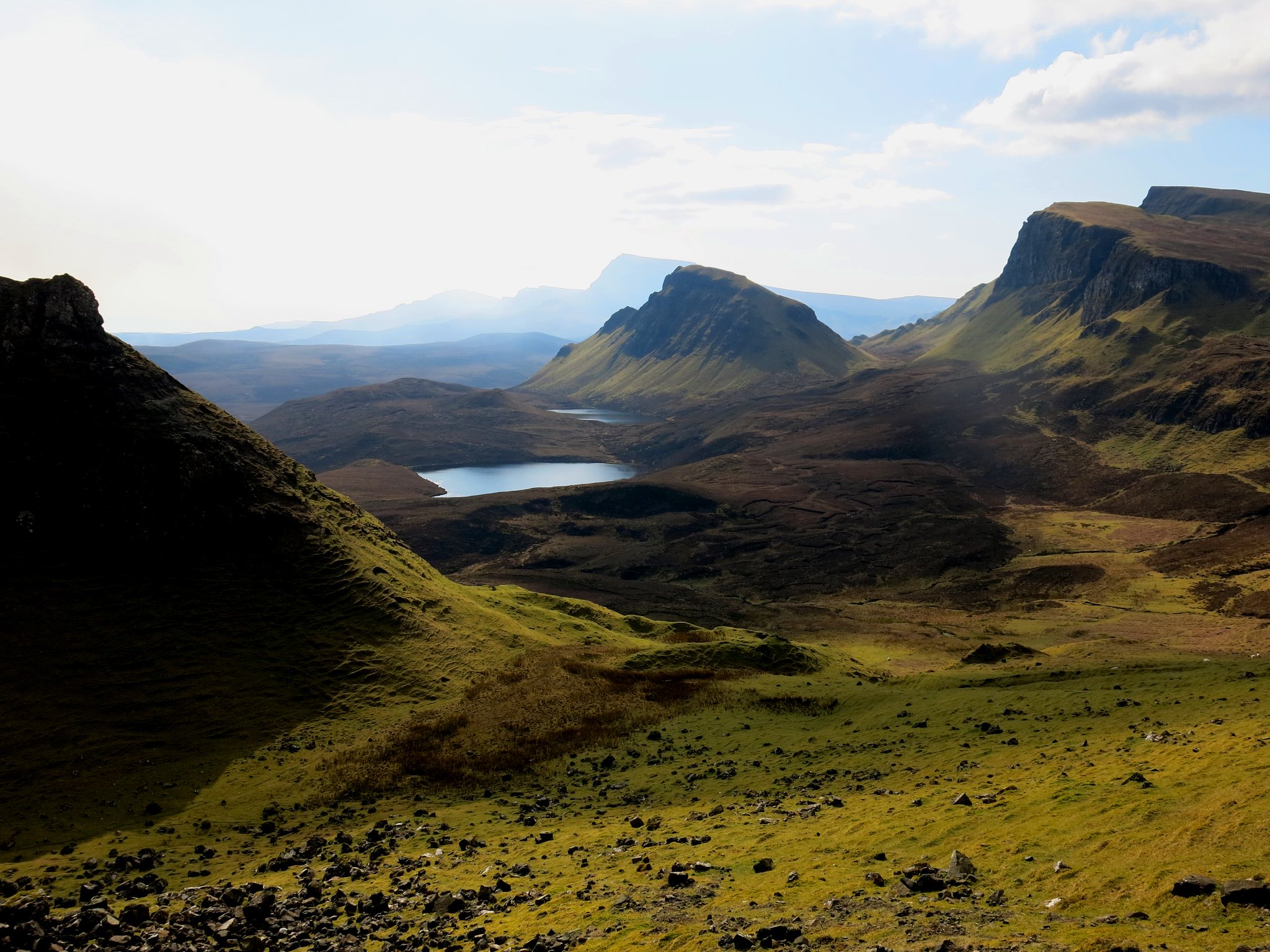
The path was delightful and very easy, and the weird crags of the Quiraing lured us onwards.
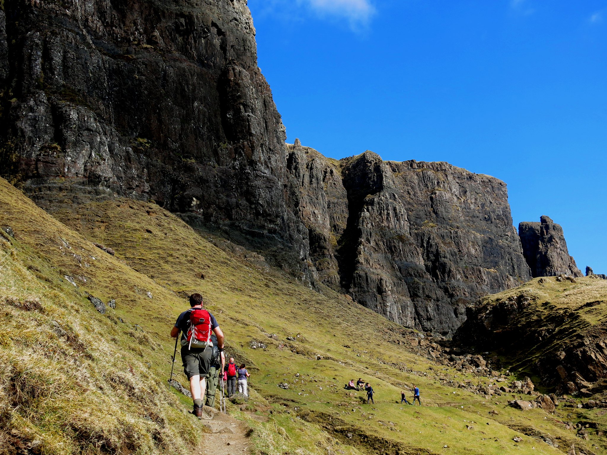 IMG_5531
 by
Half Man Half Titanium, on Flickr
Looking back from the path towards the peaks of Cleat and Beinn Edra.
 IMG_5526
 by
Half Man Half Titanium, on Flickr
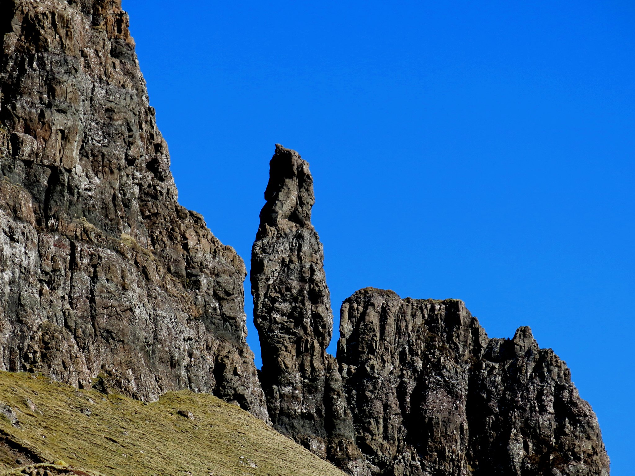
First sight of the Needle.
 IMG_5543
 by
Half Man Half Titanium, on Flickr
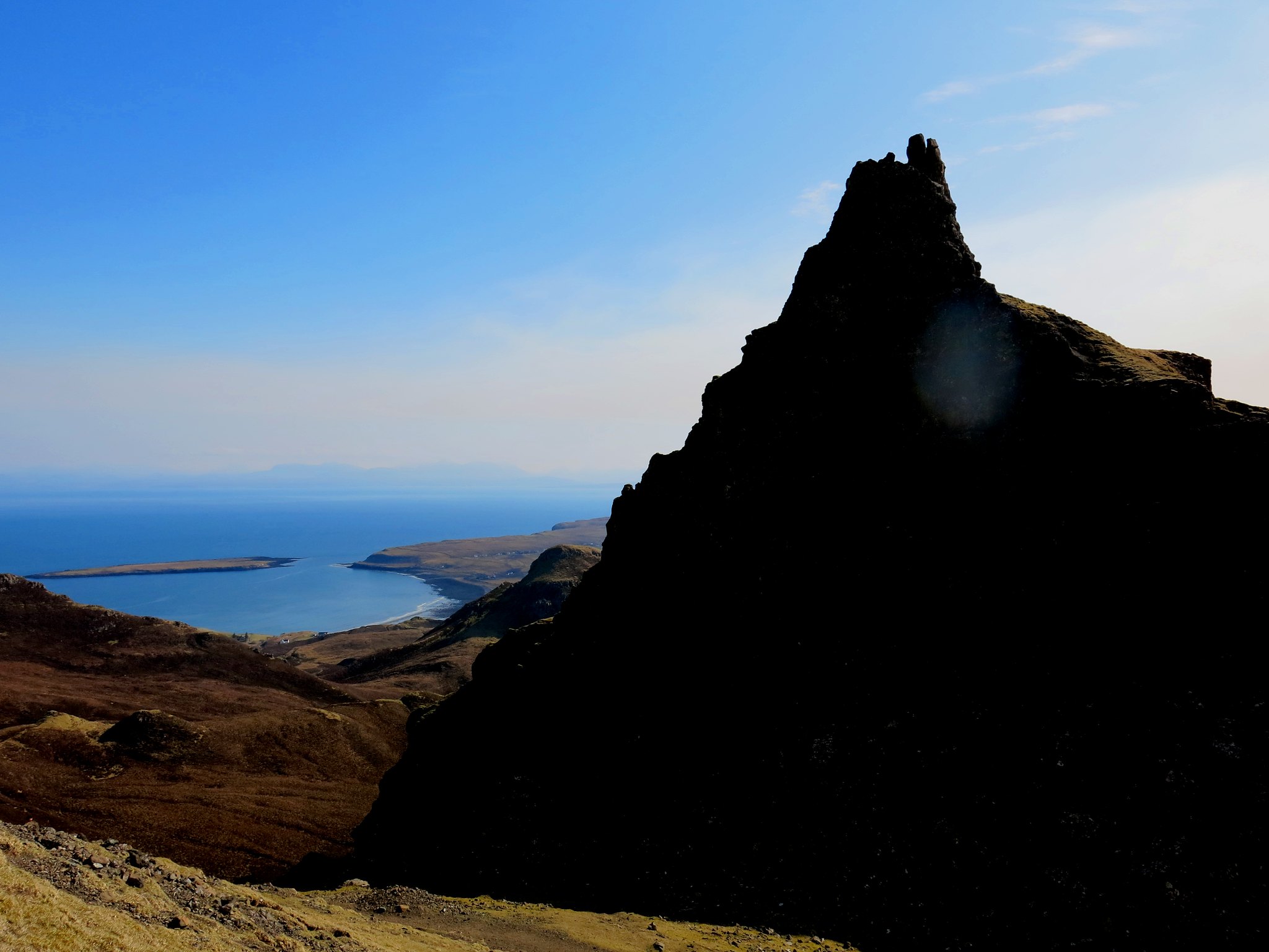
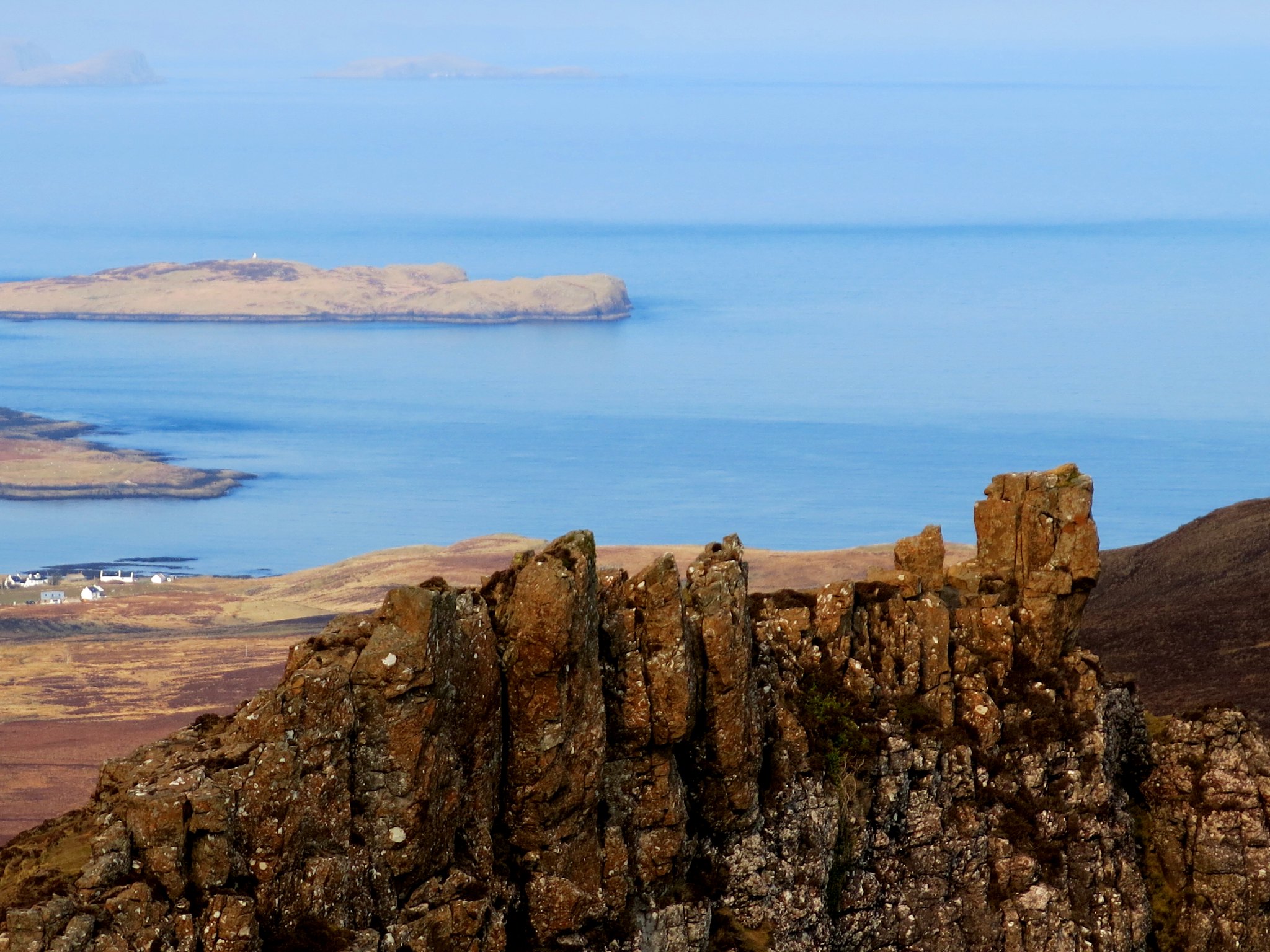
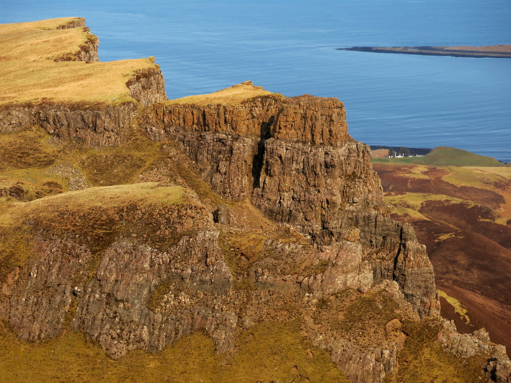
We took a break below the castellated outcrop of the Prison, from where we had a view out over Staffin Bay and Island.
 IMG_5547
 by
Half Man Half Titanium, on Flickr
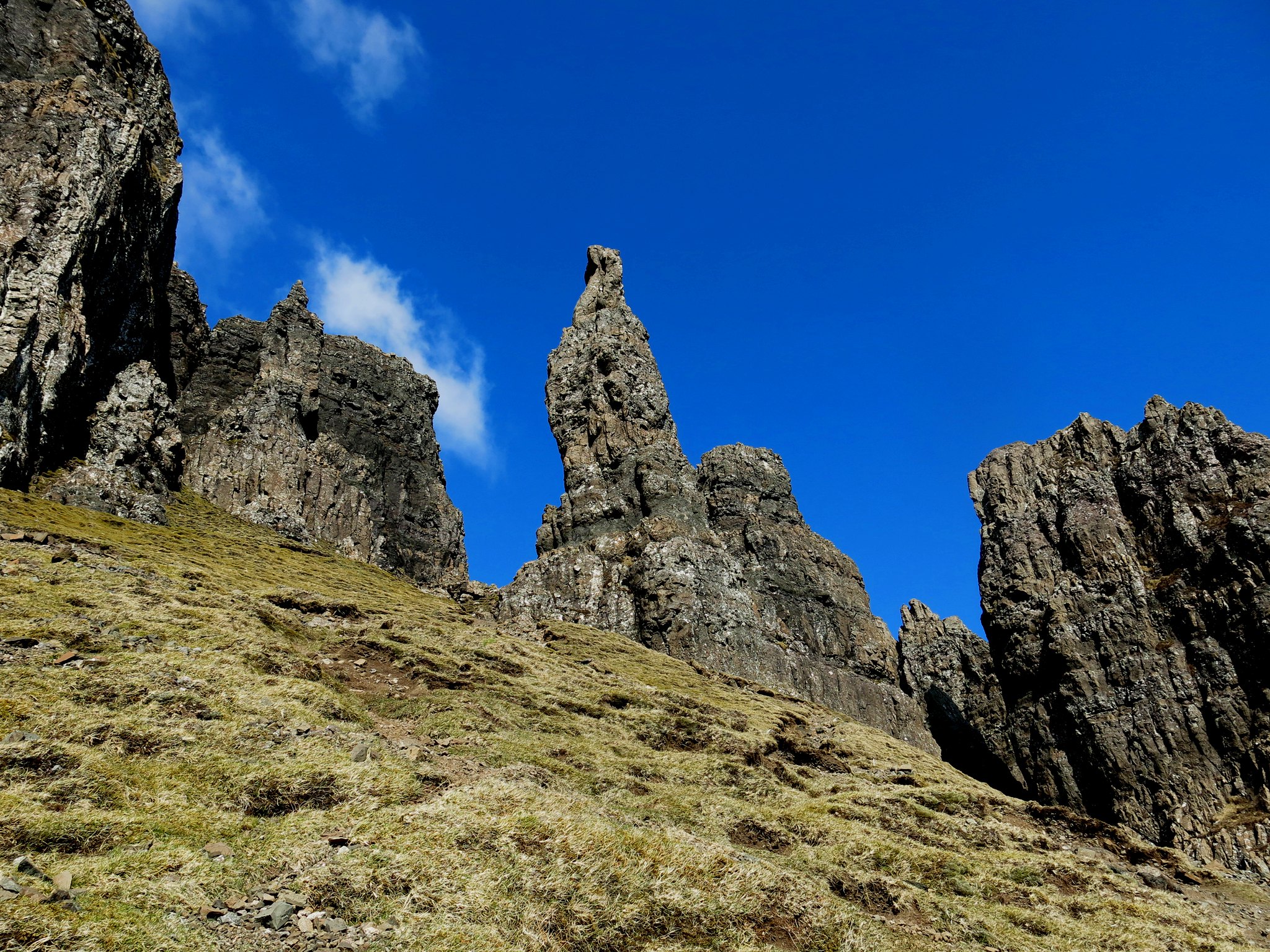
From here I decided to do a short solo explore up towards and around the back of the Needle.
 IMG_5550
 by
Half Man Half Titanium, on Flickr
The Needle seen from behind.
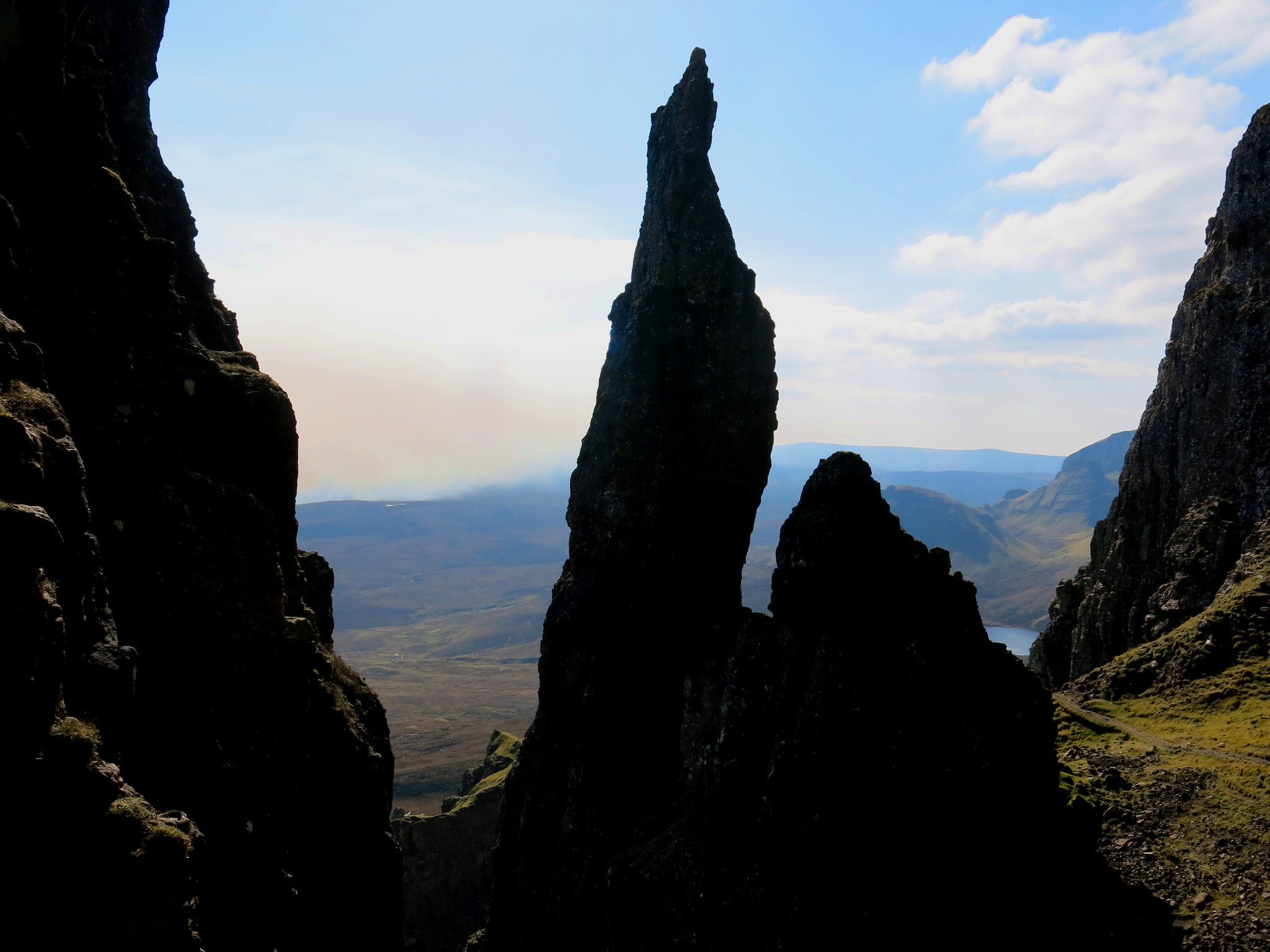 IMG_5577
 by
Half Man Half Titanium, on Flickr
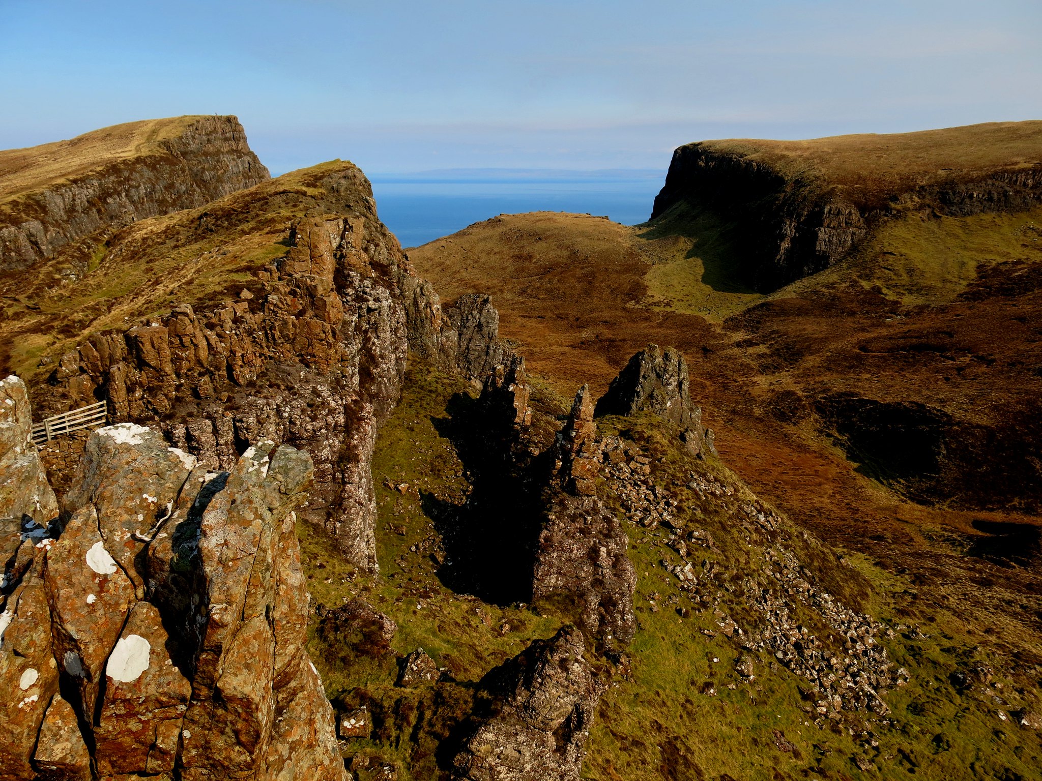
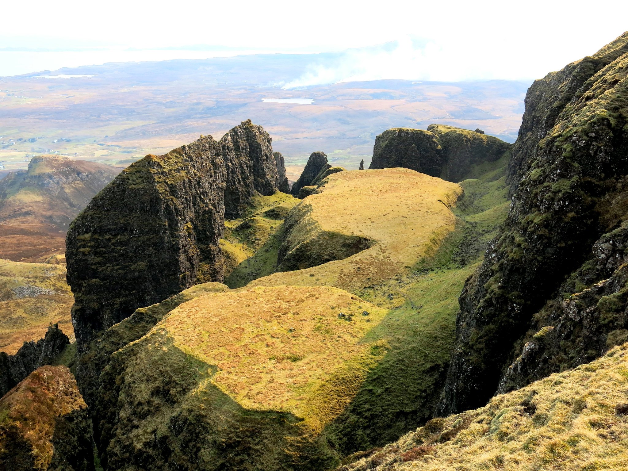
The area behind and above the Needle could be, I guess, the most complicated little bit of natural landscape anywhere in the UK. The path weaves about between rock towers and through natural gateways, like scenes from Lord of the Rings.
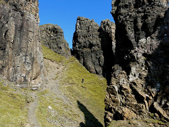 IMG_5556
 by
Half Man Half Titanium, on Flickr
Looking down to the coast through one of the many rock gateways.
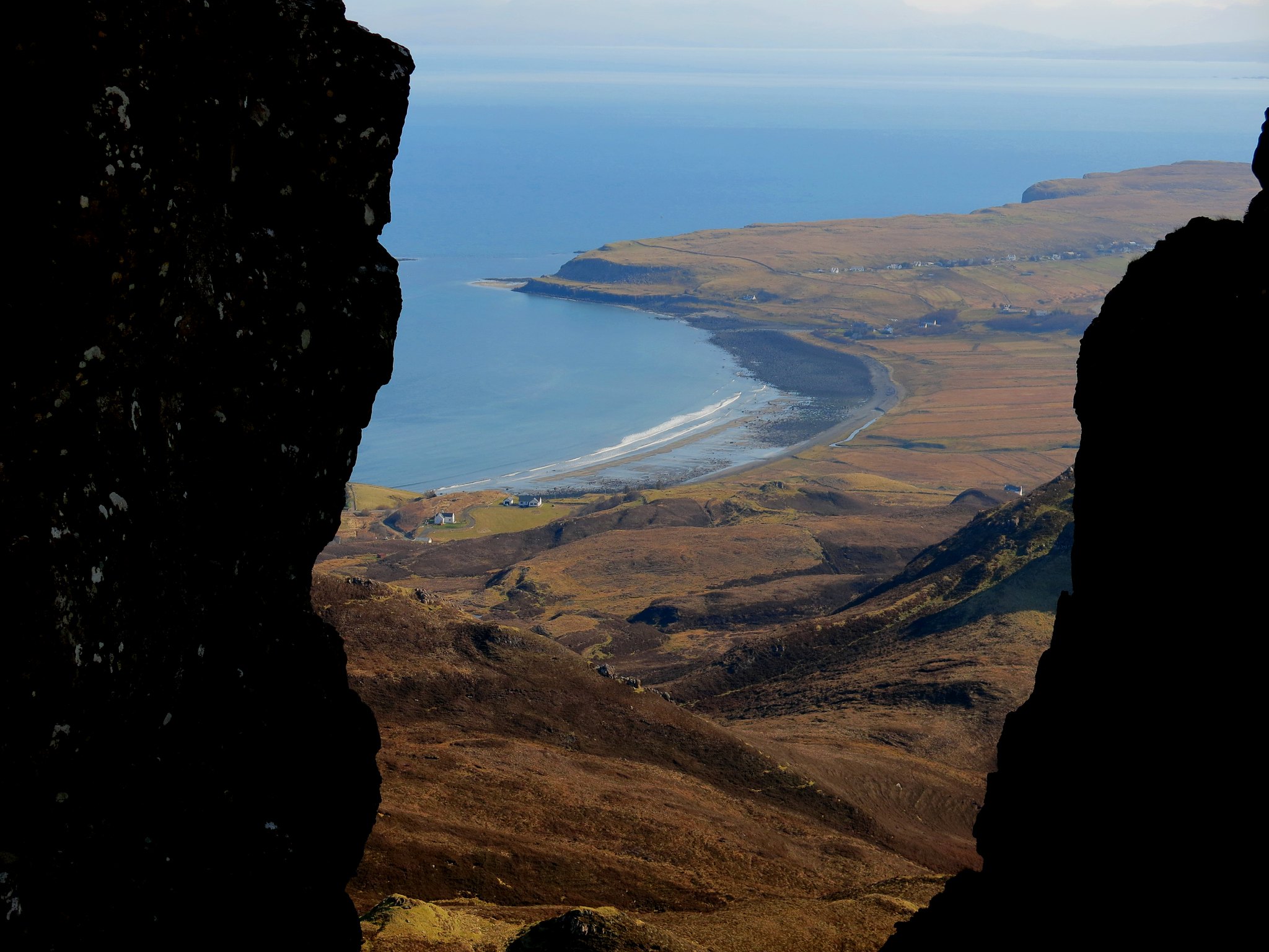 IMG_5557
 by
Half Man Half Titanium, on Flickr
I had hoped to reach the Table, but time was ticking away so I rejoined our group and we wended our way further along the path northwards.
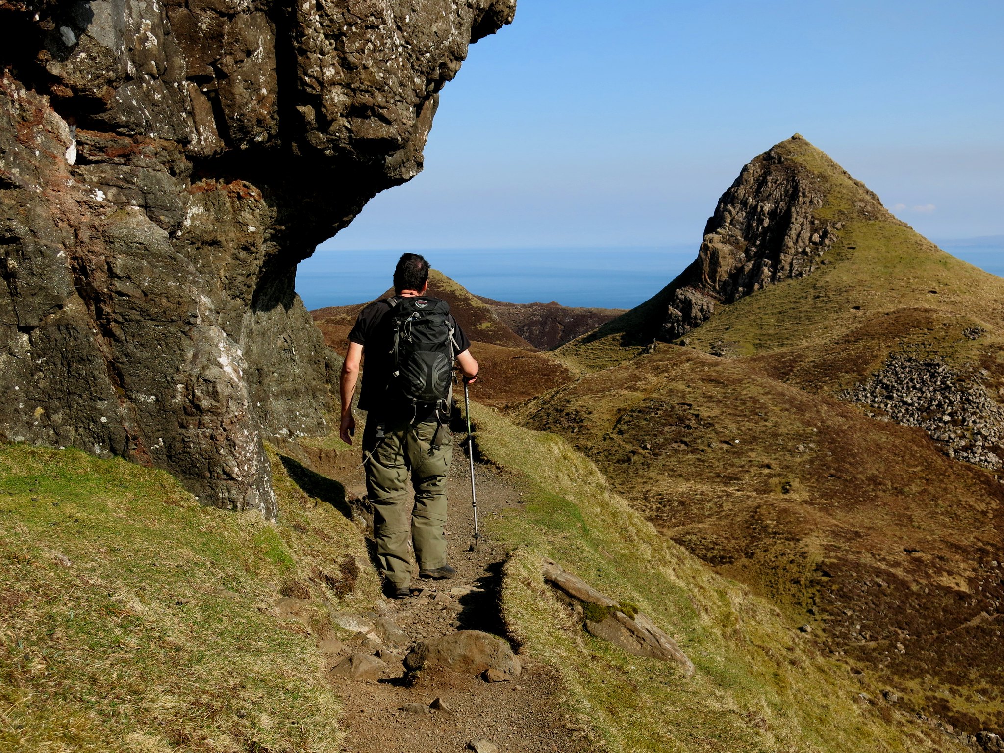 IMG_5590
 by
Half Man Half Titanium, on Flickr
Our surroundings were all gorgeous, with tiny lochans among the tumbled landscape.
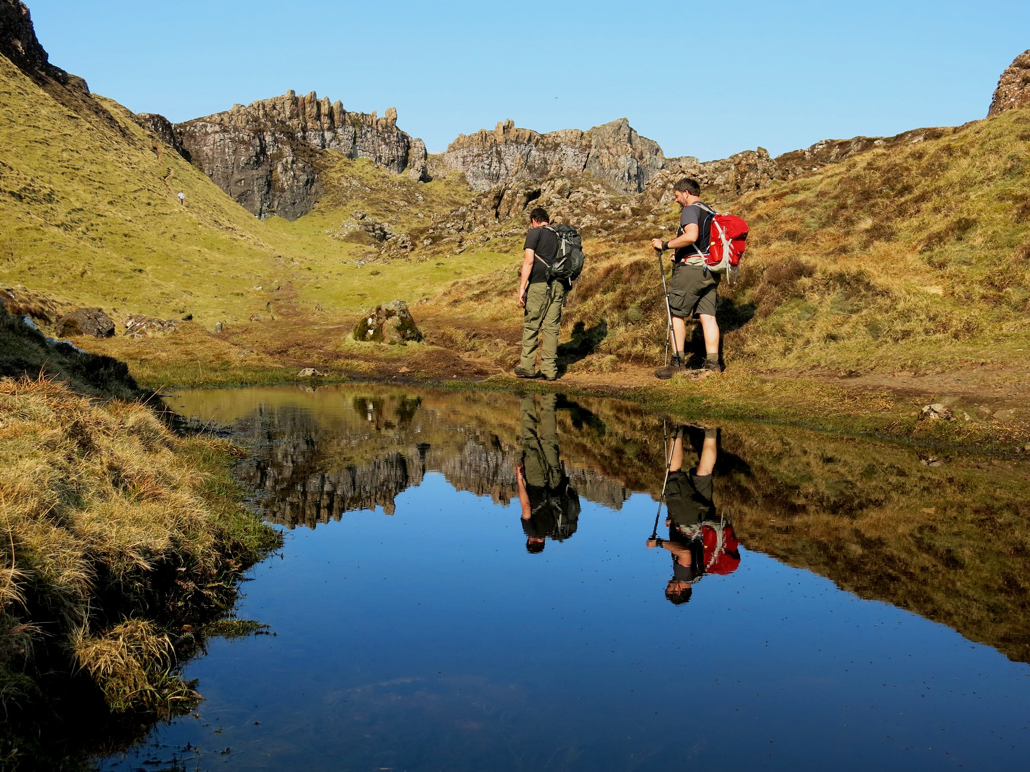 IMG_5614
 by
Half Man Half Titanium, on Flickr
The path eventually makes a short climb up to a stile on the ridge-line. This place is named Fir Bhreugach on the map. From here, a rocky little ridge like a dinosaur's back stretched out towards Sron Vourlinn and demanded that we explore it.
 IMG_5635
 by
Half Man Half Titanium, on Flickr
Here's the view eastwards from the top of the dinosaur's head.
 IMG_5626
 by
Half Man Half Titanium, on Flickr
After admiring the scenery all around, we set off up the slopes of Meall na Suiremach. Again there were great views all around - this is looking back to towards Sron Vourlinn.
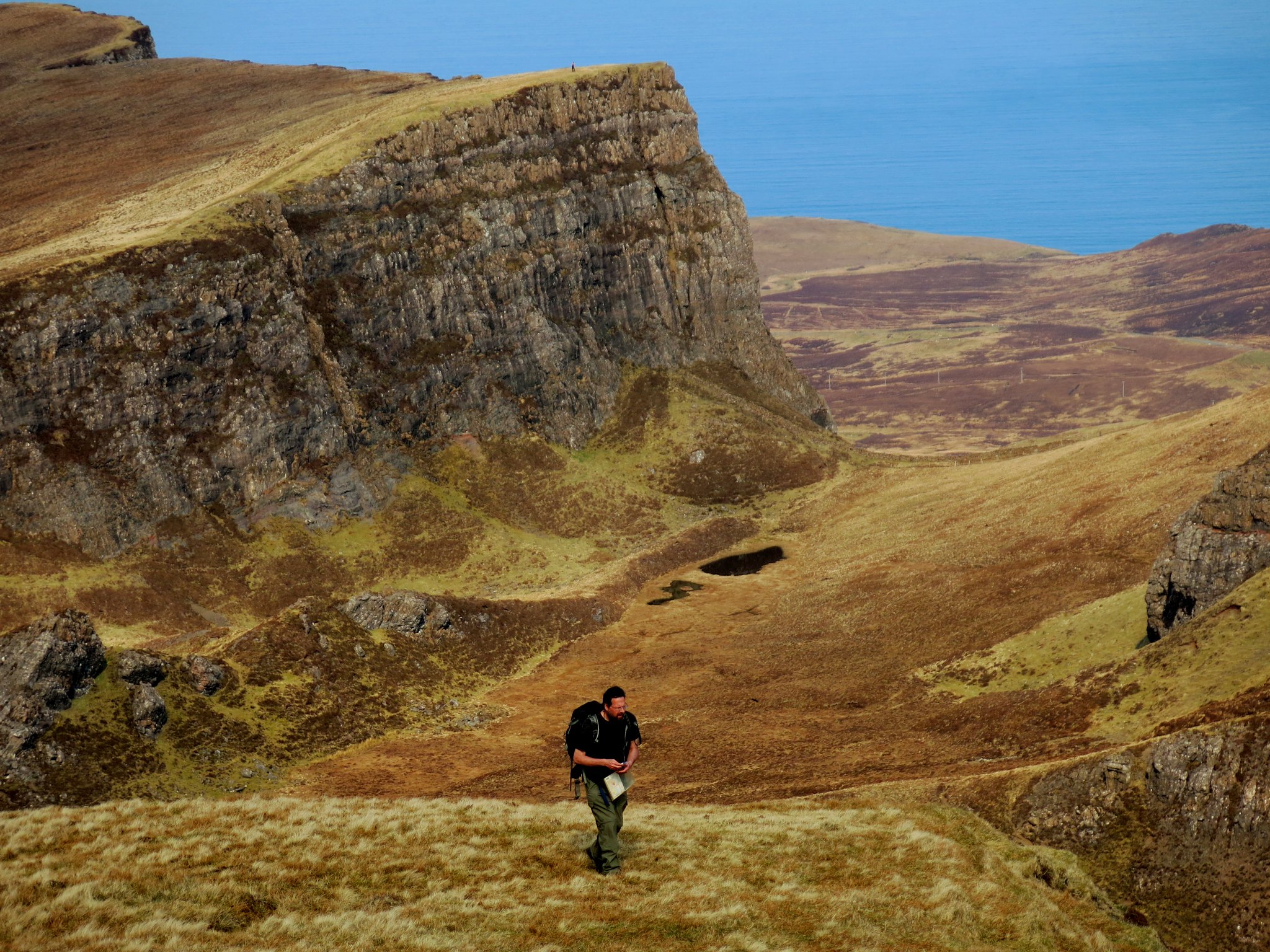 IMG_5663
 by
Half Man Half Titanium, on Flickr
Looking down on Leac nan Fionn.
 IMG_5667
 by
Half Man Half Titanium, on Flickr
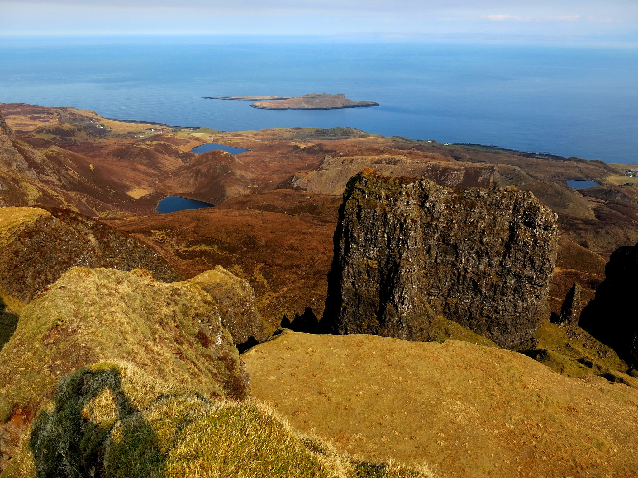
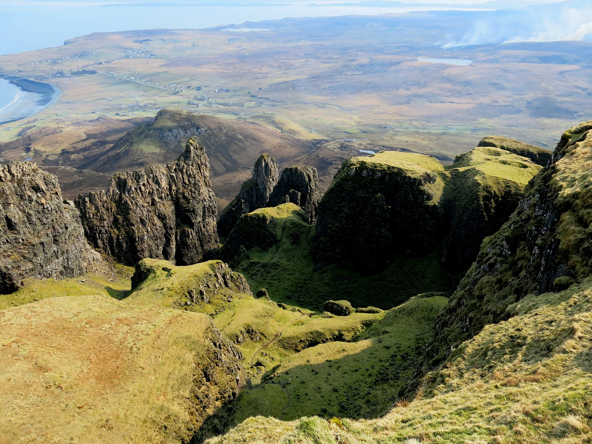
The big surprise of this route is the sudden view down into the Quiraing, with the Table centre stage. The whole thing looks unreal, like it's been CGId for a fantasy film.
 IMG_5677
 by
Half Man Half Titanium, on Flickr
From the cliff-edge of Meall na Suiremach there were great views as we walked along.
 IMG_5704
 by
Half Man Half Titanium, on Flickr
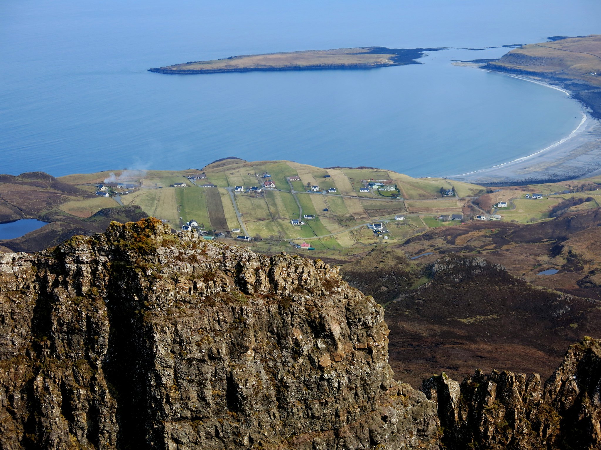
We could see Staffin village above the rock formations. This is my favourite photo from this set: the village looked like something in a painting, or a dream.
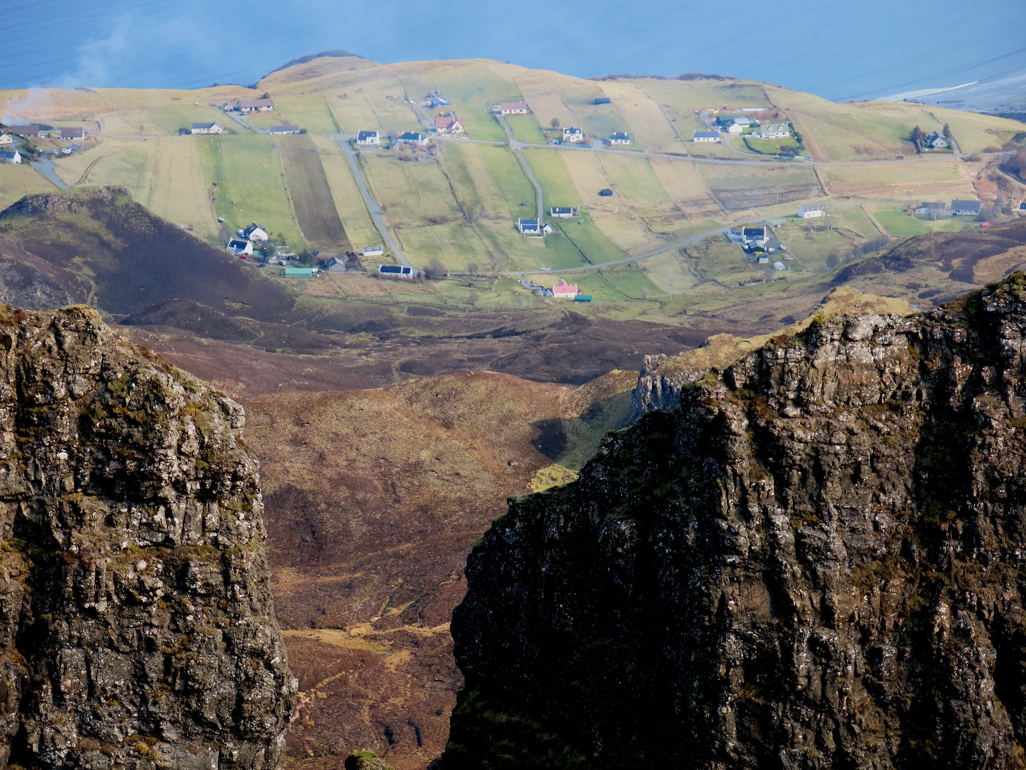 IMG_5692
 by
Half Man Half Titanium, on Flickr
Posing on one of the promontories.
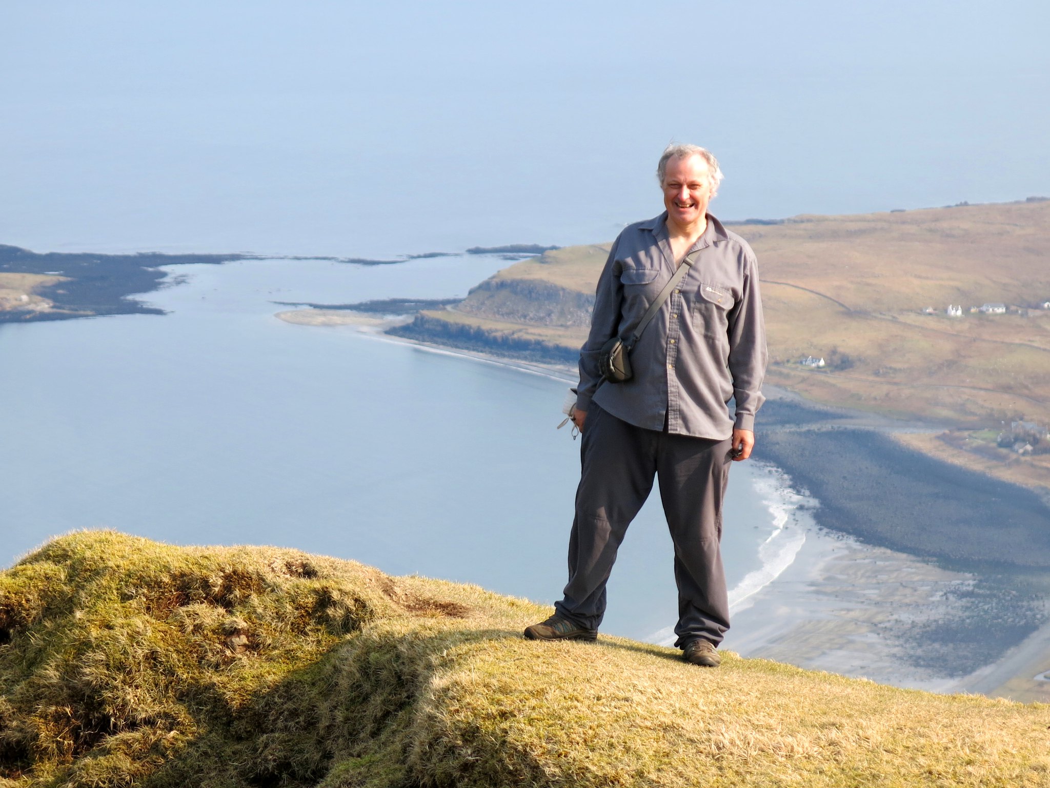 IMG_5703
 by
Half Man Half Titanium, on Flickr
We didn't visit the summit of the Meall; we wanted to just spend our time enjoying the cliff-edge views.
 IMG_5707
 by
Half Man Half Titanium, on Flickr
 IMG_5710
 by
Half Man Half Titanium, on Flickr
Eventually the path started to descend and finally wound its way down to the car park. After that it was a short drive down to Uig and a very welcome pint at the Bakur Bar (formerly Pub on the Pier).
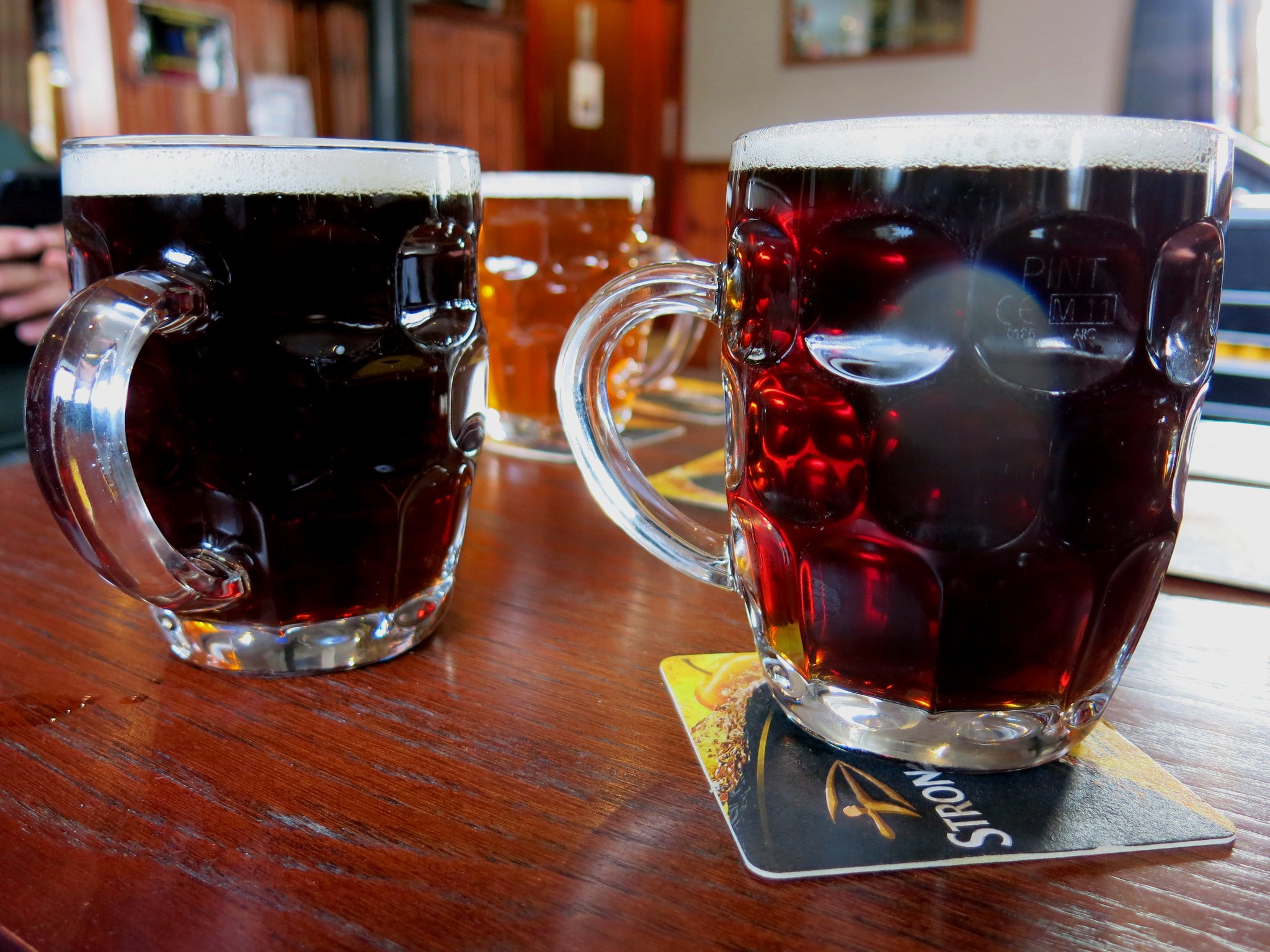 IMG_5724
 by
Half Man Half Titanium, on Flickr
