
A fab week in Kinlochewe
24 June – 01 July 2017
NB: I usually don’t set my walk reports to “public.” More often than not, I’m following either an established WH route, or have borrowed one from someone else’s WR. Keeping the entries private lets me write without censure about random weird thoughts and my mood, conversations and inside jokes, or even what’s going on at home or work. I believe that in general, there's very little that hasn't been said before, or that might be of use or interest to the wider walking community.
But last week, I had my first wee taste of the Fisherfield Munros, following a nice route that, to the best of my knowledge/research, isn't yet posted on here. It might be useful if you're looking for a way to the eastern hills that avoids the hydro mess in Kinlochewe Heights.
The entry is long -- it covers the entire week and includes various other walks and hills. Yeah, I know, I could have cut ‘n pasted it into its own entry; sorry, I just couldn’t be arsed. . You can skip all the drivel and get to the route itself, by scrolling down to “Wed 28 June.”
~~~~~~~~
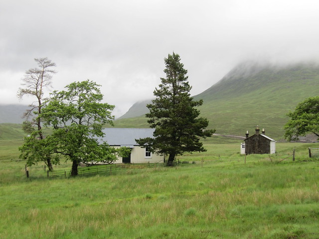
I’d booked a self-catering cabin at Kinlochewe Mountain Chalets. It’s just past the hotel, before you turn left to go down Glen Torridon. The cabin is very dated (think VHS videotapes! Of which there were plenty), and smelled slightly of dog, but was otherwise clean and fit for purpose. Some new and slightly higher-quality sheets, towels, and pillows wouldn’t go amiss, but we all know I tend toward princessy from time to time about certain things. It was comfy enough for sleeping and had a good powerful shower. It had two bedrooms and accommodated four; I’d extended an invitation to both David and Evie if they cared to join me for any or all of the week. David stayed for the first three nights.
Sat 24 June
Munro: Ben Wyvis
4 hrs / 14km / 952m
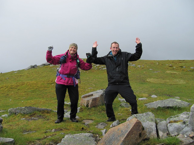
Ben Wyvis was my first solo Munro, in 2010. I’d been staying for a few days at a funky old place called Glass House, in Struy, directly across the road (the A831) from the Strathfarrar gate. I’d climbed up, up, up, through the forest, along the river, and steeply up across a large snowfield. When I reached two large cairns, and there wasn’t any more “up,” why wouldn’t I assume I was at the summit? I walked back down, feeling very pleased with myself, ticked off Munro #6, and didn’t think much more about it. It wasn’t until several years later that I even realized that I’d still been nearly 2km from the summit. I left it ticked, because it didn’t seem to matter much, until I realized that I might actually compleat someday. It was a loose end that needed tidying, and heading north to Kinlochewe seemed the perfect time to do that.
Oh dear god, the wind.
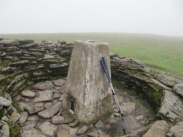
proof that I actually made the summit this time!
how can this be okay?
Sun 25 June
Munros: Lurg Mhor, Bidean a’Choire Sheasgaich
12 hrs / 39km / 1844m
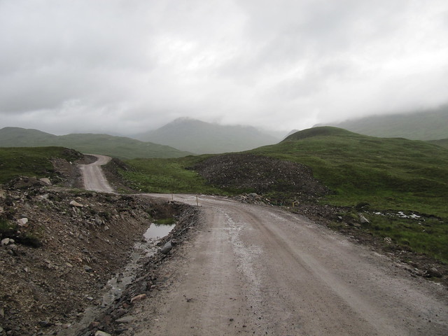
We had a long day ahead, so we made an early start, arriving at Attadale just before 7am; we were on our way at the top of the hour. We were a bit surprised when several hydro vehicles roared past us, given that it was so early on a Sunday morning. There would be many discussions throughout the day as to whether we’d accept a ride if offered one. On the way in, there weren’t any offers, so it wasn’t an issue.
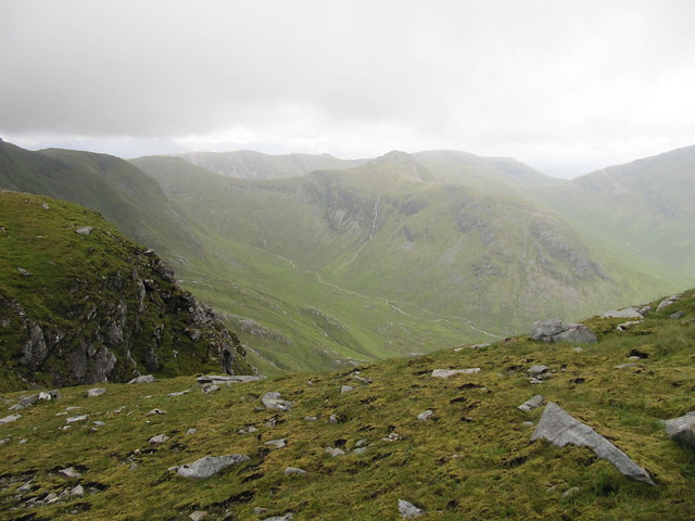
The track is in good nick, and goes for miles and miles and miles into and over the hills. There is a lot of ascent, up to more than 400m, all of which is then lost on the way down to the river, and the Bendronaig bothy soon thereafter (~9:30).
miles and miles of this...
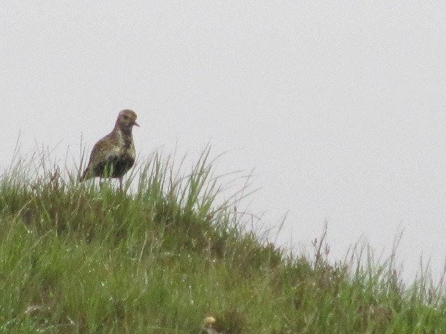
golden plover
finally, the bothy
There were two lads in the bothy who’d been doing the Cape Wrath Trail, but had realized that they’d just not allowed enough time to finish it, so were heading out to Strathcarron to make alternate plans for their last few days before heading home.
We carried on along to Loch Calavie, the original farm/stalking track being much rougher than the hydro motorway. As per the WH route description, we started making our way up the hill next to the Allt Coire Calavie. The ground was soggy, and the grass was very wet, and it wasn’t long before my summer/fabric boots were sloshing.
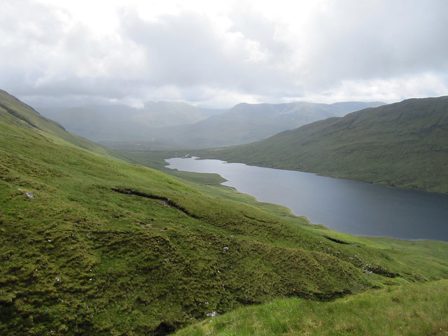
looking down on Loch Calavie
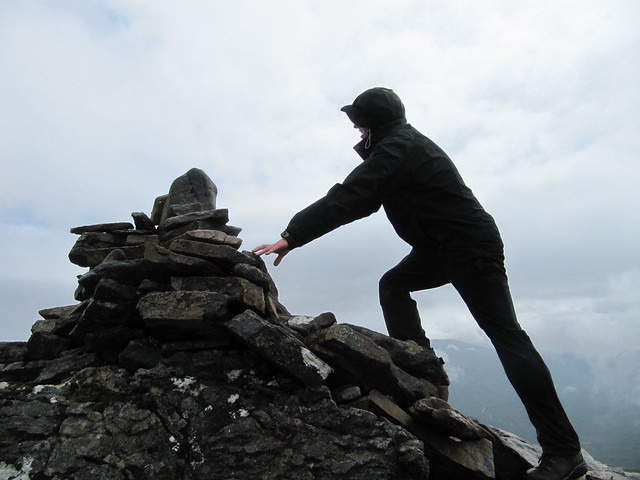
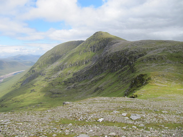
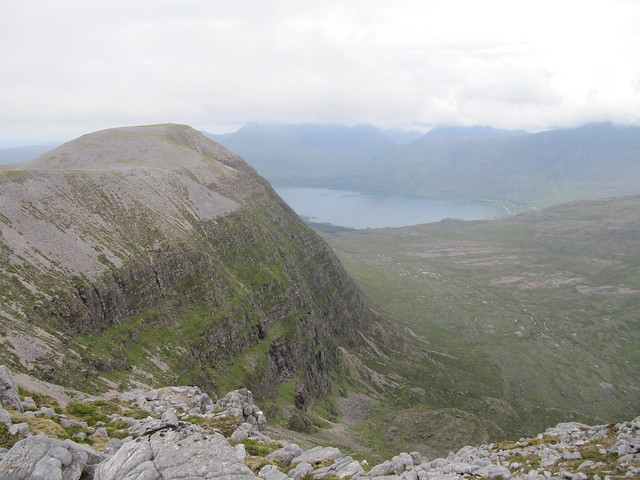
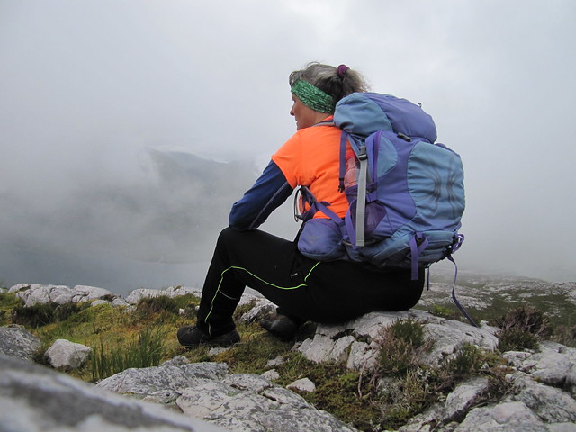
It didn’t look very far up to the bealach, but we never seemed to be getting any closer. When we finally reached it, we found a path that would carry us most of the way up to our first summit, Lurg Mhor (12:45). As we approached the summit, the clouds cleared. Huzzah! We spent a fair amount of time racing around taking photos, hill spotting/naming, and taking it all in. We were on one of the very most remotest Munros, and well pleased with the result of our effort.
summit!
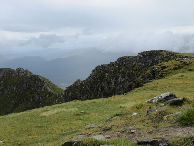
the ridge-y bit that carries along from the summit, and more in the general direction of Loch Monar

over to Ba'CS, out of the cloud at the moment. Not so pointy from this side.
summit silliness
toward Sgurrs a'Choinnich and a'Chaorachain
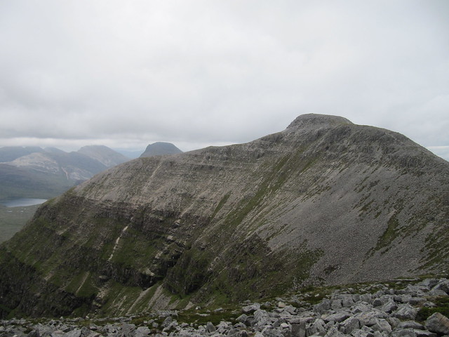
We eventually made our way back to the bealach, and stopped for a bit of food before making our way up Bidean a’Choire Sheasgaich (2:30) I’ve been issued a challenge to not use the word by which this hill is generally referred to in this blog entry. It’s not nearly as pointy from this side as it is when seen across the way from Sgurr a’Choinnich. I was, in fact, quite surprised to find that both of these hills are quite straightforward. At least they are using WH route; Evie would no doubt beg to differ, after having clawed her way up by her fingernails through the crags on the other side of Ba’CS the week before. It’s only the long walk in that makes the route so challenging, and I daresay that the hydro track mitigates even that challenge somewhat.
back toward Lurg Mhor
zoomed to the Strathcarron hills
the general direction of the way out
We didn’t spend much time on the second summit before heading down the southwest ridge, which undulated over several tops. We eventually reached the track, had another brief rest in the bothy, then started the long walk out.
This time, a cheerful young chappy offered us a lift. One of us would have had no compunction about accepting, but the other (my conscience) refused. We returned to the car at 7pm; exactly 12 hours after setting off.
finally, Lochcarron comes into view
On the way back to Kinlochewe, we stopped into the Strathcarron Hotel for a fairly awful (and truly not fine) “dining” experience.
Mon 26 June
Corbett: Sail Mhor
7.5 hrs / 13.7 km / 957m
We didn’t get an early start today. David drove us around to the start point (via Gairloch, Aultbea, Laide, etc.), and we set off at about noon.
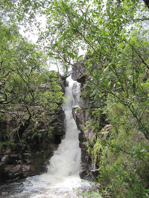
Ardessie Falls are quite impressive
lovely...
the target
We followed the WH route up the left side of the river (it was soggy), and followed it quite some way looking for a suitable crossing point. It wasn’t in spate, but neither was it easy peasy.
the river we'd eventually need to get across
target again, from just after we crossed the river
We made our way across the moor, and up to the bealach, where fabulous views started opening up.
from the summit, into the Fisherfield wilderness; the Corbetts Beinns Dearg Mor and Beag
summit cairn, out to sea, over the Summer Isles
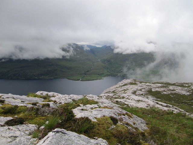
We opted to go over the bump of Ruigh Meallain on the way back, knowing it’d be a good perspective on the various lochans below. The two An Teallach Munros remained coy, choosing not to show us their lovely summits.
from Ruigh Meallain
looking back onto Sail Mhor from Ruigh Meallain

one more
The descent was gentle, and we’d soon reached the river, crossing more or less at the same place we’d crossed on the way in. The evening “came good,” and we continued to enjoy good views out to sea and over the Summer Isles.
Tues 27 June
Lochs Coulin and Clair
2.5 hrs / 10.3km / 172m
The forecast was grotty, and we were both fairly tired from the two days previous. So we had a quick leg-stretcher around this wee low-level gem. Followed by bacon rolls and a cake in the Torridon General Store.
sadly, no reflections of Liathach and/or Beinn Eighe in Loch Coulin today...
...but some nice views nonetheless

reverse psychology: if you try to take a good picture, they're sure to turn and move away...
Wed 28 June
Munros: Sgurr Ban, Mullach Coire Mhic Fhearchair, Beinn Tarsuinn
13 hrs / 32.25km / 1544 m
A cracking route provided by Evie. After a flurry of night-before emails, we settled on meeting at the layby for the Western Fannichs at 7am. As usual, we were both early, and we were on our way by 6:45am. We walked under overcast skies along Loch a’Bhraoin, following, for the moment, BlackPanther’s route of several weeks earlier. I’d not seen Evie for a while, so the first few kms passed quickly, as we chatted and caught up with each other’s news. We poked our heads into the bothy and startled a slightly scary looking man. I think we both forgot that it was still fairly early! After a brief chat, we carried on our way, ever mindful that we had a long day ahead.
first glimpse of our hills (Sgurr Ban just off to the right, MCMF). We've already walked a long way!
We had a food break just before heading up the slabs, which were dry and grippy, and eminently easier than hacking through the heather.
looking up the main slab

Evie headed up the slab -- it's steeper than it looks here!
It was a long way to the socked-in summit of Sgurr Ban; we arrived there at noon, already a full five hours having passed.
summit Sgurr Ban; not much in the way of views. Yet.
The scree route zigzagging its way up MCMF looked fairly intimidating (the cloud level was mostly just below the tops), but even Evie had to admit that it ended up being not as bad as it looked; we were at its summit only an hour after leaving Sgurr Ban.
just below the summit of MCMF; Beinn Tarsuinn to the left of Evie's head, and Slioch just in front of her nose
we chose to go over this bump rather than traverse using the narrow (looking) goat track
Evie hill-spotting on the descent from "the bump" (which was fairly steep in places)
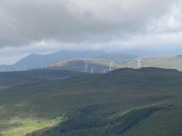
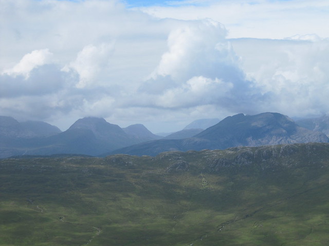
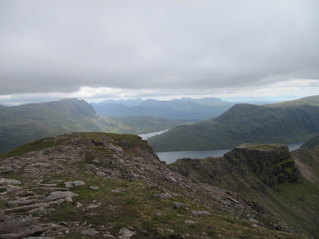
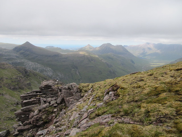
I think it was around 3pm that we reached our third summit, Beinn Tarsuinn. The views from here were even more spectacular than we’d had on our way across from MCMF—we could see the entire Fisherfield round, as well as the “back side” of Slioch, down over Lochan Fada, the causeway between Fionn and Duch lochs, and out to sea.
down over the "tennis court"; the rest of the complete F/F route carries around to the right...
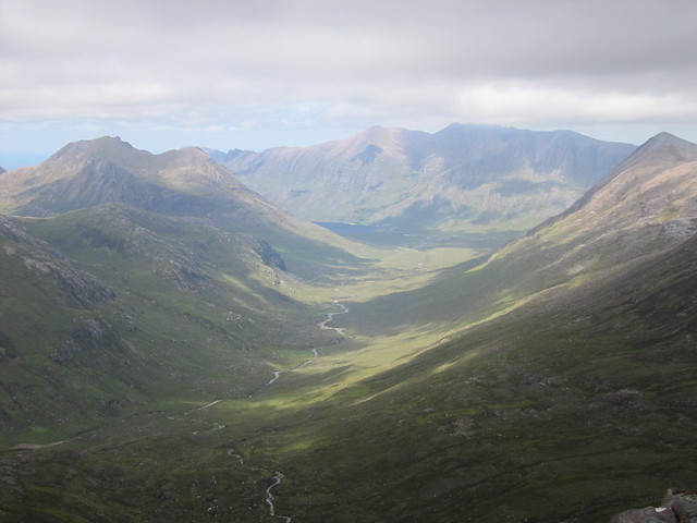
...and looks a bit like this, in part (Shenavall is around the pointy hill--the Corbett--to the right)
a bit wider shot over the tennis court, and toward the Torridon hills
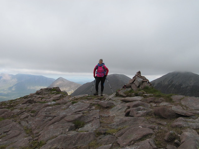
an awesome hill for #250

back toward MCMF
the last Munro in the circuit (Ruadh Stac Mor), the Beinn Dearg Corbetts, and out to sea
We spent 15-20 minutes taking photos and marvelling, before heading back down to the bealach between MCMF and BT, from where we’d head cross-country to our escape route. Thankfully, we had great visibility at this point, as the fresh batteries that Evie’d loaded into her GPS that morning had already died.
There was a fair bit of rough and at times soggy ground to cover before we found the stalkers’ path that led us back to the path/track that would carry us back to Loch a’Bhraoin. It seemed a long way. It WAS a long way. The last few kms along the loch seemed endless.
back to An Teallach from the river crossing (just before we reached the path/track)
We’d had a great day, and I think we were both on a bit of a high (at least I was), but we’d covered many kms, and were very happy to finally see our cars.
We were disappointed and annoyed to be turned away from the Aultguish. We arrived shortly after 8pm—8:08, to be exact—only to be told that the kitchen was closed, and completely shut down; the woman made it sound as though they’d stopped serving hours earlier, in spite of another woman we saw through the window tucking into the lasagne and chips just set in front of her. Another fine example of good old fashioned Scottish hospitality.
I LOVE my new Scarpa boots – SO light and comfy – 32 kms and not one step sore. And dry feet!
Thurs 29 June
Corbett: Ben Damph
4.5 hrs / 11.5 km / 980 m
It would have been ok with me had it been chucking it down this morning, and I’d said as much to Evie the night before. Rain would mean climbing back into bed with a coffee and my book. But I awoke to a cloudy, but dry morning. So I turned on BBC Breakfast, and the Scottish forecast said the rain that was imminent wouldn’t reach the northwest until later in the day. I figured I’d take a drive down Glen Torridon to see how Ben Damph looked. The cloud level was right about at the height of the hill; it wasn’t completely out of the cloud, but there was potential for it to clear as well. So it was a go. Mind, I was moving pretty slowly after yesterday’s epic, but I knew from having done Sail Mhor the other day, after our first epic, that my legs would eventually loosen up for moving, and would likely provide a better outcome than sitting on me bum all day.
Ben Damph has been on my radar ever since I’d walked the bottom part of it (to the bealach) back in March. I’ve heard only good things about it, and it didn’t disappoint today. Another gem.
I headed up from the Torridon Inn a bit after 9am. It was still overcast, but fairly mild and still, and I dared not stop in the woods for The Midge waiting to pounce. Additionally, there was a large group ahead of me, and I was keen to see if I could get past them without having to expend too much extra energy. There were good views back down over Loch Torridon, but the giants kept their heads firmly in the clouds.
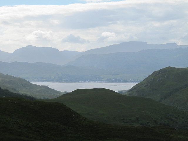
Then it was out onto the open moor, with views opening up in the general direction of Maol Chean-dearg. There’s a short, but steep and rather badly eroded section just below the bealach. I had nice views down over Loch Damph and toward both Kishorn and Shieldaig, but like their neighbours, the Applecross hills remained in the cloud.
from the bealach
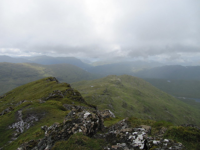
The path traverses ‘neath the stony unnamed 868m top, then heads across a large boulderfield. There are cairns to follow. I thought these cairns were leading to the summit, which looked much lower than the 868m point, and I thought that was a bit odd. When I crested this top, the ridge and the final climb to the summit finally became apparent. Wow. The ridge is narrow, airy, and dramatic.
on the ridge, looking down to my left...

...and to my right
It’s another brief rocky climb up to the summit (11:30), and wow, wow, wow. It was still hazy and overcast, but the summit was mostly clear when I reached it, and much of Torridon and Glen Carron lay before me. Hills in all directions, many of which I could identify and have actually been on. I’d not seen another person since I’d overtaken the large group, and I enjoyed having the large summit plateau to myself. I wandered one end to the other, feeling awed, small, and a little cautious, given the precipitous drops off the ends of the large flat rocks I stood on.
M C-d and An Stac Ruadh *nearly* out of the cloud
looking back over the 868m top, and down to Torridon
I revelled in being in the heart of magnificent Torridon, and gave thanks for being as lucky as I am to be able to come here as often as I do. I spent around 20 minutes taking photos, watching the mist swoop up and around me, and just soaking it in all. But I’d gotten chilled, and it was time to head down.
looking back up toward the summit
To descend, I simply retraced my steps. I returned to the Inn just before 2pm, treated myself to a bit of lunch, and by the time I left, the rain was just coming on, and continued throughout the rest of the afternoon and overnight. But I’d had a great day and climbed a smashing hill!
I should have quit while I was ahead.
Fri 30 June
Corbett: Meall a’Ghiubhais
5.5 hrs / 10.66km / 998m
The forecast was absolutely-positively to improve throughout the day. So I waited until 10am to set off. I wasn’t sure if I was going to head to Meall a’Ghiubhais, Ruadh-stac Beag, or possibly even both; I’d climb to the Conservation Cairn via the Mountain Trail, and check out the situation from there.
The Midge ensured that I kept moving as I climbed up through the forest; the morning was mild and humid, and I hoped for enough of a breeze, eventually, to carry them away.
no view of Slioch today
I spent some time sitting near the cairn and the high point of the Mtn Trail, contemplating possible routes.
The cloud remained stubbornly fixed well below the summit of both of my targeted hills and all the surrounding ones. I considered simply carrying on along the Trail, but decided instead to head up Ma’G, naively hoping that the cloud would lift. It didn’t.
The route up was steep over a mix of grass and scree, but mostly straightforward; once the bulk of the height had been gained, the summit (1pm) was a few hundred more metres along. I didn’t stick around but long enough to take a photo; there was no reason to, as by this time, not only was visibility non-existent, but it also became evident that the rain (rain? What rain? Dry day, improving later, remember ???) was more than a passing shower. Oh goody.
the summit cairn
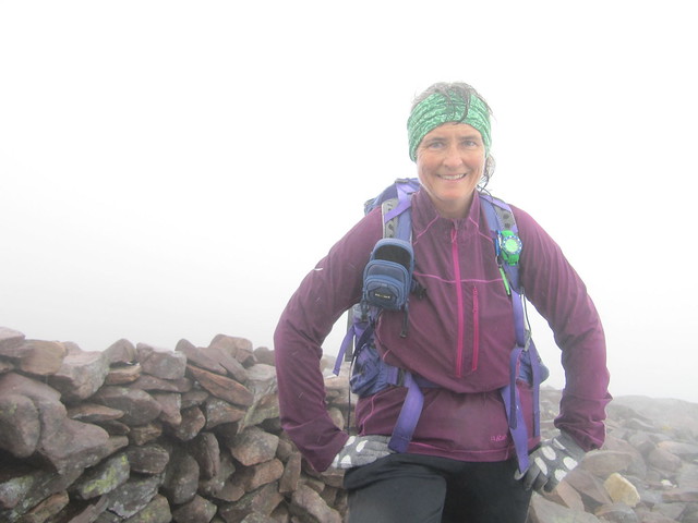
not particularly happy in spite of the smile
I headed down in what I *thought* was the correct direction, but realized that the ground was dropping away far too steeply. What followed was navigational blundering that left me wandering in various directions for a good half hour or so. The track as it’s recorded on my phone is both hilarious and humiliating. I was SO turned around, and convinced that the phone had gone wonky due to the rain. The lesson here (as well as a safe way down the correct side of the hill) finally came once I sat down with my map and compass, took a bearing, and followed it. Go figure.
My descent was slow and cautious, as both the scree and the steep grassy slopes had both become much more slippery with the rain. I fell not once, not twice, but THREE times! The first two didn’t do much damage, but the third one was both painful and very wet. I soon rejoined the Mtn Trail near the Lunar Loch, and wondered whether the voices I heard carrying through the mist had also heard my colourful language of a few moments before.
The clag was down even lower than it had been earlier. In fact, I’d descended well below the 305m marker on the Mtn Trail before Loch Maree finally came back into view. I never DID see the top of any of the surrounding hills.
After a hot shower, I walked down to the Whistle Stop and had a delicious early dinner (plus dessert!), before returning “home” to start gathering my things together for an early-morning departure, in the hope of avoiding some of the first-day-of-the-Scottish-school-holidays traffic.
So, six Munros—five of them amongst the remotest on offer—three Corbetts, two very long and memorable days spent in good company, three pairs of wet and muddy boots, two stonking and stinking bags of washing, assorted abrasions and bruises (including a large vivid one on my backside that makes me glad I do most of my work standing up), several itchy midge bumps, and a dozen or so empties to deposit in the bottle bank. It must have been a good week!
NB: I usually don’t set my walk reports to “public.” More often than not, I’m following either an established WH route, or have borrowed one from someone else’s WR. Keeping the entries private lets me write without censure about random weird thoughts and my mood, conversations and inside jokes, or even what’s going on at home or work. I believe that in general, there's very little that hasn't been said before, or that might be of use or interest to the wider walking community.
But last week, I had my first wee taste of the Fisherfield Munros, following a nice route that, to the best of my knowledge/research, isn't yet posted on here. It might be useful if you're looking for a way to the eastern hills that avoids the hydro mess in Kinlochewe Heights.
The entry is long -- it covers the entire week and includes various other walks and hills. Yeah, I know, I could have cut ‘n pasted it into its own entry; sorry, I just couldn’t be arsed.
~~~~~~~~
I’d booked a self-catering cabin at Kinlochewe Mountain Chalets. It’s just past the hotel, before you turn left to go down Glen Torridon. The cabin is very dated (think VHS videotapes! Of which there were plenty), and smelled slightly of dog, but was otherwise clean and fit for purpose. Some new and slightly higher-quality sheets, towels, and pillows wouldn’t go amiss, but we all know I tend toward princessy from time to time about certain things. It was comfy enough for sleeping and had a good powerful shower. It had two bedrooms and accommodated four; I’d extended an invitation to both David and Evie if they cared to join me for any or all of the week. David stayed for the first three nights.
Sat 24 June
Munro: Ben Wyvis
4 hrs / 14km / 952m
Ben Wyvis was my first solo Munro, in 2010. I’d been staying for a few days at a funky old place called Glass House, in Struy, directly across the road (the A831) from the Strathfarrar gate. I’d climbed up, up, up, through the forest, along the river, and steeply up across a large snowfield. When I reached two large cairns, and there wasn’t any more “up,” why wouldn’t I assume I was at the summit? I walked back down, feeling very pleased with myself, ticked off Munro #6, and didn’t think much more about it. It wasn’t until several years later that I even realized that I’d still been nearly 2km from the summit. I left it ticked, because it didn’t seem to matter much, until I realized that I might actually compleat someday. It was a loose end that needed tidying, and heading north to Kinlochewe seemed the perfect time to do that.
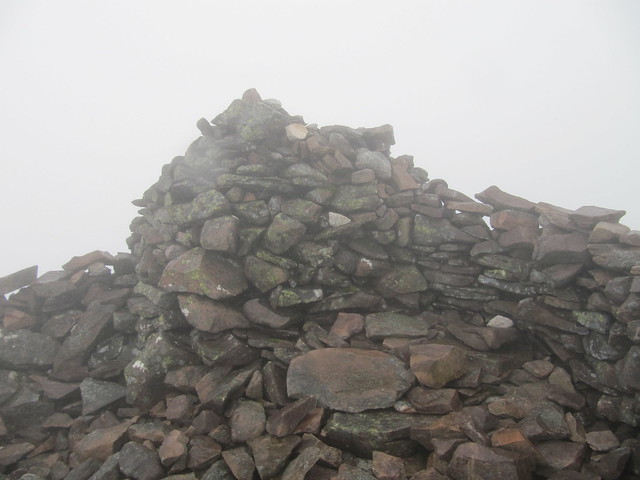
Oh dear god, the wind.
proof that I actually made the summit this time!
how can this be okay?
Sun 25 June
Munros: Lurg Mhor, Bidean a’Choire Sheasgaich
12 hrs / 39km / 1844m
We had a long day ahead, so we made an early start, arriving at Attadale just before 7am; we were on our way at the top of the hour. We were a bit surprised when several hydro vehicles roared past us, given that it was so early on a Sunday morning. There would be many discussions throughout the day as to whether we’d accept a ride if offered one. On the way in, there weren’t any offers, so it wasn’t an issue.
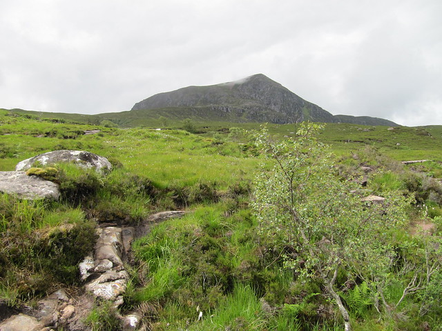
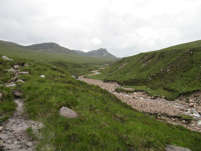
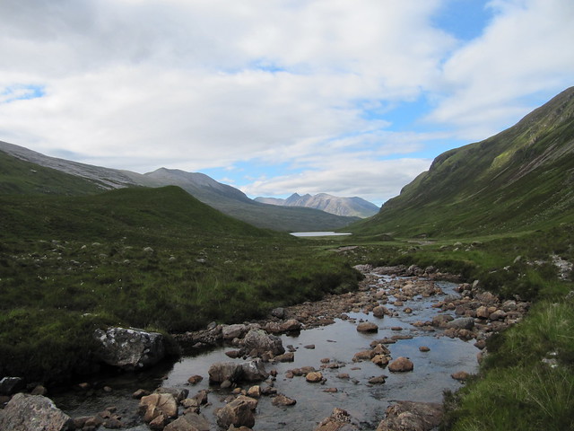
The track is in good nick, and goes for miles and miles and miles into and over the hills. There is a lot of ascent, up to more than 400m, all of which is then lost on the way down to the river, and the Bendronaig bothy soon thereafter (~9:30).
miles and miles of this...
golden plover
finally, the bothy
There were two lads in the bothy who’d been doing the Cape Wrath Trail, but had realized that they’d just not allowed enough time to finish it, so were heading out to Strathcarron to make alternate plans for their last few days before heading home.
We carried on along to Loch Calavie, the original farm/stalking track being much rougher than the hydro motorway. As per the WH route description, we started making our way up the hill next to the Allt Coire Calavie. The ground was soggy, and the grass was very wet, and it wasn’t long before my summer/fabric boots were sloshing.
looking down on Loch Calavie
It didn’t look very far up to the bealach, but we never seemed to be getting any closer. When we finally reached it, we found a path that would carry us most of the way up to our first summit, Lurg Mhor (12:45). As we approached the summit, the clouds cleared. Huzzah! We spent a fair amount of time racing around taking photos, hill spotting/naming, and taking it all in. We were on one of the very most remotest Munros, and well pleased with the result of our effort.
summit!
the ridge-y bit that carries along from the summit, and more in the general direction of Loch Monar
over to Ba'CS, out of the cloud at the moment. Not so pointy from this side.
summit silliness
toward Sgurrs a'Choinnich and a'Chaorachain
We eventually made our way back to the bealach, and stopped for a bit of food before making our way up Bidean a’Choire Sheasgaich (2:30) I’ve been issued a challenge to not use the word by which this hill is generally referred to in this blog entry. It’s not nearly as pointy from this side as it is when seen across the way from Sgurr a’Choinnich. I was, in fact, quite surprised to find that both of these hills are quite straightforward. At least they are using WH route; Evie would no doubt beg to differ, after having clawed her way up by her fingernails through the crags on the other side of Ba’CS the week before. It’s only the long walk in that makes the route so challenging, and I daresay that the hydro track mitigates even that challenge somewhat.
back toward Lurg Mhor
zoomed to the Strathcarron hills
the general direction of the way out
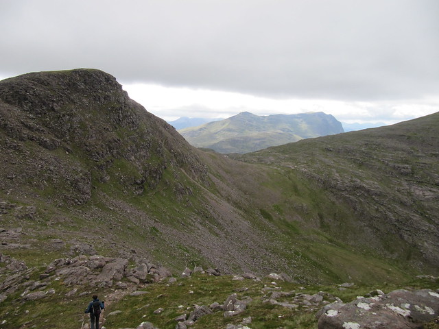
We didn’t spend much time on the second summit before heading down the southwest ridge, which undulated over several tops. We eventually reached the track, had another brief rest in the bothy, then started the long walk out.
This time, a cheerful young chappy offered us a lift. One of us would have had no compunction about accepting, but the other (my conscience) refused. We returned to the car at 7pm; exactly 12 hours after setting off.
finally, Lochcarron comes into view
On the way back to Kinlochewe, we stopped into the Strathcarron Hotel for a fairly awful (and truly not fine) “dining” experience.
Mon 26 June
Corbett: Sail Mhor
7.5 hrs / 13.7 km / 957m
We didn’t get an early start today. David drove us around to the start point (via Gairloch, Aultbea, Laide, etc.), and we set off at about noon.
Ardessie Falls are quite impressive
lovely...
the target
We followed the WH route up the left side of the river (it was soggy), and followed it quite some way looking for a suitable crossing point. It wasn’t in spate, but neither was it easy peasy.
the river we'd eventually need to get across
target again, from just after we crossed the river
We made our way across the moor, and up to the bealach, where fabulous views started opening up.
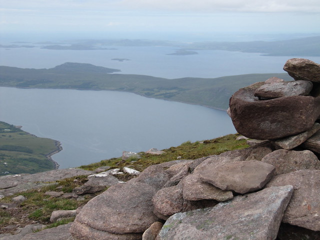
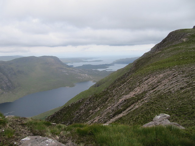
from the summit, into the Fisherfield wilderness; the Corbetts Beinns Dearg Mor and Beag
summit cairn, out to sea, over the Summer Isles
We opted to go over the bump of Ruigh Meallain on the way back, knowing it’d be a good perspective on the various lochans below. The two An Teallach Munros remained coy, choosing not to show us their lovely summits.
from Ruigh Meallain
looking back onto Sail Mhor from Ruigh Meallain
one more
The descent was gentle, and we’d soon reached the river, crossing more or less at the same place we’d crossed on the way in. The evening “came good,” and we continued to enjoy good views out to sea and over the Summer Isles.
Tues 27 June
Lochs Coulin and Clair
2.5 hrs / 10.3km / 172m
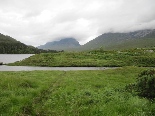
The forecast was grotty, and we were both fairly tired from the two days previous. So we had a quick leg-stretcher around this wee low-level gem. Followed by bacon rolls and a cake in the Torridon General Store.
sadly, no reflections of Liathach and/or Beinn Eighe in Loch Coulin today...
...but some nice views nonetheless
reverse psychology: if you try to take a good picture, they're sure to turn and move away...
Wed 28 June
Munros: Sgurr Ban, Mullach Coire Mhic Fhearchair, Beinn Tarsuinn
13 hrs / 32.25km / 1544 m
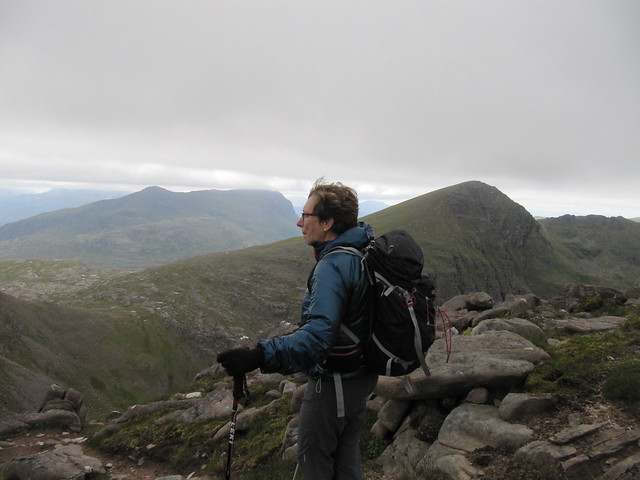
A cracking route provided by Evie. After a flurry of night-before emails, we settled on meeting at the layby for the Western Fannichs at 7am. As usual, we were both early, and we were on our way by 6:45am. We walked under overcast skies along Loch a’Bhraoin, following, for the moment, BlackPanther’s route of several weeks earlier. I’d not seen Evie for a while, so the first few kms passed quickly, as we chatted and caught up with each other’s news. We poked our heads into the bothy and startled a slightly scary looking man. I think we both forgot that it was still fairly early! After a brief chat, we carried on our way, ever mindful that we had a long day ahead.
first glimpse of our hills (Sgurr Ban just off to the right, MCMF). We've already walked a long way!
We had a food break just before heading up the slabs, which were dry and grippy, and eminently easier than hacking through the heather.
looking up the main slab
Evie headed up the slab -- it's steeper than it looks here!
It was a long way to the socked-in summit of Sgurr Ban; we arrived there at noon, already a full five hours having passed.
summit Sgurr Ban; not much in the way of views. Yet.
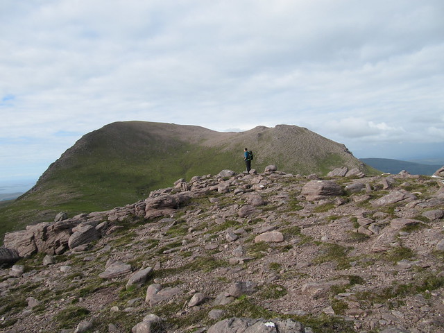
The scree route zigzagging its way up MCMF looked fairly intimidating (the cloud level was mostly just below the tops), but even Evie had to admit that it ended up being not as bad as it looked; we were at its summit only an hour after leaving Sgurr Ban.
just below the summit of MCMF; Beinn Tarsuinn to the left of Evie's head, and Slioch just in front of her nose
we chose to go over this bump rather than traverse using the narrow (looking) goat track
Evie hill-spotting on the descent from "the bump" (which was fairly steep in places)
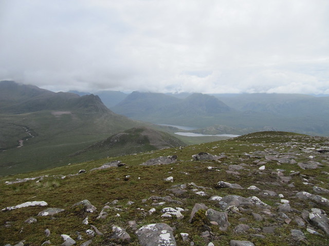
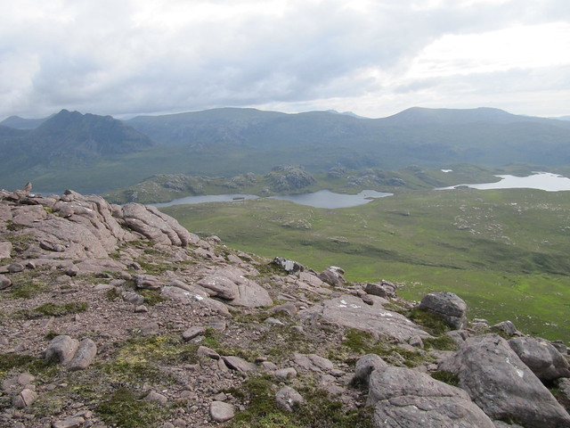
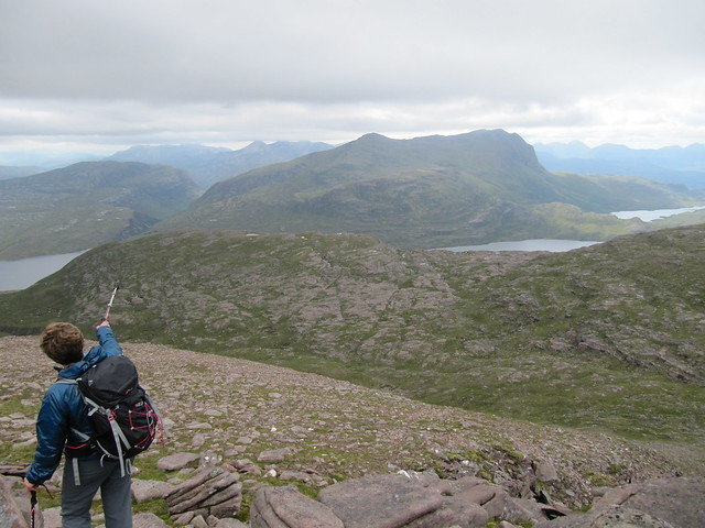
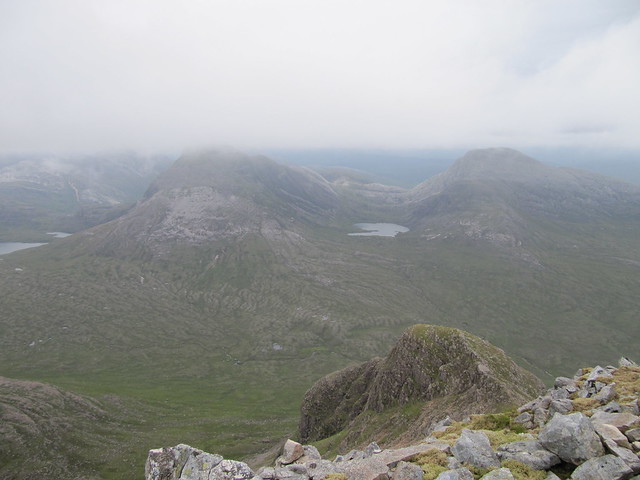
I think it was around 3pm that we reached our third summit, Beinn Tarsuinn. The views from here were even more spectacular than we’d had on our way across from MCMF—we could see the entire Fisherfield round, as well as the “back side” of Slioch, down over Lochan Fada, the causeway between Fionn and Duch lochs, and out to sea.
down over the "tennis court"; the rest of the complete F/F route carries around to the right...
...and looks a bit like this, in part (Shenavall is around the pointy hill--the Corbett--to the right)
a bit wider shot over the tennis court, and toward the Torridon hills
an awesome hill for #250
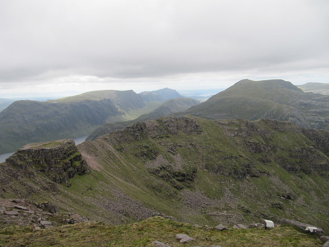
back toward MCMF
the last Munro in the circuit (Ruadh Stac Mor), the Beinn Dearg Corbetts, and out to sea
We spent 15-20 minutes taking photos and marvelling, before heading back down to the bealach between MCMF and BT, from where we’d head cross-country to our escape route. Thankfully, we had great visibility at this point, as the fresh batteries that Evie’d loaded into her GPS that morning had already died.
There was a fair bit of rough and at times soggy ground to cover before we found the stalkers’ path that led us back to the path/track that would carry us back to Loch a’Bhraoin. It seemed a long way. It WAS a long way. The last few kms along the loch seemed endless.
back to An Teallach from the river crossing (just before we reached the path/track)
We’d had a great day, and I think we were both on a bit of a high (at least I was), but we’d covered many kms, and were very happy to finally see our cars.
We were disappointed and annoyed to be turned away from the Aultguish. We arrived shortly after 8pm—8:08, to be exact—only to be told that the kitchen was closed, and completely shut down; the woman made it sound as though they’d stopped serving hours earlier, in spite of another woman we saw through the window tucking into the lasagne and chips just set in front of her. Another fine example of good old fashioned Scottish hospitality.
I LOVE my new Scarpa boots – SO light and comfy – 32 kms and not one step sore. And dry feet!
Thurs 29 June
Corbett: Ben Damph
4.5 hrs / 11.5 km / 980 m
It would have been ok with me had it been chucking it down this morning, and I’d said as much to Evie the night before. Rain would mean climbing back into bed with a coffee and my book. But I awoke to a cloudy, but dry morning. So I turned on BBC Breakfast, and the Scottish forecast said the rain that was imminent wouldn’t reach the northwest until later in the day. I figured I’d take a drive down Glen Torridon to see how Ben Damph looked. The cloud level was right about at the height of the hill; it wasn’t completely out of the cloud, but there was potential for it to clear as well. So it was a go. Mind, I was moving pretty slowly after yesterday’s epic, but I knew from having done Sail Mhor the other day, after our first epic, that my legs would eventually loosen up for moving, and would likely provide a better outcome than sitting on me bum all day.
Ben Damph has been on my radar ever since I’d walked the bottom part of it (to the bealach) back in March. I’ve heard only good things about it, and it didn’t disappoint today. Another gem.
I headed up from the Torridon Inn a bit after 9am. It was still overcast, but fairly mild and still, and I dared not stop in the woods for The Midge waiting to pounce. Additionally, there was a large group ahead of me, and I was keen to see if I could get past them without having to expend too much extra energy. There were good views back down over Loch Torridon, but the giants kept their heads firmly in the clouds.
Then it was out onto the open moor, with views opening up in the general direction of Maol Chean-dearg. There’s a short, but steep and rather badly eroded section just below the bealach. I had nice views down over Loch Damph and toward both Kishorn and Shieldaig, but like their neighbours, the Applecross hills remained in the cloud.
from the bealach
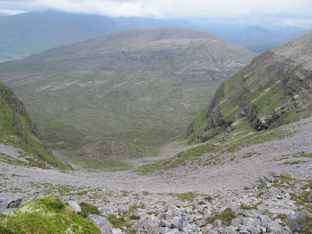
The path traverses ‘neath the stony unnamed 868m top, then heads across a large boulderfield. There are cairns to follow. I thought these cairns were leading to the summit, which looked much lower than the 868m point, and I thought that was a bit odd. When I crested this top, the ridge and the final climb to the summit finally became apparent. Wow. The ridge is narrow, airy, and dramatic.
on the ridge, looking down to my left...
...and to my right
It’s another brief rocky climb up to the summit (11:30), and wow, wow, wow. It was still hazy and overcast, but the summit was mostly clear when I reached it, and much of Torridon and Glen Carron lay before me. Hills in all directions, many of which I could identify and have actually been on. I’d not seen another person since I’d overtaken the large group, and I enjoyed having the large summit plateau to myself. I wandered one end to the other, feeling awed, small, and a little cautious, given the precipitous drops off the ends of the large flat rocks I stood on.
M C-d and An Stac Ruadh *nearly* out of the cloud
looking back over the 868m top, and down to Torridon
I revelled in being in the heart of magnificent Torridon, and gave thanks for being as lucky as I am to be able to come here as often as I do. I spent around 20 minutes taking photos, watching the mist swoop up and around me, and just soaking it in all. But I’d gotten chilled, and it was time to head down.
looking back up toward the summit
To descend, I simply retraced my steps. I returned to the Inn just before 2pm, treated myself to a bit of lunch, and by the time I left, the rain was just coming on, and continued throughout the rest of the afternoon and overnight. But I’d had a great day and climbed a smashing hill!
I should have quit while I was ahead.
Fri 30 June
Corbett: Meall a’Ghiubhais
5.5 hrs / 10.66km / 998m
The forecast was absolutely-positively to improve throughout the day. So I waited until 10am to set off. I wasn’t sure if I was going to head to Meall a’Ghiubhais, Ruadh-stac Beag, or possibly even both; I’d climb to the Conservation Cairn via the Mountain Trail, and check out the situation from there.
The Midge ensured that I kept moving as I climbed up through the forest; the morning was mild and humid, and I hoped for enough of a breeze, eventually, to carry them away.
no view of Slioch today
I spent some time sitting near the cairn and the high point of the Mtn Trail, contemplating possible routes.
The cloud remained stubbornly fixed well below the summit of both of my targeted hills and all the surrounding ones. I considered simply carrying on along the Trail, but decided instead to head up Ma’G, naively hoping that the cloud would lift. It didn’t.
The route up was steep over a mix of grass and scree, but mostly straightforward; once the bulk of the height had been gained, the summit (1pm) was a few hundred more metres along. I didn’t stick around but long enough to take a photo; there was no reason to, as by this time, not only was visibility non-existent, but it also became evident that the rain (rain? What rain? Dry day, improving later, remember ???) was more than a passing shower. Oh goody.
the summit cairn
not particularly happy in spite of the smile
I headed down in what I *thought* was the correct direction, but realized that the ground was dropping away far too steeply. What followed was navigational blundering that left me wandering in various directions for a good half hour or so. The track as it’s recorded on my phone is both hilarious and humiliating. I was SO turned around, and convinced that the phone had gone wonky due to the rain. The lesson here (as well as a safe way down the correct side of the hill) finally came once I sat down with my map and compass, took a bearing, and followed it. Go figure.
My descent was slow and cautious, as both the scree and the steep grassy slopes had both become much more slippery with the rain. I fell not once, not twice, but THREE times! The first two didn’t do much damage, but the third one was both painful and very wet. I soon rejoined the Mtn Trail near the Lunar Loch, and wondered whether the voices I heard carrying through the mist had also heard my colourful language of a few moments before.
The clag was down even lower than it had been earlier. In fact, I’d descended well below the 305m marker on the Mtn Trail before Loch Maree finally came back into view. I never DID see the top of any of the surrounding hills.
After a hot shower, I walked down to the Whistle Stop and had a delicious early dinner (plus dessert!), before returning “home” to start gathering my things together for an early-morning departure, in the hope of avoiding some of the first-day-of-the-Scottish-school-holidays traffic.
So, six Munros—five of them amongst the remotest on offer—three Corbetts, two very long and memorable days spent in good company, three pairs of wet and muddy boots, two stonking and stinking bags of washing, assorted abrasions and bruises (including a large vivid one on my backside that makes me glad I do most of my work standing up), several itchy midge bumps, and a dozen or so empties to deposit in the bottle bank. It must have been a good week!