
Cairngorm Tops - MacDhui and Chaorainn
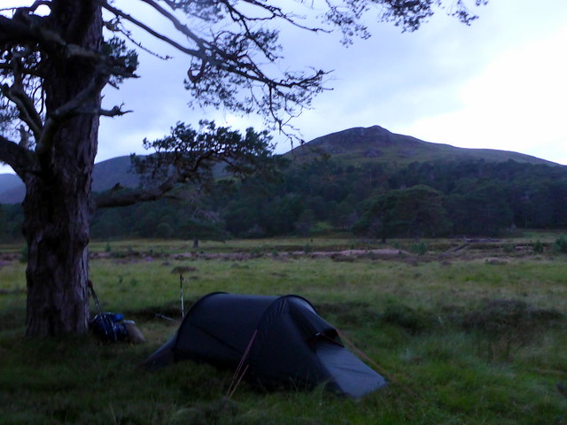
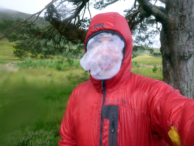
Back to the Cairngorms. I swear - the more time I spend in these mountains the more I love them. Drove up to Linn of Dee on Friday night - arrived about 8 and sat in the car eating our sandwiches as the rain thrummed on the roof. Not an auspicious start, but it did go off a while later and we ventured into the moist air to saddle up and set off for Derry Lodge amidst a cloud of midges. A gentle breeze diminished them as we strode along the track, arriving at Derry Lodge about an hour later. There were a couple of tents pitched by the river - we selected a spot underneath a pine tree, put the midge nets on to pitch and settled down for the night on a carpet of moss. Allison discovered an earwig still alive and well that must have come from our trip to Kearvaig last weekend - some transplantation of habitat for it, from the far north to the ancient Caledonian pine forest of the Cairngorms.
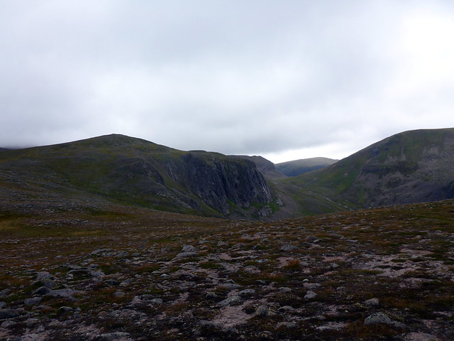
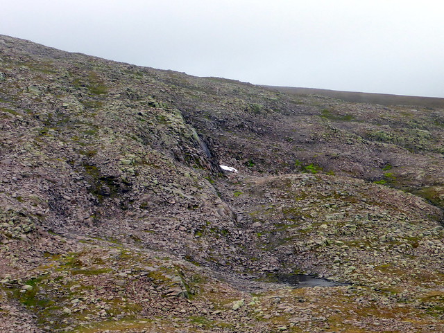
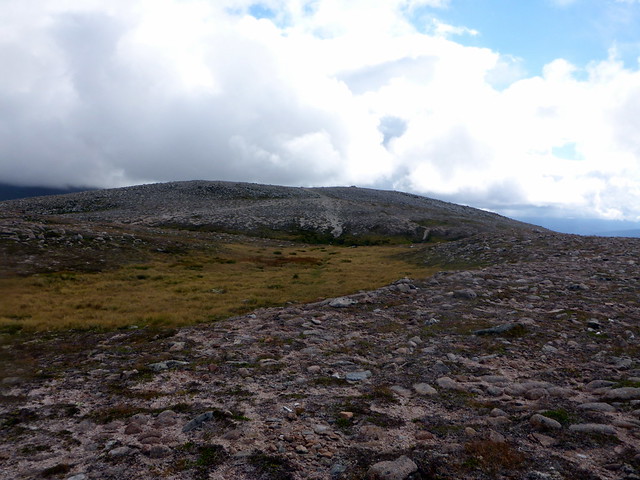
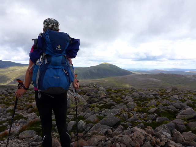
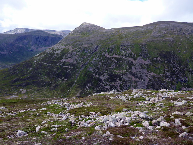
 P1160697 by Al, on Flickr
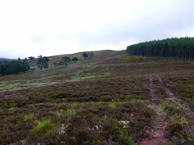
Plan for Saturday was to head up the tail of Derry Cairngorm, taking in the Simm Carn Crom we'd bypassed last time, then over DC and onto the three Tops that lie between it and MacDhui. Only there are more Tops in there that Allison hadn't done than I had realised - bad planning on my part. But more of that later. We decided to leave the tent pitched rather than lug the kit and caboodle with us when we were returning to the same spot - a bit risky I suppose, but the area around Derry Lodge is a bit like an informal campsite anyway.
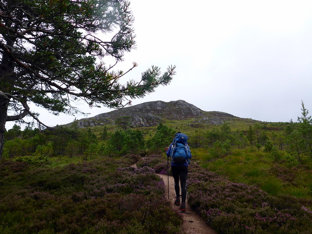
Clag was covering the peaks as we set off through the forest on a path that headed just where we wanted to go. We entered the clag at around 750m and made a short detour from the path to visit Carm Crom cairn. An easy amble from there up to the summit of Derry Cairngorm, rain having started and a cold wind whipping over the hillside. Met a couple of guys "out for a walk", one wearing a poncho from the Paris Marathon.
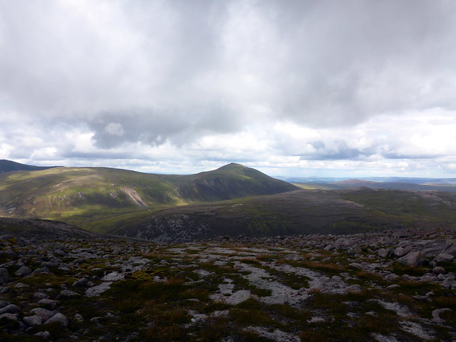
 P1160699 by Al, on Flickr
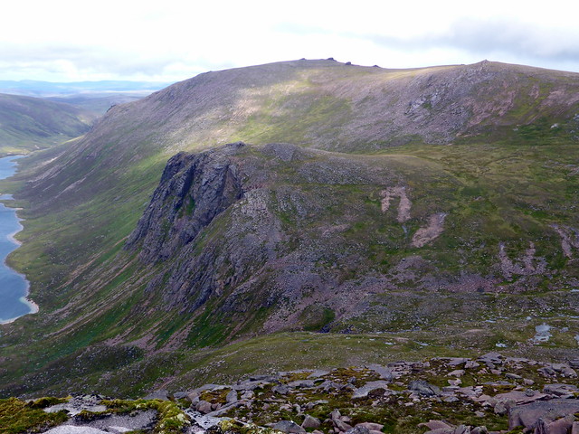
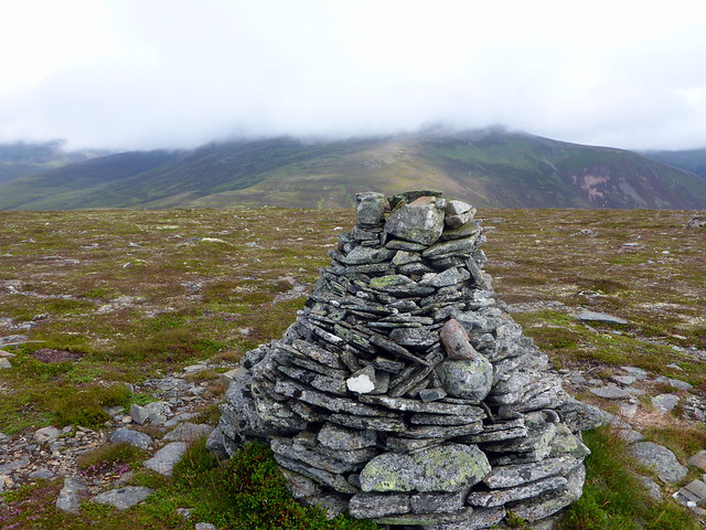
Carn Crom
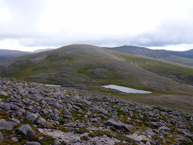
 P1160702 by Al, on Flickr
Onwards and eastwards, skirting Coire an Lochain Uaine to reach the diminutive Top of Sgurr an Lochain Uaine at a mere 983m. The fine cliffs around Coire Etchachan stood ahead of us. We continued on to Creagan a'Choire Etchachan and stopped for lunch - which I discovered I'd left in the tent... we had to make do with crisps and snack bars which was not ideal. I also realised I hadn't put Carn Etchachan into our route. I remembered it as being quite a way from MacDhui's summit and didn't really fancy an out-and-back from there, so we looked for alternatives on the map. Having made our selection we headed west to join the track up to MacDhui then turning right around Main Spout to cross the soggy hillside.
Towards Sgurr an Lochain Uaine
 P1160704 by Al, on Flickr
Coire Etchachan
 P1160706 by Al, on Flickr
 P1160707 by Al, on Flickr
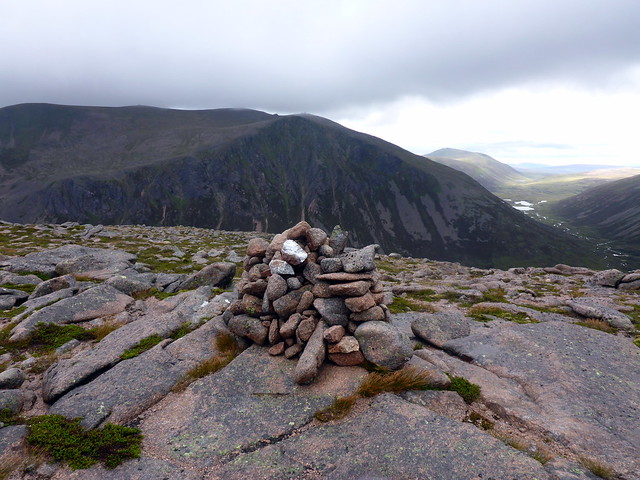
Summit Creagan a'Choire Etchachan
 P1160708 by Al, on Flickr
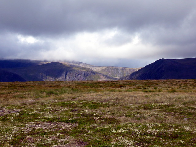
I spotted what must be one of the very last snow patches in Scotland clinging to the rocky slopes as we followed the course of the Garbh Uisge Mor towards Carn Etchachan. Up to the cairn then out to the smaller cairn at the coire edge, passing some astonishingly red lichen en route. From the cliff edge, Loch A'an lay before us. Nan Shepherd's words came to mind:
Loch A’an, Loch A’an, hoo deep ye lie!
Tell nane yer depth and nane shall I.
Bricht though yer deepmaist pit may be,
Ye’ll haunt me till the day I dee.
Bricht, an’ bricht, an’ bricht as air,
Ye’ll haunt me noo for evermair.
Garbh Uisge Mor
 P1160710 by Al, on Flickr
Snow patch
 P1160711 by Al, on Flickr
 P1160712 by Al, on Flickr
red lichen
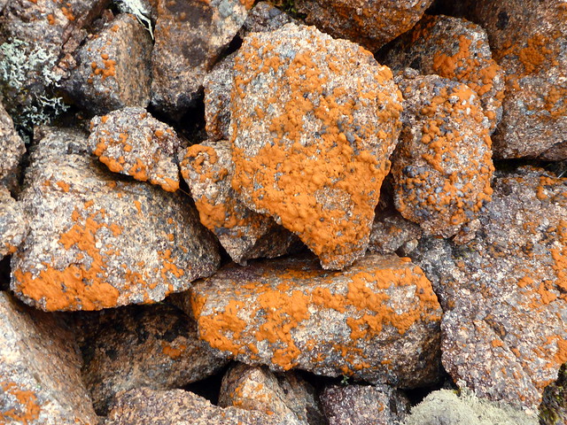 P1160714 by Al, on Flickr
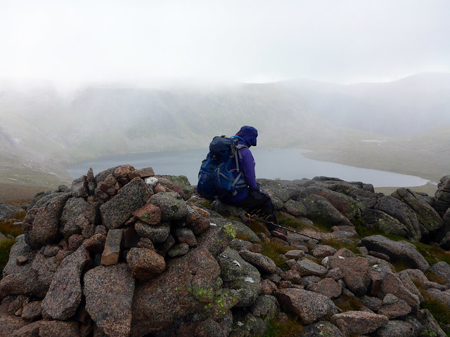
Loch A'an from Carn Etchachan
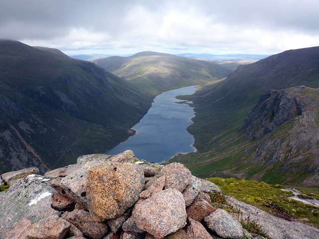 P1160718 by Al, on Flickr
Stacan Dubha - oh no - Allison hasn't climbed that one
 P1160721 by Al, on Flickr
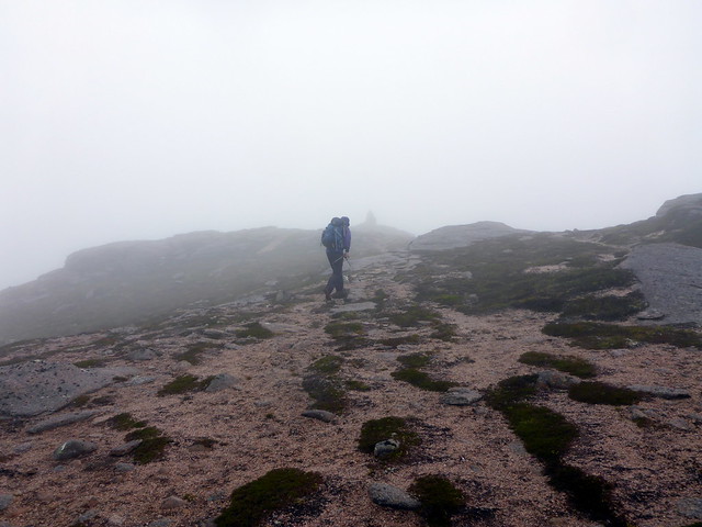
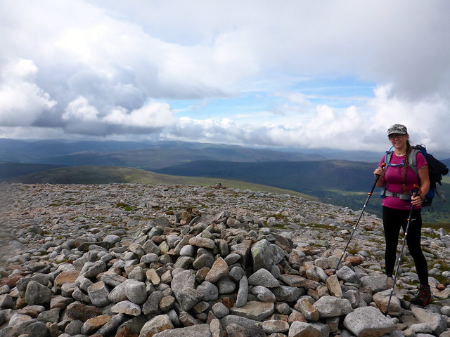
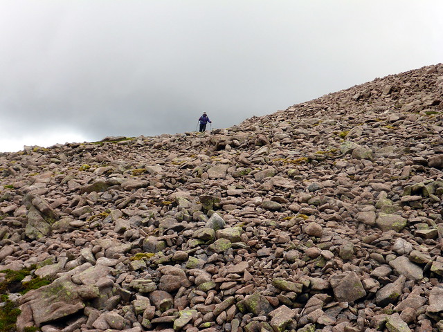
One of these days I must go for a swim there... I also realised that Stacan Dhuba was a Top that Allison hadn't done - damn. A different route might have been selected, with a night by Loch Etchachan if I'd realised that. I reckoned we might add it to tomorrow's route, or make another visit. We continued back towards the top of MacDhui - a bit of a slog over boulders. When your altitude is already 1150m it's a little disconcerting to find you still have over 150m to climb to get to the summit Anyway, get there we did, passing a number of other walkers in the clag. We set off for the final Top of the day, Sron Riach, lying at the southern end of Coire Sputan Dearg. A clear path took us over the boulders and down onto the southern shoulder. I became somewhat disoriented (probably lack of food) and insisted that the hill before us was Derry Cairngorm, which we'd traversed that morning. Allison maintained I was wrong and a look at the map confirmed it to be Carn a Mhaim (which in my defence does look a bit like Derry Cairngorm). Oh dear.
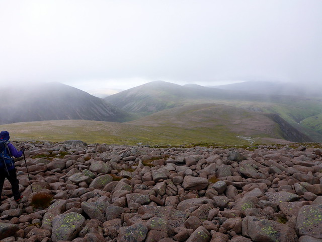
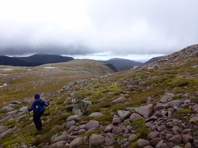
Sron Riach from Sputan Dearg
 P1160723 by Al, on Flickr
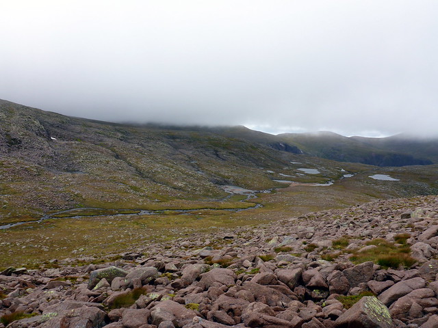
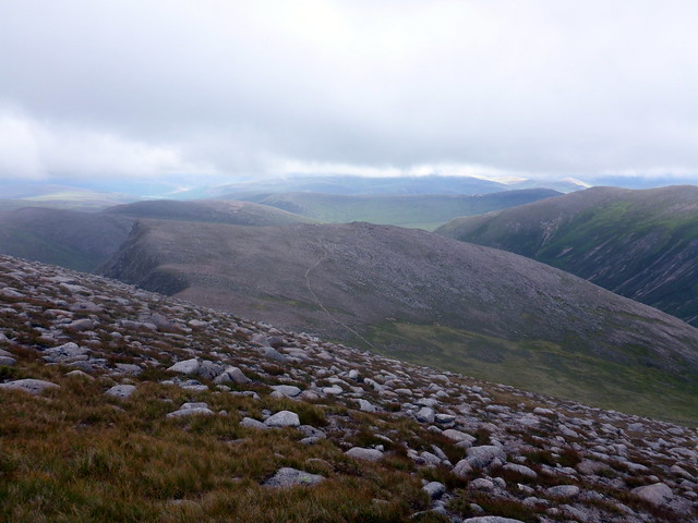
onward path
 P1160725 by Al, on Flickr
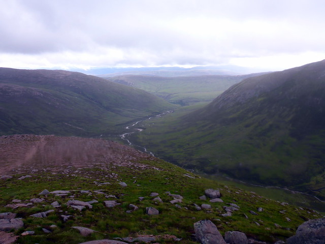
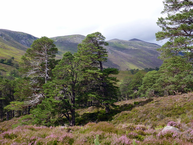
We walked down to where the confluence of rivers form the Luibeg Burn and then along into Gleann Laoigh Bheag, a pretty walk alongside the river. Allison was sore and tired, I was feeling quite weary myself - I think this was the effect of missing our usual sustenance. But we didn't have to pitch the tent, just make our tea. I dozed off after eating and a quiet night passed.
 P1160727 by Al, on Flickr
 P1160728 by Al, on Flickr
Sunday - plan was to climb Meall an Lundain (Simm) then onto Beinn Bhreac and Beinn a'Chaorainn / Bheag. I remembered the journey from Bhreac to Chaorainn as being very boggy. Whether we'd add on Stacan Dubha or not would be decided depending on our progress. First there was breakfast to make - emerging from the tent I found a shroud of midges hanging around the tent...breakfast was definately not vegan We daringly left the tent pitched again and set off along the south shore of the Derry Burn. An ATV track ascends Meall an Lundain, making progress a little easier than romping through the untamed heather.
A mildly scary sight
 P1160729 by Al, on Flickr
Up Meall an Lundain
 P1160730 by Al, on Flickr
Summit Lundain
 P1160732 by Al, on Flickr
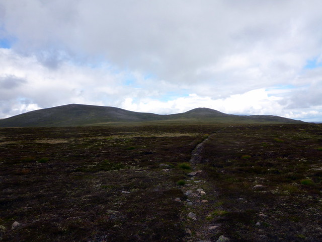
There's around 100m to descend to the bealach with Beinn Bhreac, but then a nice trail up the shoulder of that hill to the summit, which helped our time. Following the path we set off for Beinn a'Chaorainn Bheag, across the Moine Bhealaidh. Mossy bealach - gives it away a bit, no? Actually it was less waterlogged than I remembered - probably the intervening years with Grahams and Marilyns have redefined my perceptions of bogginess. We were atop Bheag before midday and stopped to have lunch, gazing at the might of Bynack More across Glen Avon.
Beinn Bhreac
 P1160733 by Al, on Flickr
 P1160734 by Al, on Flickr
On to the Chaorainns
 P1160736 by Al, on Flickr
 P1160737 by Al, on Flickr
Beinn a'Chaorainn Bheag summit looking to Bynack More
 P1160739 by Al, on Flickr
 P1160741 by Al, on Flickr
A rocky descent to the lochan then up Beinn a'Chaorainn. We sat and looked over at Stob Coire Etchachan and Beinn Mheadhoin. I had kind of decided we would just head back to the car and leave Stacan Dubha for another day (given we'd have 13km still to walk when we got down to the Lairig an Laoigh. I was surprised to find that Allison wanted to "get it done since we're here". Studying the map it appeared it would add 12km if we walked round the south of Stob Coire Etchachan to just do Stacan Dubha and back, or 9km if we took a direct route up and over Stob Coire Etchachan. This is a thing of nightmare for Allison - she distinctly remembers our previous journey ascending 300m up the steep side of Stob Coire Etchachan with big packs and it's a memory invoked whenever a particularly steep or gruelling ascent is undertaken. I was conflicted - part of me wanted the challenge but another part knew it would make the day over 35km and that was probably not wise.
Beinn a'Chaorainn
 P1160742 by Al, on Flickr
 P1160743 by Al, on Flickr
Chaorainn summit
 P1160744 by Al, on Flickr
Stob Coire Etchachan
 P1160746 by Al, on Flickr
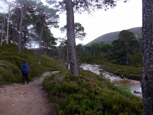
Deciding on sense not glory we descended towards the Lairig an Laoigh and followed the lovely glen back towards the tent. The bridge is still out at Derry Dam, but the higher route is fine - some restoration work underway there. We returned to the tent which was as we'd left it, packed it up amidst a small midge cloud and set off at a brisk pace back to the car, which we reached shortly before 4pm.
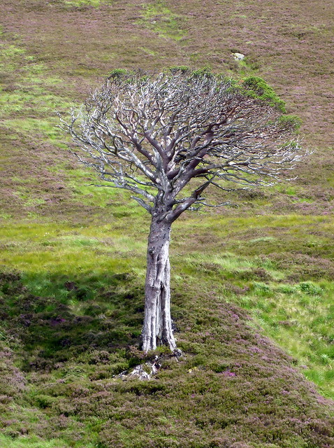
Still clinging to life
 P1160749 by Al, on Flickr
 P1160750 by Al, on Flickr
 P1160752 by Al, on Flickr
 P1160753 by Al, on Flickr
P1160697 by Al, on FlickrPlan for Saturday was to head up the tail of Derry Cairngorm, taking in the Simm Carn Crom we'd bypassed last time, then over DC and onto the three Tops that lie between it and MacDhui. Only there are more Tops in there that Allison hadn't done than I had realised - bad planning on my part. But more of that later. We decided to leave the tent pitched rather than lug the kit and caboodle with us when we were returning to the same spot - a bit risky I suppose, but the area around Derry Lodge is a bit like an informal campsite anyway.
Clag was covering the peaks as we set off through the forest on a path that headed just where we wanted to go. We entered the clag at around 750m and made a short detour from the path to visit Carm Crom cairn. An easy amble from there up to the summit of Derry Cairngorm, rain having started and a cold wind whipping over the hillside. Met a couple of guys "out for a walk", one wearing a poncho from the Paris Marathon.
P1160699 by Al, on FlickrCarn Crom
P1160702 by Al, on FlickrOnwards and eastwards, skirting Coire an Lochain Uaine to reach the diminutive Top of Sgurr an Lochain Uaine at a mere 983m. The fine cliffs around Coire Etchachan stood ahead of us. We continued on to Creagan a'Choire Etchachan and stopped for lunch - which I discovered I'd left in the tent... we had to make do with crisps and snack bars which was not ideal. I also realised I hadn't put Carn Etchachan into our route. I remembered it as being quite a way from MacDhui's summit and didn't really fancy an out-and-back from there, so we looked for alternatives on the map. Having made our selection we headed west to join the track up to MacDhui then turning right around Main Spout to cross the soggy hillside.
Towards Sgurr an Lochain Uaine
P1160704 by Al, on FlickrCoire Etchachan
P1160706 by Al, on FlickrP1160707 by Al, on FlickrSummit Creagan a'Choire Etchachan
P1160708 by Al, on FlickrI spotted what must be one of the very last snow patches in Scotland clinging to the rocky slopes as we followed the course of the Garbh Uisge Mor towards Carn Etchachan. Up to the cairn then out to the smaller cairn at the coire edge, passing some astonishingly red lichen en route. From the cliff edge, Loch A'an lay before us. Nan Shepherd's words came to mind:
Loch A’an, Loch A’an, hoo deep ye lie!
Tell nane yer depth and nane shall I.
Bricht though yer deepmaist pit may be,
Ye’ll haunt me till the day I dee.
Bricht, an’ bricht, an’ bricht as air,
Ye’ll haunt me noo for evermair.
Garbh Uisge Mor
P1160710 by Al, on FlickrSnow patch
P1160711 by Al, on FlickrP1160712 by Al, on Flickrred lichen
P1160714 by Al, on FlickrLoch A'an from Carn Etchachan
P1160718 by Al, on FlickrStacan Dubha - oh no - Allison hasn't climbed that one
P1160721 by Al, on FlickrOne of these days I must go for a swim there... I also realised that Stacan Dhuba was a Top that Allison hadn't done - damn. A different route might have been selected, with a night by Loch Etchachan if I'd realised that. I reckoned we might add it to tomorrow's route, or make another visit. We continued back towards the top of MacDhui - a bit of a slog over boulders. When your altitude is already 1150m it's a little disconcerting to find you still have over 150m to climb to get to the summit
Sron Riach from Sputan Dearg
P1160723 by Al, on Flickronward path
P1160725 by Al, on FlickrWe walked down to where the confluence of rivers form the Luibeg Burn and then along into Gleann Laoigh Bheag, a pretty walk alongside the river. Allison was sore and tired, I was feeling quite weary myself - I think this was the effect of missing our usual sustenance. But we didn't have to pitch the tent, just make our tea. I dozed off after eating and a quiet night passed.
P1160727 by Al, on FlickrP1160728 by Al, on FlickrSunday - plan was to climb Meall an Lundain (Simm) then onto Beinn Bhreac and Beinn a'Chaorainn / Bheag. I remembered the journey from Bhreac to Chaorainn as being very boggy. Whether we'd add on Stacan Dubha or not would be decided depending on our progress. First there was breakfast to make - emerging from the tent I found a shroud of midges hanging around the tent...breakfast was definately not vegan
A mildly scary sight
P1160729 by Al, on FlickrUp Meall an Lundain
P1160730 by Al, on FlickrSummit Lundain
P1160732 by Al, on FlickrThere's around 100m to descend to the bealach with Beinn Bhreac, but then a nice trail up the shoulder of that hill to the summit, which helped our time. Following the path we set off for Beinn a'Chaorainn Bheag, across the Moine Bhealaidh. Mossy bealach - gives it away a bit, no? Actually it was less waterlogged than I remembered - probably the intervening years with Grahams and Marilyns have redefined my perceptions of bogginess. We were atop Bheag before midday and stopped to have lunch, gazing at the might of Bynack More across Glen Avon.
Beinn Bhreac
P1160733 by Al, on FlickrP1160734 by Al, on FlickrOn to the Chaorainns
P1160736 by Al, on FlickrP1160737 by Al, on FlickrBeinn a'Chaorainn Bheag summit looking to Bynack More
P1160739 by Al, on FlickrP1160741 by Al, on FlickrA rocky descent to the lochan then up Beinn a'Chaorainn. We sat and looked over at Stob Coire Etchachan and Beinn Mheadhoin. I had kind of decided we would just head back to the car and leave Stacan Dubha for another day (given we'd have 13km still to walk when we got down to the Lairig an Laoigh. I was surprised to find that Allison wanted to "get it done since we're here". Studying the map it appeared it would add 12km if we walked round the south of Stob Coire Etchachan to just do Stacan Dubha and back, or 9km if we took a direct route up and over Stob Coire Etchachan. This is a thing of nightmare for Allison - she distinctly remembers our previous journey ascending 300m up the steep side of Stob Coire Etchachan with big packs and it's a memory invoked whenever a particularly steep or gruelling ascent is undertaken. I was conflicted - part of me wanted the challenge but another part knew it would make the day over 35km and that was probably not wise.
Beinn a'Chaorainn
P1160742 by Al, on FlickrP1160743 by Al, on FlickrChaorainn summit
P1160744 by Al, on FlickrStob Coire Etchachan
P1160746 by Al, on FlickrDeciding on sense not glory we descended towards the Lairig an Laoigh and followed the lovely glen back towards the tent. The bridge is still out at Derry Dam, but the higher route is fine - some restoration work underway there. We returned to the tent which was as we'd left it, packed it up amidst a small midge cloud and set off at a brisk pace back to the car, which we reached shortly before 4pm.
Still clinging to life
P1160749 by Al, on FlickrP1160750 by Al, on FlickrP1160752 by Al, on FlickrP1160753 by Al, on Flickr