free to be able to rate and comment on reports (as well as access 1:25000 mapping).
I’d not been out in the hills since MountainStar’s Snowdonia meet at the beginning of September, in spite of now having all the time in the world to walk. A combination of other commitments, plus forecasts of poor weather on the days I had available, had conspired to ensure I didn’t manage any hill time. And I was feeling increasingly stir-crazy.

All of a sudden, though, I had a time slot when the forecast at least for one day - Thursday 12th October – looked acceptable: generally fine, clear, with just a few short periods of mist and rain. Unfortunately I had to do something in the morning, which meant I wouldn’t be able to get into the hills before lunchtime, so I had to go for a half-day route.
I’d noticed some red pins to the West of Snowdon group....
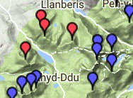
....and looking at pics of these hills and poring over the map, Mynydd Mawr at least looked to have plenty of character, and the lie of contours indicated that I could expect really good views looking southwards of the Nantlle Ridge and Irish Sea. The ridge on the east side of the valley also seemed appealing – from the map it looked like it would be clear open ridge walking, that should afford great views of many of the Welsh 3000ers - of Yr Wyddfa and of the entire ridge from Elidir Fawr to Tryfan. So I planned a round that encompassed the 4 Hewitts in question....
... starting from the Warden’s area indicated on the map. Unfortunately, when I get there, it transpires that there is no parking at the Warden’s area (though there are vast areas of what looks like parking hardstanding, plus camping areas - there are even a few tents pitched - access to which is closed off by padlocked gates); so I have to park about a kilometre or so further along the A4085 at a point where the road is wide enough to be able to do so safely. I imagine it could be really quite difficult to find somewhere to park in the vicinity during the school holidays.
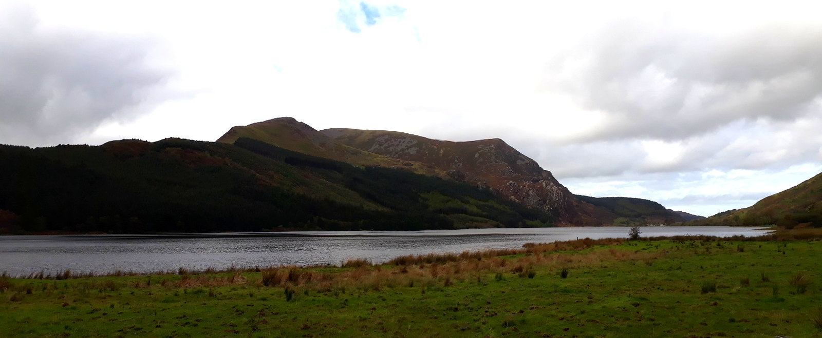
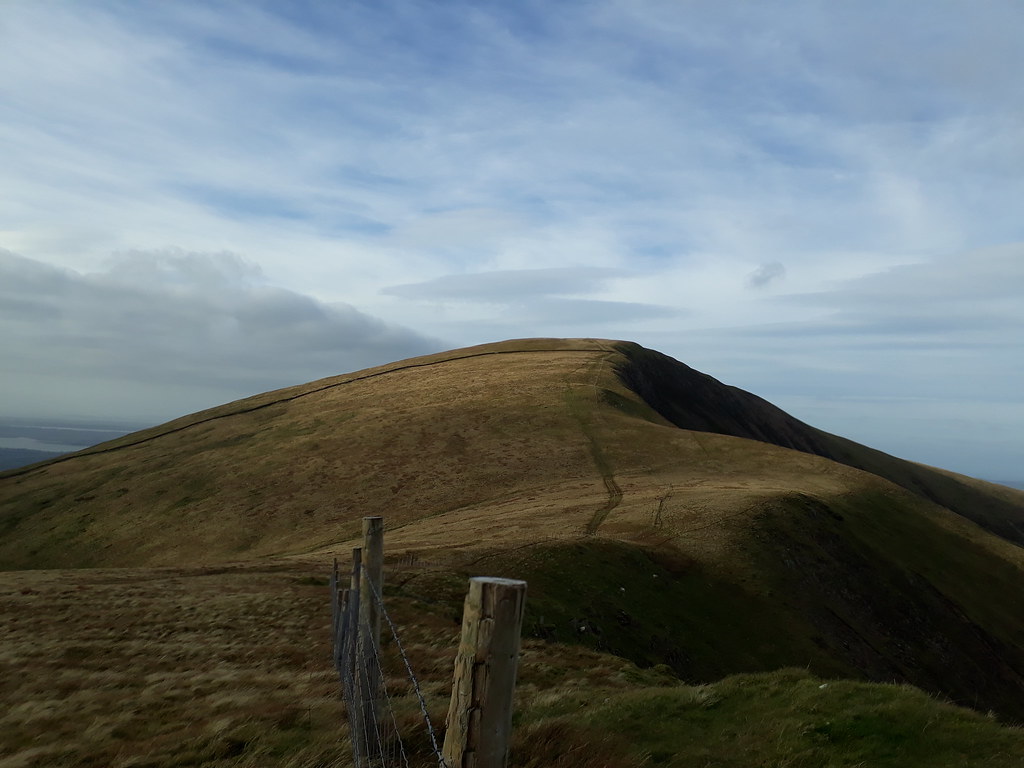
20171012_125713. The first objective, Mynydd Mawr, looking WNW from where I parked the car.
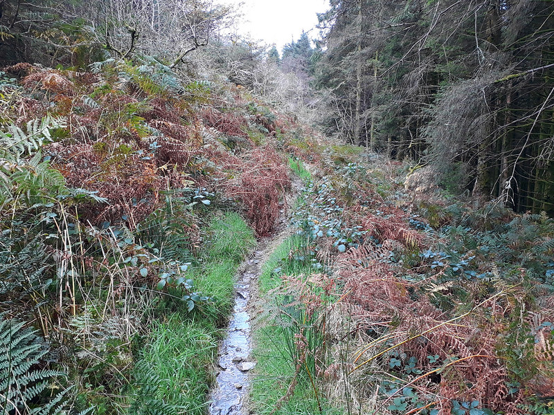
20171012_131011. The first part of the route follows a muddy track uphill through forest for a kilometre or so. The mud is not wholly unexpected: I’d heard that over 75mm of rain had fallen at Capel Curig on the Tuesday!!!
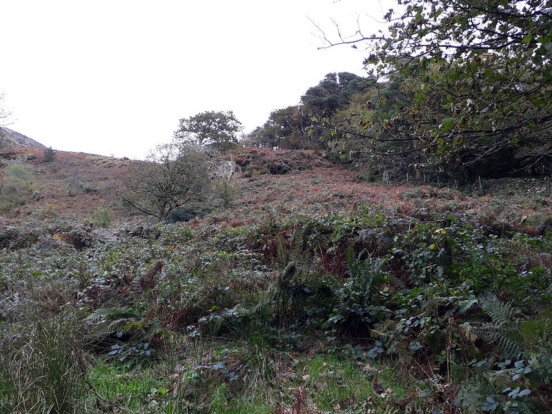
20171012_131818. Then it reaches the open hillside.
20171012_131714. Pano - Y Garn (Nantlle Ridge) on the left, Foel Rudd on the right.
On the ascent I meet the only other walkers I see all day, a couple on their way down. They mention that it's pretty blowy on the top.

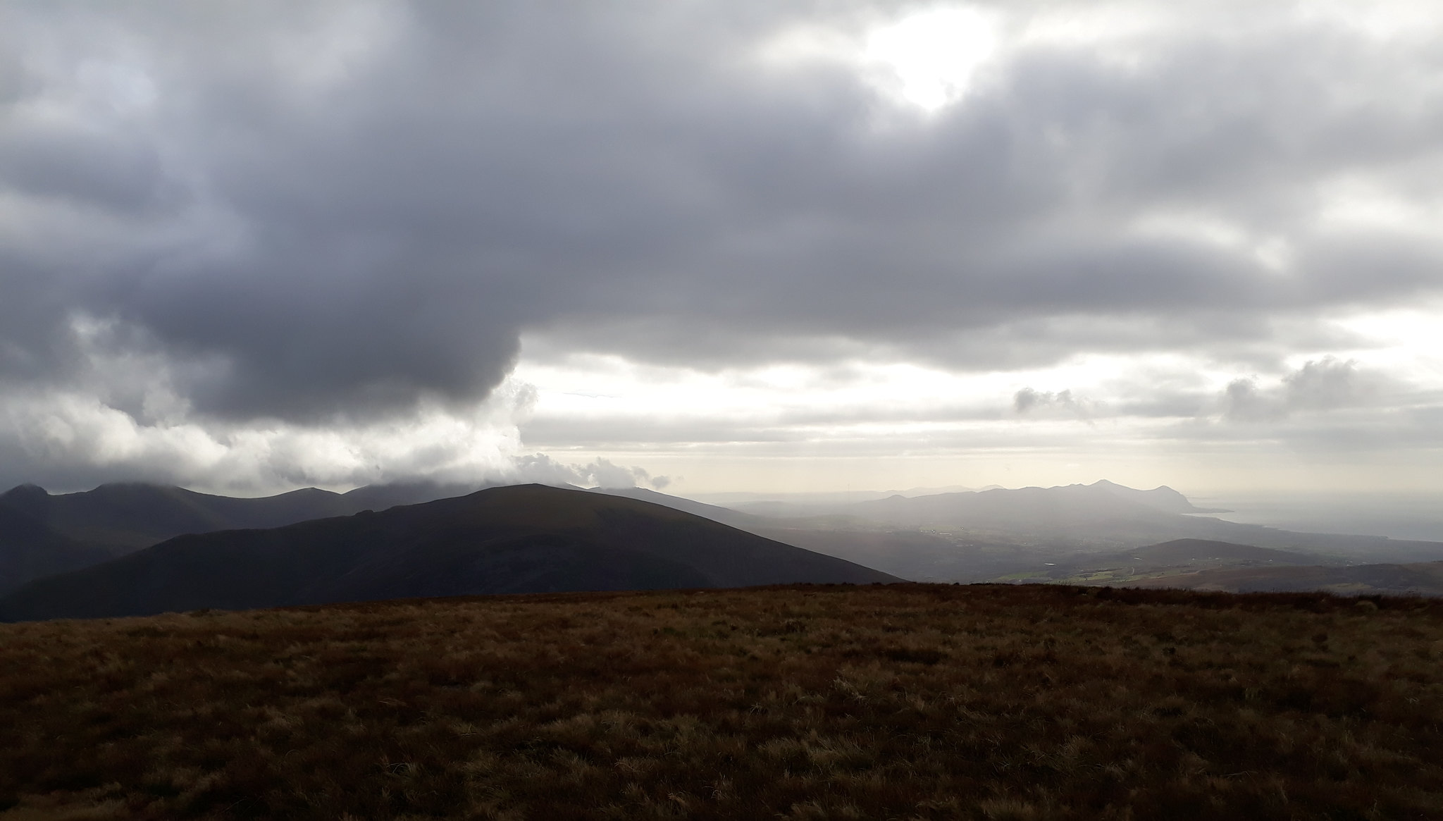
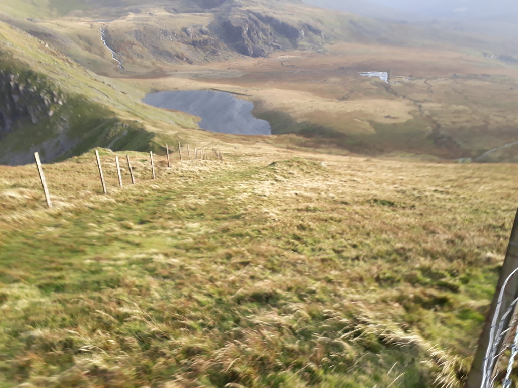
20171012_133443. Looking back ESE along the ascent route from close to Foel Rudd. The cloud is lower than forecast - it was supposed to come in towards the end of the day...
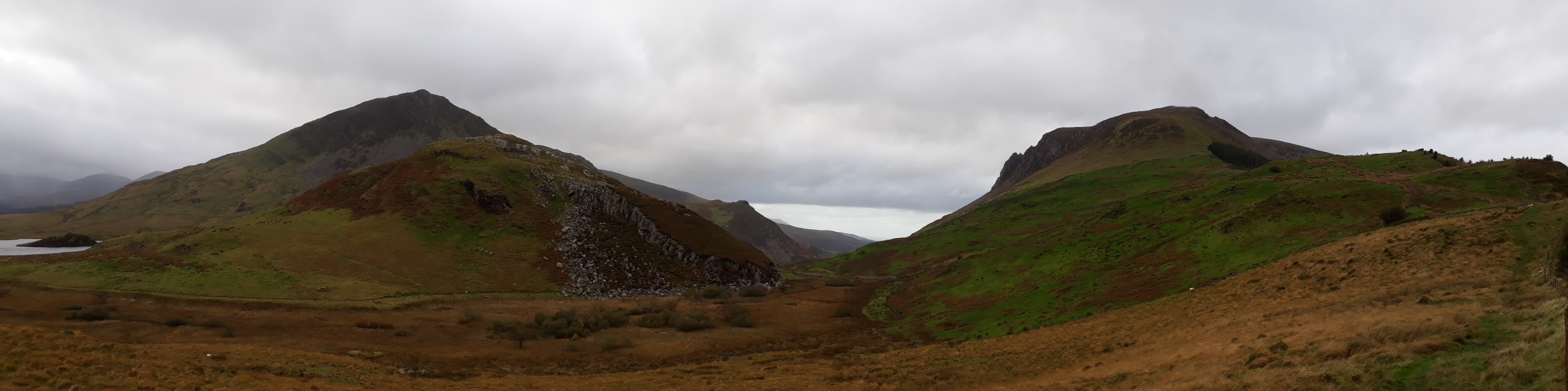
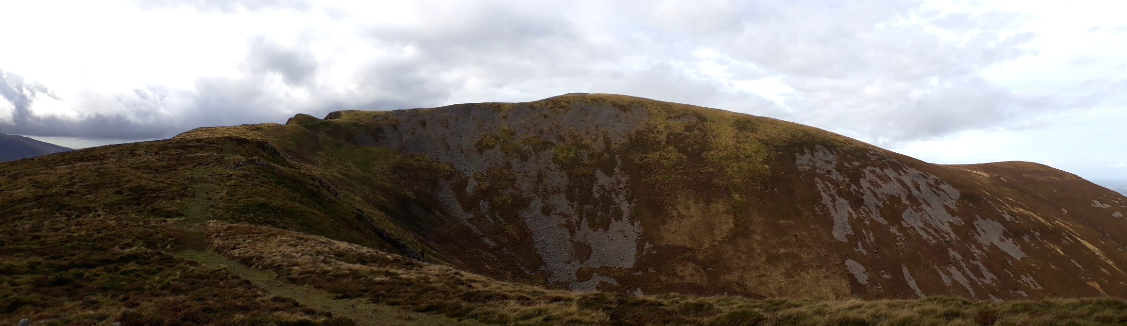
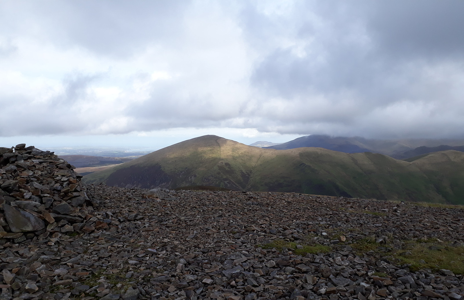
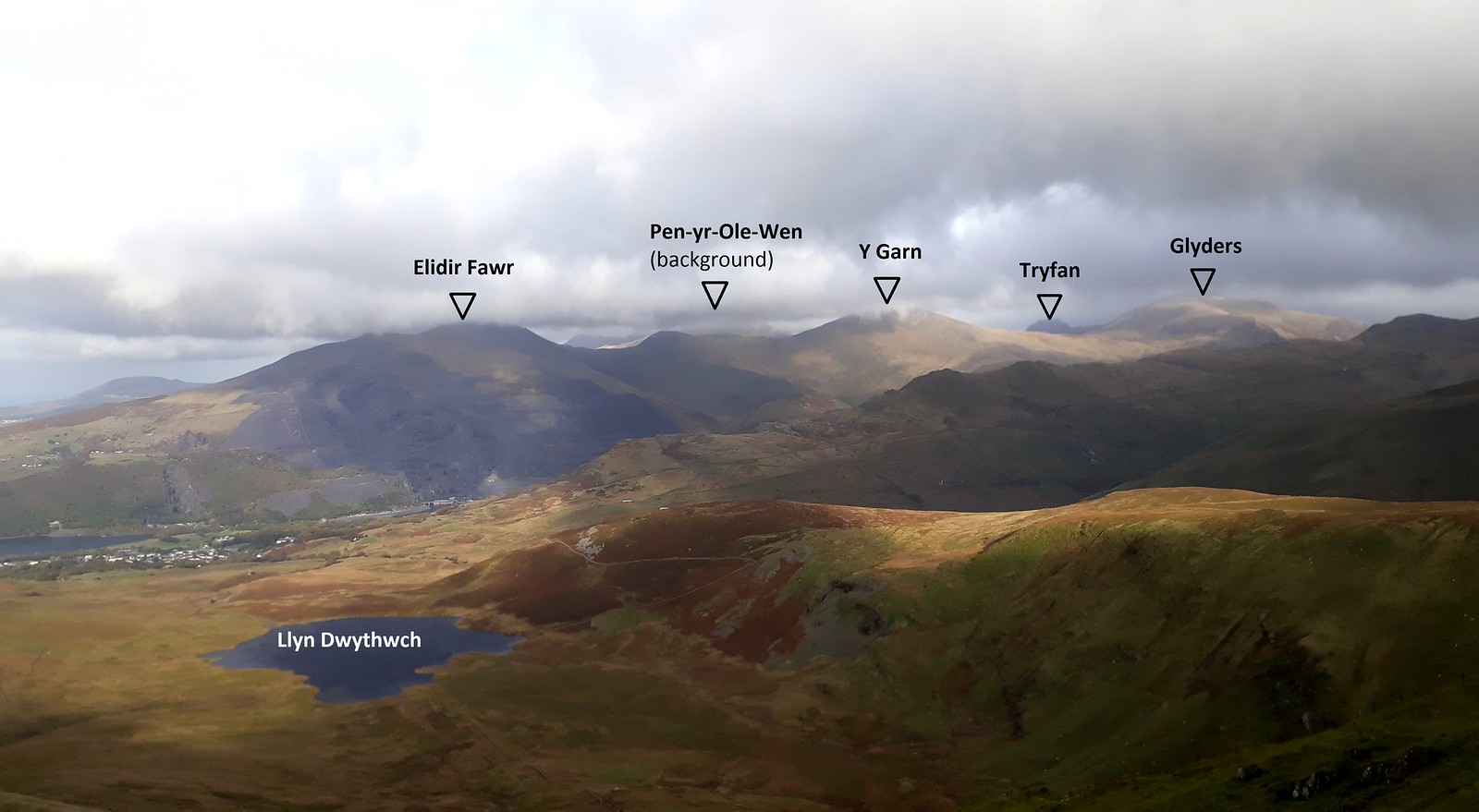
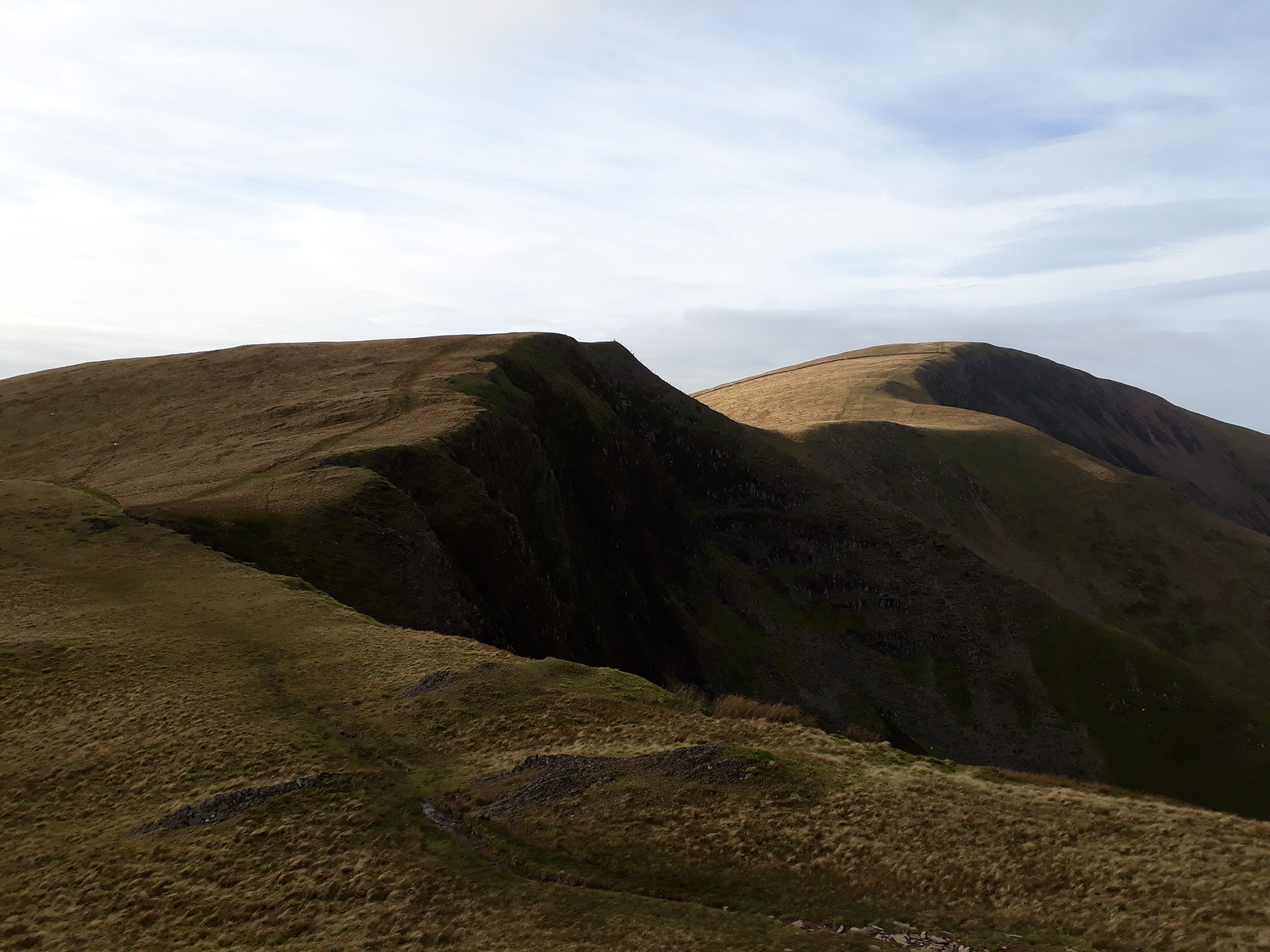
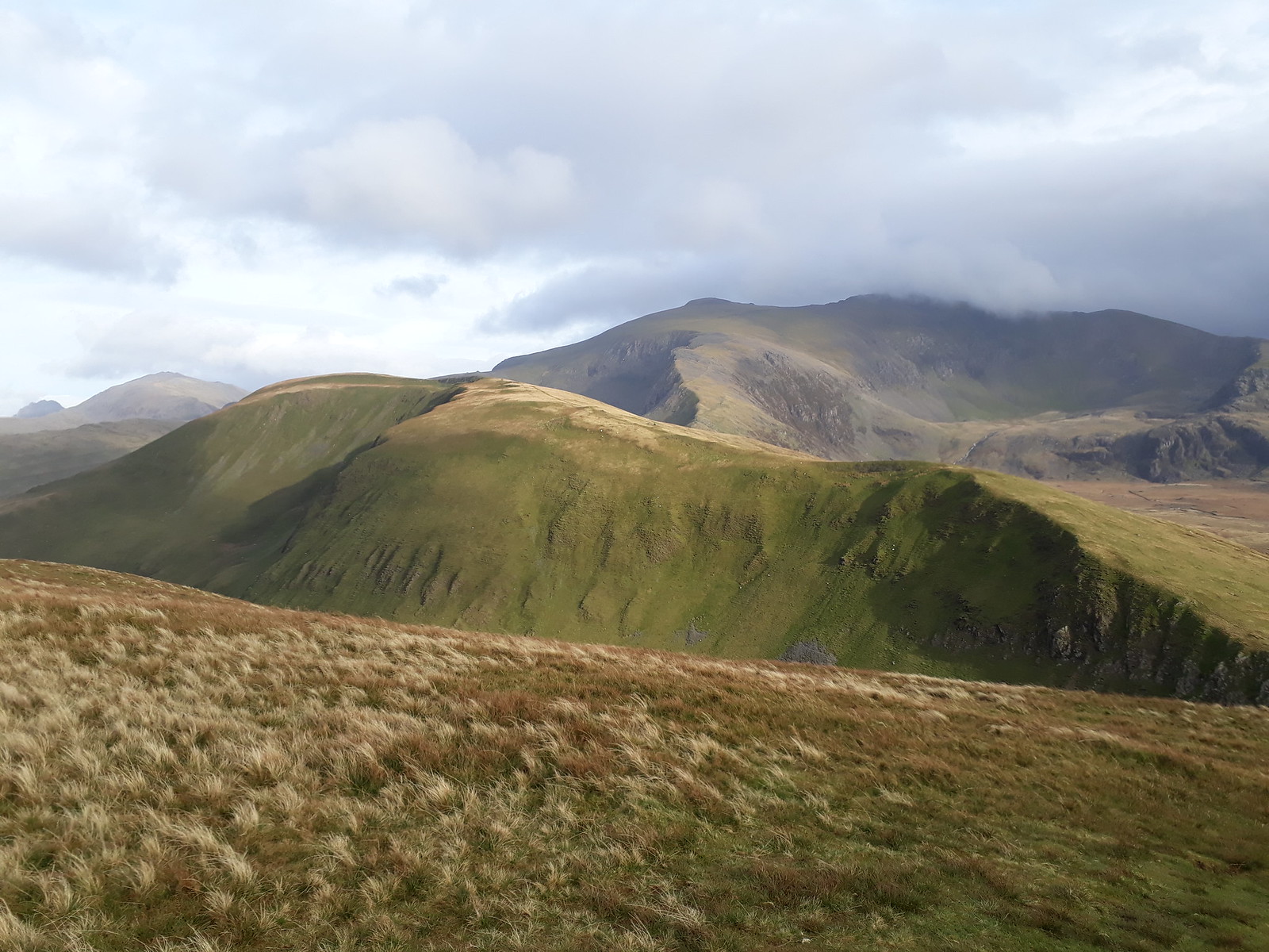
20171012_133506. Pano from the same location, showing the ridge on the other side of the valley...
20171012_133506. ... and the same view with the 3 Hewitts on it labelled.
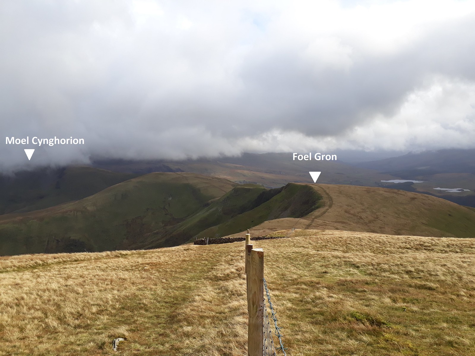
20171012_134301. Looking more or less north from Foel Rudd summit across to Moel Eilio (LHS) and Foel Gron (RHS)...
20171012_134335.. ... and north west along the ridge towards Mynydd Mawr.

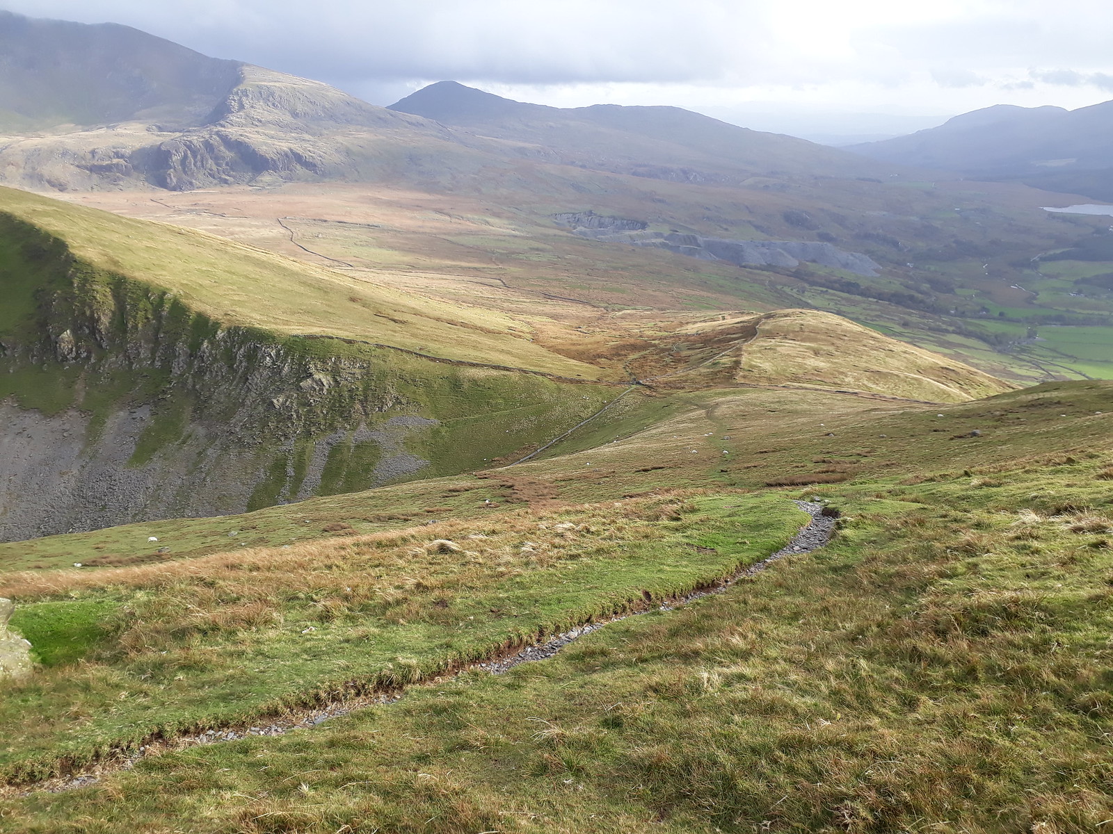
20171012_134518. The route ahead (RHS): easy walking, leaving plenty of opportunity to enjoy the views south across to the Nantlle Ridge.
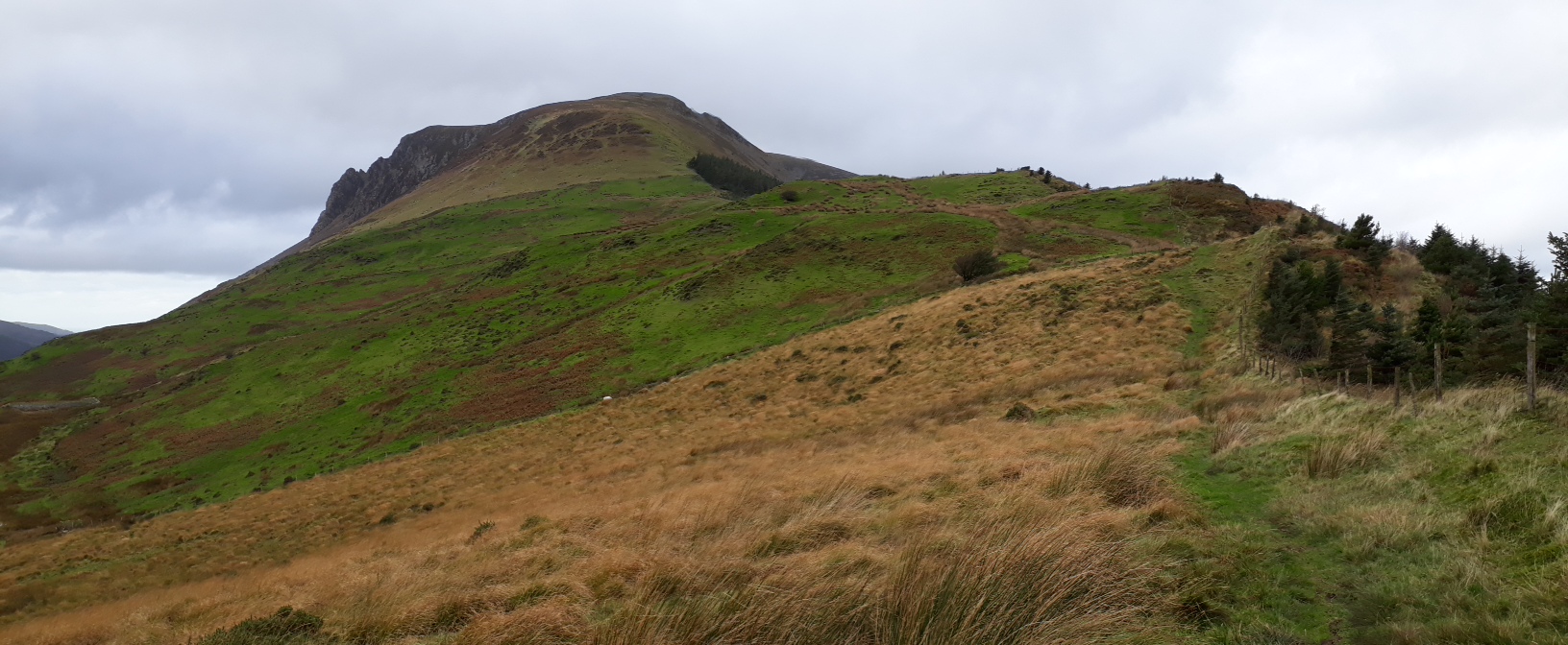
20171012_135235.
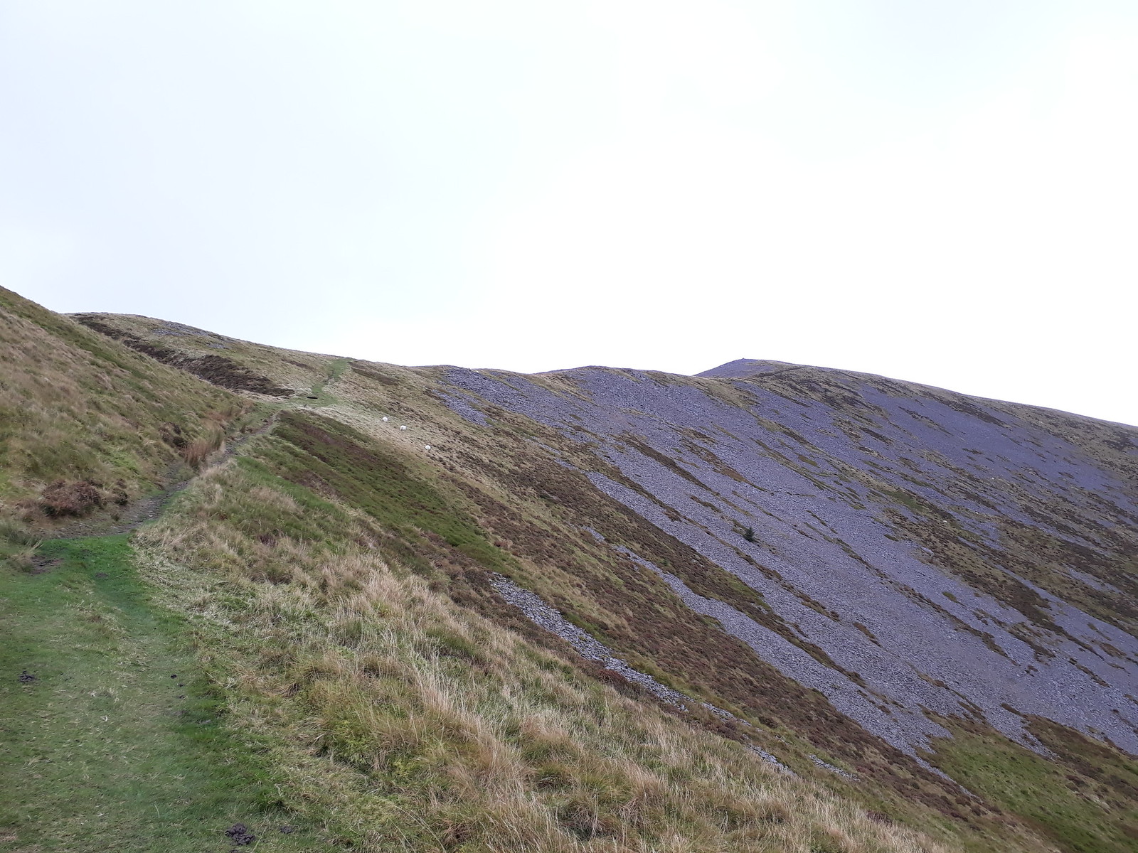
20171012_135252. The route up to Mynydd Mawr.
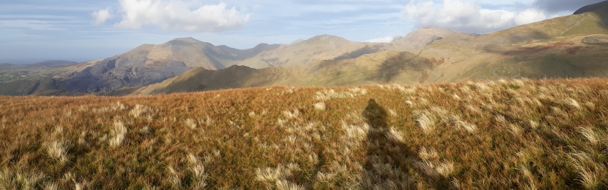
20171012_135706. Dramatic dynamic cloudscapes on the way (here looking out south towards the Lleyn Peninsula.
20171012_140214. I reach the summit about an hour after starting. This view is looking north east across to Moel Eilio....
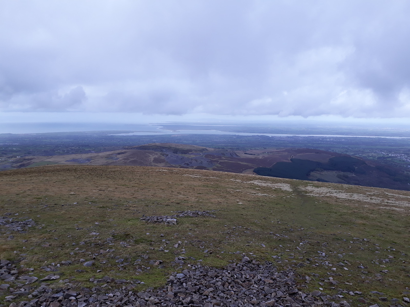
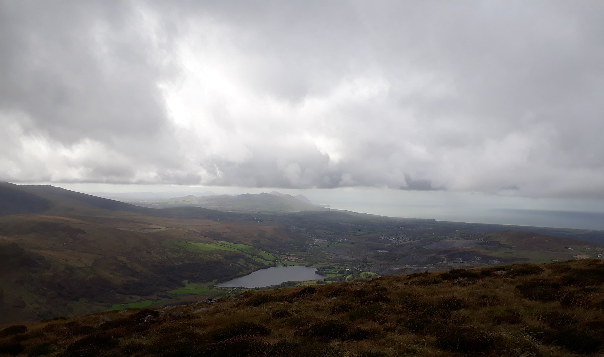
20171012_140406. ... and this north west across to Anglesey. Although the air temperature is quite high for the time of year, the wind is pretty strong so there's quite a chill factor, and I don't hang around too long.
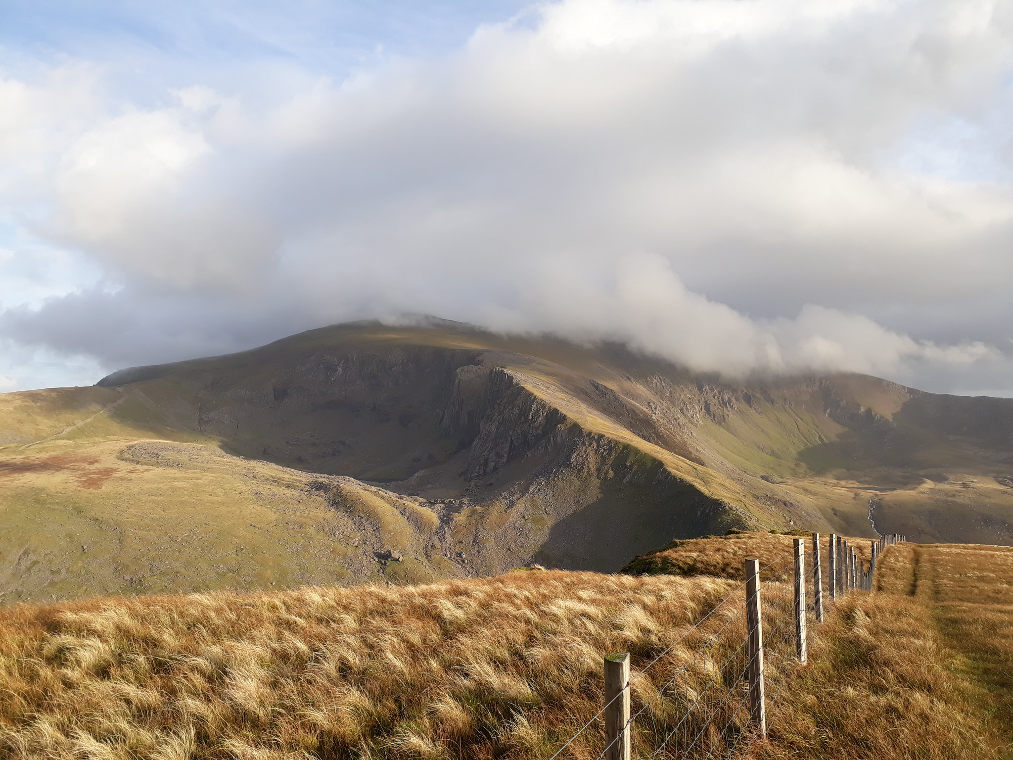
I head off north west initially, rather than heading towards Moel Eilio directly, because the north face of Mynydd Mawr looks from the map like it should be pretty spectacular.
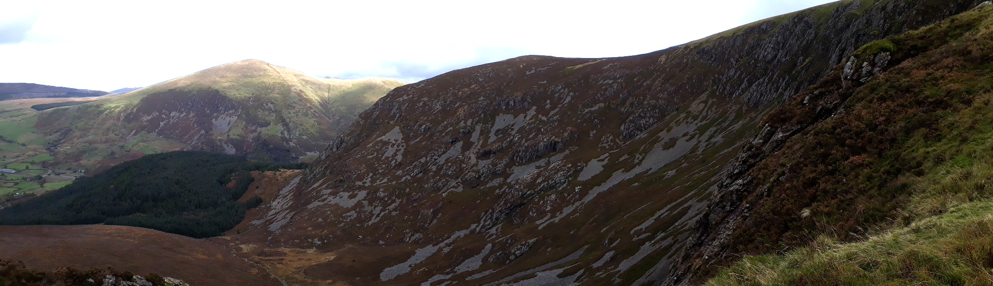
20171012_141302. And it is!
I then swing eastwards about half way down, and head across rough heather, aiming for the centre of a small wood (visible on the LHS of the pic) through which the map indicates there is a path - which indeed there is. Immediately behind the wood is Moel Eilio, the next goal.
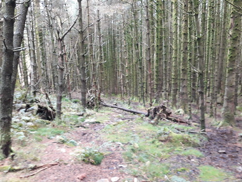
20171012_143656. It's a tad boggy, and blocked in many places with fallen trees, but presents no real problem.
20171012_144054. The end of the wood is marked by a rather charming steel gate, behind which the next goal, Moel Eilio, is visible.
20171012_144234. Some roughish ascent ahead.
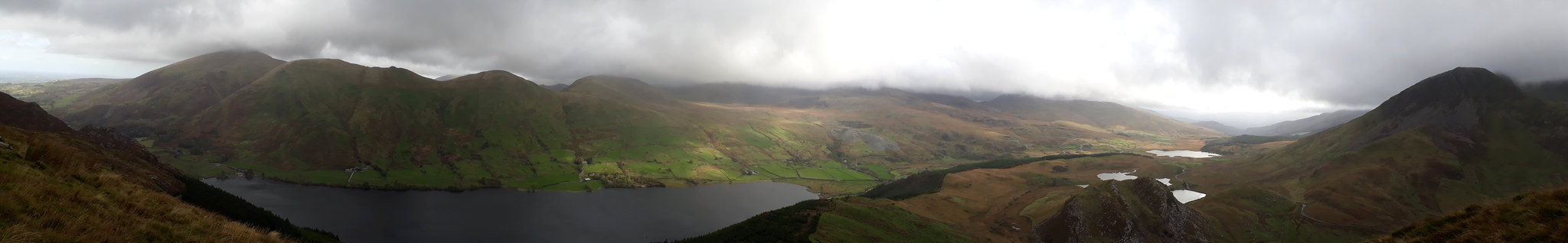
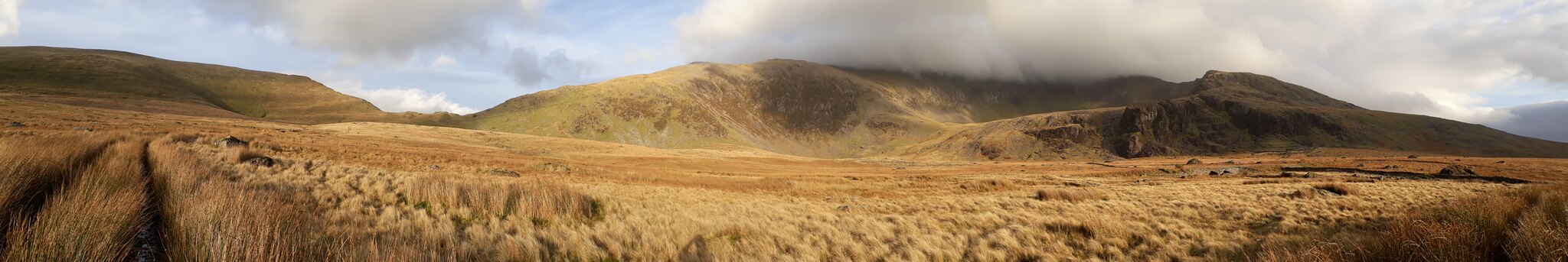
20171012_144349. Green pano looking south east towards Llyn Cwellyn, with what I take to be Yr Aran with its summit in cloud in the centre background.

20171012_144748. Looking at both the map and Google Earth when planning the route, it hadn't been clear to me that there was a crossing of the Afon Gwyfrai at this point, but fortunately it turned out there was. Just as well, given the volume of water flowing! I don't think that the rubble bag technique would have worked so well here....

a bit deep for paddling...
20171012_144954. No path is indicated on the map to start the ascent of Moel Eilio, and most of the hillside is covered with woods (= bad bad bad). I walk along the road for a short distance towards the one bit of hillside that isn't wooded. There's an old metal gate there, but no sign of a path leading from it through the thick tangle of bracken and brambles.
But it looks worse than it is, and pretty soon I'm on clear hillside.
Ascent of Moel Eilio start.
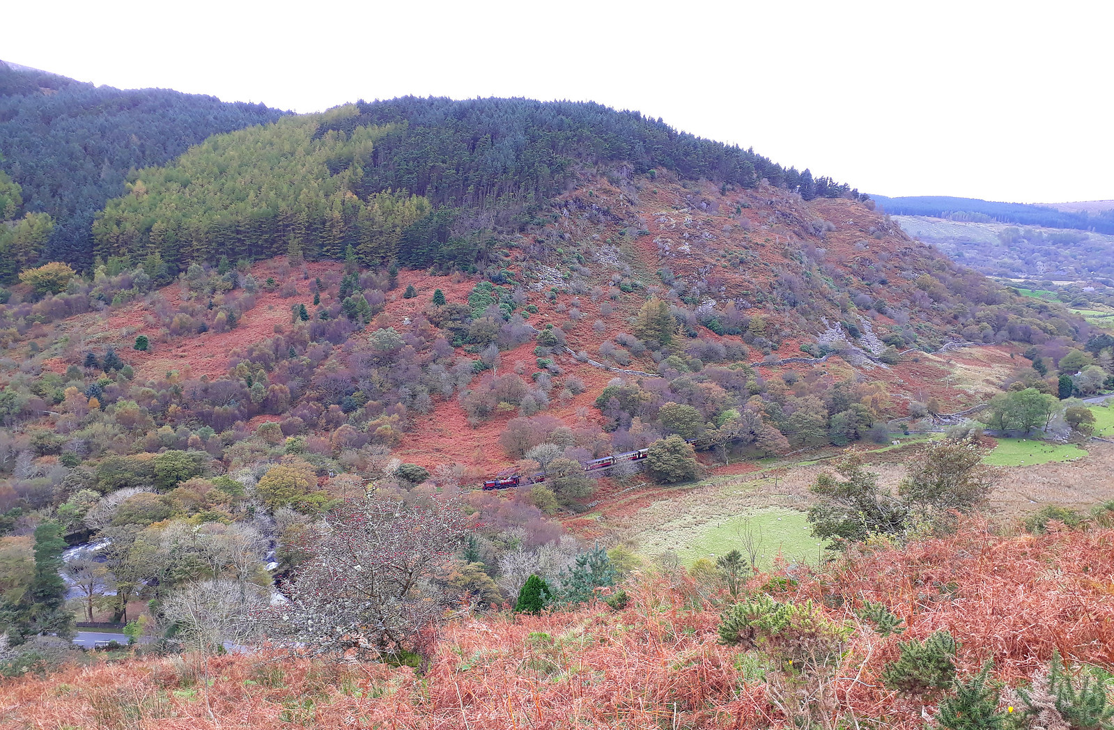
20171012_145813. Just after I clear the bracken-and-bramble jungle, I hear a train's whistle, and look down to see a long train on the narrow gauge Welsh Highland Railway.

20171012_151232. Great views of Mynydd Mawr, Llyn Cwellyn and Nant y Betws on the ascent...
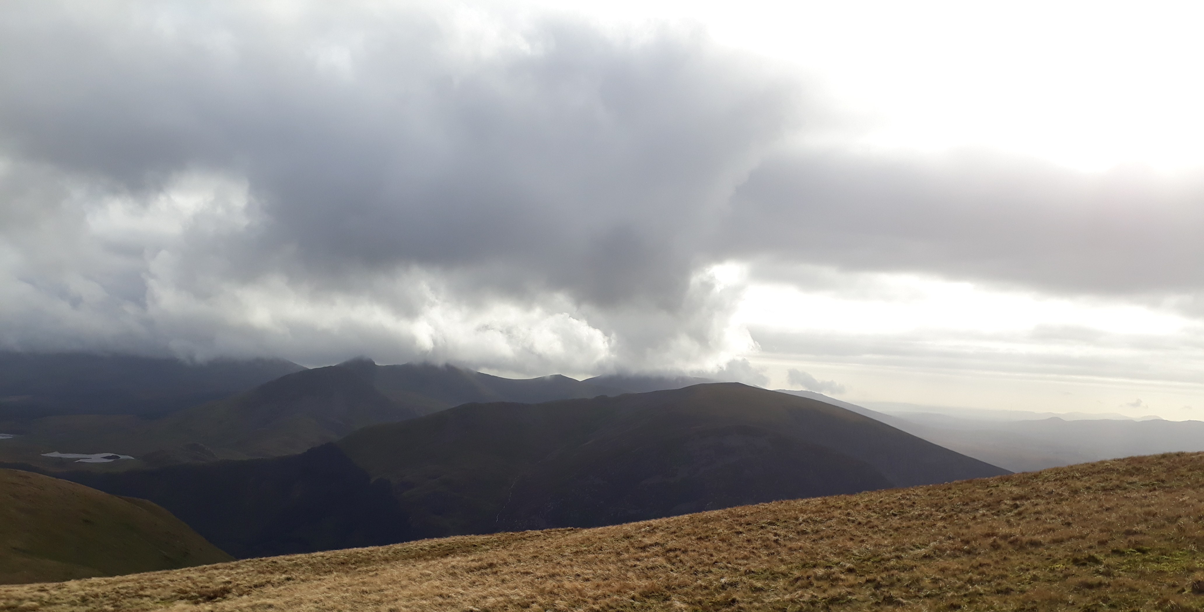
20171012_154708. The summit shelter is large and very welcome: the wind has really got up, and gusts repeatedly knock me off balance. I'm now finding it quite chilly, notwithstanding the relatively high air temperature and the exertion of the climb, so I don another layer and consume a sarnie as I enjoy the views. There is still more and lower cloud than forecast, but somewhat miraculously, the tops I'm heading for are clear (Foel Gron) or almost clear (Moel Cynghorion).
20171012_155542. The cloudscape is constantly and dramatically changing in the howling gale. This looking again towards the Lleyn Peninsula.

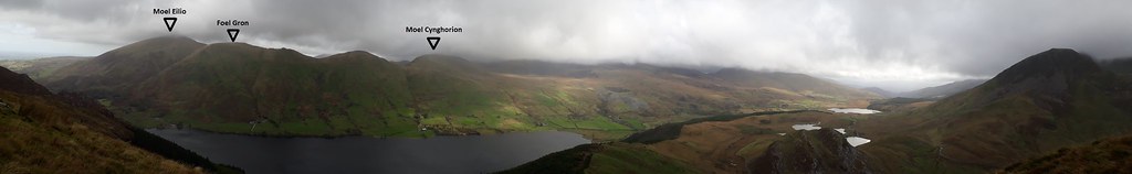
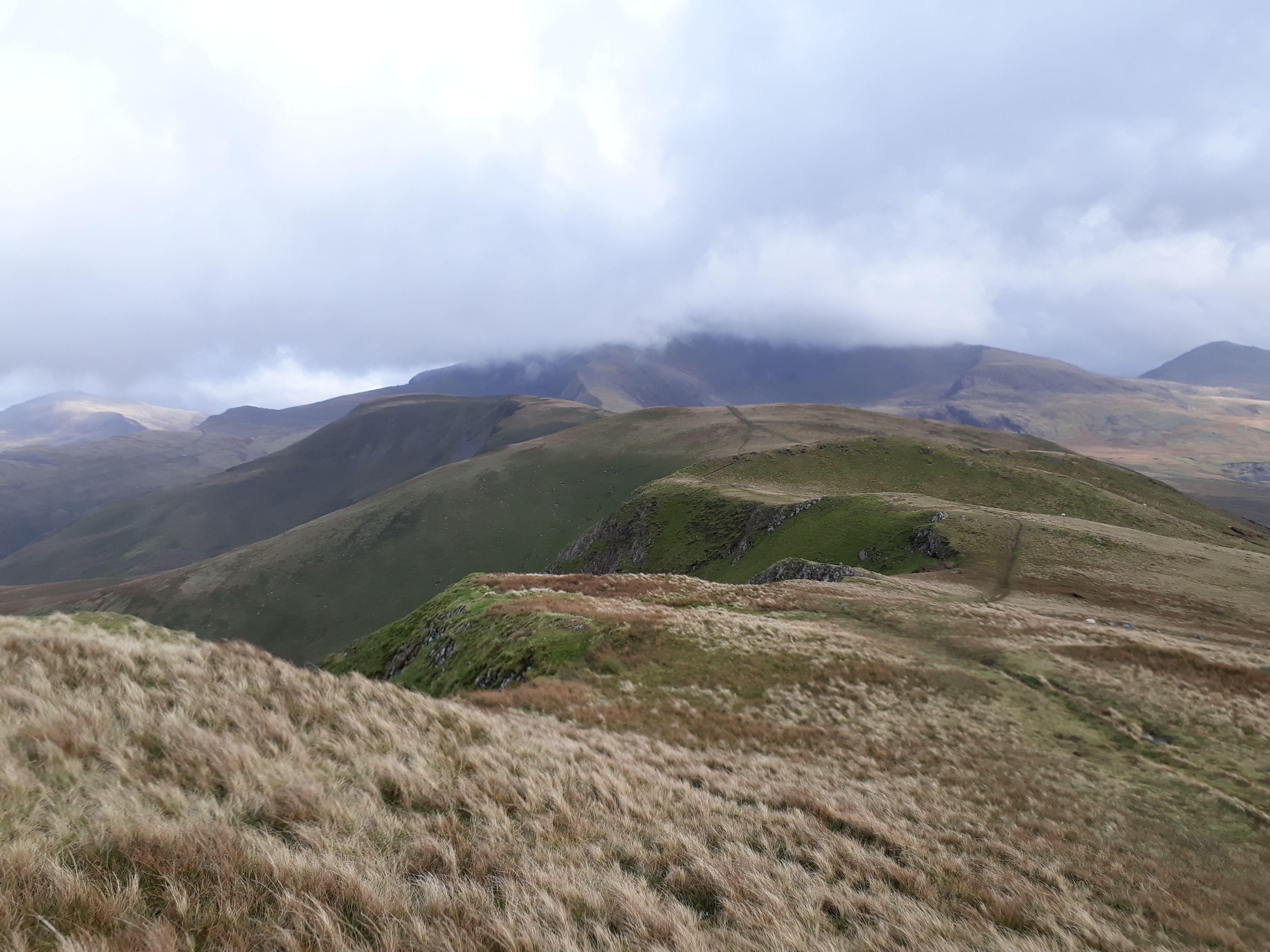
20171012_155716. A view of the next stage of the walk: the ridge from Moel Eilio to Moel Cynghorion.
20171012_155716 - labelled.
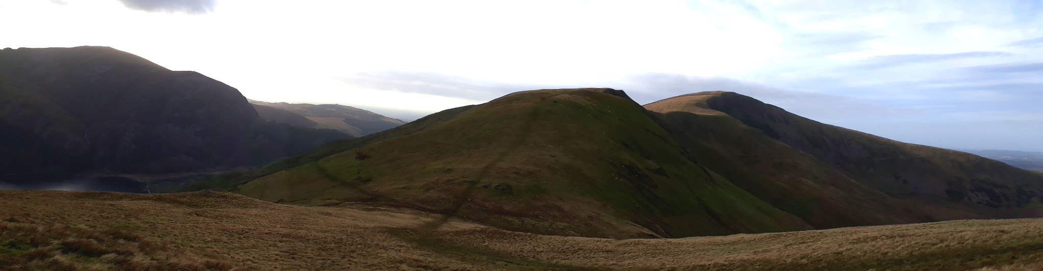
20171012_155731. Looking back at Mynydd Mawr, with the Nantlle Ridge just left of it, and to the extreme left, Moel Hebog.
---------------------------------------------------- Mynydd Mawr - Nantlle Ridge - Moel Hebog.
20171012_160652. And looking back towards Moel Eilio. It's all I can do to stand up in the gale, and I have to steady the camera on a fence post to take the pic.

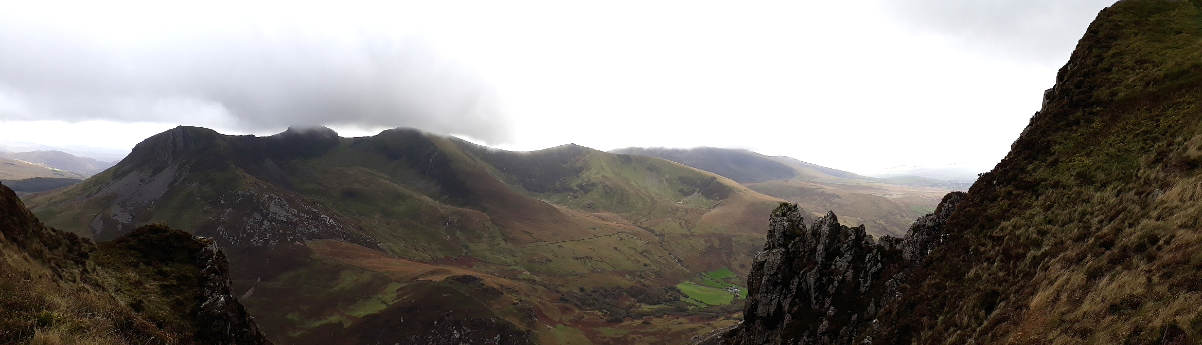
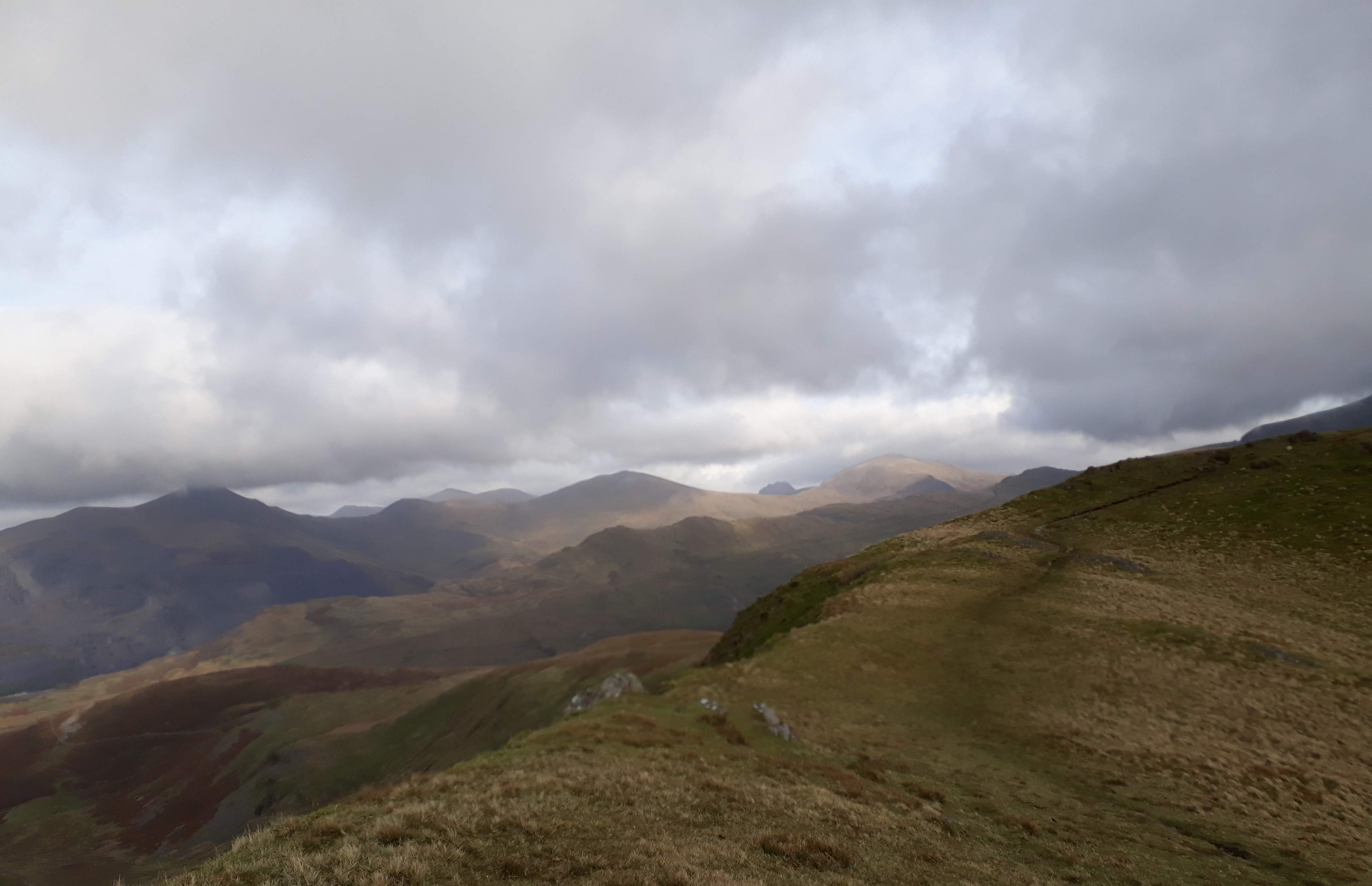
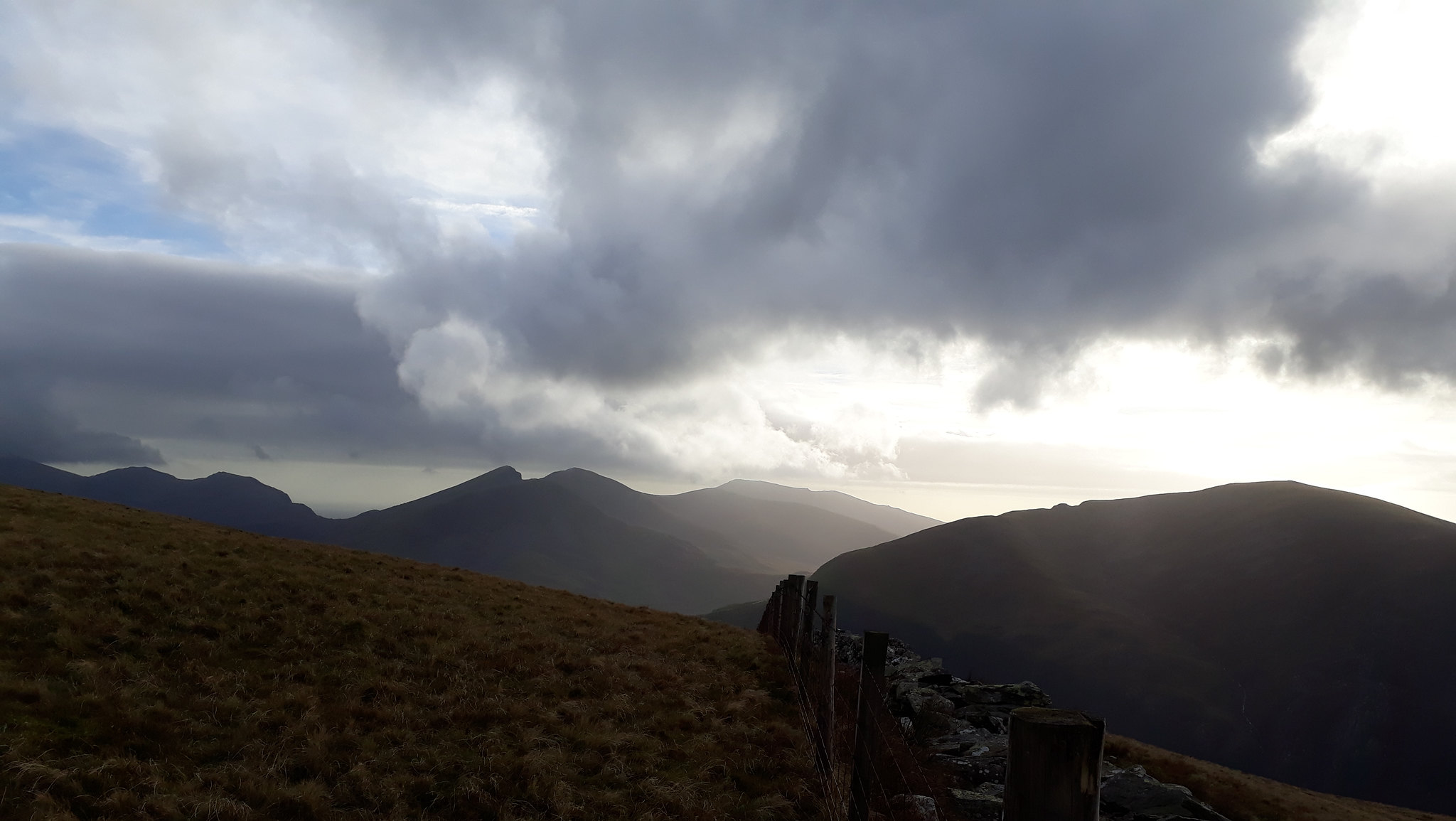
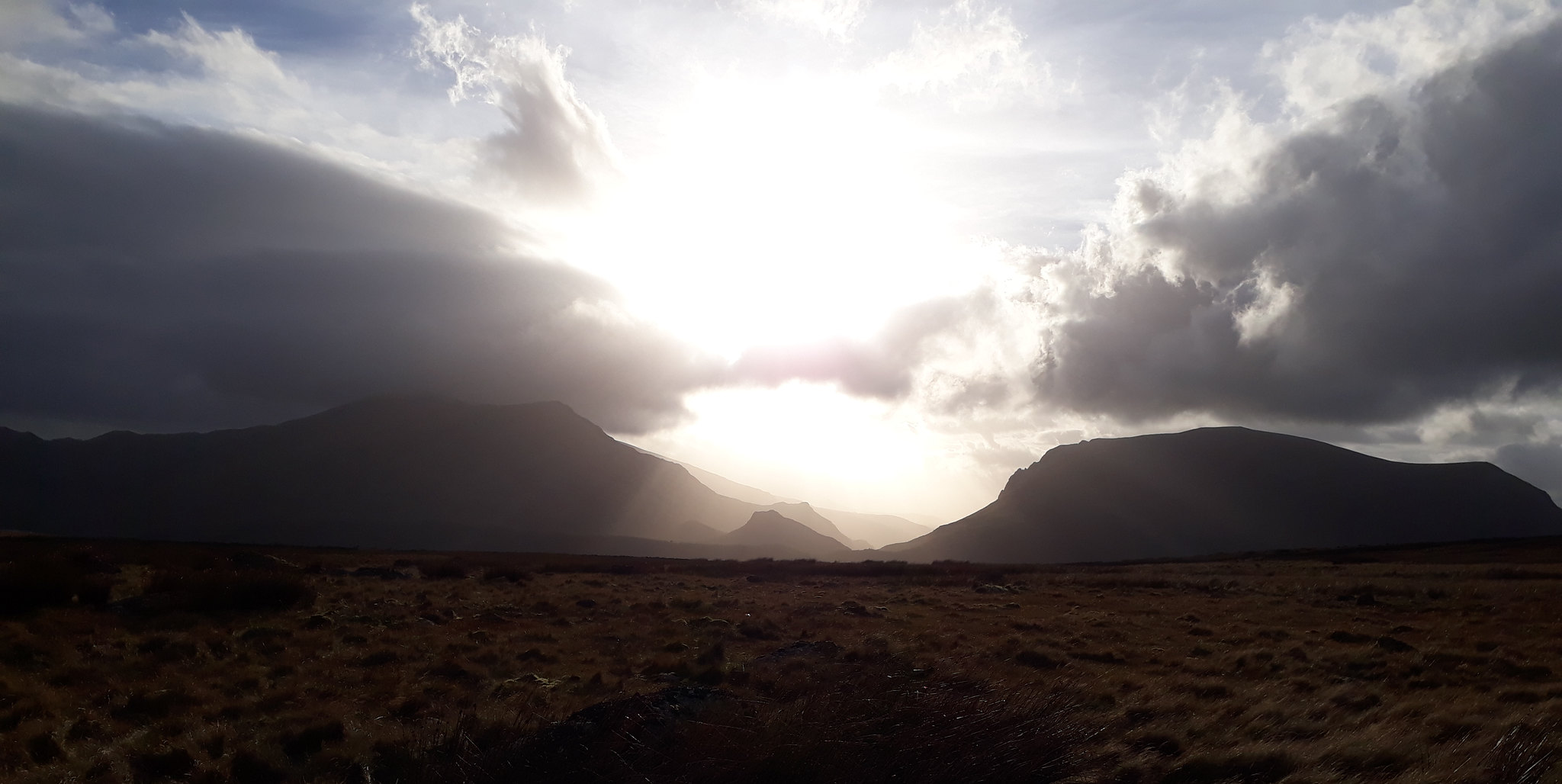
20171012_160707. Looking east, the view of the Elidir Fawr - Tryfan ridge is just stunning. This pic in no way does it justice. But when I look back at this pic in the future, I hope I'll remember how it was....
20171012_160707 - labelled.
20171012_161046. And this is what is ahead: absolutely delightful ridge walking - were it not for the howling gale, which means I have to lean about 30 degrees to the right in order to remain upright
.
20171012_161252. The Welsh 3000ers again, Tryfan more or less in the centre.
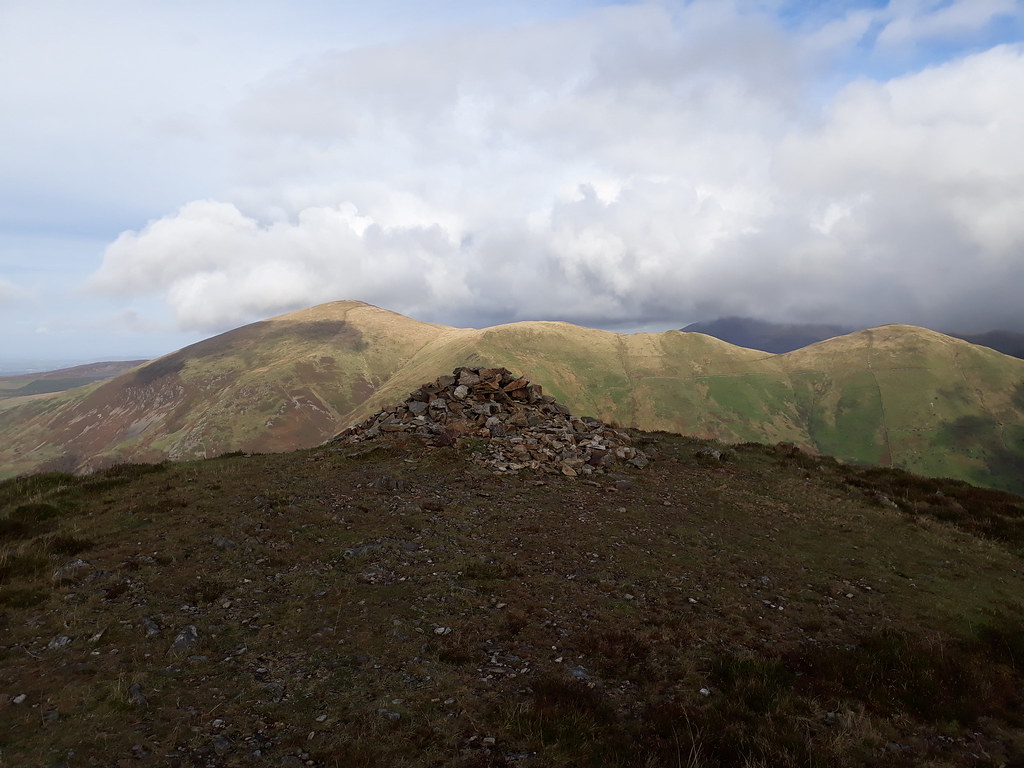
20171012_161413. Looking back towards Foel Gron and Moel Eilio. Can't get easier ridge walking that this

.
20171012_162238.
20171012_162511. I keep having to look back towards the sun setting in the west, but the wind is so strong that I have to have recourse again to resting the camera on a fence post so as to minimise the vibrations. I take 5 or 6 exposures for every view in the hope that at least one isn't too blurred... And - maddeningly - I get blown into the barbed wire topping the fence which results in a tear in my jacket. This is some wind!
r
20171012_162854. The route ahead to Moel Cynghorion, with Yr Wyddfa lowering behind. The approach to Yr Wyddfa via the Clogwyn Du'r Arddu (centre of the pic), with its precipitous cliffs, looking very imposing. (The pimple in the background on the extreme LHS is Tryfan!!!).
20171012_162930. Easy path walking to Moel Cynghorion; the Lechog ridge leading up to Yr Wyddfa just left of centre.
20171012_170208. The view looking north east from the summit of Moel Cynghorion is just superb. All the 3000ers are now out of cloud, and the sun is beaming down.
20171012_170238. Clogwym Du'r Arddu to the south east looking seriously imposing...
20171012_170612. Llyn Ffynnon-y-gwas looking pretty wind-swept!
I spend a goodly time soaking in the splendid views (while simultaneously endeavouring to avoid being blown away), before heading off back to the car. There's an easy track to follow that starts close to the mini-reservoir just south of Llyn Ffynnon-y-gwas, so progress should be quick...
20171012_171935. .... except that I keep having to stop to admire the vista of the sun setting behind the Nantlle Ridge.
20171012_172041. Looking back at the descent, Moel Cynghorion on the LHS, Cwm Clogwyn just right of centre with Yr Wyddfa in cloud behind.

20171012_173101. As I near the car, a final look back at the ridge ....
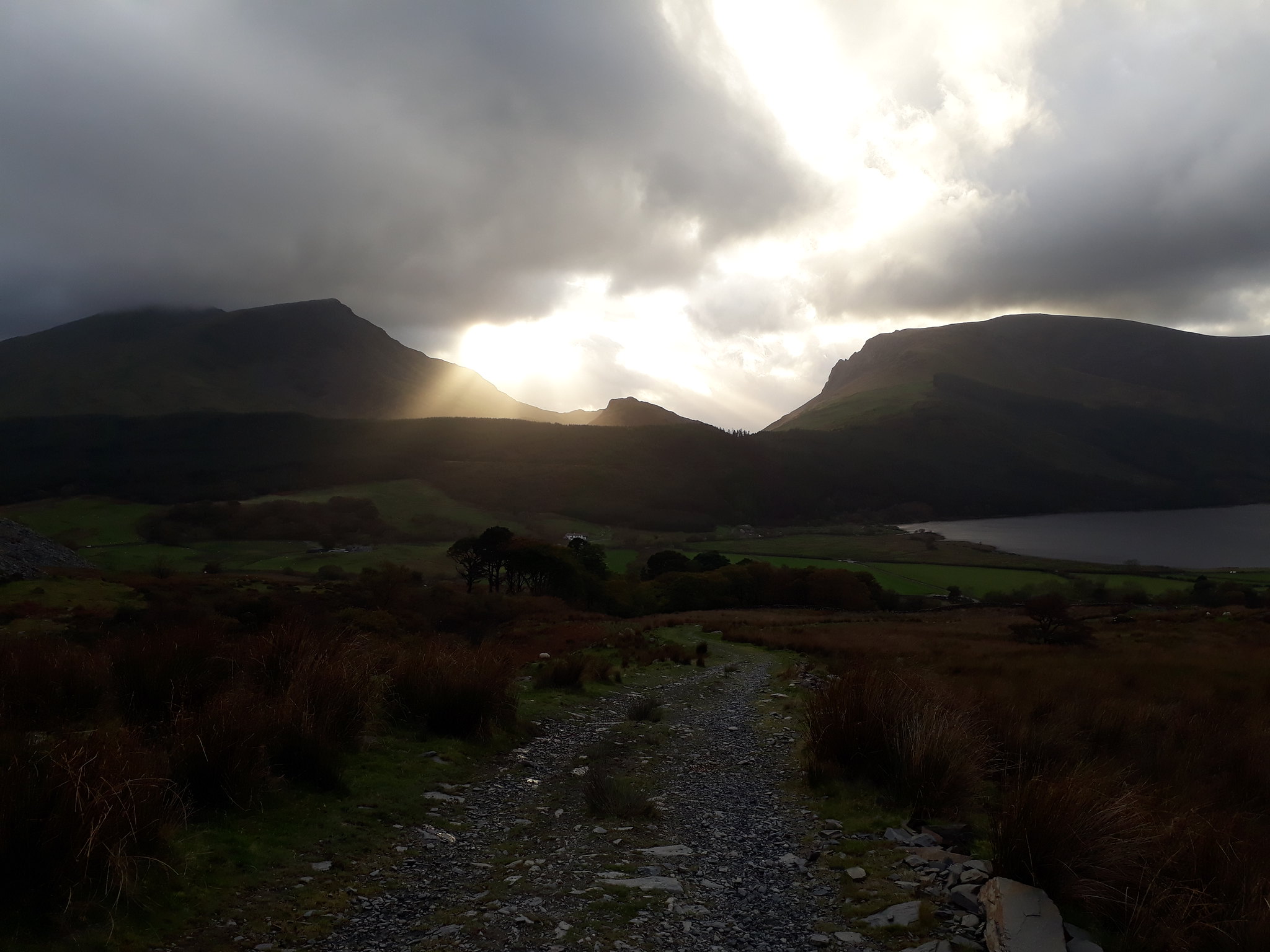
20171012_173104. ... and the phenomenal sunset (Y Garn LHS, Mynydd Mawr RHS).
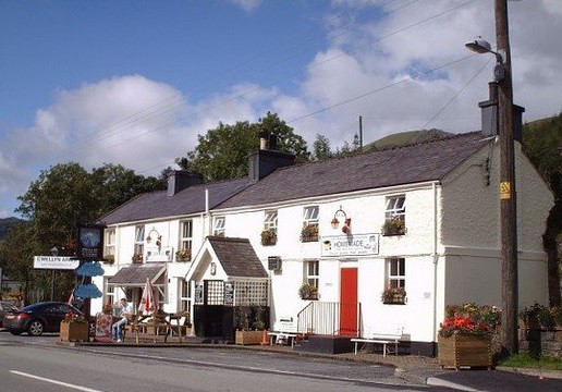
. The weather hasn't been too warm, and I've managed to source sufficient water from streams on the way; but as usual, being acutely conscious of the perils of insensible moisture loss and the medical imperative of making good such loss, I pause briefly at an establishment of cultural, historical and architectural distinction for that purpose....
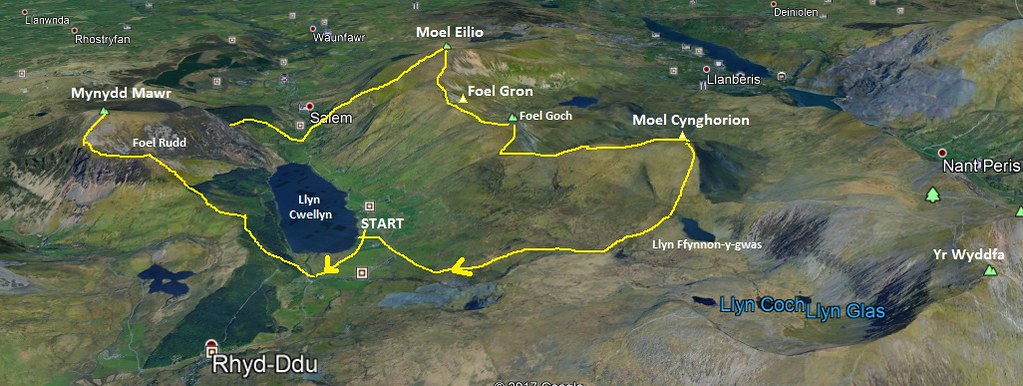
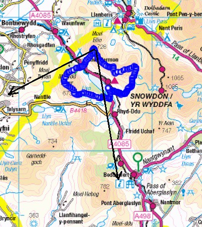
3D view of route.
