free to be able to rate and comment on reports (as well as access 1:25000 mapping).
Having done most of the Etive Hills in ones and twos in Winter, I was left with Meall nan Eun to bag. Rather than returning to Glen Etive, which seems horrendously crowded in Summer nowadays, I decided to try the approach from Victoria Bridge. After reading weedavie's report at
https://www.walkhighlands.co.uk/Forum/viewtopic.php?f=9&t=67684, I thought I would take the route via the Mam nan Sac.
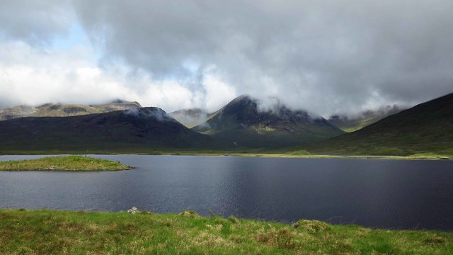
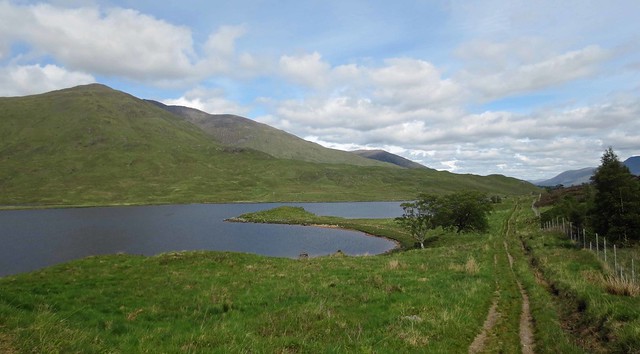
I drove up from London on the Saturday and camped at Tyndrum. Next morning I drove up to the car park at Victoria Bridge. I was last here in the 90s, and remembered you set off from the car park on the track to Clashgour, as per my 1989 OS map which I was using. What I hadn't realised was that the car park I had parked in was a new one, away from Forest Lodge. The bridge where people were camping was not in fact Victoria Bridge, which was slightly further up the road. I had therefore cycled off up the wrong track to the monument. This didn't seem right, and I soon ended up in a field of cows. At least there was a nice view back to Loch Tulla.
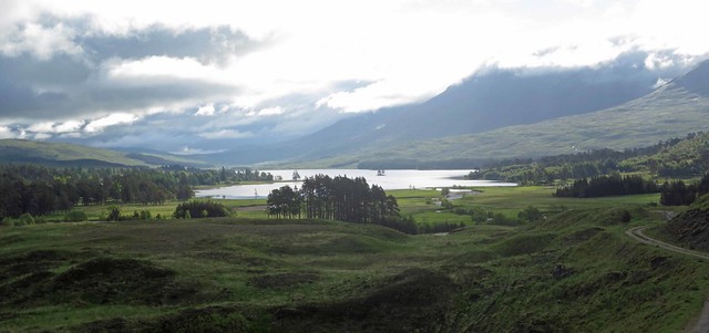 003 Loch Tulla
 by
prwild, on Flickr
Returning to the car, I consulted the 2015 Memory Map on my iPad and realised my mistake. So I set off on my bike again up the road to Forest Lodge.
A peacock was displaying at Forest Lodge, but the peahen didn't seem that interested. Or perhaps she was just playing hard to get.
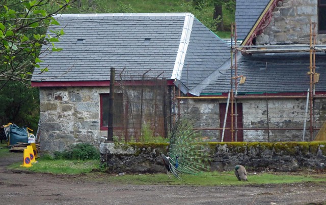 004 Peacocks
 by
prwild, on Flickr
I soon reached the point where the footpath by the Abhainn Shira branched away from the track to Clashgour Farm. Judging by the signs, the farmer preferred people take the path by the stream. I remembered weedavie had commented they were fed up with cyclists at Clashgour.
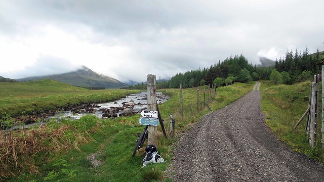 005 No Through Route to Clashgour
 by
prwild, on Flickr
I had been planning to leave the bike at Clashgour, but maybe this wasn't such a good idea. I was pretty sure I had a right of way via the farm, but had no desire to upset anyone. So I took the path by the river thinking I could perhaps head up to the farm by the gate further on (which was the way we had gone some 20 years ago on a short walk when the weather was too vile for a winter hill walk).
The path wasn't cyclable, so I locked up the bike a few yards further on, just out of sight from the track. It was a pleasant walk by the river, with the light occasionally breaking through the clouds.
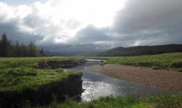 006 Light on Abhainn Shira
 by
prwild, on Flickr
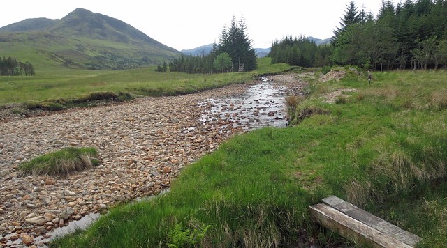
On reaching the gate, I found it closed and locked. Again, things had changed since I was last here.
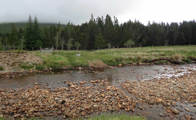 007 Ford across Allt Ghabhar
 by
prwild, on Flickr
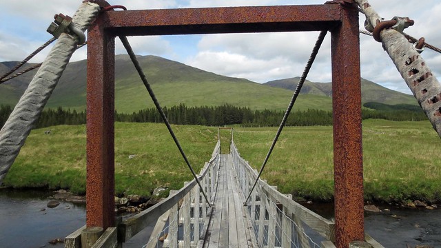
I contemplated climbing over the gate and heading up via Clashgour. But the Mam nan Sac route looked shrouded in low clouds and the route by the Abhainn Shira was pleasant, so I decided to carry on and have a look at Loch Dochart and see if I could get up to Meall nan Eun that way. So I crossed the ford and carried on through a partly wooded section, where my foot went into the mud to my knee at one point. I was a bit confused to see a footbridge ahead, as I thought I had already forded the Abhainn Shira, but on checking the map I realised that I had taken the side path through the trees (some of which must have been cut down since my map was printed) and this footbridge was the true crossing over the Abhainn Shira.
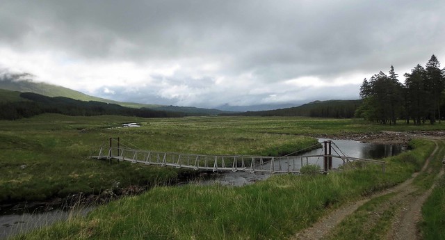 008 Footbridge over Abhainn Shira
 by
prwild, on Flickr
I carried on along what was now a better track towards Loch Dochart. This part would have been cyclable if I had got the bike this far (perhaps via Clashgour). There were some orchids along the way.
 009 Orchid
 by
prwild, on Flickr
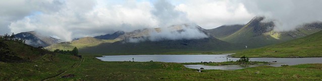
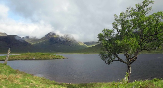
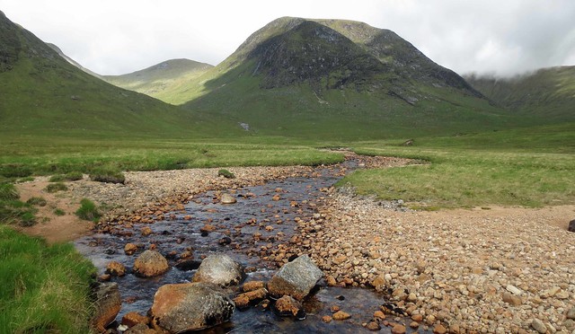
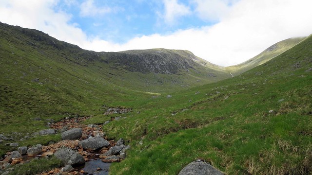
Soon Loch Dochard came into view, with glimpses of Meall nan Eun in the low cloud.
 010 Track to Loch Dochard
 by
prwild, on Flickr
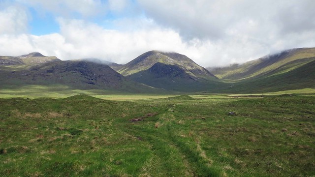
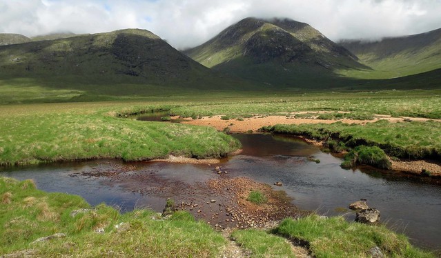
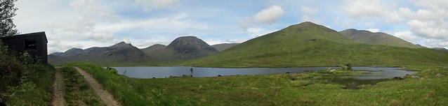
The sun began to come out as I reached the Loch, and I was pleased to have come this way as there were some good views across to Meall nan Eun and the Etive Hills.
 011 Loch Dochard Panorama
 by
prwild, on Flickr
 012 Meall nan Eun from Loch Dochard 1
 by
prwild, on Flickr
 013 Meall nan Eun from Loch Dochard 2
 by
prwild, on Flickr
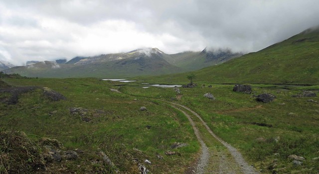
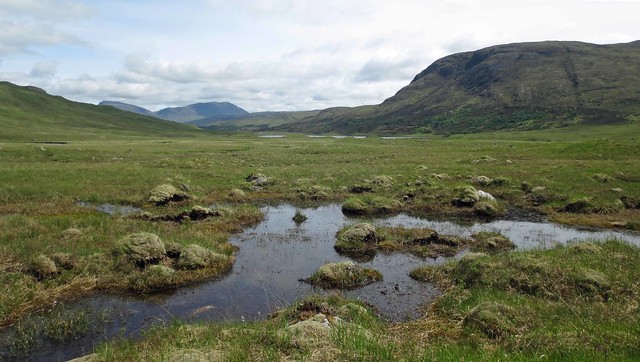
From what I had read in Irvine Butterfield's 'The High Mountains' and weedavie's comment, the approach to Meall nan Eun across the flat ground west of Loch Dochard was likely to be a bogfest. But there had been a prolonged dry spell (albeit it had rained heavily after I got my tent up last night) so I carried on, looking for a possible way across. To my surprise I found what looked a viable track heading in the right direction (which can just be made out branching off to the right in the next picture - it was clearer on the ground).
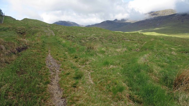 014 A faint track across the bog
 by
prwild, on Flickr
This started off well, and was quite dry (as Scottish tracks go).
 015 Cloud lifting from Meall nan Eun
 by
prwild, on Flickr
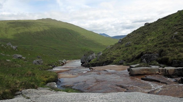
It forded a stream, with the views to Meall nan Eun improving all the time.
 016 Fording a stream
 by
prwild, on Flickr
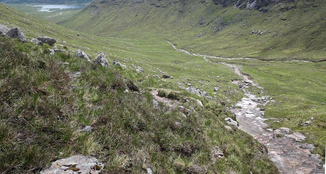
From this point the track disappeared. There was a semblance of a path, but it was getting boggier and at one point I went in up to my knees for a second time. This would not be a sensible route in wet conditions, but it was perfectly passable in dry conditions. You can put your foot in a bog on most routes in Scotland if you're not careful.
 017 Getting closer to Meall nan Eun
 by
prwild, on Flickr
The next decision was whether I took weedavie's route up the obvious gully on the SE face of the hill or went up the valley of Coire Chaorach to the left. I decided the valley looked easier and there was a nice waterslide that way.
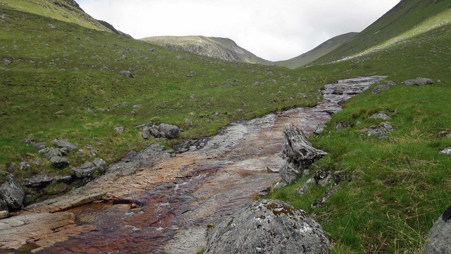 018 Waterslide in Coire Chaorach
 by
prwild, on Flickr
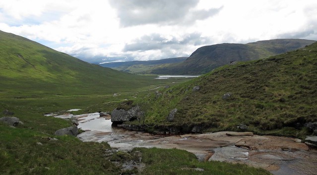 019 Looking back to Loch Dochard
 by
prwild, on Flickr
 020 Coire Chaorach
 by
prwild, on Flickr
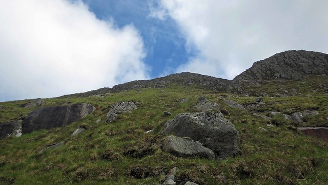
The obvious route was to follow the stream all the way up to the bealach with Meall Tarsuinn. But it's difficult to resist the temptation to head up early. I climbed gradually away from the stream, looking for a way up past the crags to my right, even though the ground was rougher and I was making slower progress. Eventually the crags began to break up, and I thought I could see a way up.
 021 My ascent route
 by
prwild, on Flickr
I climbed steeply up, with the odd minor scramble over rocky bits, and good views back to the more sensible route.
 022 Stob Coire an Albannaich and Meall Tarsuinn
 by
prwild, on Flickr
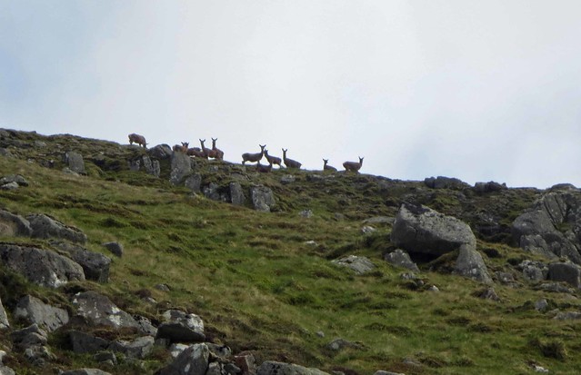
As the gradient began to ease, some deer appeared on the skyline. As they often do, they looked surprised to see a human appearing in their territory.
 023 Deer on the skyline
 by
prwild, on Flickr
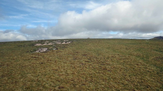
I cleared the crags and emerged onto the plateau. Soon the summit cairn appeared.
 024 First sight of the summit cairn
 by
prwild, on Flickr
An easy stroll took me to the summit. It had taken me just over 4 hours to get here (not counting the abortive start). It was now 12:15; time for lunch part 1.
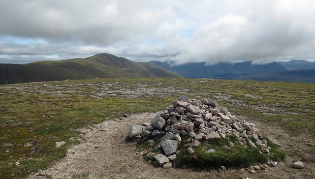 025 Meall nan Eun summit
 by
prwild, on Flickr
The earlier low cloud had cleared during my approach and moving away from the cairn gave good views
to the Stob Ghabhar group and back to Loch Dochard and Loch Tulla beyond.
 026 Stob a'Bhruaich Leith Panorama
 by
prwild, on Flickr
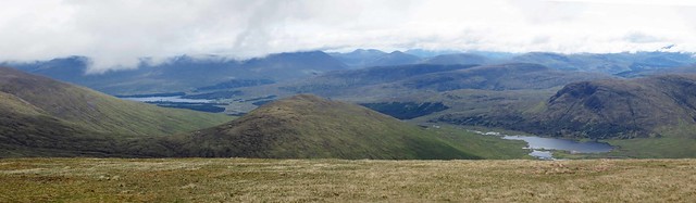 027 Lochs Dochard and Tulla Panorama
 by
prwild, on Flickr
For the return route I headed down to the bealach.
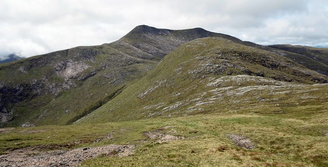 028 Stob Coir an Albannaich and Meall Tarsuinn
 by
prwild, on Flickr
My last (and 250th) Munro, Beinn Fhionnlaidh could be seen emerging from the clouds.
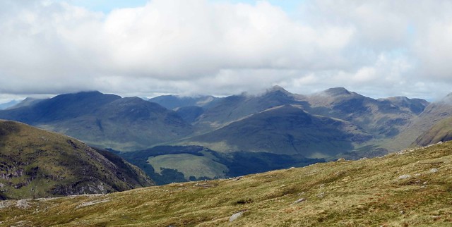 029 Towards Beinn Fhionnlaidh
 by
prwild, on Flickr
I descended by a much easier route following the stream down into Coire Chaorach.
 030 Meall nan Eun Panorama
 by
prwild, on Flickr
 031 Descent into Coire Chaorach
 by
prwild, on Flickr
There were some more orchids here.
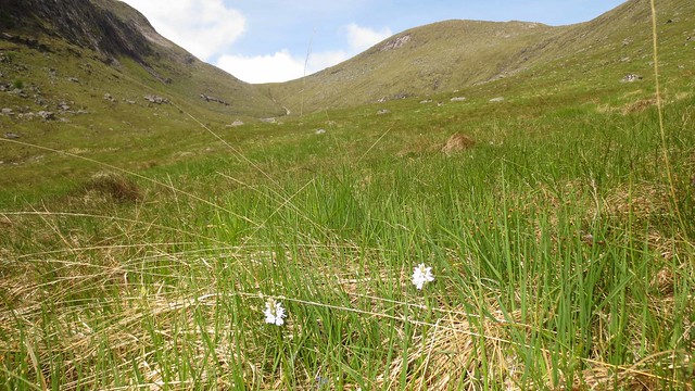 032 Orchids in Coire Chaorach
 by
prwild, on Flickr
I stopped at the waterslide to wash my feet in the cool water.
 033 Allt Coire Chaorach
 by
prwild, on Flickr
It was then just a matter of picking up my outward route and following it back. But that wasn't so easy on the boggy flats west of Loch Dochard, and my foot went in up to the knee for the third time today.
 034 A Bit Boggy
 by
prwild, on Flickr
It had cleared up nicely by now, and I retook some of my photos from earlier plus a few from different angles.
 035 Fording the stream again
 by
prwild, on Flickr
 036 Track by Loch Dochard
 by
prwild, on Flickr
 037 Meall nan Eun from Loch Dochard 3
 by
prwild, on Flickr
 038 Loch Dochard Panorama 2
 by
prwild, on Flickr
 039 Back across the Footbridge over Abhainn Shira
 by
prwild, on Flickr
I saw a distant speck which looked like it might be an eagle above the ridge leading down from Stob a' Choire Odhair, but it was too far away to come out on a photo.
 040 Stob a Choire Odhair
 by
prwild, on Flickr
 042 Ford across Allt Ghabhar 2
 by
prwild, on Flickr
Eventually I reached where I had left the bike.
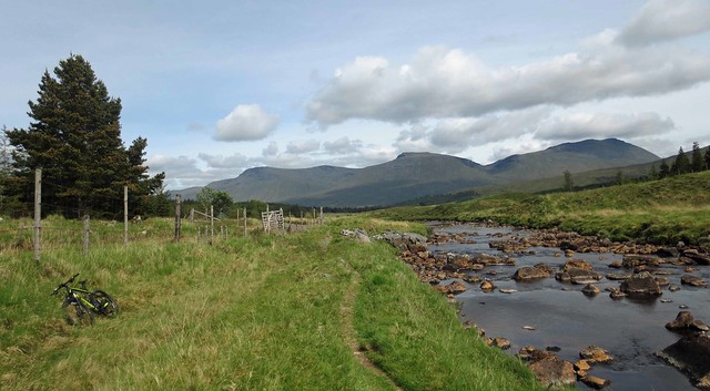 043 Back to the bike
 by
prwild, on Flickr
It was a good fast ride out down the track. Here I met my first other people of the day.
This is probably the most scenic approach to Meall nan Eun if doing it on its own, but only to be attempted in dry conditions.
