free to be able to rate and comment on reports (as well as access 1:25000 mapping).
An email to Chris resulted in choosing a trip along Carlin Gill to follow Carlingill Beck to its source behind The Spout and just below the old Yorkshire/Westmorland boundary at Blakethwaite Bottom, passing Black Force Waterfall on our way. A grubby start to the day was forecast promising to improve towards mid morning indicating higher temperatures and sunshine, something that we were only allowed a glimpse of until nearly the end of the walk. What we got until descending from Fell Head was grey skies, fog, and snow, snow that persisted in landing on my camera lens and marring what could have been a decent picture or two.
The two of us met at Tebay and leaving my car behind Chris drove along the A685 road towards Kendal and then turning left to pass under the viaduct and bridge that carries the M6 and the West Coast Mainline railway over Borrow Beck that joins up with the River Lune at this point. Just after the viaduct and on the right hand side are the hidden remains of a Roman Fort built to guard what was once the Roman Road running along the Lune Gorge/Valley, this road being now named as Fairmile Road.
It's about a 3 kilometres drive from Tebay along a very narrow metalled road that hosts very few passing places to our start point at Carlingill Bridge, a road that today was fraught with the dangers of sheets of ice that warrants no spreading of salt due to its lowly status as a little used by-road. Taking a sharp left just past Low Carlingill the road dips down a few metres towards the bridge - our starting point - then a short but sharp turn right over the bridge where the wheels started spinning on the ice. A look around showed very little parking space by the bridge, a small slot on the left in front of an overgrown gate leading onto the foot of Blease Fell. With a north eastern grunt and a look of determination my man reversed as far as he could and took a run at the bridge taking it and the following slope with all the skill of a world class rally driver, just avoiding starting our walk from the car being parked up on the path by the side of the beck. A couple of impressive swerves and we were at the top of the next bank where there is a small parking space - SD624995 - for about three cars if parked sensibly.
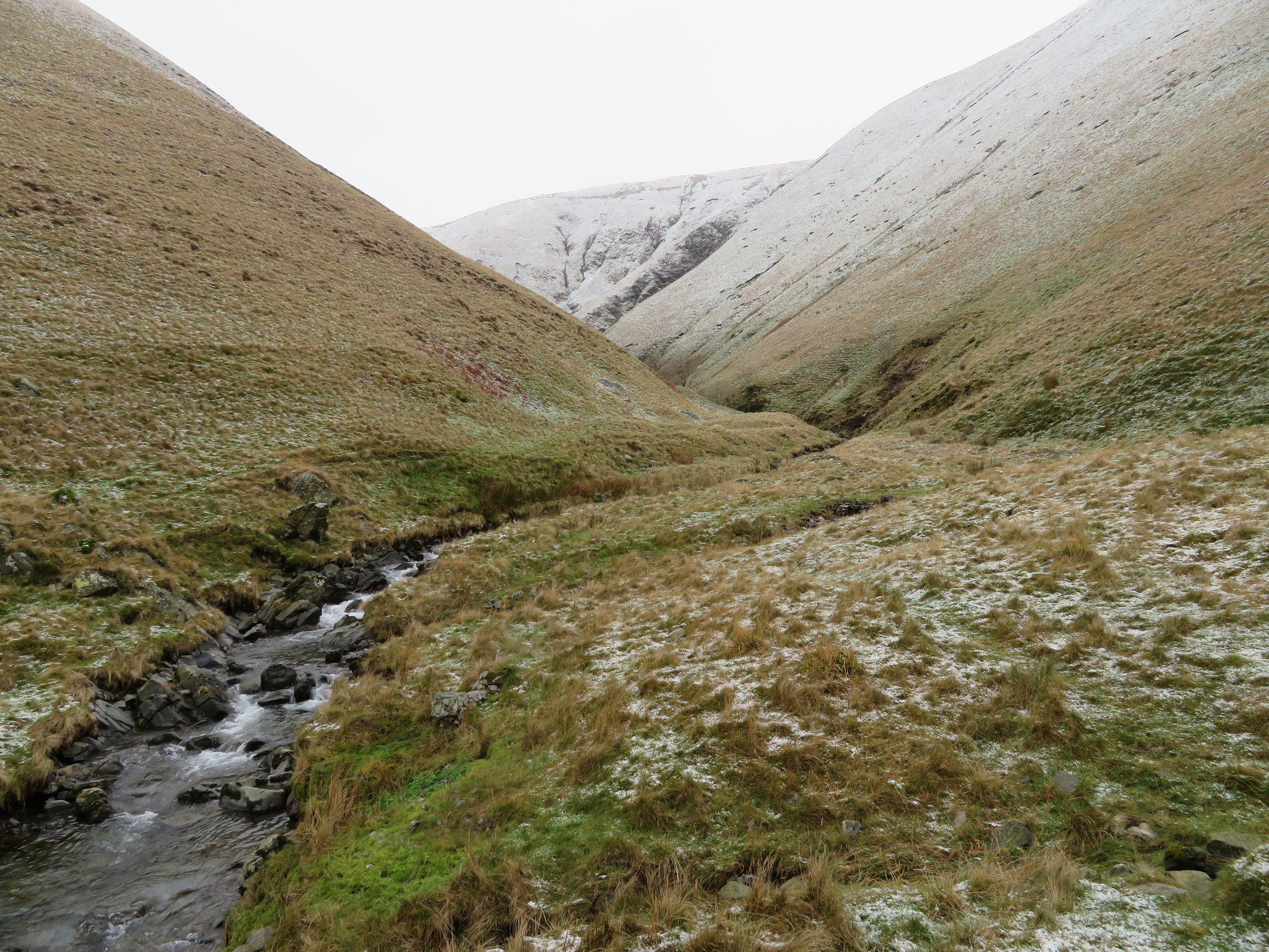
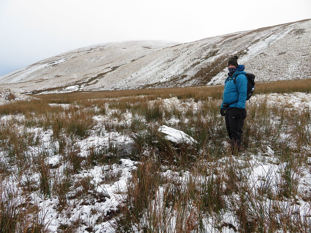
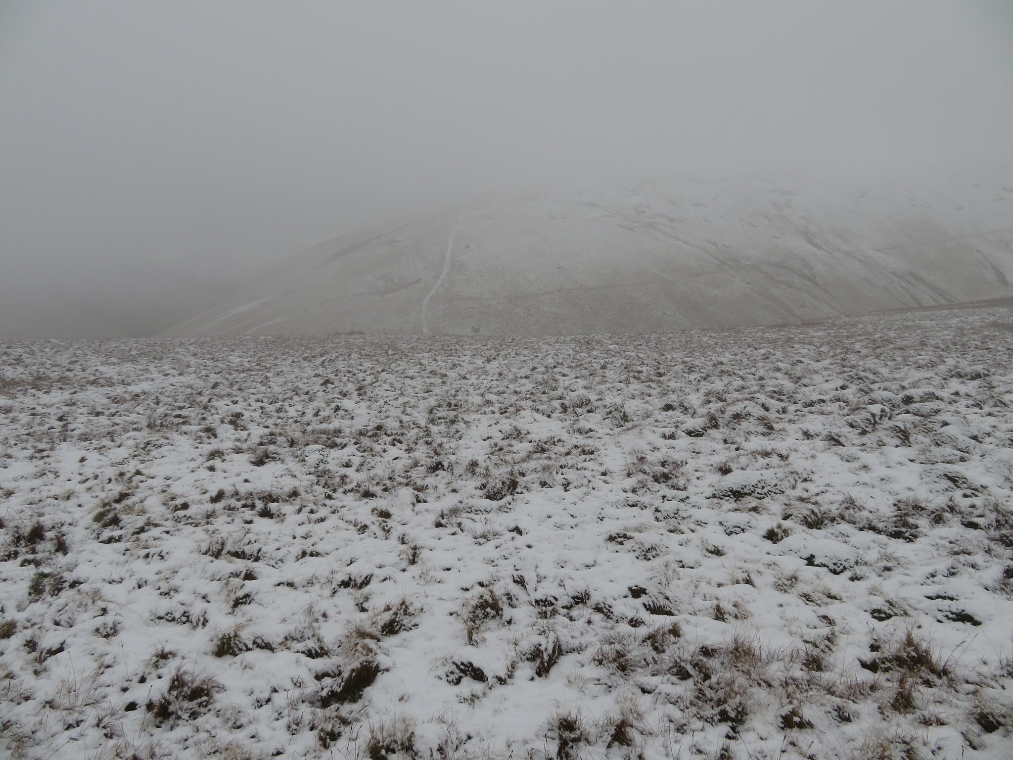
As we got ready the skies were grey above us and where we were heading, but over to the west and south there was blue skies and sunshine, surely a good omen for the day ahead. Minus 1°c saw us walking down to the bridge from where a good view of the snow covered slopes of Uldale Head and Archer Hill was in front of us and taking the thin but obvious path along the south side of the beck…
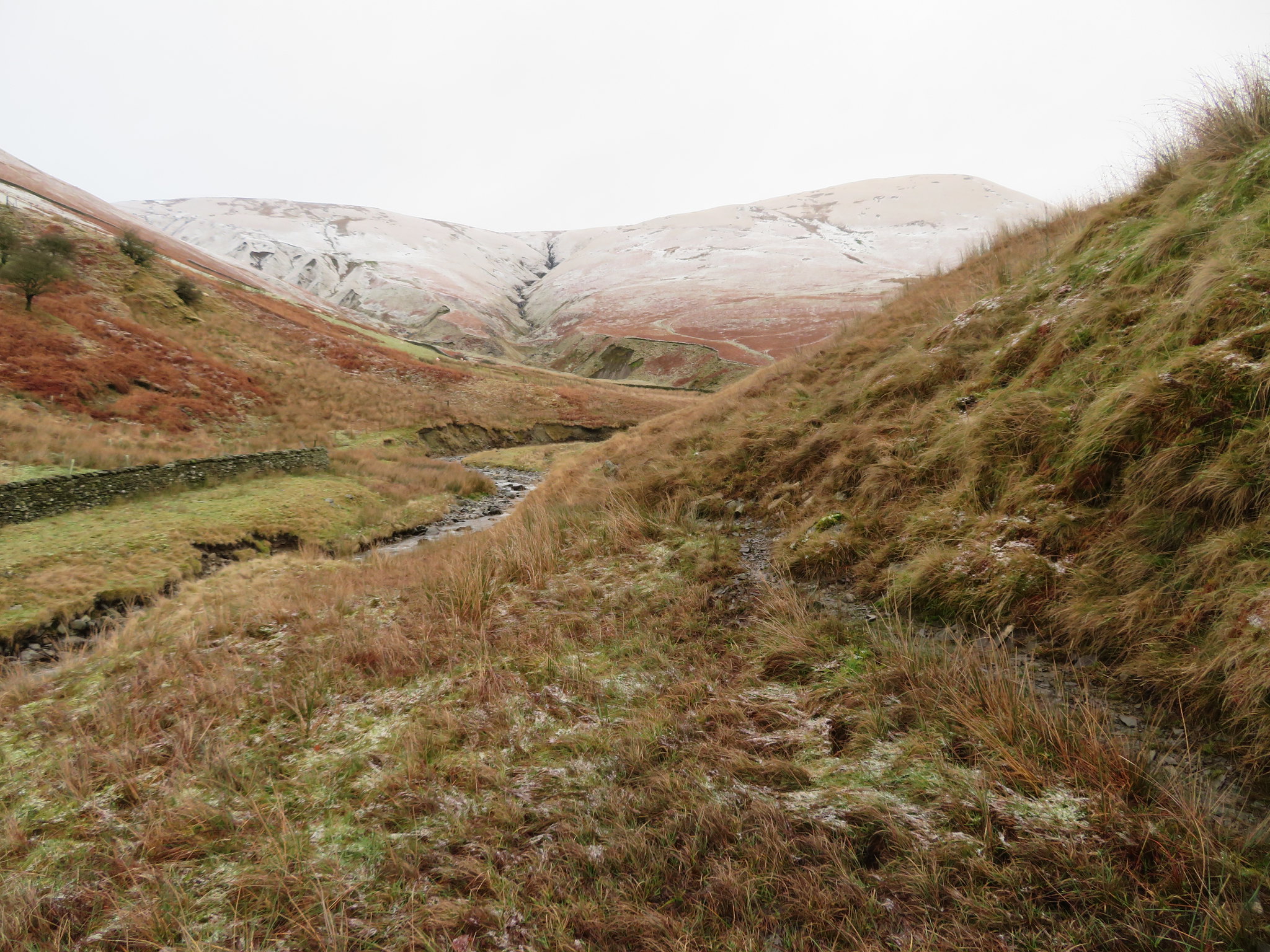 Entering the gill from the road
 for a good few metres until we got to a point where we could go no further on that side. Carlingill Beck is quite wide, and due to the recent rain and snow deep at this point and for much of the way up until it begins to squeeze itself into the confines of the gorge much higher along the valley.
We had to get across somehow and somewhere so walking back we found a place where there is a shingle bank but where the water also gushed through a wide and deep trough between it and the opposite bank, so, ford building skills required. As I have a construction background I led the way on this complicated structure by throwing the first large boulder into the gushing torrent, it got washed away, damn. Chris followed suit by hurling an even larger one in the gap, it held and acted as an anchor for the remaining ones to follow, slowly building up to an uneven but fairly stable bed of rocks that were just below the water's surface that allowed us to cross and stand on a small portion of rock before climbing onto the north side path. Building bridges, what a great way to start a walk, a passage back in time reminds me of when we were kids and doing similar things in the local waterways, getting wet through but not caring one jot until remembering that you had a mother at home who expected you to go out and 'play' whilst remaining in a pristine condition. What a hope. I don't think the 'ford' will survive the next fall of rain that will increase the flow of the beck, but if it does then those that follow may find it a useful addition to the route.
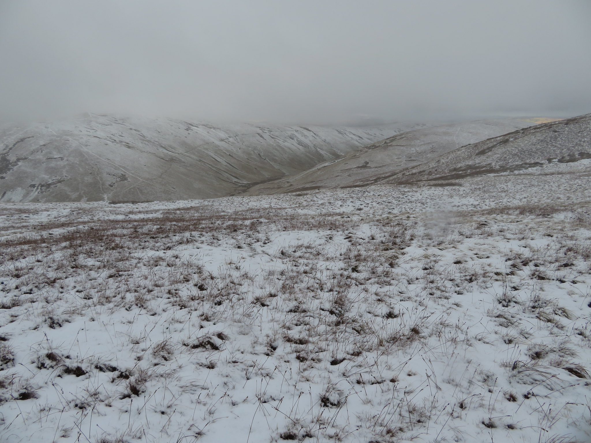
We followed the wet and muddy path that makes its way roughly east above and along the open fellside with Uldale Head getting ever larger in front of us and from where we could also see the higher level path rising up from Weasel Gill to find its way around 60 metres higher than the valley bottom.
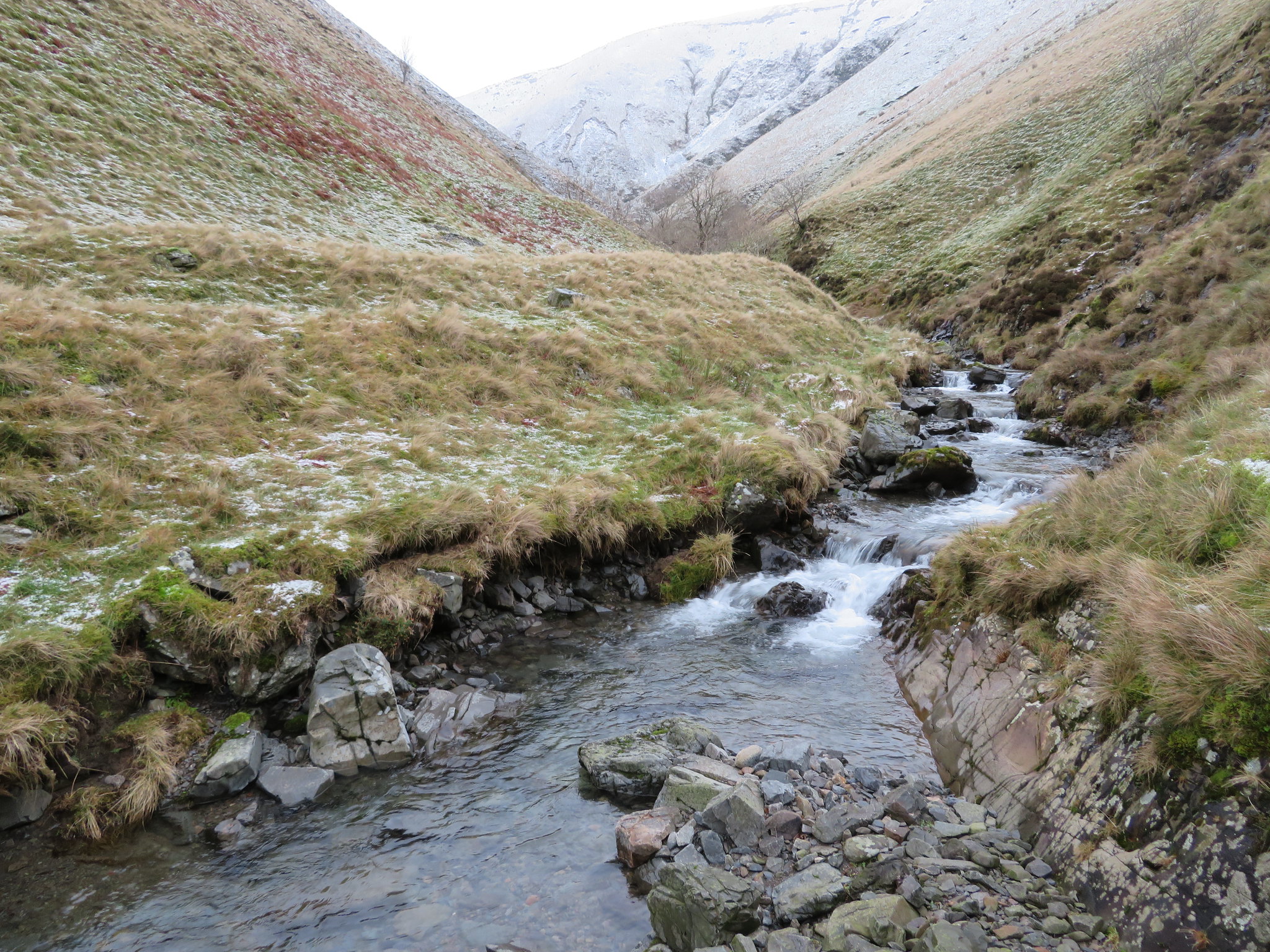
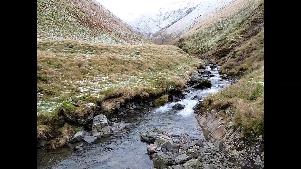
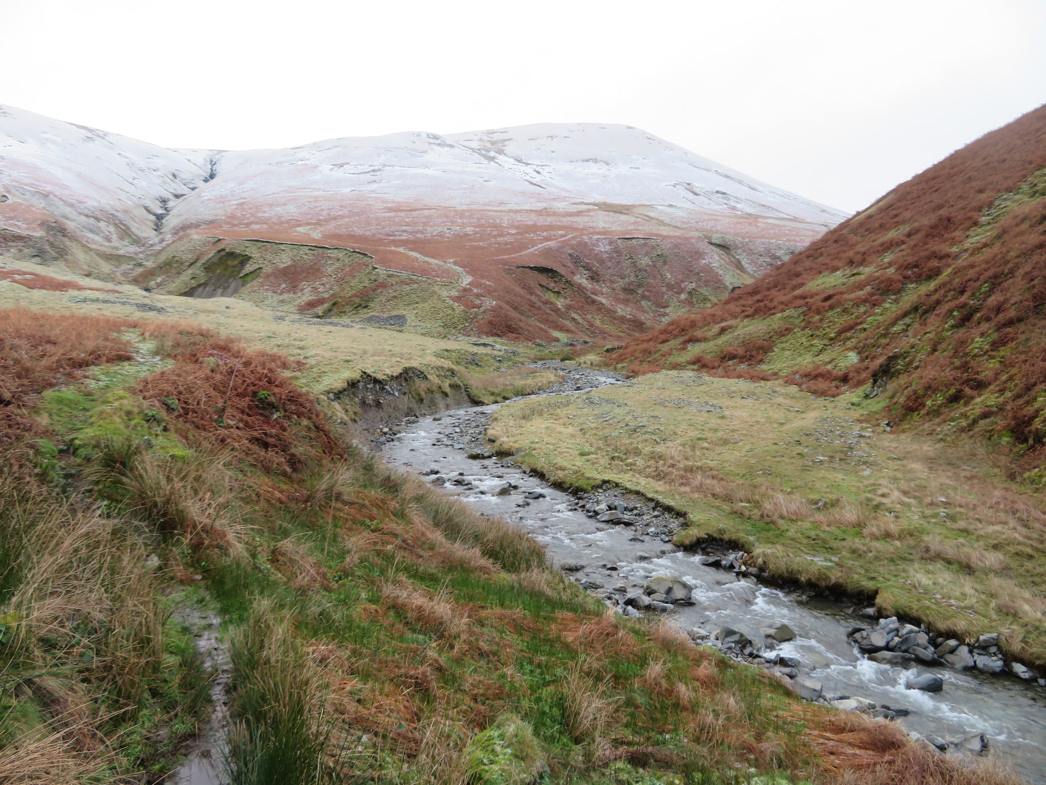 Carlingill Beck with Uldale Head behind
 We are taking the lower route along the beck despite the fact that we know nothing about it and the water is running fast and deep, we could see a faint path of sorts so that was good enough for us. As we progressed upstream we came upon many landslips some of them quite large…
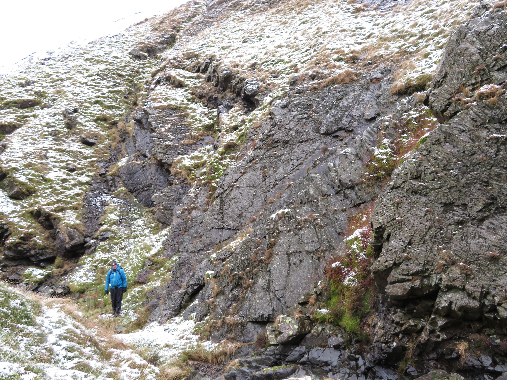
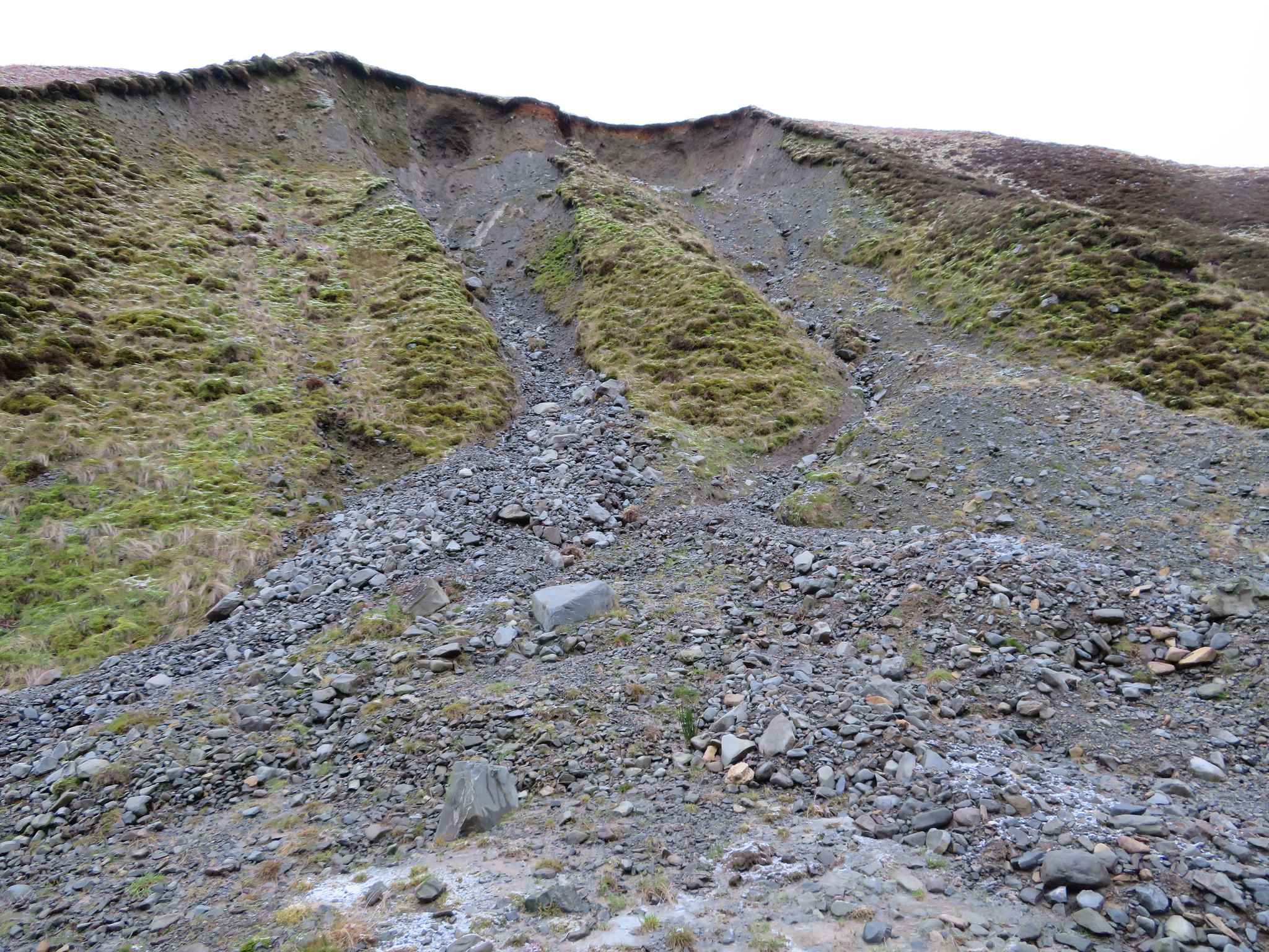 Large landslips in Carlin Gill
 with the spoil flowing across the path and into the beck in some places.
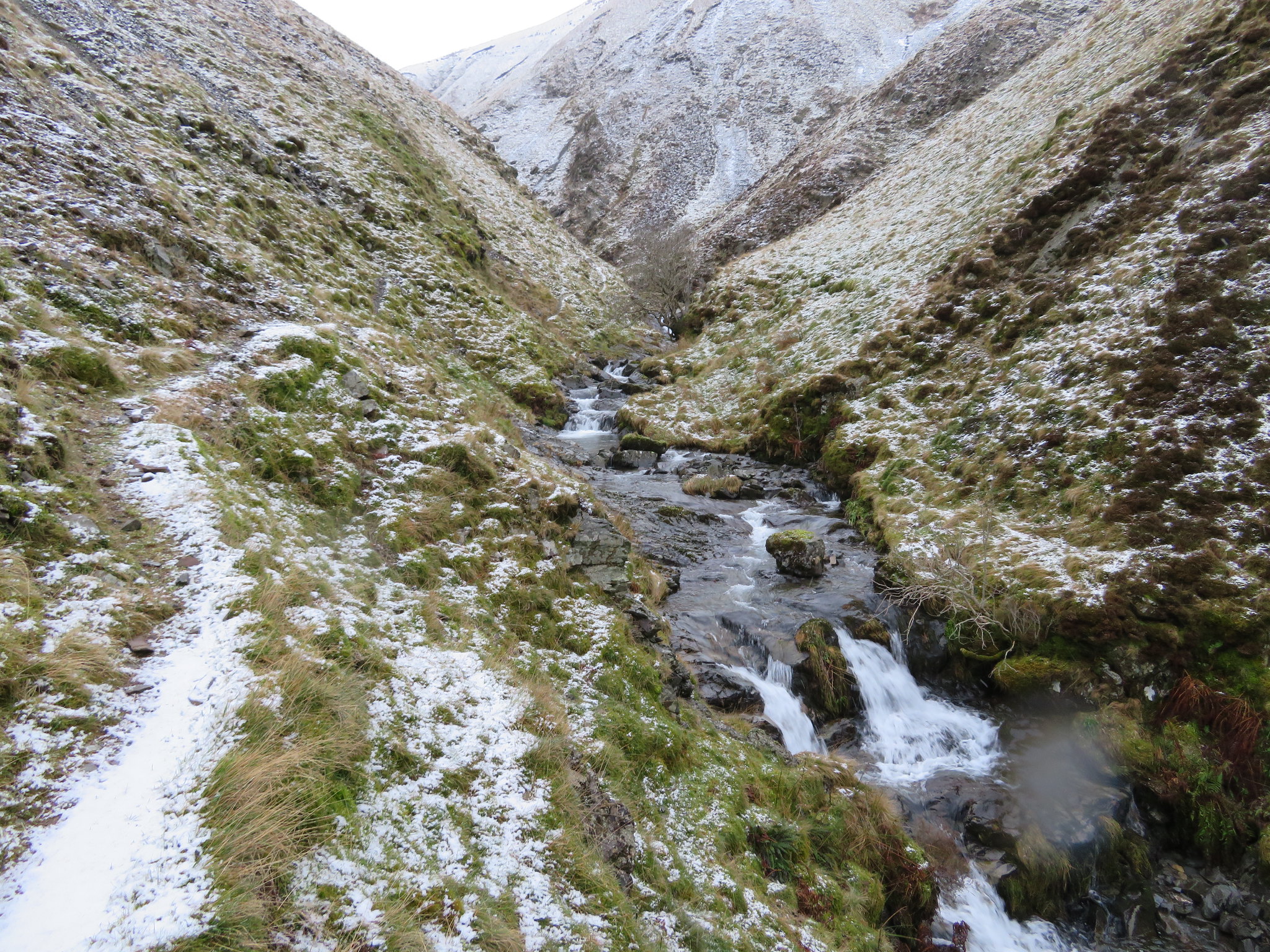
The beck winds about a fair bit as it travels through the valley that changes between being quite narrow to more wide open where there are large flat areas of grass covered ground and it wasn't long before the black gash of Black Force appeared on the snow covered flanks of Force Brow and Ulgill Rigg.
 In Carlin Gill below Uldale Head
 This is a typical - albeit smaller version - of the valleys or dales that lie well inside the Howgill Range of hills, an independent range of hills that are magnificent of stature with wide valleys and many waterways, grains, and gills to explore. Great walking country where one can stride out unhindered for miles whilst taking in great views of the surrounding Shap Fells and the far distant Lake District with even Morecambe Bay in the south looking like a large silver slab on a good weather day.
Soon after leaving the place of the last photo the valley begins to close in quite quickly and the first of the trees that reside in those narrow confines begins to appear.
 The valley closes in near Small Gill
So far so good with the path being easy though intermittent to follow and despite having to cross and re-cross the beck a few times at well chosen places we were enjoying ourselves immensely. It was during one of these crossings that my left foot went underwater and although I do carry spare socks I decided to carry on and let it dry best it could. Despite the cold we were warm from working our way ever forward under the grey leaden skies, and the morning showers that were forecast had not yet arrived so fingers were crossed that the rain had passed us by. We'd climbed about 100 metres by the time we had got to Small Gill and although the snow was only a thin covering underfoot it was getting more in evidence the higher we climbed.
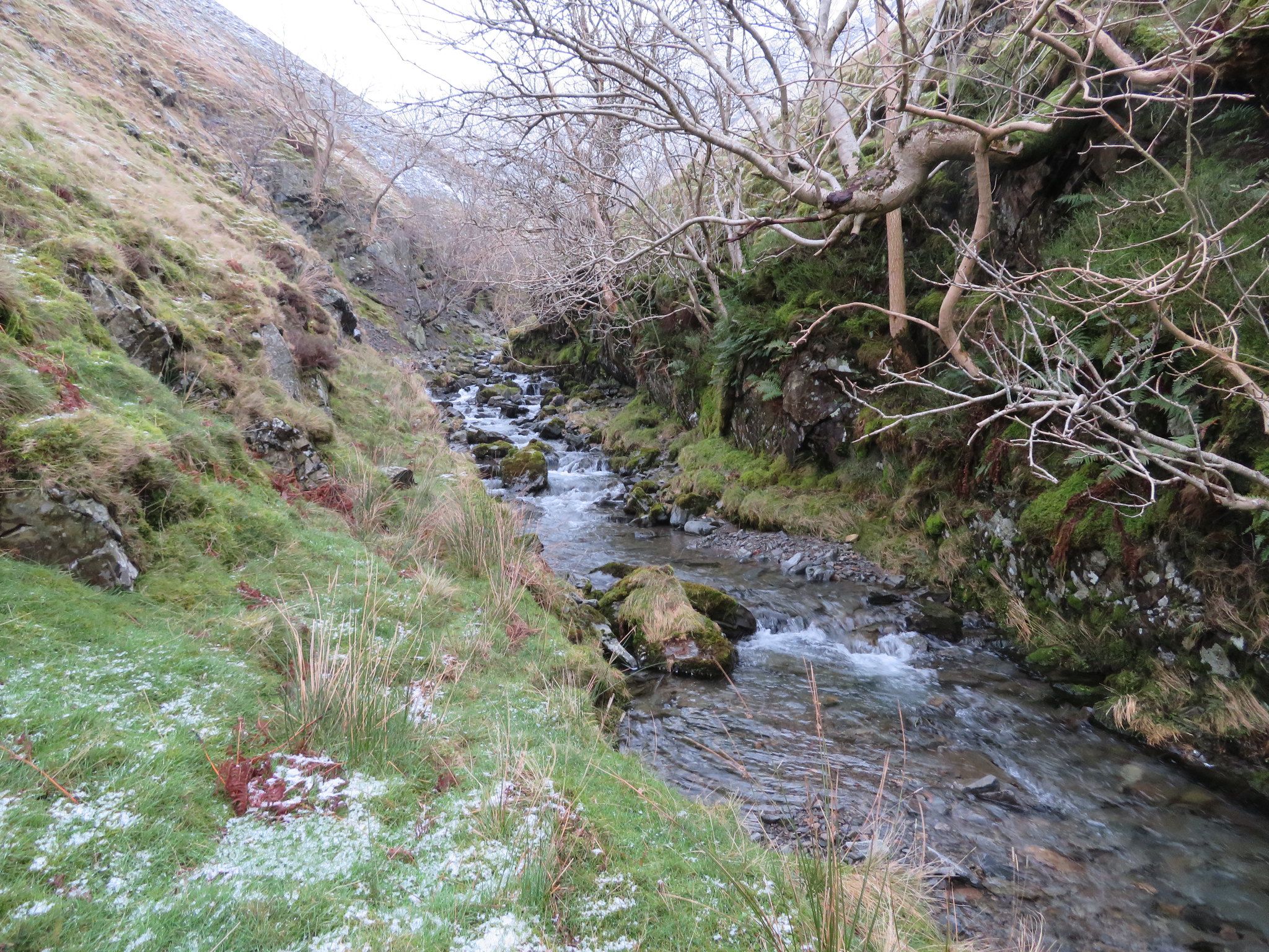
It was from Small Gill that I took a series of photographs as we worked our way along the narrow tree lined gorge that has to be passed through before clapping eyes on the magnificence of Black Force Waterfall if one decides to take this route rather than the high level one. And now it's snowing quite hard.
 The start of the narrow tree lined gulley is just ahead
 In summer - or even winter - after a dry spell the beck would be easy to walk along its bed but today even though it doesn't look it on the photos it was running fast and high with the ground underfoot getting decidedly sparser and rougher the further that we got into the gorge.
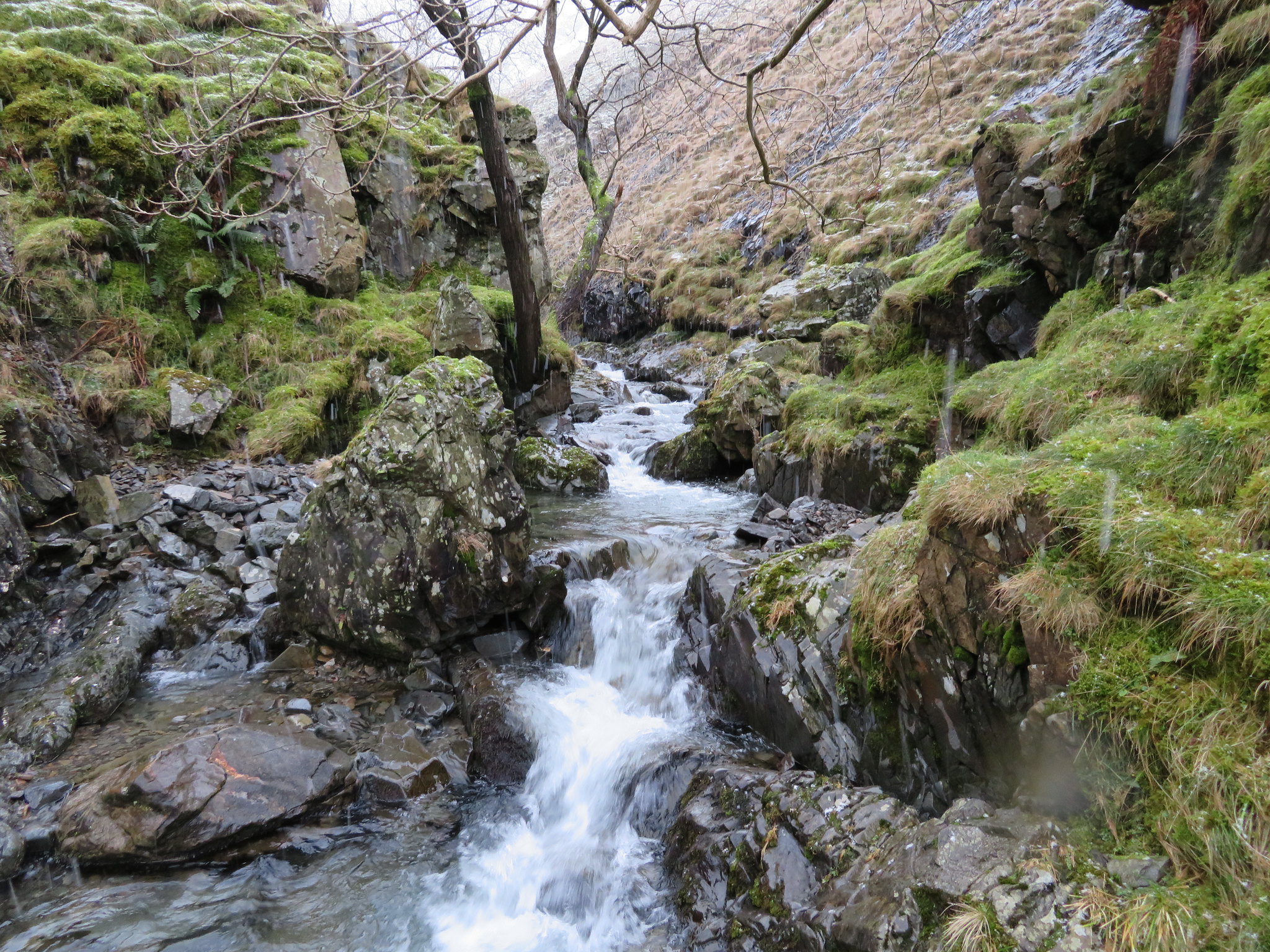
 Trees clinging to the rock face in Carlin Gill
 The trees are amazing, seemingly growing out of the rock itself and have probably survived because they are out of grazing range of sheep and fell ponies.
 The rugged beauty of Carlin Gill
 This stretch of tree lined gorge would look particularly photogenic in spring or summer when in leaf.
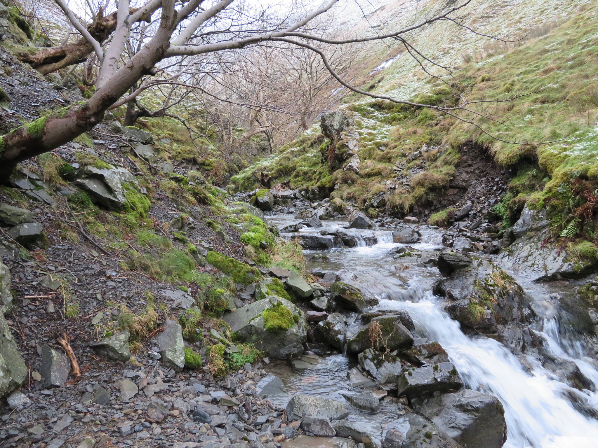
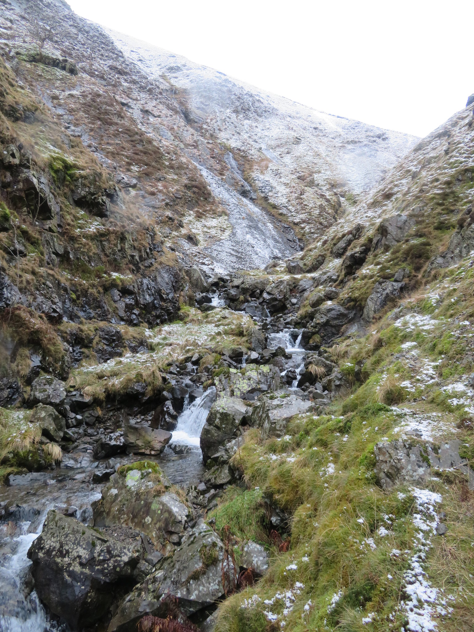
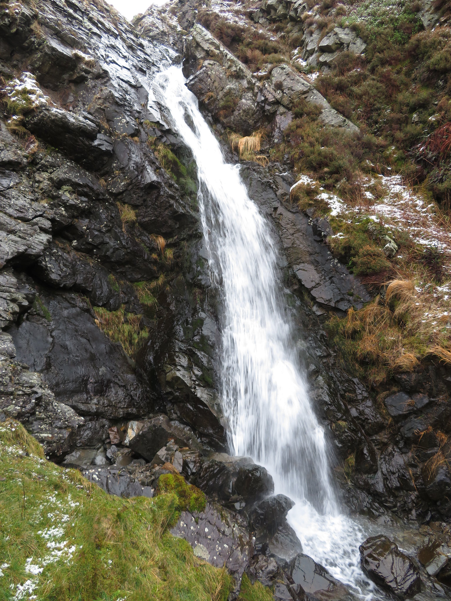
 Below the Screes of Black Force
 There are one or two difficult places to get around without resorting to actual gill scrambling as everything including the rocks in the beck was wet and greasy with moss or soft snow. The falling snow can be seen in the above photo and I had a job keeping the camera lens clear of it, with it getting worse as we climbed out of the confines of the gorge.
This is a great walk, a secret haven that is best kept a secret. The beck has tumbling waterfalls along its length and although it is buried deep down at the foot of the fells with restricted views it is far from a plod, a boring walk it is not, as there is much to keep one occupied and vigilant as progression is made forward onto more difficult ground.
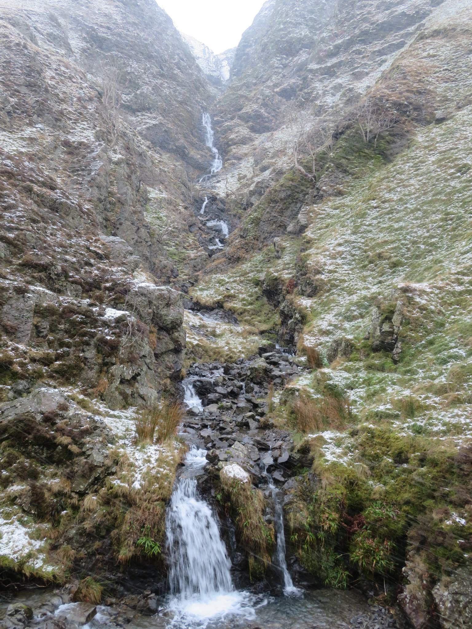
Having got to the end of the gorge we came to an impasse, a place that we couldn't get around due to the volume of water so we took to the hills. We scrambled up a short scree slope - about 3 metres - to reach the higher level path and more open ground and from where we could hear the roar of Black Force from just a short distance ahead of us.
 The last tree before reaching Black Force
 The snow was still falling and even though it looks very festive I can't keep my lens dry. There are more trees just a short distance ahead and the roar got louder as we walked along the good snow covered path and it took us but a careful few minutes to arrive at the waterfall that begins its journey as feeder sykes joining up to form Little Ulgill Beck that is the main source of Black Force as it drops down the gully between the two black and grey masses of exposed rock. Unfortunately the photo below is not at its best as I had to keep clearing the lens of snow.
 Black Force with snow wiped off lens
 A better photo could have been taken from a higher level on the Black Force Screes but the ground was too bad to be able to scramble up there today, too wet and too slippery.
We left this place hoping to get back sometime when the weather was much better; summer seems a good time, with the way forward getting progressively harder to negotiate as we made our way to have a look at The Spout.
 A rough passage to The Spout
 The way ahead was made for slower going as the uneven ground was across sloping fellside in some places with the falling snow of the soft variety making for very greasy conditions underfoot.
 Slow going along the gill
 The gill had to be crossed again at various safe points and not far from The Spout I caught Chris in posing mode.
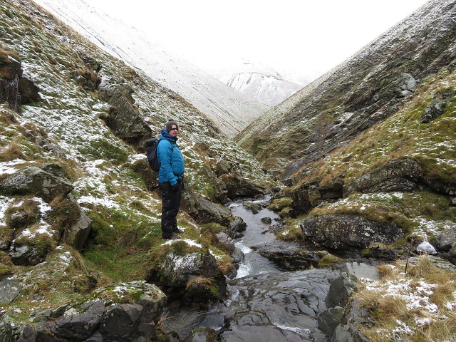 Chris and a snow covered Linghaw in the background
 Four minutes later The Spout just came into view, the sound of it heard before it was seen.
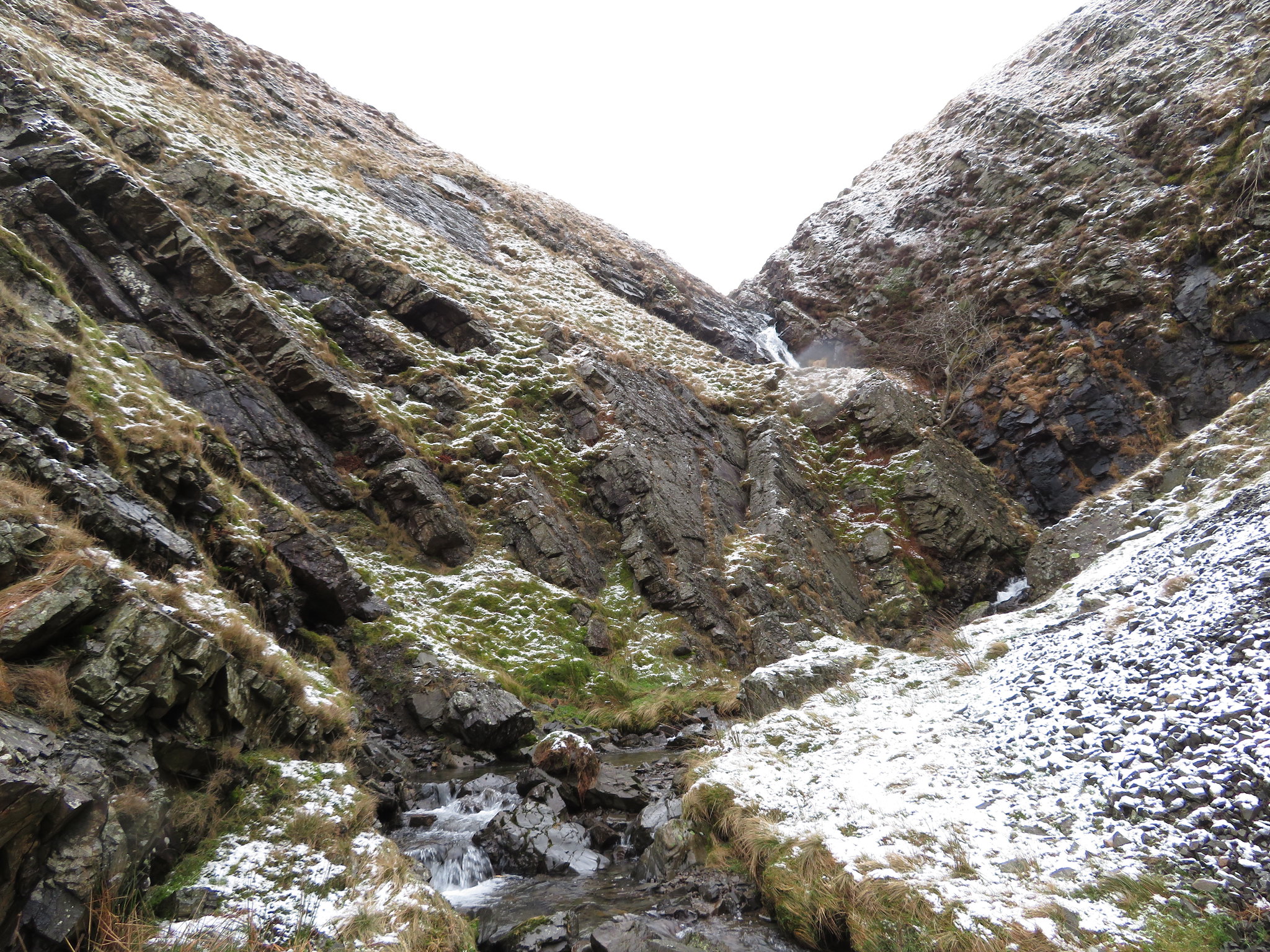 The Spout comes into view
 From Black Force to The Spout there is a climb of some 100 metres and some mild scrambling.
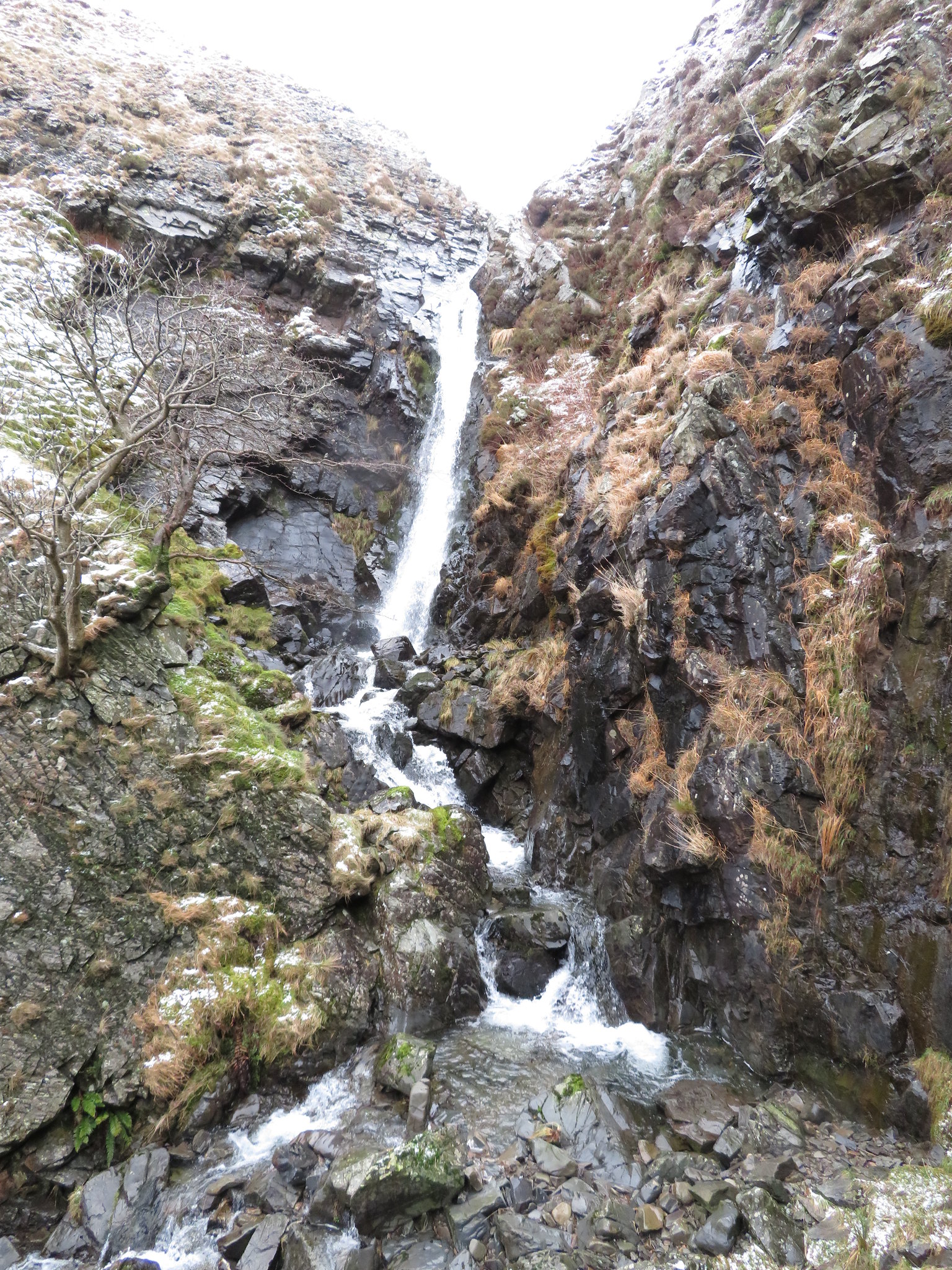 The Spout in Carlin Gill
 Whereas Black Force is fed by Little Ulgill Beck the much smaller falls of The Spout begins their journey by being fed by Great Ulgill Beck that is in turn filled up by the feeders that start their life in the narrow folds of Breaks and Bleak Tongue both being the northern slopes of the 638 metre high Breaks Head.
On a better and warmer weather day a body could linger here awhile soaking up the ambience of the place, surrounded by bare areas of sloping rock slabs on either side of the falls, scree slopes, a couple of stunted trees fighting for survival and doing a good job of it with small patches of grass to rest ones weary bones on whilst listening to the noise of falling water tumbling into the pool at its foot. But we have to leave this magical valley and find our way up to higher ground by either re-tracing our steps back down to Black Force, take the thin path that rises to the northeast towards Great Ulgill Beck or by climbing out from where we were by way of the rock face on the north bank, we chose the latter option.
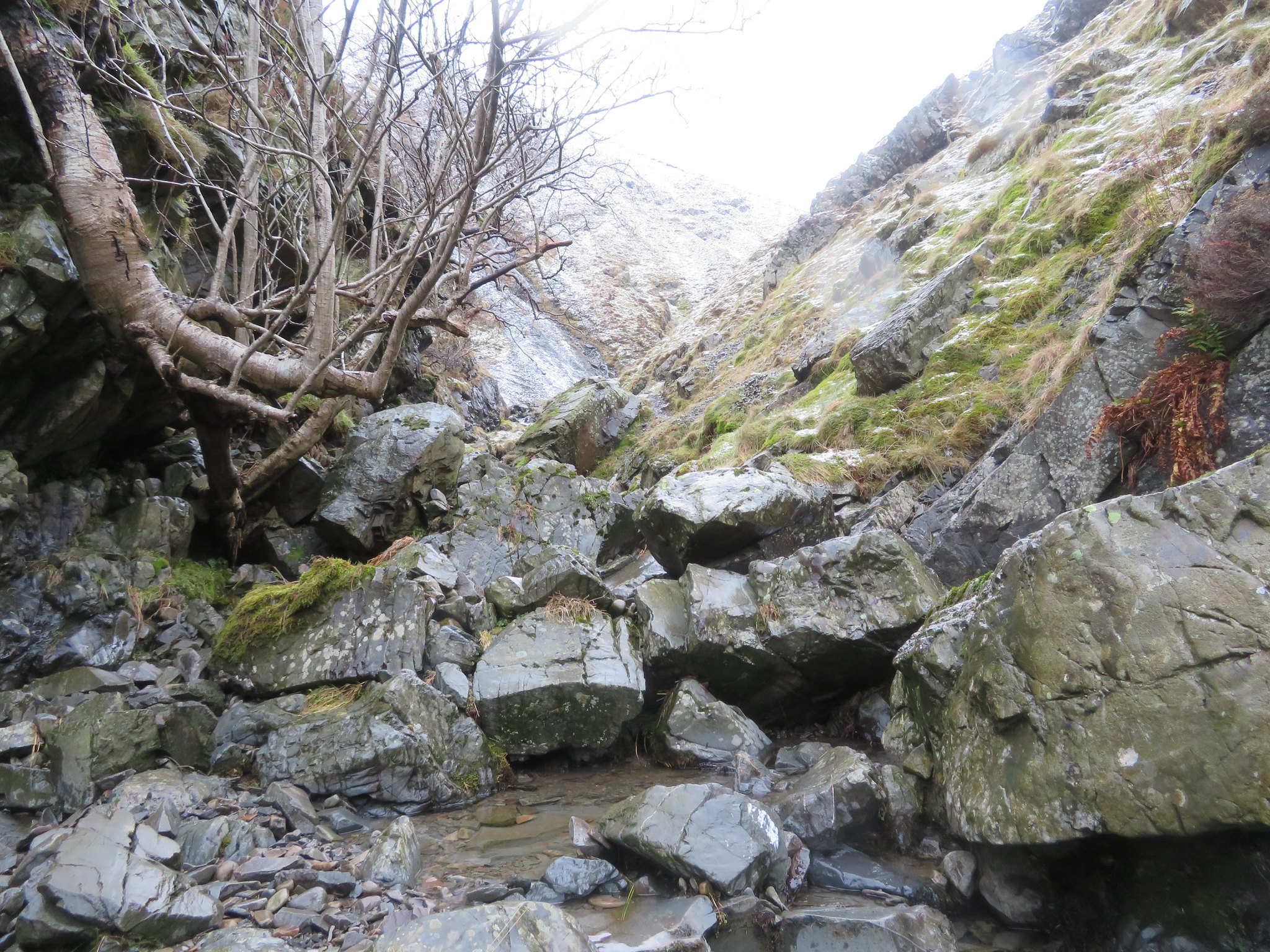
We are going to make our way to Blakethwaite Bottom and the site of the boulder that marks the old Yorkshire/Westmorland border so needed to climb out by way of the sloping ledge of rock on the north side.
 Our way out is by way of the sloping rock ledge
 When dry this smooth sloping ledge would present no problems, however, today it was wet with small patches of snow and nothing really to get a hold of to assist with the upward motion. A couple of slips and curses with the odd handful of soft vegetation breaking away when grabbed made for an interesting scramble up to the small ledge overlooking the falls from where a half decent photo was grabbed…
 The Spout from above the rock ledge
 whilst Chris was fighting his own personal battle with the sloping ledge.
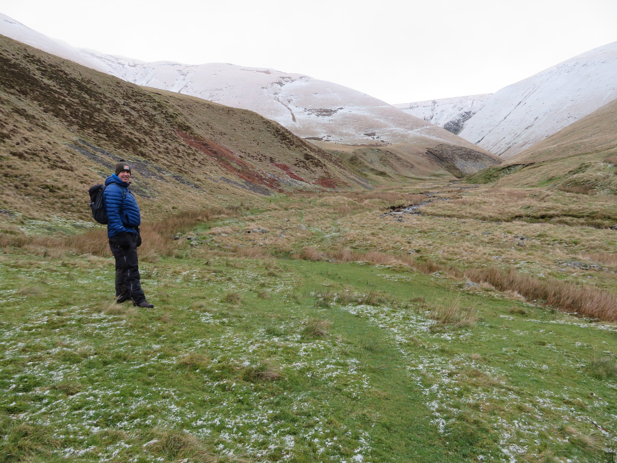
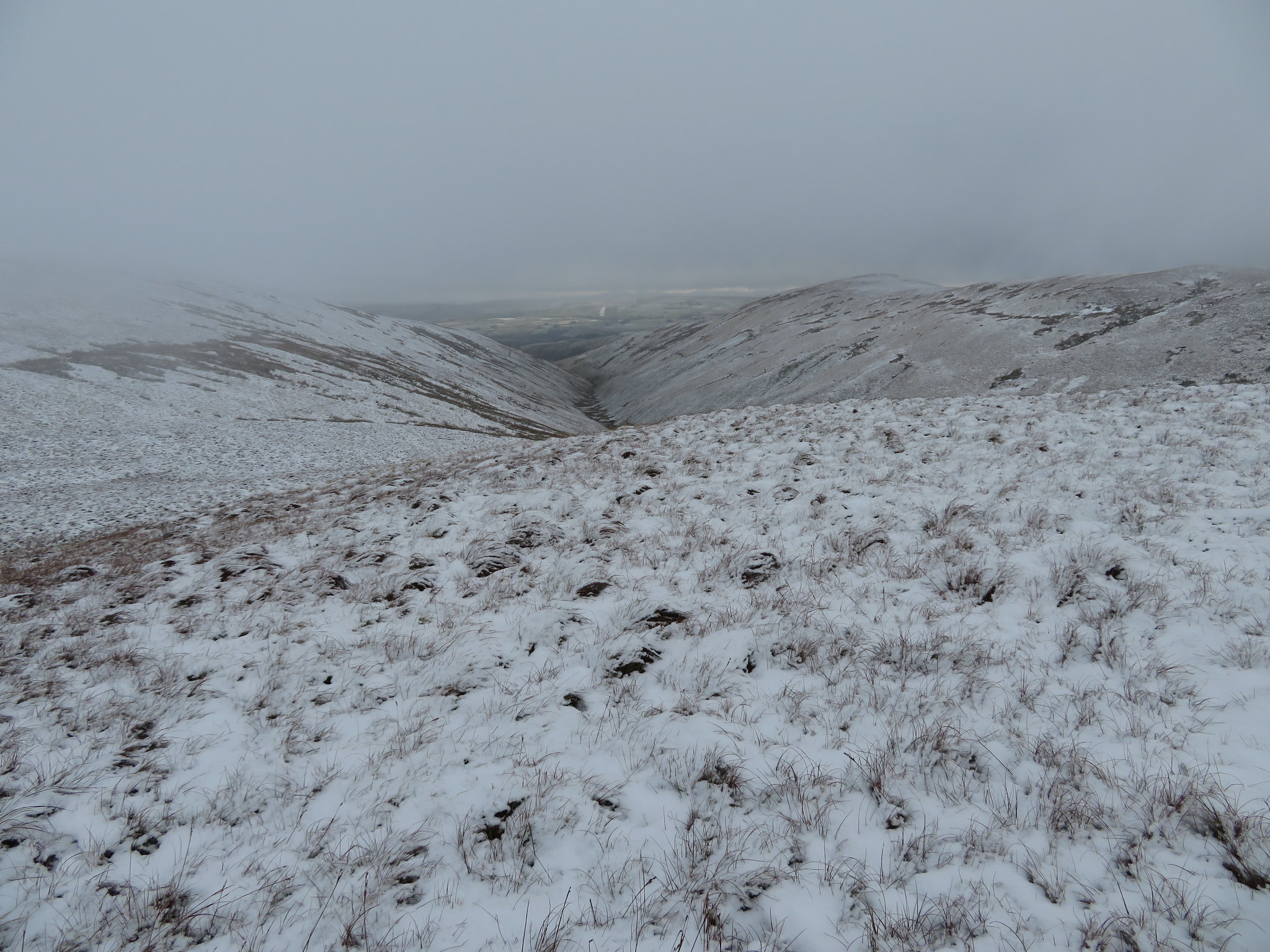
From the top of the rock our original plan was to continue following the beck onwards to Blakethwaite Bottom along the steadily rising fellside but as it slopes quite steeply down towards the beck the soft snow made the walking quite treacherous and after a couple of slips and slides that nearly resulted in another visit to the beck we felt it prudent to take the harder option and climb some 60 metres up the fellside to where the slope eased off. Once on easier ground we made better progress as we walked northeast along the foot of Uldale Head to soon arrive at the level swampy area that lies between Uldale Head and Docker Knott. This large swampy area is the gathering ground for the water that forms the head of Uldale Beck, the beck of the valley of Uldale, itself a worthy place to visit.
 Blakethwaite Bottom from the foot of Uldale Head
I've been here a few times before but since my last visit I noted a quad bike track rising all the way up to the summit of Uldale Head making the climb look a lot easier than the ones that I have done up the pathless fellside on quite a few occasions, such is progress, or not. We walked over to the old boundary stone, a large rock really that that has a number of inscriptions carved on that today were covered in ice and snow.
 Blakethwaite Stone with Hand Lake behind left
 We left by walking along the west edge of the marsh but needed to cross it to get to our next hills but picking a way through this sodden morass wasn't all that easy and despite the cold the ground wasn't frozen hard enough to hold our weight as we turned to the northeast again and made for the col between Hand Lake and Docker Knott. An interesting journey was made across the marsh, tottering about trying to stand on clumps of rushes and trying not to sink too far into the freezing water. I already had one wet foot and I didn't want another or a top up of the first one. We made it more or less safely across and started the steady climb up to the col through snow covered grass and after a walk of 20 minutes reached the wide track at the col. From here we could see the quad bike track running up the east flank of Uldale Head.
 Uldale Head from the col between Hand Lake and Docker Knott
 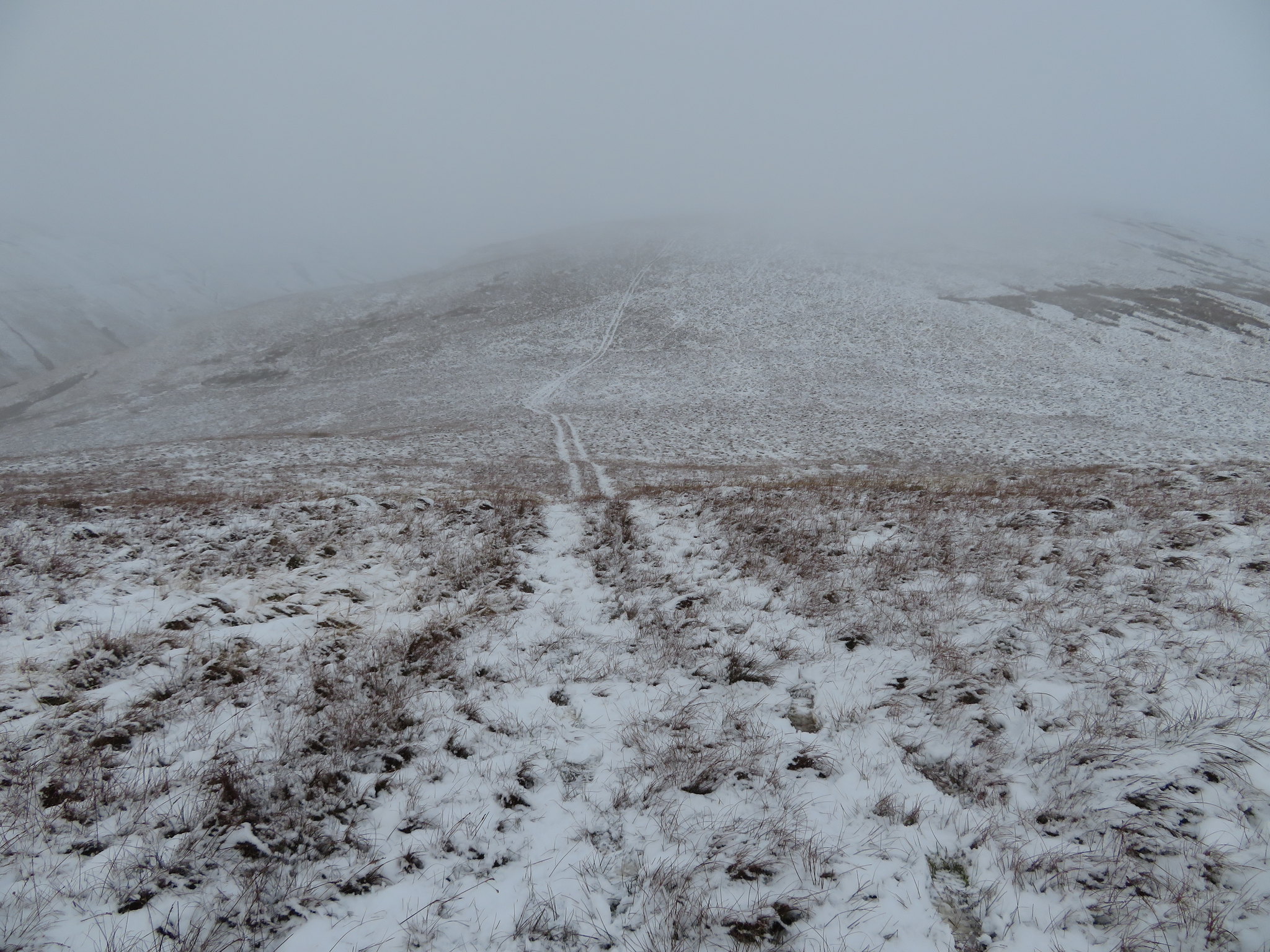 Hand Lake in fog and snow
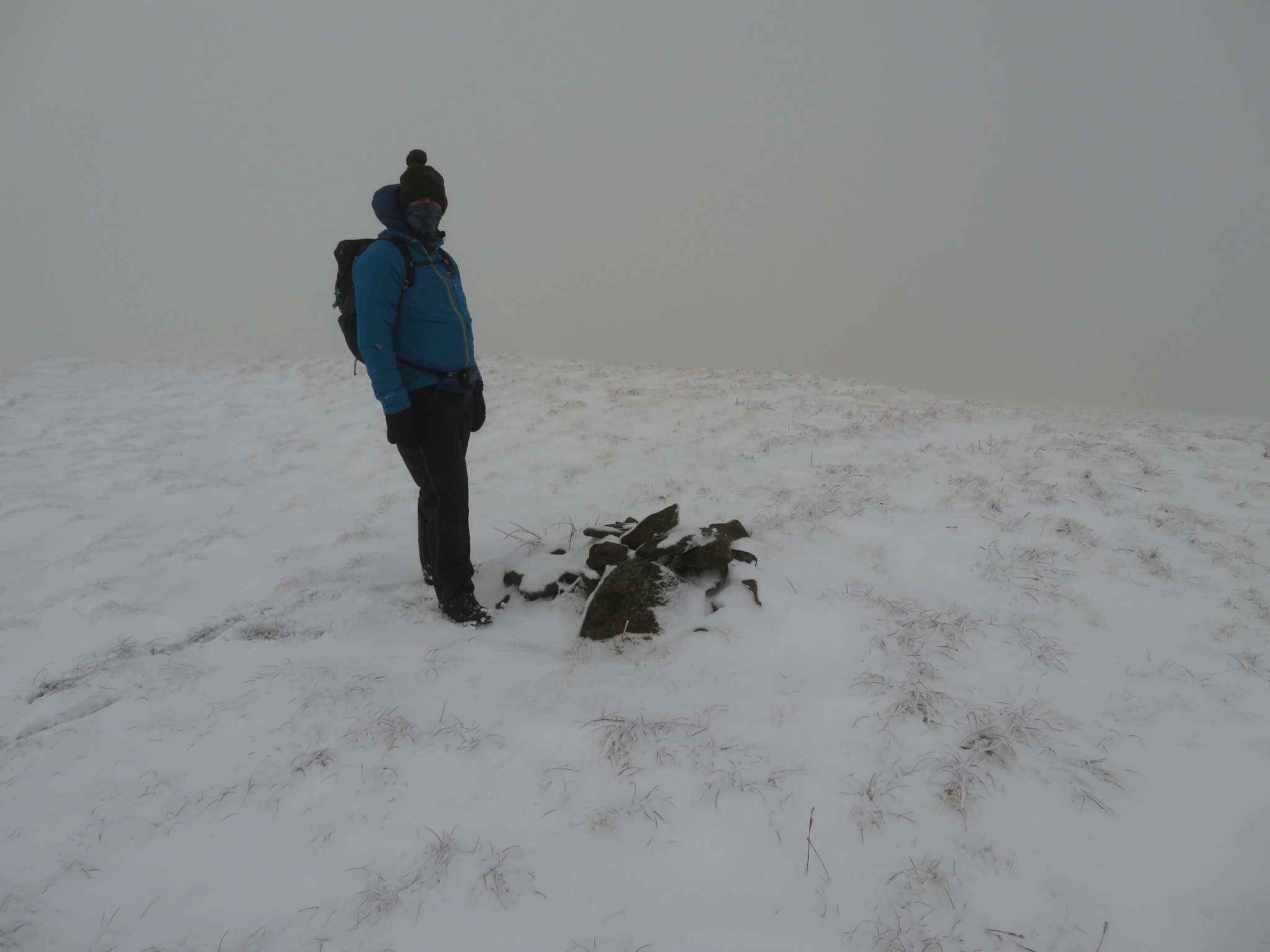
 From the col we then turned to the southeast to make the climb up to the grassy summit of Docker Knott to find a small snow covered cairn of stones and a pose from Chris. The walk up was done in clag, and with the snow covered ground was one done in a land of white and grey, the only touch of colour being from our two blue coats. The higher we climbed the harder the snow got beneath our feet with a hard crust covering the soft below it, a crust that didn't prevent us breaking through into the softness below and became akin to a kind of heather bashing. The fog lifted and we got a glimpse of brightness as we turned and looked along the length of Churn Gill.
 North along Churn Gill towards Raisbeck
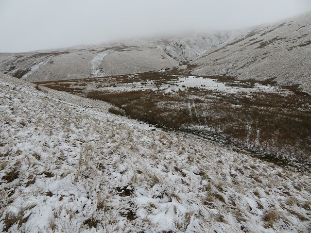
Leaving Docker Knott behind we were now heading south for Over Sale and the fog had dropped in on us again so with not much to look at concentrated on the snow covered soul destroying quad bike track that forever disappeared into the grey of the clag, it was liking being lost in a part of some 3rd dimension, a world of silence and grey wraiths with no signs of life apart from the two of us with even our footfalls making no sound.
 Over Sale lost in the clag
 Once again the fog lifted and we got a short time of being able to see what was around us with the view to the north being the best we could hope for.
 Uldale Head-Uldale Beck-Hand Lake view from Over Sale north ridge
A few minutes later we arrived at the cairn less summit of Over Sale from where a look to the west showed a window of green sun bathed fells, a lovely patch of colour amongst the otherwise grey of today.
 Dillicar Common and Shap Fells from Over Sale summit
 From this top we had a small descent before a short climb to the top of Taffergill Hill with a view to the north being the better option for a photo this time.
 Great Blea Gill from Taffergill Hill
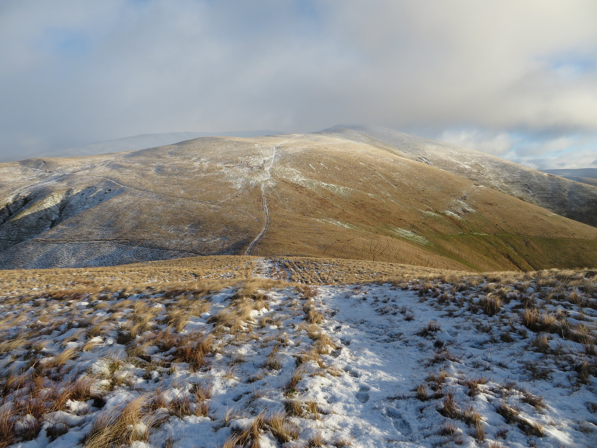
 Next on are Wind Scarth and Stowgill Brow with yet another walk southeast into what Chris had described as a 'white wilderness'.
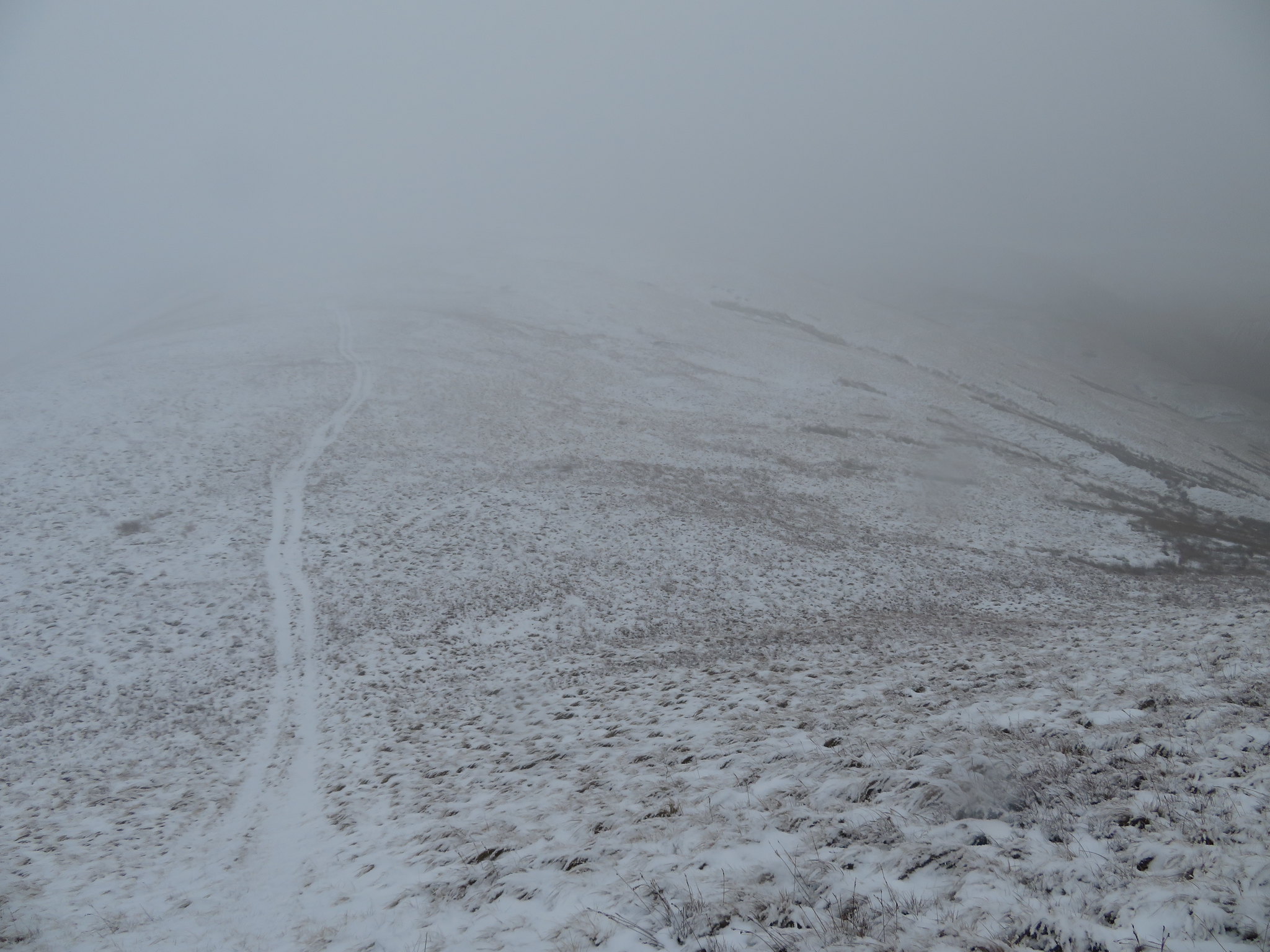
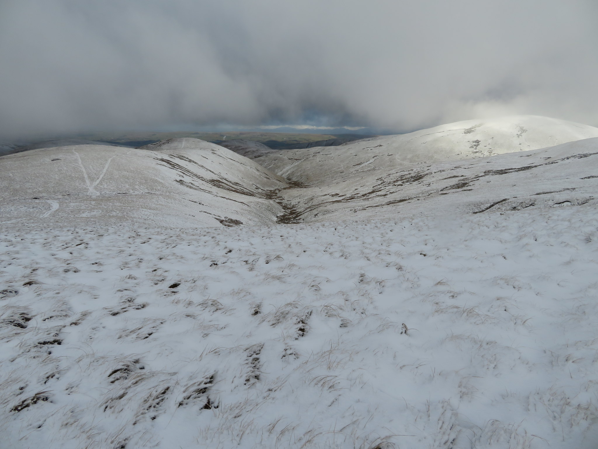
 Onwards to Wind Scarth and Stowgill Brow
 The long white track wound on uphill ahead of us seemingly never ending as it got lost in a grey wall of fog. The wind had begun to pick up, getting stronger the higher we climbed and Wind Scarth is well named as when we arrived there we had a hell of a job keeping on our feet, a wind that would stay with us all the way to Fell Head and not easing off until we got into the lee of the ridge down Blake Ridge. Once we had arrived at the 638 metre top of Breaks Head the incline eases off somewhat but the wind was making it a difficult walk as we turned to the west and made our way towards Fell Head first of all passing by the larger cairn that stands at the head of Long Rigg. The only break in the fog was when we were between that cairn and the summit of Fell Head above Long Rigg Gill with a view south over Brown Moor.
 South over Brown Moor towards Sedbergh
 We arrived at Fell Head fairly well battered by the strong wind to find the small cairn almost buried in the snow where despite the conditions Chris took his usual pose stance with only the red of his eyes showing between pulled down hat and pulled up neck gaiter.
 Fell Head summit
 We hadn't stopped for a fuel up yet with no opportunity being found due to the weather and lack of shelter on these hills, shelter being at a premium with the only sheepfolds to be found being down in the valleys and the only summit shelter that I can recall just now being on Rispa Pike. We didn't linger as it was a really freezing wind, my left foot was feeling cold and Chris's fingers were beginning to feel it even though he had thick waterproof gloves on. We commented on the fact that it wouldn't do to have an accident if walking solo in these conditions as a body wouldn't last too long if not found quickly.
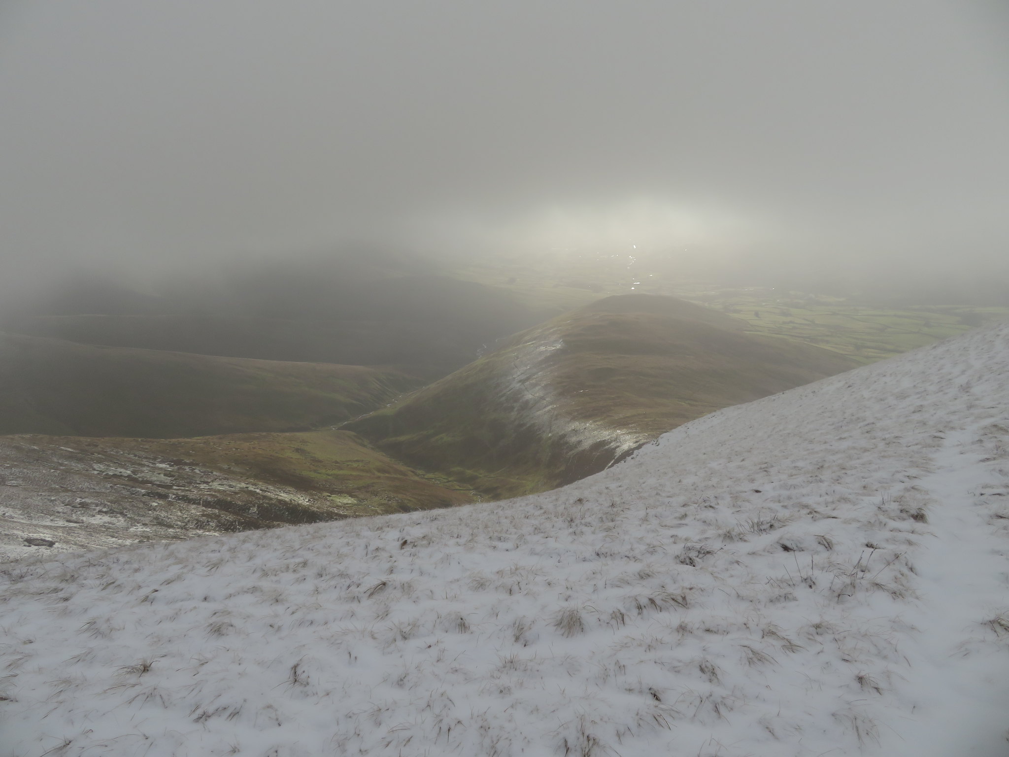
A turn in direction to the northwest found us walking along the track down Blake Ridge, not to the 525 metre spot that is shown on the map but down the western ridge towards Linghaw and Knowles. It's a very easy incline that soon got us out of the worst of the wind with it now blowing on our backs instead of front on and from the north, strange how it turned, maybe Uldale Head was turning it around somehow. As we started to descend the low clouds lifted slightly affording us a view down towards Blease Fell and the distant Lake District.
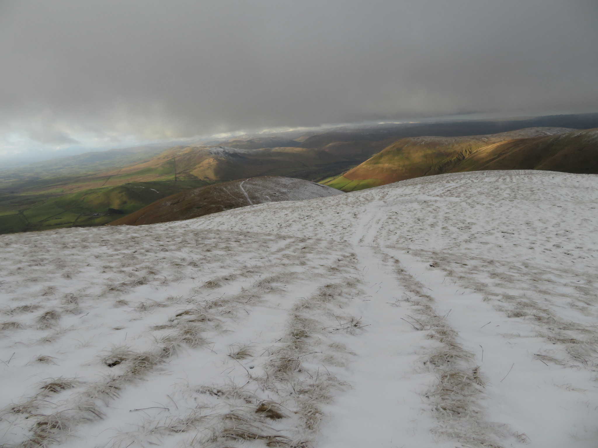 Northwest to Blease Fell-Grayrigg Pike and the Shap Fells
 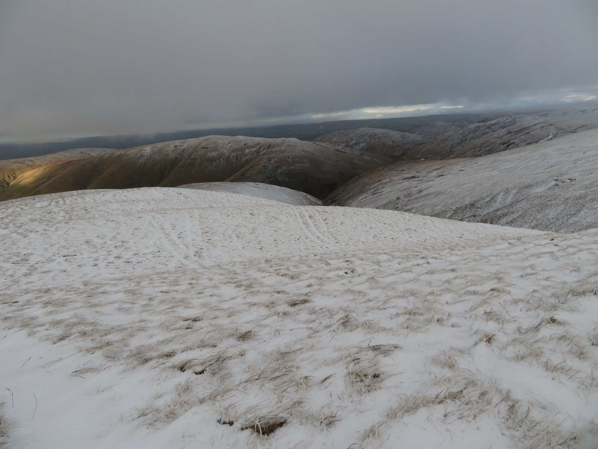 North towards Uldale Head
 As we descended Blake Ridge the sky and the views opened up.
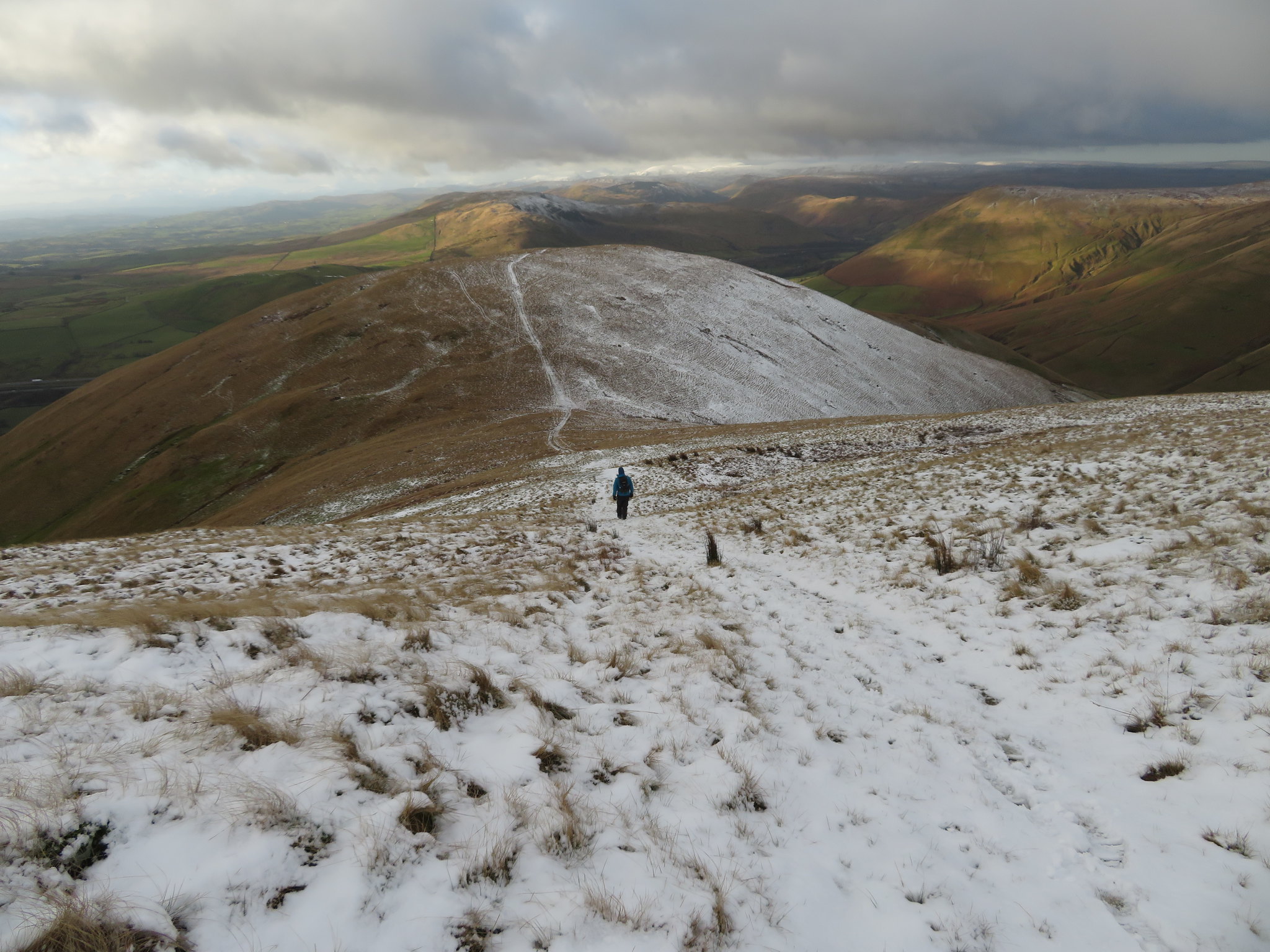 Linghaw with Blease Fell right and the Lake District mountains behind the Shap Fells
It's a good clear track down but it was slippery with patches of ice under the snow so the walking was a bit tentative along this stretch. The view to the southwest opened up with the M6 making an appearance with the five large wind turbines just visible on the skyline but today Morecambe Bay lost in the background haze.
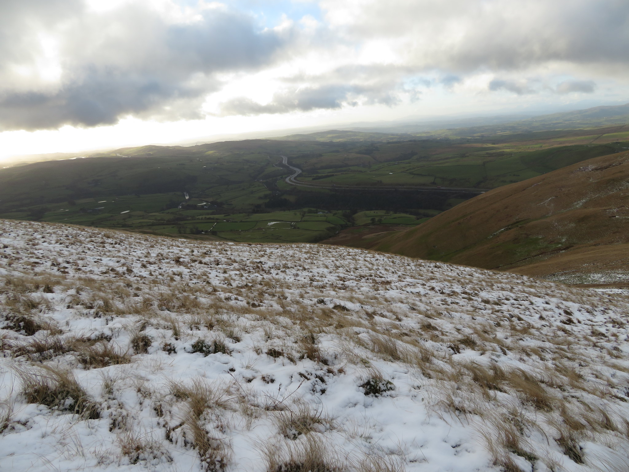 Southwest along the M6
 Well it's all over bar the shouting as we topped out on Linghaw summit and looking back it was just Sod's Law that the fells had now cleared of fog and a great view back to Fell Head was to be seen.
 Looking back to Fell Head from Linghaw
 The snow was disappearing from underfoot and we were walking into glorious sunshine the fells being lit up in a golden glow as we arrived at the small rocky knoll of Back Balk with Blease Fell prominent to the north, the Whinash and Whinfell hills in front and above the north running M6 as it passes through the Lune Gorge.
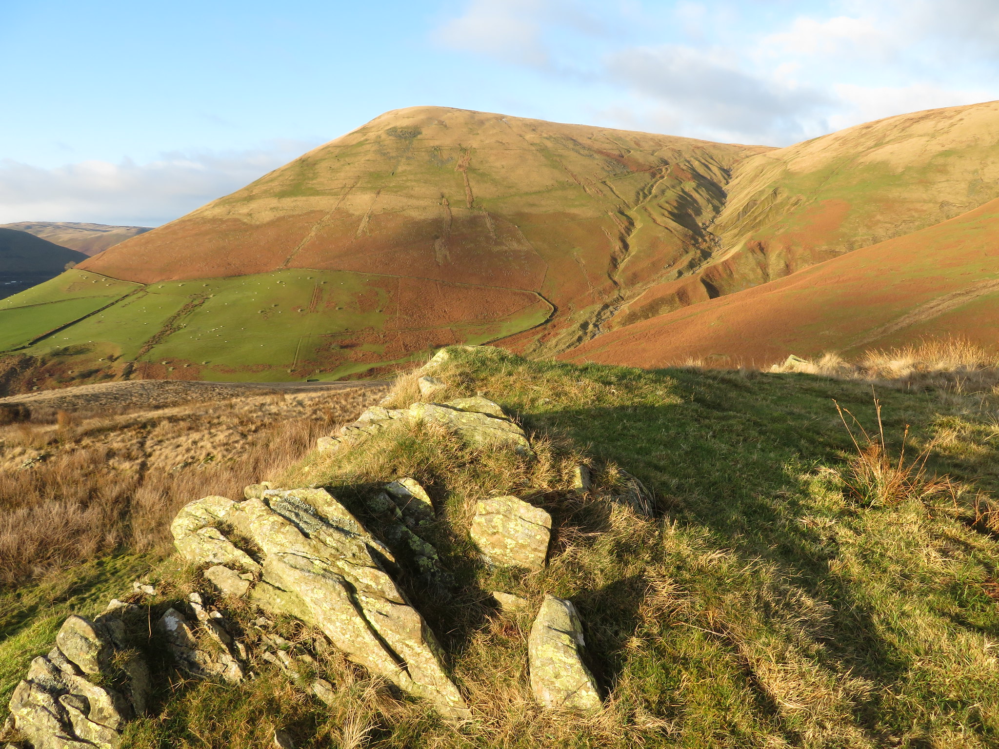 Blease Fell and Weasel Gill from Back Balk
 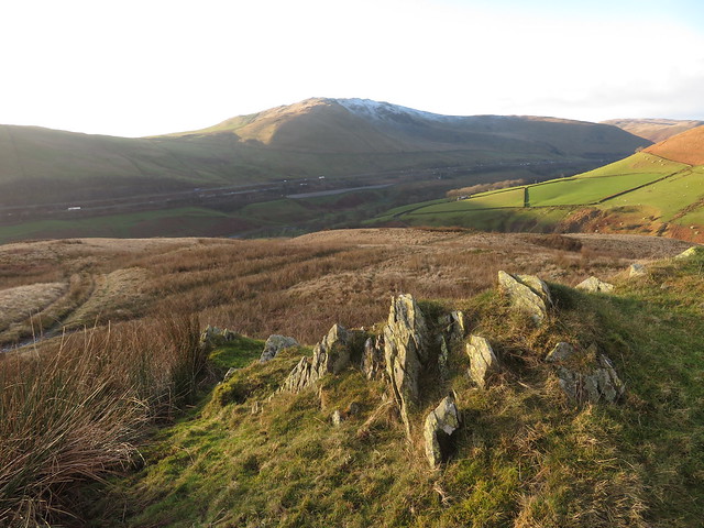 Grayrigg Pike and the M6 from Back Balk
 We could see the car from Back Balk sat below Gibbett Hill, the promise of food and drink to stave away the pangs of hunger and dry throat.
In the 17th century - and maybe long before that - Gibbett Hill stood above what was then the main road between Lancaster and Carlisle - the old Roman Road - and was a place where an annual fair was held, hence the name Fairmile Road. Gibbett Hill is well named as in 1684 a local rogue by the name of William Smurthwaite was left to rot in an iron cage suspended from a gibbett, maybe whilst people were enjoying themselves at the fair. According to the Old Cumbria Gazetteer
'William Smurthwaite was High Constable for Lonsdale, and a juror at the Quarter Sessions at Kendal. But he was also the leader, with his brother George, of a gang who indulged in theft, burglary and clipping coins. They were arrested and tried at the Assizes at Appleby in 1683, but acquitted. A year later they were tried again in the court of Judge Jeffries and sentenced to hanging at Lancaster Castle. William Smurthwaite’s body was hung up in a metal cage at Gibbet Hill as a warning to others'. Judge Jeffries was the infamous 'Hanging Judge' of the day.
Within minutes of leaving Back Balk we were changed and sitting in the car having a bite to eat leaving the parched throats until we entered the Black Bull in Kirkby Stephen where a couple of the best that they could offer went down a treat.
This has been a great day out, one of the best despite the strong arctic wind conditions on high with the walk along the beck more than making up for the struggle against it. We had seen neither man nor beast, feathered or otherwise apart from ourselves making the walk in the snow and foggy conditions seem more remote and barren than what it actually is. The Howgills are great hills to be amongst but like everything else today they are not like they used to be. Where once upon a time not so long ago there were only a few tracks along the easier ridges and walking along narrow trods or pathless fells were the norm they are now crisscrossed by countless quad bike tracks that obviously make the walking easier, although whether that is a good thing or not is a matter of personal opinion.
A funny old day. The rain never showed up but was replaced by a snow blizzard for short time with the skies not clearing but getting progressively closer to the fell tops. The short cloud clearances were a bonus amid the clag that hung low over these fells today and it was frustrating to see glimpses of the sunshine over the far hills, flooding the Eden Valley, seeing the LD mountains bathed in sunlight. Sometimes the life of the fell walker can be a bitch, such is life.
The video below is a late addition and after thought to the report and was taken when accidently pressing the video button on the camera when taking a photo. I know, it's crap and will work on my video skills.
 Accidental video taken in Carlin Gill