
An Isle of Harris Gem - Beinn Dhubh
 P1330138.jpg by scotlandmac, on Flickr
I love Harris. It has to be one of the most beautiful places I have ever seen anywhere in the world. This summer, I was lucky enough to visit a couple of destinations which had been on my bucket list for years – Iceland and Norway including Lofoten. Yet I came back from those trips thinking that , for me, the Western Highlands of Scotland and the Hebrides still win hands down in the wow and beauty stakes.
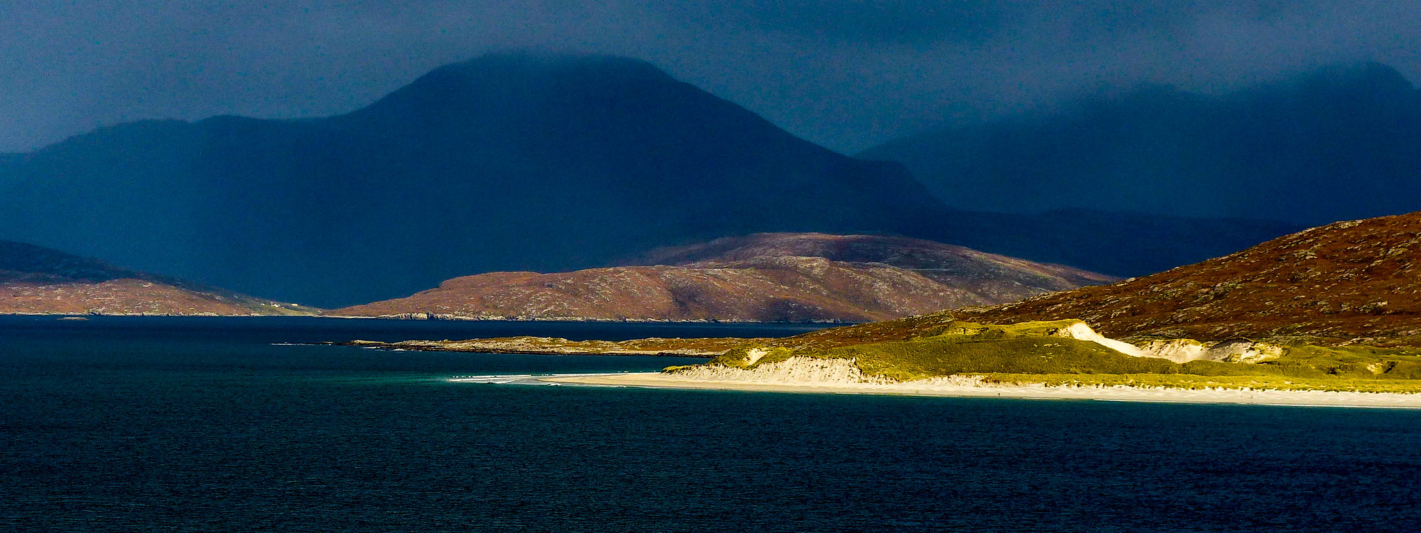
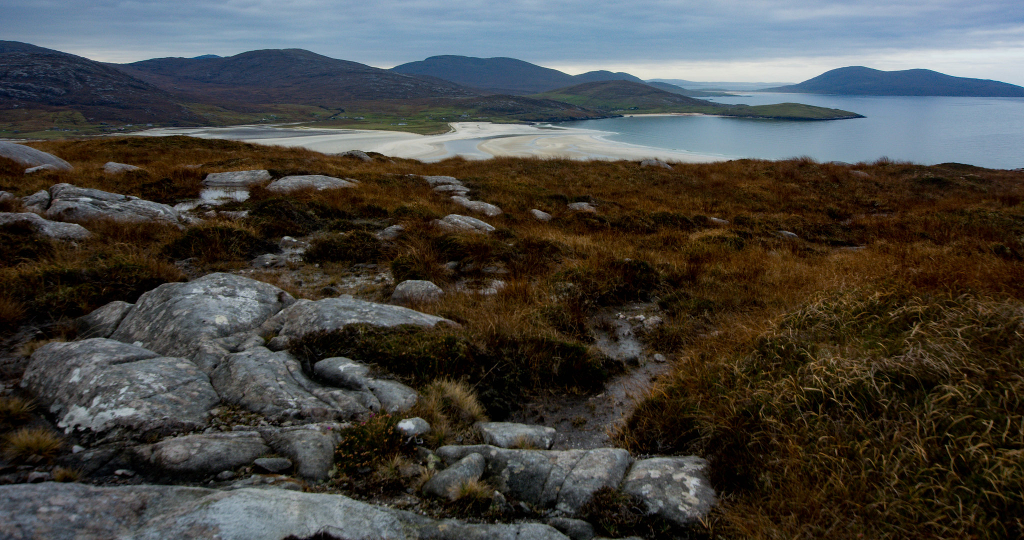
 DSC_8344.jpg by scotlandmac, on Flickr
Beinn Dhubh - pronounced Ben Ghoo - is not a high hill at 506m, but it’s a beautiful mountain, very shapely when seen from Luskentyre beach.It sweeps straight up from the creamy sands and turquoise ocean directly opposite the impressive mountains of North Harris. The whole massif is called Beinn Luskentyre with Dhubh being the highest top.
 P1250126.jpg by scotlandmac, on Flickr
I’ve read that its summit is considered by some to be Harris’s finest viewpoint and even the understated SMC Guide commented on its 'unsurpassed' views. Unfortunately on our only outing on the hill a few years ago, the forecasters had been unsurpassed in getting it totally wrong (nothing new there
Ever since, getting a good clear day to enjoy this hill had been worrying me like a loose tooth.Mid-way through a November week on Harris this year, a weather window looked likely mid week and our Beinn Dhubh attempt Mark 2 beckoned.
So at 8.15am on our second last day on the island, after downing multiple mugs of tea, off we set along Luskentyre's deserted, single track road hoping to enjoy better luck and see the hill at its best.It was a glorious morning for it, so far anyway.
 DSC_2420.jpg by scotlandmac, on Flickr
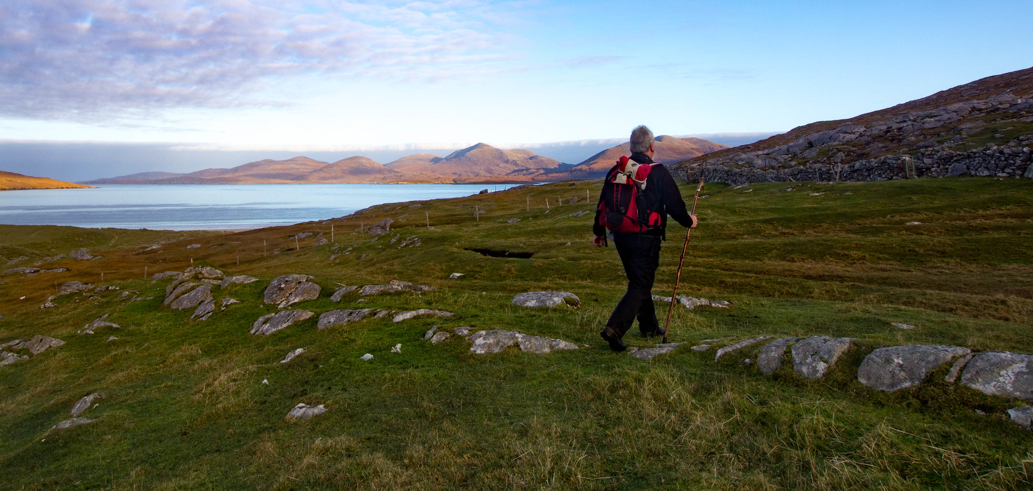
We were staying in Atlantic Shore Cottage, overlooking the famous Luskentyre sands and perfectly placed for a quick hike up the hill.Our route was also described by the SMC Guide as giving the 'easiest' ascent of its tussocky, wild slopes - another plus point in my book!
However, it's not always easy to get access to the hill from here, given the heavily crofted landscape. Barbed wire fences rule and it took us a good wee while to finally spy a gate that led across sheep cropped grass which didn't look 'private' in any way.It was almost right beside the house of one of Harris's famous residents, Donald John, who weaves Harris tweed in a tiny shed just off the road. It's not unusual to hear the clack- clack of the loom as he works.
No clacking today though but even if there had been, it was the North Harris hills that drew my attention.
 DSC_8261.jpg by scotlandmac, on Flickr
I find them absolutely stunning. Big shapely mountains of tawny , dusky moorland and pink rock rearing out of a turquoise sea fringed by creamy white sands.
 P1330437.jpg by scotlandmac, on Flickr
Sands that would make the Caribbean flush in shame
 P1250212.jpg by scotlandmac, on Flickr
 Next 'obstacle' was a substantial drytane dyke wall which runs the length of Luskentyre but our route took us neatly to a gate, avoiding the need of a clamber.Now, the rough walking really began.
 P1330516.jpg by scotlandmac, on Flickr
I had my eye on a line that I thought would allow us to avoid the steep, rocky route we took last time and managed to convince my husband Chris to give it a go, despite his doubtful looks. In fact, this ‘easier’ line soon became a mix of bog, reeds, rocks and more bog!
For the next 80 minutes of uphill slog, it felt like we were walking on sand, where every step feels like three.We were both soon huffing and puffing, making what I thought was a meal of a short ascent. I said as much but Chris was having none of it. ''We've got a combined age of 120, remember?' In other words, give us both a break! We're doing ok!
There were some lovely moments though, despite my efforts to grump my way up.We surprised a woodcock which shot up out of the undergrowth just a few yards ahead of us, then flew off at speed.Gorgeous bird. Several snipe rose too, piping loudly in alarm and zig zagging their way across the moorland. I could almost imagine them thinking – for God’s sake, have all these blasted tourists not gone for the year?
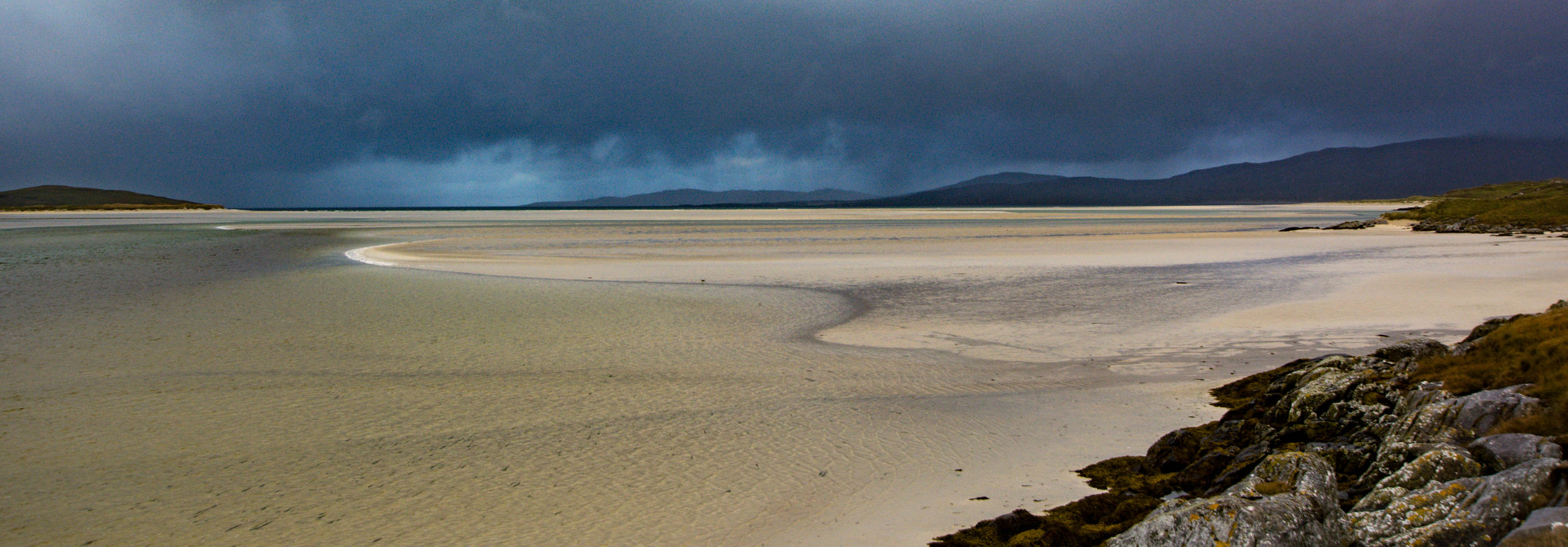
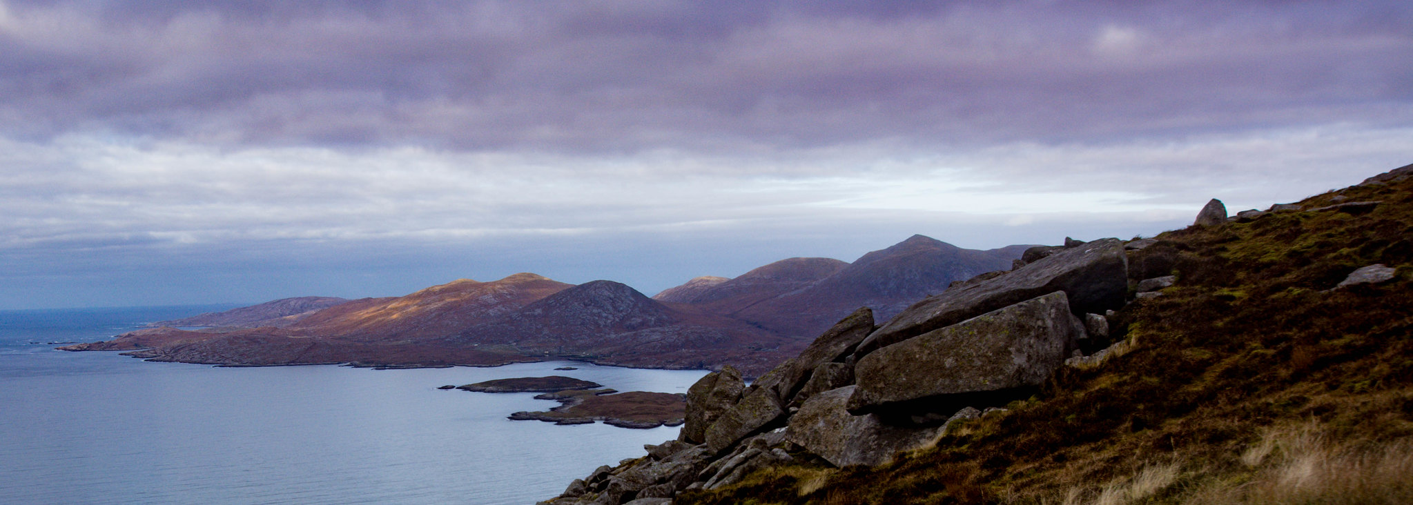
Taking a breather, the views behind us over the Seilebost sands and out to the island of Taransay were already glorious.It was worth it already.
 DSC_8322.jpg by scotlandmac, on Flickr
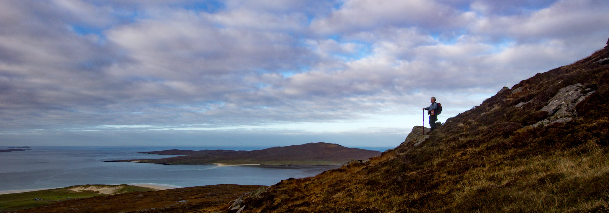 DSC_8271.jpg by scotlandmac, on Flickr
I could feel Chris pulling us always to the left, to the steeper ground, but I was sure the terrain would improve on 'my' line which was steep enough. However, it didn’t!! If anything, it seemed to get worse, more tussocky and quagmire-ish amongst the slab rock.
 DSC_8318.jpg by scotlandmac, on Flickr
But the end was in sight. Suddenly, the angle flattened out and we found ourselves cresting the ridge with the bog giving way to lovely dry, tundra like terrain.
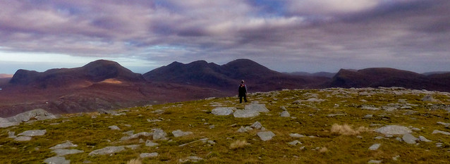
Wow! The views from the marker cairn were magnificent in every direction! As always on a hill, all the pain and effort - such as it was for a very short time - vanished as we took in the scene.
 P1330485.jpg by scotlandmac, on Flickr
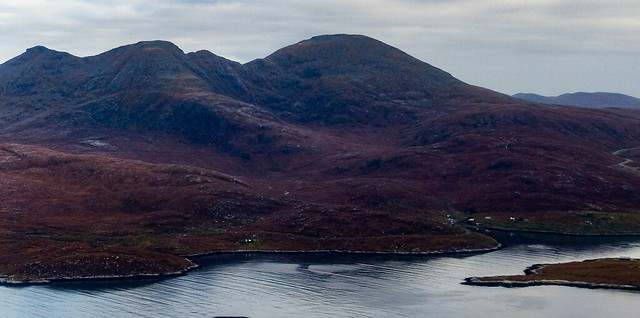 P1330486.jpg by scotlandmac, on Flickr
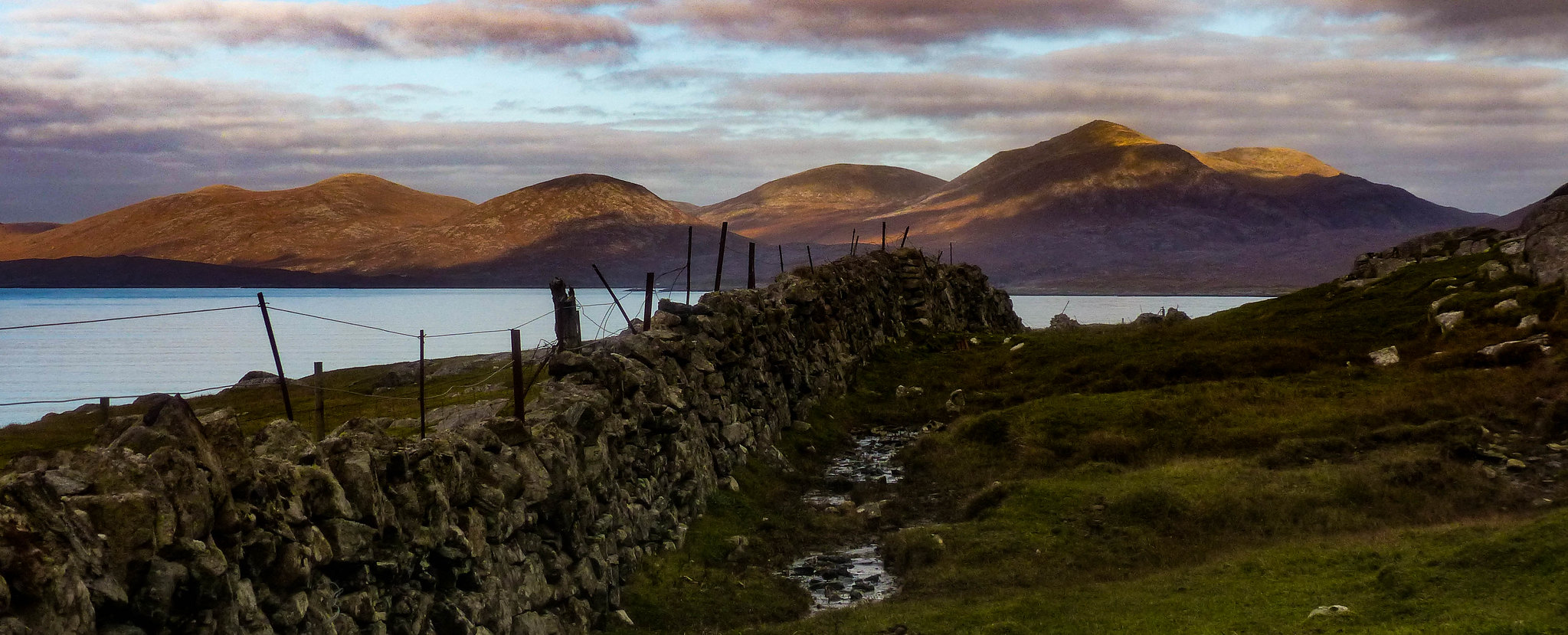
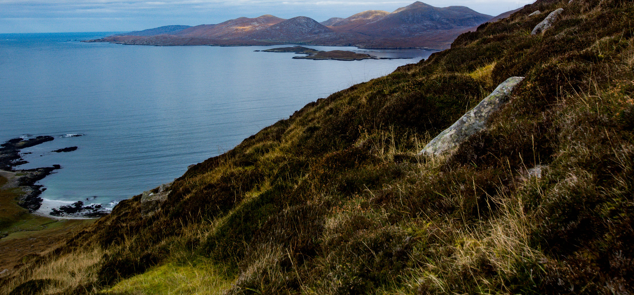
The Clisham, Harris's highest mountain, Tiorga Mor and the other North Harris hills were a rich dusky purple/brown, that amazing colour that the western hills take on in late autumn/winter.In brighter light than we had, they can look almost orange. The sea below was flat calm, like glass, deepest blue.
 DSC_8284.jpg by scotlandmac, on Flickr
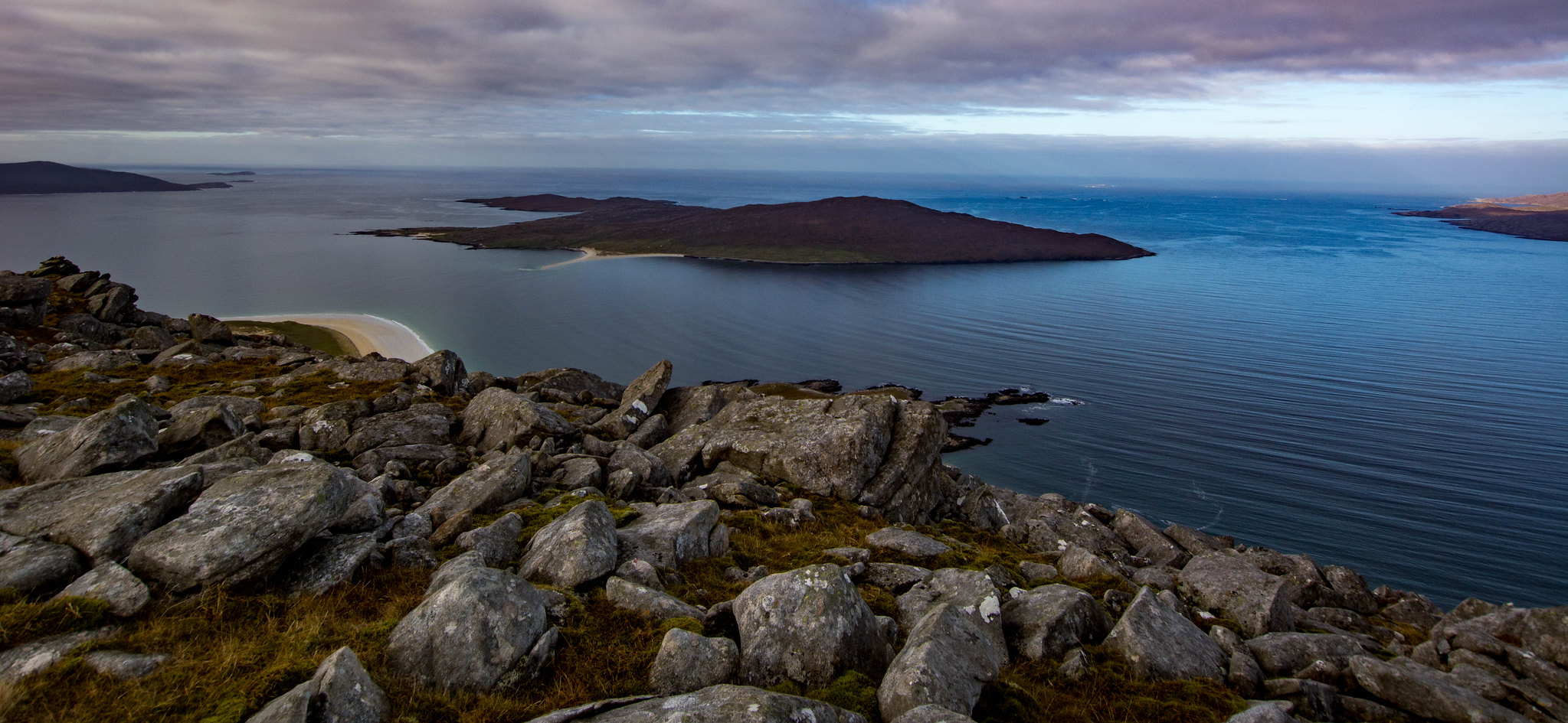 DSC_8287.jpg by scotlandmac, on Flickr
A smile on my face, after all the huffs and puffs and groans...
 DSC_8297.jpg by scotlandmac, on Flickr
Over 40 miles west, St Kilda and Boreray were faint on the horizon, islands we’d visited this summer, our second and finally successful attempt at getting to those remote outposts.
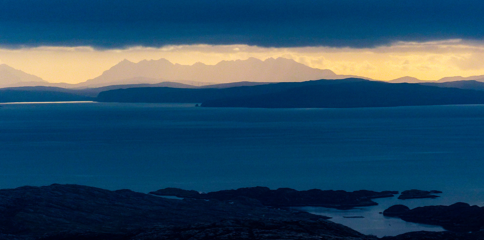
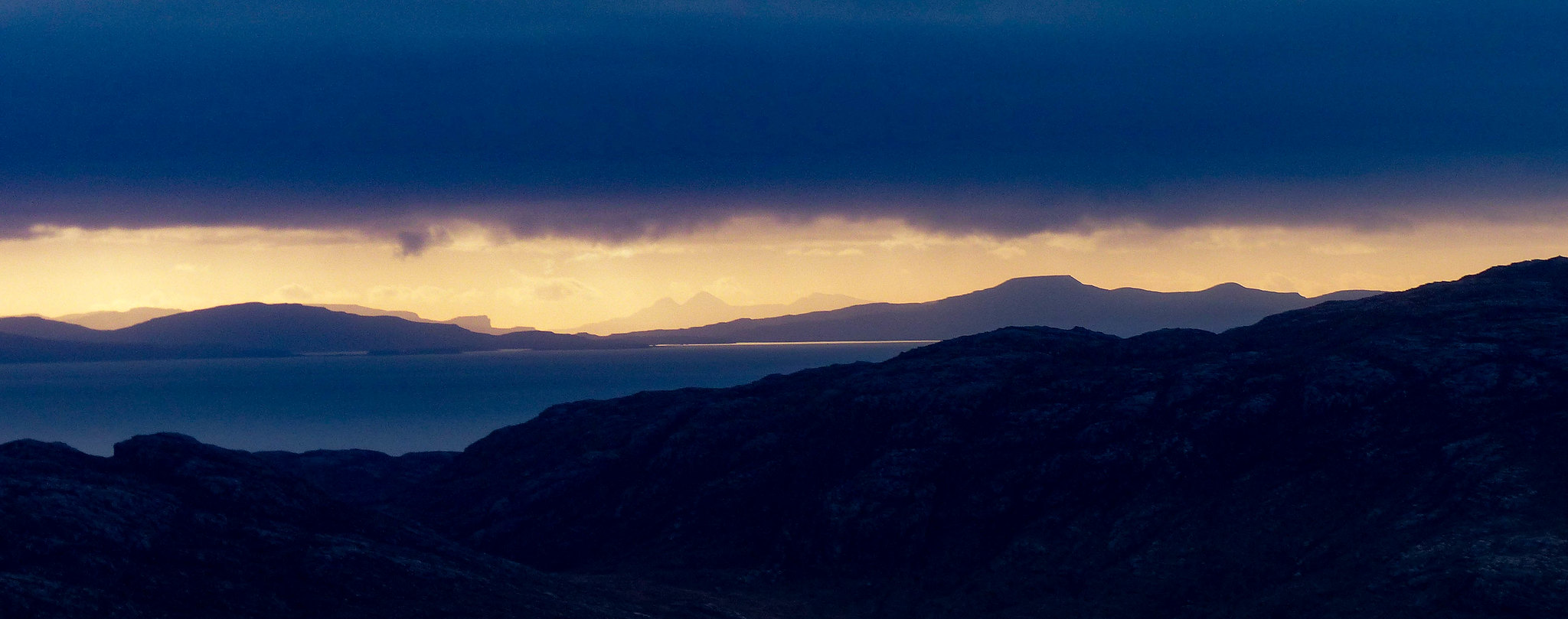
And just as alluring was the view to the east, across Harris’s rocky wild hinterland. From the Sea of the Hebrides rose the distinctive outline of the Black Cuillin.
 P1330477.jpg by scotlandmac, on Flickr
Sgurr nan Gillean's summits were like sharks fins, serrated against a clear lemon sky.Chris, a native Gaelic speaker, has always suspected that the accepted translation of that mountain as the 'Mountain of the Young Men' is wrong and that it means 'Mountain of The Gills or Fins' , as in fish gills/fins. Certainly, mountains are usually named descriptively in Gaelic, so that would make sense.
To the left sat the Red Cuillin’s rounded summits and further west, Rum’s shapely twin peaks were visible beyond Dunvegan Head and Neist Point. It was just outstanding. Mesmerising.
 P1330450.jpg by scotlandmac, on Flickr
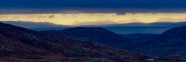 P1330448.jpg by scotlandmac, on Flickr
I went a bit nuts with the zoom lens but it really, was a joy to make out these familiar peaks and cliffs , so crystal clear even from this distance.
 P1330492.jpg by scotlandmac, on Flickr
Looking further north, we could make out the Torridons and the great wedge of Slioch above Loch Maree. In fact, it was the light that was the thing. While some thin cloud was already moving across Harris and 'dulling' the scene just a little, it was fantastically clear to the east with that lemony sky you get in really cold northern airstreams. Really spectacular with everything sort of silhouetted in sharp relief.The Shiants were visible too. Amazing country all around.
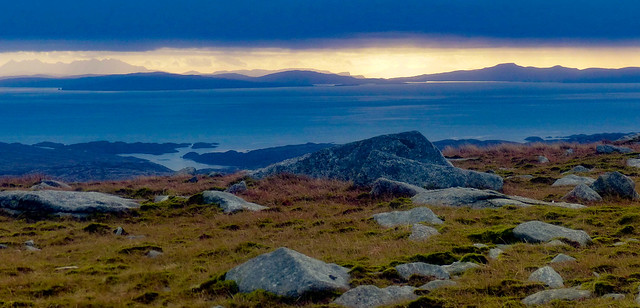
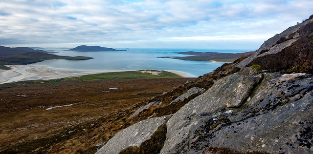
When I finally pulled my gaze away from all of this, I’d almost forgotten that below us, in all their glory, lay the huge sands of Luskentyre and Seilebost which seemed to stretch forever. We could make out the Scarista sands too where my youngest son was enjoying a few holes on the golf course. He was recovering from knee surgery and a hill, even a small one, was out this time.
 DSC_8309.jpg by scotlandmac, on Flickr
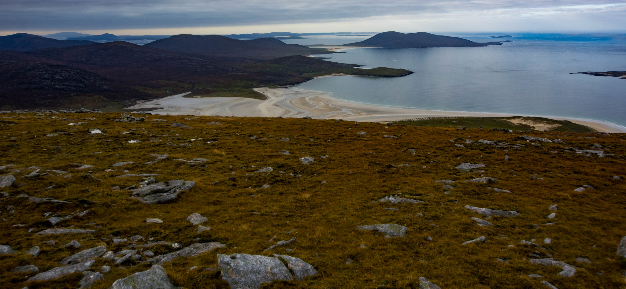
Beyond South Harris lay the sheep grazing island of Pabbay and also Berneray with its 4 mile long white sand beach. North Uist was visible too, land of my mother’s family and my favourite island of the whole Outer Hebrides chain.I'm sure genetic memory plays a role as I feel such a strong connection to North Uist, always.
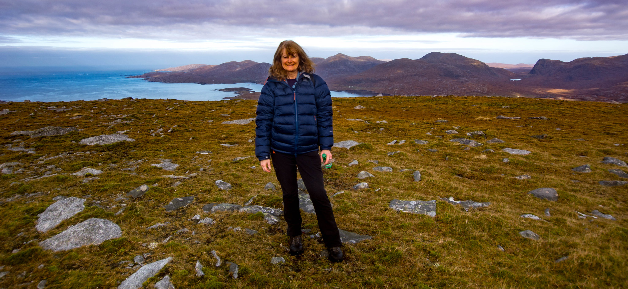
There wasn’t a breath of wind on the top, though the northerly airstream was Arctic cold. All this standing about admiring everything was great but we were cooling down rapidly! We still had five minutes walking up to the true summit so off we set and as we did, the views kept opening up even more.
 P1330478.jpg by scotlandmac, on Flickr
Tiny Tarbert village appeared and the ribbon of spectacular road that winds up and over mountainous North Harris before sweeping down into Lewis, a majestic drive.
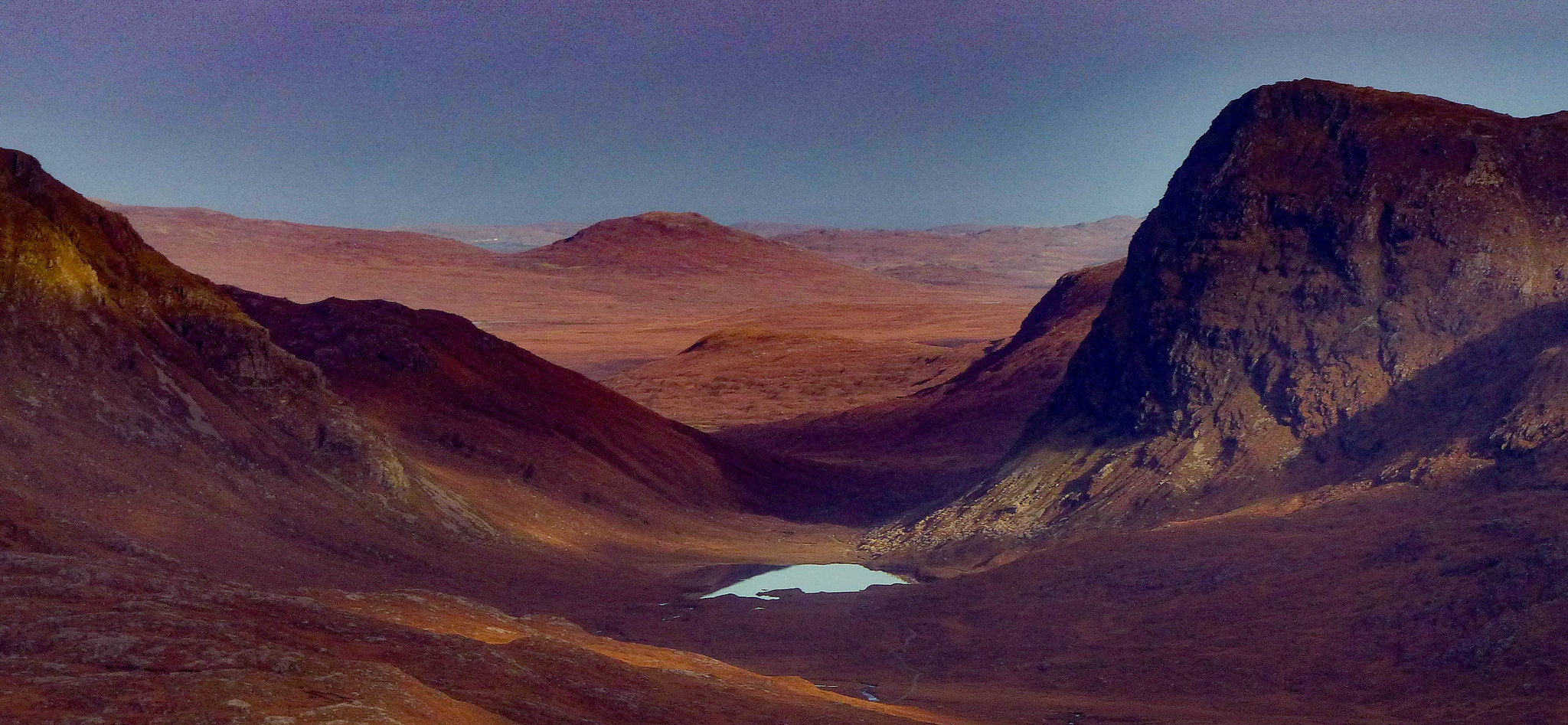
 P1330490.jpg by scotlandmac, on Flickr
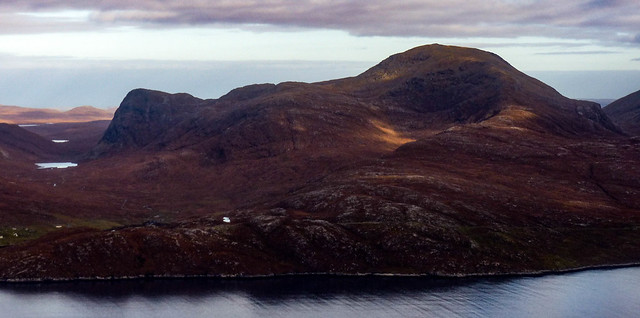
Sron Ulladale's cliff face looked superb and through a gap beyond a wild lochan, I thought I could make out the settlement of Uig on West Lewis. Beautiful hills and country. Wild as you could want.
 P1330472.jpg by scotlandmac, on Flickr
We spent twenty minutes or so just drinking it all in, feeling very lucky to have finally seen the hill at its best. I can’t agree more with the opinion that it offers one of the finest views from any hill on Harris though I must say that we climbed Clisham last year and it was outstanding too.I think these island hills often are, no matter how relatively lowly in height.
 DSC_8316.jpg by scotlandmac, on Flickr
We took the steep route down, the rockier option and as often happens, came across a sort of track winding its way down between the bouldery rough terrain. It would have been a much easier ascent this way so my route idea was wrong.Ah well I have plenty previous convictions for that
 DSC_8273.jpg by scotlandmac, on Flickr
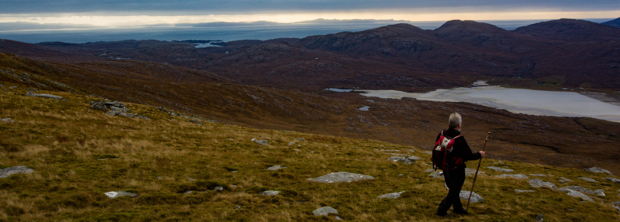 DSC_8314.jpg by scotlandmac, on Flickr
It was 12.30pm before we arrived back at the cottage, our hearts full of Beinn Dhubh and its amazing views. I think the thing to do would be to wild camp up there in summer and catch sunset and/or sunrise.