free to be able to rate and comment on reports (as well as access 1:25000 mapping).
The last weekend of 2017 - I had plans to head up to Kintail for some Tops for Allison then cross over to Skye for New Year, inspired by the fine scenes from Wilkie Murray's post earlier in the week of the snowy Cuillin. Maybe Bla Bheinn or some Subs like Beinn na Cro which would reveal the beauty without the challenge of the snow. However the forecast became increasingly unpleasant and the thought of wild-camping roadside in Kintail for two or three nights with snow at ground level (according to the pictures from TrafficScotland webcams) didn't really appeal. Must be going soft

So a last minute change of plans was hatched - we'd go up to Loch Linnhe campsite, pick off some Marilyns around that area and then head up to Skye on Hogmanay if conditions were suitable. Loch Linnhe was at least open which was something at this time of year. Allison got away a little earlier than usual so we managed most of the drive up in the light - surprisingly little snow in Glencoe, colder as we drive further north. I'm surprised to see another tent in the site - I expected it to be busy with the lodges and campervans etc, but not tents.
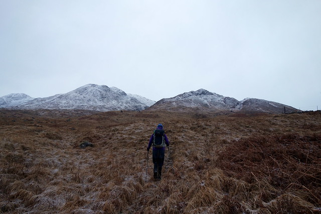
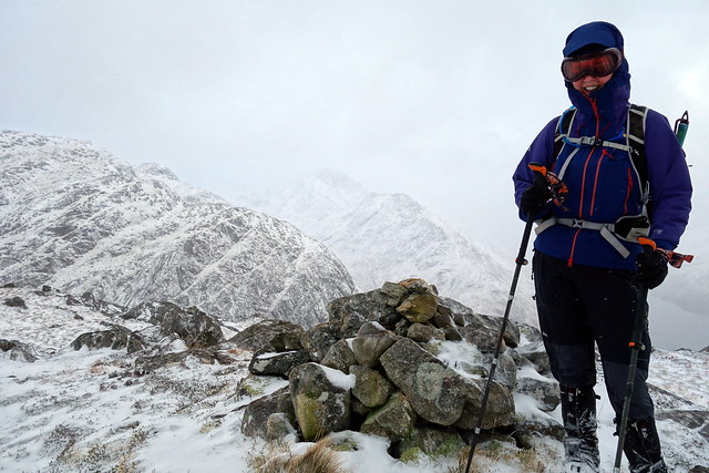
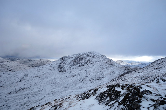
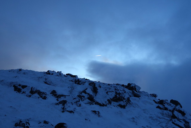
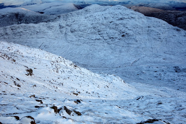
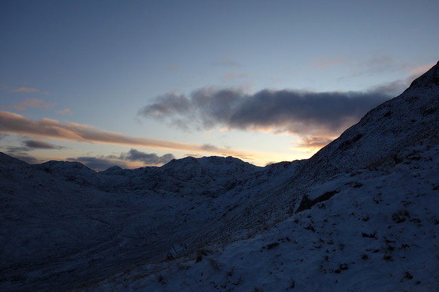
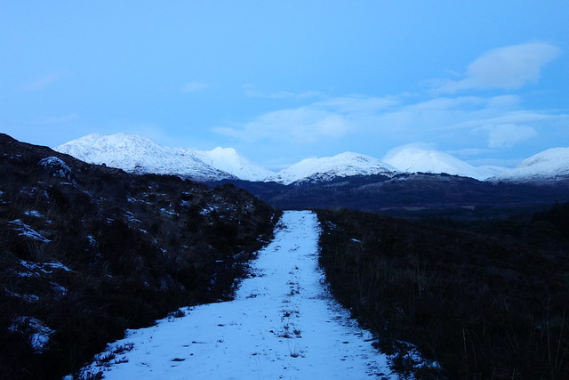
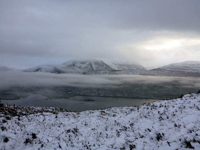
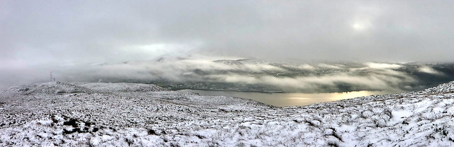
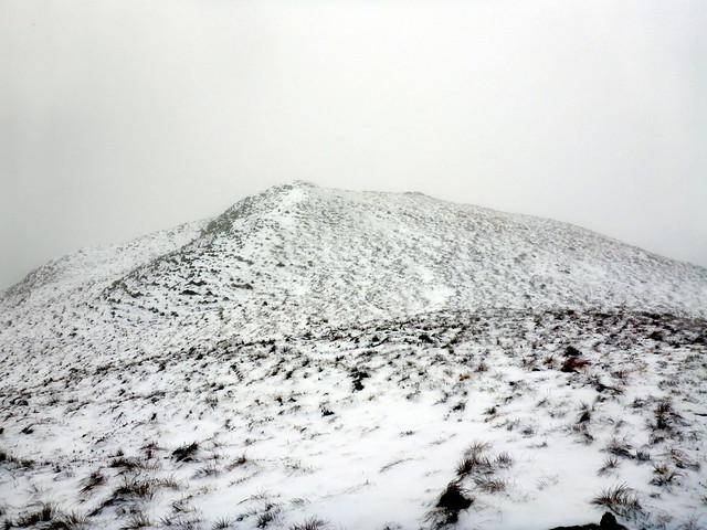
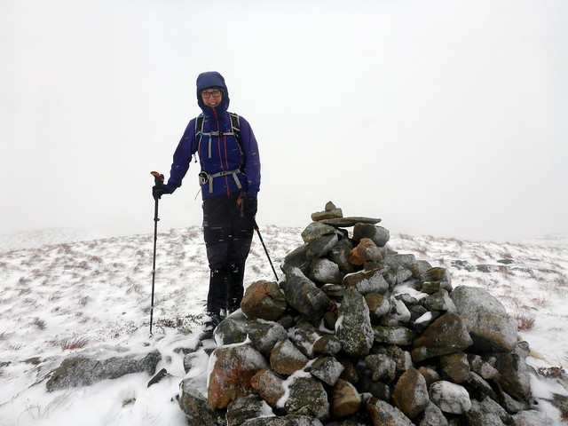
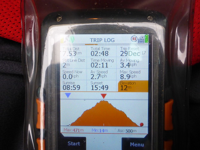
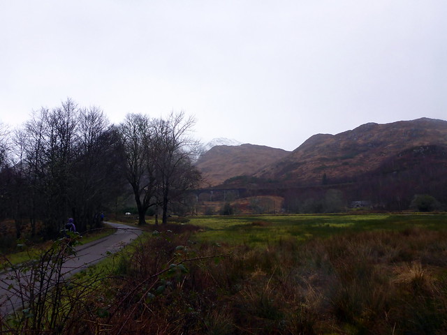
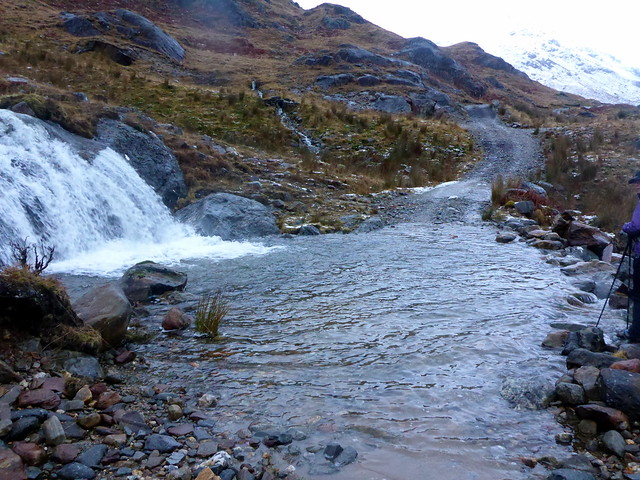
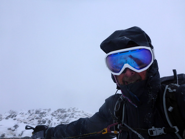
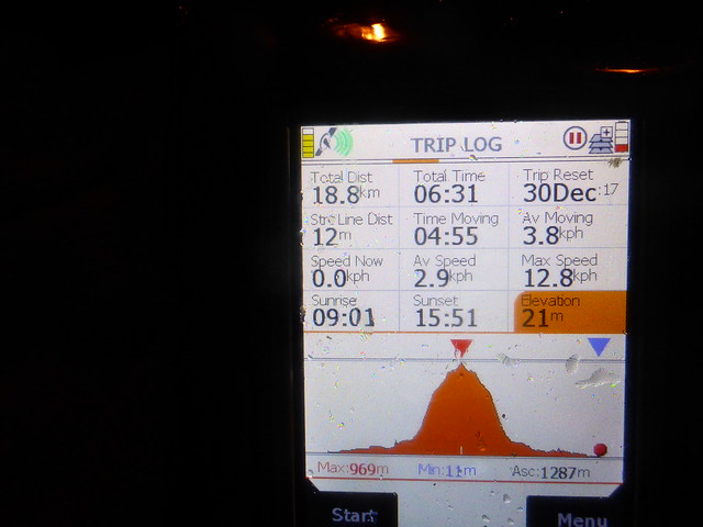
We pass a quiet night and look out to a dry morning, if a bit claggy. My plan for today is to drive along to Callops and climb Meall a'Bhainne, possibly adding on 2 adjacent Simms and the Corbett of Sgorr Craobh a'Chaorainn to make a pleasing round. If there's time we'll head to Meall an t-Slamain too (there wasn't). Park at the frosty parking spot. We cross over the fence just at the start of the track and walk over wet tussocks, following the stream that runs down Meall na h-Airigh. Off to the north the sun glints on the white backs of Streap and Sgurr Thuilm. The hillside becomes more rugged as we ascend, rocks glazed with ice. We reach the summit and start across to Meall a'Bhainne, involving some loss of height and small scrambles. At the summit everything is white - flurries of snow, mist curtails the view. Confounded to find fresh footprints in the snow at the top - who on earth is up a Marilyn today? We didn't see the pair, but they must have been less than an hour ahead of us going by the freshness of the prints. What's more, for a while they followed the route I'd drawn up towards the first of the Simms, Sgorr nan Cearc, though they didn't end up going that way. Meeting fellow Simm baggers would be a real eyeopener

Heading for Meall na h-Airigh(R), Bhainne (L)
 DSC00319
 by
Al, on Flickr
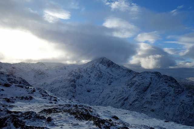
Looking over to Bhainne
 DSC00322
 by
Al, on Flickr
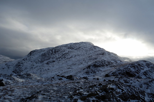
Summit Bhainne
 DSC00324
 by
Al, on Flickr
Sgorr nan Cearc
 DSC00326
 by
Al, on Flickr
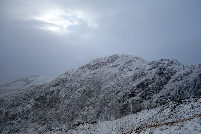
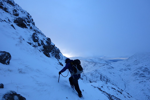
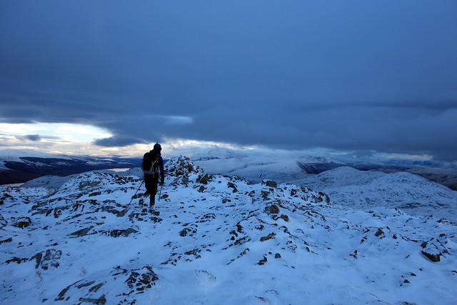
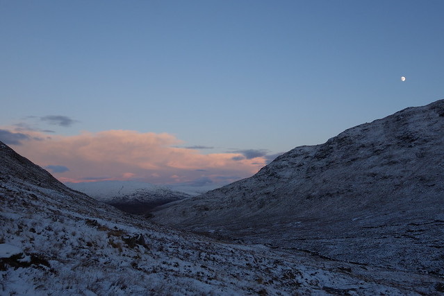
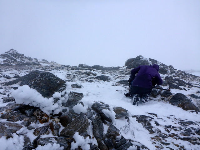
The southern slopes of Sgorr nan Cearc looked very rugged - we needed to descend quite a way to find a suitable point to clamber steeply up. Glazed rocks under a veil of fresh snow offered false promise of footing - that was to be a problem for the rest of the day. We made it to the top, and to the nearby Simm of Meall Doire nan Mnatha (rounded hill of the bean grove???). We were both enjoying the challenge of the conditions and decided to continue on to Sgorr Craobh a'Chaorainn - I remembered this as a fairly undemanding hill. Further ahead the peak of Sgurr Ghiubhsachain rose steeply.
View north
 DSC00328
 by
Al, on Flickr
Craobh Chaorainn
 DSC00331
 by
Al, on Flickr
Ghuibhsachain
 DSC00334
 by
Al, on Flickr
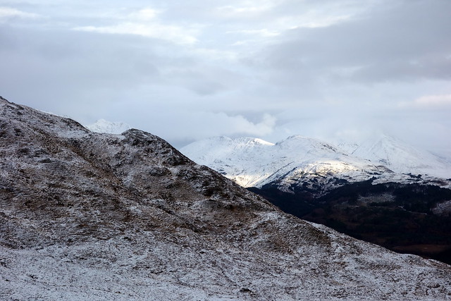
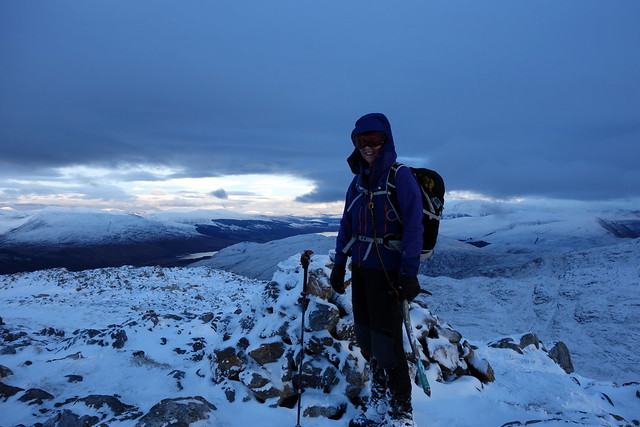
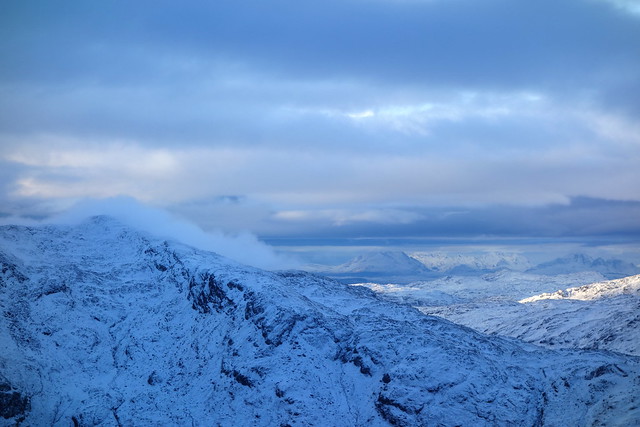
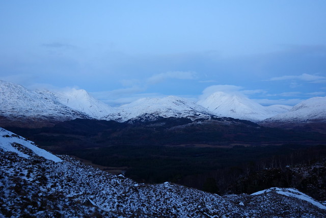
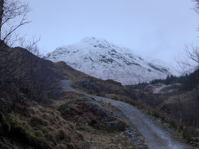
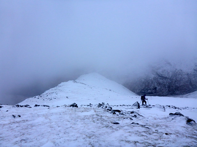
We started up a series of terraces on the north slopes of Chaorainn - steeper than it looked from afar and ascent hampered by icy rock - even crampons would have gained little purchase on the thin ice. Arriving at the summit the views opened up, including a very white topped Ben Nevis. I inexplicably started down the steep and rocky west side (following the wrong bit of a route from when I did these three Corbetts) - thought this doesn't look very safe and retraced my steps before I'd descended too far, reminding Allison to check a bearing at the top of every hill we summit to prevent my strange direction making moves.
Closer to Chaorainn
 DSC00336
 by
Al, on Flickr
 DSC00338
 by
Al, on Flickr
 DSC00339
 by
Al, on Flickr
 DSC00341
 by
Al, on Flickr
 DSC00342
 by
Al, on Flickr
The Ben in the distance
 DSC00343
 by
Al, on Flickr
Over to Skye
 DSC00344
 by
Al, on Flickr
Mmmm - bit steep
 DSC00345
 by
Al, on Flickr
The way from here was still steepish but over snowy/icy grass, not rock. We cut down into the glen and join the soggy boggy track back to Callops. A longer than expected day, but one full of excitement and elation - we both have missed this in recent times doing Marilyns. Good to have your ice axe being put to proper use. Still dry when we get back to the tent and we finish off a tasty curry sitting outside by the light of headtorches.
 DSC00348
 by
Al, on Flickr
 DSC00349
 by
Al, on Flickr
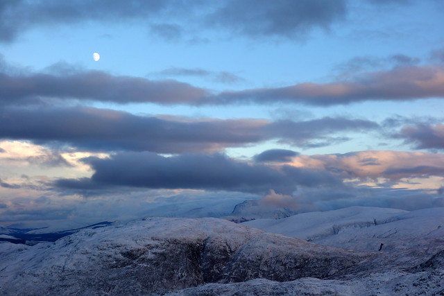
Rosy topped peaks as the sun sets
 DSC00350
 by
Al, on Flickr
Druim Tarsuinn
 DSC00352
 by
Al, on Flickr
 DSC00353
 by
Al, on Flickr
 DSC00354
 by
Al, on Flickr
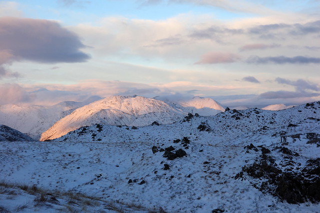
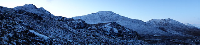
Our hills for the day
 DSC00355
 by
Al, on Flickr
 DSC00356
 by
Al, on Flickr
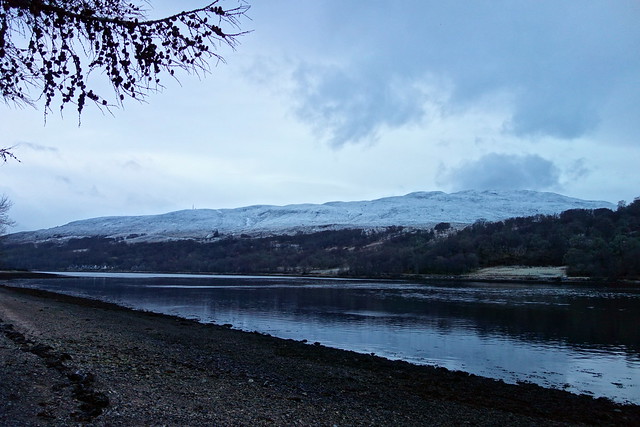
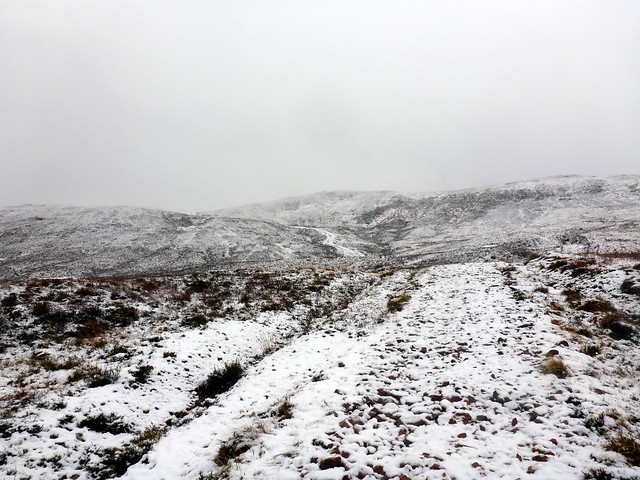
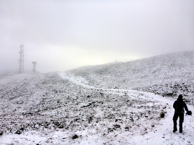
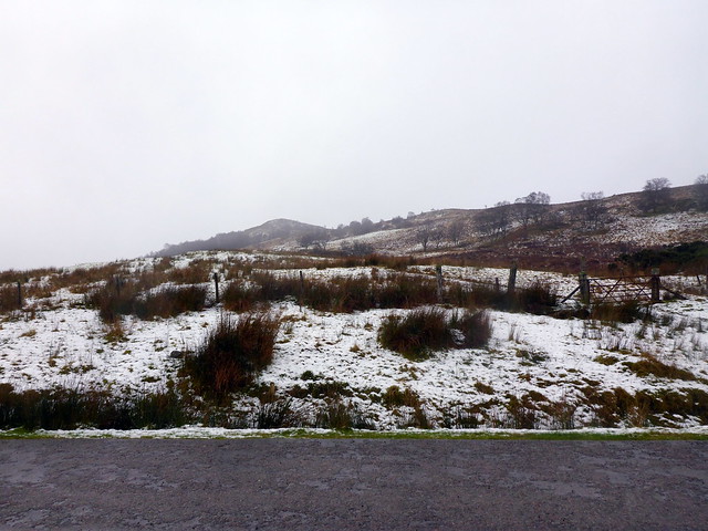
Saturday is a much moister day - clag sitting on the hilltops and rain forecast. First on the list is the Marilyn of Meall an t-Slamain - this is an instantly recognizable hill to anyone driving through Fort William as it rises from Camusnagaul in a series of bumps across Loch Eil. Annoyingly we can see it clearly from the campsite - the start at Ach a'Phubuil is half a mile from our tent as the raven flies but requires a round trip of 32 miles to get there by road. Mountainlove might have floated over The Narrows on a Thermarest, but we drive there and back. There's parking at the houses at Ach na Phubuil from where it's a short walk to the track leading to the transmitter mast and viewpoint. Bleak white landscape - we get to the trig point by the mast and get a view over Fort William - I can imagine this is a great vantage point on a clear day. Although we're at the trig, there's 1.5km and 160m ascent to undertake before the summit is reached. We set off and climb false summit after false summit, clag fully down around us, unfortunately. It takes longer than anticipated to reach the top - we follow our tracks on the way back down, stopping at the trig for a bit of lunch.
Meall an t-Slamain from the campsite on Friday morning
 DSC00316
 by
Al, on Flickr
 P1180386
 by
Al, on Flickr
 P1180388
 by
Al, on Flickr
 P1180389
 by
Al, on Flickr
 P1180390
 by
Al, on Flickr
 P1180393
 by
Al, on Flickr
One of many false summits
 P1180395
 by
Al, on Flickr
 P1180396
 by
Al, on Flickr
 P1180397
 by
Al, on Flickr
Our intended route
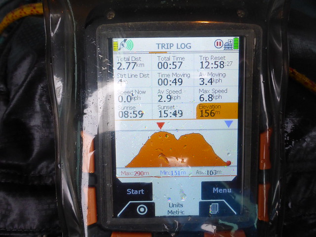
There are a couple of Marilyns above Fort William that are next on the list - the diminutive Druim na h-Earba at a mighty 288m and Bidean Bad na h-Iolaire at a much more respectable 528m - I nearly climbed this coming along the West Highland Way earlier in the year from the eastern side. We stop at the parking area beside a viewpoint and follow the footpath to the summit, as a number of others have done before us today. Another good vantage point on a clear day. We start down to the south to cross over the glen to Bidean Bad na h-Iolaire but see there's a stream to cross near the road, and there's 50m additional drop from the parking place. It's raining, claggy and generally miserable and neither of us can summon enthusiasm for the task in hand. Bugger it - we retrace our steps and go back to the car and go into Fort William for a mooch round the outdoor shops and a pint.
Druim na h-Earba
 P1180398
 by
Al, on Flickr
 P1180400
 by
Al, on Flickr
 P1180402
 by
Al, on Flickr
Back at the campsite it rains continually, heavily overnight. What are we going to do? Skye is now out of the picture as the forecast is similar there - no views of pristine white Cuillin. Might as well do something more local. Sgurr Thuilm is an option - a longish walk but most of that's on track. e've both decided that we'd like to do more Munros in the coming year and I lie awake naming as many as I can of the 102 I have left to do (I manage 96).
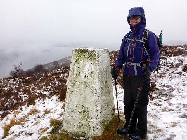
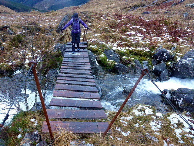
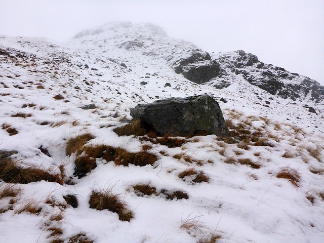
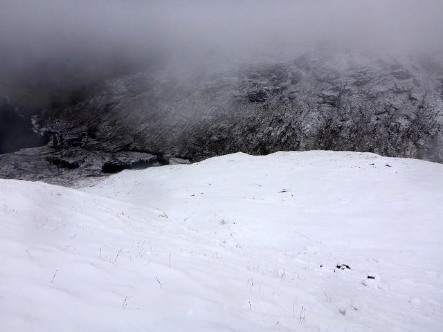
Very heavy rain prevents the early start I had in mind - we lie awake at 7am listening to stair-rods hitting the tent. However it lessens as the morning goes on and I reckon we've still time to get this one done. Drive the few miles to Glenfinnan, the car park quite busy with tourists walking along to see the Potter-Viaduct. A rather dreich morning, snow having been washed away at lover levels. The track makes it easy going - we pass by Corryhully Bothy which has a good fire going judging by the coil of smoke spiraling upwards. Up towards Druim Coire a'Bheithe following the standard path (where we can see it in the snow and run off water) and onto the back of the mountain. It's so miserable that we utilise the orange survival shelter for lunch. The snow looks suspicious as we get onto the ridge proper - lots of snowballing going on, but up ahead it's mostly been scoured away by the wind, which strengthens considerably as we climb. Visibility isn't great and I'm pleased when we meet the line of fence posts.
 P1180404
 by
Al, on Flickr
 P1180405
 by
Al, on Flickr
 P1180408
 by
Al, on Flickr
Thuilm
 P1180410
 by
Al, on Flickr
The path's a bit wet...
 P1180411
 by
Al, on Flickr
Fortunately there's a bridge
 P1180412
 by
Al, on Flickr
 P1180414
 by
Al, on Flickr
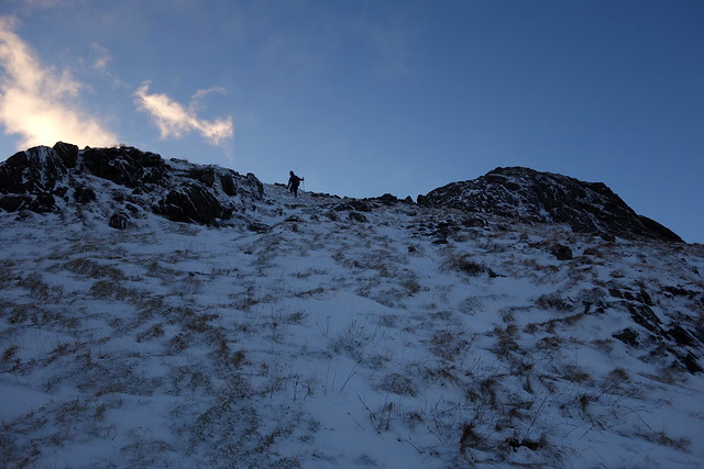
Wind now very strong on our backs as we near the summit - windchill turning my sodden waterproof into a suit of ice, freezing all the straps on my rucksack and my ice axe leash. How I've missed these days! We don't pause long at the top - luckily the wind hasn't completely covered our tracks and we can - after a shaky start - follow our own steps back down. Back in the glen we pass a stalker with a Rangerover full of tourists who's feeding a bunch of biosterous stags from a large sack. He asks if we've done the two Munros - no, just the one, which he considers wise under the conditions. I have lasting memories of a horrible time coming down off Sgurr Nan Coireachan in very similar conditions almost 4 years ago - and anyway I have plans to do it from the west in a loop taking in Meith Bheinn, An Stac and some remote Simms - but in the summer months
 P1180416
 by
Al, on Flickr
 P1180417
 by
Al, on Flickr
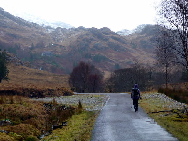
Allison taking a bearing at the top
 P1180418
 by
Al, on Flickr
 P1180419
 by
Al, on Flickr
 P1180420
 by
Al, on Flickr
 P1180422
 by
Al, on Flickr
 P1180423
 by
Al, on Flickr
A hot shower is most welcome back at the campsite, as is a spicy chili accompanied by a bottle of Malbec. Rain is still heavy - we're in bed by 7.15, awakened by what sounds like artillery fire from just behind us at midnight as other campsite patrons celebrate 2018. Sleep is elusive after that, not aided by the seagulls who have been startled by the fireworks squaking for a while. Rain drums on the tent - quite soothing when you're snug and warm.
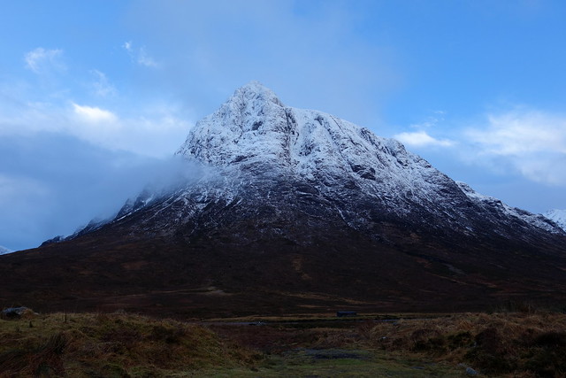
For New Year's Day we thought we might do Stob Ban in the Grey Corries - a similar type of hill to Thuilm with a long walk in along track. There's been a good deal of snow on the hills overnight - we check the "pizza of death" which is decidedly not favourable to the route up Stob Ban. One of the drawbacks about returning to doing Munros - one has to pay attention to avalanche forecasts - not usually a problem on Subs! Other options - maybe Ben Lomond? Forecast there is promising and it's on the way home. However Allison doesn't look very well - she's been coughing all weekend and this morning she has a waxy look that does not suggest going up a hill is a great idea. By the time we've reached Crianlarich (past a lovely snow-topped Buachaille and surprisingly through heavy snow/sleet coming into Tyndrum) she admits she feels crap and we head home.
 DSC00360
 by
Al, on Flickr
So not quite the weekend we had anticipated, but a couple of good days out nonetheless and an appetite whetted for some more big hills this year
