free to be able to rate and comment on reports (as well as access 1:25000 mapping).
On a cold, crisp morning I set off slightly later than scheduled to fulfil a wish – to get a view from the summit of Stuc a’Chroin. The forecast was for clear, sunny, calm conditions and this was my chance. I didn’t want to do too much driving so I elected to go via Beinn Each. What I saved in petrol, I probably burnt off in additional calories! I knew this was not a fast route and I also predicted slower progress than usual. Did I predict 7h30 hours of walking? Probably not. I’m always fairly optimistic with my times!

It was pretty icy going into the dark and dank forestry so it was nice to pass the last gate onto more open slopes. The snow line started at the Beinn Each sign and it was pretty relentless from them on. Eventually in the wee dip before the last rise to the summit, I joined another couple who were gearing up with their crampons. I’m not sure when I had last put mine on but I made a total mess of them and they came off as soon as I started walking! At last fully cramponed on and armed with my axe I surged up to the summit.
The views were amazing:
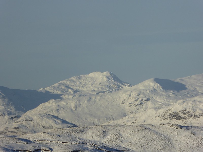
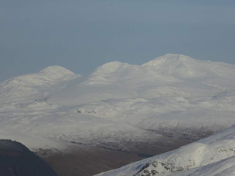
 Ben More & Stob Binnein
 by
Emmanuelle Tulle, on Flickr
 Cruach Ardrain
 by
Emmanuelle Tulle, on Flickr
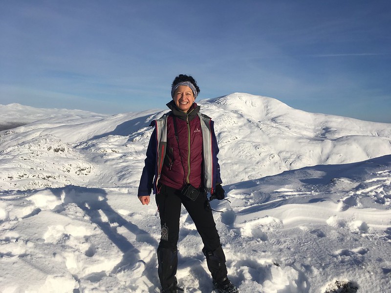
The object of my desire stood right in front of me, all complicated and very mighty looking. I chatted to a couple of chaps, one of whom remembered reading my compleation post (Walkhighlands fame!), and then hurried down to the first bealach. It was later than I felt comfortable with and I figured I’d be on the summit by 2pm, lucky to get there any earlier.
 File 17-01-2018, 17 17 14
 by
Emmanuelle Tulle, on Flickr
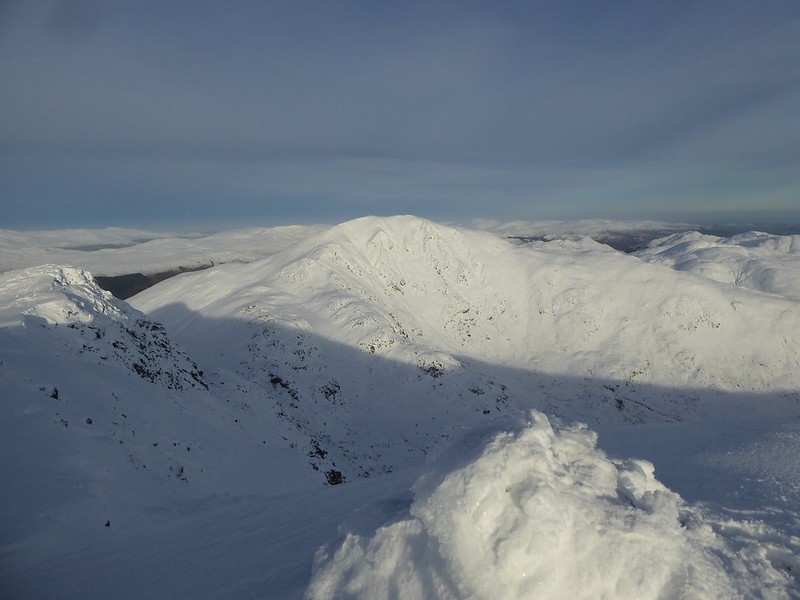
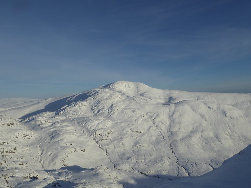 Stuc a'Chroin
 by
Emmanuelle Tulle, on Flickr
I caught up with a young couple on the last slide down and tried to work out an ‘easy’ line. For those not familiar with this route, the ‘bealach’ between Beinn Each and Stuc a’Chroin is a right mess. It’s actually two bealachs with 2-3 not insubstantial knolls, including a 735m one which is quite rocky. And then it’s a WNW zigzag to the summit. So the trick is to find a line that doesn’t involve unnecessary climbing without heading too far east either. Following the line of fence posts is not helpful until you start the climb up to the summit proper as the early sections go over all these tops. At the same time, confusion can be caused by the deer tracks of which there were quite a lot that day. I did follow tracks and eventually I rounded a corner to find the first fence post that was safe to aim for. It seemed a long way away with all that snow to walk across. Ahead I could see various folk making steady progress. They seemed so far away. My own progress felt sluggish. It was bloody hard work. My left leg is much weaker than my right leg and boy did I feel it that day. Crampons helped on scoured sections but were completely useless in deep snow. This side of Stuc a’Chroin is south facing so the snow was quite soft and in the hidden hollows I sank up to my thighs. Hauling my sorry ass out of these holes required a lot of energy and I had to stop every 10-20 steps to catch my breath, vary how I stepped up, sideways left, sideways right, feet straight up and back again, just to find some relief from the pain! But real relief was brought on by the superb views, the artistic riming on the fenceposts and just the pure joy of being out in proper winter conditions.
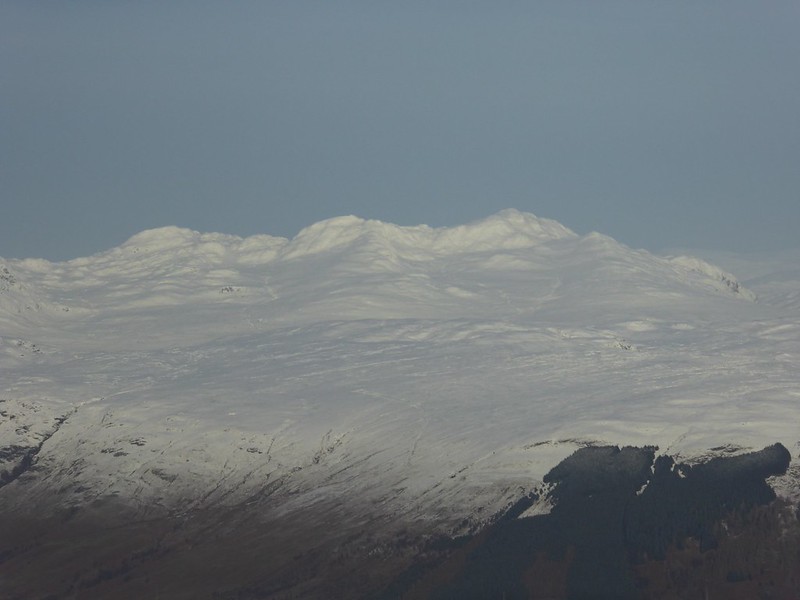 Tarmachan Ridge
 by
Emmanuelle Tulle, on Flickr
 Ben Lawers group
 by
Emmanuelle Tulle, on Flickr
 Ben Vorlich
 by
Emmanuelle Tulle, on Flickr
On the way up I lost sight of a couple and I caught up with a guy carrying a very heavy pack. Eventually I reached the first cairn, headed straight for the next one and took some pics with what was left of the juice in my camera (not much). I used to think this hill and Ben Vorlich weren’t remote enough. But I have come to appreciate the contrast between the vast plains of the Forth valley, its smoking chimney stacks and the mountains of the Trossachs and beyond.
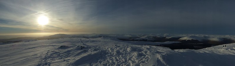 Panorama
 by
Emmanuelle Tulle, on Flickr
I headed back down satiated. There was still a ways to go before I could sit down to home made spag bol. There was some uncertainty about where best on this double bealach to head down. Eventually the man with heavy pack and I joined forces, his GPS and my map and compass, to find a way down. From there it was a lengthy contour of Beinn Each following deer tracks and fording burns, pretty dull to be honest. Just as well I had a walking companion to liven things up. The track never really looked to be getting closer which was a bit disheartening, but eventually, after an hour of trudging through heather and skirting round verglas, we did land on hard ground and rushed along. We got benighted so the head torches came out and eventually we made it back to our respective cars. I was back in Falkirk an hour later!
An excellent day, with all the winter trimmings, but in hindsight, it might have been better to come off after the 735m top.
