free to be able to rate and comment on reports (as well as access 1:25000 mapping).
Map: OS 1:50,000 nos. 79 & 80
Attendees: Me, Big Dog, Small Dog
Time taken: 4hr 30m
This was a largely grey day and -for enjoyment factor- it proved to be one of diminishing returns. Things were compounded by poor route choices. Some were entirely my own doing, some not.
Rubers Law Distance: 8k. Ascent: 334m. Time: 2hr 30m.
I had spent time considering options for Rubers Law. I eventually settled on a route described in Alan Hall’s book ‘The Border Country’ (Cicerone, 2010). This involved an approach from Denholm village to the north. It included the hill and a return detour via ‘…picturesque, arboreal Denholm Dean’. Sometimes it’s not just about the hills. This sounded good. (I hadn’t realised it at the time but ‘John923’ had already covered a similar combination in a 2011 trip report.)
Having parked up in the square at Denholm, I set off eastwards out of the village on the A698. I turned southeast after a short distance into the Loaning. A narrow street, it led on to a stony track signed for Bedrule and the Border Abbeys Way. At a T-junction, I then turned left on to a hedged lane covered in slippery mud. This duly arrived at the northeast corner of Denholmhill Wood.
Following the perimeter wall southeast and then southwest, I entered the wood through a gap. As woods go, Denholmhill wasn’t that impressive. Despite the mature trees, its overall appearance was scraggy. There were several manmade constructions in view. I’m unsure what their purpose was. Large sections of scaffolding lay on the ground like skeletal remains. It seemed somebody had started a project but failed to finish it.
Signage at end of the Loaning on to stony track 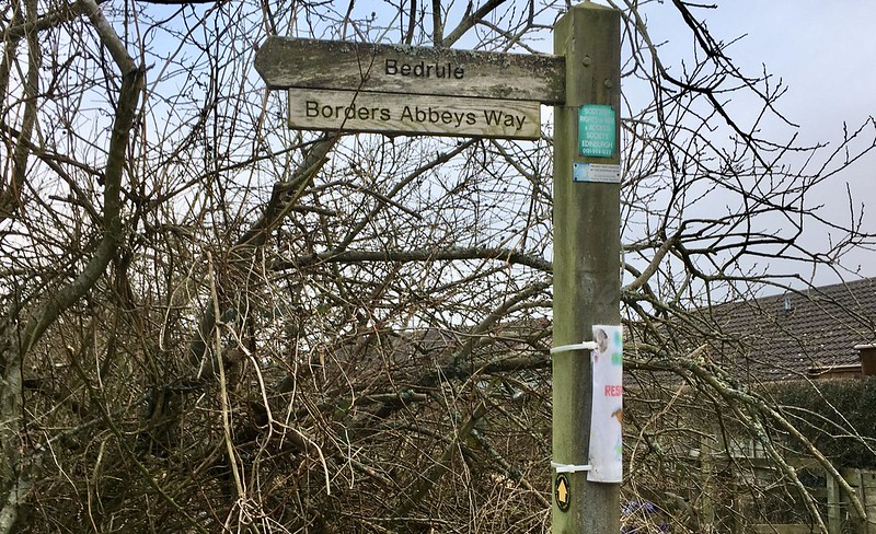 Untitled
 by
NDM, on Flickr
Left at T-junction from stony track on route to Denholmhill Wood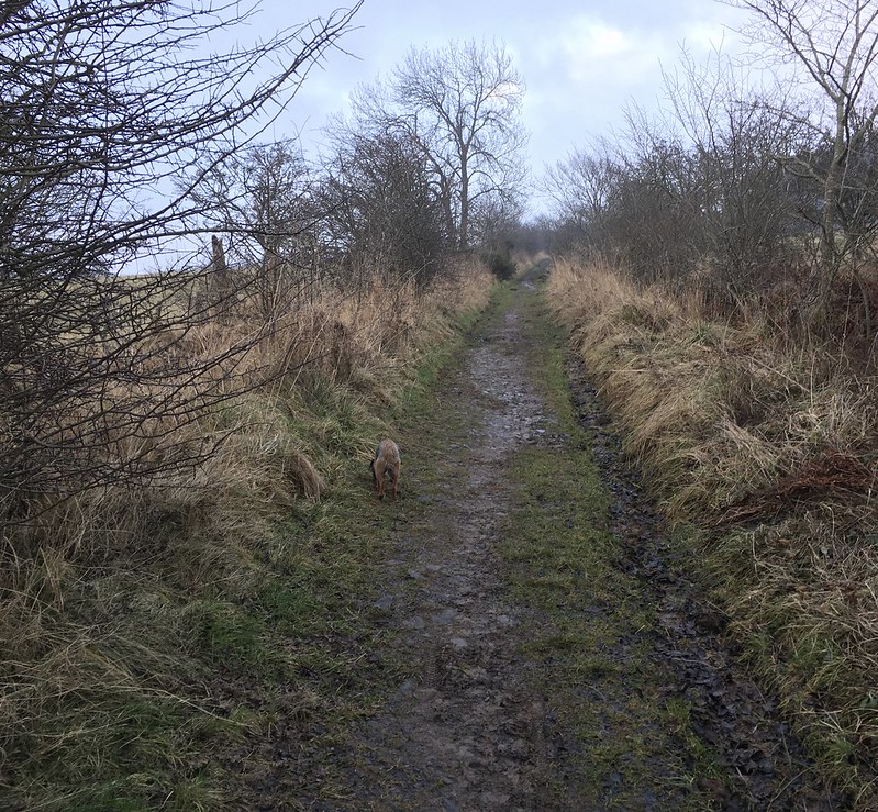 Untitled
 by
NDM, on Flickr
I exited the southwest corner of the wood through a pedestrian gate and negotiated my way over a stile and an electric fence into a field. It was an awkward combination – they stood about 2 feet apart. The field was clearly pasture for sheep or cattle. Neither was present. Rubers Law was now visible to the south.
In summary, Hall’s suggestion is follow a wall on your left all the way to the base of the hill. But I soon found the terrain here marshy and dull. I had noticed a good path through a narrow band of trees beyond the wall. After a time, I hopped over and joined it.
Field with Rubers Law in the distance 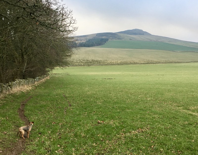 Untitled
 by
NDM, on Flickr
Path through the trees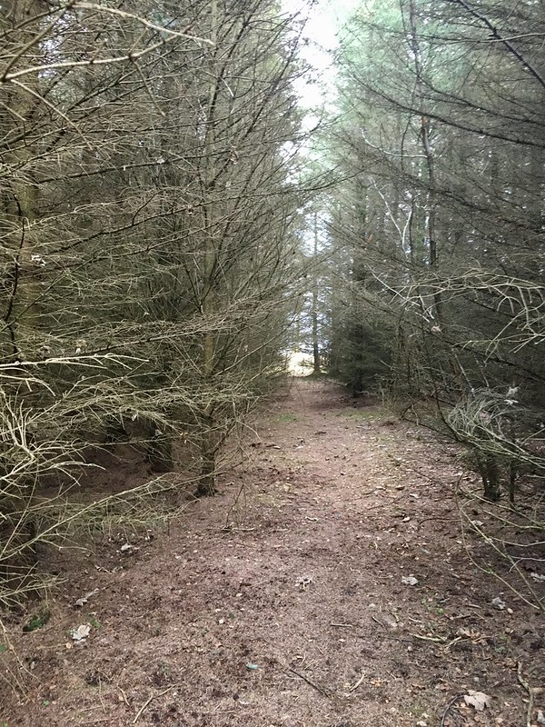 Untitled
 by
NDM, on Flickr
This led gently uphill. It later faded out as the forest widened. Considering onward options, I heard a dog walker off to my left. I made my way to the east boundary fence and climbed over. Another decent path/track was obvious on the open ground. It led upwards to a gate at the top of the woods. On route, the other dog walker and I passed each other. We chatted for a couple of minutes before she headed downhill.
Pedestrian gate above woods 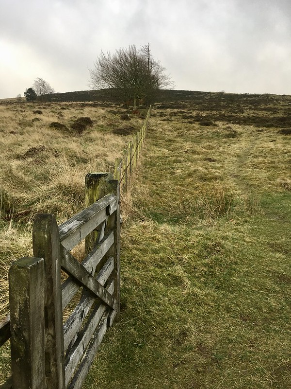 Untitled
 by
NDM, on Flickr
It was a straightforward walk on this path, and later a selection of grassy trods, to the summit. There were two or three plaques/memorials here, one of which was located in a large cleft to the rear of the trig point. The top of Rubers Law was the site of old Covenanting services. Views were reasonable but impeded by low lying cloud.
Trig point on Rubers Law 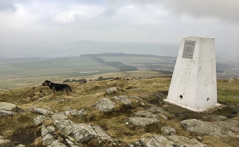 Untitled
 by
NDM, on Flickr
Plaque near summit 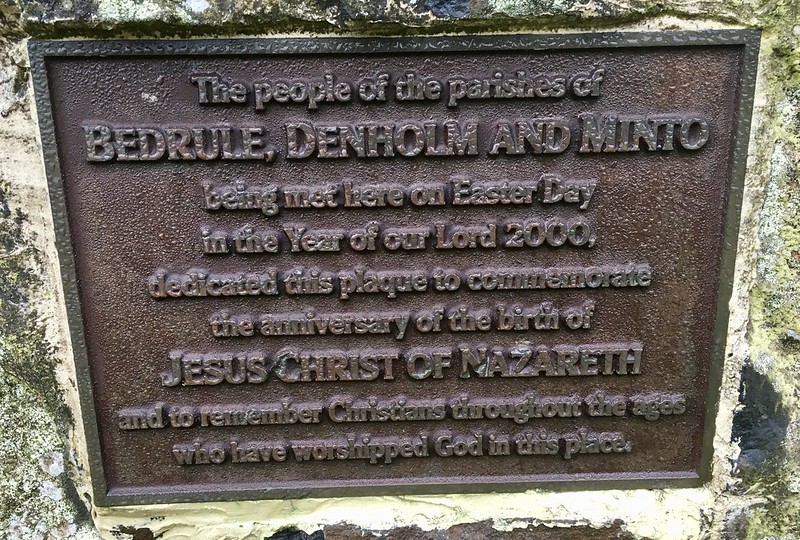 Untitled
 by
NDM, on Flickr
The dogs and I retraced our steps back into Denholmhill Wood. Once through the aforementioned pedestrian gate, we turned left. A descending path looped out of the trees and joined a grassy track. This ran southwest, past 2 chairs on wooden decking, and later an electricity sub-station. We arrived at a narrow road on the outskirts of Denholm. Here we turned right. 100 yards further on, a lane leads off the road and drops down into Denholm Dean.
Maybe it was the time of year but I found the place disappointing. It has a long history as a beauty spot. Maybe so. But I can think of several more attractive places within 15 minutes of my front door in south Edinburgh. It struck me as scrubby and dishevelled. Litter was obvious, paths had been neglected and I noticed at least two long abandoned shelters that had been built in the trees. Hall predicts that the walker will be ‘…accompanied by constant birdsong’. I didn’t see a single bird, far less hear one. (In fact, while I’m on the subject I wasn’t to see any wildlife all day.)
Ironically, the most impressive thing I found at Denholm Dean was of human making. A small creation of sticks and stones. It could have been a mini shrine, an impromptu art work, or something a child put together. I couldn’t decide which.
Seating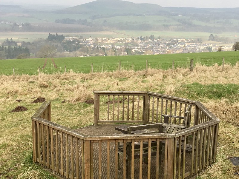 Untitled
 by
NDM, on Flickr
Shelter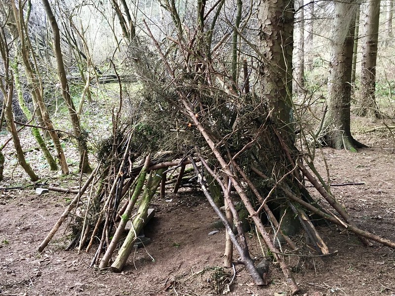 Untitled
 by
NDM, on Flickr
The highlight of Denholm Dean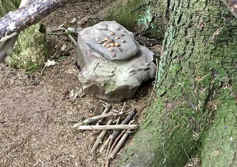 Untitled
 by
NDM, on Flickr
I followed the eastwards course of the Dean Burn, eventually emerging close to the village square.
Belling HillDistance: 2k. Ascent: 55m. Time: 30m.
One thing Denholm did provide me with was decent coffee and a bacon roll. Afterwards, I drove south and then east to a minor road signed for Chesters. Opposite the house at Falside I located a parking area (GR644144) partly occupied by a large trailer. It appeared to have been in situ for a while.
A solid track (not shown on my OS map) ran northeast into the forestry. I followed that for 20m or so before turning sharp left on to a softer, grassier version. This quickly narrowed to a path. After 200-300m, I arrived at an area of clearfell on the right. Where this met the edge of the plantation, I found a faint path which ascended an embankment. The weather had improved markedly by this time.
Parking for Belling Hill 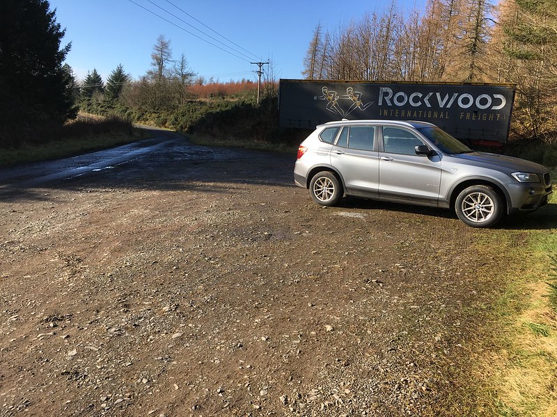 Untitled
 by
NDM, on Flickr
Proximity of parking area, solid track (both centre left of photo) and grassy track (centre right of photo) 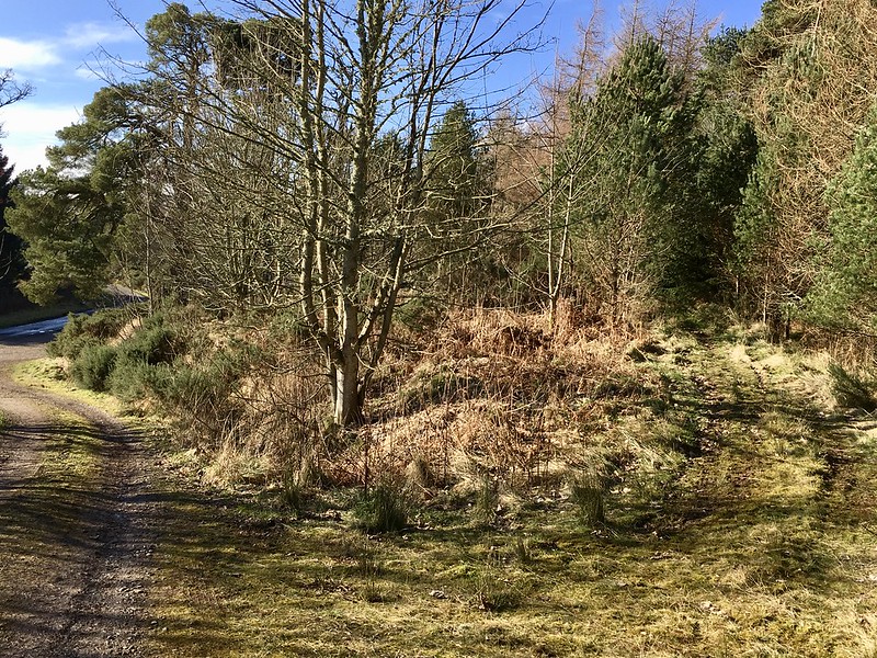 Untitled
 by
NDM, on Flickr
Looking back down to edge of forestry from top of embankment. Faint path just visible to centre right  Untitled
 by
NDM, on Flickr
I could now see a large firebreak nearby on the right. I followed this northwards to the summit area. It was a rough section of ground by the corner of a wall. There were pleasant views northwards to older forestry. Despite wandering around the top for several minutes (and double-checking my ‘phone to verify coordinates), I failed to find a cairn. I understand there is a small one and can only assume I missed it amidst the long grass and tree stumps.
Walking along firebreak Untitled
 by
NDM, on Flickr
View north on reaching end of firebreak  Untitled
 by
NDM, on Flickr
Belling Hill summit Untitled
 by
NDM, on Flickr
I retraced my steps to the car.
Law KneisDistance: 5k. Ascent: 228m. Time: 1hr 30m.
Signage for Tima parking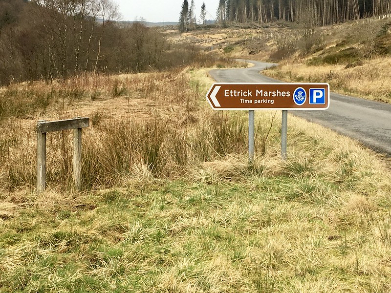 Untitled
 by
NDM, on Flickr
Law Kneis south of Ettrick was not an obvious addition to the day. It’s normally tackled with its neighbour, Ward Law. I had two reasons for including it. One, I had time to spare and it didn’t require a substantial detour on my way back to Edinburgh. Two, I’d already seen enough of Ward Law from previous visits to Ettrick to know it was a hill I liked the look of. It seemed a hill worth taking time over and I’d mentally allocated it a day on its own.
I drove north and found my way to the Tima car park at GR280131. The weather had reverted to gloomy. My plans followed suit. They went awry from the outset.
I had made notes for a route up Law Kneis l from another walking website I use. These notes didn’t come with a map or graphic and I hadn’t looked at Google Earth. They were reliant, in the early part at least, on an awareness of colour coded waymark signs from Tima. I discovered one or two waymark posts quickly. But there were only blank spaces where the colour codes should have been. I couldn’t tell whether this was weathering, deliberate removal by some local body or agency, or vandalism.
Waymark post – no colour codings, just a smiley face. Oh how I laughed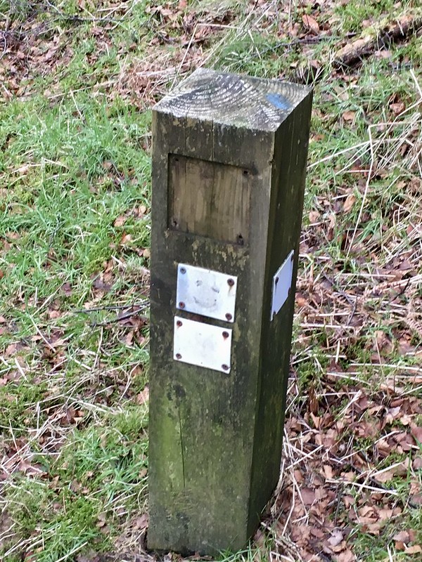 Untitled
 by
NDM, on Flickr
Not to worry. I still had three or four grid references I could use. And there was always the internet for other options. Well, no. I’d neglected to note the grid references and there was no phone reception here. (Not even that woeful ‘E’ icon for the web.)
So, it was simply the walk description and my trusty Landranger map. Actually, the map wasn’t that trusty. Looking at the landscape in front of me, it was clearly out of date. It didn’t show, for example, a good forest track that left the road nearby and headed northeast up the hill.
I decided –poorly in retrospect- to stick with my original plan. The first part of this was to follow a path south from the car park for 200m to a conspicuous firebreak. There I should ascend steeply up the slope to a track. I did so. Or at least I thought I did. I now wonder if I’d left the path too early.
The firebreak I entered was conspicuous. It was certainly steep. Very steep. It was also sodden and overgrown with long grass and soft lichen. The soil underneath was thin, at times barely covering greasy tree roots. Front footholds wouldn’t stick. If they did, I had to move and secure my trailing foot quickly. It didn’t always work. I fell often. And cursed more.
Another problem was that the firebreak was gradually funneling in on both sides. It felt like walking along the inside of an inverted ice cream cone. (Not that I've done that obviously

just by way of analogy.) Eventually the firebreak closed altogether. What now? I could have descended and looked elsewhere. But if it had been bad on the way up, how much worse on the way down?
I decided to press on and entered the forest. The going was okay at first, with reasonable gaps between tree lanes. That didn’t last long and I was soon into forest bashing mode. The light was poor and I quickly became wet and cold from moisture dripping off the pines. It was about this time I decided to move my ‘phone from my jacket to my rucksack. I had been concerned about water intrusion.
Looking back down an easy section of the first forest thwack Untitled
 by
NDM, on Flickr
I had been trying to keep an eye on the compass to ensure I was going east. On reflection, I didn’t get this right. A constant search for the path of least resistance –over or around fallen trees and avoiding cobwebbed clusters of branches- pushed me further south than I realised.
Progress was slow but after a time I emerged on to the forestry track shown my map. It ran north to south and had a visible high point to my left. From there, I turned upward into the trees again. There was a narrow firebreak which, as before, dwindled to nothing. Forest Bash Part 2 commenced.
Higher up, I came across a third firebreak, this time at right angles to my direction of progress. I used it for a breather. I also used my ’phone app. to get a fix on my position. It would have been prudent to do this before then. Why hadn’t I? I can only attribute that to either a) being too lazy to retrieve the 'phone from my rucksack or b) sheer bloody-mindedness that I would make this route work. It was probably the latter.
The higher firebreak Untitled
 by
NDM, on Flickr
I had assumed I was nearing the summit of Law Kneis’s westerly twin, Gatecleuch Hill. I also assumed I was in a direct line west of its summit. I was wrong on both counts. My grid reference locked me to a position further south and east than I expected. I used the firebreak to move north and then turned right –yet again- to strike up through the trees.
Terrain on final approach to summit Untitled
 by
NDM, on Flickr
On this occasion, I didn’t have far to travel before the gradient eased and the ground started to flatten out. The forestry thinned and began to be replaced by numerous mossy mounds. It felt like an entirely different place, eerily quiet and suddenly light again. Which is not to say it was entirely smooth progress either. I came across two or three tangles of fallen trees that required short detours to get around.
Finally, I broke free from the trees on top of Law Kneis. It was slightly anticlimactic. Cloud and plantations meant there was little to see. I didn’t even bother to take a photograph at the summit.
My approach for the return was not sophisticated. I simply held my compass in front of me on a westerly bearing and followed it. My clothes were already dirty and resin stained. They couldn't get any worse. I was drier and slightly warmer than before but I’d also been longer on the hill than I’d anticipated. In short, I was just keen to get back to the car.
Odd thing is I hardly encountered any forestry hazards or difficulties on the way down. I didn’t use any firebreaks; simply followed tree lanes all the way. Any deviations I did make –discounting contour readjustments- were only by 2 or 3 lanes.
The forest eventually threw me out just south of the car park.
It occurs to me this has been a long summary for one hill. It had been barely 5k of walking and just over 200m of ascent. My lunchtime dog walk most days has similar statistics. What the latter doesn’t have is the wearying unpredictability of a tangled forestry on a route neither foreseen nor properly considered once underway. I was footsore and tired at Tima. In many ways though, it had been a valuable experience.
Overall summary? Working backwards:
• Law Kneis
If not already evident, better routes are available.
• Belling Hill
An easy tick on the Sub 2k list. But little else. If I did it again, I’d aim for a longer and (hopefully) more scenic approach from the north.
• Rubers Law
Decent hill on a so-so route. From the top, an easterly approach struck me as preferable. Extra time and distance involved for Denholm Dean would have better used elsewhere.
