
Superb Snowy Southern Cairngorms
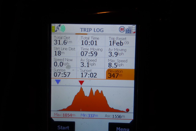
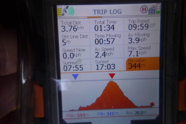
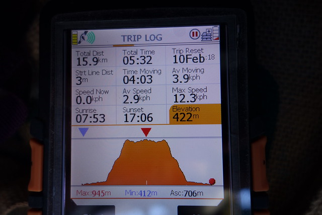
Oh where to go this weekend? I had planned to head for Loch Laggan and nip up some of the hills around there. The forecast wasn't playing ball however and by Thursday morning the prospect of heavy snow and winds up to 70 mph rather put me off. A bit further east seemed better - in fact sunshine was promised for the Glenshee area on Friday. Last minute change of plans then - still some Munros to do up in the section by Cairnwell plus a couple of Munro Tops for the lady. Allison managed to get away from work a bit earlier than usual, which made getting through Glasgow so much easier - we get to our selected layby for camping, a few miles short of The Spittal in the twilight and pitched for the night. Fortunately the road was quiet overnight and we slept fairly well. An early start the next day though - I'd come up with a route of 32km covering Glas Tulaichean, Carn an Righ and 2 Munro Tops off Beinn Iutharn Mhor, knowing that snowshoes or crampons were likely to be needed for a fair whack of it - a big ask perhaps? At least the last 5 miles or so would be on track.
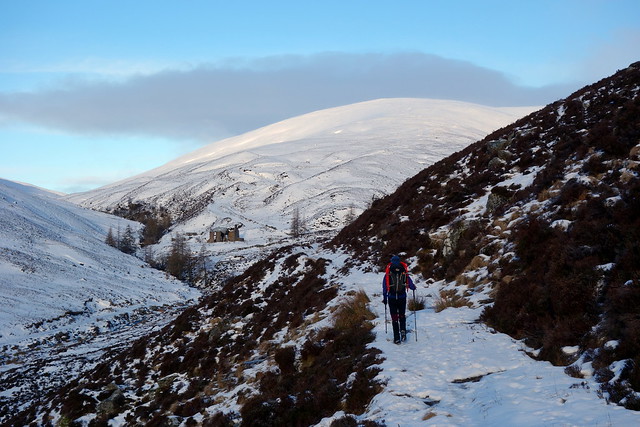
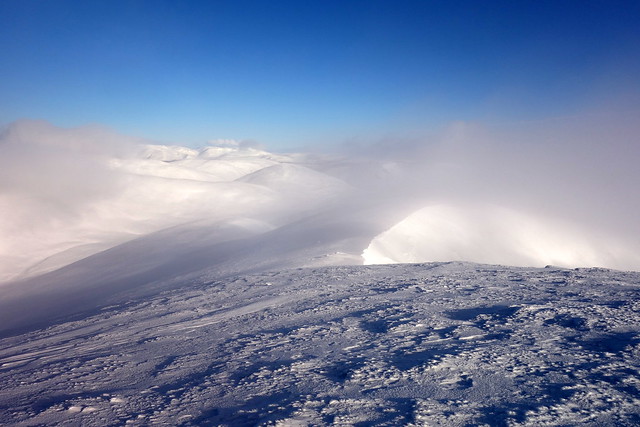
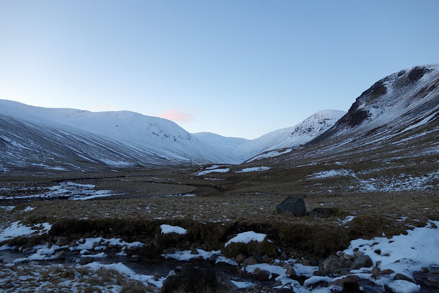
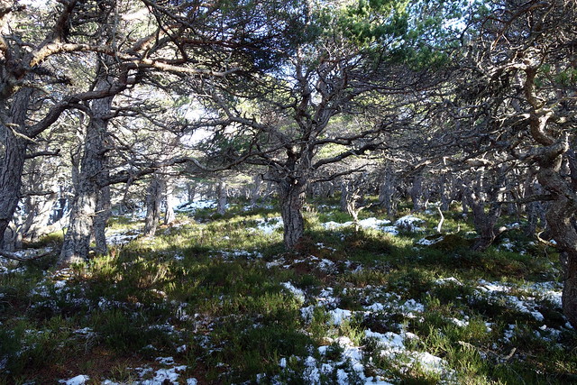
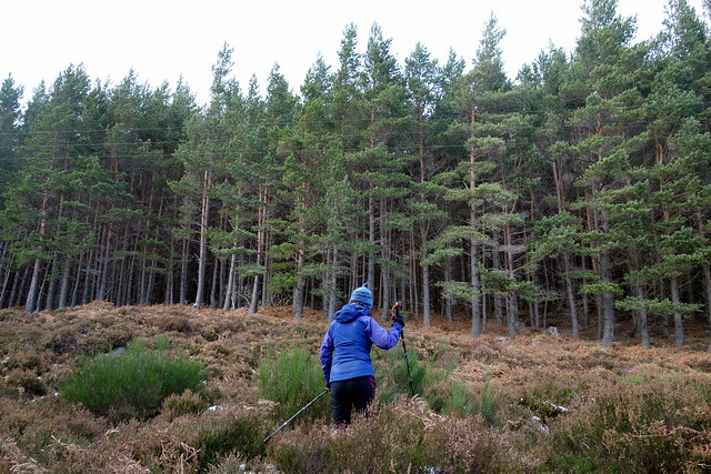
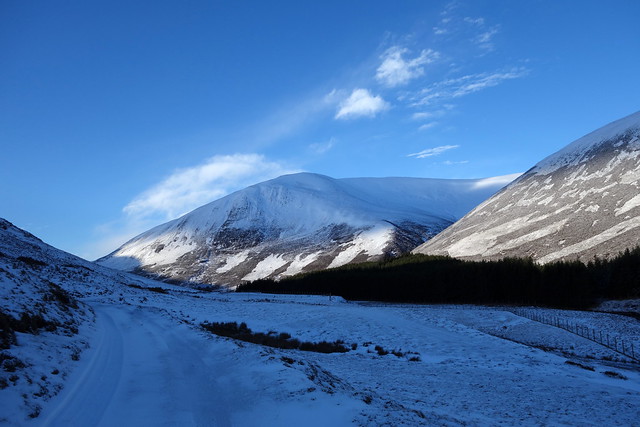
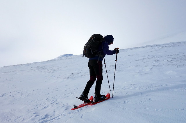
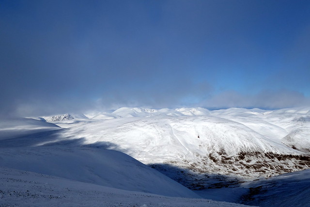
My 56 birthday: I know how to celebrate- up at 6.30 and parked up at The Spittal and ready to go just before 8am. A fine morning, the promise of a good - if cold - day to come. Crisp and clear - barked at by the dogs at the gatehouse and along an icy road towards Dalmunzie Hotel. I could remember little of this route - we'd done these 2 Munros in summer by this route in a little under 8 hours some years back. How much time adding on the Tops would require I was not sure of... Through the farm, a minor wrong direction then back onto the track by the stream and up onto the heathery hillside. I did remember the ruined building at Glenlochsie where we had a bit of stepping-stone-icyness to get across the river. Continuing up the track, the snow drifts getting deeper to the point where snowshoes started to make sense. Glas Tulaichean stretched away ahead of us in snowy meringue folds. Blue sky, nippy wind.
 DSC00570 by Al, on Flickr
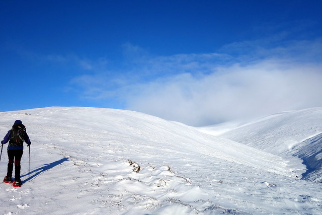
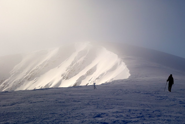
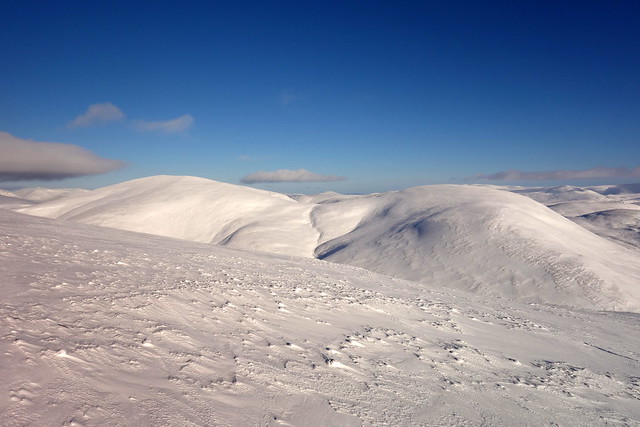
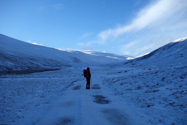
Great conditions for snowshoes - Glas Tulaichean stretching off ahead
 DSC00572 by Al, on Flickr
 DSC00574 by Al, on Flickr
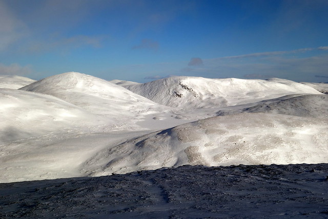
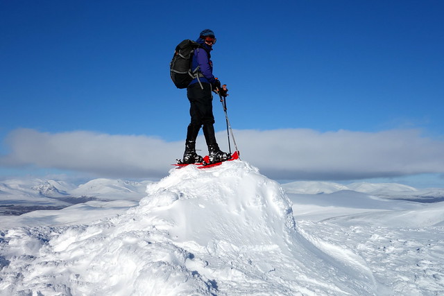
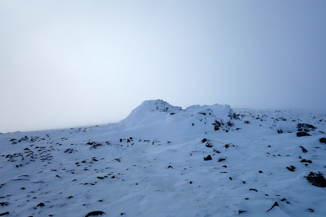
Glas Tulaichean summit
 DSC00576 by Al, on Flickr
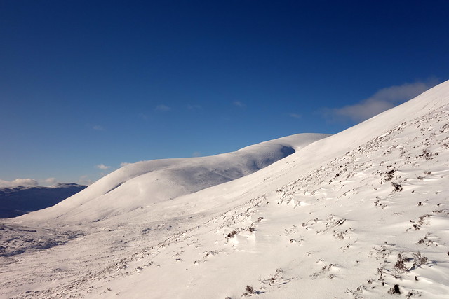
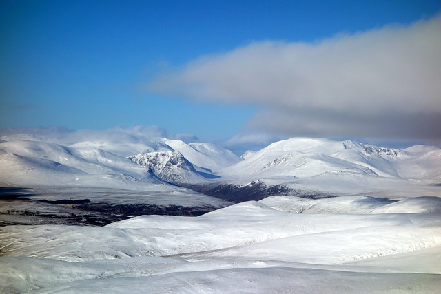
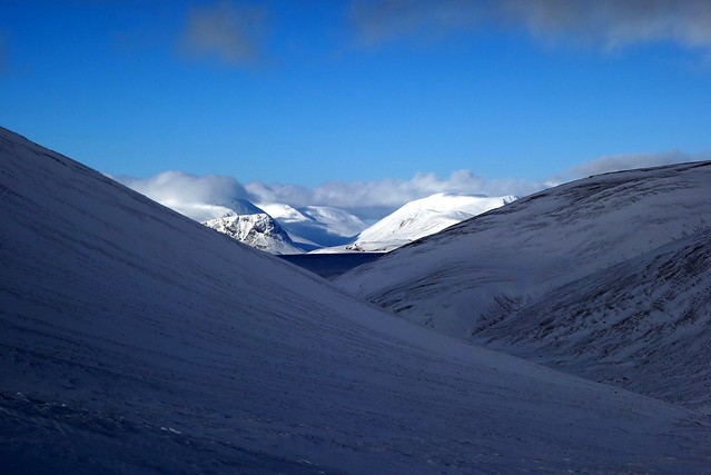
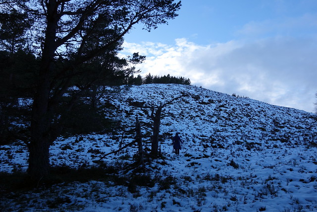
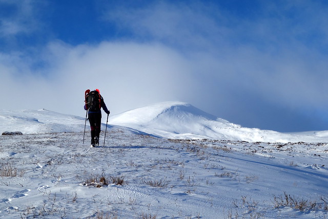
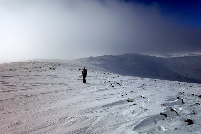
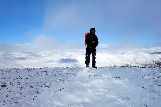
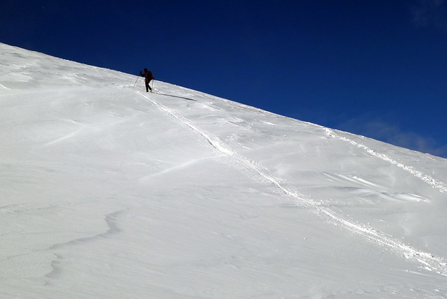
After a time snowshoes were replaced by crampons - mostly because I (wrongly) assumed those would be needed for the descent. Up to the ice-decorated trig point, a corniced egde along the coire rim ahead of us. Follow the fence line down - in retrospect we should probably have come off the NW shoulder of Tulaichean heading more directly for Carn an Righ rather than follow the standard route, as this meant contouring round Mam nan Carn. take it from me - contouring in snowshoes is not recommended Contour we did, though and after what seemed a long time, arrived at the bealach between Mam nan Carn and Carn an Righ. Steep up for 300m - snow relatively thin and icy to the cairn. A fine winter's panorama to the north, including Carn Toul and Beinn MacDhui.
 DSC00577 by Al, on Flickr
 DSC00579 by Al, on Flickr
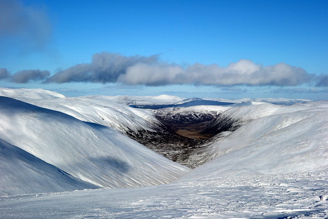
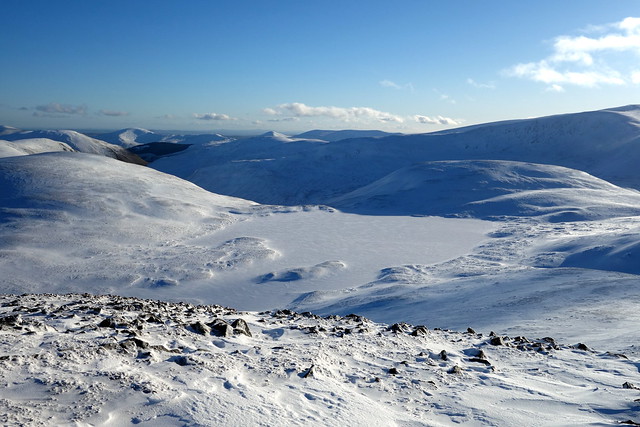
Loch nan Eun frozen over
 DSC00581 by Al, on Flickr
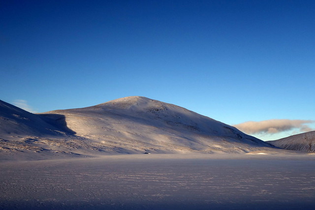
Carn an Righ ahead
 DSC00582 by Al, on Flickr
Beinn Iutharn Mhor (L) and Mam nan Carn
 DSC00583 by Al, on Flickr
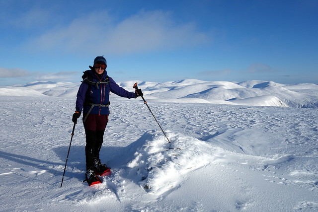
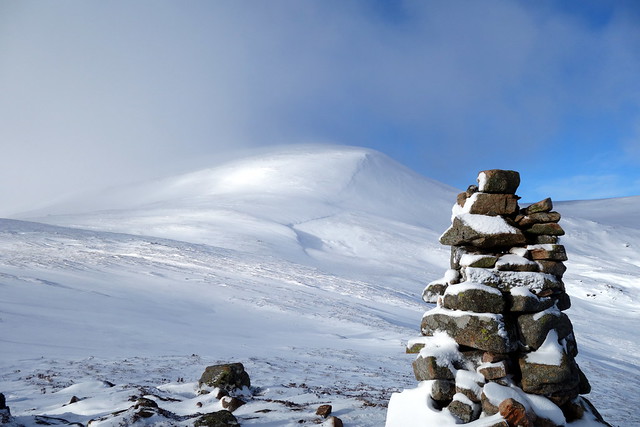
Summit Carn an Righ
 DSC00585 by Al, on Flickr
 DSC00586 by Al, on Flickr
Beinn a'Bhuird/ Beinn A'an
 DSC00587 by Al, on Flickr
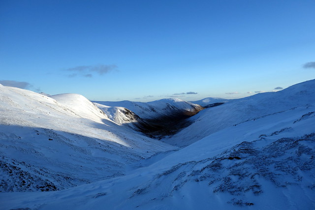
Looking north up the Lairig Ghru
 DSC00588 by Al, on Flickr
 DSC00589 by Al, on Flickr
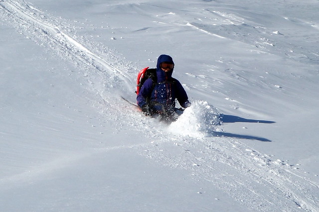
We now had a choice to make - descend and contour back round Mam nan Carn to Loch nan Eun or head over the 2 Munro Tops of Mam nan Carn and Beinn Iutharn Beag with around 300m ascent to do. No contest (contouring in snowshoes = very bad stuff) - we went for the Tops. A long pull up Mam nan Carn to the summit - we see a walker at the summit of Beinn Iutharn Mhor which, unfortunately, is just too far to tag onto today's already long circuit; a glance up Glen Ey which was relatively snow free, then down and we're faced with a steep looking ascent up Beinn Iutharn Beag. It turns out to be easier than it appeared however and we've summited by 3.15pm with a steep snowy descent to the frozen, snow covered Loch nan Eun by 3.30. I ponder just how thick the ice is on the loch, but ensure we skirt round it anyway - falling into freezing water would not be a sensible option with the wind chill factor today
 DSC00590 by Al, on Flickr
Mam nan Carn
 DSC00591 by Al, on Flickr
Looking up Glen Ey
 DSC00592 by Al, on Flickr
Beinn Iutharn Beag
 DSC00593 by Al, on Flickr
Summit
 DSC00594 by Al, on Flickr
Loch nan Eun again
 DSC00595 by Al, on Flickr
Beinn Iutharn Beag
 DSC00596 by Al, on Flickr
Our descent is down Gleann Taitneach - I was relieved to see there didn't seem a lot of snow in the glen - hadn't really thought through what the options were if it had loaded side walls as it's a narrow entry into the glen from the south side of Loch nan Eun - probably go high over Creag Easgaidh if needed. After some deep snow games we follow the line of the river, a bit higher up than the marked track just in case of avalanche risk until we get to sparse snow and follow along the floor of the glen. A fairly long walk out - my feet are complaining - a combination of many miles in winter boots and snow shoes isn't soothing. We continue down the eastern side of the Allt which brings us, in time, back to the road and the welcome sight of the car, just before 6pm. Managed the walk without need for headtorch - yeah!
Descent route along Gleann Taitneach
 DSC00597 by Al, on Flickr
Looking back the way we've come
 DSC00599 by Al, on Flickr
 DSC00600 by Al, on Flickr
Defrost the car windscreen, change kit and off to the relative civilization of Braemar campsite, a tasty curry and a hot shower - bliss. Feet are quite sore after the long day - I've already said to Allison I think we should have a rest day tomorrow (nothing to do with 70mph winds, honest). It is windy outside the tent overnight - a great way to minimise condensation inside.
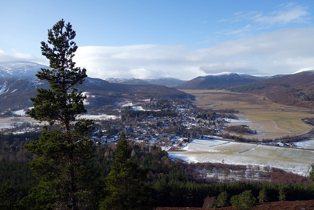
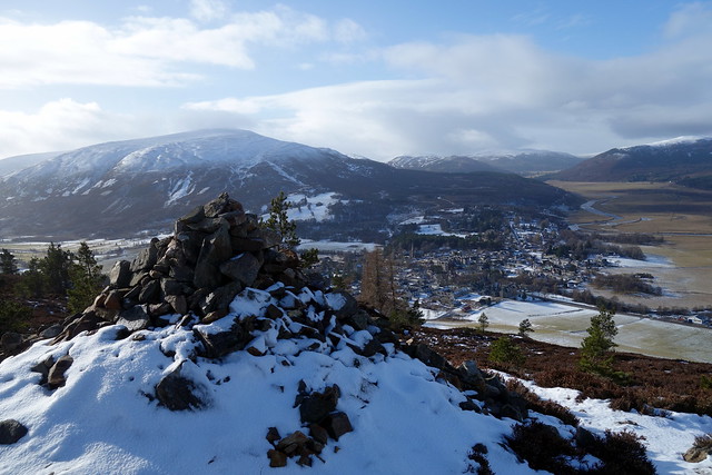
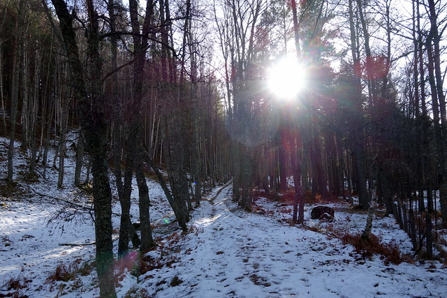
We rise quite late - it's been snowing lightly overnight. What to do... my right 1st metatarsal is aching big time as I hobble to the toilet block. Don't think I'll be doing much hillwise today. We wander into Braemar centre, most of which is undergoing refurbishment. The Co-Op doesn't have Biscoff. We return to the tent and decide to wander up the wee hill right in the centre of Braemar, Creag Choinnich, which I thought was a Marilyn, but isn't (merely a Hump). It is a nice walk through the woods and a good viewpoint to see the village from. We lunch by one of several cairns. Contemplate continuing up the hillside to the south to do two or three of the Sims there, but there are so many Sims in this area that it would be a mere drop in the ocean. Instead I decide we should do one or both of the Marilyns east of Braemar.
Braemar
 DSC00603 by Al, on Flickr
Summit Creag Choinnich
 DSC00606 by Al, on Flickr
Local resident
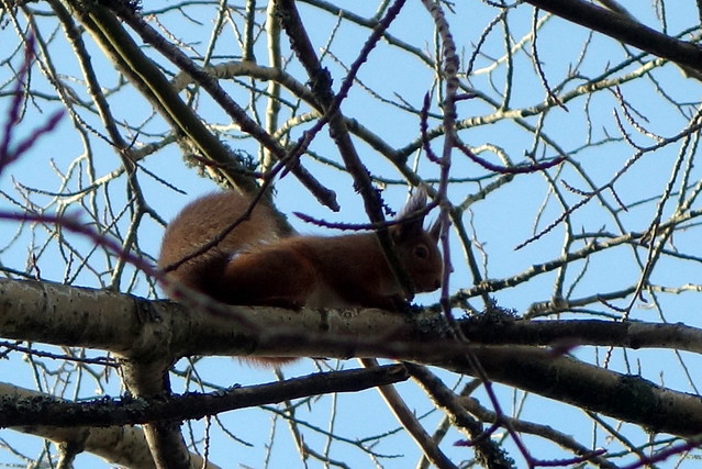 DSC00608 by Al, on Flickr
 DSC00609 by Al, on Flickr
We settle on Creag Ghuibhais first (at least I have a map with it on) and drive along past Balmoral, finding a place to park beside a gate in the deer fence beside our hill. A pleasant walk through fir trees then straight up a tussocky hillside, effort of combatting the tussocks something Allison sarcastically says she's missed in recent weeks. Stonier as we ascend, then into pretty Scots pine to the small summit cairn. Views north-east to Morven, a descent down the western shoulder and back to the car in just over an hour.
 DSC00610 by Al, on Flickr
 DSC00611 by Al, on Flickr
 DSC00612 by Al, on Flickr
 DSC00613 by Al, on Flickr
 DSC00615 by Al, on Flickr
 DSC00616 by Al, on Flickr
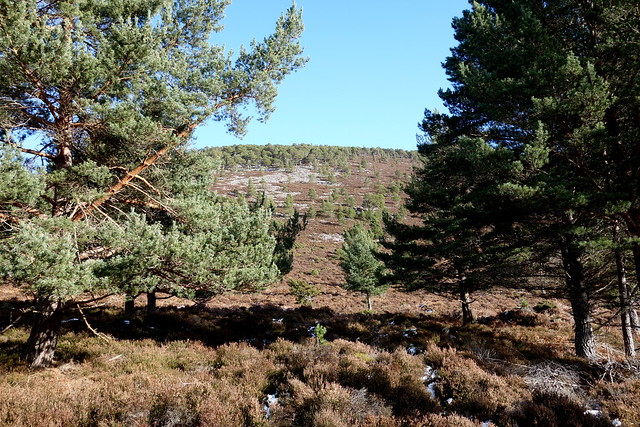
We drive back towards Braemar, pull into a large parking area directly south of our next target, Meall Alvie. This one is forested all around, but fortunately the trees are spaced wide enough apart to make a pleasant walk rather than a jungle expedition. After some time heading up through trees we come to a tumbledown wall which we follow, through quite deep snow, gaining the small summit cairn. Grand views of Lochnagar from here. We retrace our steps, watch a small procession of stags flit through the trees below us and return to the car. Not a bad day out after all.
Start of the route doesn't look promising...
 DSC00617 by Al, on Flickr
 DSC00618 by Al, on Flickr
White Lochnagar
 DSC00620 by Al, on Flickr
Summit Meall Alvie
 DSC00621 by Al, on Flickr
 DSC00625 by Al, on Flickr
Things deteriorate a bit at the campsite. A chap with a teepee has pitched quite close to us and has some music on as we get our tea. OK, I can live with that. We turn in early and around 8.30pm his friend arrives. For the next few hours we are treated to every nuance of their mightily interesting conversation, at a volume which one or two campers in Ballater might not have been able to catch. Now I'm getting a little hard of hearing as I age, but I heard every word. Imagine Beavis and Butthead have become middle-aged, rather posh Edinburgers and you get the jist. 11pm comes and goes. Midnight - they go to the toilet and I hope they're going to sleep now, but no, they resume their exchanges until I explode and ask them to STFU. Silence at last, but sleep is elusive. I decide I can't cope with a spring/summer of noisy and inconsiderate campsite dwellers and really I should get a van. Then I start thinking through all the permutations of that - meanwhile the weather's gone from relatively balmy to Baltic.
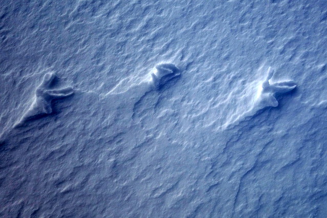
No sleep then was had, or precious little. At least the Edinburgers didn't snore and they have the decency to remain in their teepee til we've departed. Today's treat is An Socach from Baddoch. I hadn't actually realised (til I got home) that this was the WH route for this hill, it just seemed a sensible way in. I had thought of tagging on Beinn Iutharn Mhor, but that adds some 5 miles and a lot of ascent/re-ascent, so that one will need to wait now for a walk down Glen Ey (somewhere we've not been yet). Anyway, I digress. Parked up at the gate, got snowshoes onto the packs and off along a snowy track. Some ponies are cropping short grass under the snow. Someone's been along the track before us, then his footprints disappear and we are left with a record of animal comings and goings only. Punched out steps of deer, hoppity marks of hares, miniscule trails of mice and stellate signs of grouse. We come across signs of a scuffle - rabbit or hare tracks co-inciding with those of a pair of foxes. The snow is flattened with the evidence of something being dragged, the rabbit tracks disappear, the fox continues. No blood is shed - here at any rate.
 DSC00627 by Al, on Flickr
 DSC00628 by Al, on Flickr
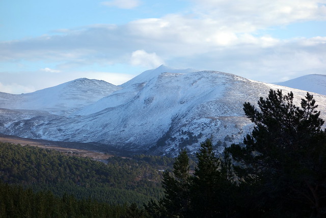
After a few km we come to the start of the shoulder of An Socach, crossing the Allt Coire Fhearneasg. A vague ATV track seems to go up here, co-opted by hares and other creatures for their own designs. The track quickly disappears under snow - we make for the large cairn at 700m, snowshoes on again. From here we see the rise of the East Top of An Socach, which is reached with one steep pull up some quite heavily snow-laden slopes. Once we reach the cairn we remove snowshoes - they're little help over the rocky terrain, as much of the snow cover has been blasted away. It's over 2km to the summit from here - we have to contend with a strong and extremely cold wind blowing across us from the north. Halfway along I have to stop and pull on my belay jacket under my waterproof and change into my thickest gloves - that helps a lot. The going is otherwise fairly easy as the snow isn't deep and we make the summit in good time, finding a little shelter behind the cairn for lunch. Beinn MacDhui is revealed in all its snowy glory to the north.
 DSC00630 by Al, on Flickr
The 700m cairn
 DSC00632 by Al, on Flickr
 DSC00633 by Al, on Flickr
Ptarmigan traces
 DSC00636 by Al, on Flickr
East Top
 DSC00637 by Al, on Flickr
Heading along the plateau
 DSC00640 by Al, on Flickr
Beinn MacDhui
 DSC00645 by Al, on Flickr
Summit An Socach
 DSC00646 by Al, on Flickr
We retrace our steps, meeting up with a couple we spoke to at the parking area. Descent is helped by the wind being slightly on our backs and the odd bumslide. It's another beautiful day - warm enough out of the wind to strip off to base layer. I have a renewed respect for these maligned hills now - it helps to have been able to see from them (as previously it's been mostly clag views) but they are grand winter hills, particularly when away from the madness of the ski-folk. As we drive past the Ski Centre it is absolutely mobbed, with cars everywhere. No doubt our Edinburger chums are in there somewhere, gabbing away in overly loud voices
 DSC00648 by Al, on Flickr
 DSC00649 by Al, on Flickr
 DSC00650 by Al, on Flickr
My 56 birthday: I know how to celebrate- up at 6.30 and parked up at The Spittal and ready to go just before 8am. A fine morning, the promise of a good - if cold - day to come. Crisp and clear - barked at by the dogs at the gatehouse and along an icy road towards Dalmunzie Hotel. I could remember little of this route - we'd done these 2 Munros in summer by this route in a little under 8 hours some years back. How much time adding on the Tops would require I was not sure of... Through the farm, a minor wrong direction then back onto the track by the stream and up onto the heathery hillside. I did remember the ruined building at Glenlochsie where we had a bit of stepping-stone-icyness to get across the river. Continuing up the track, the snow drifts getting deeper to the point where snowshoes started to make sense. Glas Tulaichean stretched away ahead of us in snowy meringue folds. Blue sky, nippy wind.
DSC00570 by Al, on FlickrGreat conditions for snowshoes - Glas Tulaichean stretching off ahead
DSC00572 by Al, on FlickrDSC00574 by Al, on FlickrGlas Tulaichean summit
DSC00576 by Al, on FlickrAfter a time snowshoes were replaced by crampons - mostly because I (wrongly) assumed those would be needed for the descent. Up to the ice-decorated trig point, a corniced egde along the coire rim ahead of us. Follow the fence line down - in retrospect we should probably have come off the NW shoulder of Tulaichean heading more directly for Carn an Righ rather than follow the standard route, as this meant contouring round Mam nan Carn. take it from me - contouring in snowshoes is not recommended
DSC00577 by Al, on FlickrDSC00579 by Al, on FlickrLoch nan Eun frozen over
DSC00581 by Al, on FlickrCarn an Righ ahead
DSC00582 by Al, on FlickrBeinn Iutharn Mhor (L) and Mam nan Carn
DSC00583 by Al, on FlickrSummit Carn an Righ
DSC00585 by Al, on FlickrDSC00586 by Al, on FlickrBeinn a'Bhuird/ Beinn A'an
DSC00587 by Al, on FlickrLooking north up the Lairig Ghru
DSC00588 by Al, on FlickrDSC00589 by Al, on FlickrWe now had a choice to make - descend and contour back round Mam nan Carn to Loch nan Eun or head over the 2 Munro Tops of Mam nan Carn and Beinn Iutharn Beag with around 300m ascent to do. No contest (contouring in snowshoes = very bad stuff) - we went for the Tops. A long pull up Mam nan Carn to the summit - we see a walker at the summit of Beinn Iutharn Mhor which, unfortunately, is just too far to tag onto today's already long circuit; a glance up Glen Ey which was relatively snow free, then down and we're faced with a steep looking ascent up Beinn Iutharn Beag. It turns out to be easier than it appeared however and we've summited by 3.15pm with a steep snowy descent to the frozen, snow covered Loch nan Eun by 3.30. I ponder just how thick the ice is on the loch, but ensure we skirt round it anyway - falling into freezing water would not be a sensible option with the wind chill factor today
DSC00590 by Al, on FlickrMam nan Carn
DSC00591 by Al, on FlickrLooking up Glen Ey
DSC00592 by Al, on FlickrBeinn Iutharn Beag
DSC00593 by Al, on FlickrSummit
DSC00594 by Al, on FlickrLoch nan Eun again
DSC00595 by Al, on FlickrBeinn Iutharn Beag
DSC00596 by Al, on FlickrOur descent is down Gleann Taitneach - I was relieved to see there didn't seem a lot of snow in the glen - hadn't really thought through what the options were if it had loaded side walls as it's a narrow entry into the glen from the south side of Loch nan Eun - probably go high over Creag Easgaidh if needed. After some deep snow games we follow the line of the river, a bit higher up than the marked track just in case of avalanche risk until we get to sparse snow and follow along the floor of the glen. A fairly long walk out - my feet are complaining - a combination of many miles in winter boots and snow shoes isn't soothing. We continue down the eastern side of the Allt which brings us, in time, back to the road and the welcome sight of the car, just before 6pm. Managed the walk without need for headtorch - yeah!
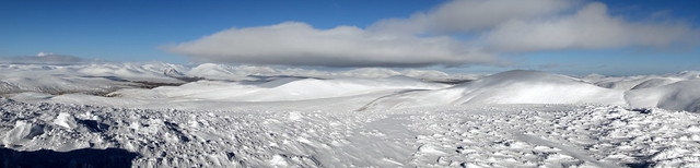
Descent route along Gleann Taitneach
DSC00597 by Al, on FlickrLooking back the way we've come
DSC00599 by Al, on FlickrDSC00600 by Al, on FlickrDefrost the car windscreen, change kit and off to the relative civilization of Braemar campsite, a tasty curry and a hot shower - bliss. Feet are quite sore after the long day - I've already said to Allison I think we should have a rest day tomorrow (nothing to do with 70mph winds, honest
We rise quite late - it's been snowing lightly overnight. What to do... my right 1st metatarsal is aching big time as I hobble to the toilet block. Don't think I'll be doing much hillwise today. We wander into Braemar centre, most of which is undergoing refurbishment. The Co-Op doesn't have Biscoff. We return to the tent and decide to wander up the wee hill right in the centre of Braemar, Creag Choinnich, which I thought was a Marilyn, but isn't (merely a Hump). It is a nice walk through the woods and a good viewpoint to see the village from. We lunch by one of several cairns. Contemplate continuing up the hillside to the south to do two or three of the Sims there, but there are so many Sims in this area that it would be a mere drop in the ocean. Instead I decide we should do one or both of the Marilyns east of Braemar.
Braemar
DSC00603 by Al, on FlickrSummit Creag Choinnich
DSC00606 by Al, on FlickrLocal resident
DSC00608 by Al, on FlickrDSC00609 by Al, on FlickrWe settle on Creag Ghuibhais first (at least I have a map with it on) and drive along past Balmoral, finding a place to park beside a gate in the deer fence beside our hill. A pleasant walk through fir trees then straight up a tussocky hillside, effort of combatting the tussocks something Allison sarcastically says she's missed in recent weeks. Stonier as we ascend, then into pretty Scots pine to the small summit cairn. Views north-east to Morven, a descent down the western shoulder and back to the car in just over an hour.
DSC00610 by Al, on FlickrDSC00611 by Al, on FlickrDSC00612 by Al, on FlickrDSC00613 by Al, on FlickrDSC00615 by Al, on FlickrDSC00616 by Al, on FlickrWe drive back towards Braemar, pull into a large parking area directly south of our next target, Meall Alvie. This one is forested all around, but fortunately the trees are spaced wide enough apart to make a pleasant walk rather than a jungle expedition. After some time heading up through trees we come to a tumbledown wall which we follow, through quite deep snow, gaining the small summit cairn. Grand views of Lochnagar from here. We retrace our steps, watch a small procession of stags flit through the trees below us and return to the car. Not a bad day out after all.
Start of the route doesn't look promising...
DSC00617 by Al, on FlickrDSC00618 by Al, on FlickrWhite Lochnagar
DSC00620 by Al, on FlickrSummit Meall Alvie
DSC00621 by Al, on FlickrDSC00625 by Al, on FlickrThings deteriorate a bit at the campsite. A chap with a teepee has pitched quite close to us and has some music on as we get our tea. OK, I can live with that. We turn in early and around 8.30pm his friend arrives. For the next few hours we are treated to every nuance of their mightily interesting conversation, at a volume which one or two campers in Ballater might not have been able to catch. Now I'm getting a little hard of hearing as I age, but I heard every word. Imagine Beavis and Butthead have become middle-aged, rather posh Edinburgers and you get the jist. 11pm comes and goes. Midnight - they go to the toilet and I hope they're going to sleep now, but no, they resume their exchanges until I explode and ask them to STFU. Silence at last, but sleep is elusive. I decide I can't cope with a spring/summer of noisy and inconsiderate campsite dwellers and really I should get a van. Then I start thinking through all the permutations of that - meanwhile the weather's gone from relatively balmy to Baltic.
No sleep then was had, or precious little. At least the Edinburgers didn't snore and they have the decency to remain in their teepee til we've departed. Today's treat is An Socach from Baddoch. I hadn't actually realised (til I got home) that this was the WH route for this hill, it just seemed a sensible way in. I had thought of tagging on Beinn Iutharn Mhor, but that adds some 5 miles and a lot of ascent/re-ascent, so that one will need to wait now for a walk down Glen Ey (somewhere we've not been yet). Anyway, I digress. Parked up at the gate, got snowshoes onto the packs and off along a snowy track. Some ponies are cropping short grass under the snow. Someone's been along the track before us, then his footprints disappear and we are left with a record of animal comings and goings only. Punched out steps of deer, hoppity marks of hares, miniscule trails of mice and stellate signs of grouse. We come across signs of a scuffle - rabbit or hare tracks co-inciding with those of a pair of foxes. The snow is flattened with the evidence of something being dragged, the rabbit tracks disappear, the fox continues. No blood is shed - here at any rate.
DSC00627 by Al, on FlickrDSC00628 by Al, on FlickrAfter a few km we come to the start of the shoulder of An Socach, crossing the Allt Coire Fhearneasg. A vague ATV track seems to go up here, co-opted by hares and other creatures for their own designs. The track quickly disappears under snow - we make for the large cairn at 700m, snowshoes on again. From here we see the rise of the East Top of An Socach, which is reached with one steep pull up some quite heavily snow-laden slopes. Once we reach the cairn we remove snowshoes - they're little help over the rocky terrain, as much of the snow cover has been blasted away. It's over 2km to the summit from here - we have to contend with a strong and extremely cold wind blowing across us from the north. Halfway along I have to stop and pull on my belay jacket under my waterproof and change into my thickest gloves - that helps a lot. The going is otherwise fairly easy as the snow isn't deep and we make the summit in good time, finding a little shelter behind the cairn for lunch. Beinn MacDhui is revealed in all its snowy glory to the north.
DSC00630 by Al, on FlickrThe 700m cairn
DSC00632 by Al, on FlickrDSC00633 by Al, on FlickrPtarmigan traces
DSC00636 by Al, on FlickrEast Top
DSC00637 by Al, on FlickrHeading along the plateau
DSC00640 by Al, on FlickrBeinn MacDhui
DSC00645 by Al, on FlickrSummit An Socach
DSC00646 by Al, on FlickrWe retrace our steps, meeting up with a couple we spoke to at the parking area. Descent is helped by the wind being slightly on our backs and the odd bumslide. It's another beautiful day - warm enough out of the wind to strip off to base layer. I have a renewed respect for these maligned hills now - it helps to have been able to see from them (as previously it's been mostly clag views) but they are grand winter hills, particularly when away from the madness of the ski-folk. As we drive past the Ski Centre it is absolutely mobbed, with cars everywhere. No doubt our Edinburger chums are in there somewhere, gabbing away in overly loud voices
DSC00648 by Al, on FlickrDSC00649 by Al, on FlickrDSC00650 by Al, on Flickr