free to be able to rate and comment on reports (as well as access 1:25000 mapping).
 Chris silhouetted against the ridge
 by
scotlandmac, on Flickr
This is a sort of 'Blue Peter' walk report of a walk we did earlier back in Feb 2017 , in fact almost to the day. The contrast with February conditions this year are incredible, given the lack of snow a year ago.
We first climbed this rugged Cuillin outlier about 8 years ago on a broiling hot June day, both of us absolutely sweltering in the heat and exhausted after the slog up the very sheltered corrie onto the ridge itself.

My husband Chris had pronounced the hill a ‘steep wee bugger’ but the views made every huff and puff worth it ten times over. The hill translates from the Gaelic as The Peak of Strife and it had caused us a bit of that in the heat

It’s also become widely hailed as offering ‘Britain’s best view’ – difficult to argue with when the horseshoe of the whole Black Cuillin ridge is set out before you like some kind of Lord of the Rings landscape! I remember thinking at the time – if it’s as magnificent as this in summer, what must it be like in winter, with snow on the jagged peaks? That thought - of seeing it under snow and in winter colours - really stuck in my mind but it was only last year (seems ridiculous really) that timing, weather, opportunity, family commitments etc, all came together to allow it to happen.
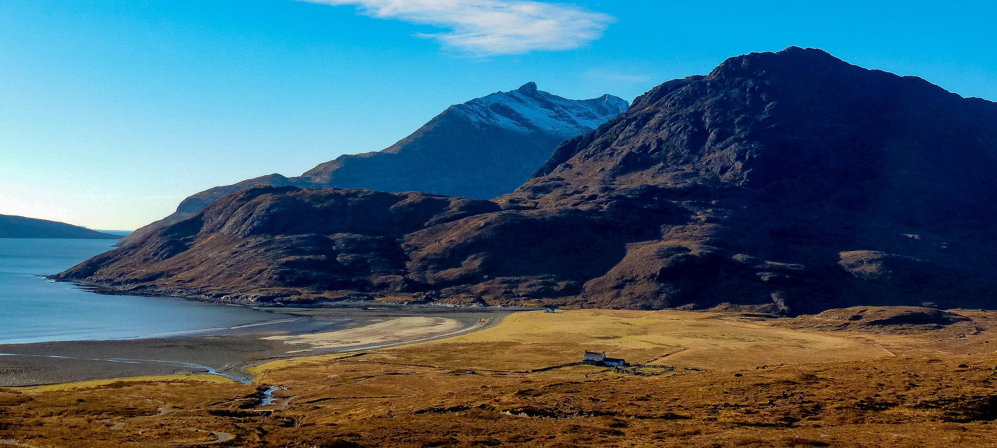
So on a bitterly cold February morning in 2017, we set off from our base on North Skye at 6.45am, the roads gritted given the -7C temperatures.It was Baltic! It took us about 75 minutes to reach the Kilmarie parking area on the Elgol road. We could have used the Sligachan route and saved ourselves the extra travel but I love Camasunary - it’s just so incredibly beautiful.
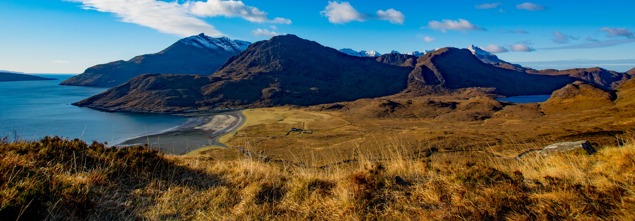
 Another view over Camasunary, one of my favourites on Skye (or anywhere)
 by
scotlandmac, on Flickr
Parked up, just one other car there and got ourselves sorted out, then headed through the gate and onto the big wide stony track that leads up to the top of the pass - Am Mam - above Camasunary Bay. It was 8.15am. What a gorgeous morning it was! Yes, bitterly cold but the sky was a dusky pink as dawn broke; it was looking good. I was keeping my fingers crossed that the Mountain Weather Service and the BBC ( the blighters) had got the 'promised'

good forecast right. We’d only made the decision to race up to Skye the day before, when a wee weather window looked as if it was settling over the North West Highlands.
It took us about 40 minutes to reach the top of the Mam and it’s only at that point that suddenly, the first spectacular view of the Cuillin Ridge hit us between the eyes. It was a jaw drop. No wonder the Cuillin are called the British Alps

Now they were snow dusted, rising over three thousand feet straight out of the ocean and the emerald sward of Camasunary bay. It was stunning, just gorgeous. We also had a fine view of the our objective for today , looking much higher than its 500m height.
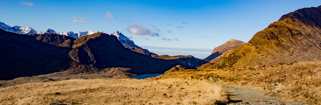
 The route in to the Sgurr na Stri climb from Kilmarie
 by
scotlandmac, on Flickr
 The path weaves down to the bay.Sgurr nan Gillean's sharp pyramid appears ahead.
 by
scotlandmac, on Flickr
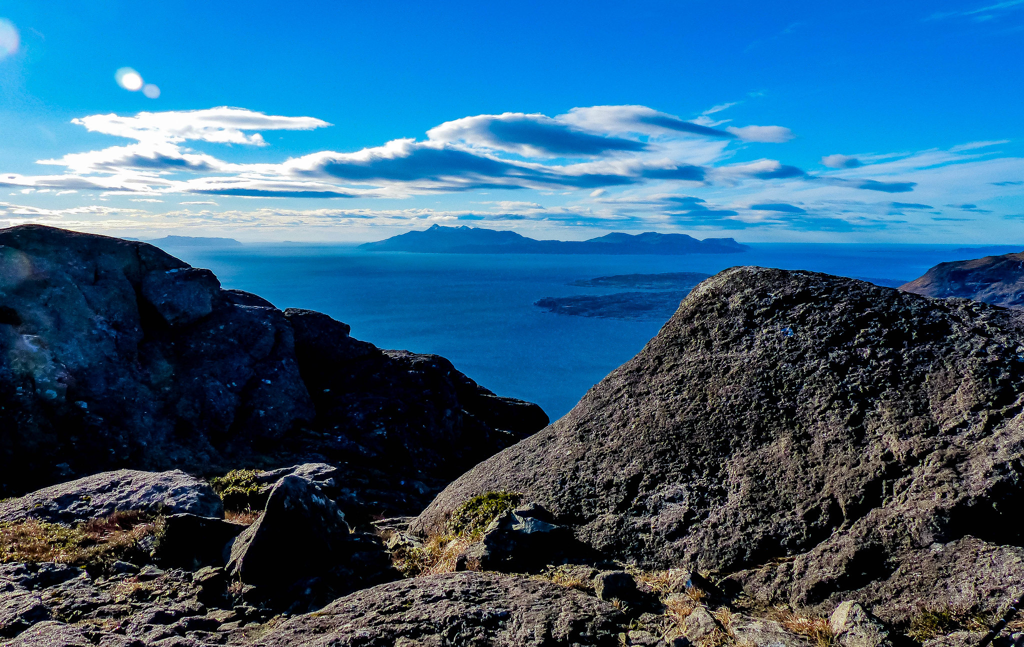
No point in dawdling too long up here though, there was work to do! So down we went, a 180m descent on the big rubbly track to the lovely bay itself , washed by gently crashing surf and the air alive with the piping cry of oyster catchers. Rum sat serenely on the horizon and the rosy sky had now turned into clear blue. Blaven’s south ridge was sunlit, emerging from the cold shadow of night. What a huge temptation to stay right here on the sand, watch the ocean and just ‘be.’

But - the Peak of Strife was calling us….
I’m really interested in what the hill names mean and posed all my usual ' what/why/when /who' questions when we're on a walk.With Chris's big interest in Highland history , he thought the 'strife' might refer to the tensions between the Clan Chiefs of the MacDonalds and the Macleods over the land boundary that the hill marked (rather than my initial assumption that it was the huffing and puffing it caused on the ascent

)Sounded pretty reasonable to me.
 Camasunary Bay, a wonderful, wild spot.
 by
scotlandmac, on Flickr
It's a beautiful part of the walk, just strolling along the beach beside the sea.Rum sat serenely on the horizon and the rosy sky had now turned into a deep clear blue.
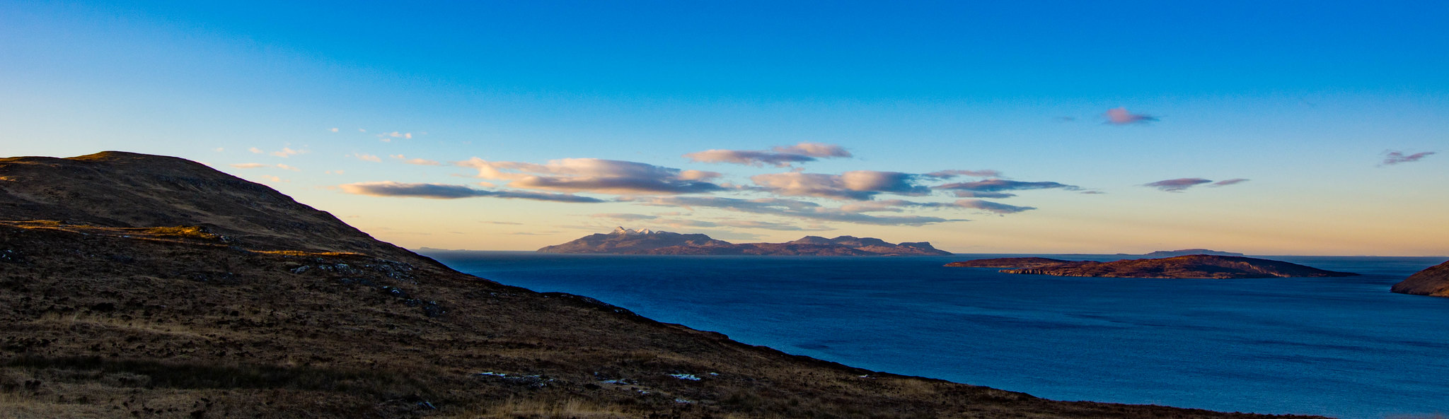 From the pass to Rum and Canna
 by
scotlandmac, on Flickr
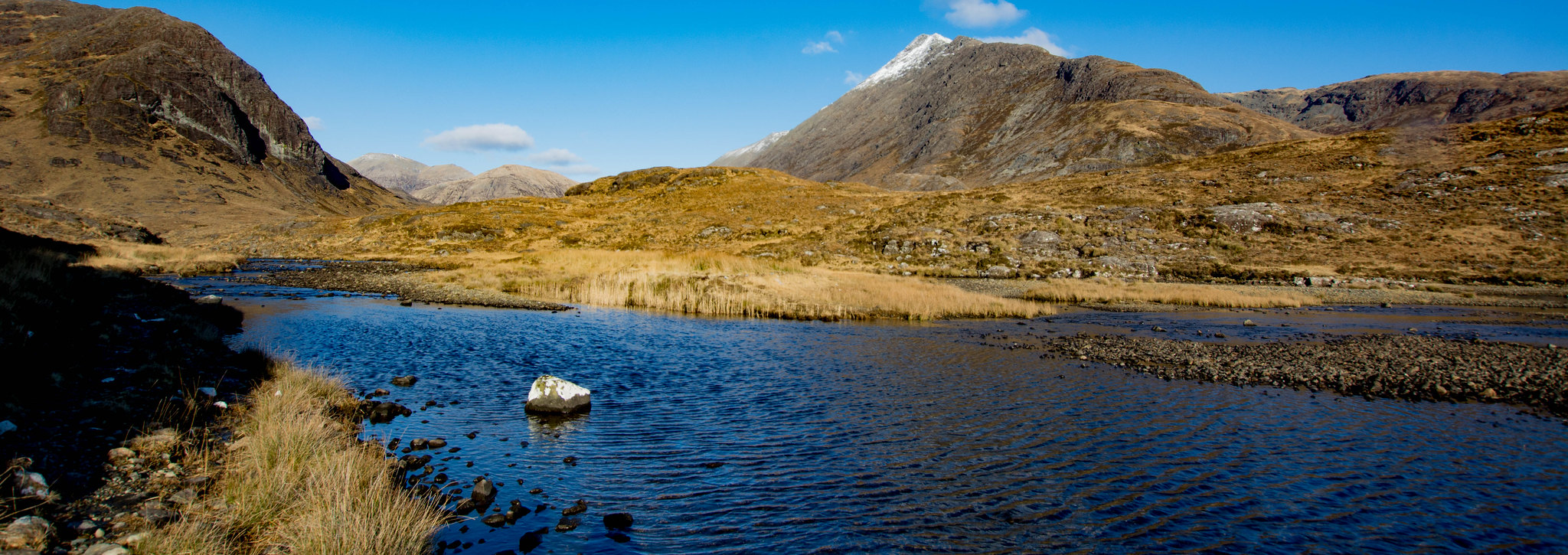 Crossing the river below Blaven (on the right)
 by
scotlandmac, on Flickr
Once across beach, we headed upstream to ford the river, thankfully quite low,then made contoured on very boggy, rough ground to where an obvious burn coursed down the moorland from the ridge itself.We'd used this route last time but it was now a good 30 degrees cooler,thankfully
Now the slog began in earnest though to be fair it wasn’t too bad. At 10am, we were halfway up the corrie and stopped for a break and some water and for me, a Picnic.( I ignored the 2 oranges and 2 apples which were supposed to be my attempt at healthier eating on the hills.They never did get eaten till we got back to the car.)
’Big bird,’ Chris suddenly announced and pointed above. Sure enough, an eagle (golden or young sea eagle, not sure) swept across the sky above our heads and soared over the bay towards Blaven. What a sight! Of course, this had to be the one time I had stuck the camera with the zoom lens in my rucksack! A sort of Murphy’s Law I suppose.
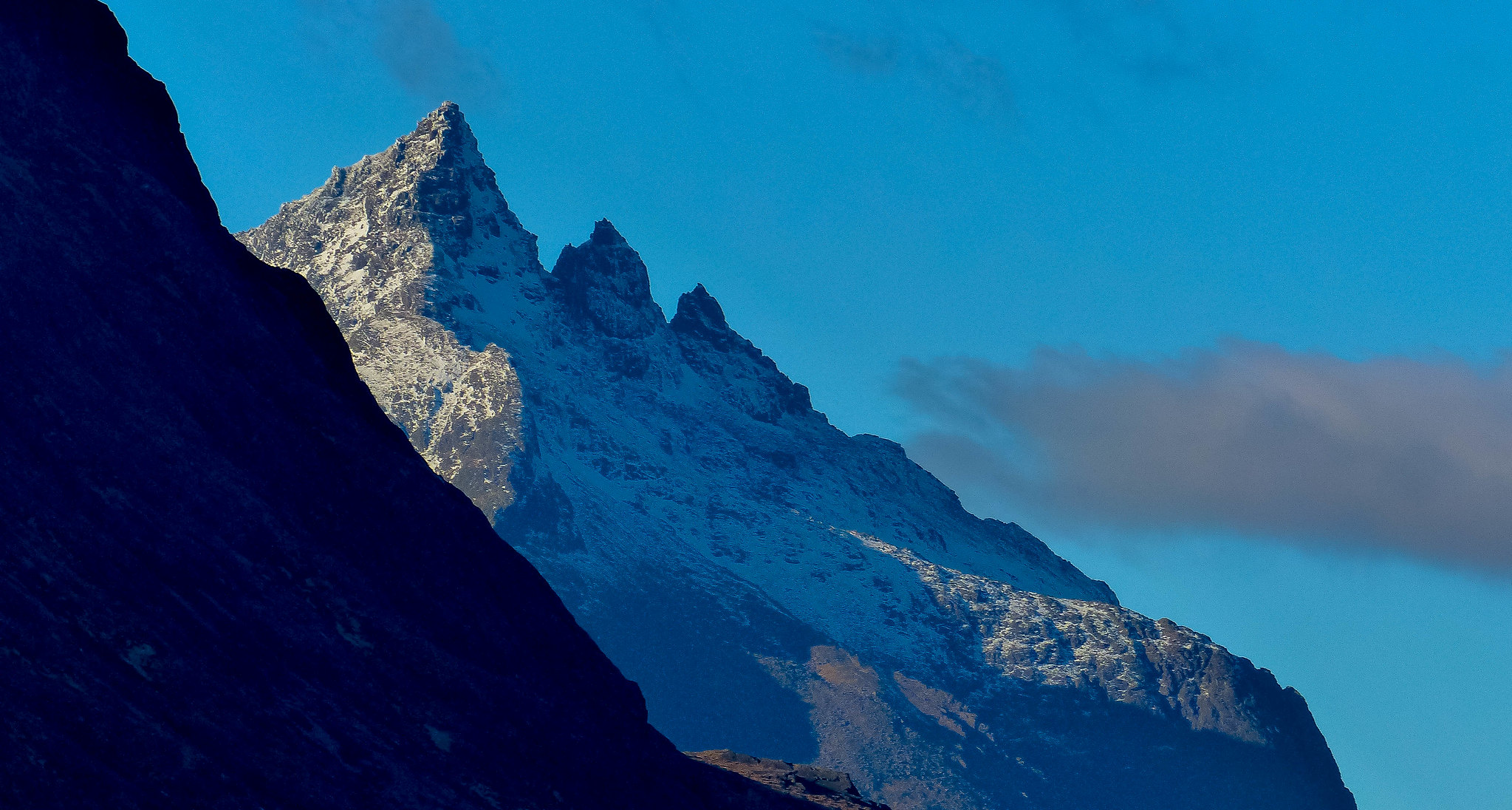
On and upwards we headed, with a short steeper slog to the ridge itself before we crested it and an Alpine scene reared magnificently before us.
Chris silhouetted against the ridge by
scotlandmac, on Flickr
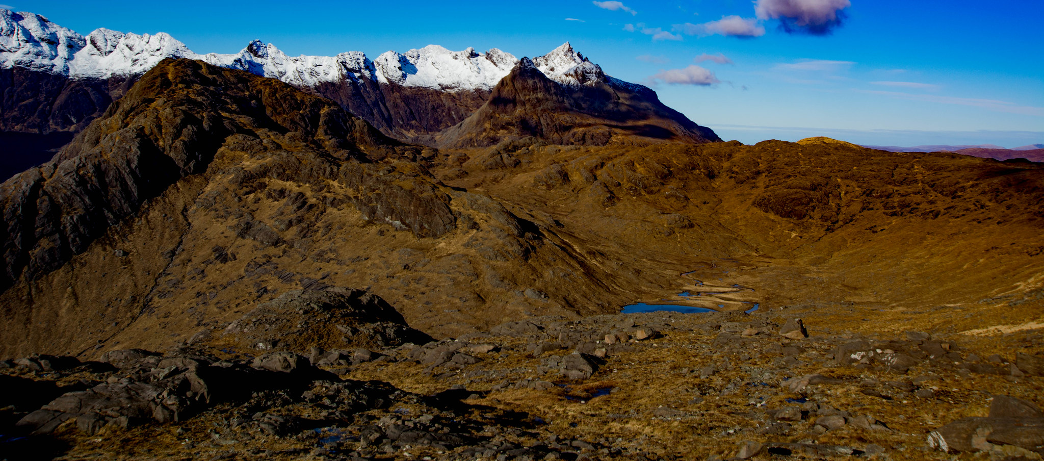 The wilderness between the hill and the Cuillin
 by
scotlandmac, on Flickr
It’s impossible to describe it with any real justice. I think it was the writer Robert MacFarlane who called the Cuillin ‘Gothic’ and that definitely captures something of their majesty. They looked every inch of their 3,000 feet + and more. I have to say that later on that summer we climbed Galdhopiggen, Norway’s highest mountain.While it was impressive of course, the views did not match the splendour of what was before us at this moment.Water - whether the sea or lochs or both - just sets the scene so brilliantly.
 Druim na Ramh ridge and Sgurr nan Gillean
 by
scotlandmac, on Flickr
After eventually calming down from all the superlatives and photo taking, we headed across the broken, slabby ground heading south and up towards the summit. The terrain is incredibly complex, but we picked up a faint track and followed it over rocks and down into dips and hollows, then up again, avoiding mini gullies and little drops and always, heading closer to the slab covered edge which teetered over Loch Scavaig below. My eye took in the thousand foot drops and I shuddered a little. Me and my vertigo are always close companions.

 Sgurr Alasdair ( named my eldest after this highest of the Cuillin peaks)
 by
scotlandmac, on Flickr
 Loch Scavaig
 by
scotlandmac, on Flickr
Now came false summit after false summit, the hill seeming bigger and longer and much, much rockier than I remembered. Slabbier is a better word I think. Big Cuillin slabs. I was sure we'd taken a grassier route last time which had brought us to a small lochan where we watched a hind and her calf , watchful of us , but continuing to graze. They were such a beautiful sight.Nope, this is the way up Chris insisted when I began to fret and moan a bit that we'd chosen the wrong route.
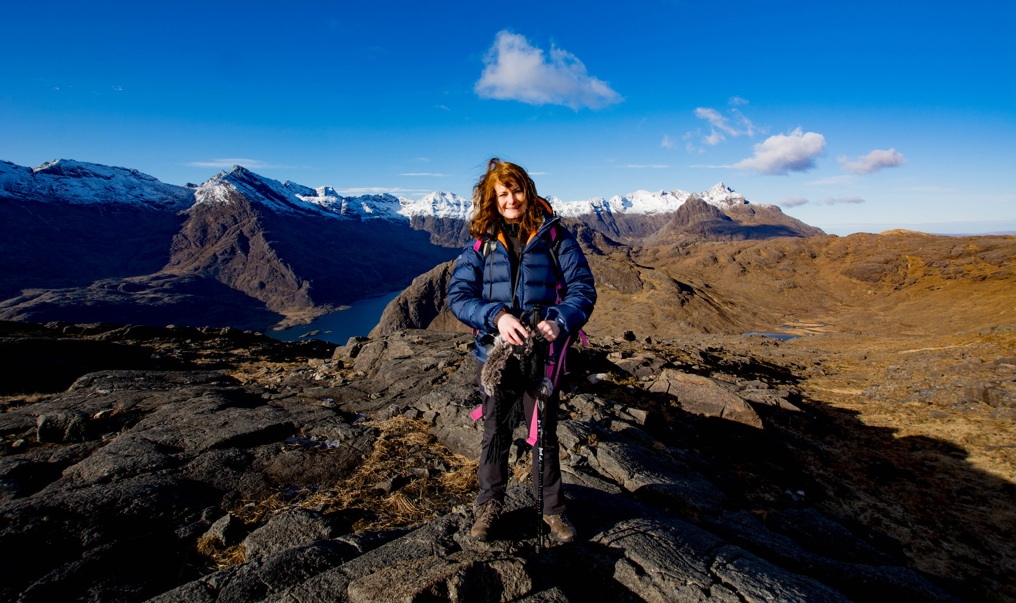
But then suddenly we were at the top and the splendour of the view opened up below and all around.
What a surge of achievement as we drank in one of the finest views I have seen anywhere. That killer combo of deep blue ocean and lochs, islands, jagged snow dusted peaks, the endless sea of mainland mountains that is Knoydart and Kintail, all in tawny and copper and gold. It was mesmerising.
 Loch Coruisk
 by
scotlandmac, on Flickr
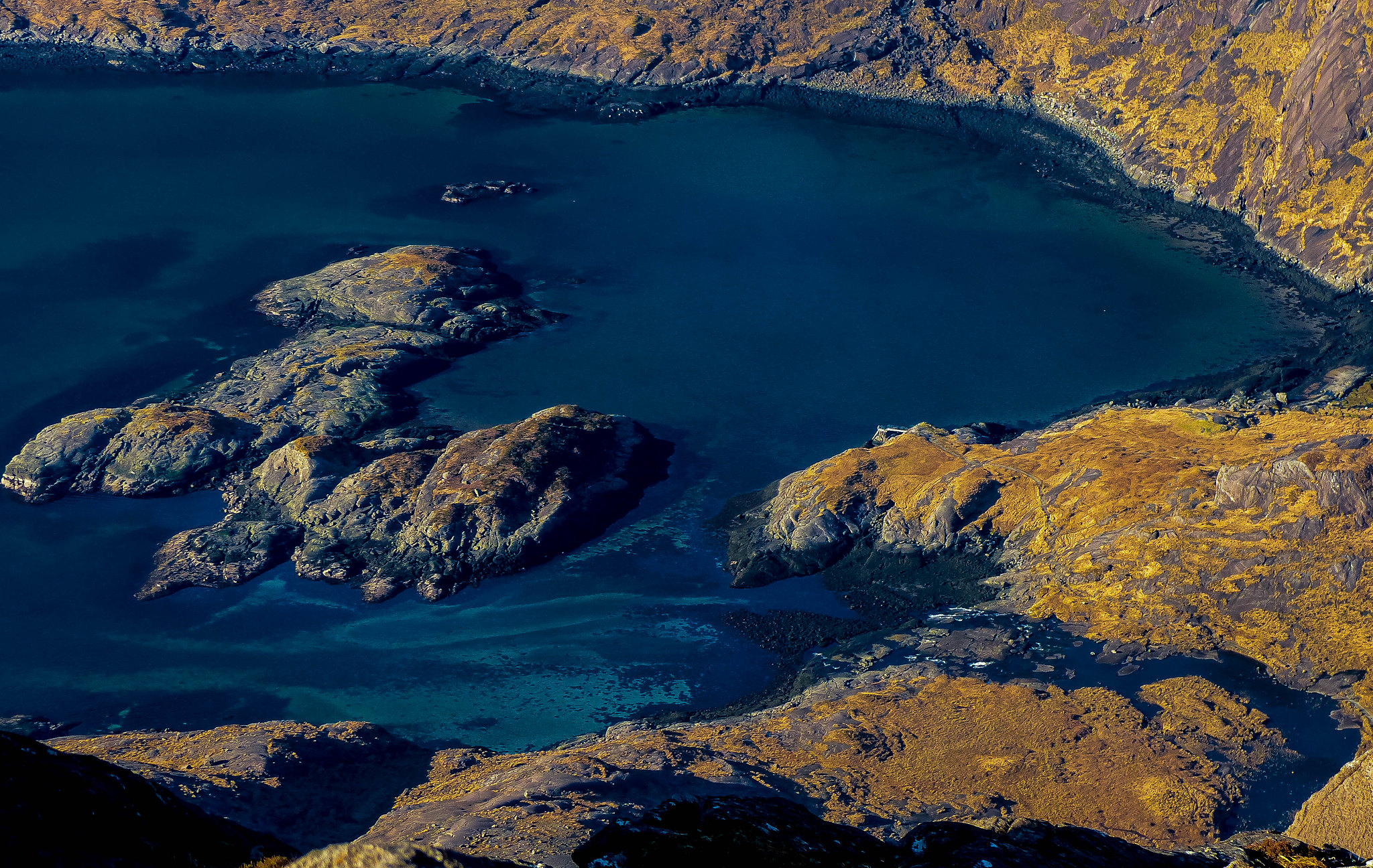
 I love the colour of Loch Scavaig, turquoise green
 by
scotlandmac, on Flickr
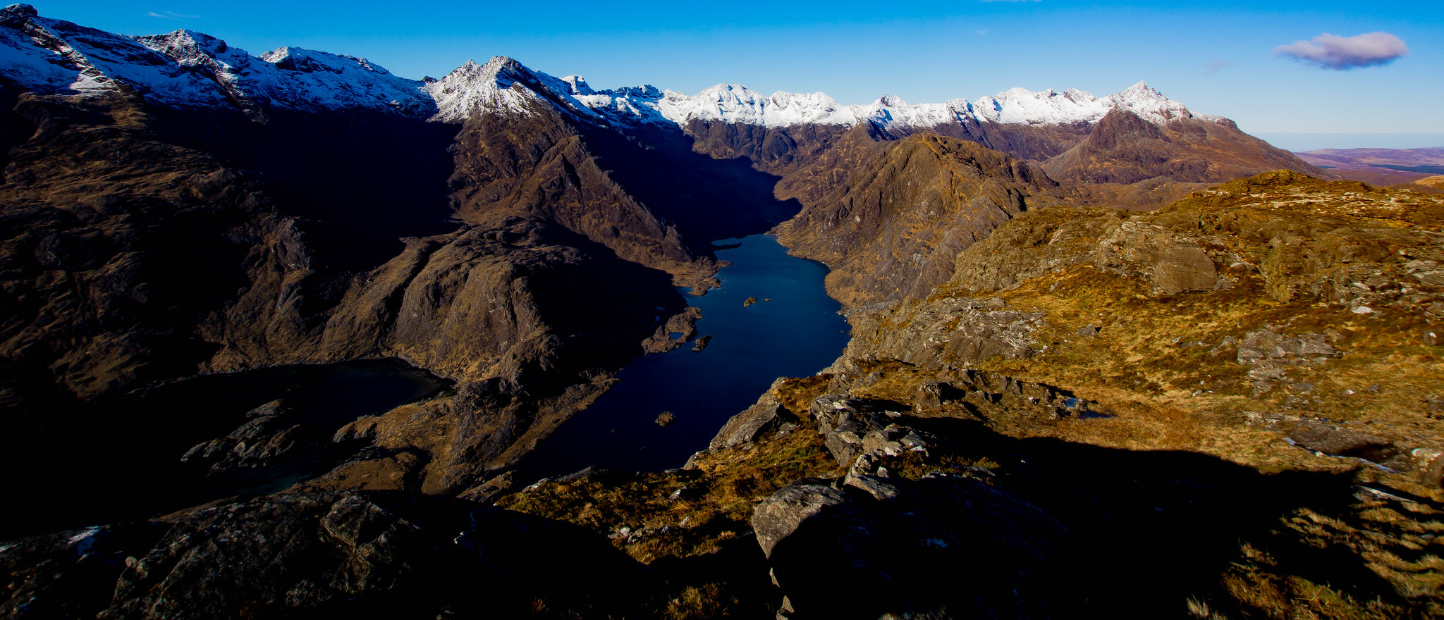
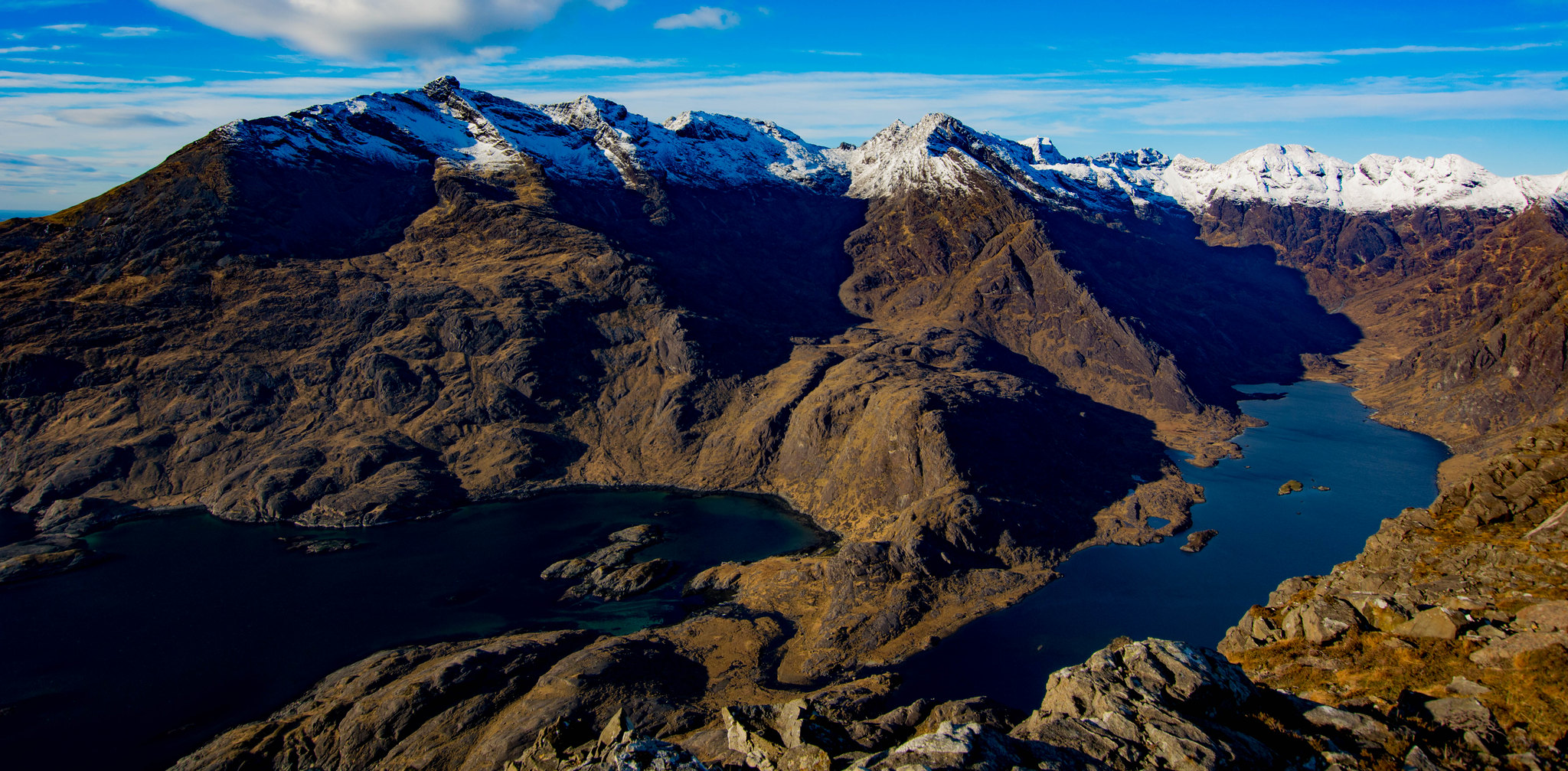 Loch Coruisk and Loch Scavaig
 by
scotlandmac, on Flickr
 Taken once I'd stopped moaning about how rocky it was....
 by
scotlandmac, on Flickr
The wind had got up a bit suddenly so we hunkered down behind a rocky knoll (plenty of those

) and I devoured more chocolate, while Chris made me feel very guilty by peeling several oranges.But the day was too good to spend hidden behind some rocks munching away, so we were soon up on our feet again to enjoy the eagle’s eye view.
 To Rum, Canna,Eigg, Muck and Coll
 by
scotlandmac, on Flickr
We spent half an hour just wandering around, taking umpteen photos, peering way down to Loch Scavaig, making out the tiny jetty where the boats from Elgol land for the Coruisk trip.The loch's little white beaches and translucent green water looked like something out of the Caribbean rather than the Western Highlands.
Way out on the far horizon, Barra was a chain of small , hazy blue pyramids.Closer, lay Rum and Eigg and Canna, basking under the winter sunshine.
 View from Sgurr na Stri over Gars Bheinn and Rum and Eigg.
 by
scotlandmac, on Flickr
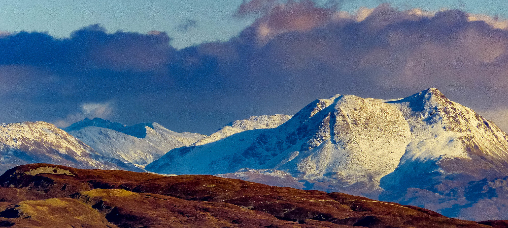
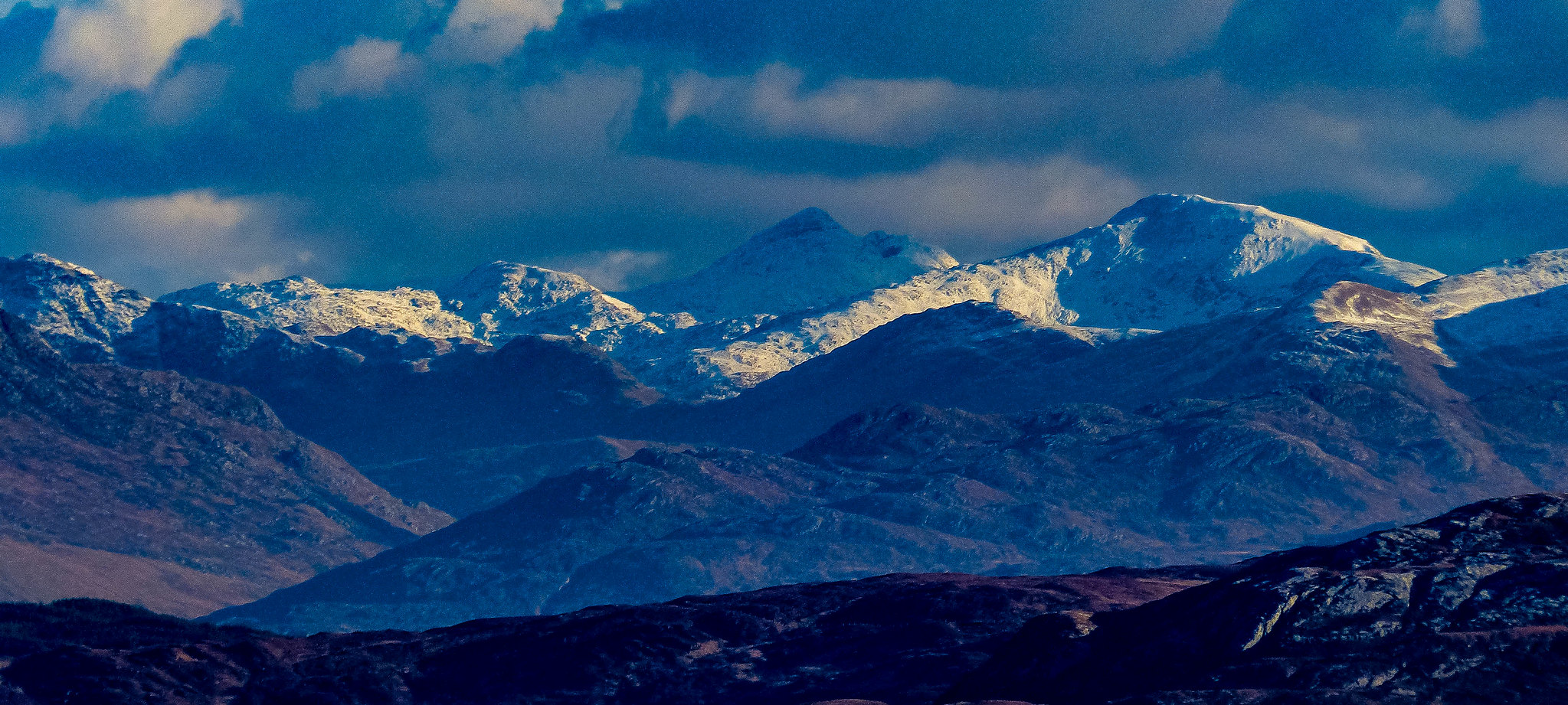
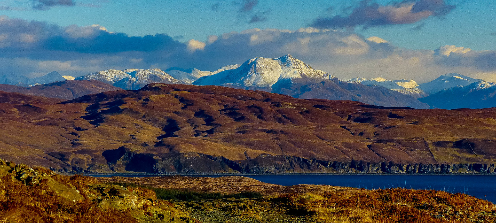
The mainland mountains looked wonderful - Kintail and Knoydart in all their splendour.
 Beinn Sgritheall
 by
scotlandmac, on Flickr
 Ladhar Bheinn, Knoydart
 by
scotlandmac, on Flickr
What a hard place to leave!
But down we had to go eventually, finding the spot where we crested the ridge (wouldn’t be an easy place in mist to navigate). Two young guys were making their across the ridge from what looked like the glen approach but somehow we lost them in the complex, broken ground. They were the only people we saw all day.
It was difficult to stop taking photos though of those amazing Cuillin peaks, looking like something a CGI expert in films might have created and which you could hardly believe were real.
 Sgurr na h'Uamha - peak of the cave
 by
scotlandmac, on Flickr
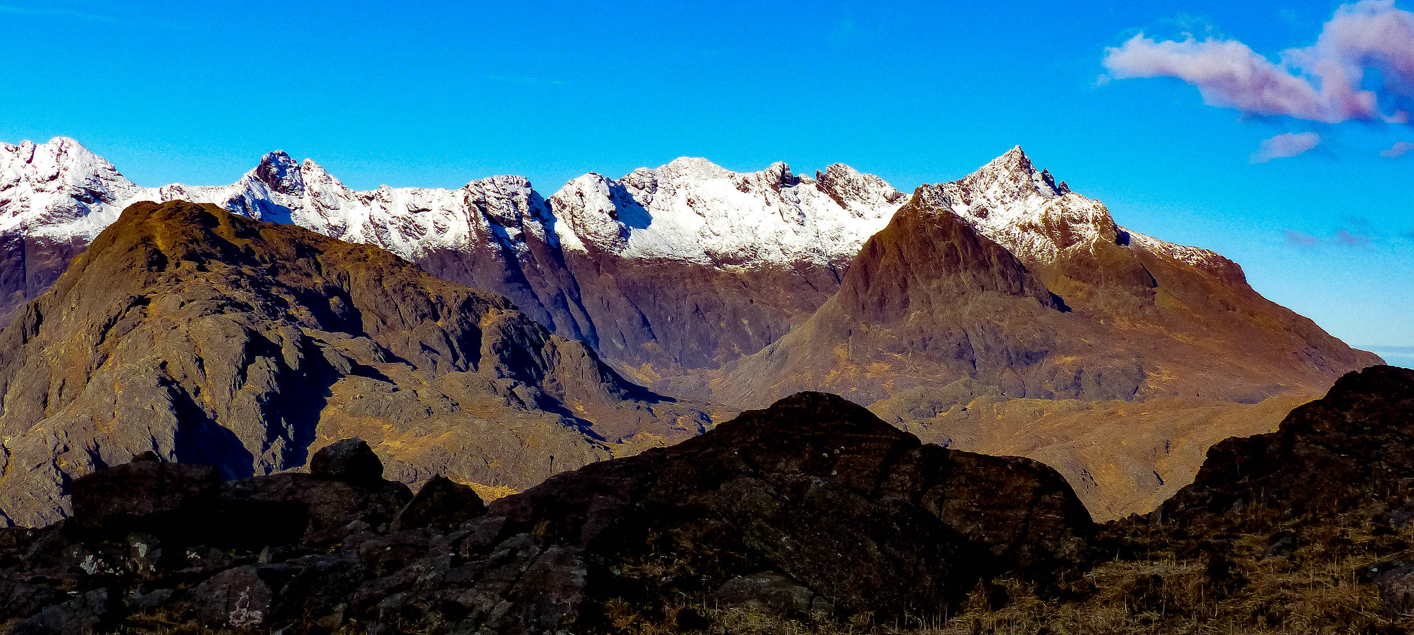
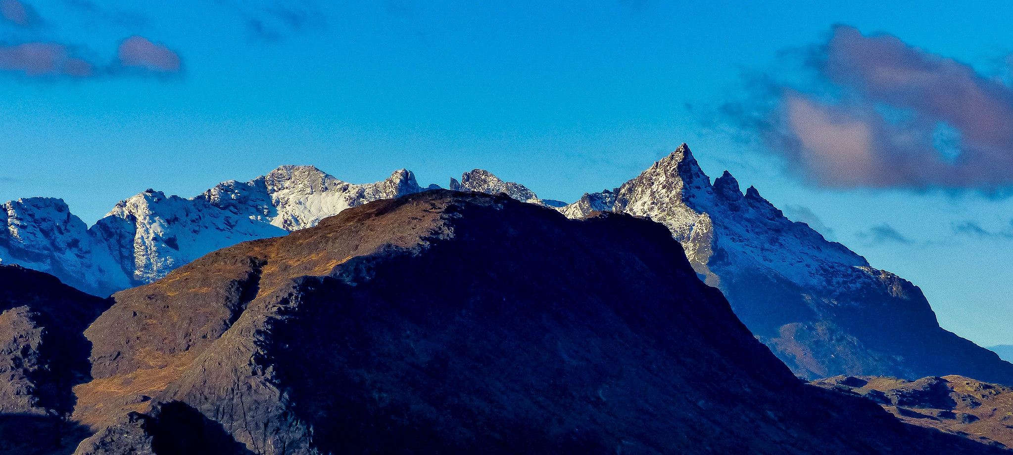 From right to left....Sgurr nan Gillean, Am Basteir, Bruach na Frithe.....
 by
scotlandmac, on Flickr
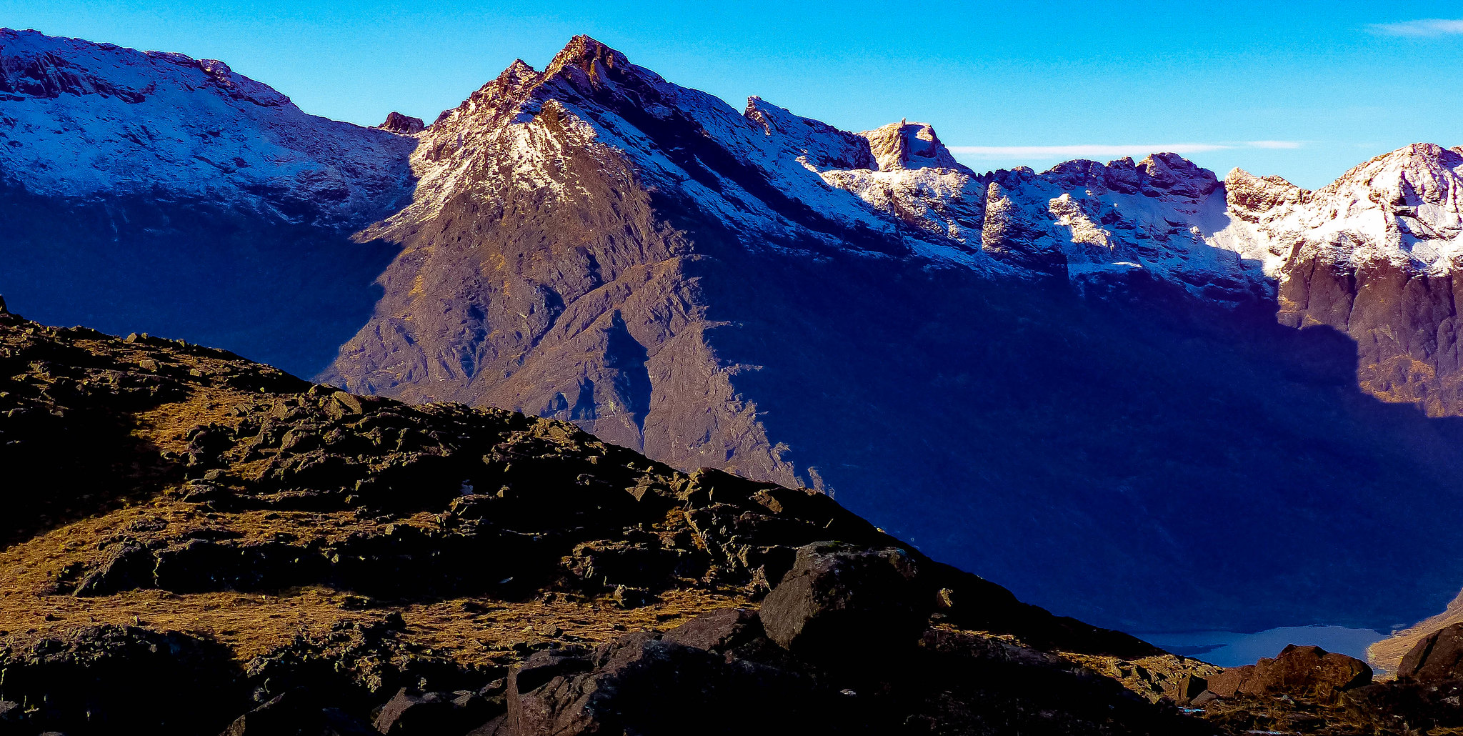
 Sgurr nan Gillean
 by
scotlandmac, on Flickr
Then it was down the steep corrie with Camasunary Bay looking gorgeous below.
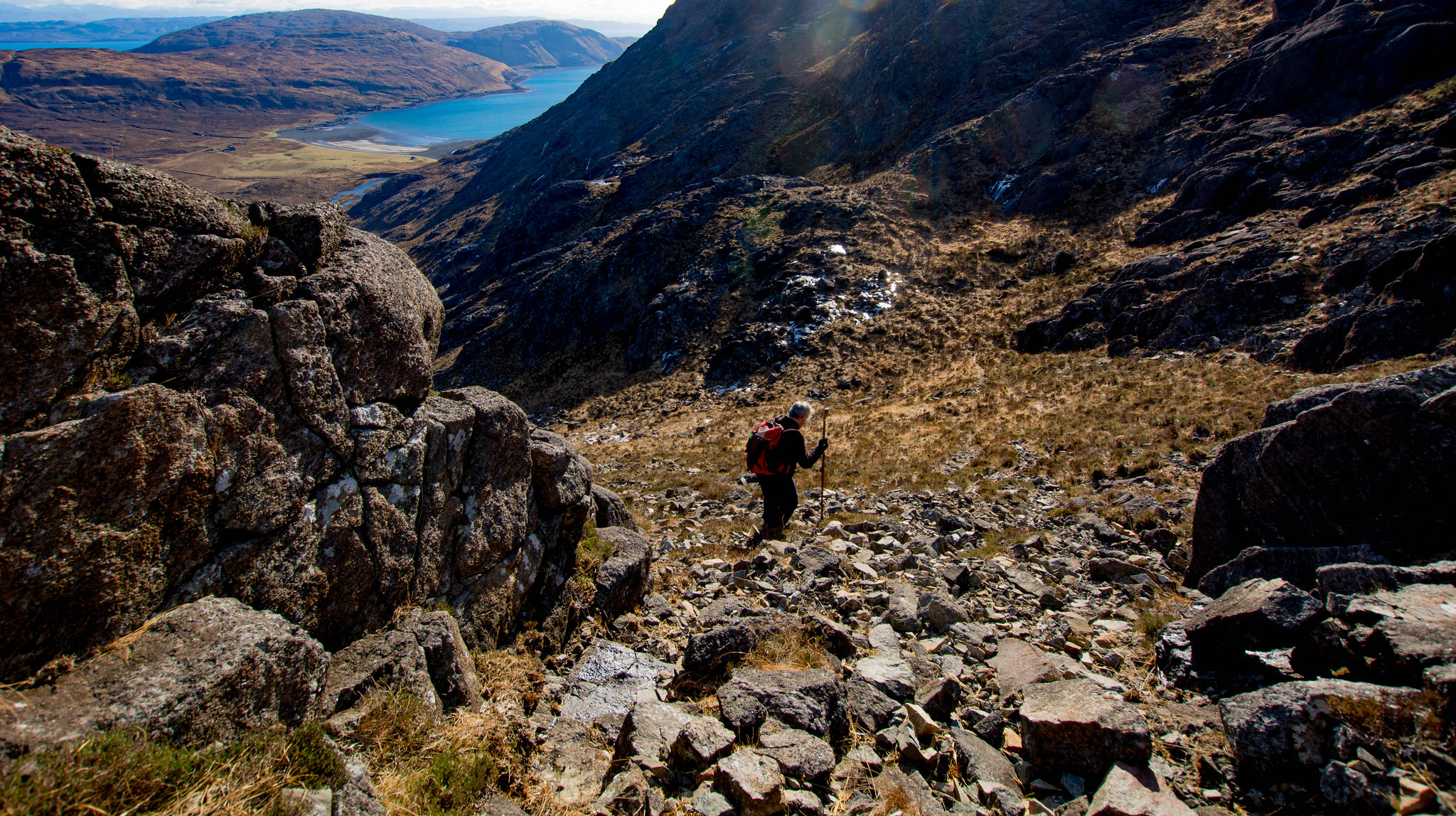 The rough slog back down to Camasunary
 by
scotlandmac, on Flickr
Halfway down, Chris turned and whispered 'Look. To your left.'
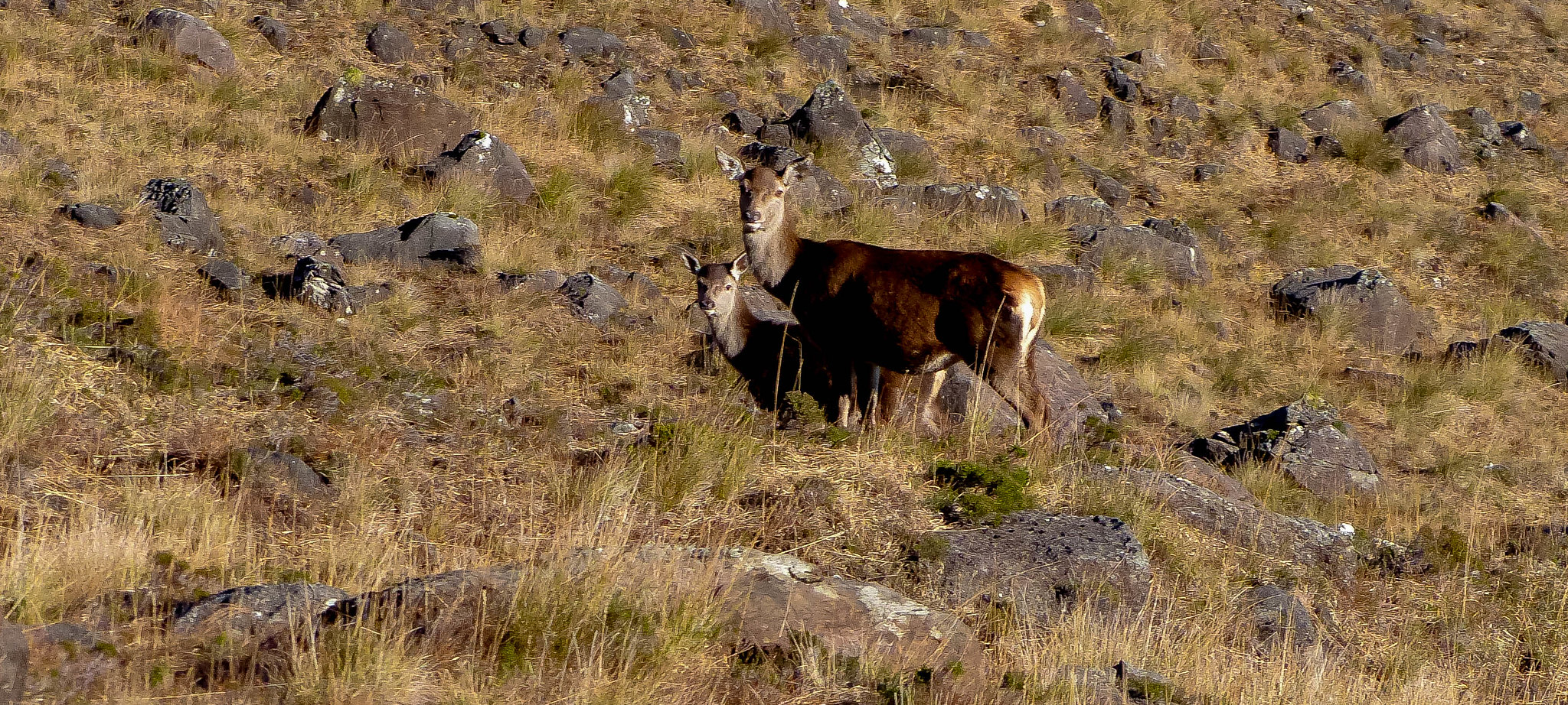 Mother hind and last year's calf
 by
scotlandmac, on Flickr
A red deer hind looked up from grazing and stared hard at us. She had two calves and they watched us warily as we stopped to admire them. So beautiful. We both wondered whether this was the fawn we saw last time, now grown and a mother herself.
Then the joy of reaching Camasunary Bay and its flat, easy ground. A chance to sit for 10 minutes enjoying the crash of the surf and the faint warmth of the winter sun, now that most of the hard work was over. I say 'most' because ahead of us, the big stony track now climbed 200 metres up to the pass so we had that minor ascent still to go. (In all, this route has about 800m of ascent all in.) It’s a spot with many memories as we have camped here several times.In June last year, we camped at the top of the pass itself and the sunset over the Black Cuillin was just incredible.
 Sunset over the Black Cuillin
 by
scotlandmac, on Flickr
 Sunset over the Black Cuillin from Camasunary
 by
scotlandmac, on Flickr
As we headed back across the beach, Rum sat serenely in a sparkling sea......
 Rum from Camasunary
 by
scotlandmac, on Flickr
And the walk back to Kilmarie gave us some final views of the mainland hills in all their glory....
 Knoydart and Kintail hills from Kilmarie track
 by
scotlandmac, on Flickr
It was 3.15pm by the time we got back to the car, tired but ecstatic that the forecast had been spot on and we had been privileged to enjoy Sgurr na Stri in such incredible conditions.(Given what February has been like in 2018, the contrast couldn't be more extreme re. lack of snow.It was positively benign.)
We had to make the short drive a few miles down the road to Elgol for a final look at our day's objective, sitting amidst its big brothers, the main Cuillin ridge.Holding it's own though, I always think, very intriguing looking and distinctive.

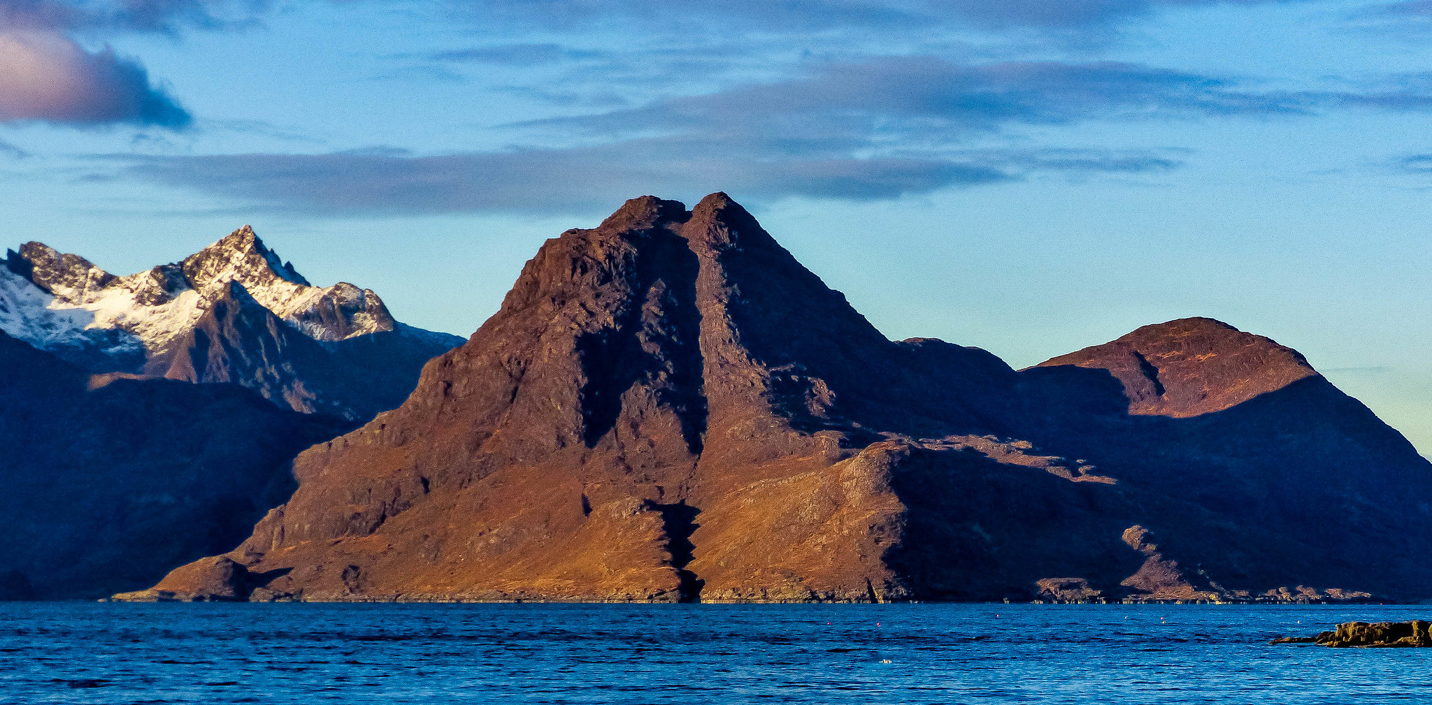 Sgurr na Stri from Elgol
 by
scotlandmac, on Flickr
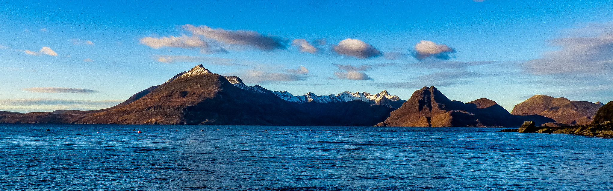 Pano from Elgol
 by
scotlandmac, on Flickr
