free to be able to rate and comment on reports (as well as access 1:25000 mapping).
Quite a few weeks ago I suggested to MiniRambo that we meet up and walked the fells - or at least one of them - together sometime in the near future as we have done so many times in the past, albeit, not for a few years due to mixed commitments from both of us. Knowing that although he has a penchant for the Scottish Highlands with their magnificent mountains this next walk together, due to time constraints, would have to be in the Lake District, and with a pickup time of 2pm on a Sunday afternoon it would have to be one of the nearer, shorter and lesser of the remaining Wainwright's that he still has to touch the top of. Giving him his head on the choice of what to climb he chose Rosthwaite Fell that has the charmingly named Bessyboot as its summit although at 550 metres in height it is somewhat lower than its southern neighbour, Rosthwaite Cam at 612 metres in height. Once again Wainwright for reasons known only to himself chose the lesser of the two fells as the summit. Maybe it was because Bessyboot is more or less in the centre of Rosthwaite Fell, but with only Tarn at Leaves separating it from Rosthwaite Cam the views in all directions are no less - in fact probably better - from RC than they are from the lower and more northerly fell.
It was a sad looking day when Dacre arrived to collect me, grey clouds filled the sky, it was damp and cold with the hint of a strong breeze that later on would see us fighting it as it grew stronger by the hour. As we drove over to our start point at Stonethwaite it began to rain and an afternoon spent playing dominos with a pint at the elbow seemed a more likely attraction than battling the elements on a late Sunday afternoon dressed up like a North Sea trawler man. But hey ho, there's always some sort of weather at this time of year and what could be a better time than this for breaking Dacre back into fell walking mode again.
There is plenty of parking space just before arriving at the hamlet of Stonethwaite with wide grass verges and the local school allowing parking in its grounds for a small fee but we thought that we would chance our arm and drive on hoping to find a vacant spot near the pub, which we did with just one space available.
Getting out of a warm car into a cold and miserable day is never a pleasant experience and this was no exception as we donned our most appropriate clothing for this occasion, a wet day on the fells.
Our way took us past the Langstrath Country Inn that serves good food and ale to all who call in and is now a popular overnight stop for walkers on the Coast to Coast and the Cumbria Way. I struggled on past it thinking of the roaring fire and how we could improve the landlords livelihood by consuming copious amounts of his excellent ale, but it was with a sigh that I put my head down and headed off into the rain and dark shadowy confines of the lane that would take us to the riverside campsite and the start of the walk up and alongside Big Stanger Gill.
There are two gates leading into the foot of the woodland that covers the steep sided fell and we would take the first one that is alongside the wider gate whilst the second and much older one that is just a few metres further on adjacent to a drystone wall will lead you a merry dance as it really leaves one stranded in the wood that then entails either returning to the gate or crossing steep and rough ground to pick up the Stanger Gill path.
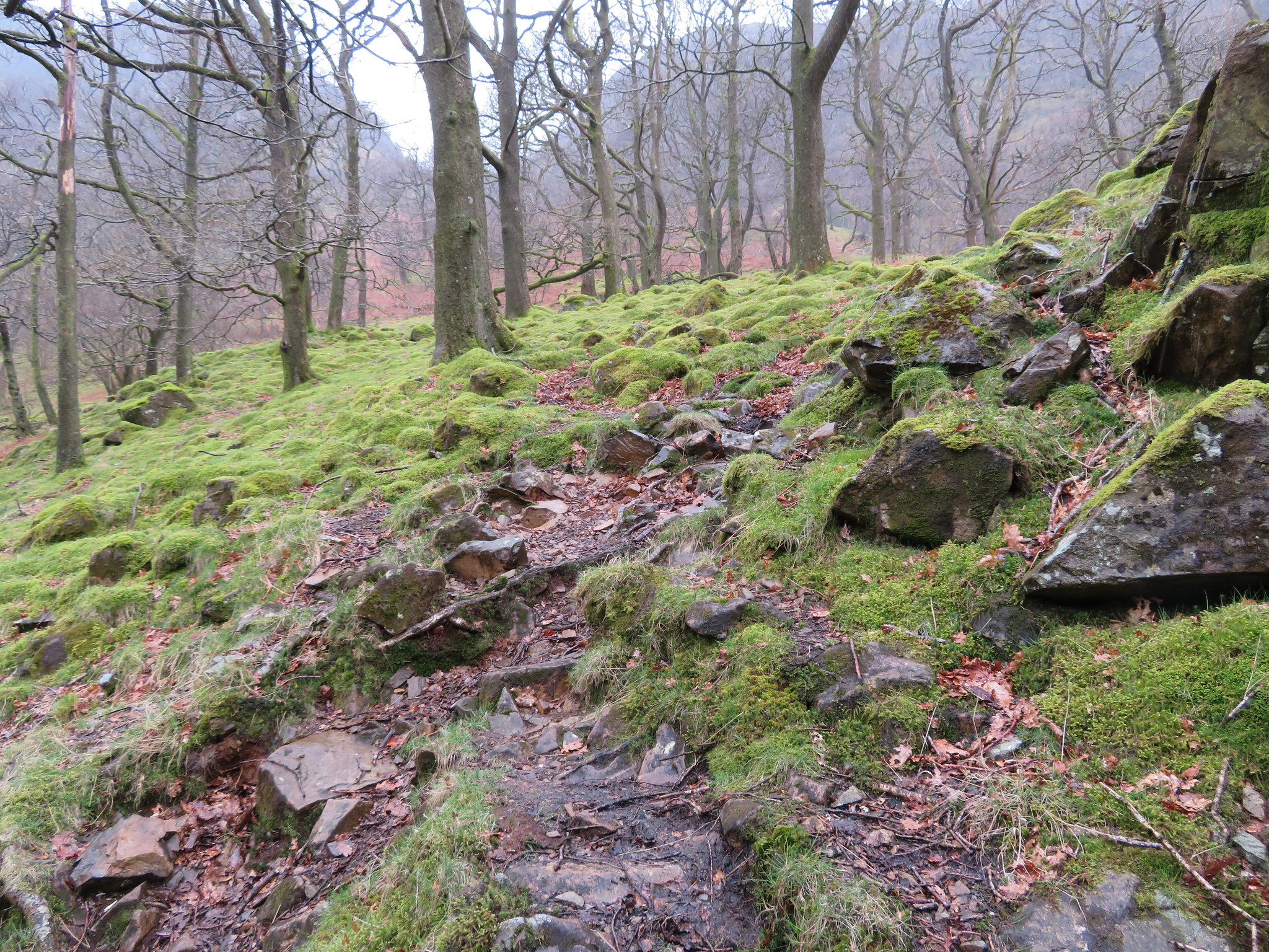
Through the gate and walk over a short expanse of grass before starting the climb up the steep path through the wood, a path that is partly formed out of pitched stones that today were covered in a scattering of left over autumn leaves and those combined with the rain made for a slippery climb up.
 Not pitch perfect as we climb alongside Big Stanger Gill
Not only were the stones slippery but they are very uneven and look in places as though they have just been dropped with no rhyme or reason to them, thrown down with gay abandon also comes to mind, but no matter, a path it is, one that leads us south along a narrow ridge that climbs alongside Big Stanger Gill. The pitched stone path is missing in places with plenty of tree roots making it no less of a trip or slip hazard in the rain and although we were sheltered somewhat from the wind it was still a nuisance at times as we plodded on up the relentless steepness that seemed ever so pleasant despite the rain dripping from the overhead and bare tree branches. The consolation was that the higher one climbs the better the view down into Borrowdale.
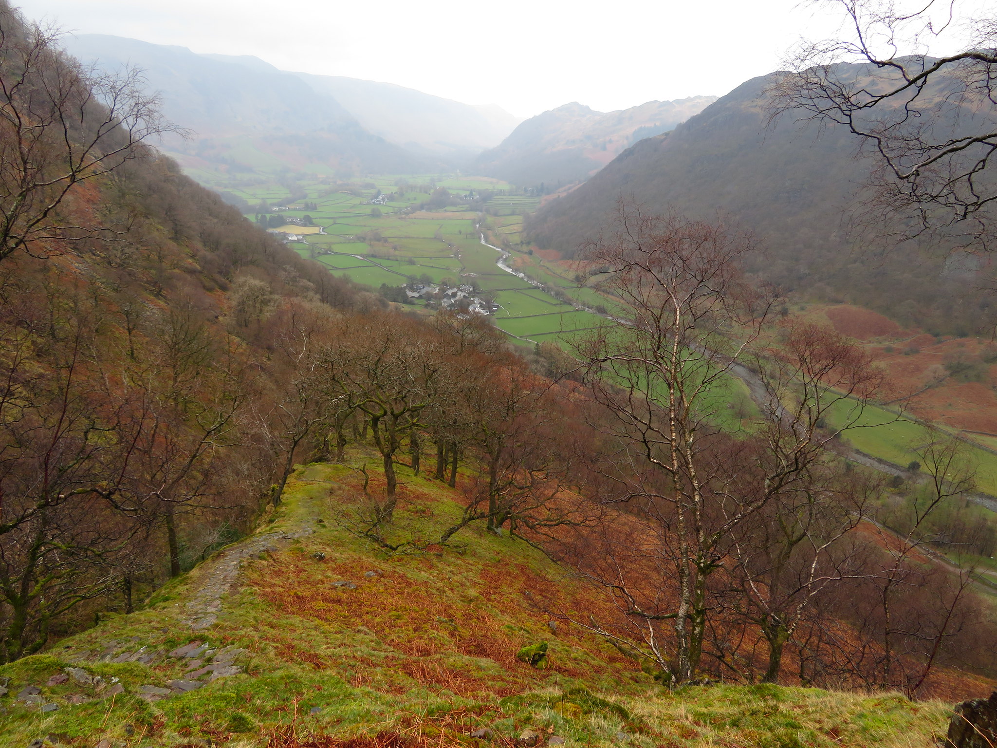 Borrowdale from the 300 metre mark
 Today the rain has made the valley bottom look like an emerald, green against the more austere and various shades of brown and black that clothed both sides of the valley with trees taking place of the dead bracken as height is gained. A little huddle of white buildings mark the spot where Stonethwaite resides, and looking down into the now peaceful valley one can hardly imagine how it must have been a couple of hundred years or so ago when mining was so prevalent in the area, a time when there were many more trees along Langstrath and Borrowdale, trees that were cut down to fire the furnaces for the smelter that once sat on Smithymire Island. Aren't we glad that those days are gone?
Looking at this next photo one wouldn't think that it was raining with Dacre enjoying every drop as he posed with an inane smile upon his face.
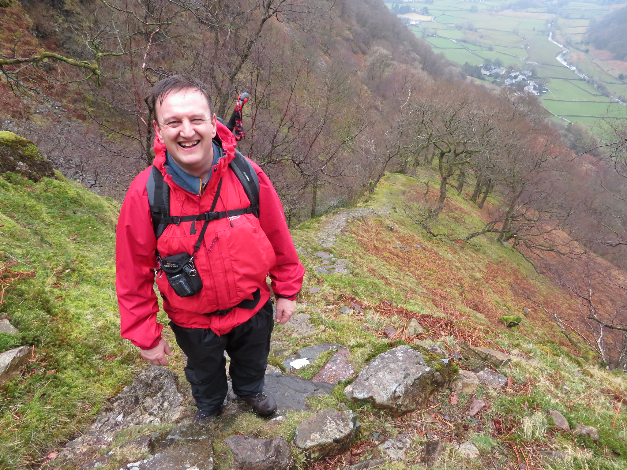 Walking alongside Big Stanger Gill
 Despite the damp coldness of the day we were very warm beneath our waterproofs as we climbed ever onwards and upwards with the old dry stone wall just below Alisongrass Crag and Hanging Haystacks getting ever nearer and before long we were climbing through the gap stile to arrive at the large hollow that sits more or less between the two crags.
 The dip between Alisongrass Crag and Hanging Haystacks
 A narrow path down into the dip with the gill and fallen trees just below and then a steeper climb out the other side now saw us on the fell proper with grass now under our feet instead of rock, roots and rotting vegetation.
Hanging Haysacks is a great mass of near vertical rock with shrubs and clumps of heather clinging into any soil filled orifice and crack that they can find.
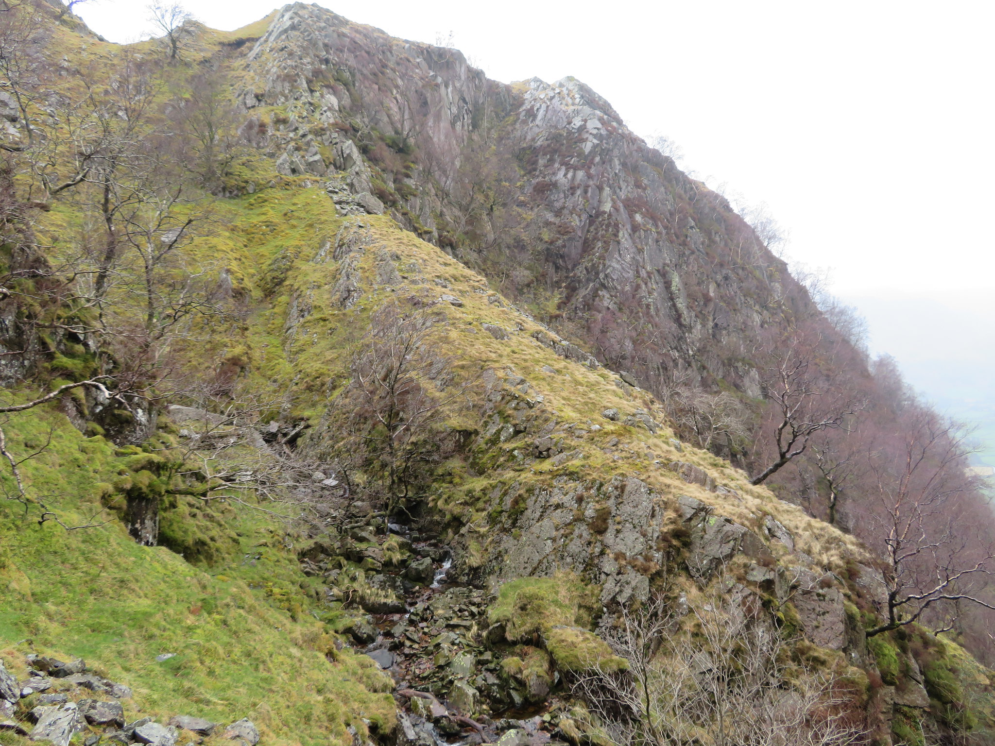 Hanging Haystacks
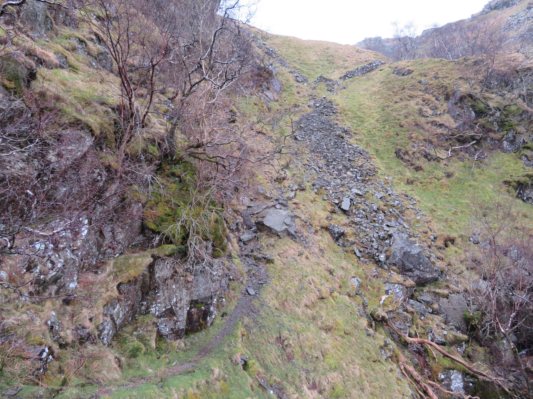
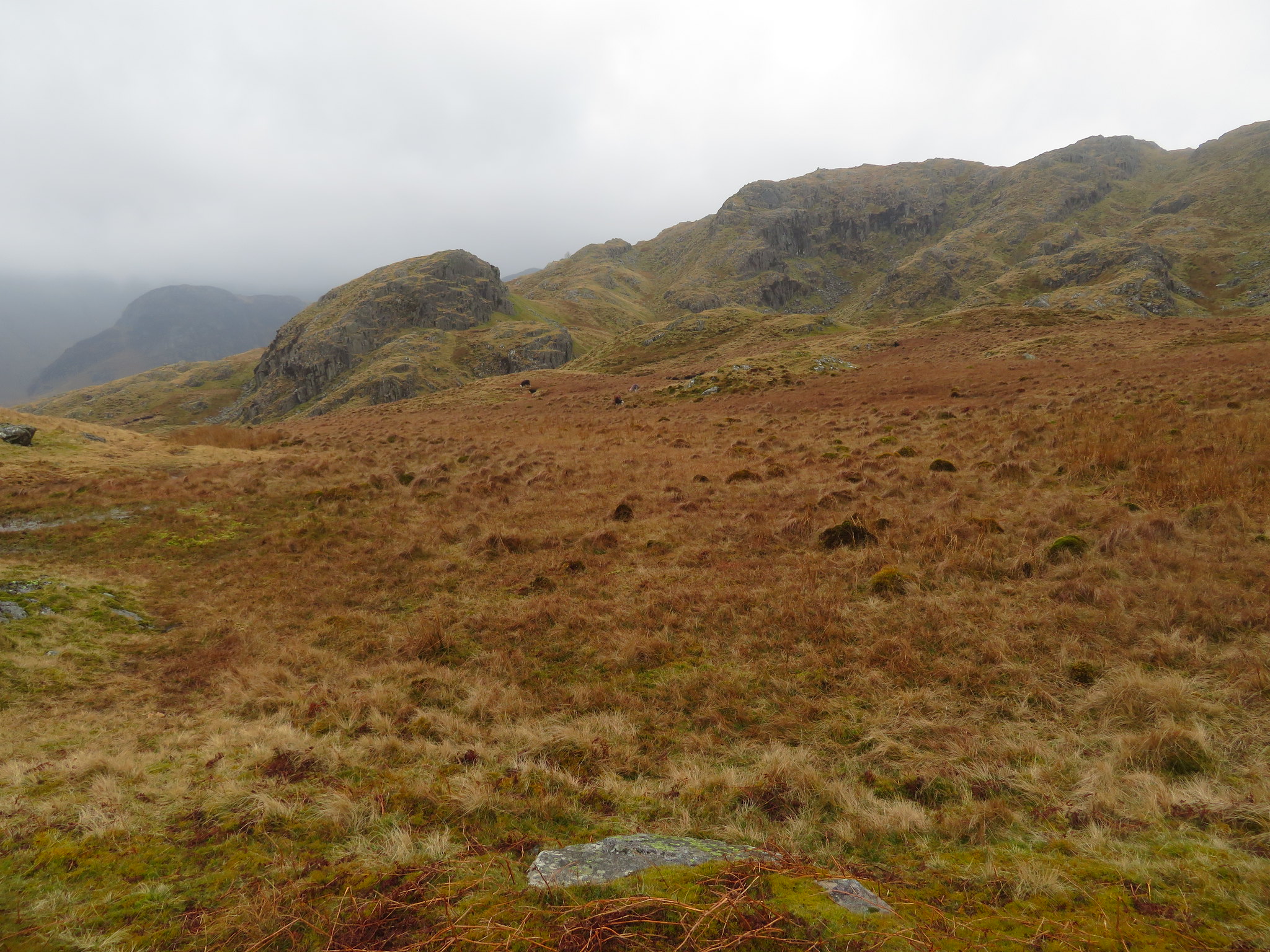
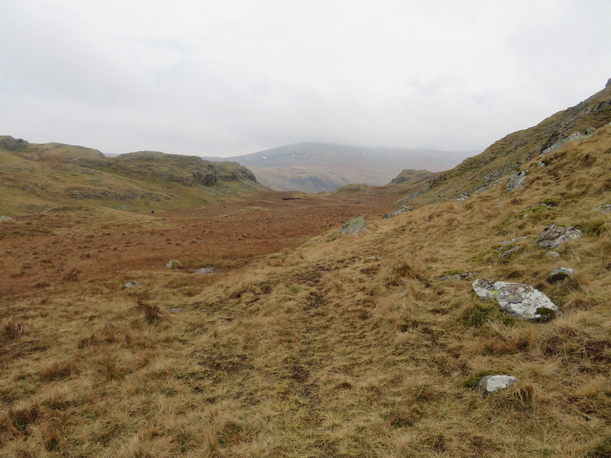
 We now had around another 160 metres of height gain before reaching the summit of Bessyboot but with the quite large undulations of the fell on the way up it is quite a lot more than that in real terms. A boggy path opened up before us as we continued on to the fence stile and gate just below Racom Bands, a large expanse of grass and rocky outcrops that sit to the east of Bessyboot spreading southwards past Tarn at Leaves and finally running out of steam just north of Tansey Gill.
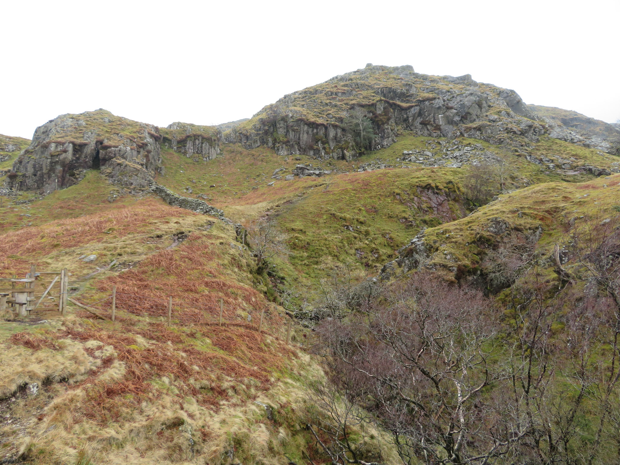 The face of Racom Bands
 We crossed over a second tumbledown wall before swinging around to the right to cross over to the opposite side of Big Stanger Gill from where there is a short climb along a gravel path before setting foot upon the fairly boggy and easily graded fell for the walk in before reaching our target for today. Once out of the Stanger Gill gully we had a rather hazy view of Eagle Crag and Sergeant's Crag over to the east.
 Alisongrass Crag with Eagle Crag and Sergeant's Crag behind
 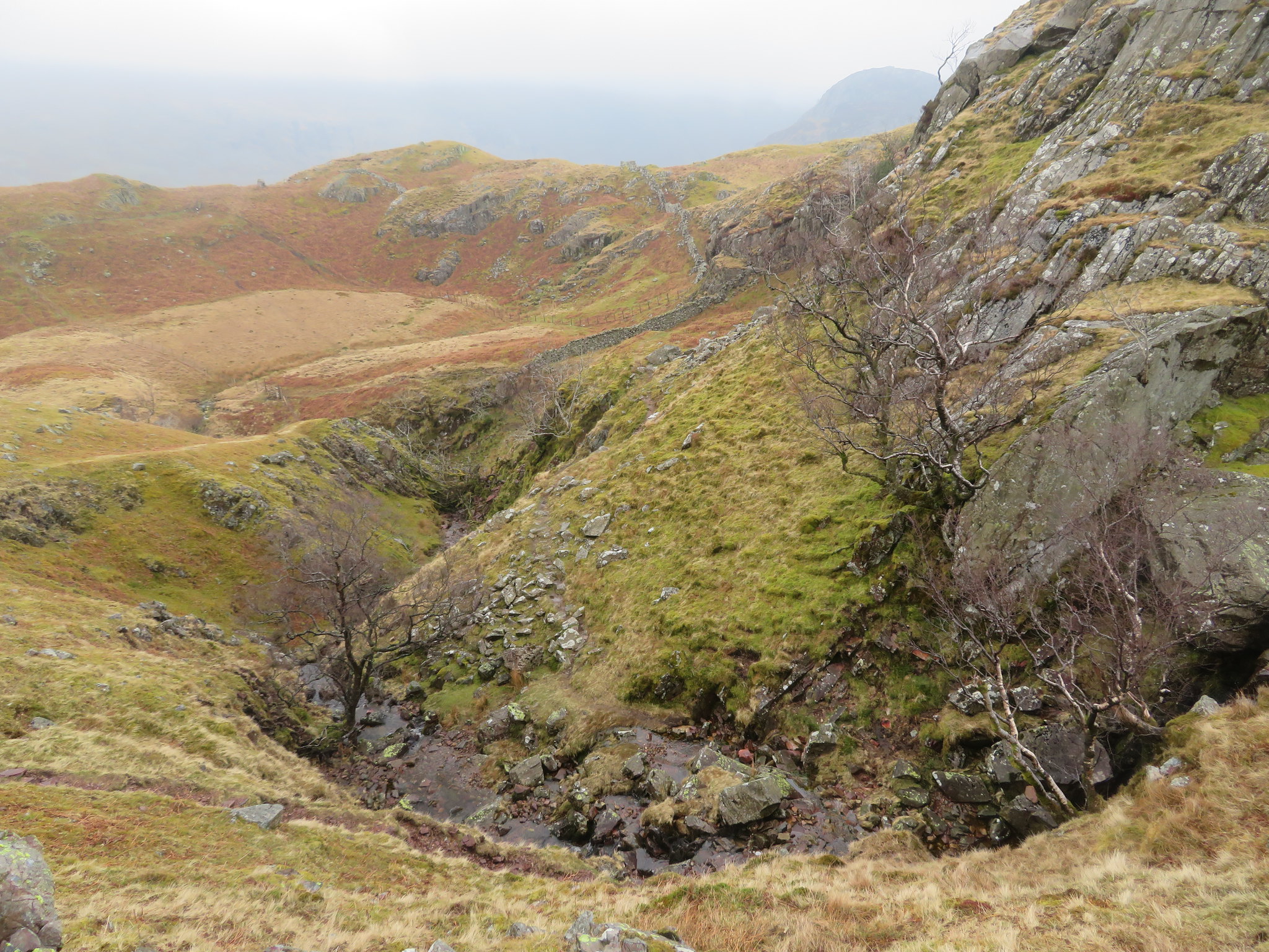 Looking across Big Stanger Gill
 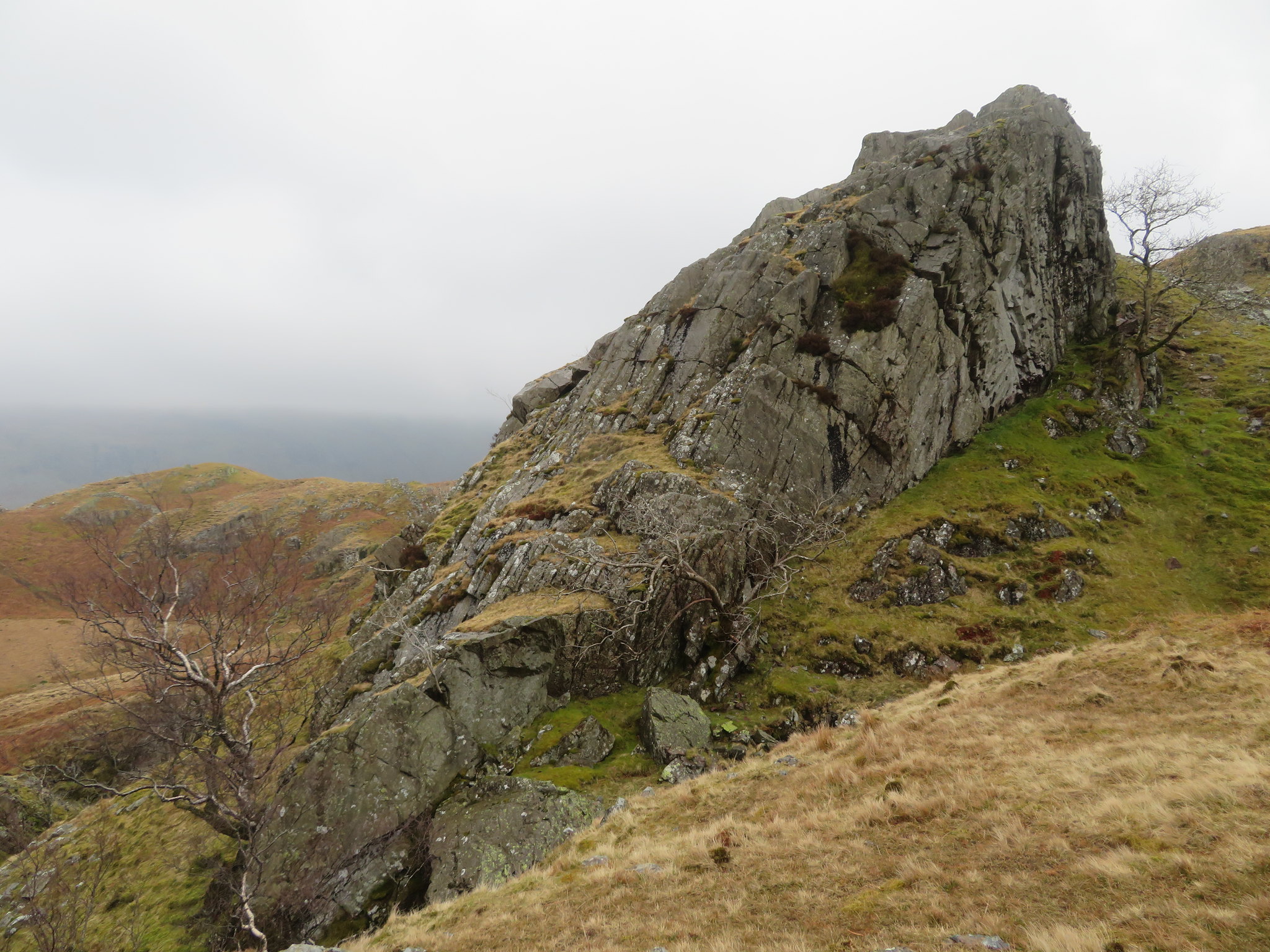 Plenty of these around here
 As we continued on we passed the crags that form the back - north side - of Bessyboot.
 Back of Bessyboot
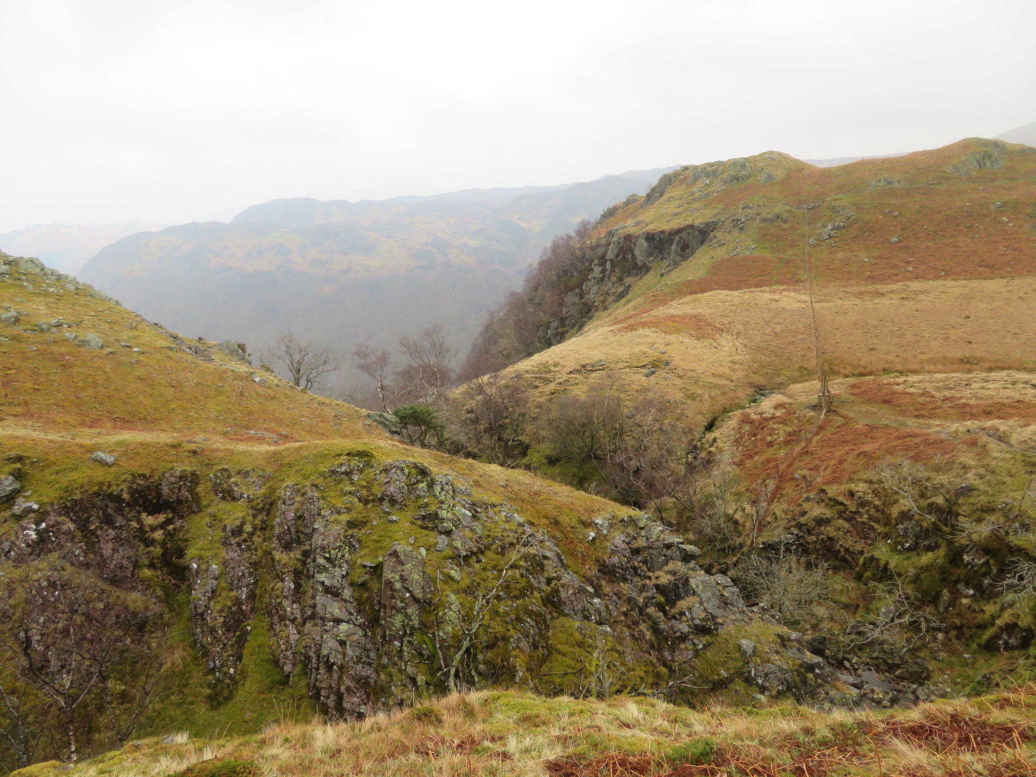
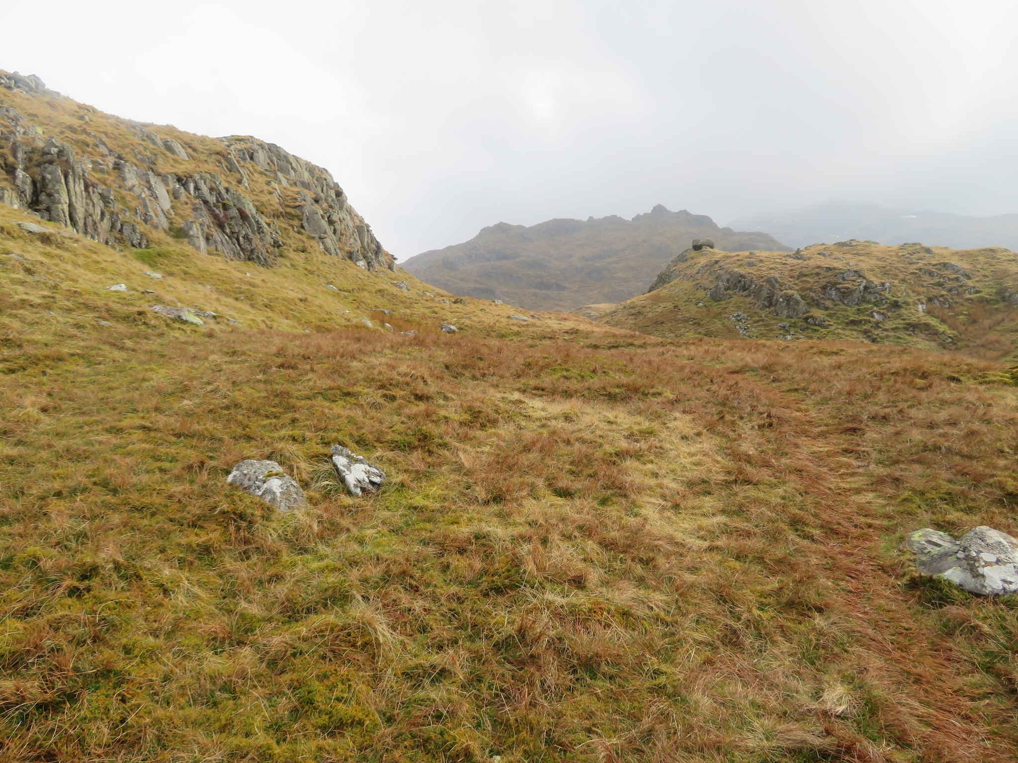
  Typical landscape of Rosthwaite Fell
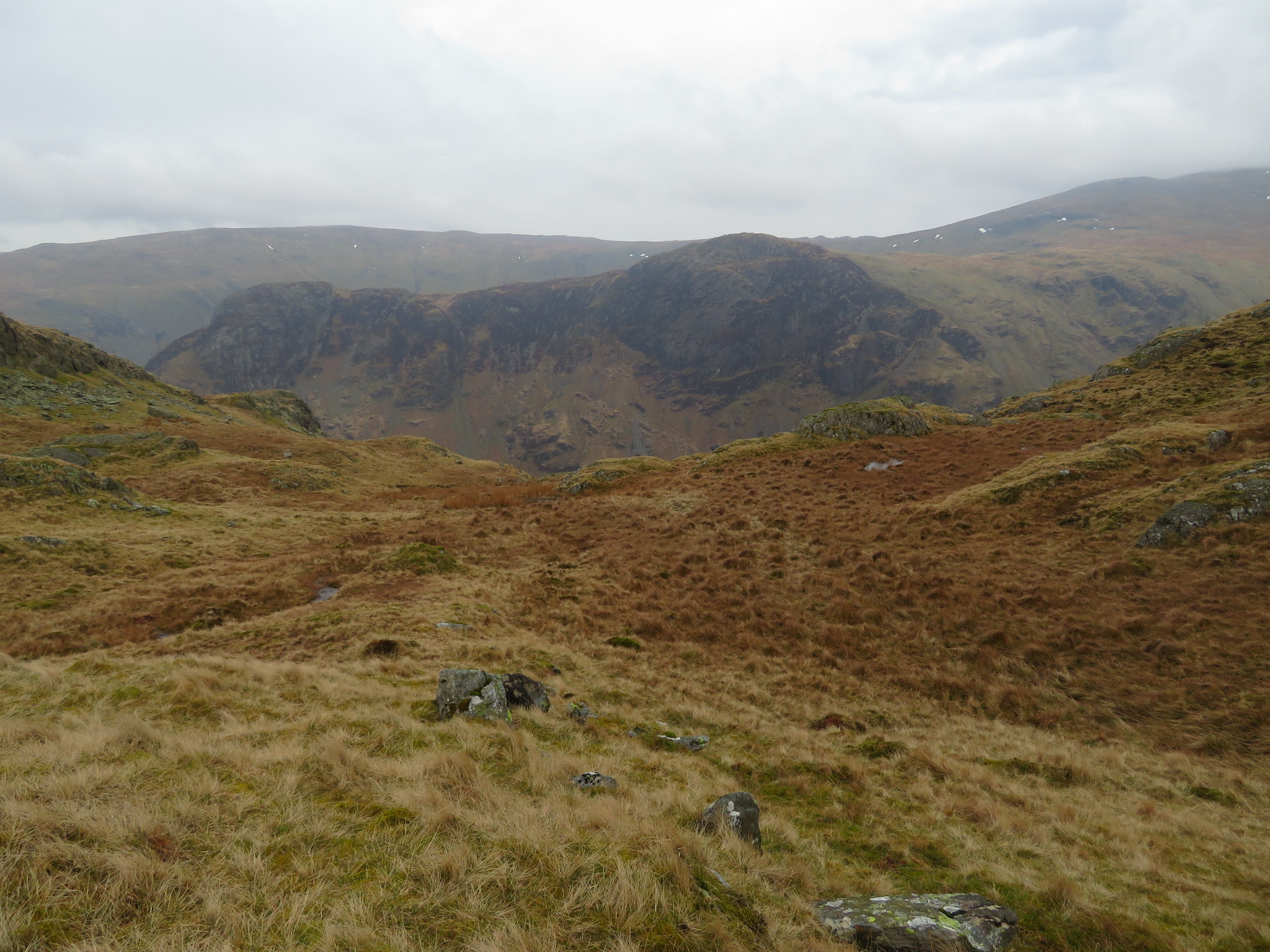
 Despite the wet ground, rain and wind we made steady progress and as we turned from walking west to go south we could see a hazy Rosthwaite Cam rearing up looking rough and knobbly in front of us. And the rain stopped falling.
 Rosthwaite Cam beyond Tarn at Leaves
 The Cam is at the far southern end of Rosthwaite Fell and our intention initially was to get our boots on that also but we decided to delay that decision until we had first climbed to the summit of Bessyboot. But before we climbed to the summit we had a half decent cloud filled view to the west/northwest.
 Looking towards Thornythwaite Fell - Base Brown - Fleetwith Pike etc
 There are three paths leading to the top of Bessyboot from around its west side and one we suspect that makes its way over Racom Bands from where we crossed over Big Stanger Gill in its higher reaches as we saw the makings of a path leading up through the small crags there. A path that I shall investigate later this year as a wander across the Bands should be interesting.
The climb up any of the paths to the summit is easy enough and we soon topped out to find that the extra height had seen the force of the wind increase considerably making it difficult to hold a stance whilst trying to take photographs, but at least it was now dry. We quickly dropped our bags for a fuel up session with Dacre well pleased with the views that I have seen many times before although it was just a shame that there was so much cloud and haze about. Dacre sat exposed to the elements enjoying the views whilst I myself hunkered down behind a large rock to have my meagre refreshments.
 Enjoying the views from Bessyboot - Rosthwaite Fell
 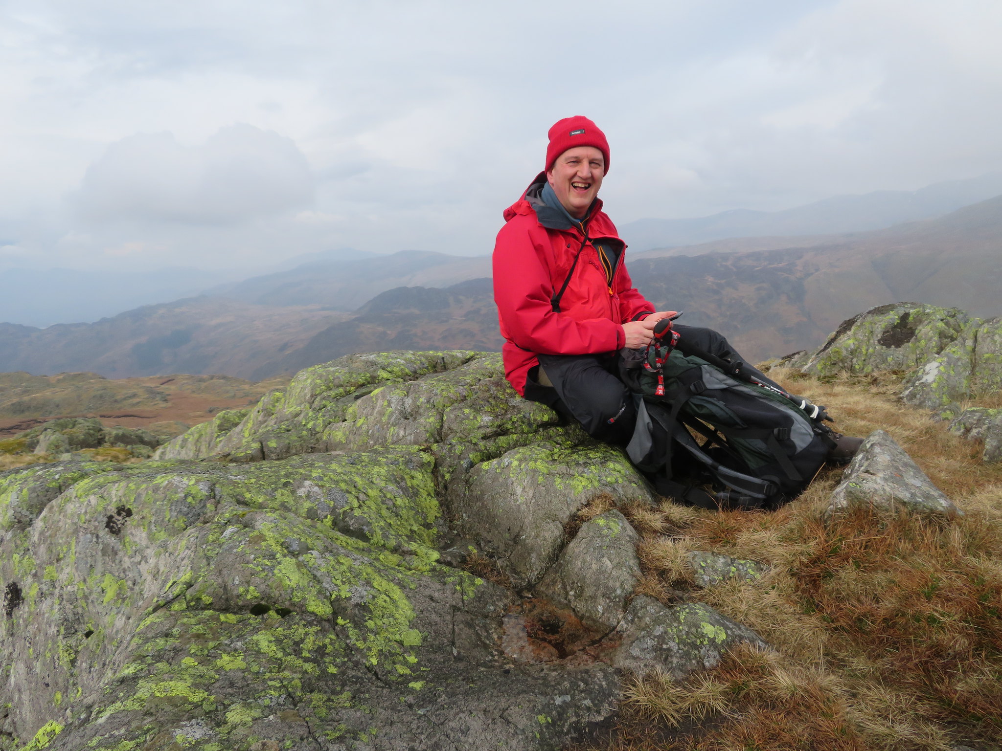 Time to refuel on Bessyboot
 After the Mini Rambo shots I thought that I would take something more sensible and took a couple of the surrounding fells and with the wind as it was wondered if the cameras image stabiliser was all that it was made out to be. Looking at the photos it did its job.
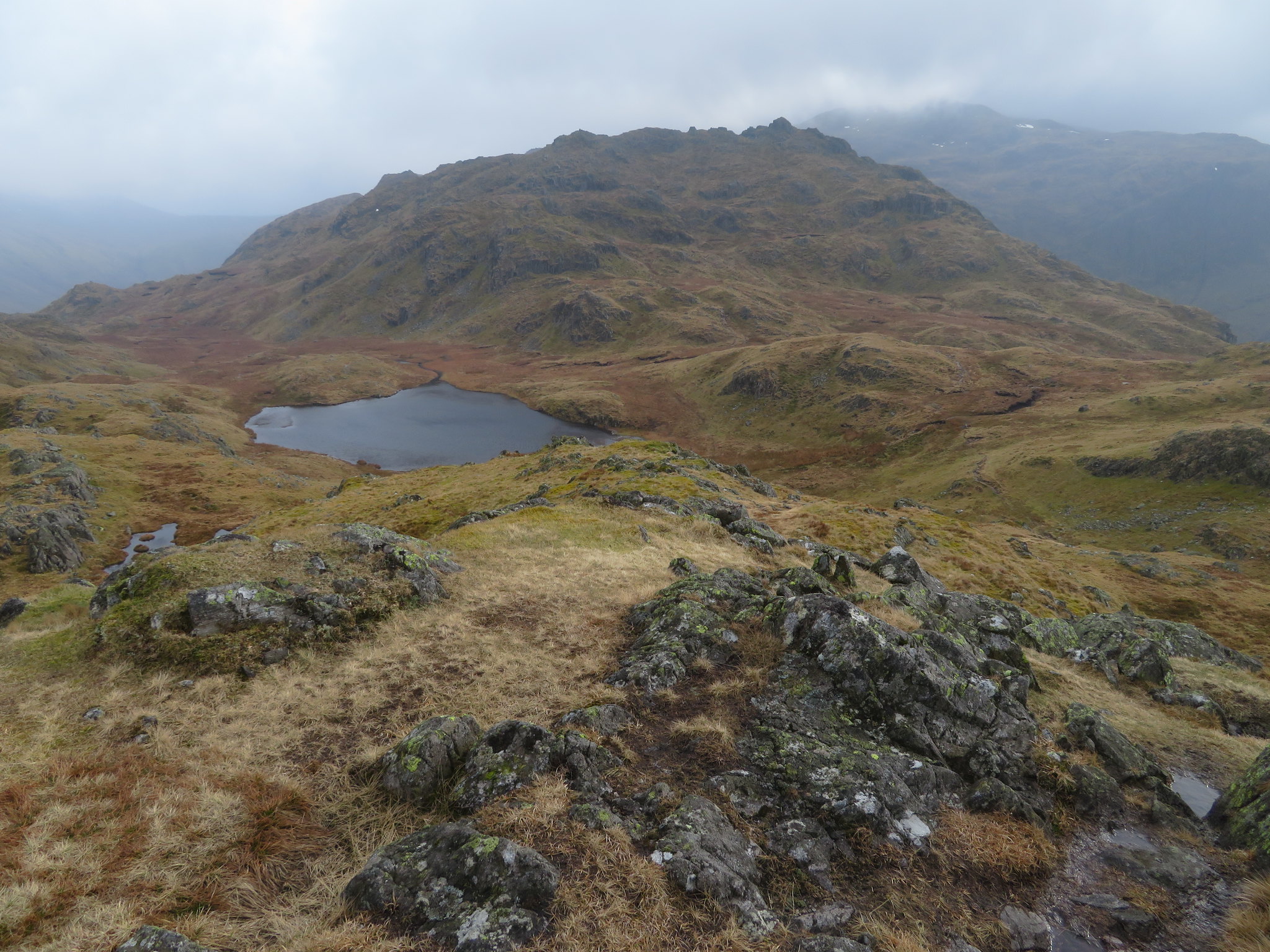 Rosthwaite Cam behind Tarn at Leaves - Glaramara behind
 And a view along Borrowdale towards Derwent Water.
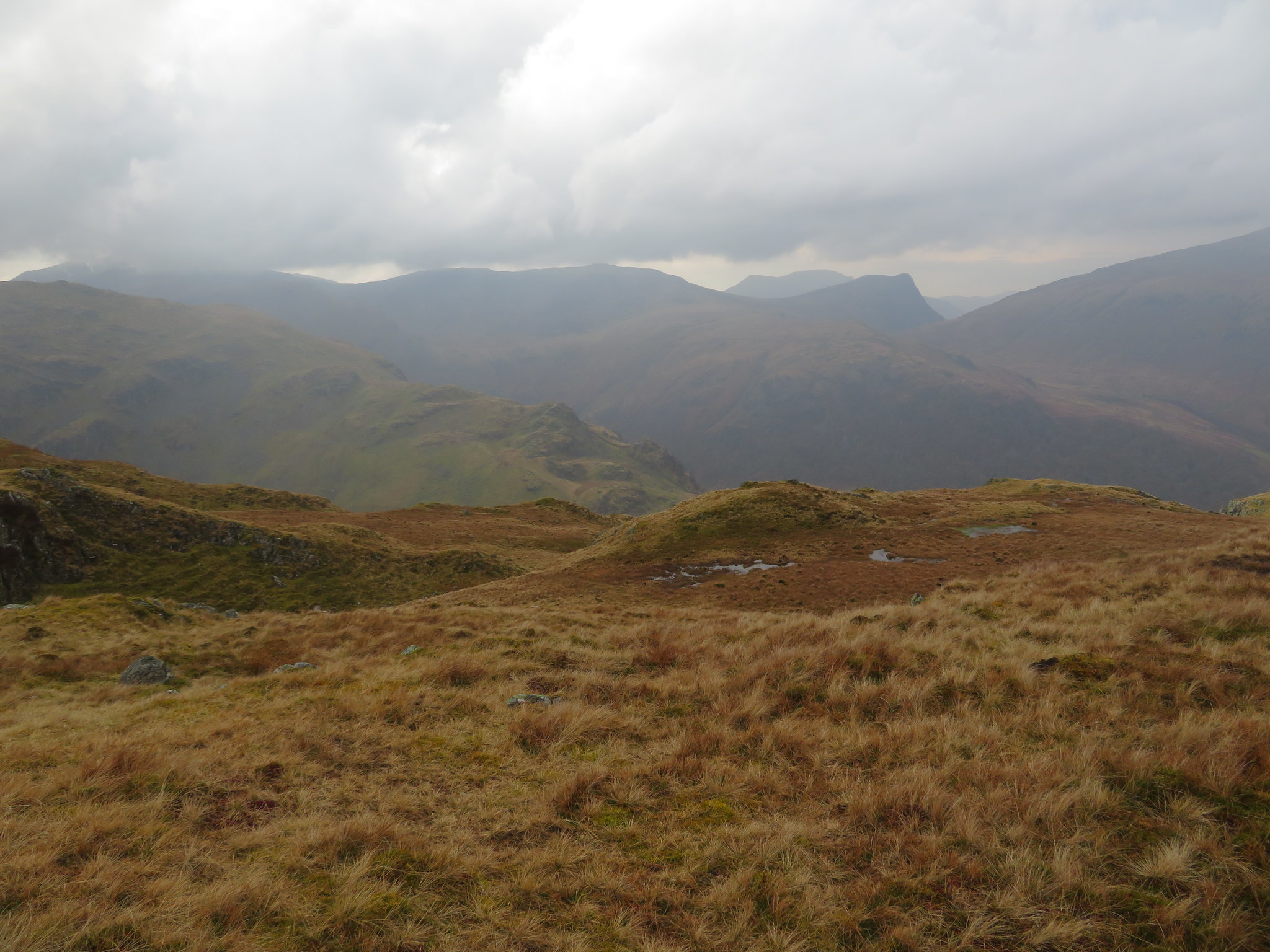
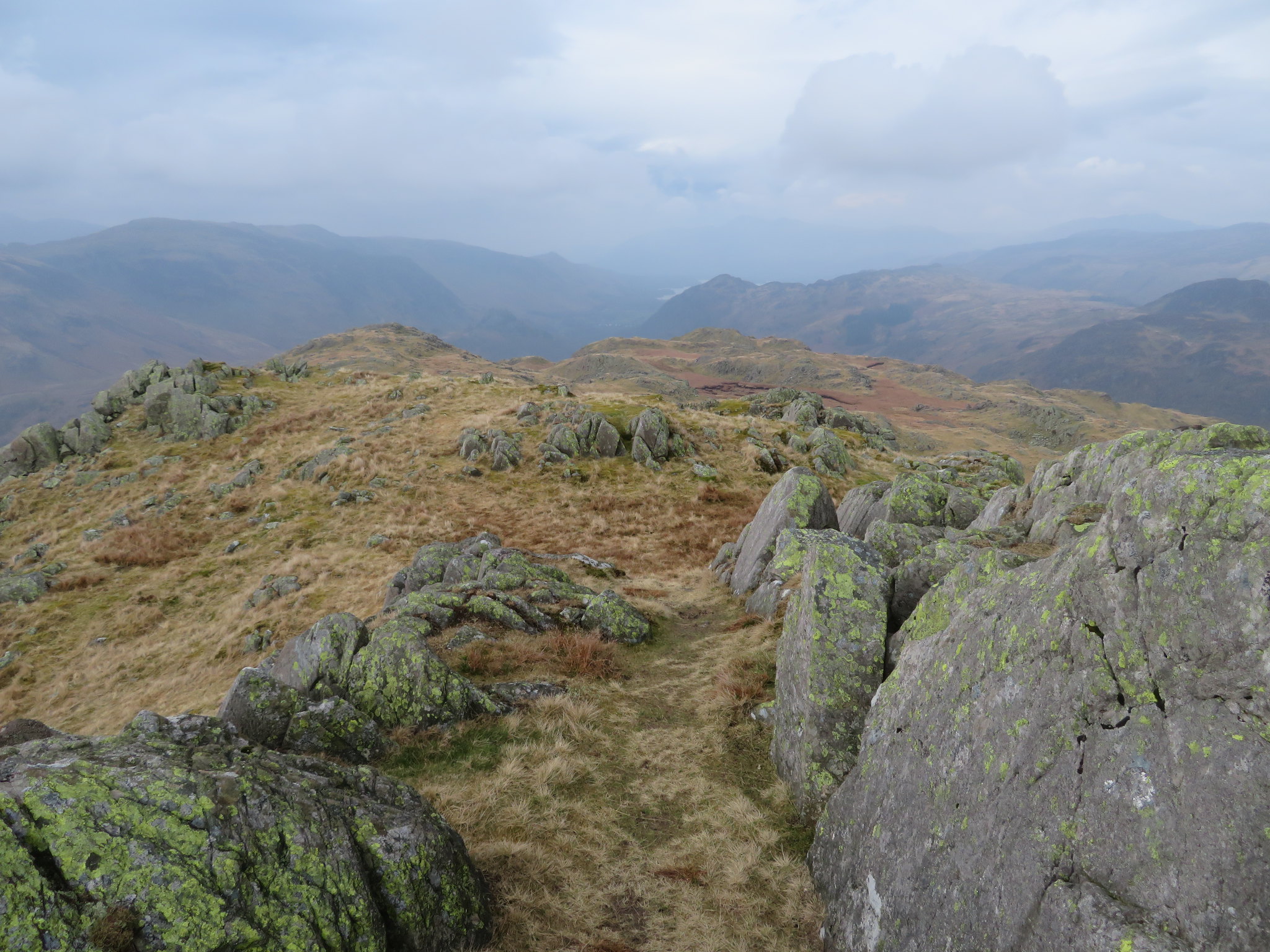 The view north from Bessyboot summit
Having fuelled up it was time to make a decision, do we go for Rosthwaite Cam or not?
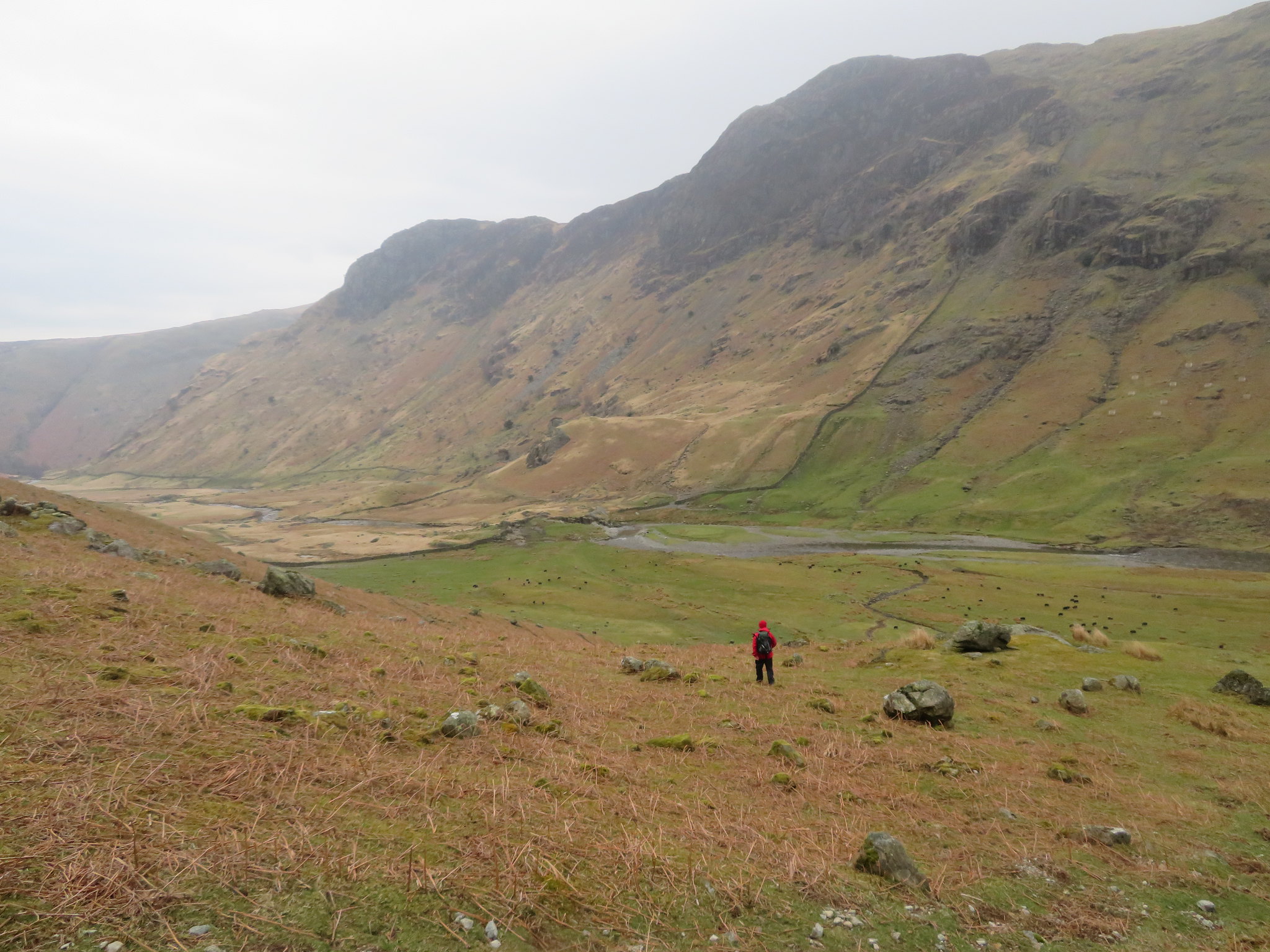
Time was getting on, the wind was strong, the way is rough and steep and Dacres' time was limited so we decided to forego it this time around and make our way around the west side of Tarn at Leaves and then make our way down and across the fellside east of Rosthwaite Cam, down to Stickle Brow to then continue south along the foot of Cam Crag and down to Woof Stones from where we would then drop off to pick up the path down into the valley of Langstrath. The way down to Woof Stones is pathless with many outcrops of rock but it was easy enough to pick a decent way down the only obstacles being two fences that had to be scaled, again without any problems.
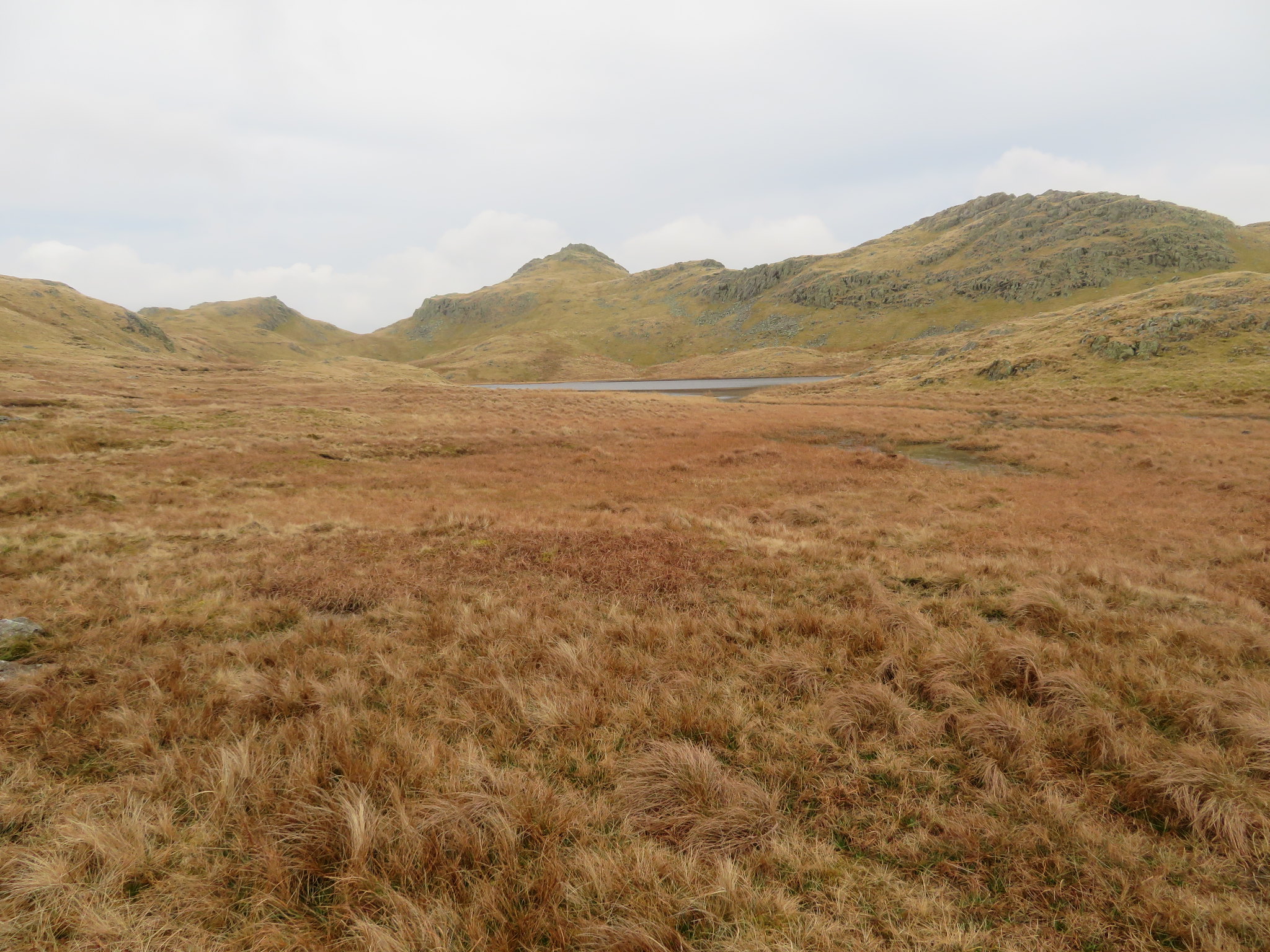 Bessyboot behind Tarn at Leaves
 As we walked past the tarn we had a good view of a cloud covered Ullscarf…
 Ullscarf under cloud
 and after another few steps.
 Eagle Crag and Sergeant's Crag
 As we rounded the corner of Stickle Brow we got our first proper glimpse of Langstrath and the highest top of the Langdale Pikes. And now it was raining again.
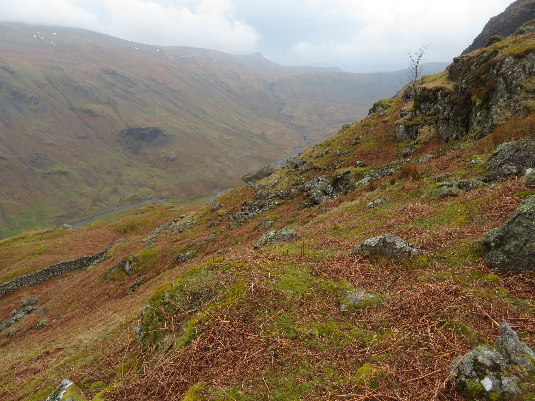 A view across Langstrath and a hint of Harrison Stickle
 As we made our way down and as Dacre hadn't visited the cave bothy before we made a point of calling in for him to see what it was like. It is around two years since I was last here and things have changed a bit, some for the worst and one for the better. The wall to the left of the entrance that was disguised by a natural growth of algae and moss etc has now been broken through and the stones pushed roughly back into place whilst care had not been taken to block up the main entrance sufficiently enough to effectively disguise the entrance. On a good note someone has taken the trouble to acknowledge the efforts of Malcolm Prentice who found this spot and civilised it for the use of climbers and dedicated fell walkers alike.
We opened it up so that Dacre could have a look inside and then sealed it up again…
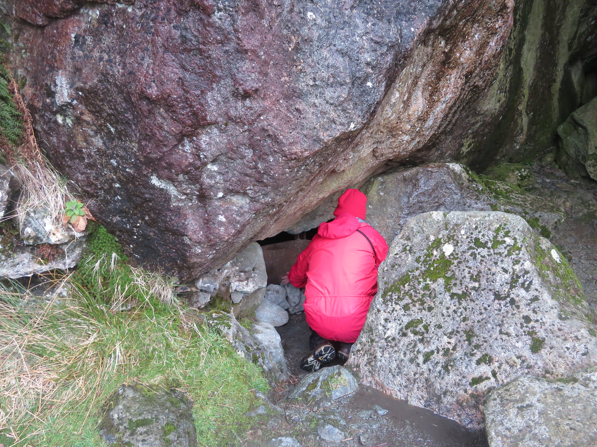 Closing up the secret cave bothy
 A memorial plaque has been fixed to one of the nearby rocks behind which was stashed some items of clothing and a sleeping bag. Why they weren't left in the bothy where it is dry is a bit of a mystery.
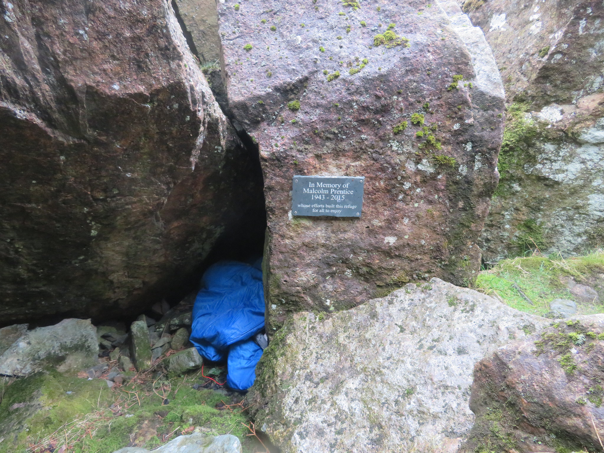 Stashed gear behind the memorial plaque
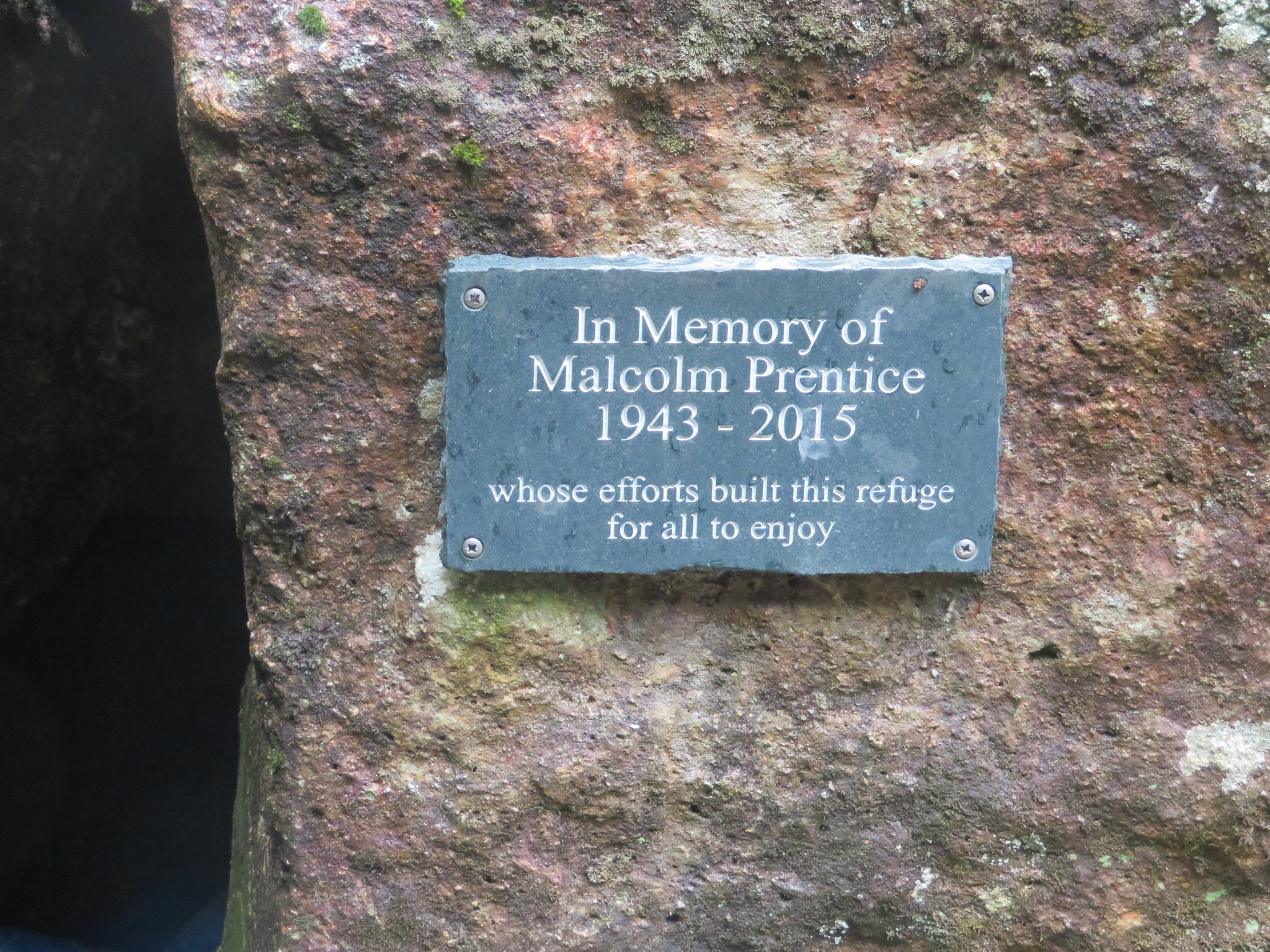 Memorial plaque at the cave bothy
 We left this spot by a stony path that leads down to a step stile and a gate stile that is further along the fence to the left from where it is a pathless wander down the fellside to then meet up with the Langstrath Valley path that runs past Blackmoss Pot and the towering black masses of the west faces of Heron Crag and Sergeant's Crag.
 Eagle Crag - Sergeant's Crag as we approach Blackmoss Pot
 A quick look back through a rain spattered lens…
 Back to Cam Crag and Woof Stones
 and then the walk along the good path/track back north towards our starting point at Stonethwaite.
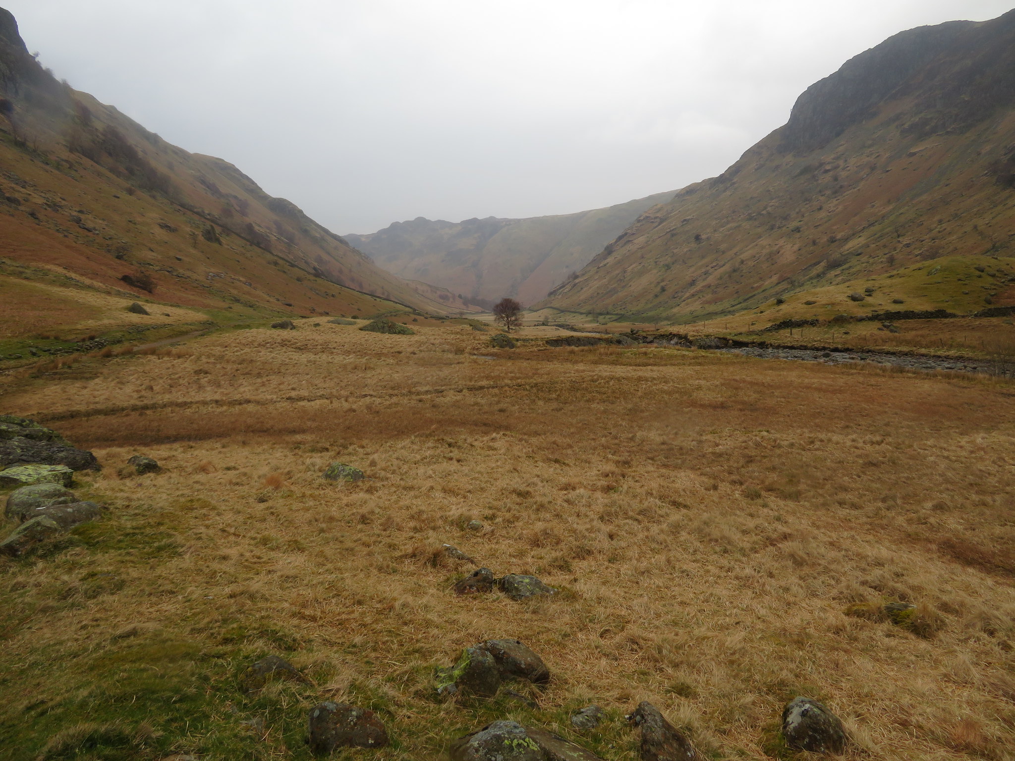 North along Langstrath towards Great Crag
 Rosthwaite Fell is always a good one to take on especially in spring when the trees are glowing a crisp and new green and there's usually a cuckoo sounding off as he looks for this year's romance and despite the initial steepness of the start once Hanging Haystacks has been reached it's nearly all over. On a good day the views are amazing as they so often are from the lesser fells and if a longer walk is required it is easy enough to attain the heights of Glaramara by passing over Rosthwaite Cam and then on to Combe Door, Combe Head and then a cock stride to the top of Glaramara with the then multiple choices of exit back to the start.
Despite the rain and strong winds a cheerful countenance saw us enjoying the walk as well as having a catch up after not being out together for quite some time. Another meet will happen later this year with the destination chosen by MR again and as he only has about 24 Wainwright's left to complete the round - I think - I shall await the call and see what he has in store for me.
