free to be able to rate and comment on reports (as well as access 1:25000 mapping).
Knowing this hill had a bit of a reputation for views, had delayed climbing Morrone until there was favourable weather with clear visibility. The forecast for the day around the Braemar area was extremely good with very little cloud and light winds of 15mph or less. Ideal - so off I trotted on the ninety minute drive. Didn’t want to walk through the town centre so chose to park in the car park at the top of Chapel Brae. Surprisingly it was fairly large and also empty at 11am. Where was everyone? Seemed such a waste of space on a sunny day like this!
Quickly geared up and with very little delay it was onwards and upwards. I turned left up the track, over a cattle grid and followed the green signposts for Morrone. This would be my fourth Corbett. First stop was the sheltered viewing area complete with view/hilltop indicator and wooden bench. The indicator was constructed by the Deeside Field Club many years ago. It’s a short ten to fifteen minutes walk from the Chapel Brae car park and gave good initial views over the Linn of Dee to Cairn Toul and Ben Macdui. As there were a few people already resting here, I quickly moved on through and joined the nearby single track heading uphill to the summit.
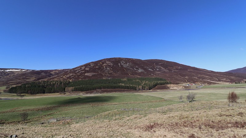
First view of Morrone aka 'Big Nose' from A93 near Auchallater.
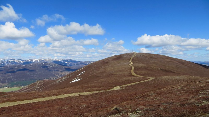
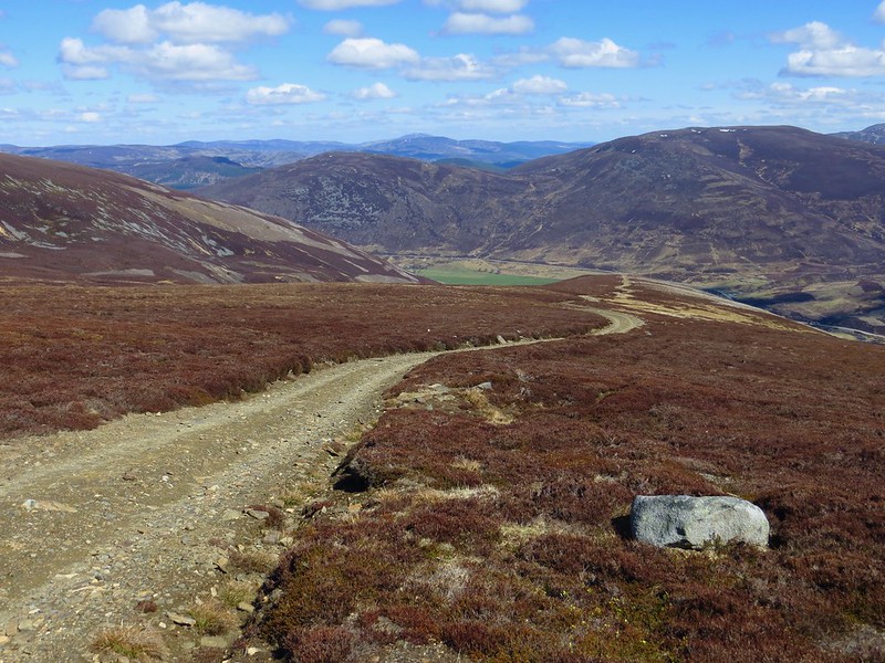
The initial ascent was steepish, stony and a bit boggy in places but the effort of climbing was soon forgotten as the vistas really did open up all around. Stopped regularly to take advantage of this. At the top of this steeper section you pass some small stone cairns and from that point the walk gets much easier on a wider path. In fact when the summit's telecoms mast came into sight, I just headed straight for it over the short heather - very easy going!
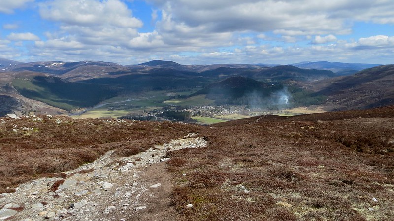
Looking back down track over Braemar. Morven silhouetted on skyline.
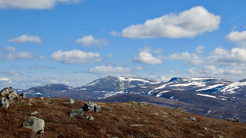
Impressive views open up behind.
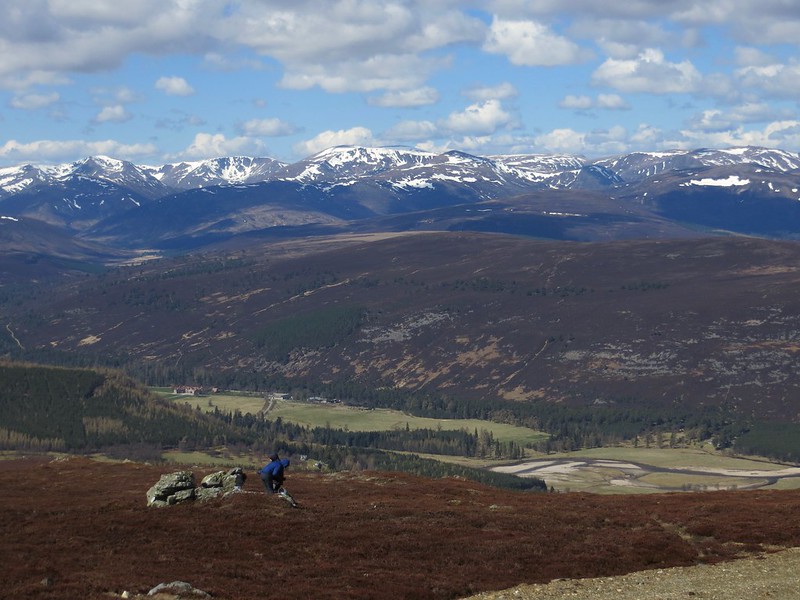
Once on top the summit views were crystal clear. To the north west the wall of Cairgorm peaks and cols particularily stood out, still half covered in snow, as was Lochnagar to the east and An Socach to the south. To the south east Loch Callater glinted in the sun with Tolmount and Tom Buidhe behind.
A small crowd of hillwalkers were gathered together beside the mast chatting and generally enjoying the sunshine so I popped over to join them. An uplifting moment for all as we enthusiastically took in the surrounding landscapes and identified the hills all around. Something I'm getting better at as my walk log gets bigger!
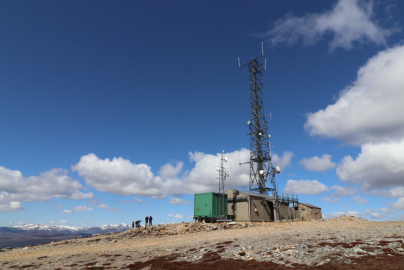
Fellow Corbetteers resting and chatting beside telecoms mast on summit.
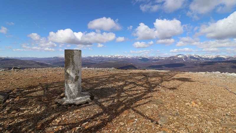
Mast throwing a shadow over summit trig point. Looking west towards the Southern Cairngorms.
However ..... very cold on top so didn’t chat for long - wanted to keep moving! Completed the obligatory summit photo run around, including descending west a little to get a better angle on the valley below, then proceeded south on the well defined track which loops down and around the southern flank of the hill and into Glen Clunie. Here you join 'Old Military Road’ back towards Braemar. At a very easy pace it took me an hour to descend to the road. Lots of wildlife seen on the way down including one grouse that unexpectedly exploded out of the heather right to one side and scared the bejiggers out of me

Needed to catch my breathe after that one!

This couple have found a great spot to have their hot drinks!
Same position - looking back at Morrone summit.
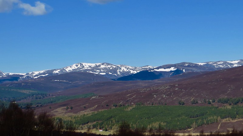
Lochnagar to east. Looks as if the summit is now clear of snow. My No.1 target for this year!
Descent track meandering down to Glen Clunie. Easy going.
Next part of this anti-clockwise circuit was a very pleasant and enjoyable tarmac transit along the eastern side of the hill. I agree with fellow WH scribe ‘pennitom’ on this one - not to be missed! There were no cars, only two local lady cyclists who passed twice in opposite directions. Very tranquil. A great landscape to walk through and a good way to wind down after the efforts on the hill. I loved the golf course which was in perfect condition - well maintained. Only two sets of players that I could see so very quiet too. Must bring my golf clubs next time.

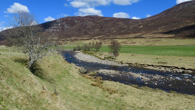
First view of Clunie Water which joins the River Dee just north of Braemar.
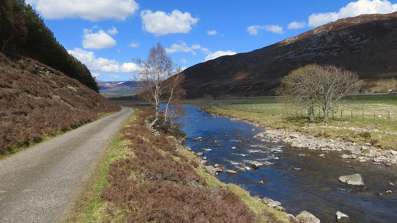
Proceeding along Old Military Road which at this point parallels Clunie Water.
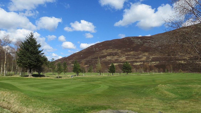
12th hole Braemar Golf Course. Watch out for flying golf balls here
Especially if I'm playing!
Further down the road, just after the clubhouse, I was looking for a footpath I’d seen on the map which leads back over the slope to the viewing area I'd gone through earlier. This would avoid going into Braemar and be a much more direct and 'green' way to return to the car. In fact this junction, off to the left, is marked with a standard small wooden ‘arrow post’ that points uphill. Initially you climb to and through a small caravan park to a gate in the high fence and then on into a lovely grassy wood. The narrow track beyond is steep and twisty initially but then gets easier. I followed this all the way until joining a small vehicle track where I turned left and soon arrived back at the junction just along from the viewing area. Took no time at all and a good alternative for those using the Chapel Brae car park.
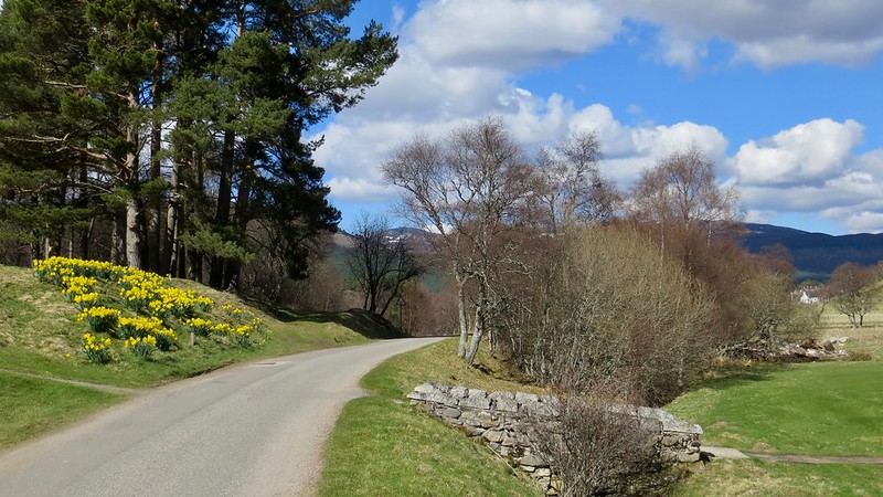
Start of short cut back to viewing area is left up grass track just to right of daffodils.
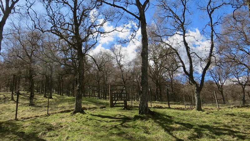
Gate just beyond caravan park.
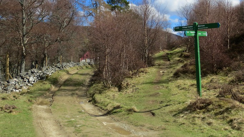
Back at track junction beside viewing area. Ascended on path to right, returned on vehicle track to left. As you can see well signposted.
Stopped off at the viewing area to enjoy the views one last time and reflect on an memorable day before retracing my steps back down to the car.
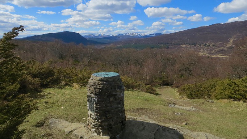
Morrone viewing area. Looking over the view indicator to north-west.
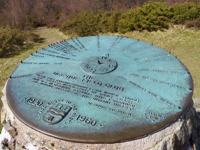
Brass top of view indicator. Designed by well known local architect and author Fenton Wyness who was a member of the Deeside Field Club.
Loved this walk, well signposted with a variety of landscapes to pass through. Views from the summit top notch. Couldn’t have asked for a better day. I’ll happily give it four stars

